The Aqua Blaze – A True Whitewater Journey

Well, the opportunity came up this spring to kayak down the Colorado River through the Grand Canyon for two weeks towards summers end and I took it! As most of you know kayaking has been a love of mine for a very long time now and that’s pretty much how I inherited my trail name, Whitewater.

Conquistadors-Aisle-653x522

Photo from Oars Blog They Call Me Groover Boy

It’s pretty hard to believe that I started paddling 38 years ago, when a friend of mine from high school, Henry, and I decided to plan a canoe trip down the Cahaba River in Alabama for a spring break trip back in 1975. The canoe trip basically went pretty well, except for tornadoes and flooding rains that we got caught in one night several days into our liquid adventure. Luckily, we had made camp on the edge of an old farm that had a dirt road leading from the river to a nearby main road going into Marion, Alabama. It was sometime in the middle of the night that we finally figured out that staying in our tents was no longer an option. Somehow, I think the foot of water which had taken over our campsite was the final straw. We vacated camp and started hiking towards town, leaving everything behind. There were four of us in all and we hiked in the pouring down rain and lighting for about a mile before finding the main road to town.

Shortly after making it to the road, a pickup truck pulled up along the side of us and rolled down the window and I think he asked us if we were looking for someone? We proceeded to tell him what were doing when suddenly he leaned forward and the passenger beside him spoke up. It was my dad out with some local folks he had rounded up in the area who volunteered to help look for us along the river.

We went back and got my Dad’s company car, a green Chevrolet Impala nicknamed the Tank, and proceeded down the old farm road, fording creeks, back towards the river bank to take down camp and pick up our gear. We finally got the canoes and the two tons of wet camping gear loaded up in the Tank and headed home in the pouring down rain. Yes…of course the four crew members (mere teenagers at the time) slept all the home.

Grand Canyon photo By Small World AdventuresSo that’s how it all started and now after years of wanting to do the Colorado River…I’m finally doing it and I Can’t Wait!

Let’s Load Up, Hit the Road and Head West for some REAL WHITEWATER FUN!!

Photo from Small World Adventures news letter

Posted in Post-Hike | 11 Comments

Trail Days and The Virginia Creeper

My son, Bill, picked me up along with several other 2013 thru hikers that I had met on AT my last several days of hiking this year.  Honey, Mooner, (a nice just married couple) and Bear Paw, rode with us to Trail Days from Hot Springs, NC.

On Friday, Bill and I along with a new friend, Brad, that we had met the night before in camp, set out to bike the Virginia Creeper Trail.  It was something that I’ve been wanting to do since last year when I noticed that the AT actually overlaps a couple of miles with the Virginia Creeper Trail. After renting bikes, we got on the shuttle to the top of the mountain and rode back down the trail beside the Laurel River to Damascus, VA. We spent about three hours riding down, taking a long lunch stop and enjoying many sight seeing breaks along the way. The rat snakes seemed to be out in force sunning themselves on the many trestles that exist along the way. On one trestle alone, I think we counted three snakes just hanging out…pretty cool!

It’s an unbelievable bike ride and I would recommend it to anyone!

DSC03071DSC03070DSC03093DSC03092DSC03077DSC03094DSC03085DSC03099DSC03080DSC03082

My favorite part of the weekend was seeing and visiting with some of the great folks that were out on the trail with me last year…Video, Grok, Meat, Rummy, Sharkey, Walking Home, Sean (Warrior Hike), Mandela and Terranauta. I also enjoyed visiting tent city, about a mile of out town, where most of the hikers stayed, and strolling through the many areas set up for vendors and equipment representatives that came to Damascus for Trail Days this year. It was a great time for reminiscing!

However, my first Trail Days experience turned out to be a bit tragic. On Saturday afternoon, the parade I was walking in with the hiking class of 2012 had just gotten over the first bridge into town when suddenly a car accident happened less than fifty yards behind me.  An elderly man apparently having a medical issue drove into the parade hitting and injuring around 50 to 60 people. The good news is no one was killed, but the accident definitely put a damper on the rest of the festivities for the weekend. Here’s a link if you haven’t already heard about what took place during the hiker parade this year at Trail Days. It was a shocking experience, but everyone quickly rushed to clear the hikers in the parade and help out those who were injured.

DSC03113DSC03119DSC03120DSC03110IMG_1055[1]

I’m pretty excited to say that my next long distance journey, towards summer’s end, will be a 280 mile fourteen day Aqua Blaze. Any guesses where?

Posted in Post-Hike | 4 Comments

My Benton MacKaye Trail (BMT) Thru Hike

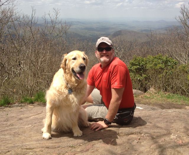
Well, I had another great send off from Amicalola Falls State Park on Thursday, April 18, 2013 as I started my hike from the AT approach trail up to the top of Springer Mountain. Mary, (Mrs. Whitewater) and Jackson drove around that afternoon to meet me on the summit. It was a beautiful day and I think Jackson had a ball!

IMG_1007 BDSC02607 BIMG_1012

DSC02618
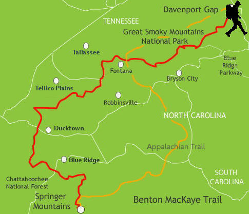
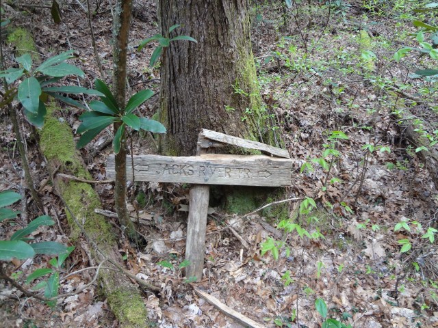
So, where do I start telling you about my trail journey? The BMT is often refered to as a brother/sister trail to the Appalachian Trail. After thru hiking it, I think the family must be pretty upset with the BMT because it appears to me that it is the red-headed step child of the family. It’s my feeling it has been abandoned to some degree. While the trail has some very well marked and maintained areas, I found just as many miles where the trail was hardly visible at all in my opinion and very difficult to follow. The tough areas pretty much lay between the end of Jacks River or Daily Gap (if you missed the BMT trail intersection like I did) in Georgia to the Twentymile Ranger Station at the entrance to the Great Smoky Mountain National Park (GSMNP).

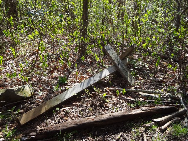
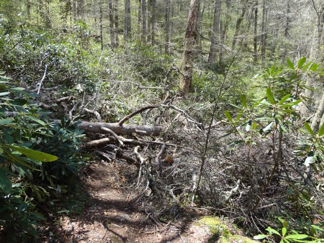
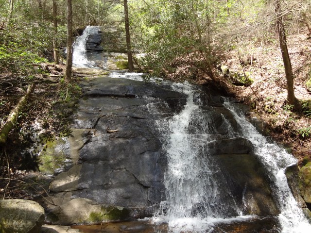
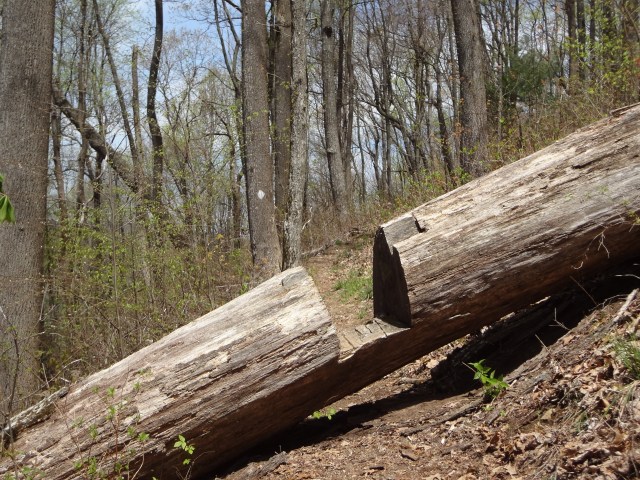
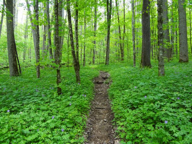
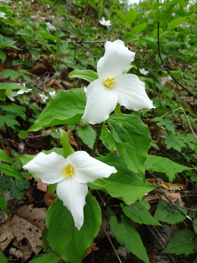
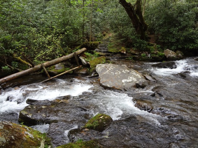
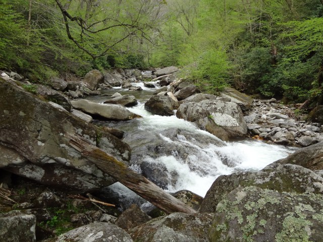
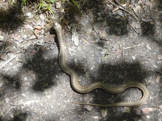
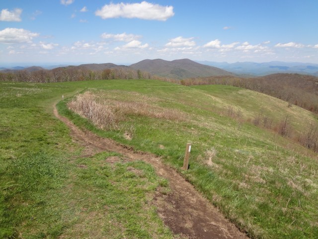
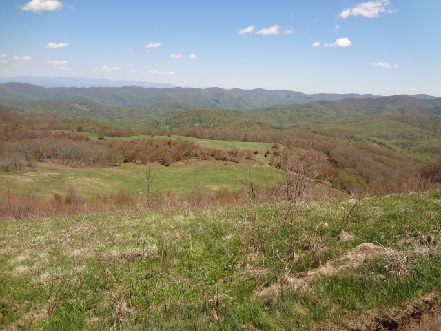
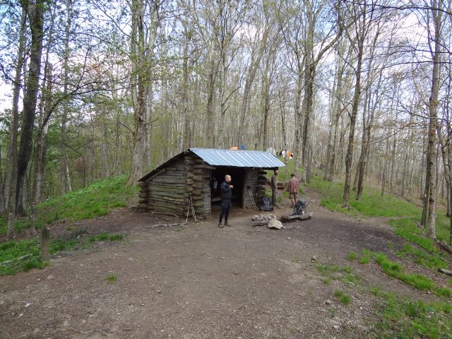
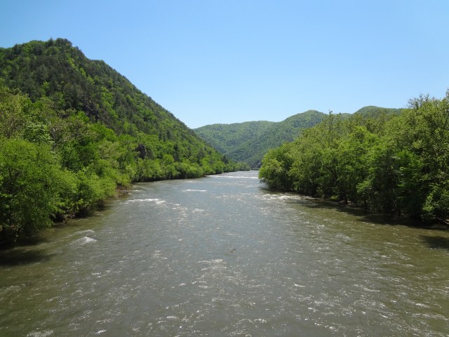
Just a few photos of what the trail really looks like below…this stuff goes on and on!

DSC02716DSC02831DSC02788DSC02720

DSC03014

With all that said …the BMT is still a fairly new trail.  It officially opened on July 16, 2005 and is mostly maintained and funded by volunteers and donations. I do realize that it has taken many, many volunteer hours to get the trail established.  I do appreciate the hard work. THANK YOU!

Did I have fun? I would still have to say YES, but I did find it very hard to mentally keep in sync with the trail this year. The weather was pretty much mostly wet and rainy with unusually cool temperatures for this late in spring. Last year on my Appalachian Trail thru hike, I never even spent one night camping alone. I didn’t plan it that way, that’s just the way it worked out. On my Benton MacKaye trip, I only shared a campsite twice with fellow hikers and that was when I was already in the Smokies. I could easily count the number of hikers on one hand that I saw on the entire BMT.  All of whom were basically day hikers. So my journey was really about three weeks of solo hiking with very limited to no people interaction. I always thought that I enjoyed solitude, but I’ve since learned that more than a week is too much.

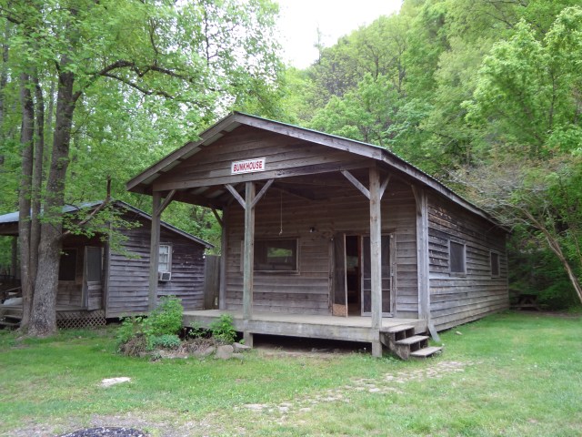
During my first real weekend on the trail, I found myself waiting out one of the many rain monsoons that took place on my trip just hanging out in a bunk house for three nights at the Hiwassee River Outfitters in Reliance, TN. This place was completely quiet and dead. I became the “chief security guard” on the property, basically because there was no one else around and no other place to visit within walking distance. The Hiwassee River Outfitters doesn’t open for business until Memorial Day weekend each year. I watched it rain and rain for two and a half days with zero entertainment. I was able to find one location on the property that I could call out to Mrs. Whitewater a few times between the almost constant rain throughout the weekend. I know now what solitary confinement in a prison must feel like, but at least they get three meals a day, TV, and a recreation hour! Being stuck in an empty bunk house in Reliance, TN was a pretty horrible experience to say the least.

DSC02764

DSC02769DSC02767Now, on to all the good stuff about the BMT which still far out weighed the bad.

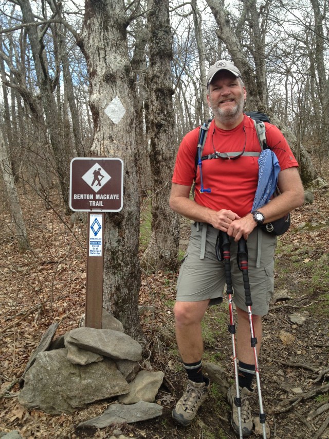
After completing the 8.8 mile AT approach trail and enjoying some time with Mrs. Whitewater and Jackson on top of Springer Mountain, I began my journey on the BMT. For the first few miles the trail winds down Springer, occasionally crossing and sharing the same path with the Appalachian Trail.  The BMT also follows a portion of the old original AT, which I understand was rerouted after 1957. Looping further west, the BMT crosses Chester Creek a couple of times before Three Forks (Chester is one of the creeks that make up Three Forks) about 6 miles from the top of Springer. I made camp the first night at Three Forks and what a beautiful spot it was.

DSC02623DSC02626

The next day after leaving Three Forks I hiked over The Bald, Wildcat Ridge, across the Toccoca River Bridge, and back up and over Mount Toonowee onto GA60.  Then I hiked down the road to Skeenah Creek Campground for the night to dry out from all the rain.

DSC02632DSC02634DSC02635

DSC02641After leaving the Skeenah Creek Campground, I made my way toward Blue Ridge, GA.

DSC02662DSC02673DSC02696DSC02700DSC02710
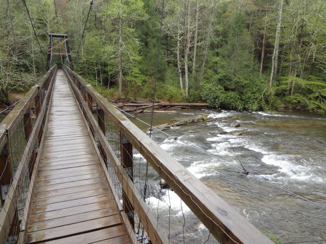
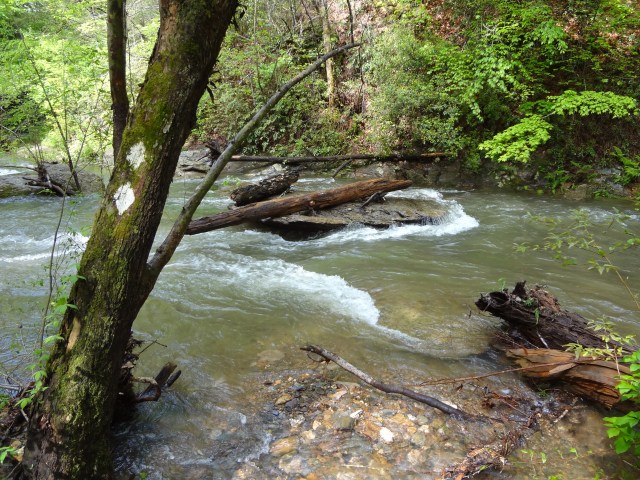
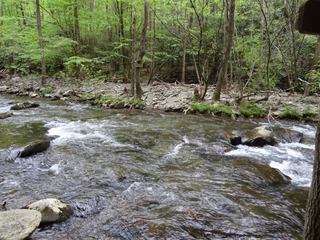
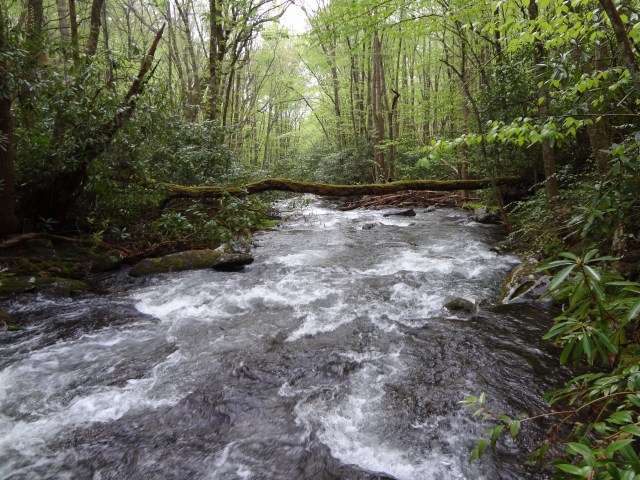
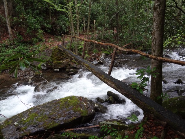
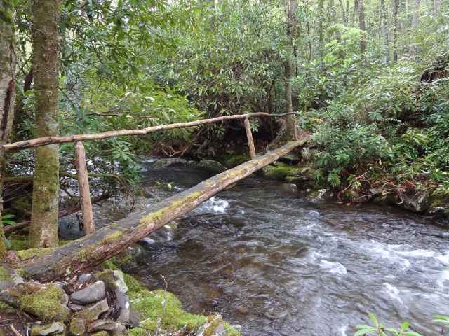
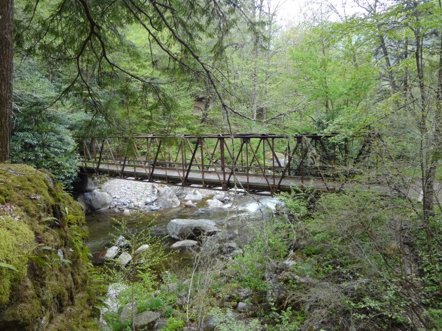
If you like fording creeks and streams, then the BMT would be for you. I honestly lost count of how many I crossed, but it was a lot! The heavy rains made for a couple of really epic crossings with the water well above my waist. All I could think about was how long it would take someone to find me if I got into trouble!

DSC02774DSC02775DSC02797DSC02804DSC02830DSC02897

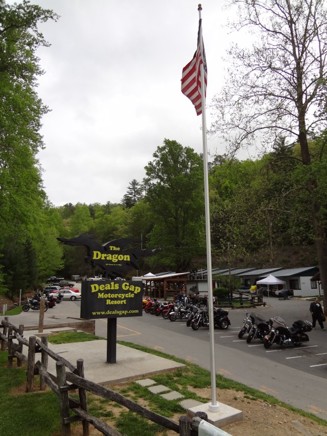
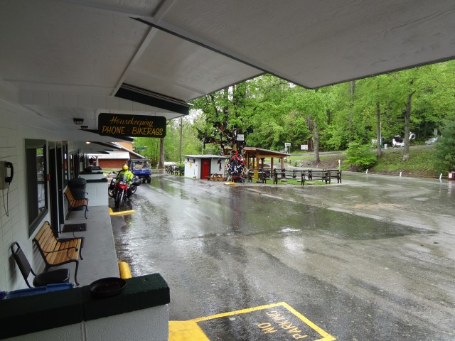
Before entering the Great Smoky Mountains, I was able to get to Deals Gap, TN on a Friday night before another weekend long rain out. At least this time I had some people around, a TV, and a place to grab a burger. Life was good!

Deals Gap Motorcycle Resort is just that, a place where motorcycle enthusiasts come from all over to ride the famous Dragon. The 11-mile stretch of the Dragon in Tennessee is said to have 318 curves. Some of the Dragon’s sharpest curves have names like Copperhead Corner, Hog Pen Bend, Wheelie Hell, Shade Tree Corner, Mud Corner, Sunset Corner, Gravity Cavity, Beginner’s End, and Brake or Bust Bend. The road earned its name from its curves being said to resemble a dragon’s tail. The Dragon also seems to be a very popular destination now for Mini Cooper owners as well.

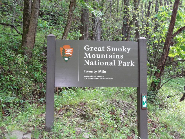
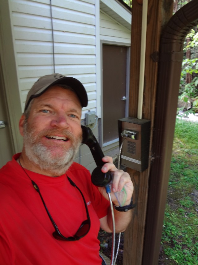
On Monday, the skies began to clear and I was able to leave Deals Gap and head into the Great Smoky Mountains National Park. Upon arriving at the Twentymile Ranger Station, I tried to make a backcountry reservation using the phone provided by the park service, but it was out-of-order. I proceeded on without a permit and truly didn’t feel one bit bad about it.

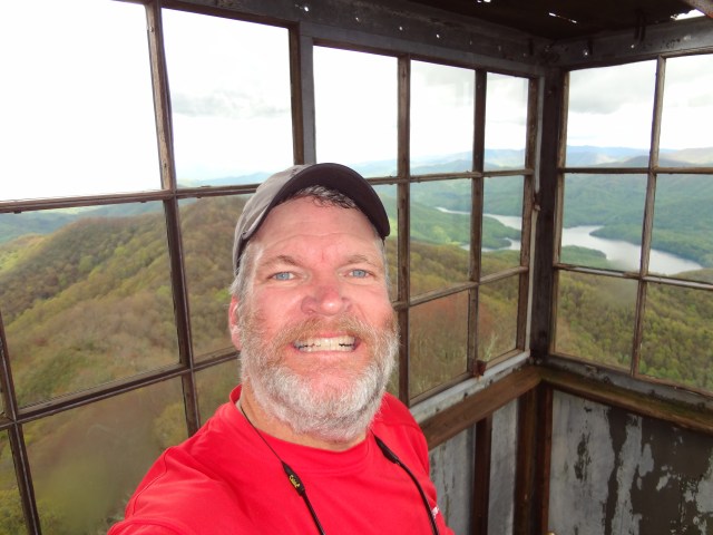
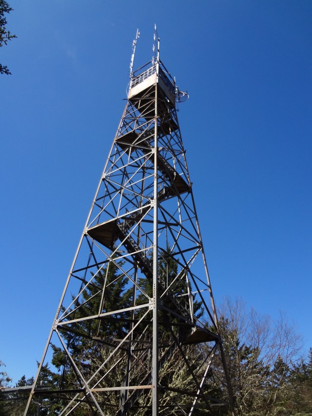
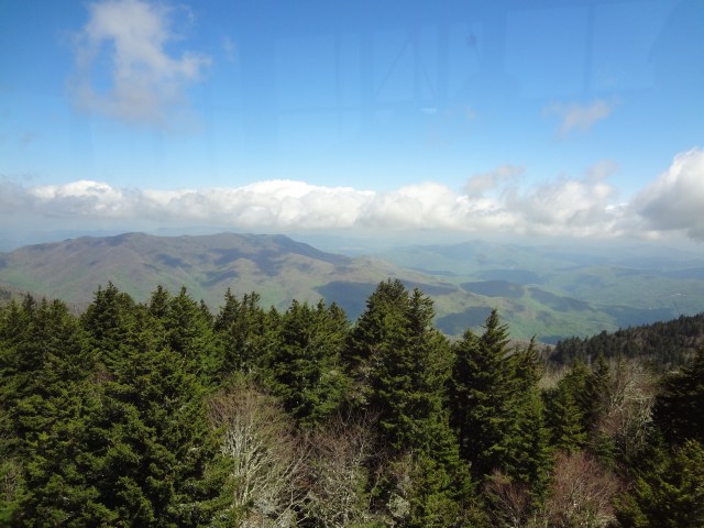
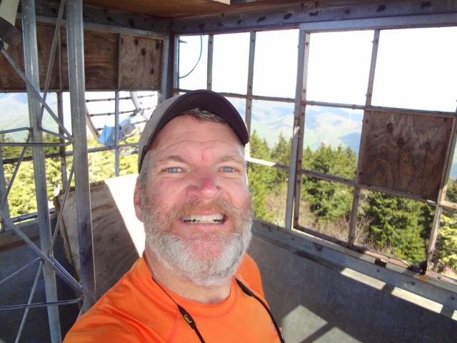
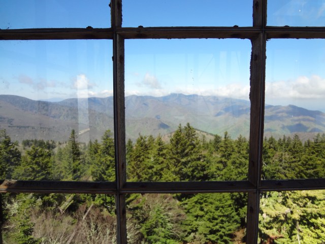
After several miles, I took a detour on the AT and went up to the Shuckstack fire tower. What a great view! The fire tower is old and dilapidated, a scary climb up, but what fantastic panoramic scenery awaits from the top.

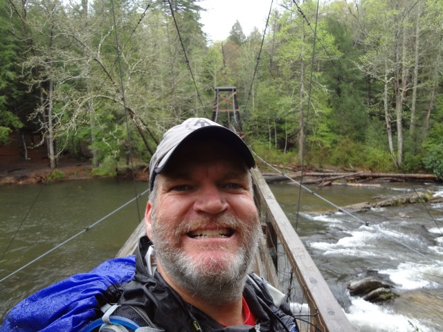
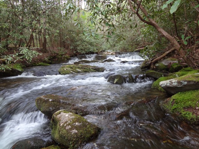
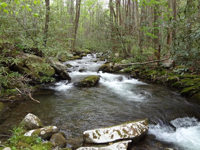
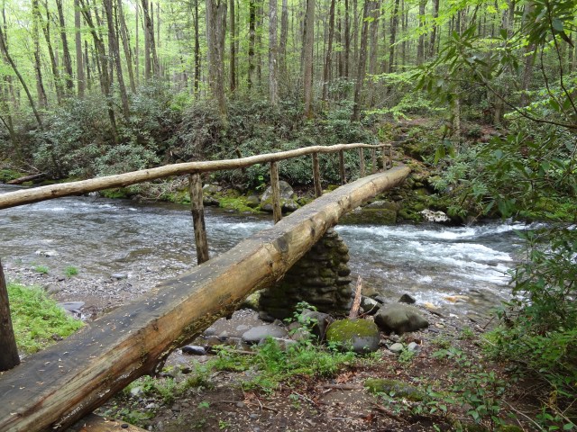
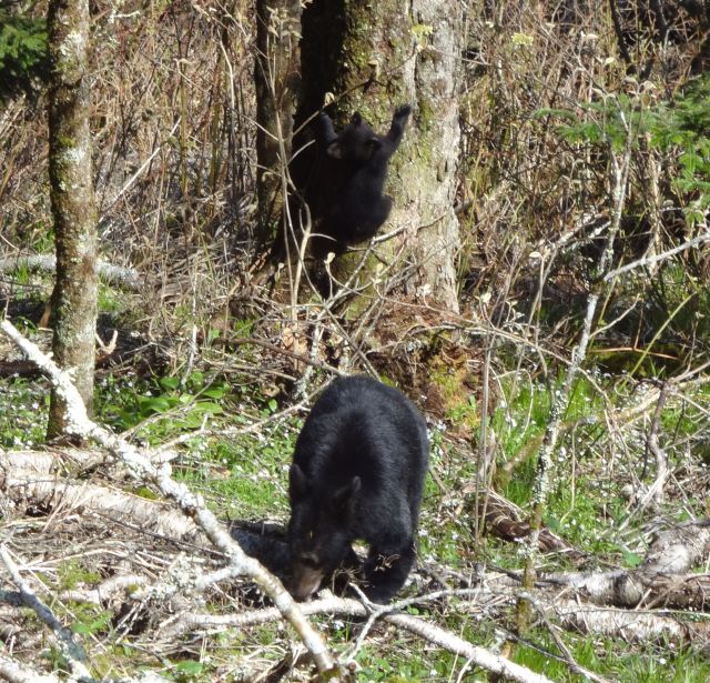
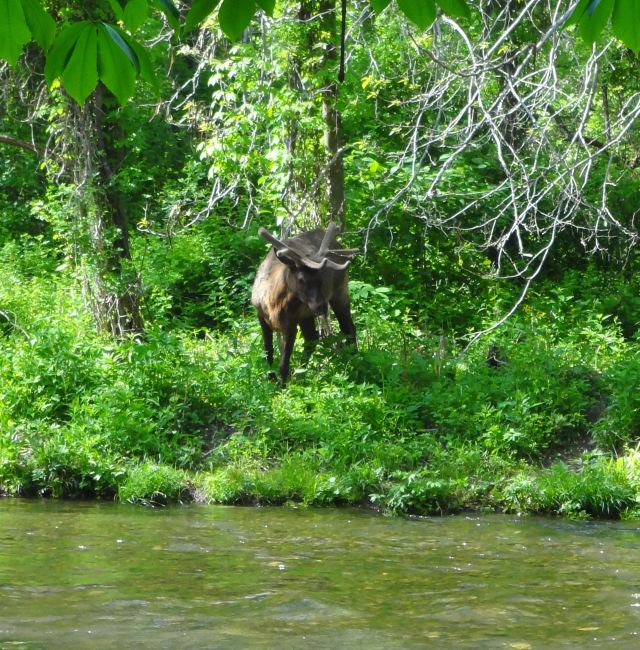
For the most part, the Smoky Mountains provided some better ways of crossing the creeks and streams.

DSC02844DSC02855DSC02857DSC02859DSC02872DSC02868DSC02894DSC02898DSC02905

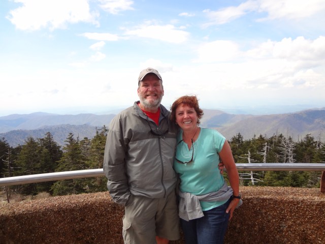
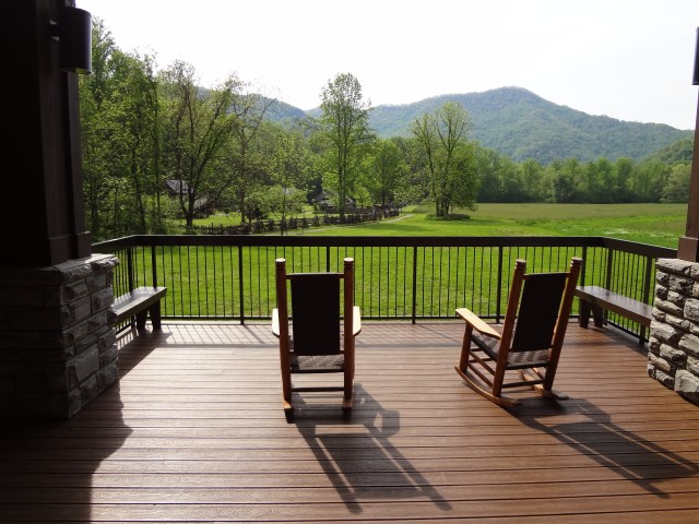
During my first three days in the Smokies, I covered 66 miles of trail and arrived at  Newfound Gap a day earlier than I had expected. So I camped at the Smokemont Campground there in the park. My camping neighbors were very nice. One couple brought me coffee in the morning and another couple brought me a bag of home-made cookies. I’m guessing they probably felt sorry for me and thought I may have been a bum or something. That’s a pretty common thing that can happen when you’re living in the woods for too long . Mrs. Whitewater drove up the next day and we toured the park and drove on into Cherokee, NC for the evening. What a great time we had and I enjoyed just relaxing. The shower, clean clothes, and food were a welcome change as well.

DSC02929DSC02930DSC02931 BDSC02942 BDSC02948

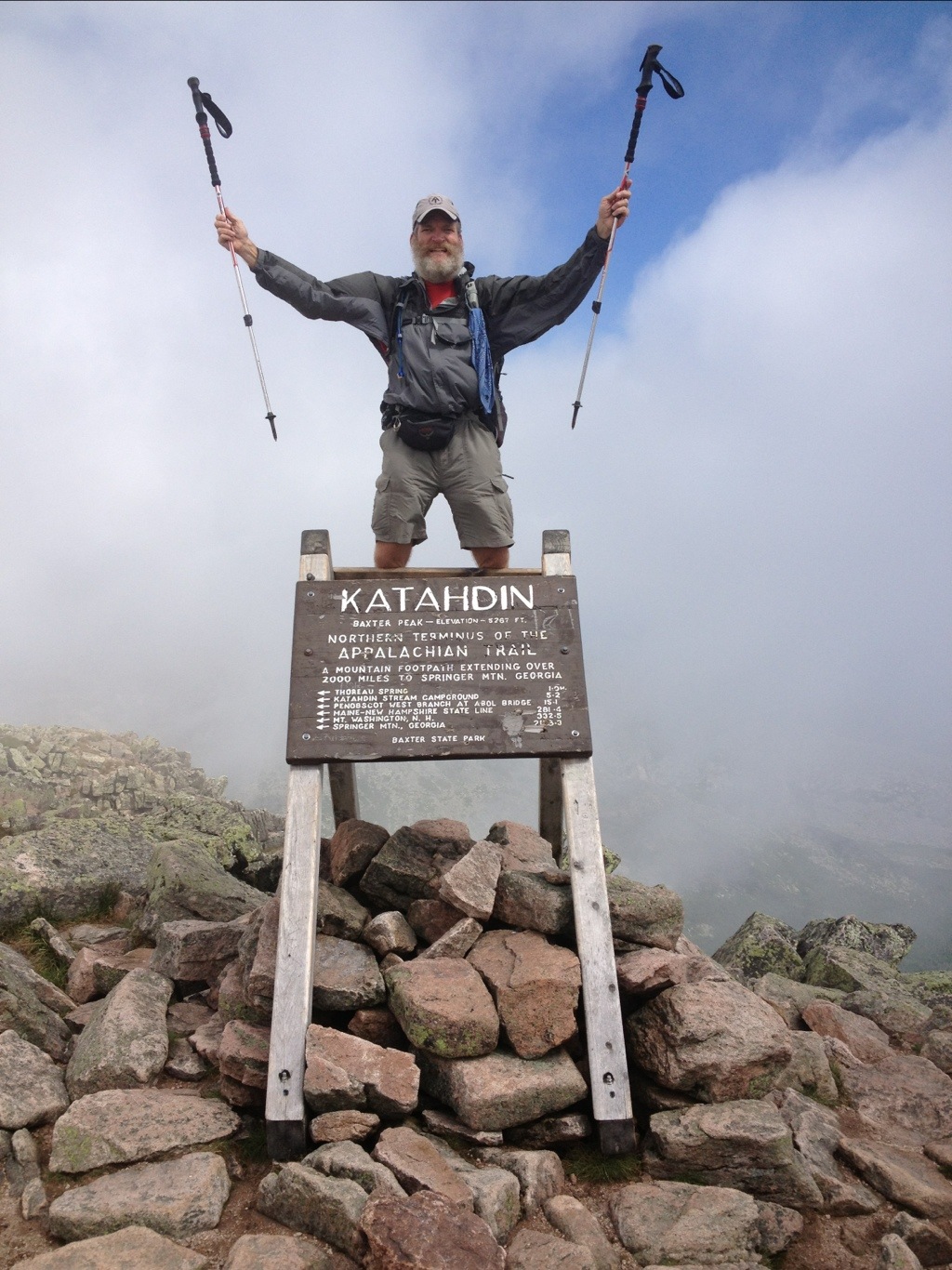
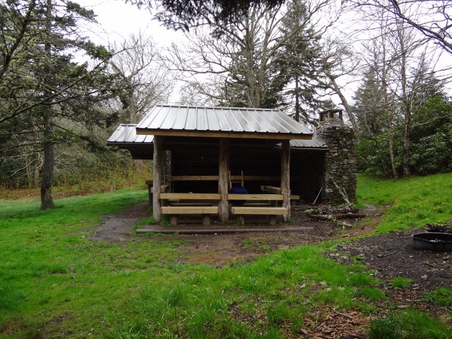
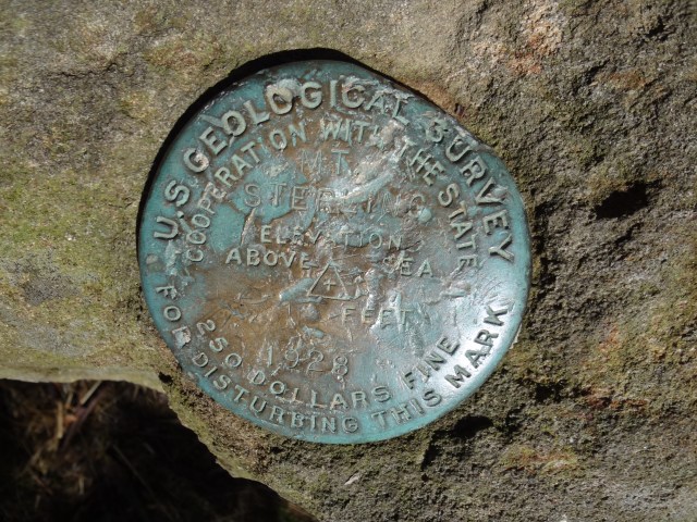
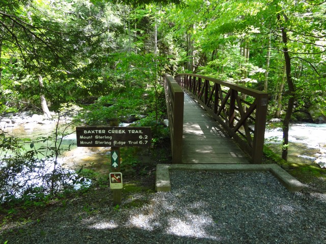
On my last night in the Smokies, which was also my last night on the BMT, I stayed at the Laurel Gap Shelter. I arrived very early, before noon, having covered only about nine miles so far for the day. The weather was rainy and I didn’t really want to summit Mount Sterling on an ugly day. I’m glad I waited because the next day was clear and beautiful. I enjoyed my walk up to the summit of Mount Sterling, which is also the highest point on the BMT at 5,842 feet. I took in the views from another old fire tower that still stands on its summit. From there I dropped down more than 4,000 feet to the bridge over Big Creek which is basically the end of the Benton MacKaye Trail (BMT).

DSC02957DSC02958DSC02964DSC02970DSC02980DSC02982DSC02988DSC02996

DSC02999DSC03000DSC03005DSC03006DSC03008DSC03017DSC03021

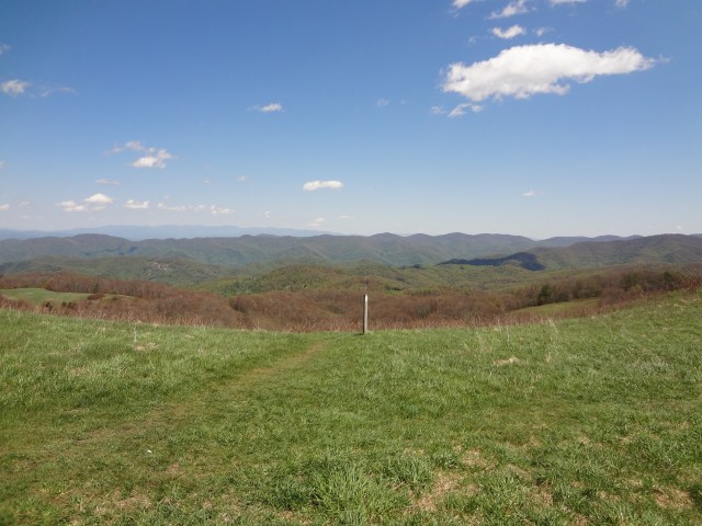
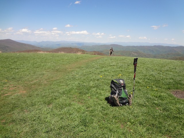
I spent two additional days hiking north on the AT before ending my hike in Hot Springs, NC. The AT was like hitting a major interstate! It was so well marked and full of people hiking north and south! On my thru-hike last year I had to hurry across Max Patch due to the weather. This year I had great weather and really enjoyed just taking my time across this beautiful area.
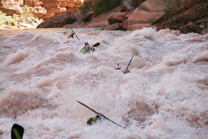
DSC03036DSC03037DSC03043DSC03047DSC03048DSC03050DSC03052DSC03063DSC03066DSC03067

Posted in Trail Updates | 26 Comments

Hitting The Benton MacKaye Trail (BMT)

7 BMT Map at Davenport GapI was beginning to think that mid April wouldn’t get here fast enough for me. I’ve been really looking forward to getting back out on a trail somewhere. I’m planning to start my Benton MacKaye thru hike next Thursday at Amicalola Falls State Park which is also the approach trail for the Appalachian Trail. Shortly after the summit of Springer Mountain, the Benton MacKaye Trail (BMT) forks away from the Appalachian Trail. The BMT runs from Springer Mountain in Georgia to Davenport Gap on the northern edge of the Great Smoky Mountains National Park. The BMT claims to pass through some of the most remote backcountry in Georgia, Tennessee and North Carolina.

During my hike, I plan to use the map above to mark my general progress along the trail with the use of this little guy AT Georgia to Maine Hiker Small II Black Transparentto mark my approximate location. Right now, my little guy, looks like he wants to head out on the Appalachian Trail, I’ll have to make sure he doesn’t go that way. I may not be able to do a post update along the way and may have to wait until I return from Trail Days in Damascus, VA.  I will keep current my trail stats, my general location map above and the Follow Me link on the right margin of my blog along the way.

DSC02557Mary (aka Mrs. Whitewater) will drop me off at the approach trail, pick me up for a night in Blue Ridge, and she and my dad hope to join me along the way and spend an evening camping out near Ducktown, TN at Thunder Rock campground next to one of my favorite rivers, the Ocoee. My son, Bill, will picking me up in either Hot Springs, NC or Erwin, TN and we’ll head on to Trail Days 2013 from there.

Can’t wait to be back on a trail…I’m ready!!

Posted in Pre-Hike | 10 Comments

Trail Magic Time!

Had fun this past weekend doing some trail magic for the 2013 NOBOs with Joe Jackson (Video) at Stecoah Gap in North Carolina. We fed burgers and hot dogs to forty plus hikers coming through the gap during a two-day period. It was great to meet all the folks heading north to Maine. It sounds like it’s been a tough couple of weeks out there on the trail from Springer Mountain with lots of snow, cold temperatures and rain to start their journey so far. I’m so thankful for the weather I had last year when starting my trek north…unseasonably warm weather. These guys have had a pretty rough start, to say the least. They truly deserved some good food and a fun break.DSC02591 B

DSC02593 B

Good luck to all the 2013 NOBOs !!  Enjoy the journey!!

Posted in Post-Hike | 1 Comment

Missing the Trail…

Well, it’s been almost six months now since I finished my thru-hike on the summit of Mt. Katahdin in Maine and at that time I thought that walking was out of my system and that I had accomplished enough on my journey north on the Appalachian Trail. Well, I’m just not sure if that’s going to turn out to be correct these days. It seems like there’s not an hour that goes by now that I’m not thinking about or wishing that I was back on a trail somewhere. This seems to be a very real and common problem among long distance hikers and I always heard that adjusting back to the real world was going to be tough. I think I’m finding that to be true.

So with permission from Mrs. Whitewater, I may…and that’s a big word…start planning and learning more about doing another thru-hike, this time on the Pacific Crest Trail in 2014. The (PCT) starts in Mexico and ends in Canada passing through three states California, Oregon and Washington. Along it’s 2,650 mile path, the trail goes from the desert, to alpine country, and then on to the rain forests of the Pacific Northeast. That’s pretty appealing to me, since I’ve never really spent much time on the west coast. I think I would really enjoy seeing this part of the county by walking through it. Some of the sites I would be trekking through would include: the Mojave Desert, the Sierra Nevada and Mt. Whitney, Yosemite National Park, Marble Mountain and the Russian Wilderness in Northern California, the volcanoes of the Cascades including Mt. Shasta and Mt. Hood, Carter Lake, Columbia River Gorge, Mt Rainer, and the remote Northern Cascades. Some awesome country to say the least!

So stayed tuned to my blog, because it may continue to expand in a new direction. I’ll wait and see where my life takes me here in the early days of 2013. Hopefully looking forward to getting back on a trail somewhere! My eyes have not adjusted back to my current environment, I’d rather be looking at something like this in the photo below!!

Sheep Lake

In the mean time while I continue to ponder over my PCT adventure up the west coast, I’m planning to do a short thru-hike here in the southeast this spring on the Benton MacKaye Trail (BMT) ending on the AT either in Hot Springs, NC or Erwin, TN, roughly a 400 mile trek. If my timing is right, I hope to finish the BMT in time to continue on north to Damascus, VA for Trail Days 2013 which is on the weekend of May 17th thru 20th.

Hiking On…WHITEWATER.

Posted in Post-Hike | 9 Comments

Mt. Katahdin, Baxter State Park, ME

Day 150 – Monday, August 6

I’M ALL DONE WALKING…I will continue to make several adds to this post in the coming days after returning home from Maine. Thanks for everyone’s interest and support in both my journey and the Hudson Family Foundation!

20120807-203305.jpg

“Man is born to die, his works are short-lived. Buildings crumble, Monuments decay. Wealth vanishes but Katahdin in all its glory, Forever shall remain The Mountain Of the People of Maine..”
~Percival P. Baxter

History of Baxter State Park: The park was a gift to the people of Maine from Governor Percival P. Baxter, who used his personal wealth over a 32-year period to purchase and donate the original 201,018 acres of the park.  Since his death in 1969, the park’s size has been increased several times.  The headquarters is located of 20 miles from the actual park entrance in the small town of Millinocket.  There are no stores or gas stations inside the park.  Access and use are strictly regulated in accordance with Gov. Baxter’s wishes to keep the park “forever wild”.

Some additional Mt. Katahdin summit photos.

Fellow thru-hikers below (Motown, Philly Ben, Stinger, Whitewater..me, Red Man and Dundee)

Mary and Bill made the final summit with me.

Some photos climbing up and going down Mt. Katahdin. The picture below is Katahdin Stream Falls.

Bill, on the way to the summit of Mt.Katahdin, which is in the clouds behind him.

I enjoyed some local fun and music in Monson before entering the 100-Mile Wilderness. The local town hardware store opens up every Friday night for an impromptu jam session… everyone welcome…bring your favorite instrument…or in my case, ears, for some serious jamming. Really good stuff!!

A quick video below of the action.

Entering the 100-Mile Wilderness.

Taking a Blue Blaze over to White House Landing.

Moving on through the Wilderness towards Abol Bridge.


And Yes…One last summit photo for the old Yellowstone Dew Crew!

Posted in Trail Updates | 23 Comments

Monson, ME

Day 140 – Friday, July 27

114 Miles remaining to Mt. Katahdin, Maine – and Lobsterfest

Coming into Monson, ME yesterday afternoon was pretty emotional knowing it’s the last trail town until I complete my thru-hike. Monson is the southern most point of the 100-mile wilderness before entering Baxter State Park and Mt. Katahdin. I’m having lots and lots of mixed emotions these days as my journey’s end is very near.

The pictures below are some of my last in New Hampshire before crossing over the state line and entering my last state…Maine.

Proud to be a new member of the 2,000-miler club!

On top of Avery Peak…great views and great weather!

Screwloose doing another food challenge in Stratton.

Those beavers know how to do some construction work!

Crossing the Kennebec River by the last man powered ferry service in the country.

A memorial sits out in front of the Pierce Pond Lean-to for Parkside, the first 2012 thru-hiker to die on the trail. He drowned while swimming in Pierce Pond.

Just a few additional photos below, while hiking through Maine.

Wow…I’m very close to the end and Mt. Katahdin. Looking forward to the 100-Mile Wilderness up ahead.

Posted in Trail Updates | 4 Comments

Gorham, NH

Day 126 – Friday, July 13

316 Miles remaining to Mt. Katahdin, Maine – and Lobsterfest

The White Mountains are just AWESOME!! I’m so glad that the scenery continues to get better and better as I head north to Maine.

We all enjoyed our first work for stay at the Lonesome Lake Hut as we started into the Whites and up Franconia Ridge.

Lake of the Clouds Hut and the summit of Mt. Washington, home of the worst weather in the world.

I’m just a couple of days out from entering Maine now. 🙂

Posted in Trail Updates | 10 Comments

North Woodstock / Lincoln, NH

Day 120 – Saturday, July 7

389 Miles Remaining to Mt. Katahdin, Maine – and Lobsterfest

Thought I needed to add a few additional photos from my family and friend’s visit to Vermont. Below is my son, Bill, my wife, Mary “Mrs. Whitewater,” and our good friend, Yvette Westbrook enjoying a break on Baker Peak just outside of Danby, VT.

My last day of hiking in Vermont was really beautiful and I even got invited by some kind local folks for a shower and dinner. Thanks so much for the fine hospitality given by Alexandra, Martha, and their daughters in White River Junction, VT. What a great treat and break from the trail! The coffee and breakfast the next morning were a nice way to start the day as well. Many thanks again!

From Vermont, we crossed over into New Hampshire at Hanover and spent several hours walking around Dartmouth College and the town and visiting as many of the local restaurants as we could. As we moved on towards the White Mountains, Bill below, offered a great break from the trail on his porch as he gave thru hikers free ice cream and water before heading up the trail to the top of Smarts Mountain. On the 4th of July, and on my way up Smarts Mountain, I passed a really neat mile marker indicating that I had 412 miles left to Katahdin. It now seems to be very close and I have chosen Monday, August 6th to be my final day on the trail and journey’s end on Mt. Katahdin.

Yesterday, I made it to the top of Mt. Moosilauke, which is right at the beginning of the White Mountains.  The view was panoramic…360 degrees….just awesome!

I hope everyone had a great 4th of July! Moving on towards Maine! WHITEWATER

Posted in Trail Updates | 3 Comments