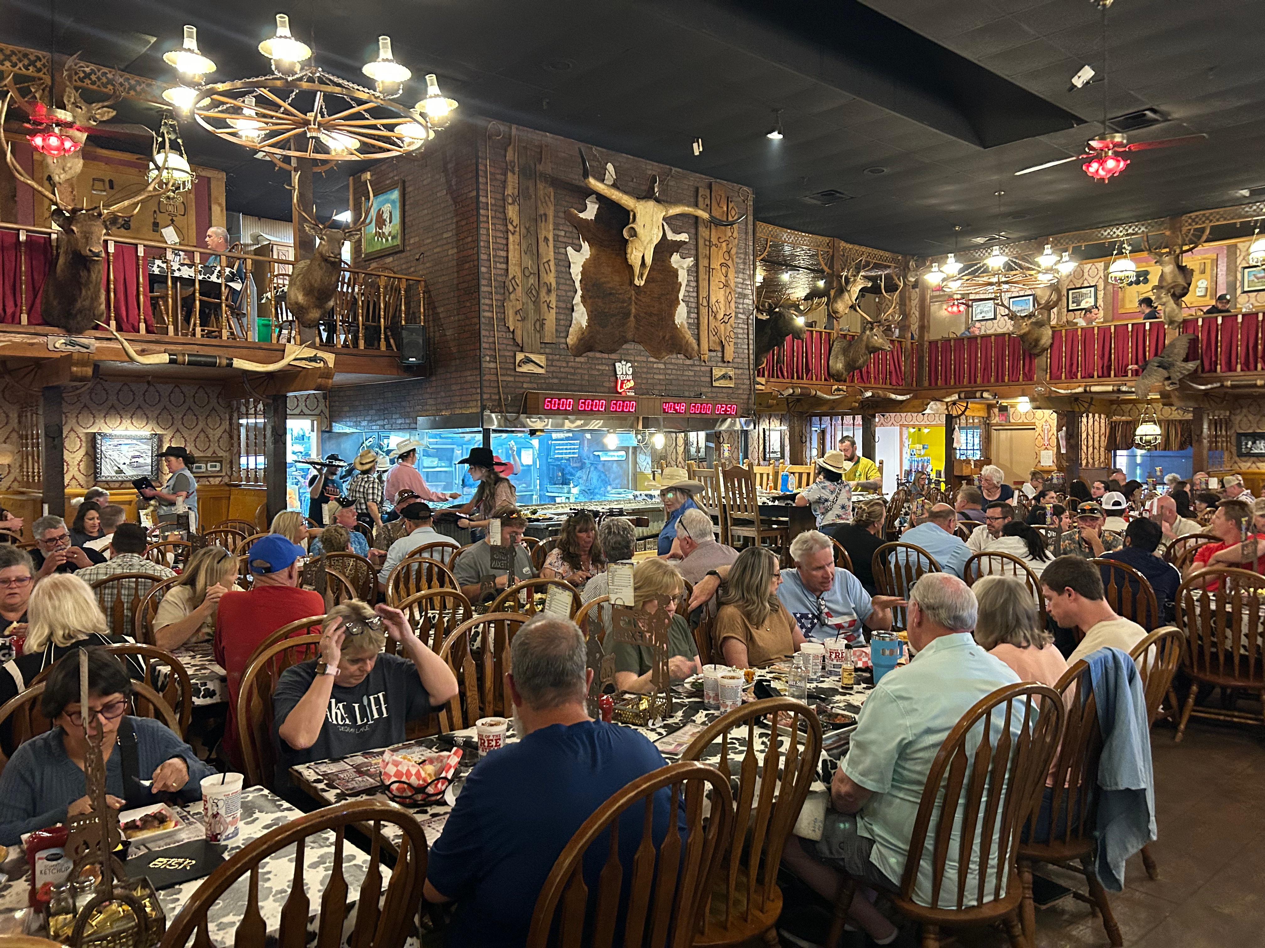
I hit the road heading west on Tuesday September 2nd towards Moab, Utah to meet up with the Green River Canoe trip crew for the following week’s adventure. I left the north Georgia mountains around noontime and stopped by the Bass Pro Shop in Huntsville, Alabama. It has been a while since I’ve been in Huntsville but enjoyed my visit there. I was very impressed with the whole area and how nice it was. Later that evening I found a camper friendly Walmart parking lot somewhere in Arkansas to get some sleep in the ROG camper for a few hours. I hit the road again early the next morning in hopes at arriving in Amarillo, Texas and stopping by the Big Texan Steak Ranch for dinner. I made it there late afternoon and ended up camping at their Big Texan RV Ranch a block down the road from the restaurant. I had a great dinner and the campground turned out to be a nice and enjoyable spot for the evening.
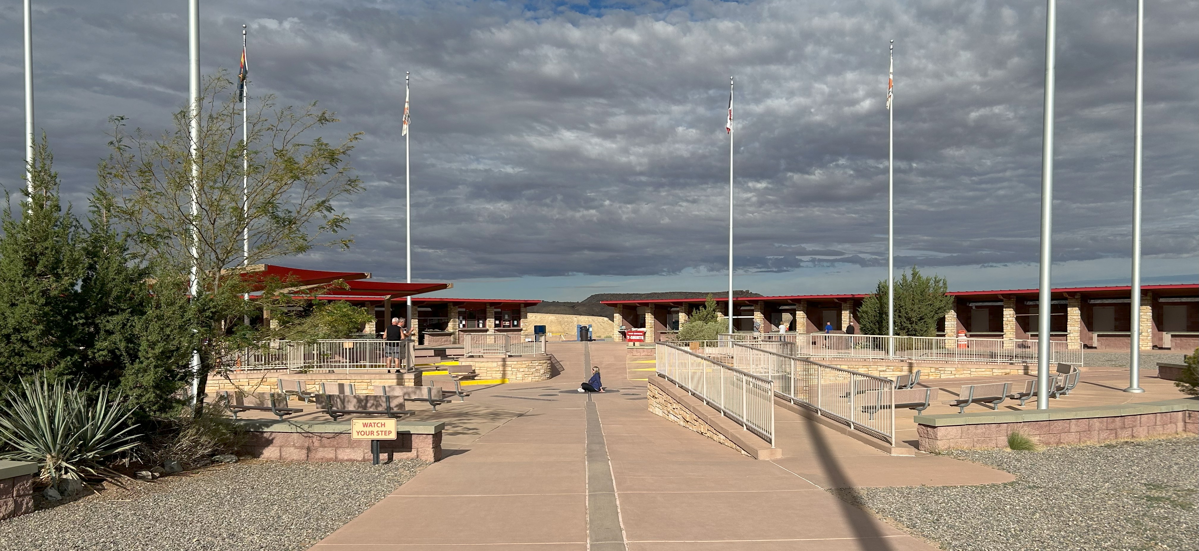
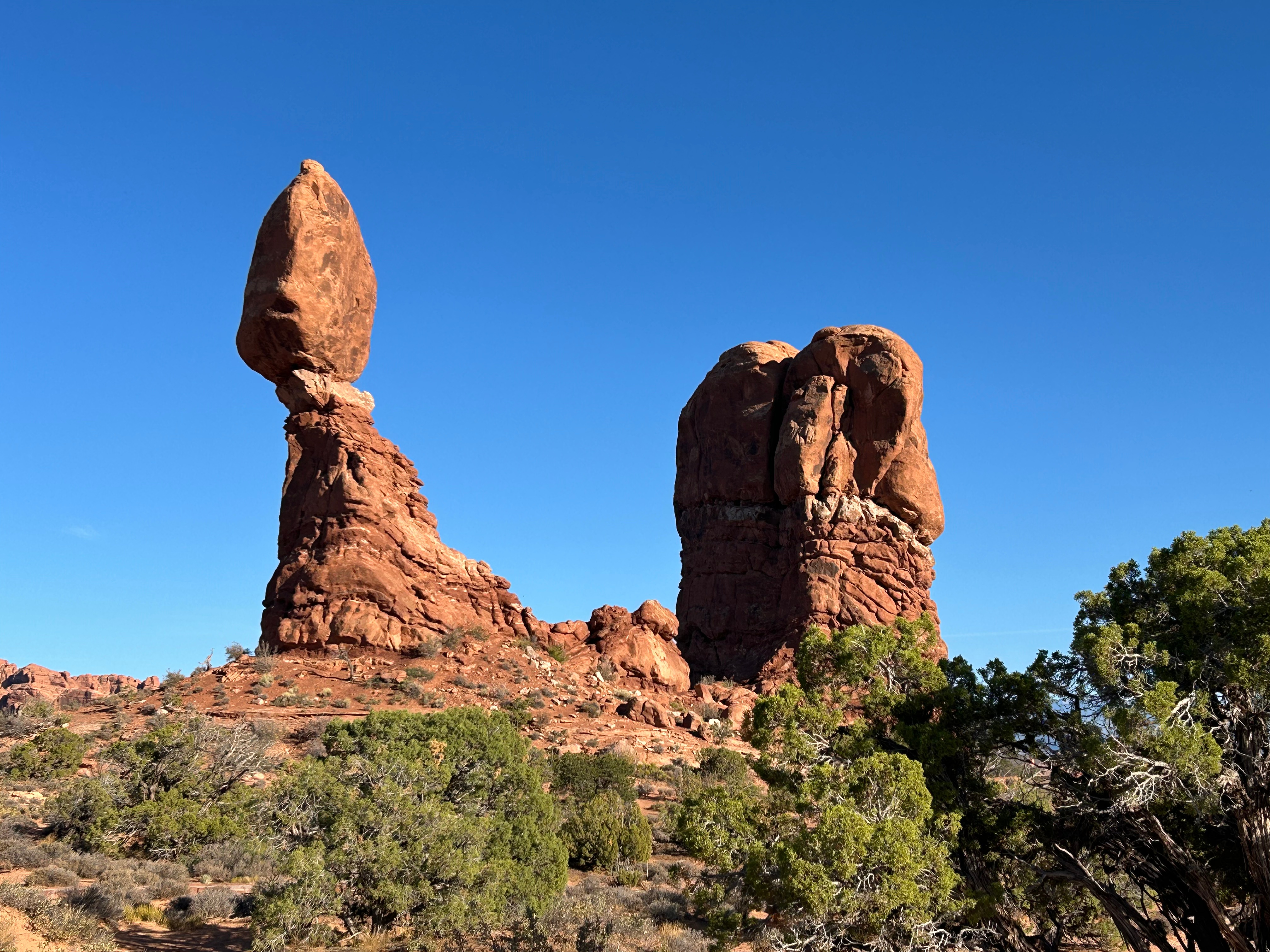
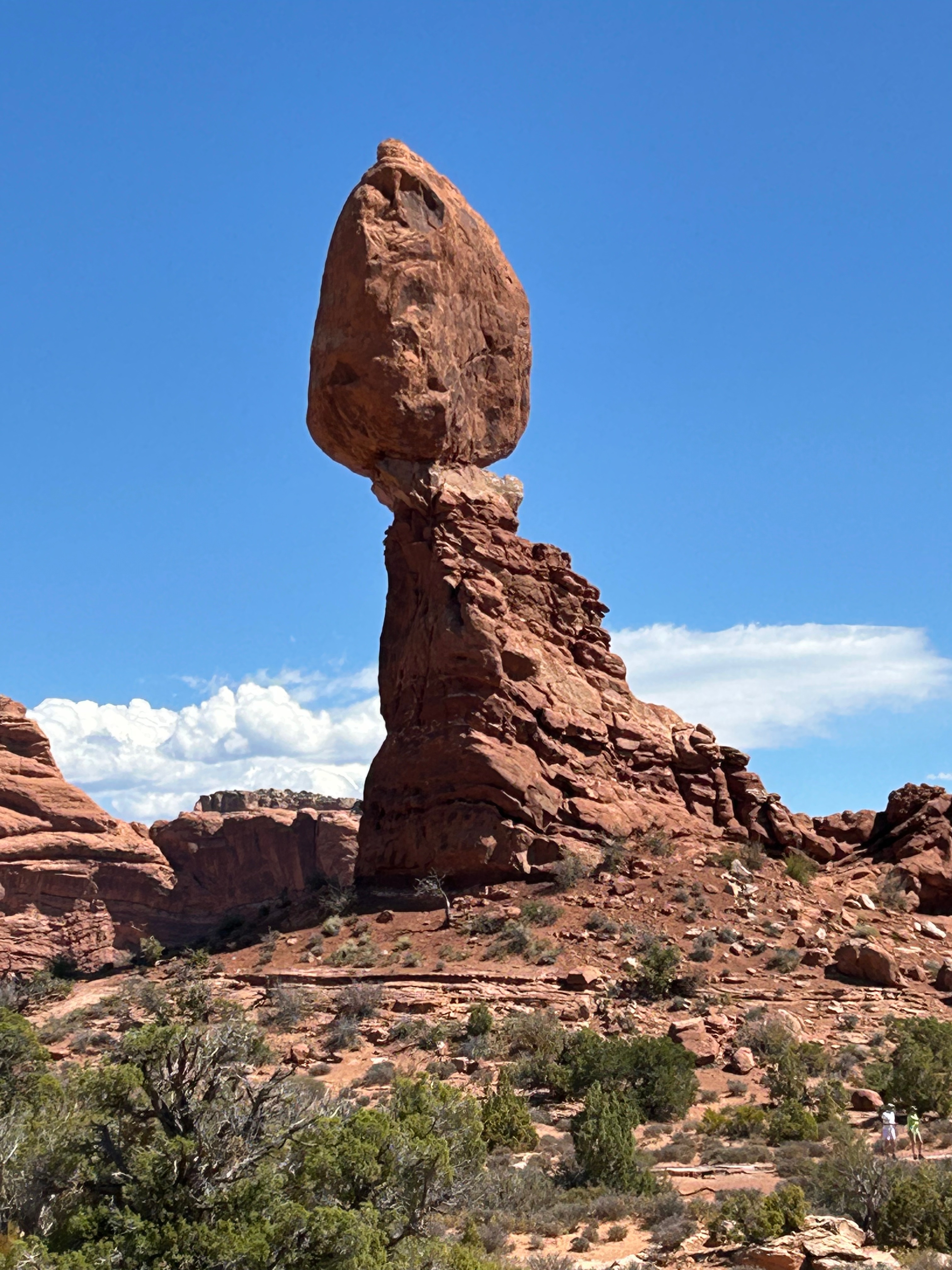
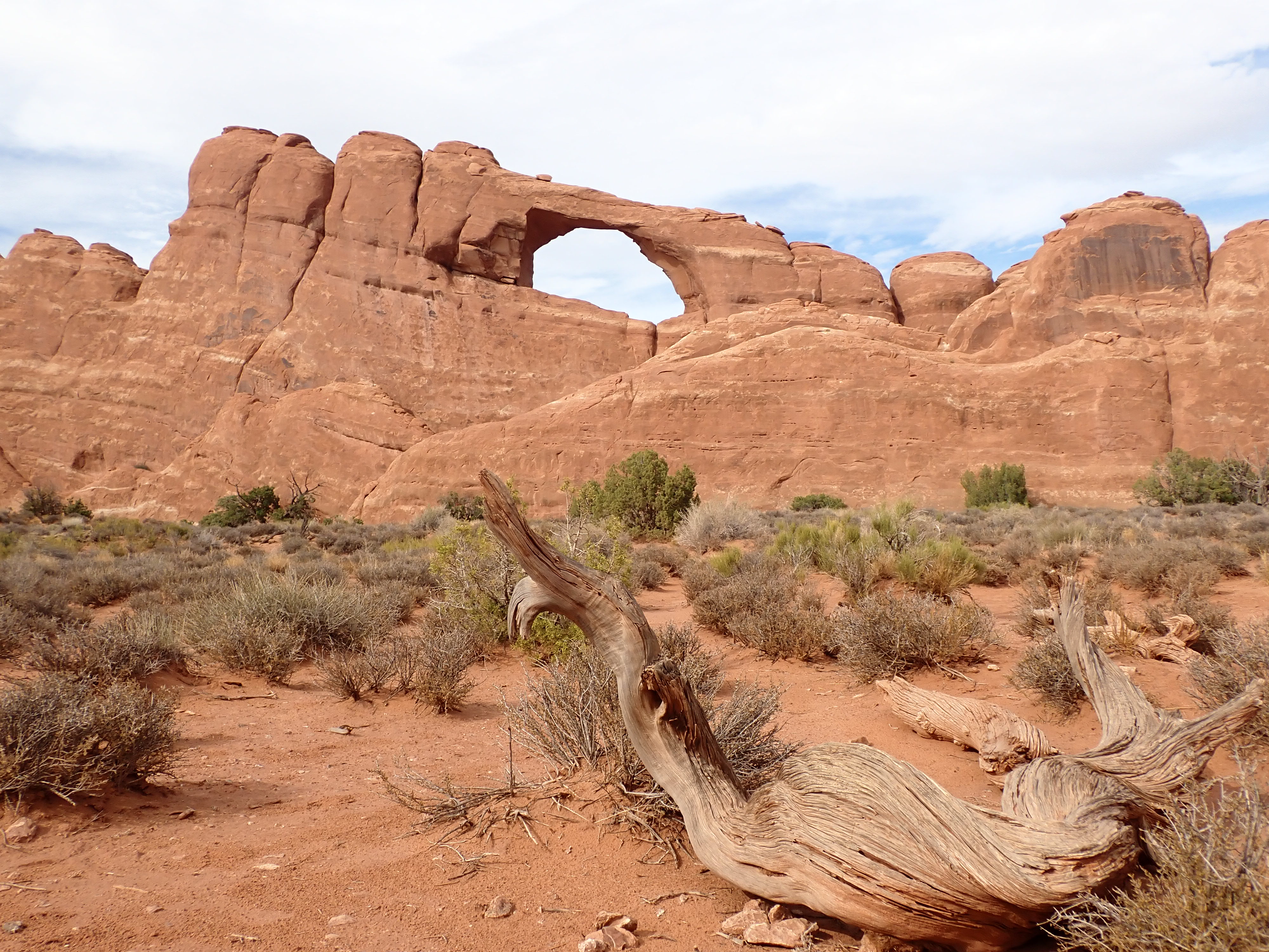
By Thursday night I had made it to UTE Mountain Casino RV Park in Towaoc, Colorado for the night. I had a pretty good buffet dinner at the Kuchu’s Restaurant there at the casino. I woke up the next morning and decided that I would do a little back tracking to the Four Corners Monument. It was pretty cool to stand in four states at one time, but I’m not sure I would advise anyone to go out of their way to see or visit this attraction. From there, I had a very scenic drive into Moab, Utah. I had already made a camp reservation for the next three nights at a pretty cool campground called Sun Outdoors Moab Downtown. A lady camping next to me in Amarillo told me she had just left the Moab area and highly recommended Sun Outdoors for the place to camp in Moab, especially for its convenience. It was a really nice location for I could walk everywhere in the town and Arches National Park was just up the road a small piece by car. I spent most of the weekend exploring the surrounding area.
On Monday morning, September 8th, I had to close my camp down and take the ROG camper to a secured short term storage area while on the Green River Canoe trip. That night before the canoe trip and the night after I already had a hotel reservation at the Hoodoo (Hilton) in town. The grounds and rooms there were extremely nice.
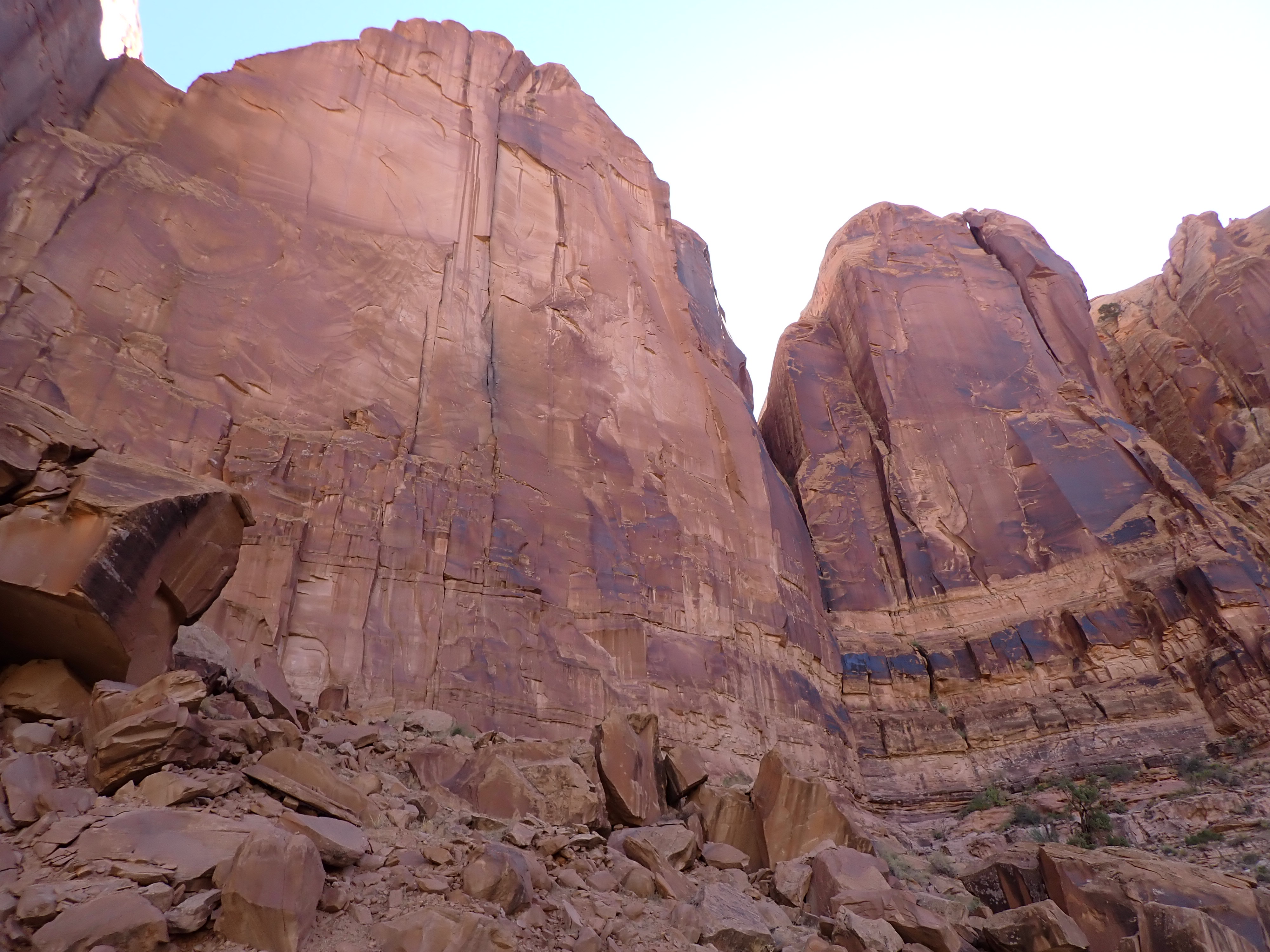
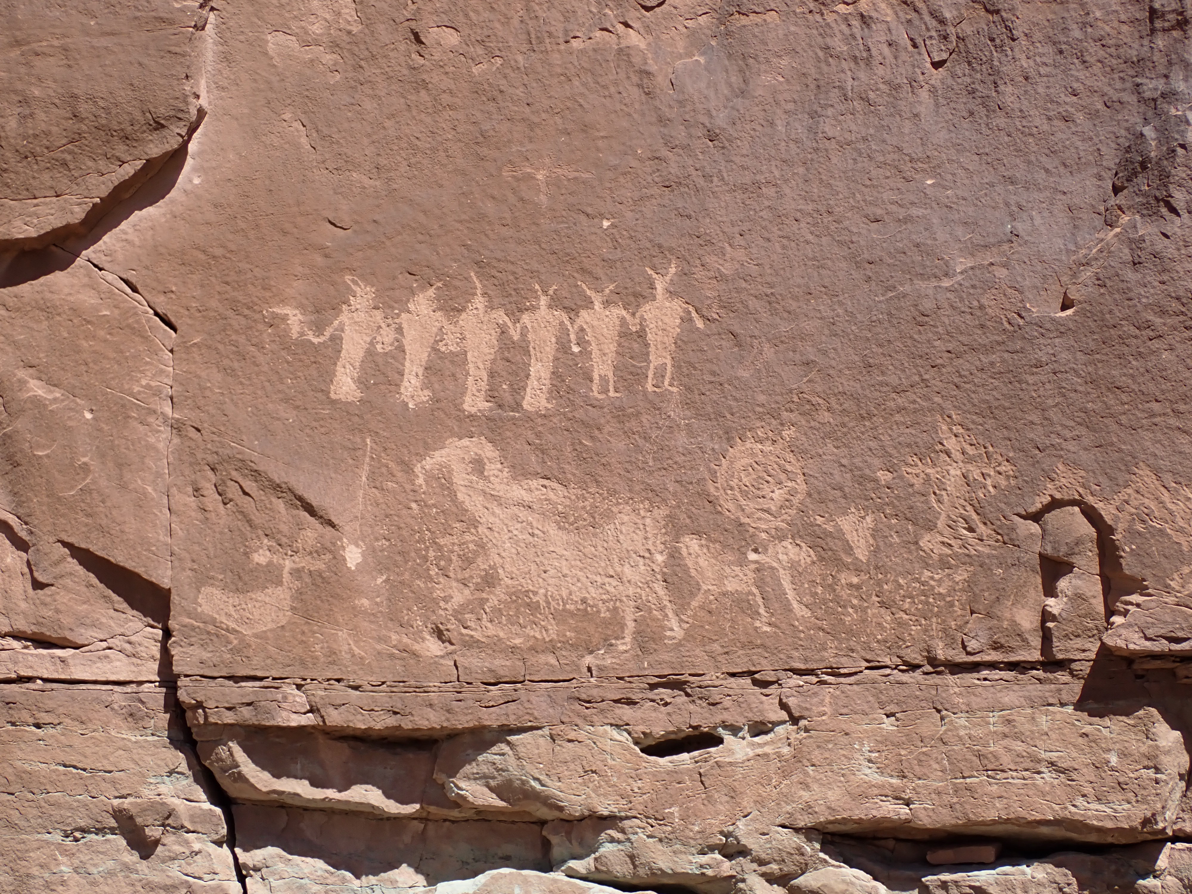
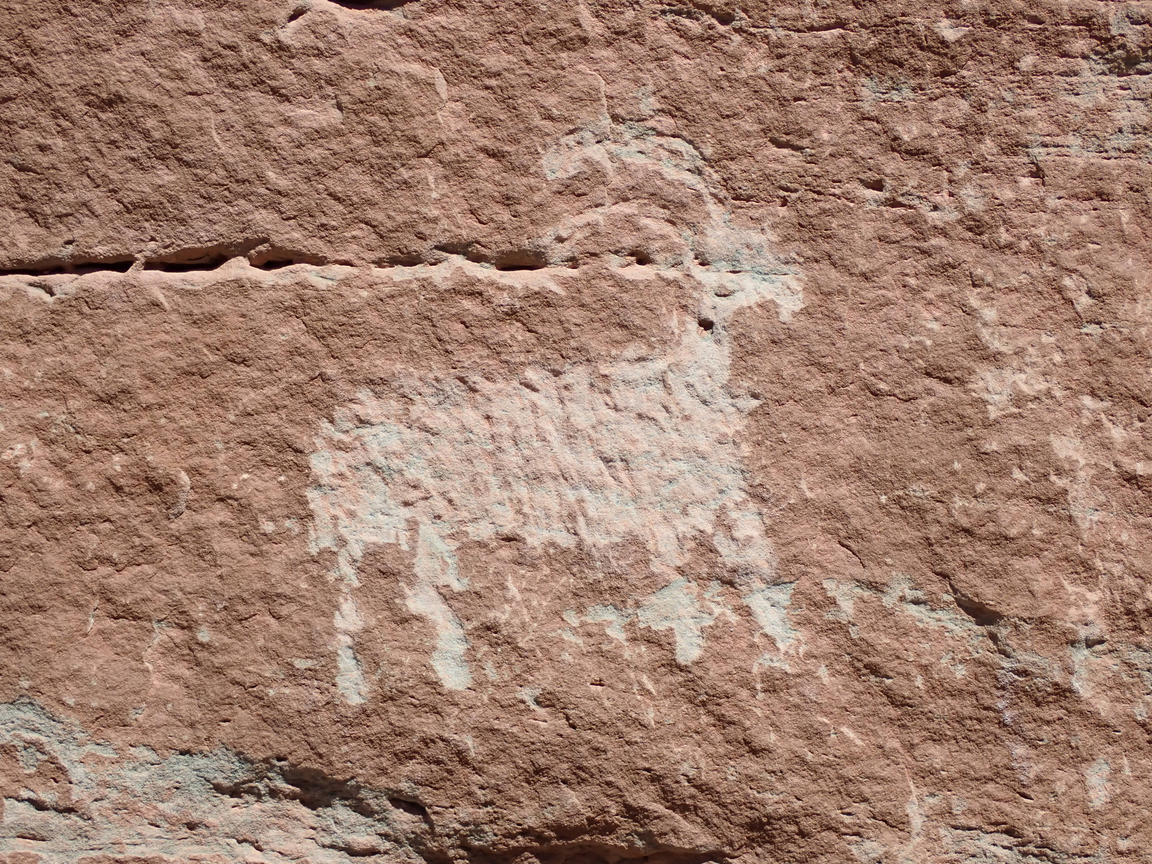
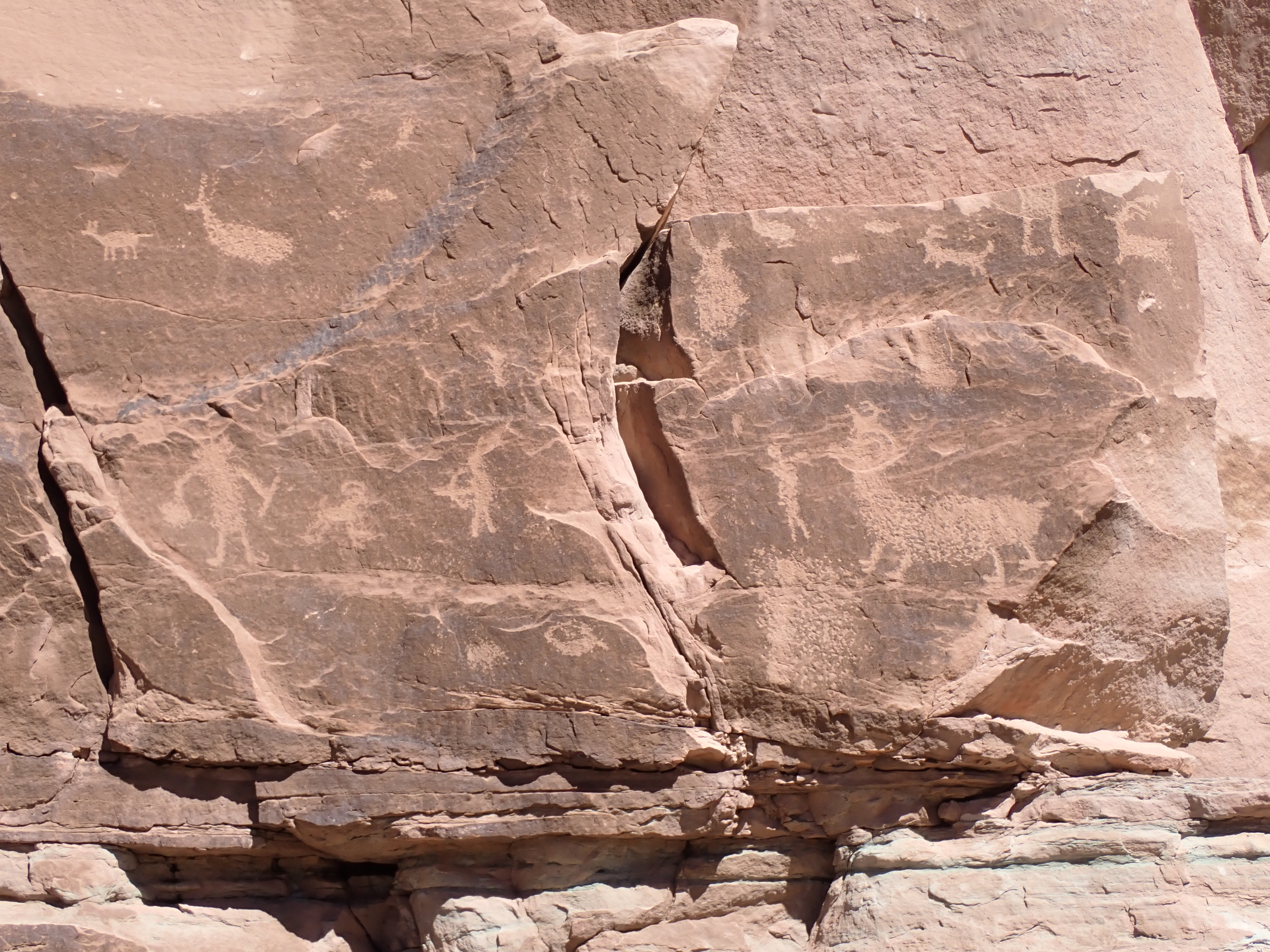
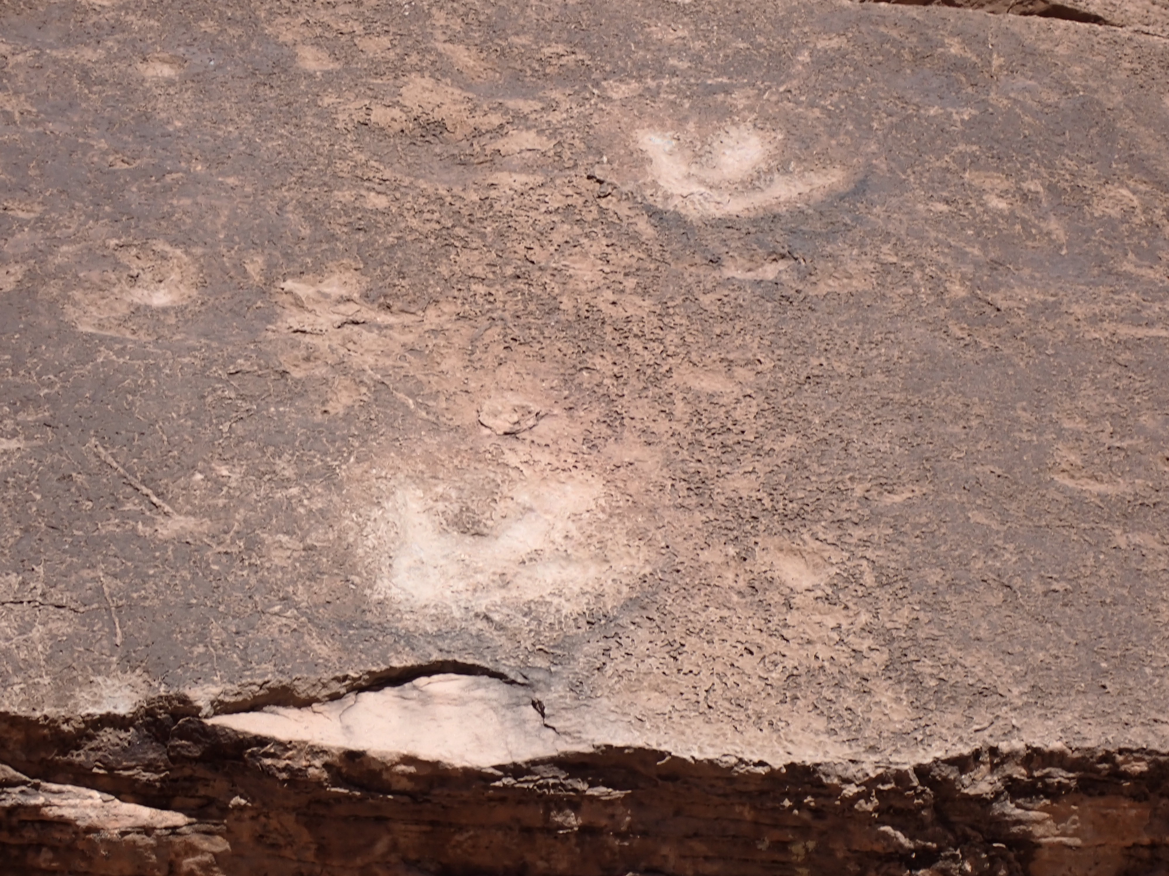
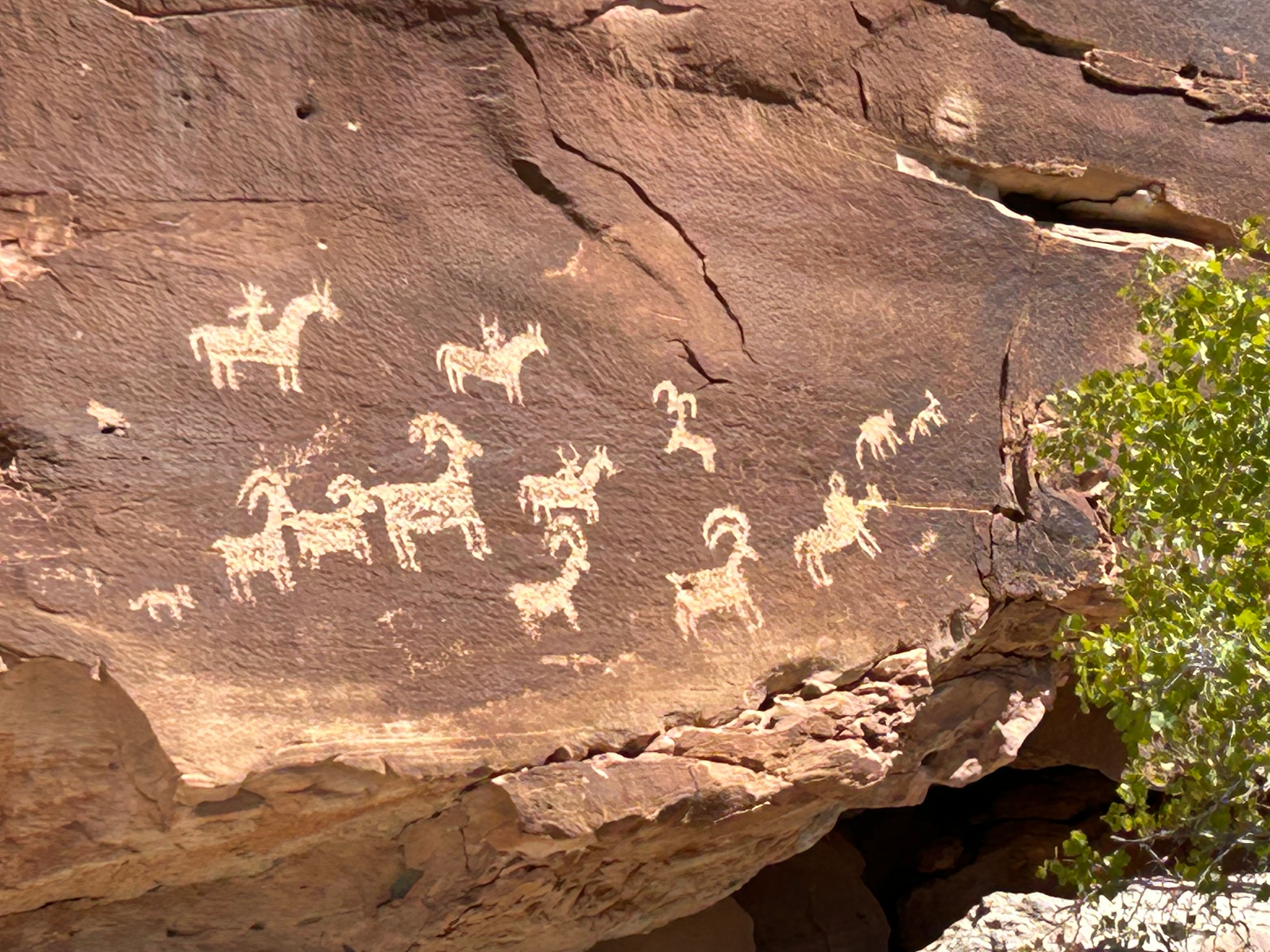
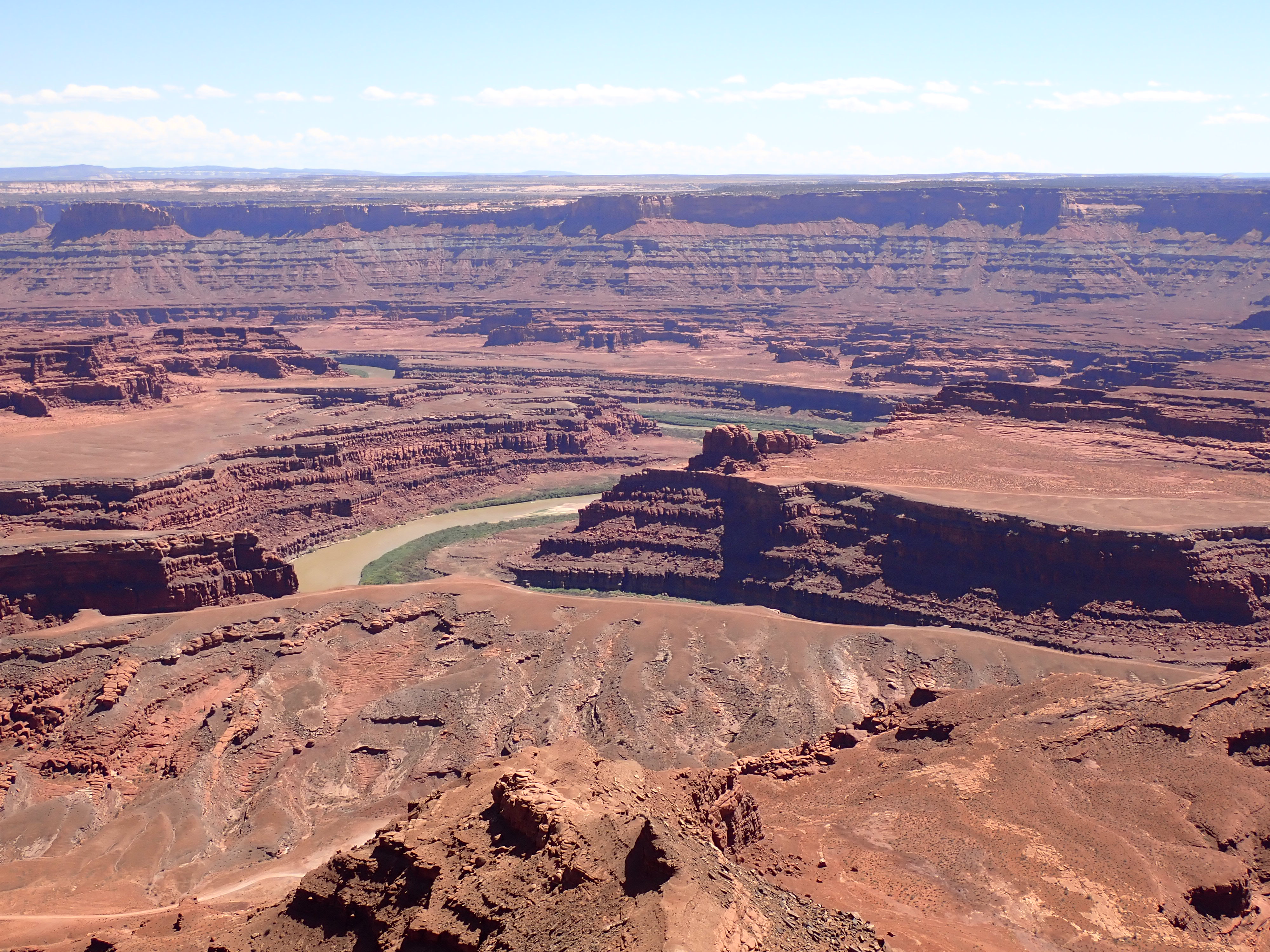
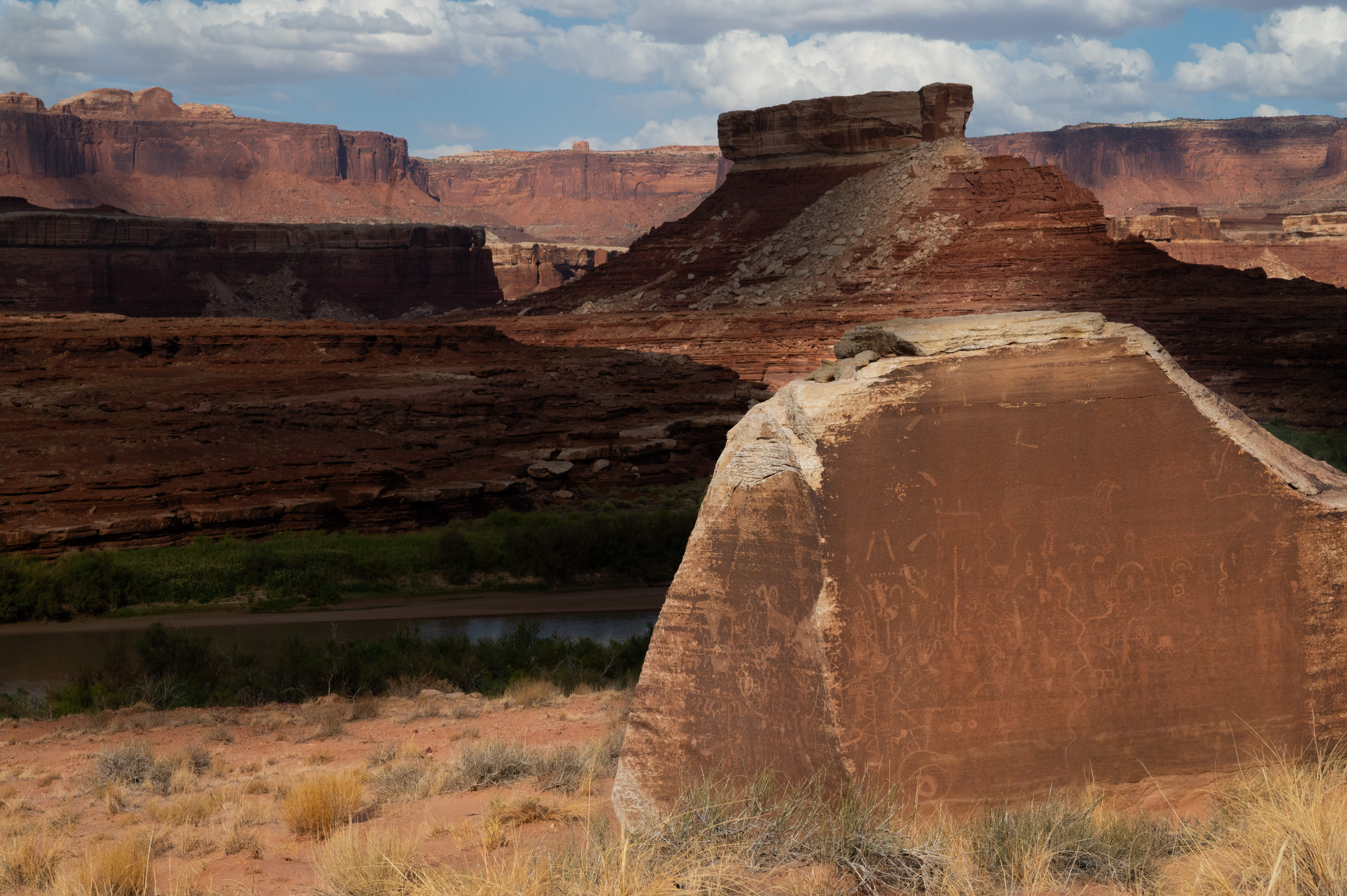
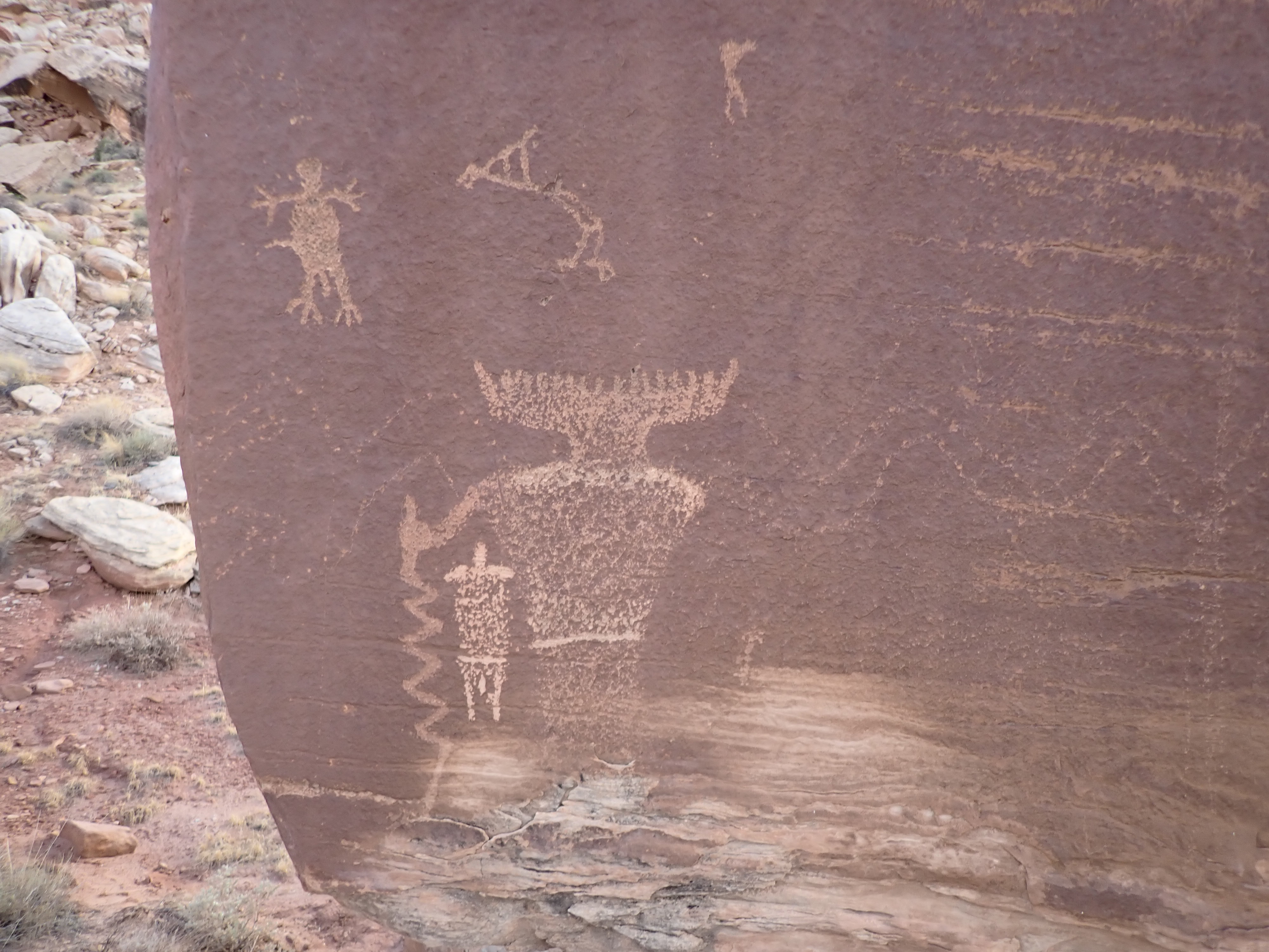
The storage area was just a couple of miles south of town and just when I arrived there, I see Bob and Ryne out touring around and looking for petroglyphs locations in the area. I suddenly found myself in their rented jeep and off we went for the afternoon checking out more petroglyphs finds. We even found some dinosaur footprints dating back 190 million years ago, very cool! We had a great time and even made a quick stop in Dead Horse State Park before having to pick a couple of other crew members up at the Canyonlands Regional Airport.
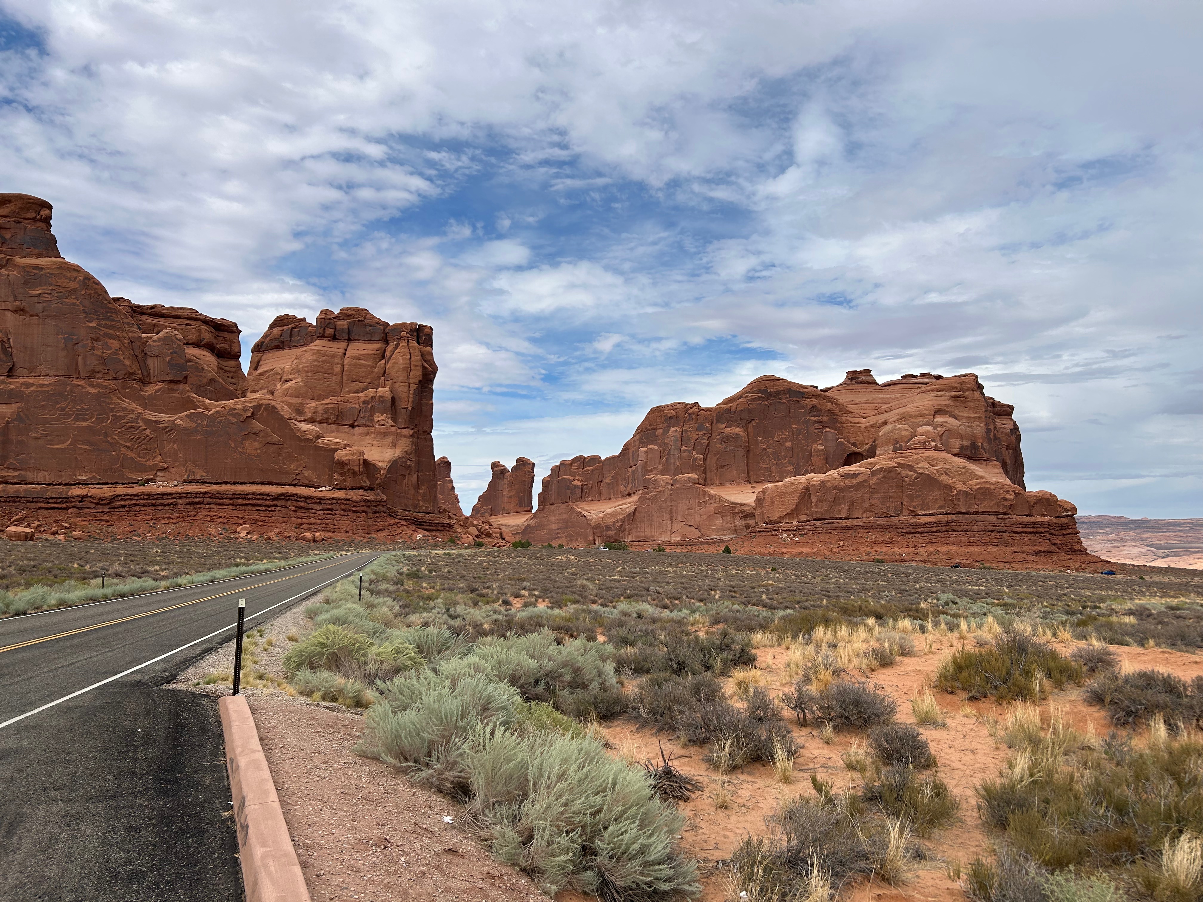
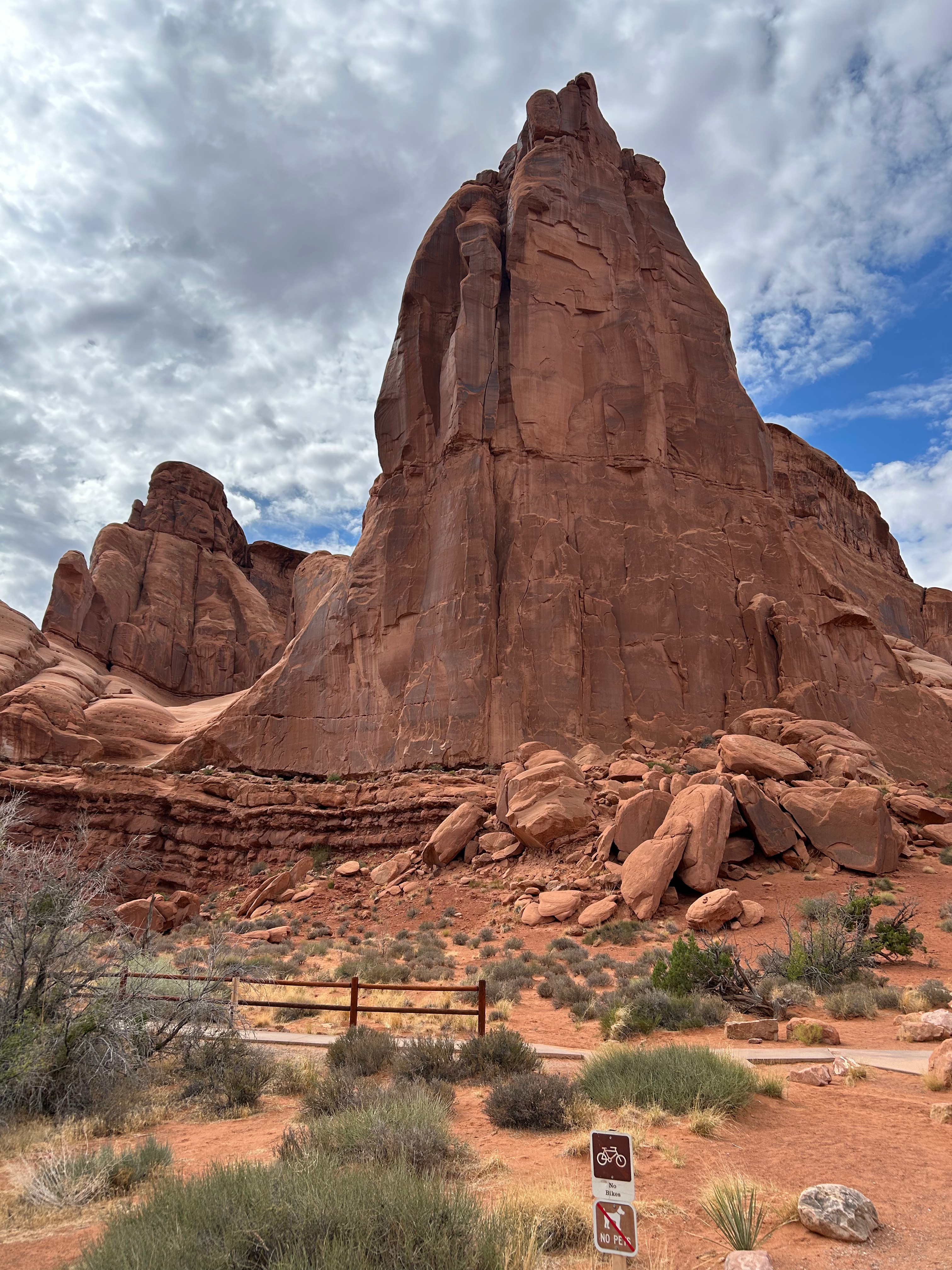
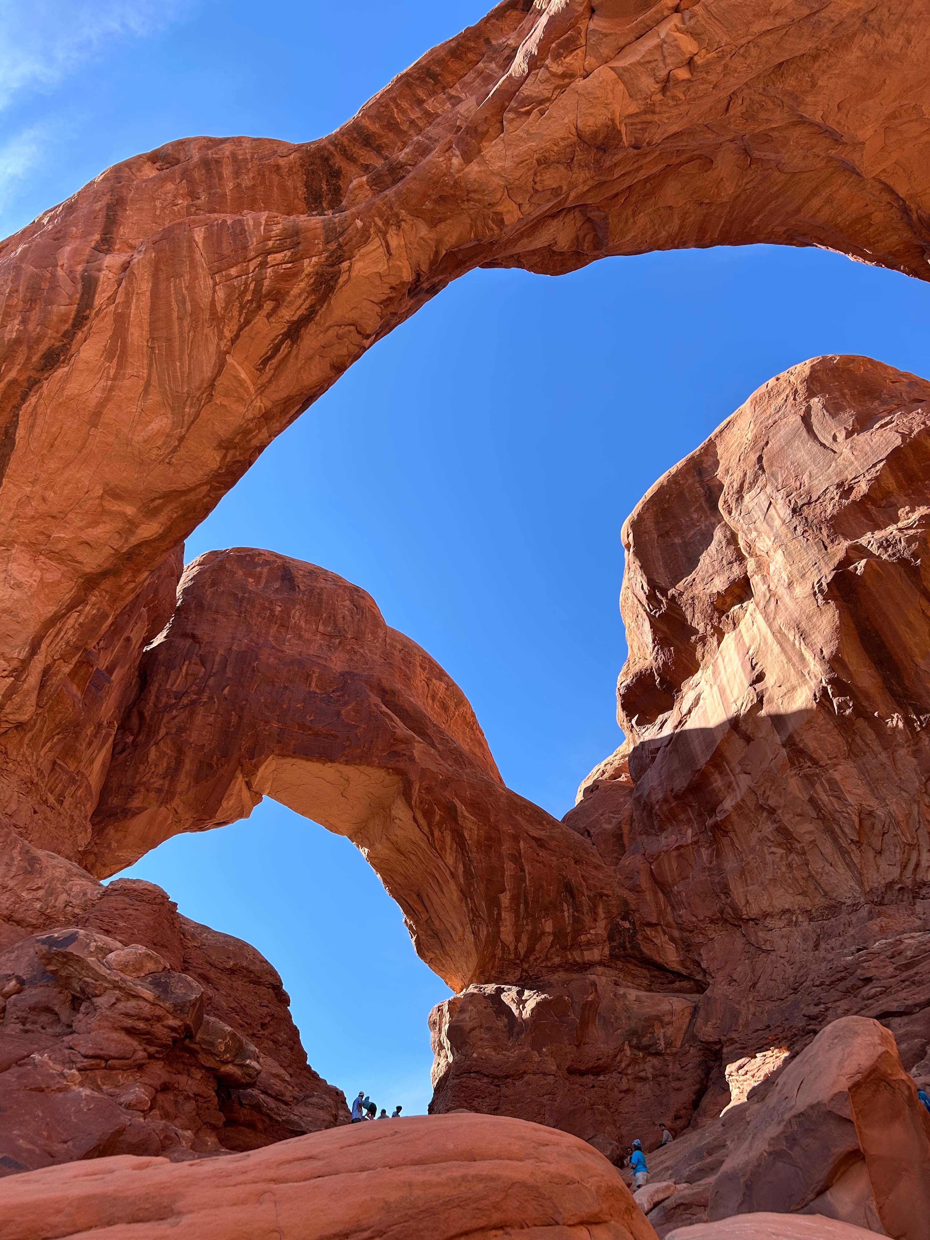
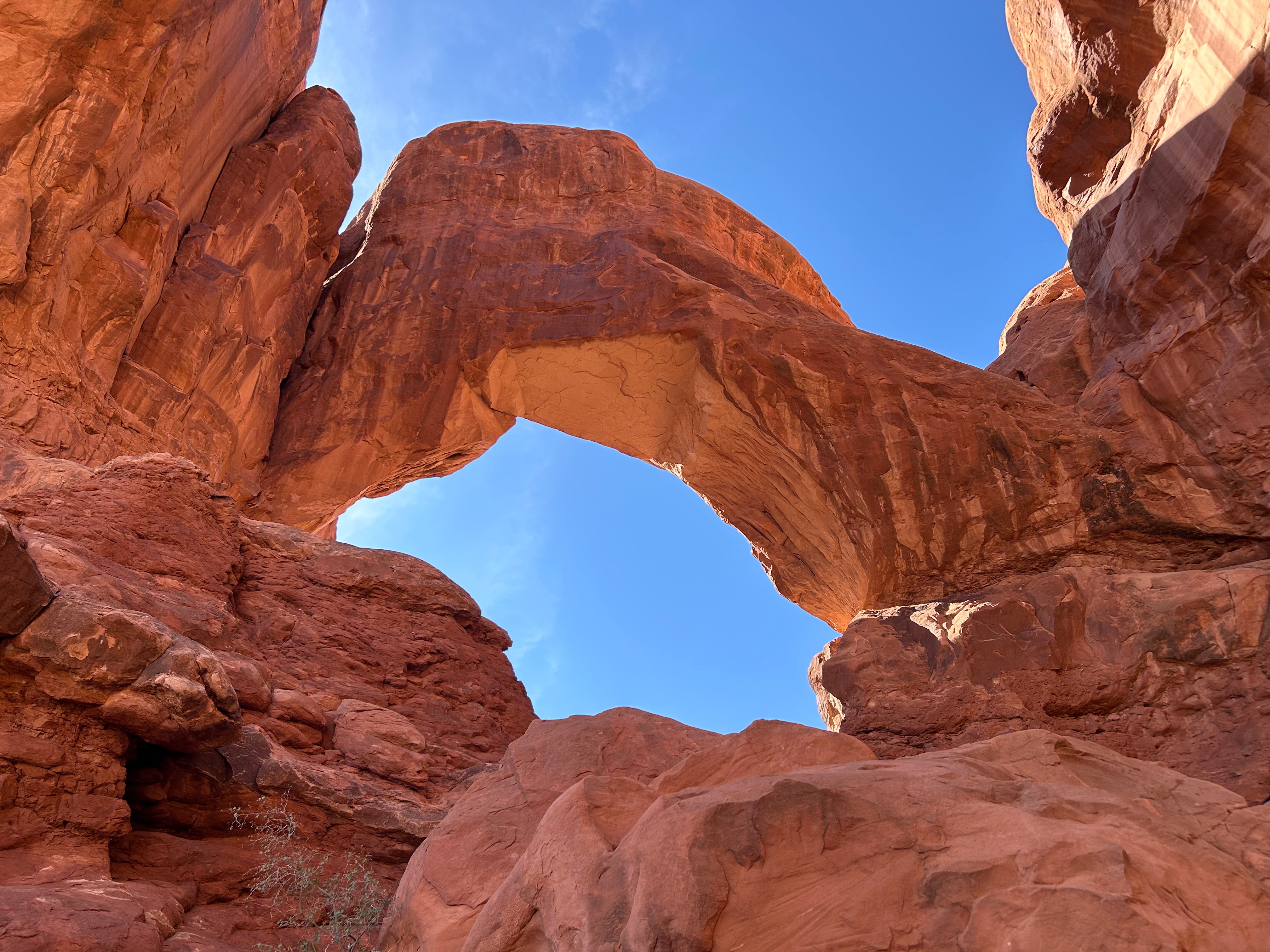
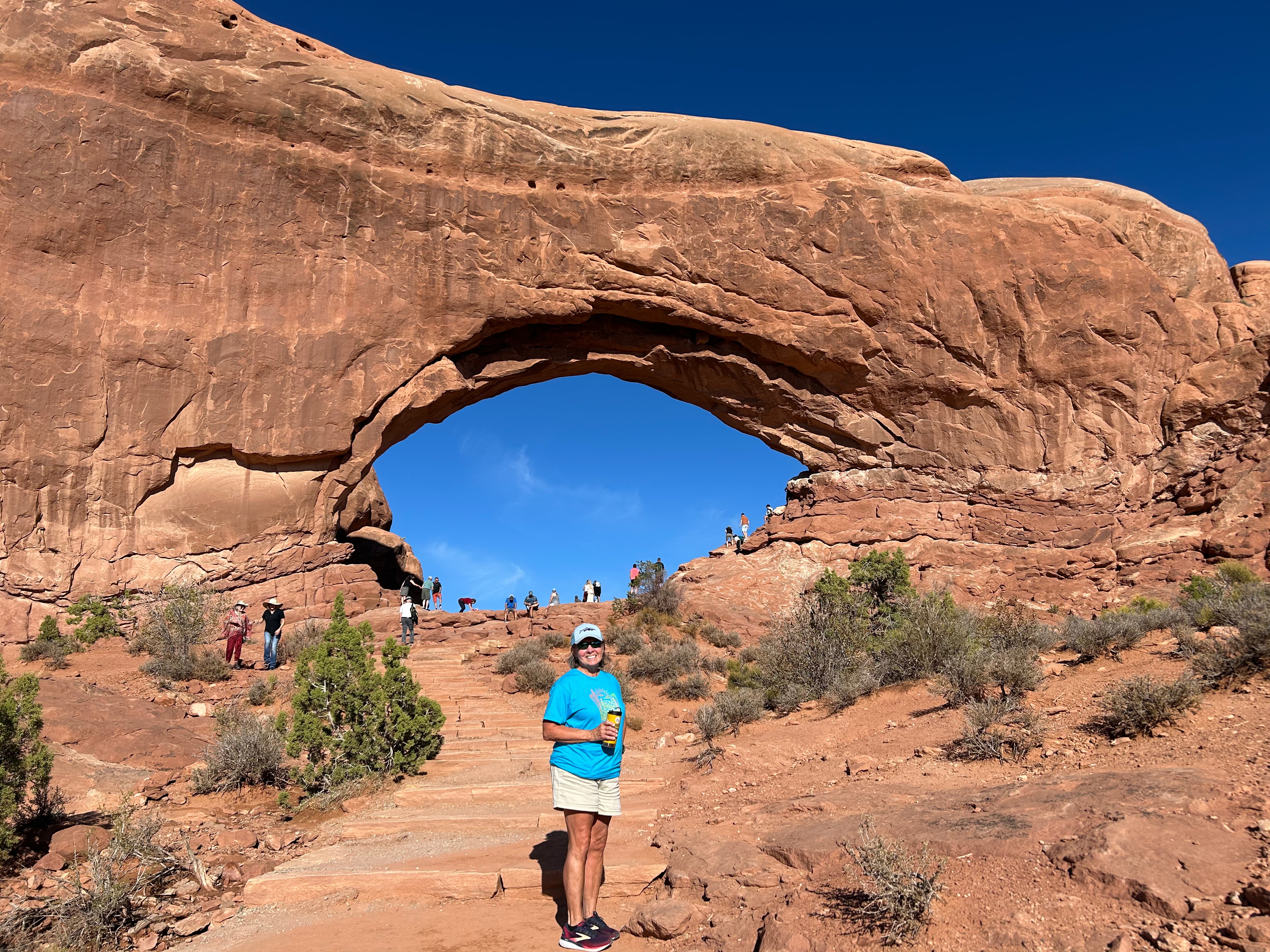
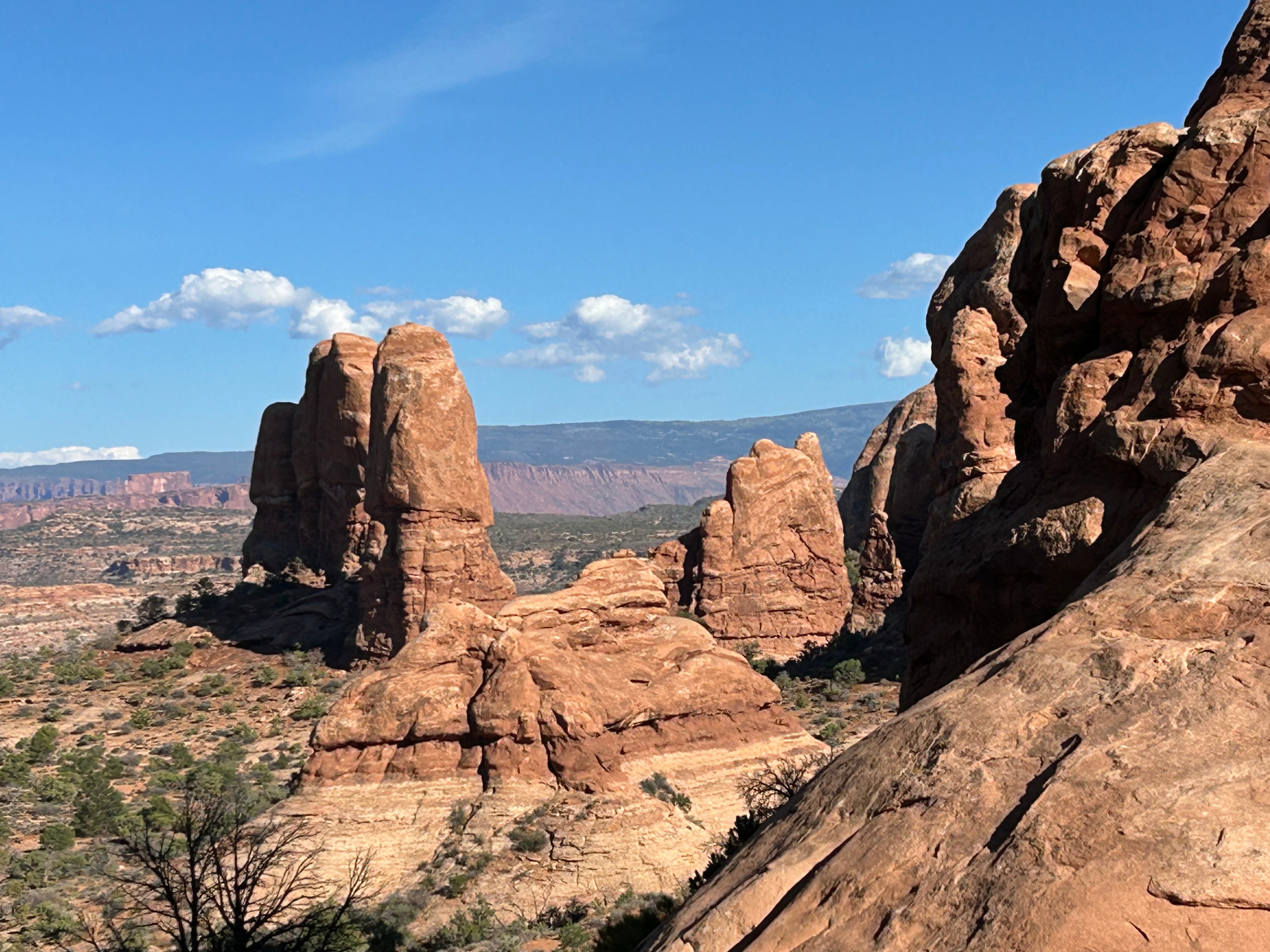
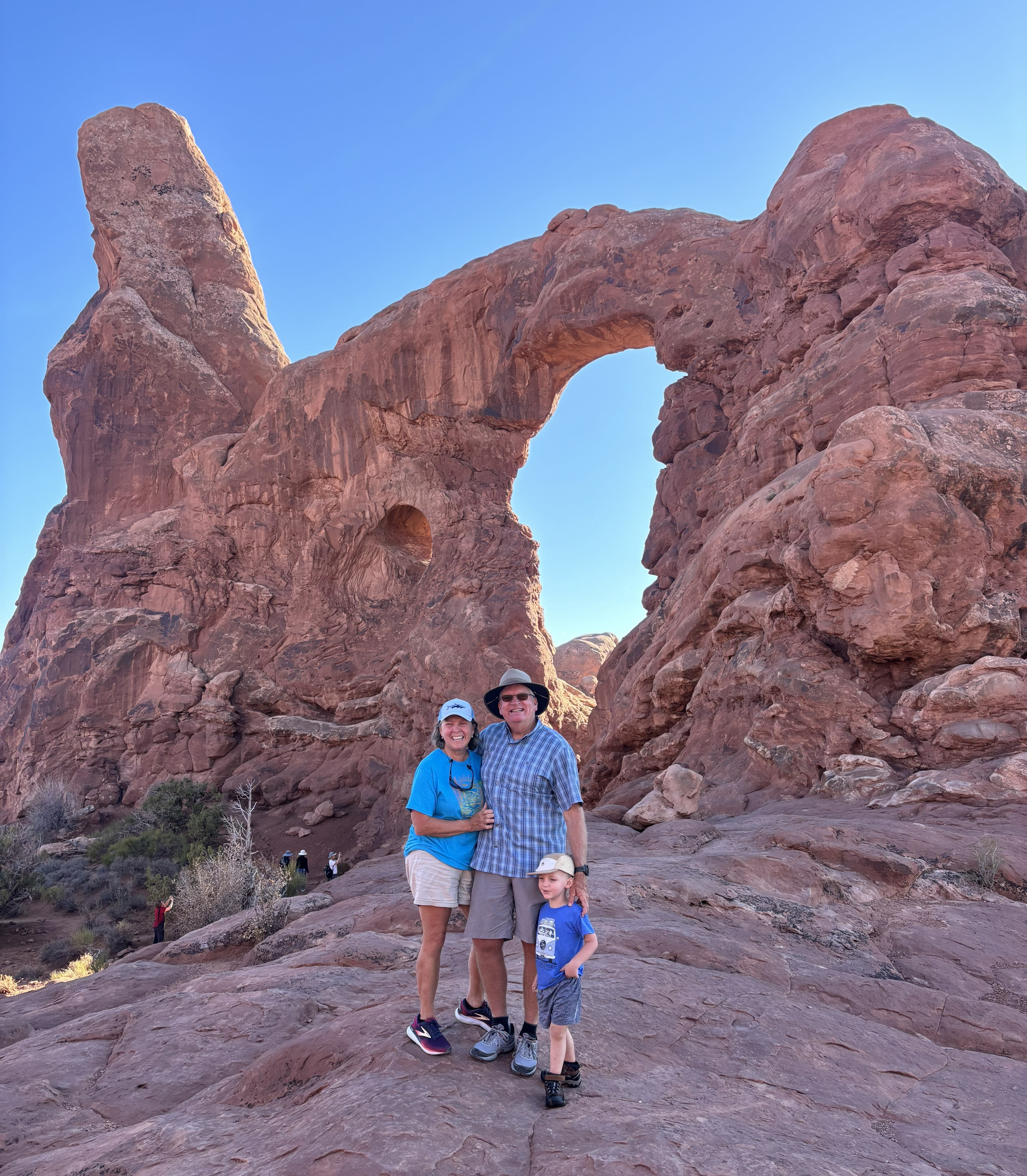
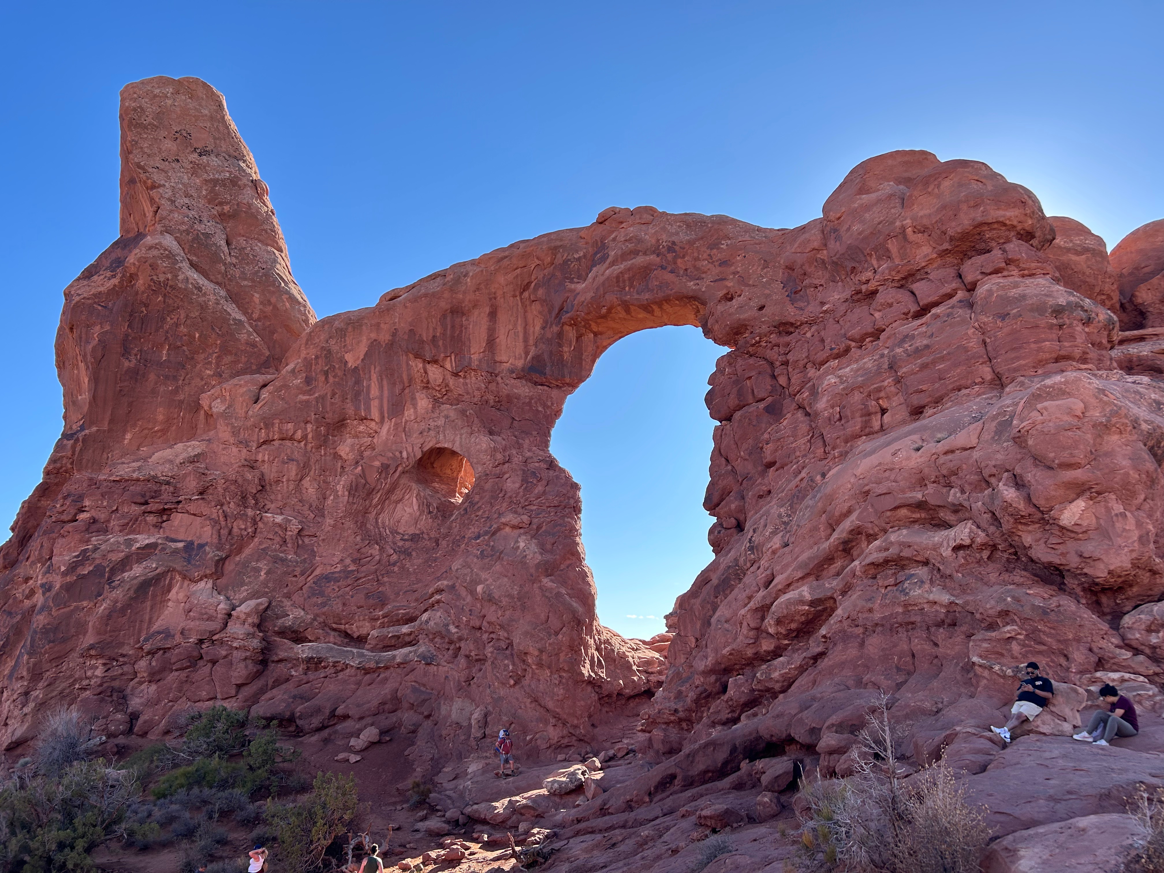
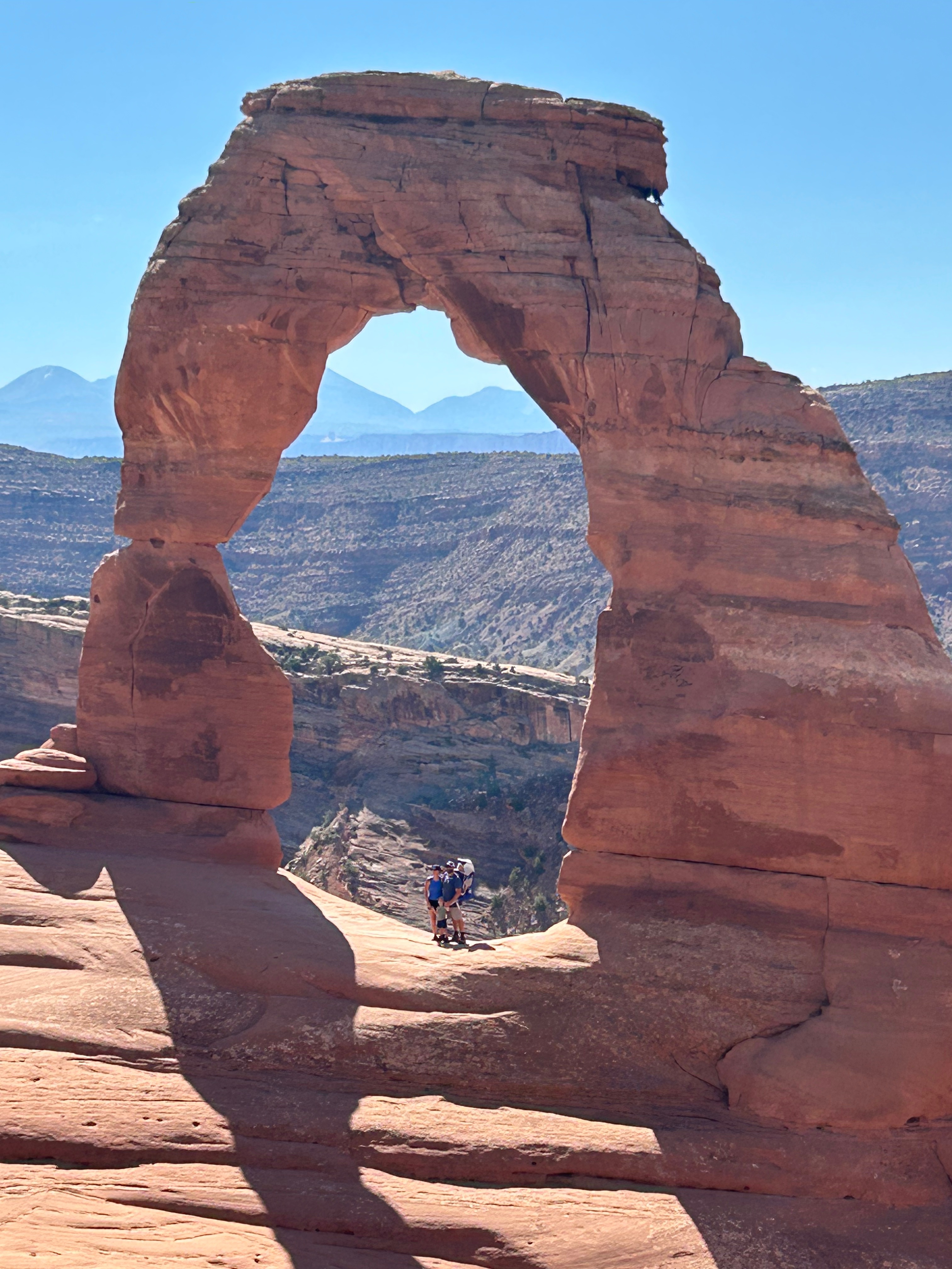
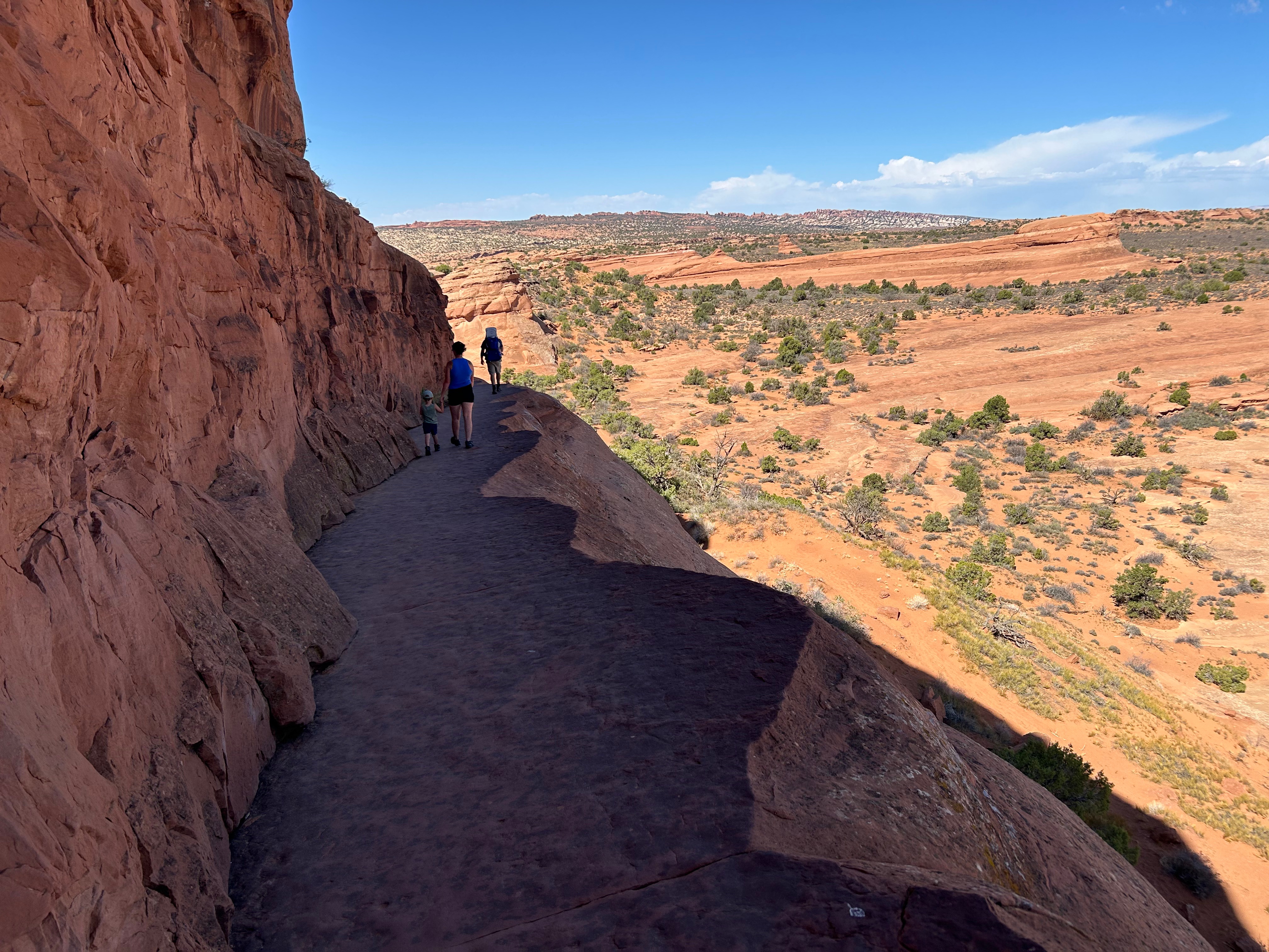
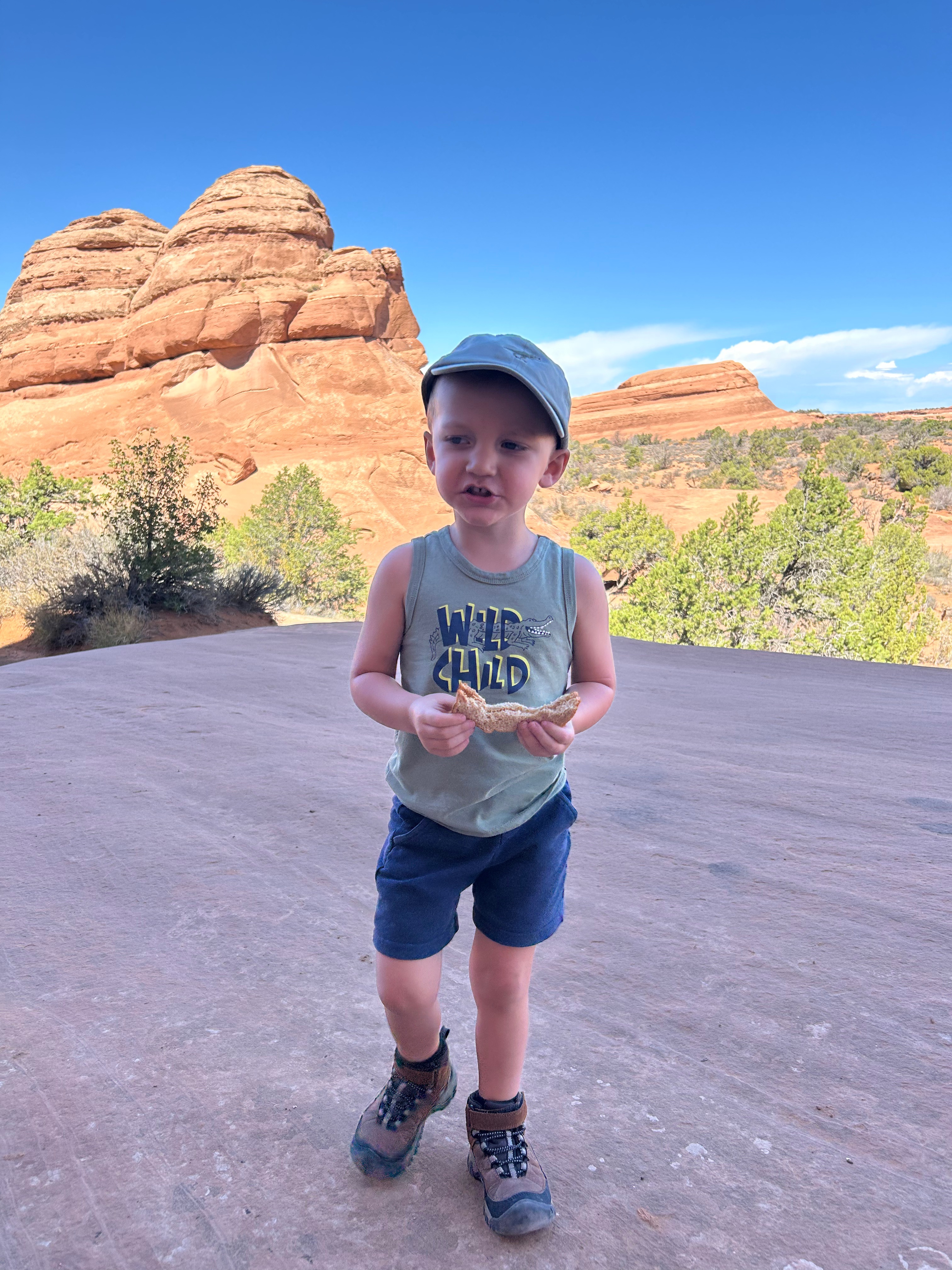
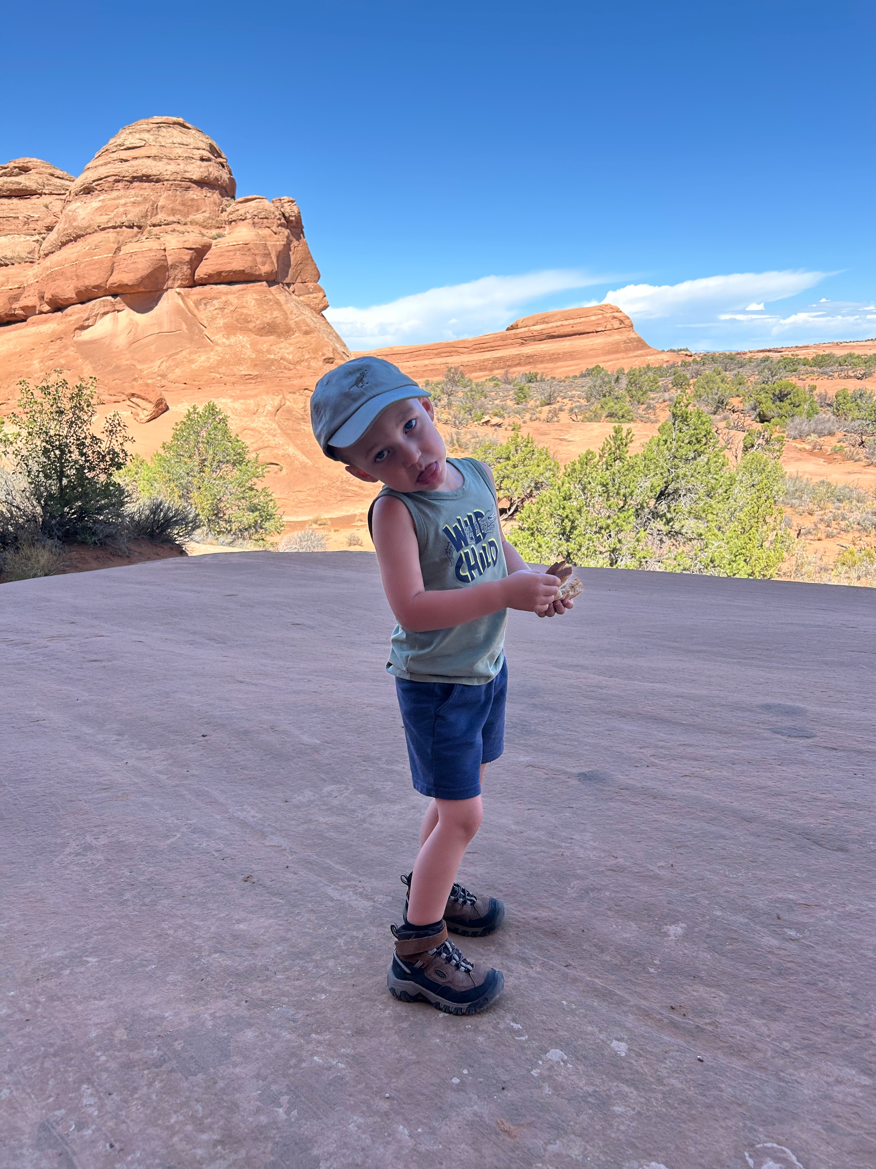
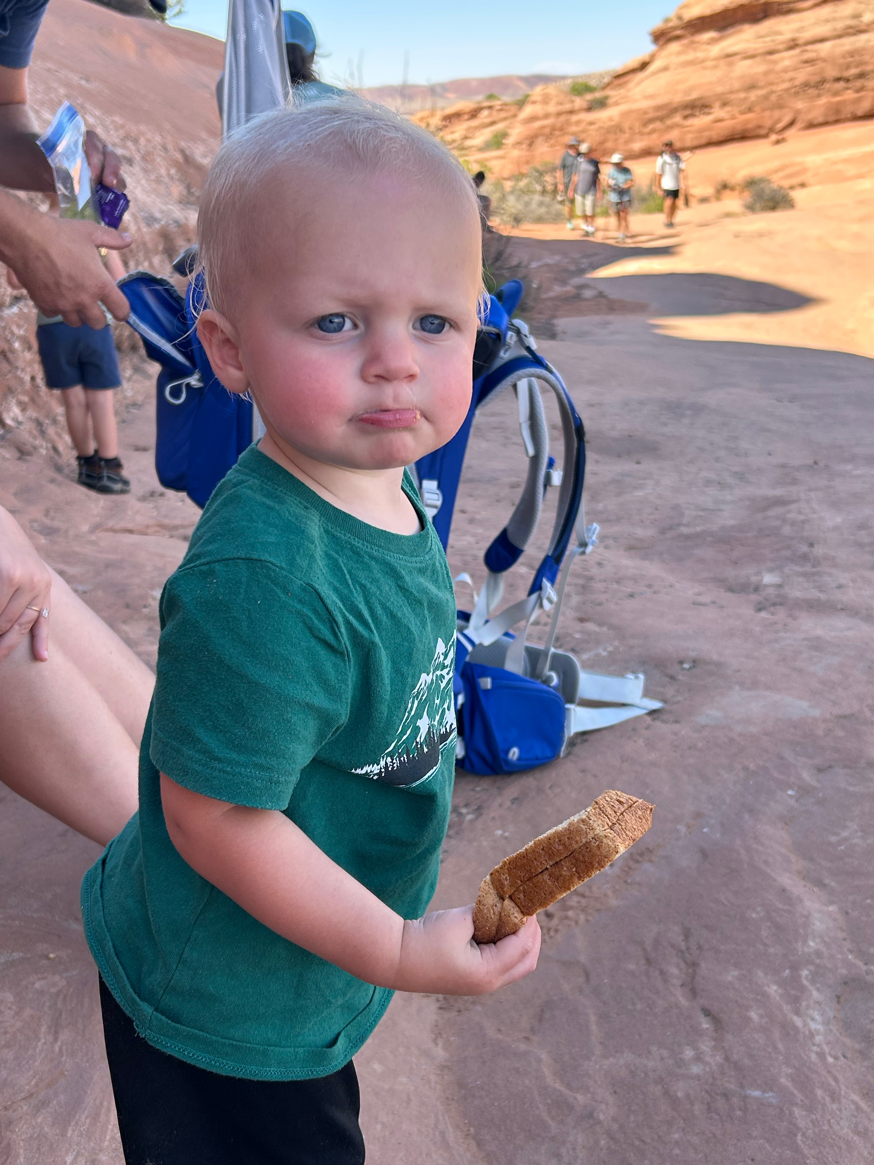
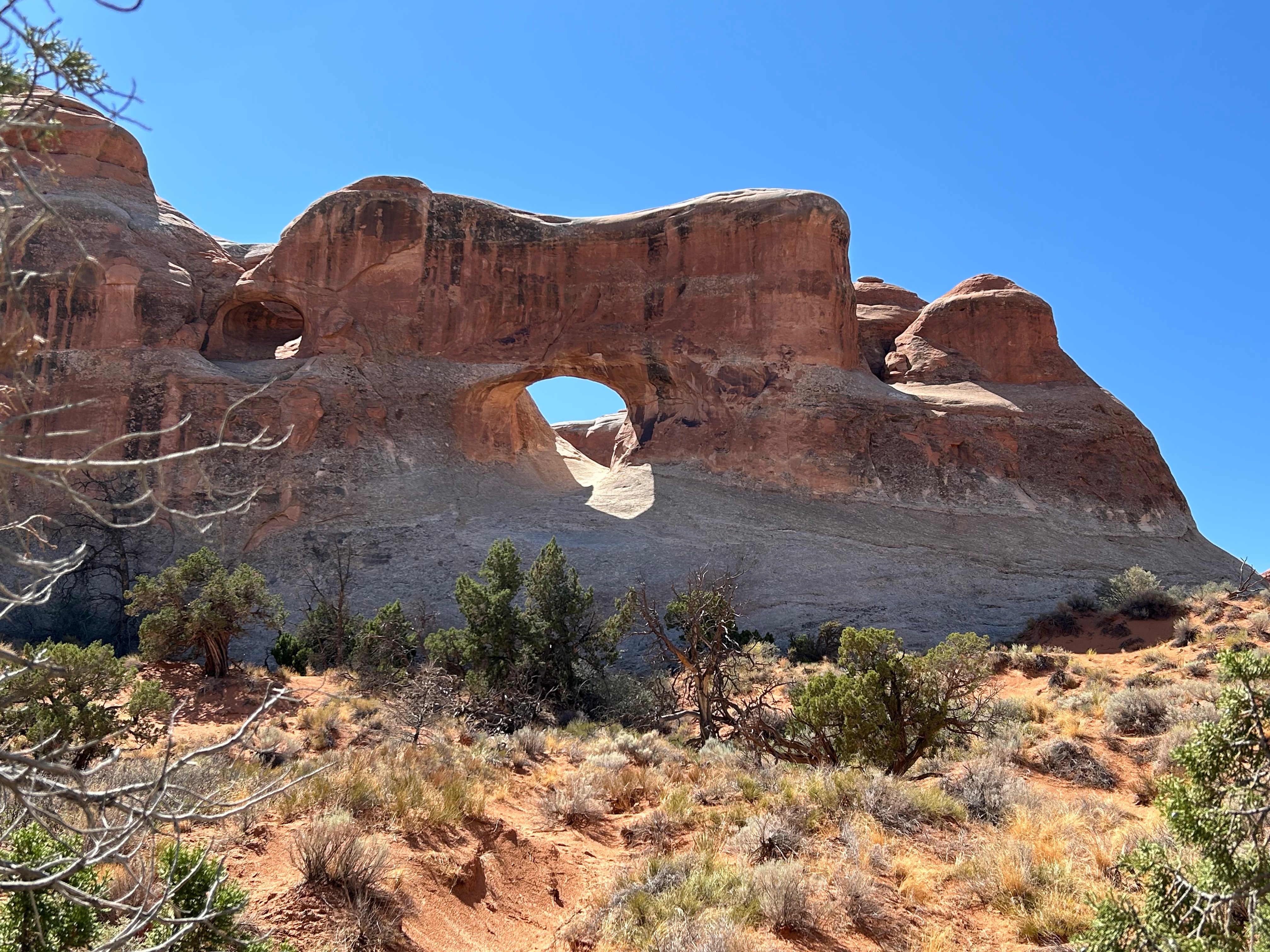
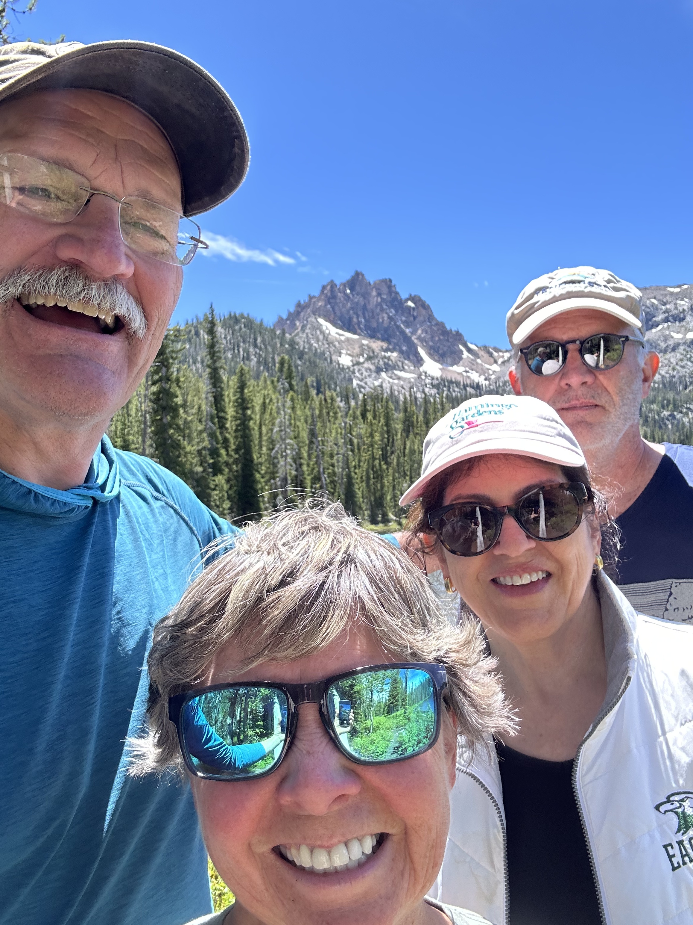
By mid-morning on Sunday, Mary, Bill, Bayli, Declan and Brooks arrived for three more nights in the Moab area. The photos are not completely in order by date but we definingly spent time in Arches National Park on at least two of the three days in the area. What a fantastic park to hike in and explore!
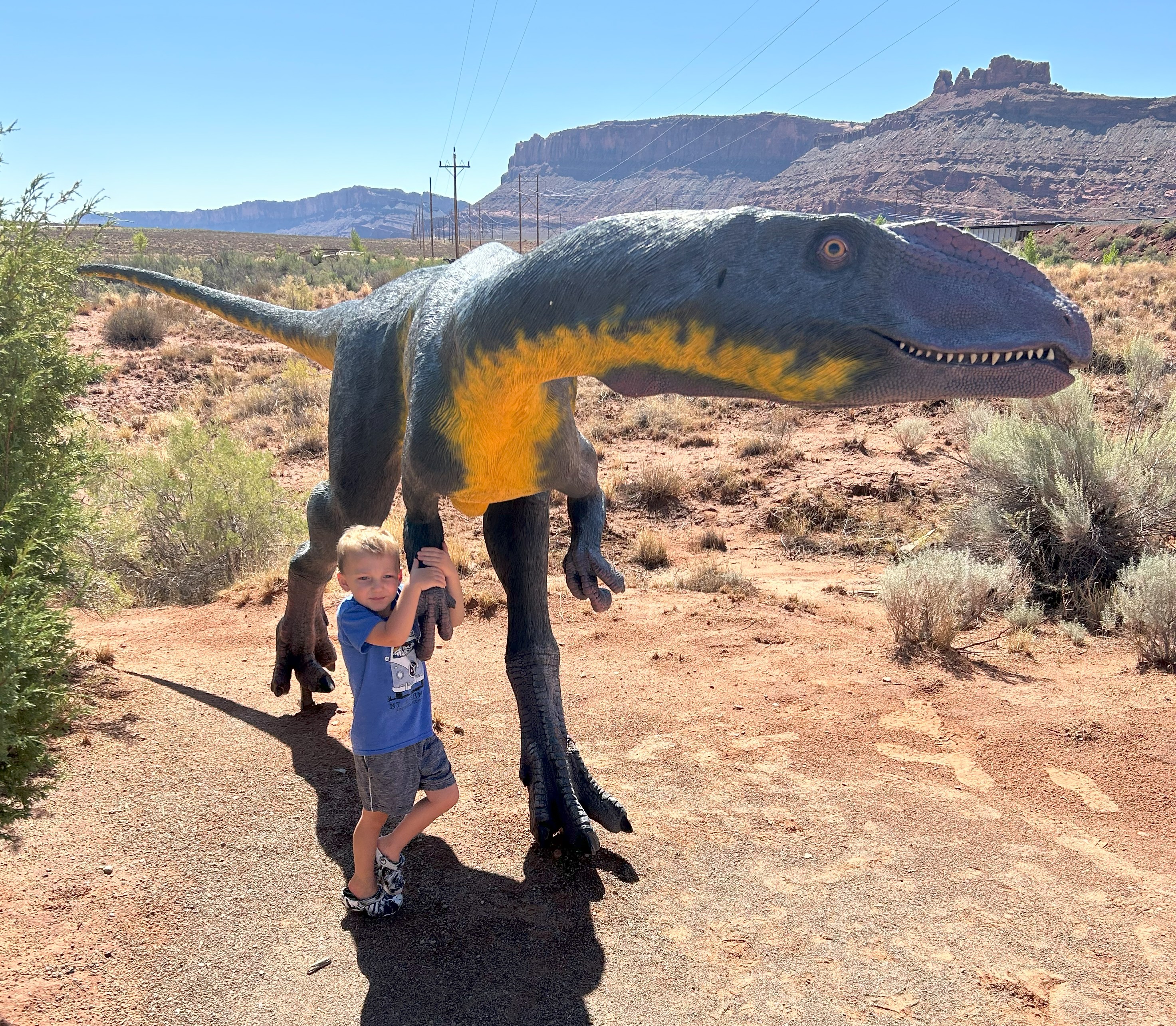
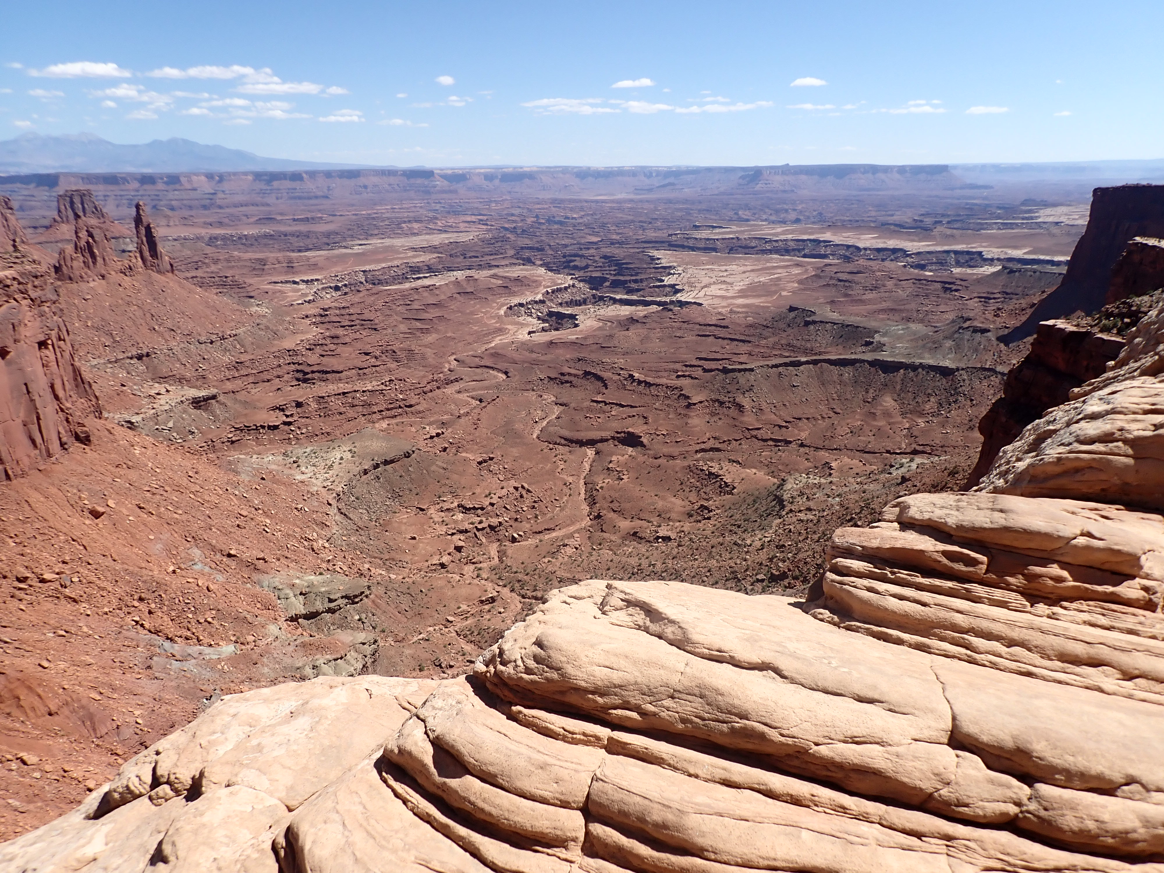
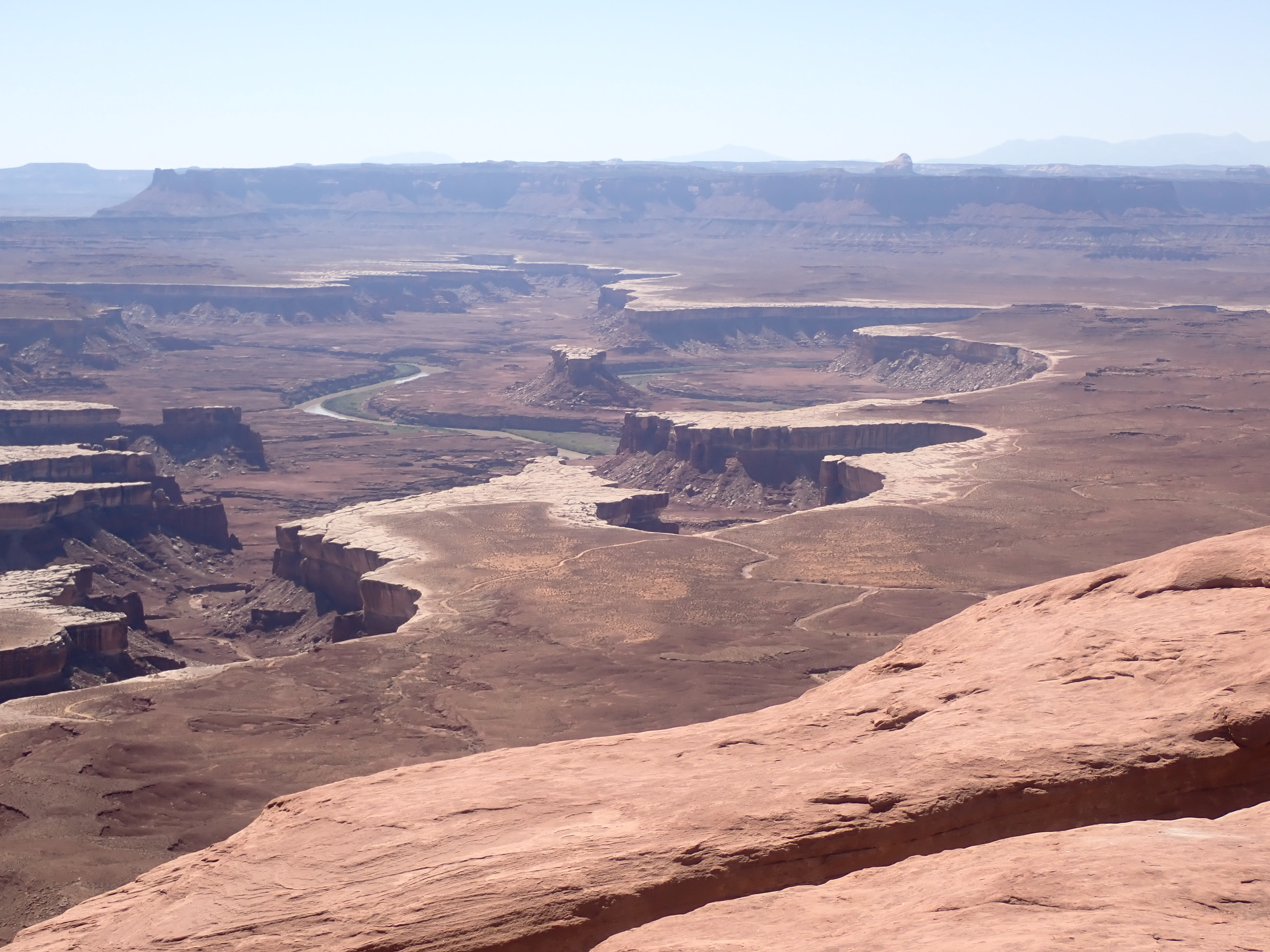
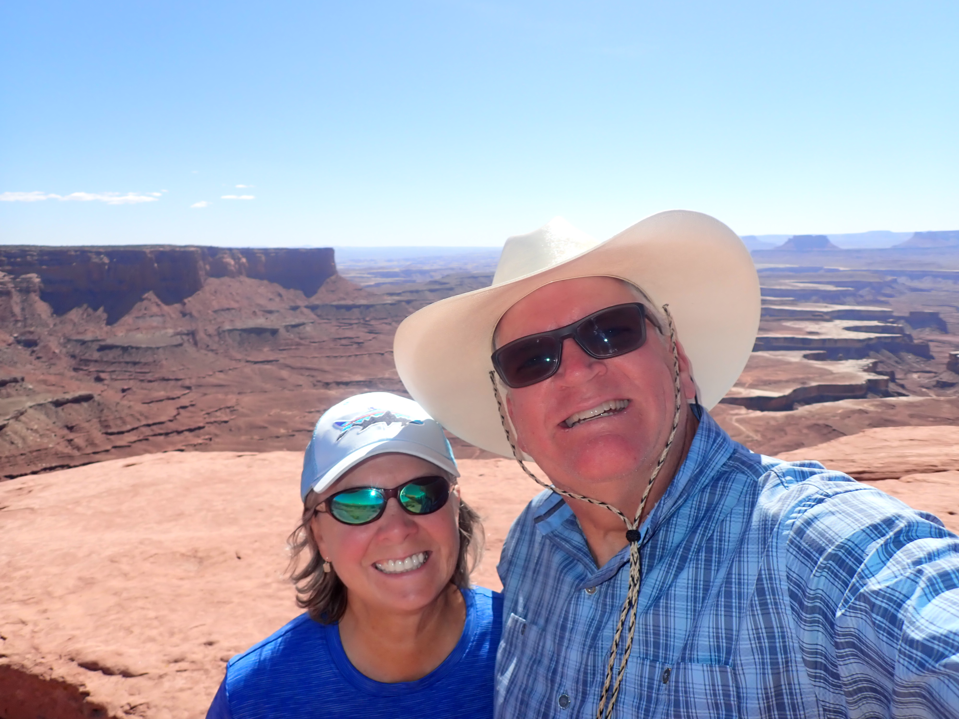
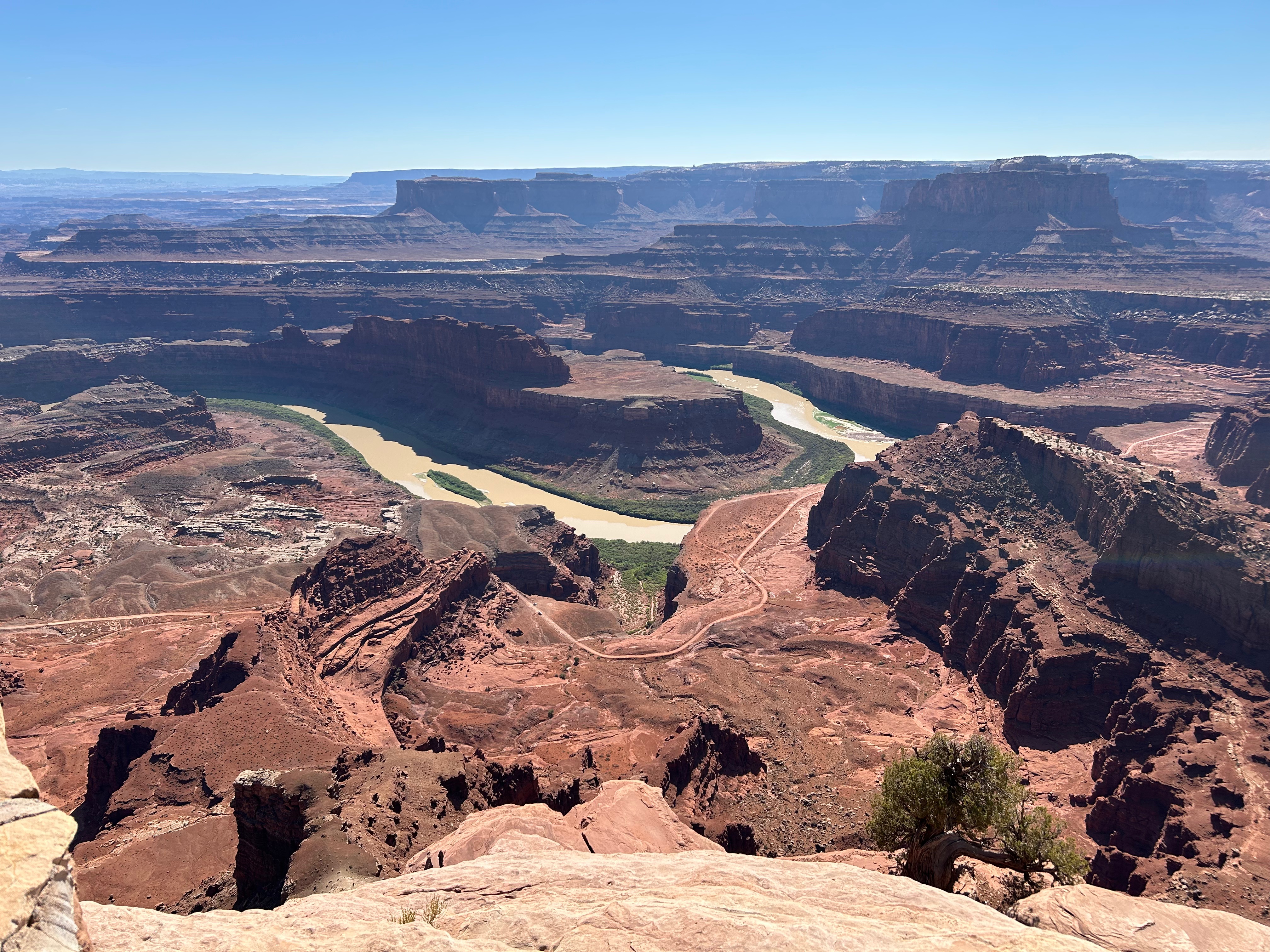
On one of our days in Moab, we took the grandkids out to the Moab Aventure Center (Moab Giants Dinosaur Park & Tracks Museum). Declan absolutely loves dinosaurs, so this was a super exciting trip for him. On that same day we went out and visited both Canyonlands National Park and Dead Horse State Park.
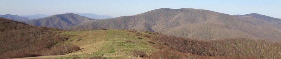
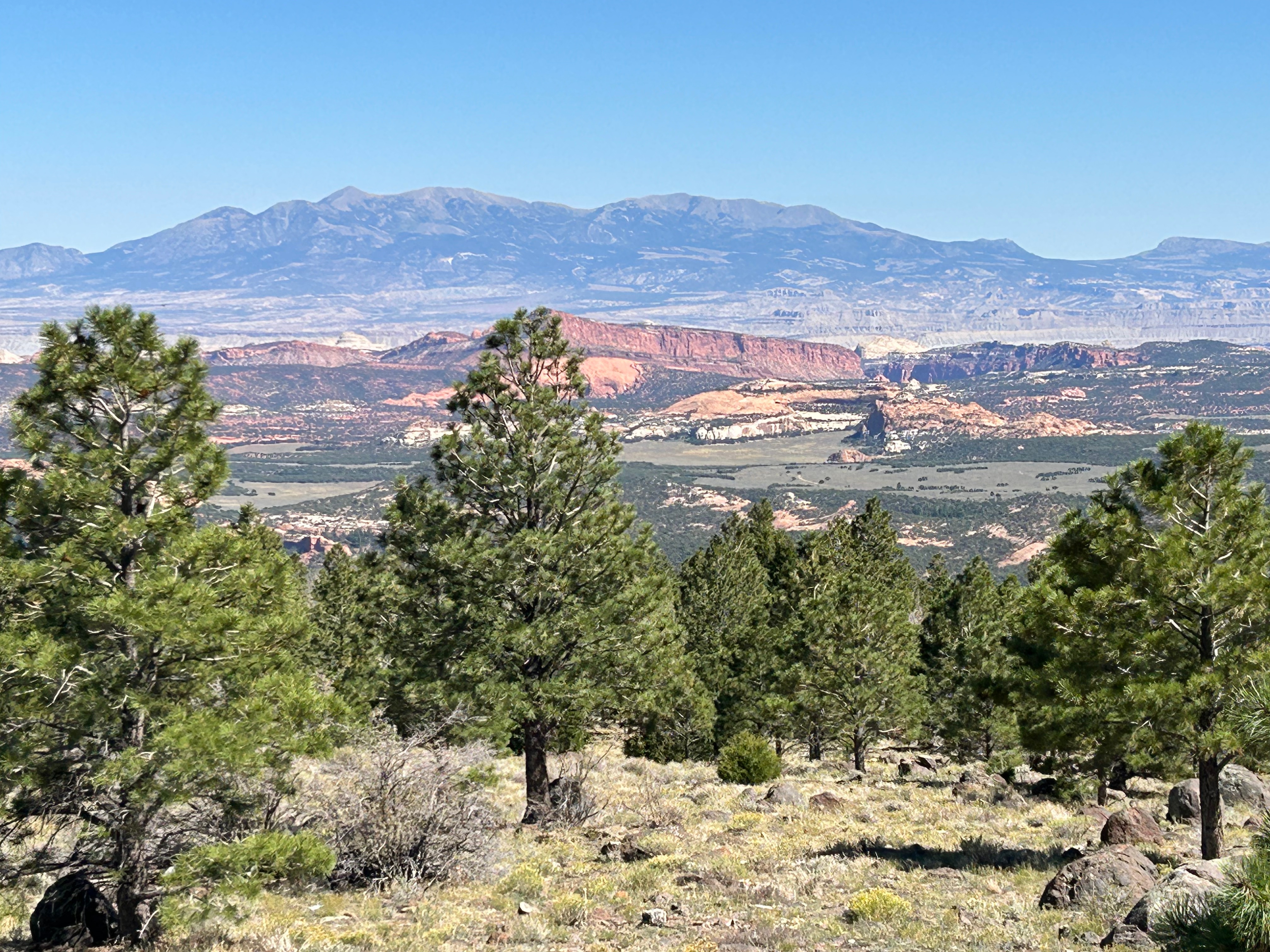
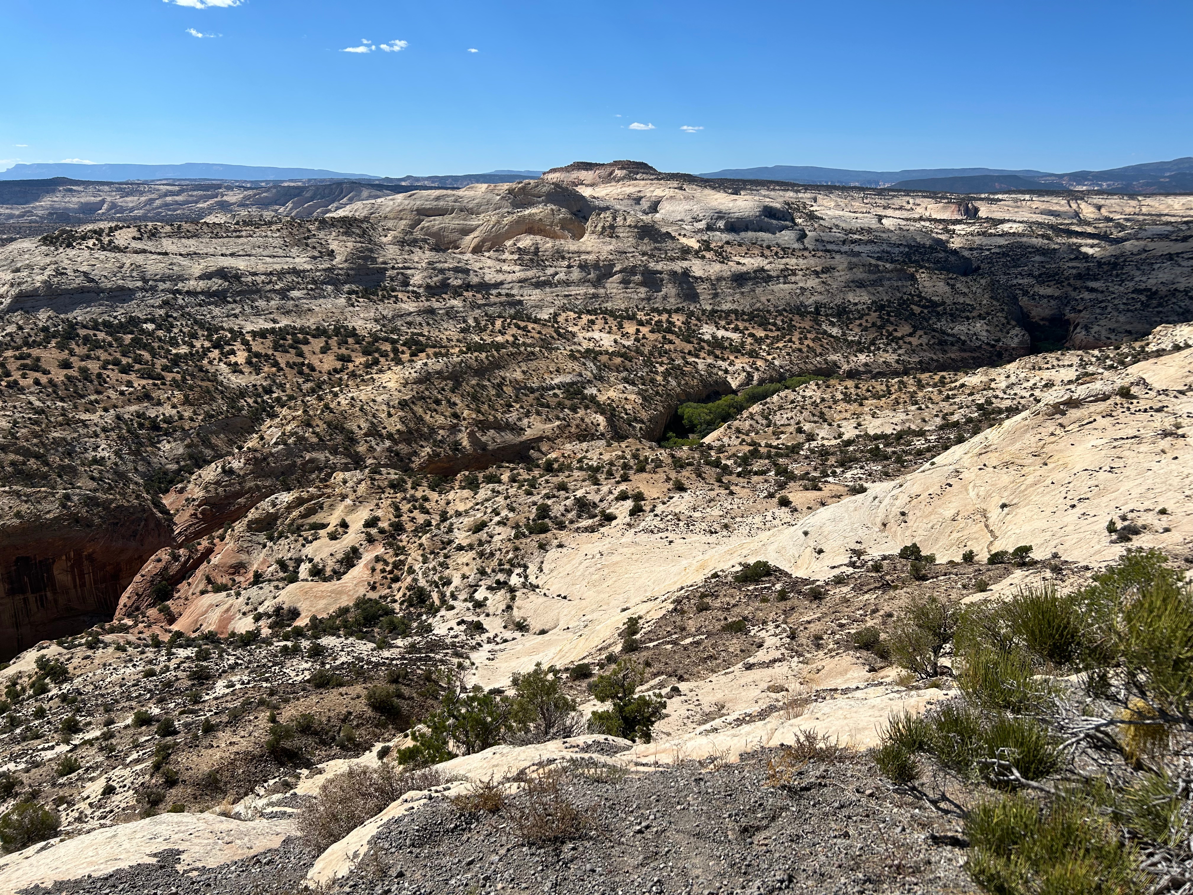
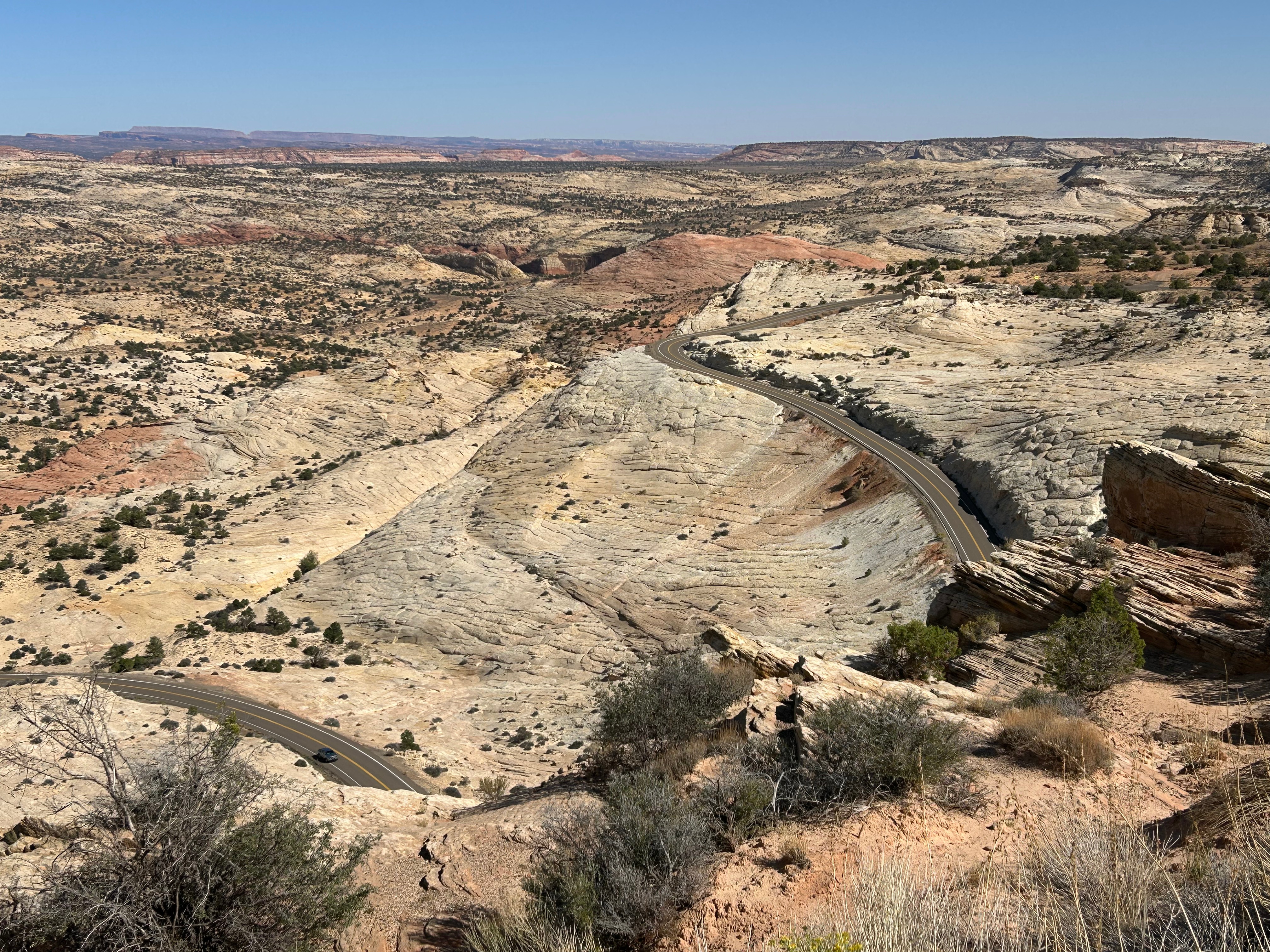
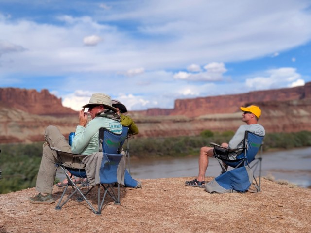
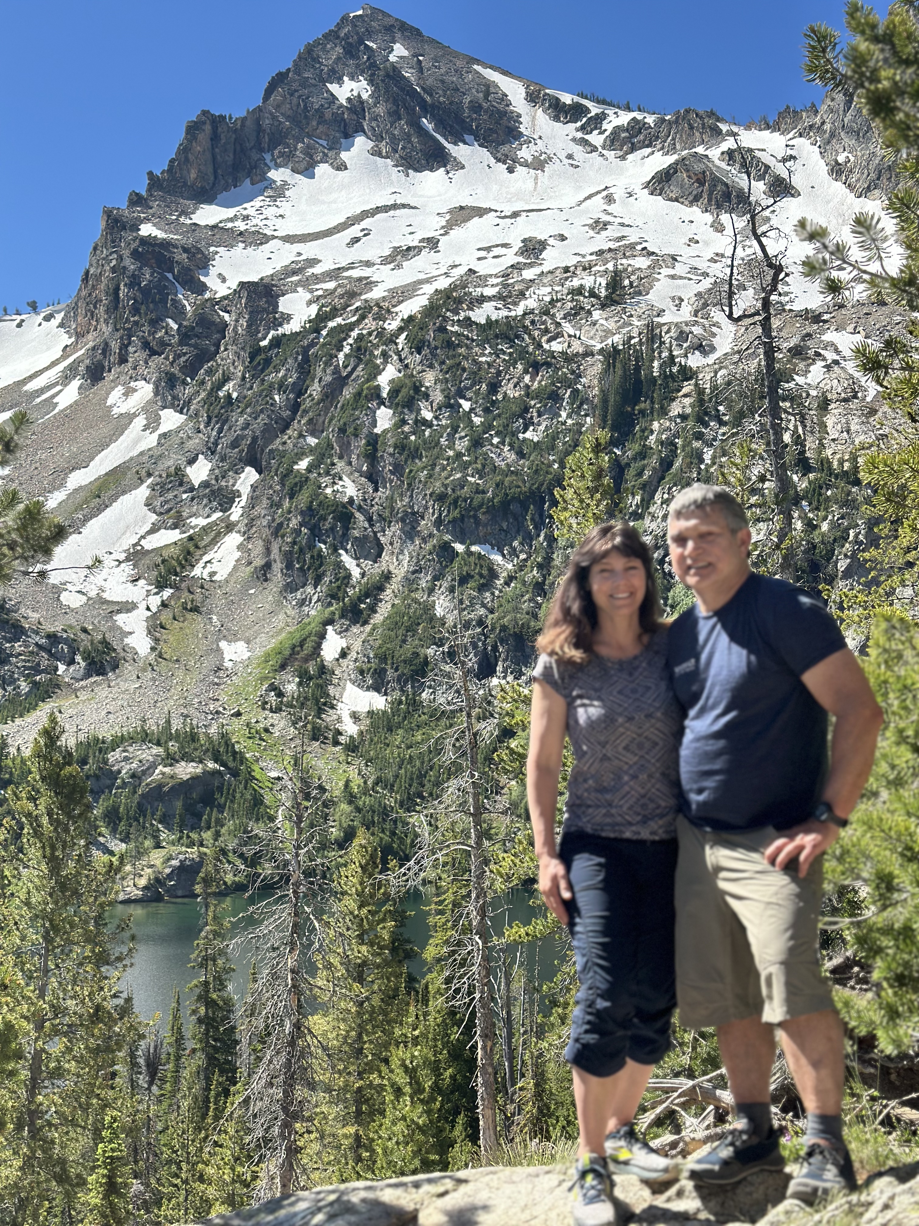
On Wednesday, we left Moab and headed southwest stopping first in Capitol Reef National Park. We mostly took a driving tour here enjoying the amazing land formations. Next, we traveled through Fishlake National Forest and viewed the Grand Staircase-Escalante National Monument. At the end of the day, we made a brief visit to Bryce Canyon National Park. It is definitely a place that Mary and I would like to visit again.
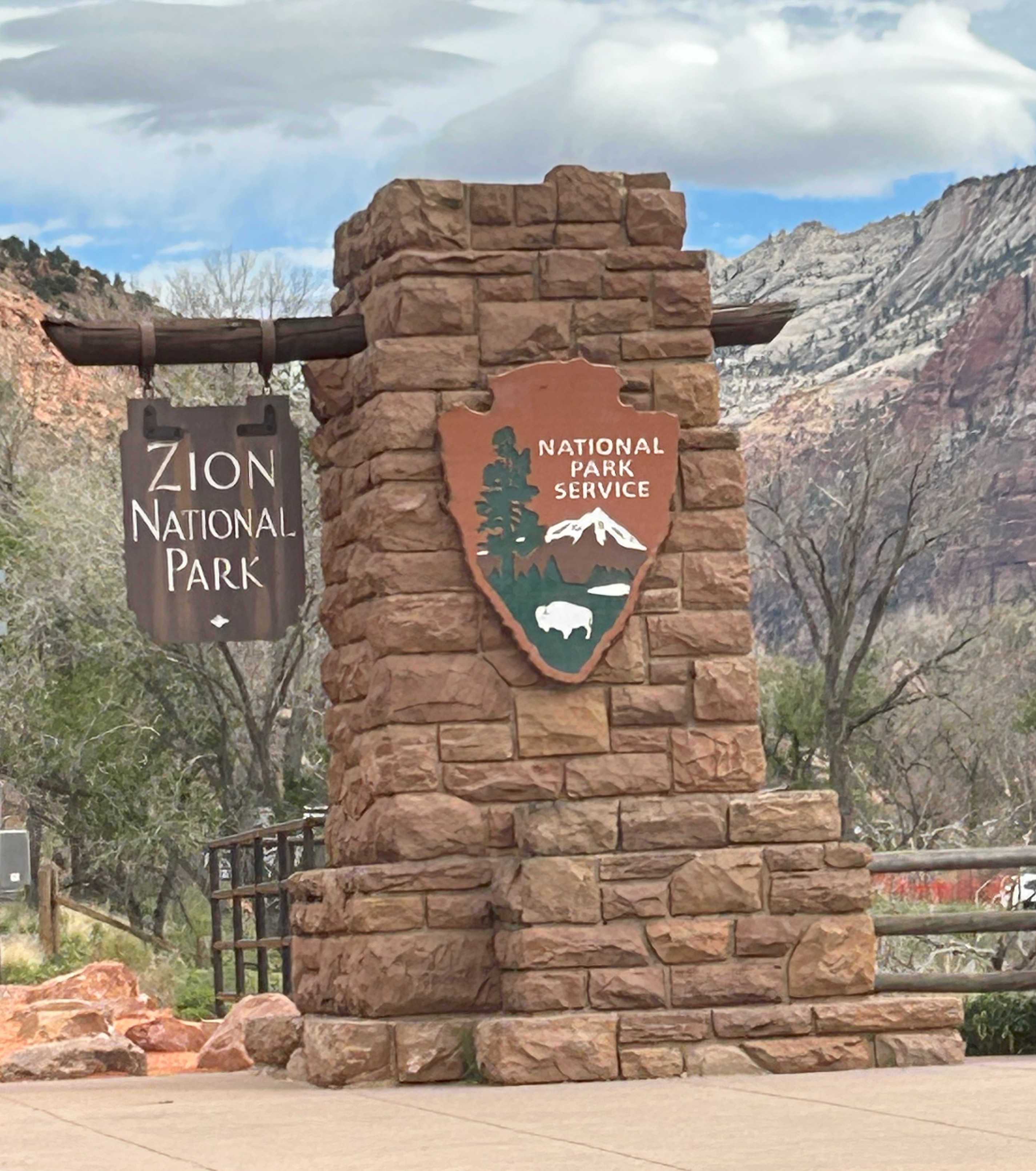
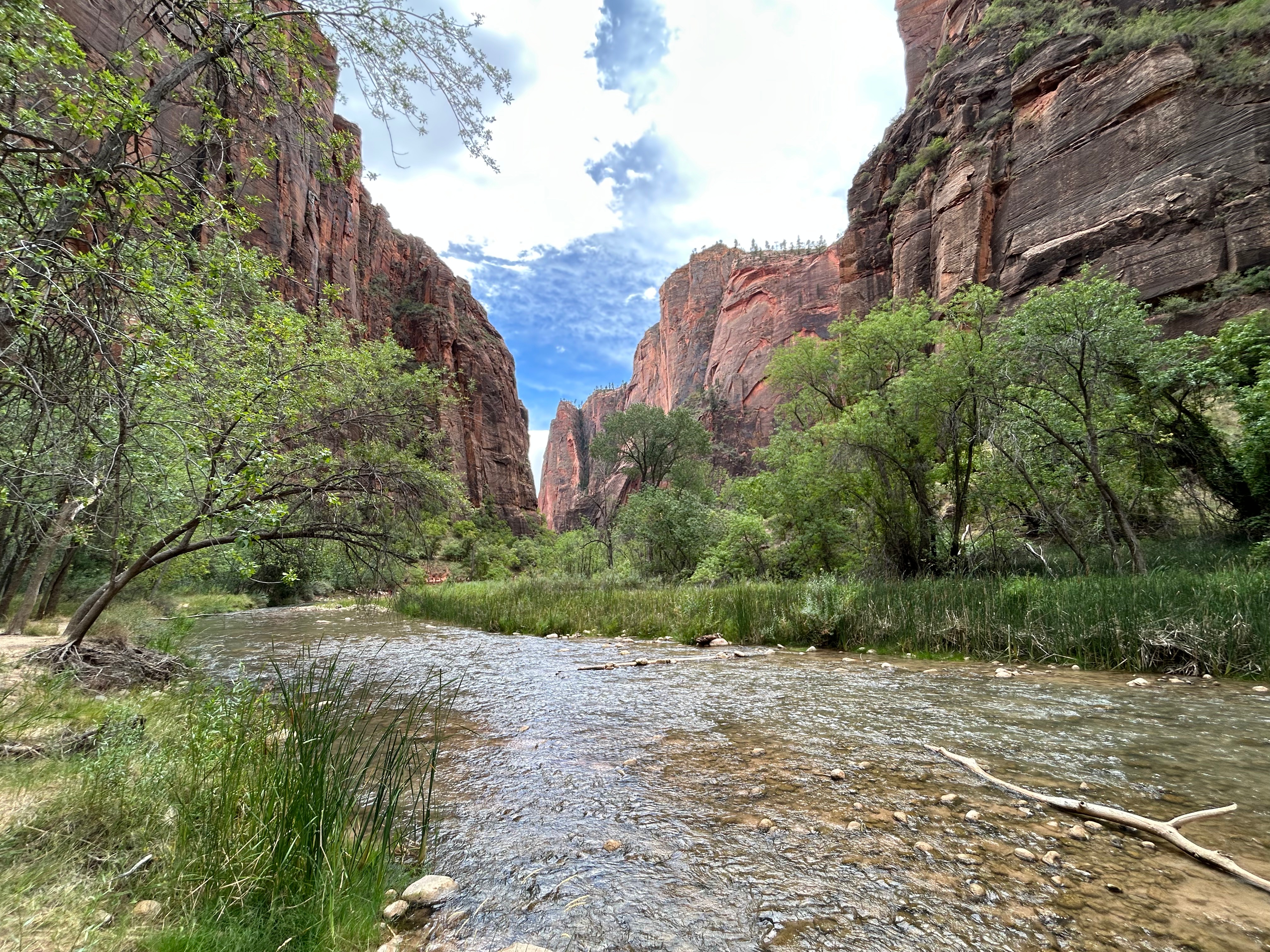
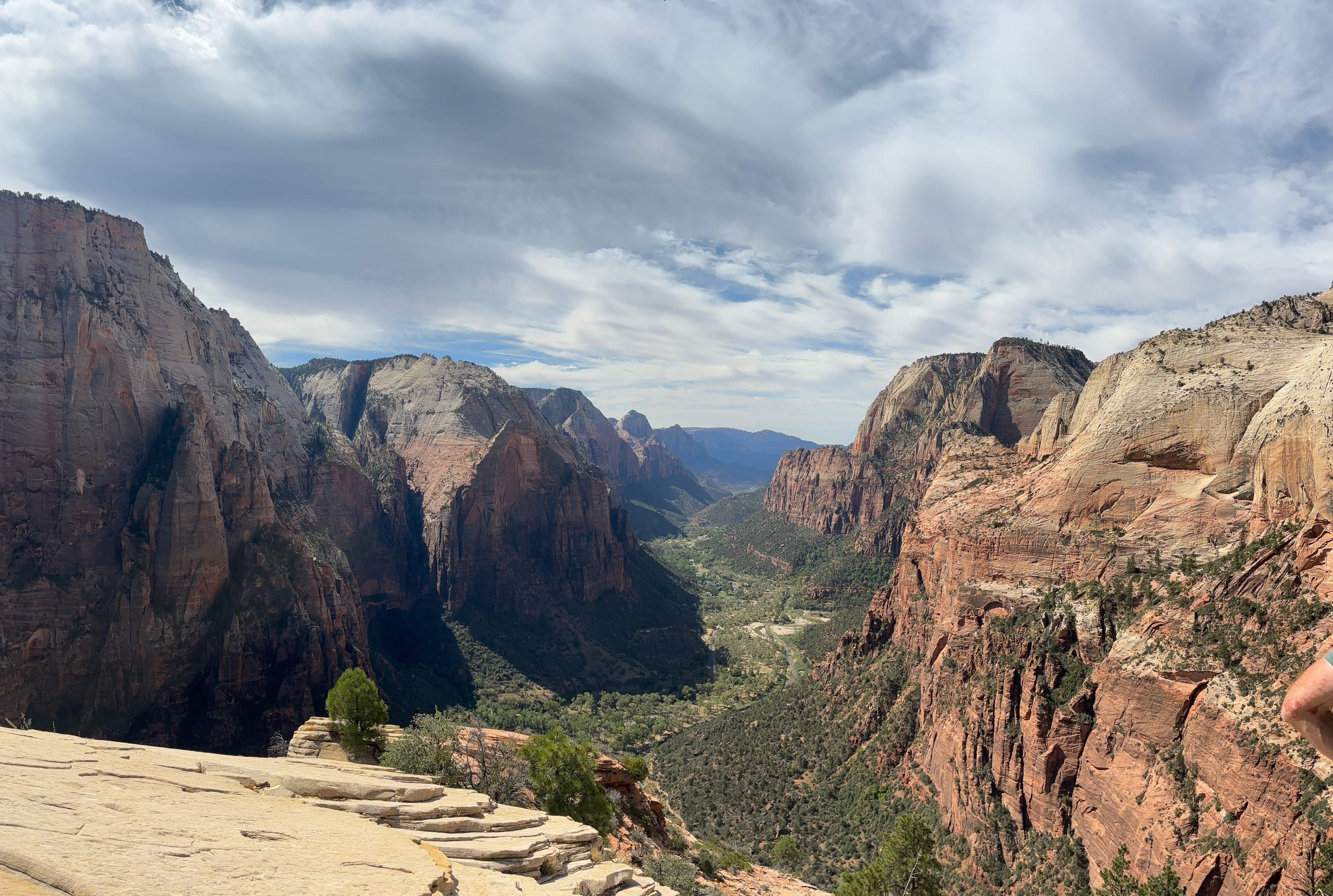
Zion National Park was beautiful, but we were somewhat disappointed in our visit there due to how very crowded it was. Bill and Bayli spent the first day hiking the scenic, but very highly traveled trail to Angel’s Landing while Mary and I played with our grandsons. The next day it was difficult to find parking at the entrance where we then we had to board extremely packed shuttle buses to get around the park. We joined many others taking the Riverside Walk trail and enjoyed visiting Zion Lodge. We all decided that we would prefer to visit Zion in the off season.
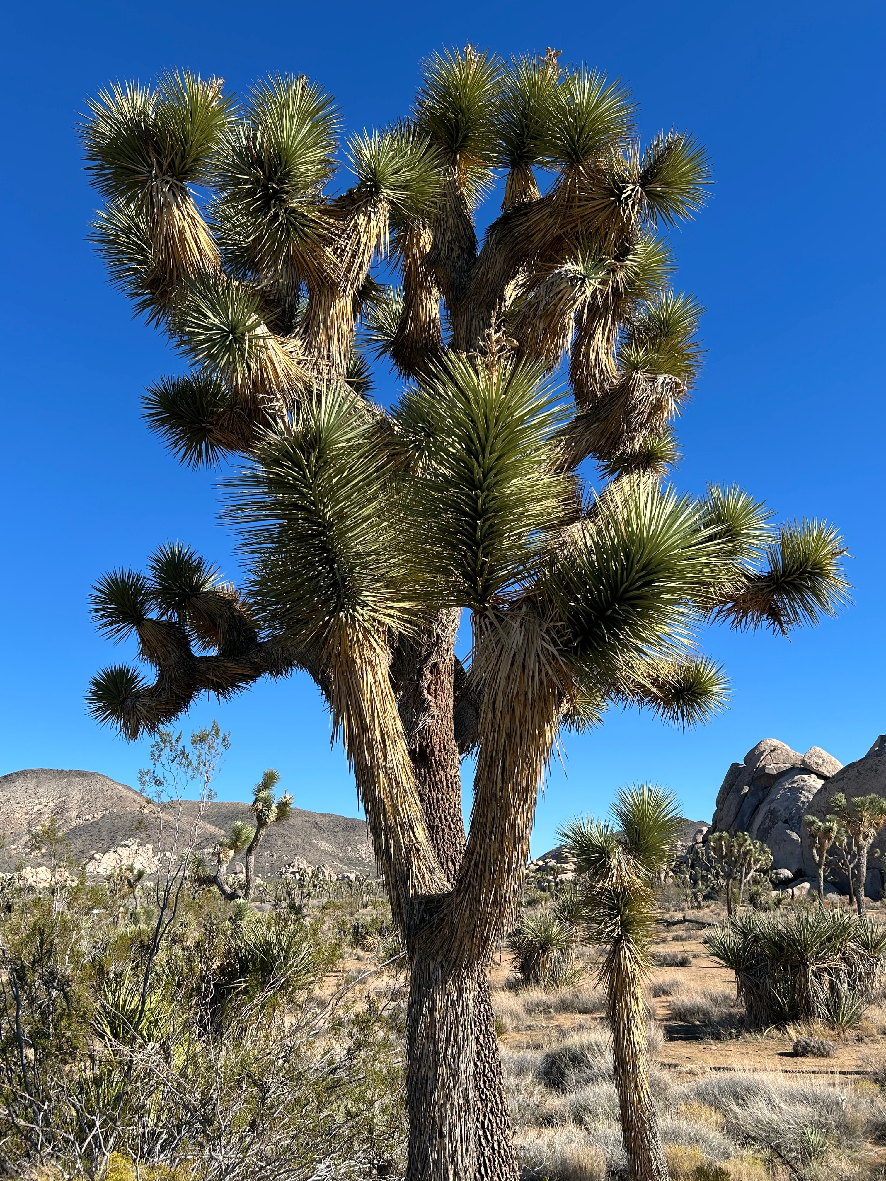
On Saturday morning, we parted ways with Bill’s family. They headed south to Grand Canyon National Park, and Mary and I drove west to Joshua Tree National Park in California. Although we didn’t have time to take any hikes there, we really enjoyed seeing the many sizes and shapes of the thousands of Joshua Trees, cacti, other unique desert plants and the ever-changing landscape.
In one of the photos below, the San Jacinto Mountains and the San Andreas Fault can be seen looking across the valley towards Palm Springs. The tallest mountain is San Jacinto Peak at 10,832 ft. which I crossed over in 2014 on my PCT thru hike.
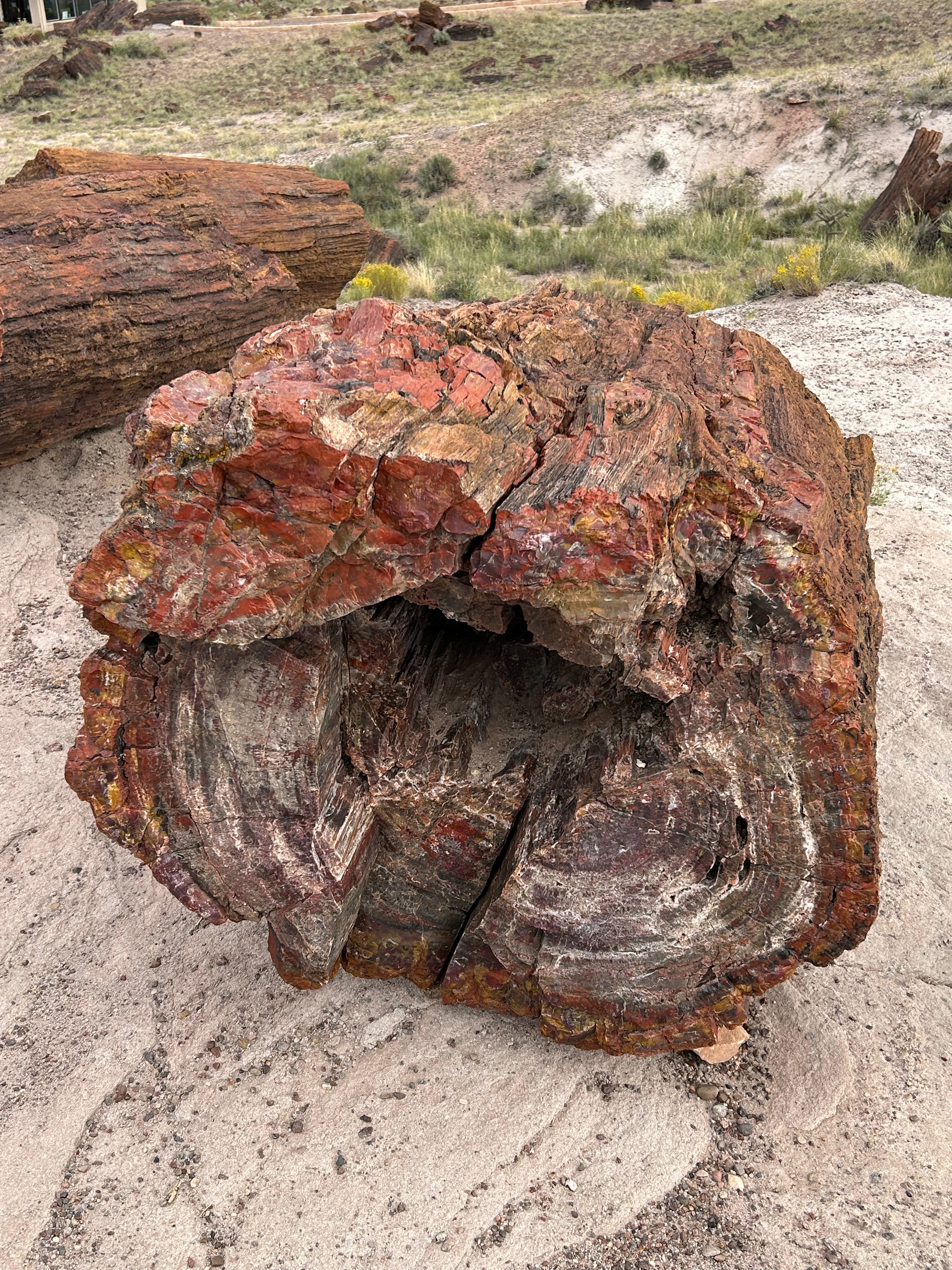
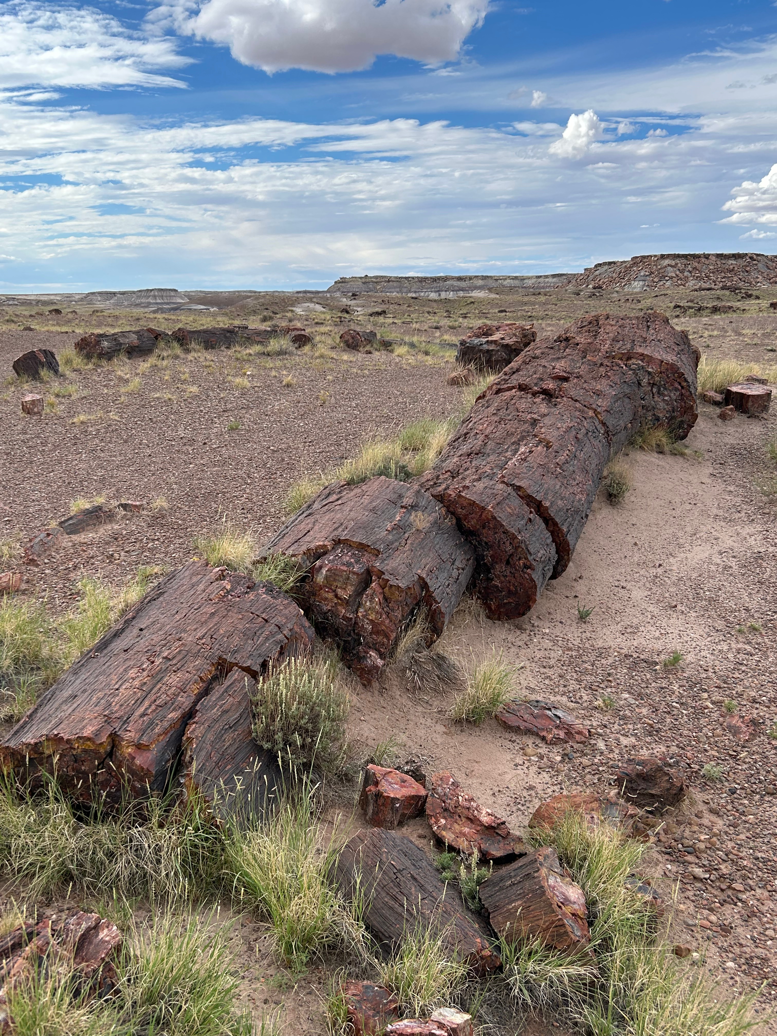
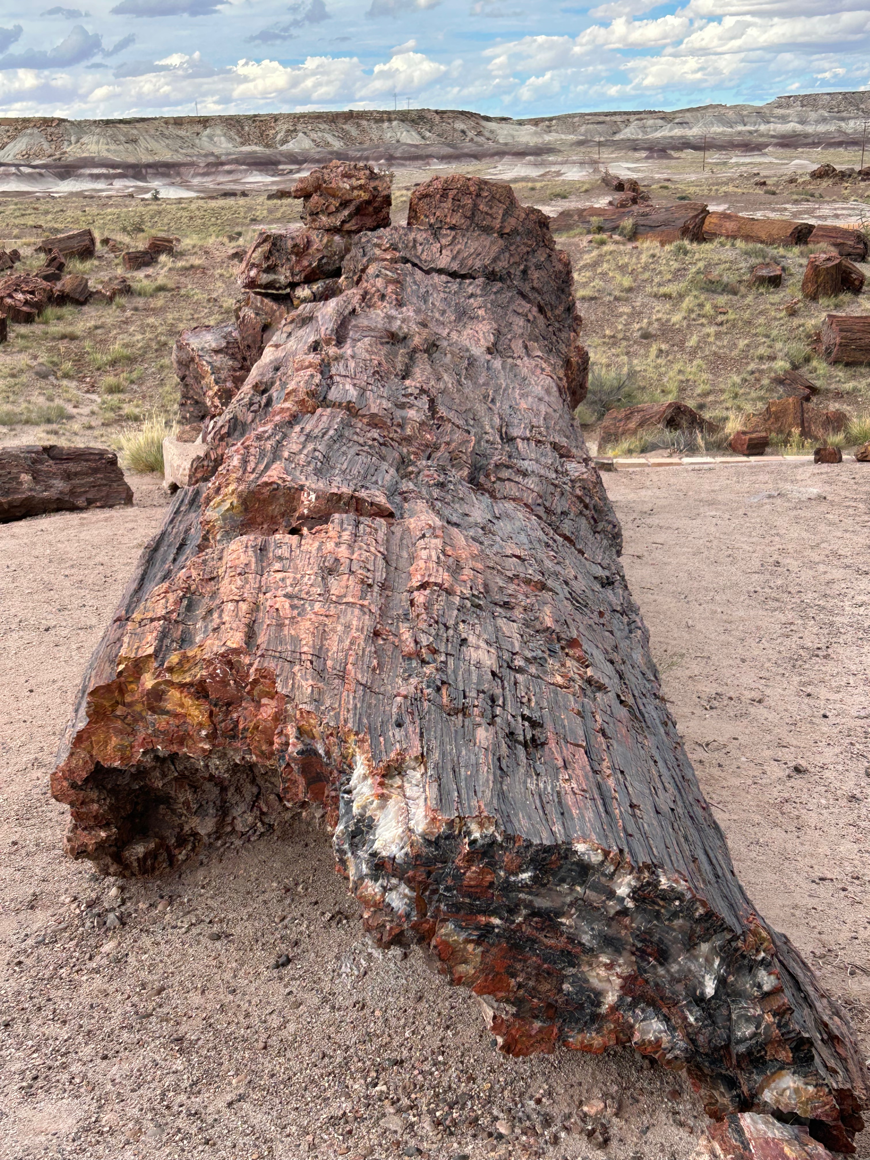
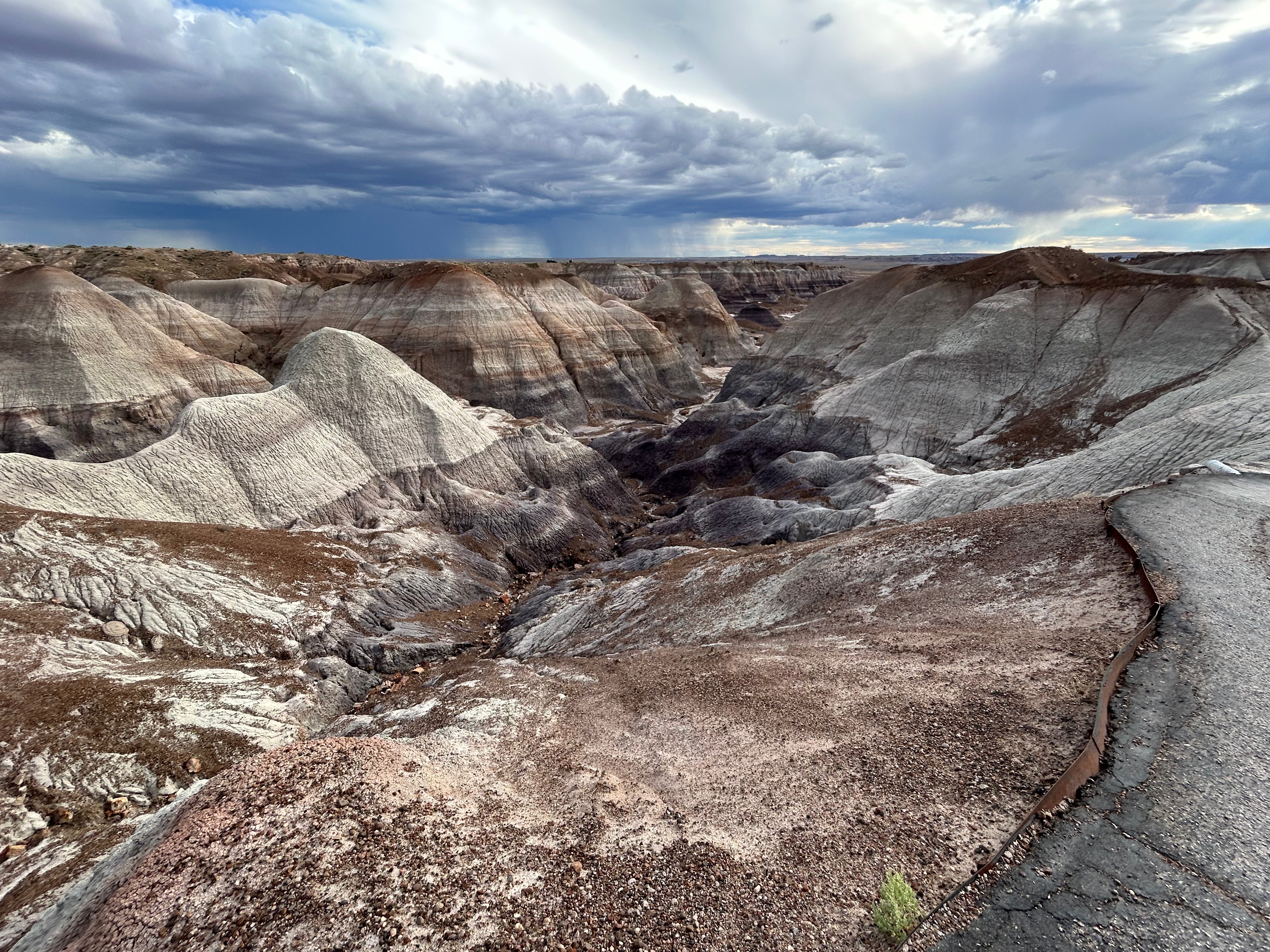
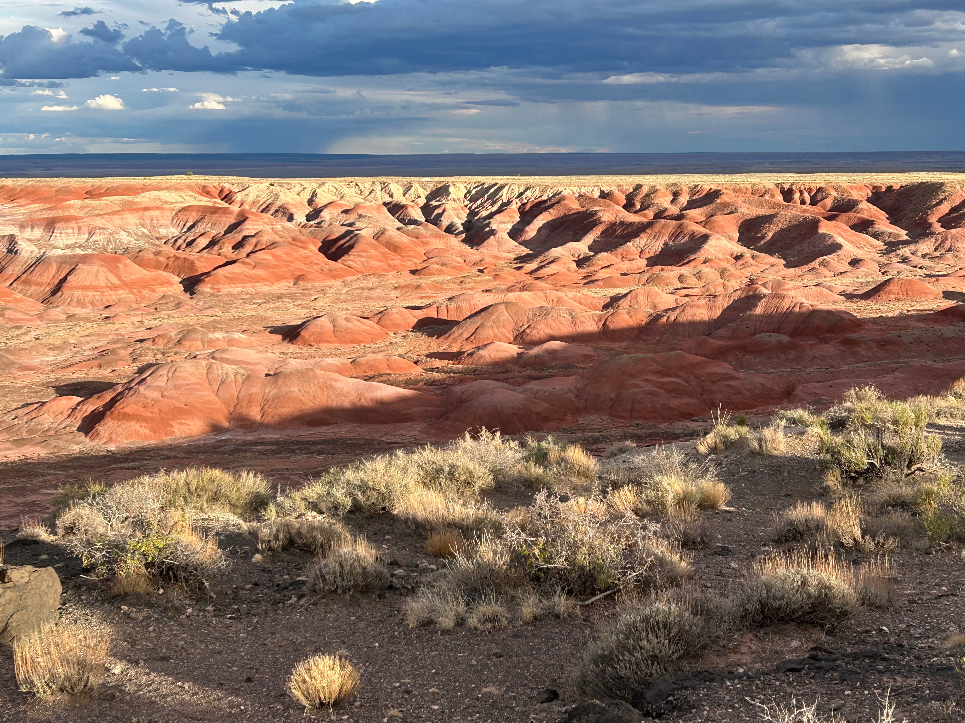
We spent Sunday on the road in Arizona. Our first stop was Winslow, AZ along Route 66 where we took pictures “Standin’ on the Corner” made famous by the 1970’s Eagles song. We also discovered the Relic Road Brewing Company which was a fun little brewery with great food. Later that afternoon, we toured Petrified Forest National Park and Painted Desert. It turned out to be one of our favorite stops. The petrified trees and the landscapes were so colorful and distinctive. There was also a storm building up on the horizon which really enhanced the beauty of everywhere we stopped.
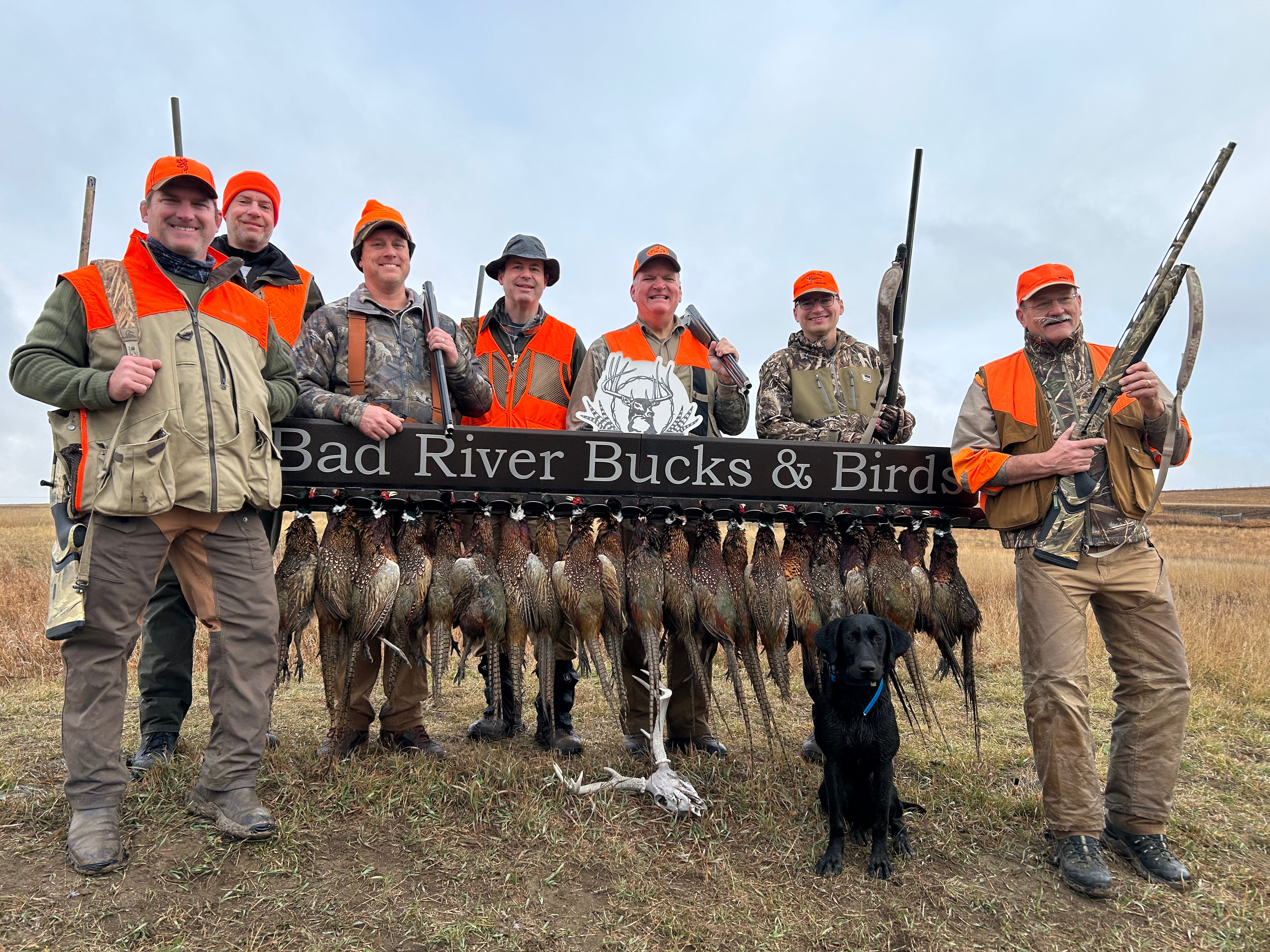
From Arizona, we traveled many miles across New Mexico, Oklahoma, Texas, Arkansas, and Tennessee with only a few stops and arrived back home in Georgia on the night of Tuesday, September 23rd. I’m already looking forward to hitting the road again in a few weeks for what’s become an annual Pheasant Hunting trip out in South Dakota.
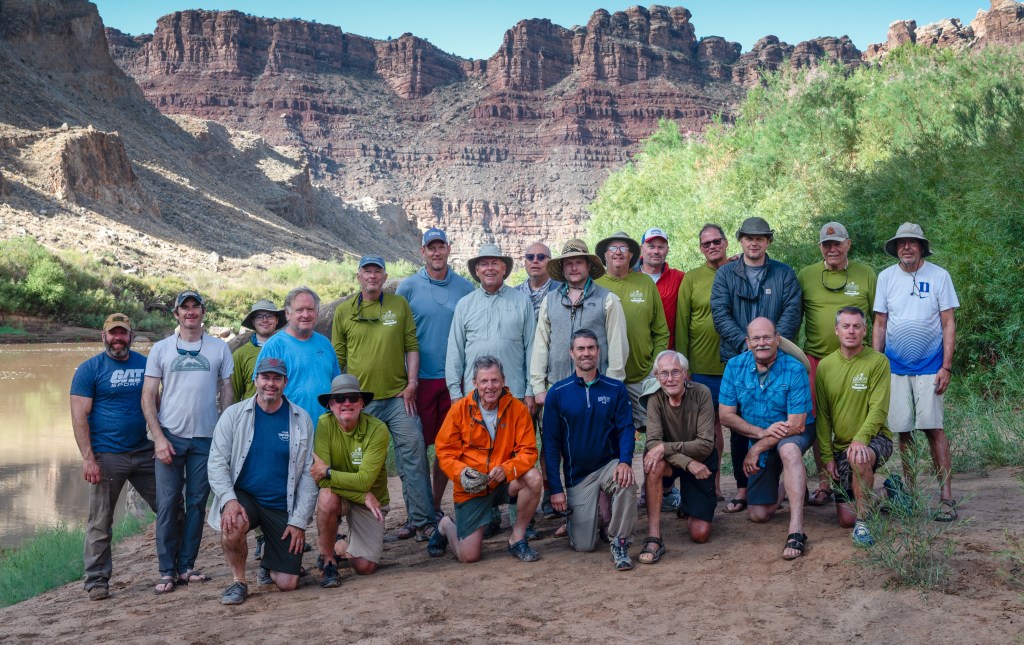
Back in February when I was confined to a recliner at home for a number of months after breaking my knee and having surgery on my tibia plateau, I received an email from my good friend Bob from Nashville asking me if I would be interested in joining his church group, St. Geoge’s Episcopal, on a 55-mile flatwater canoe trip down the Green River in Utah in September. My first thought was that I should be mobile enough to do this trip so within minutes after discussing the opportunity with my event coordinator and home scheduler (Mary) I was signed up.
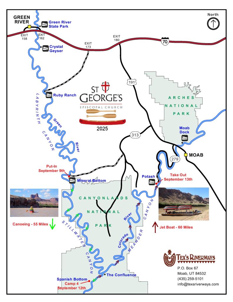
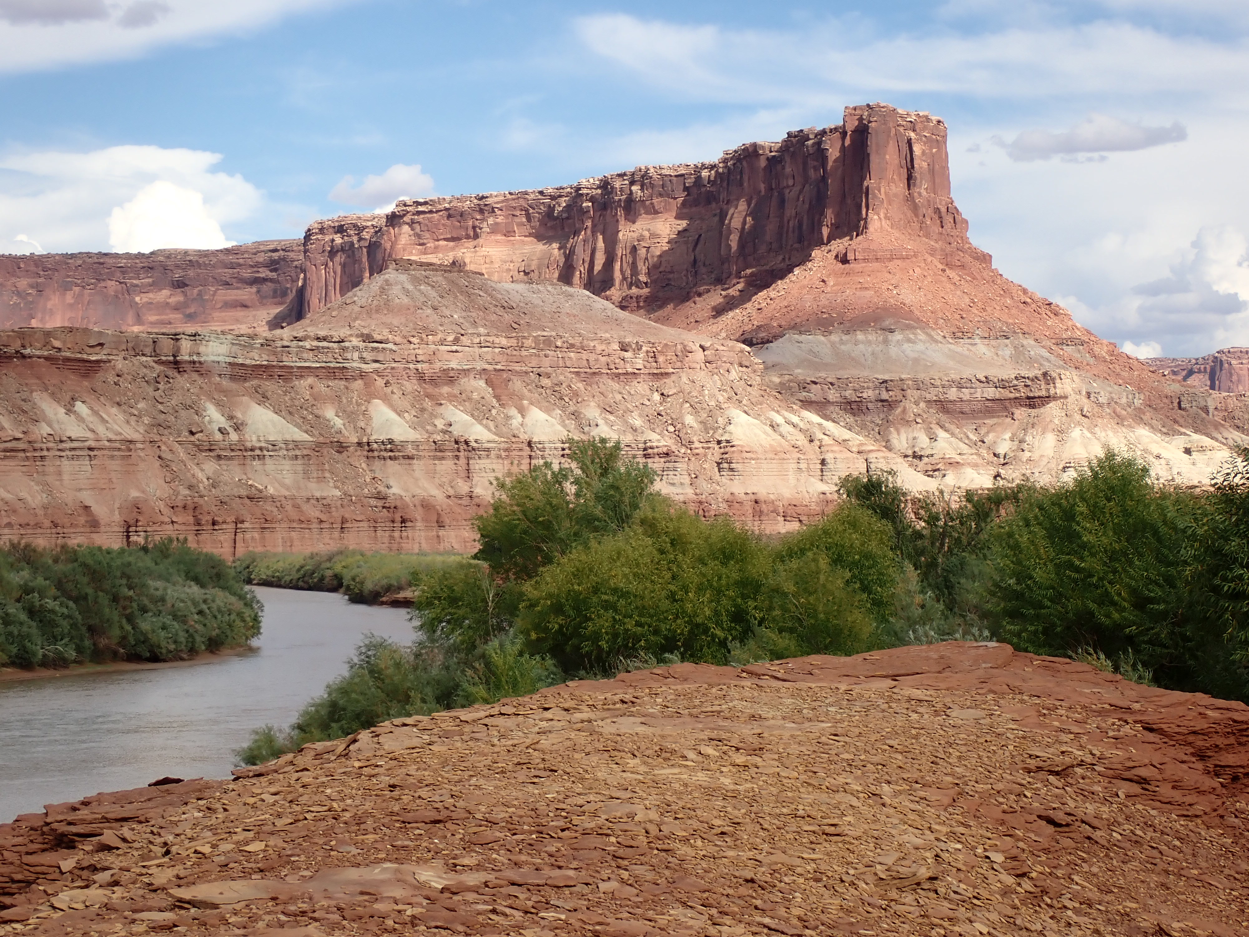
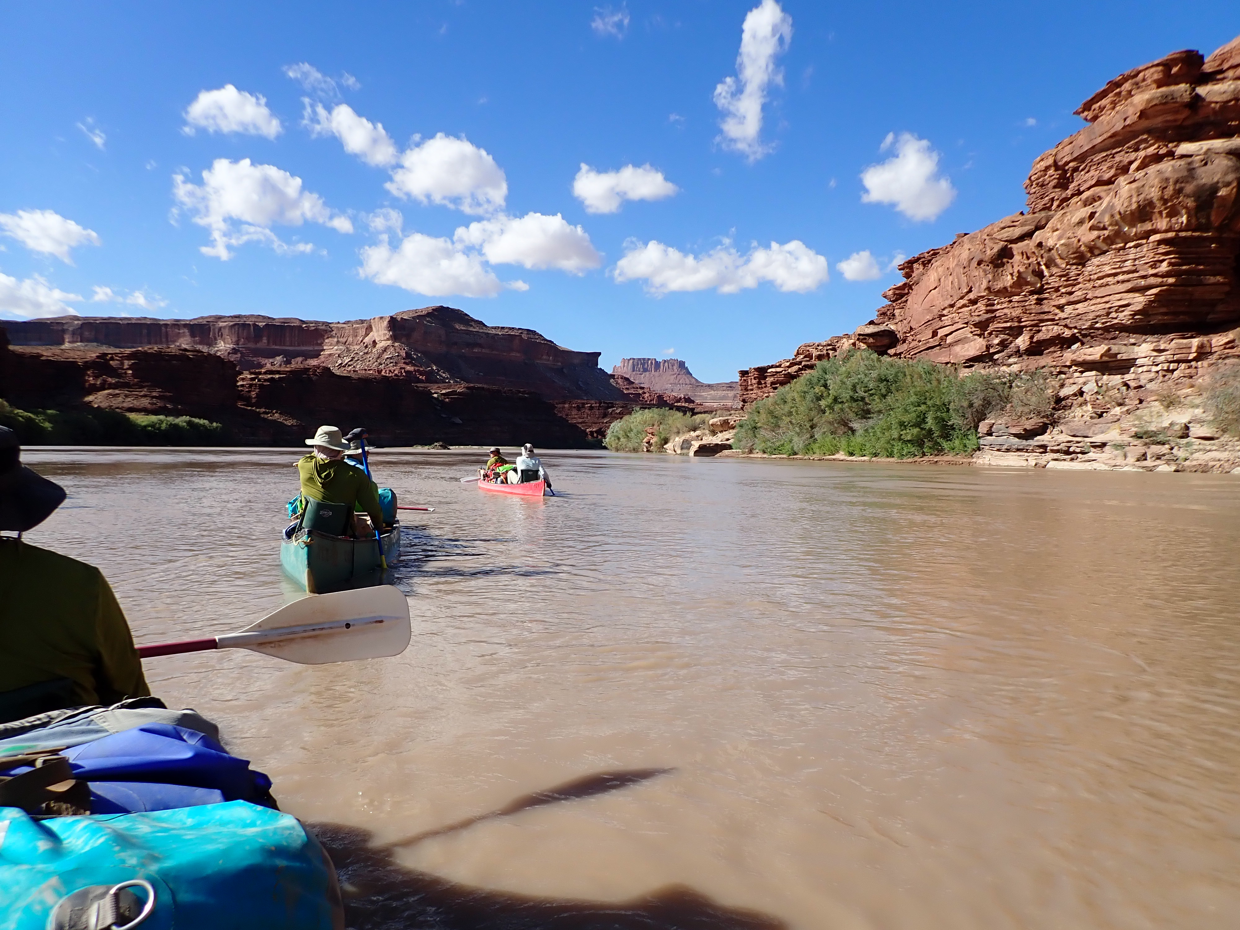
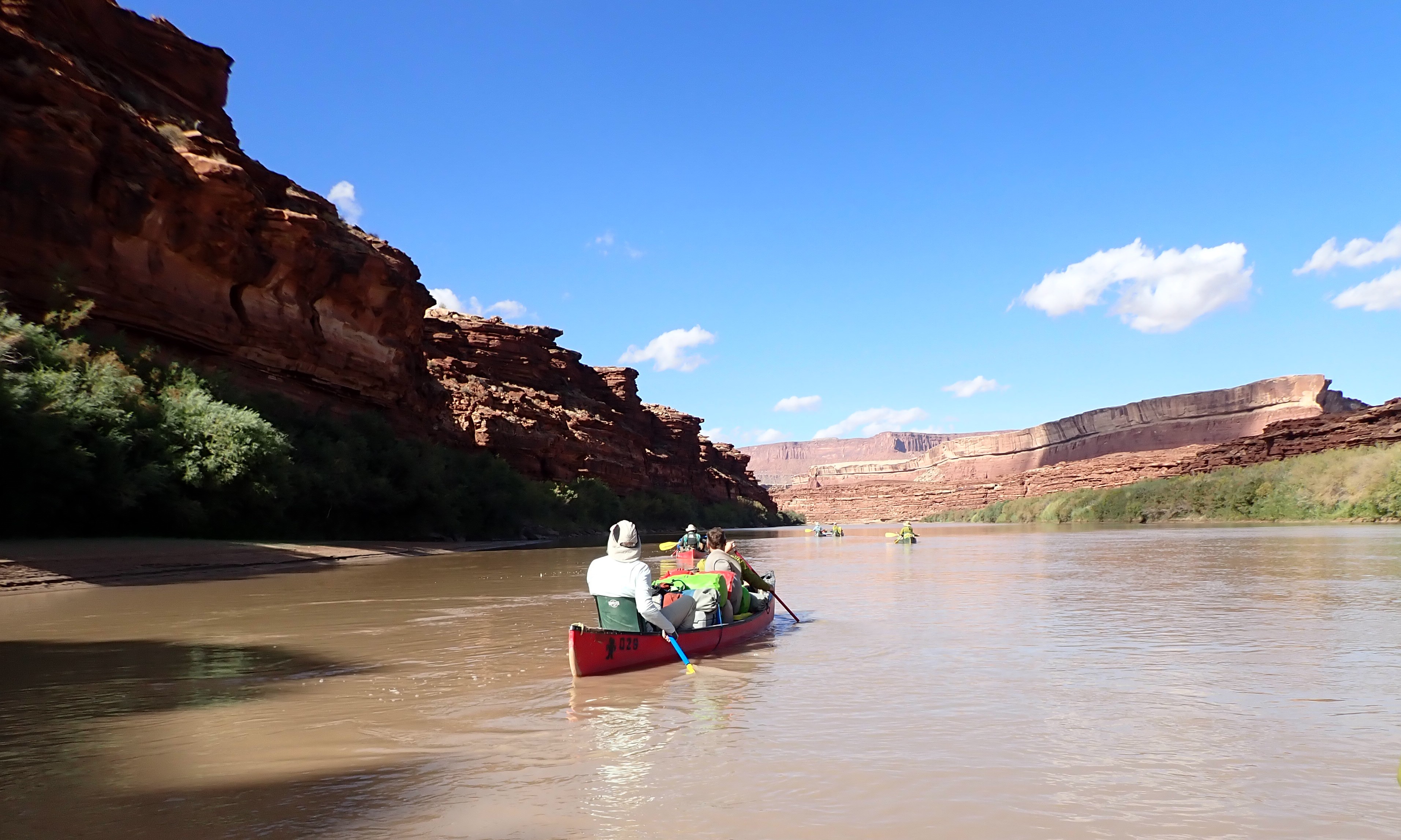
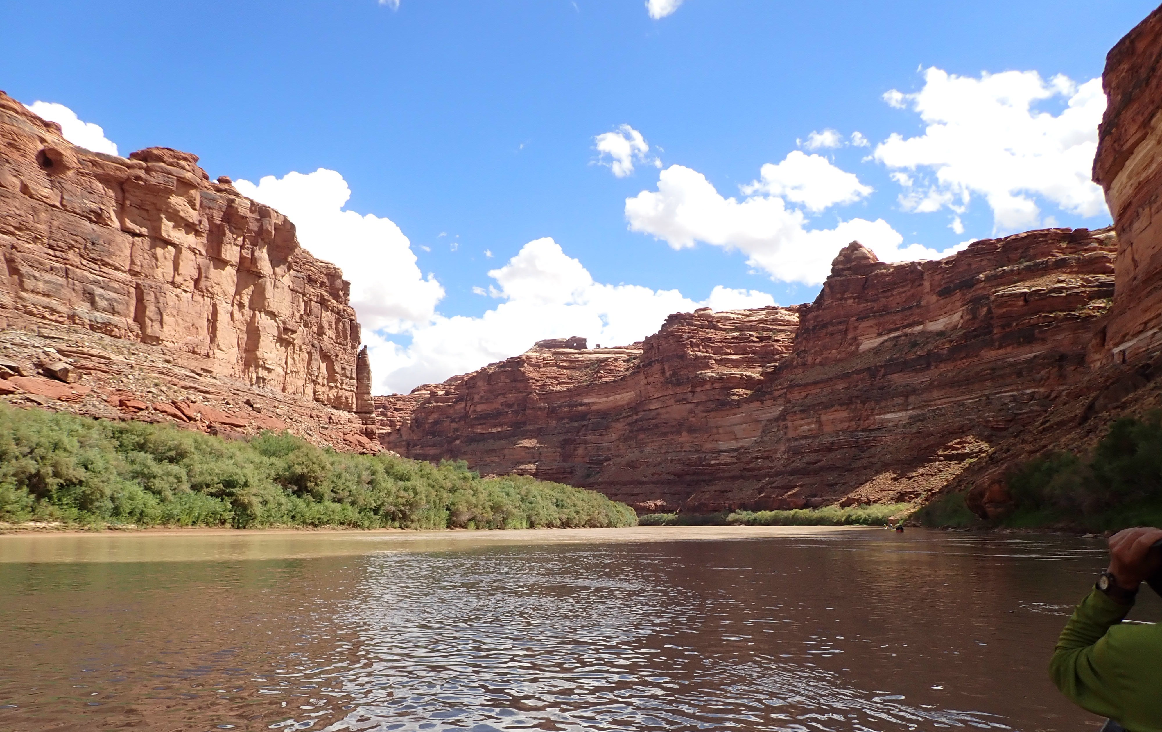
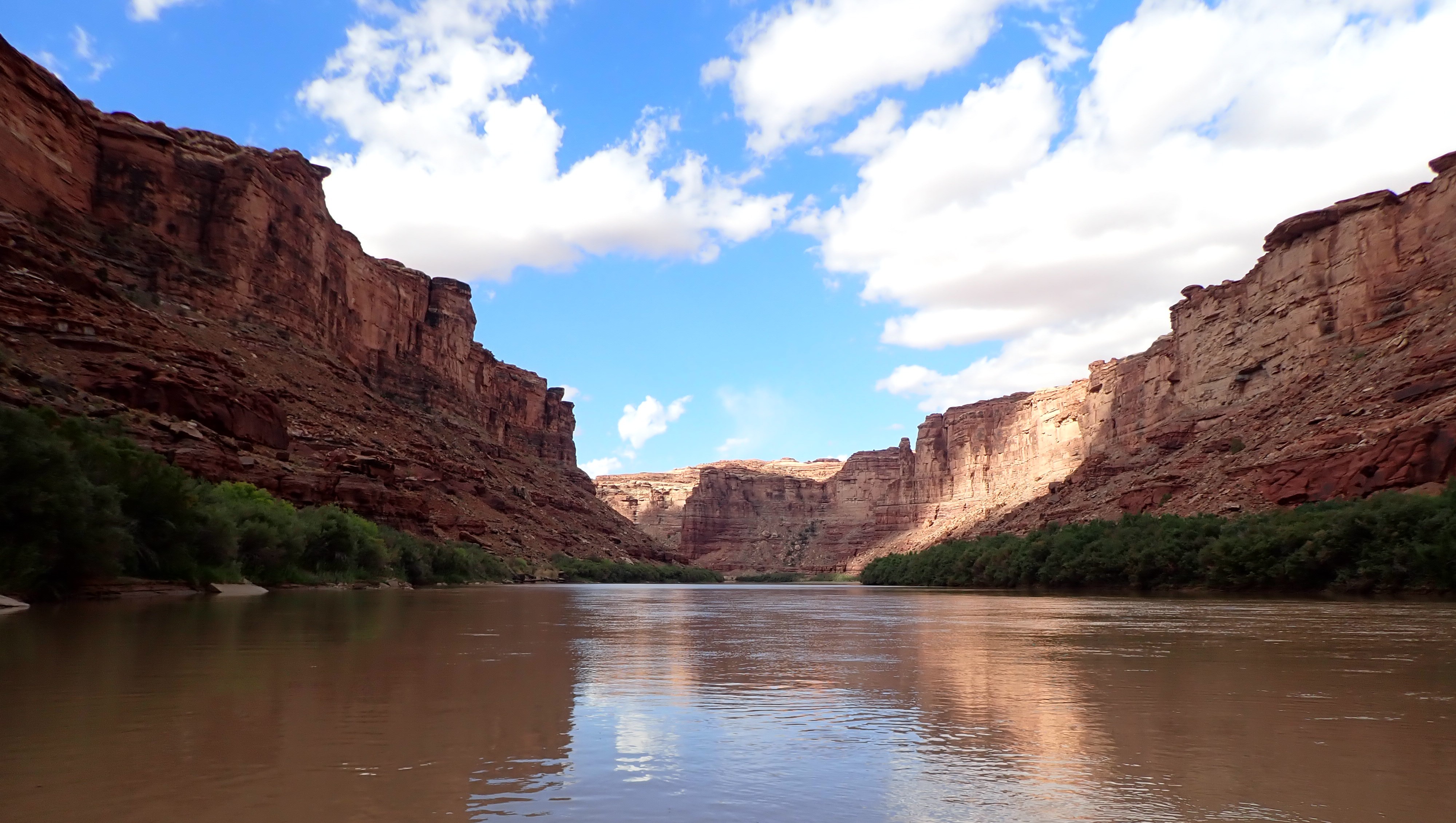
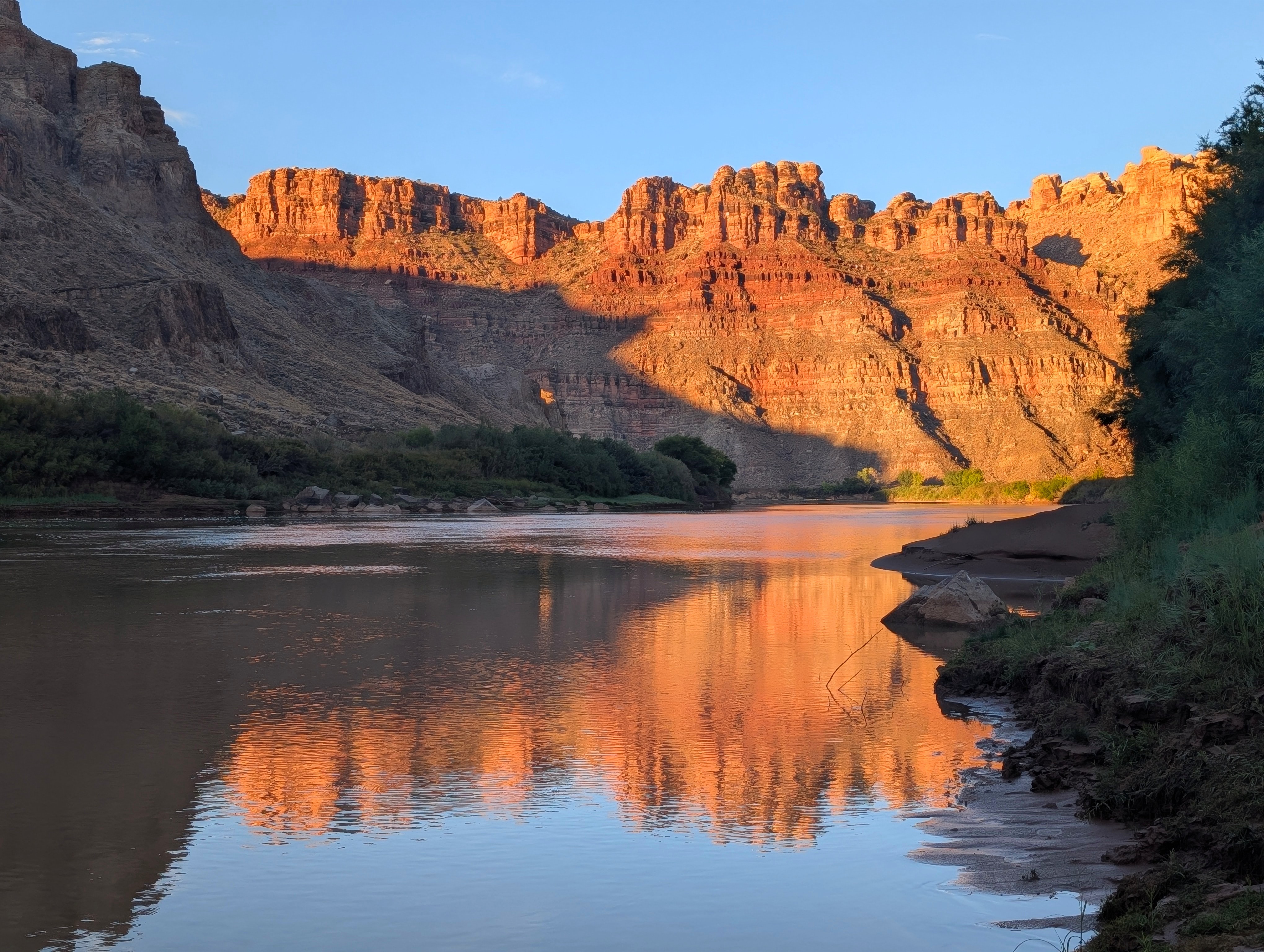
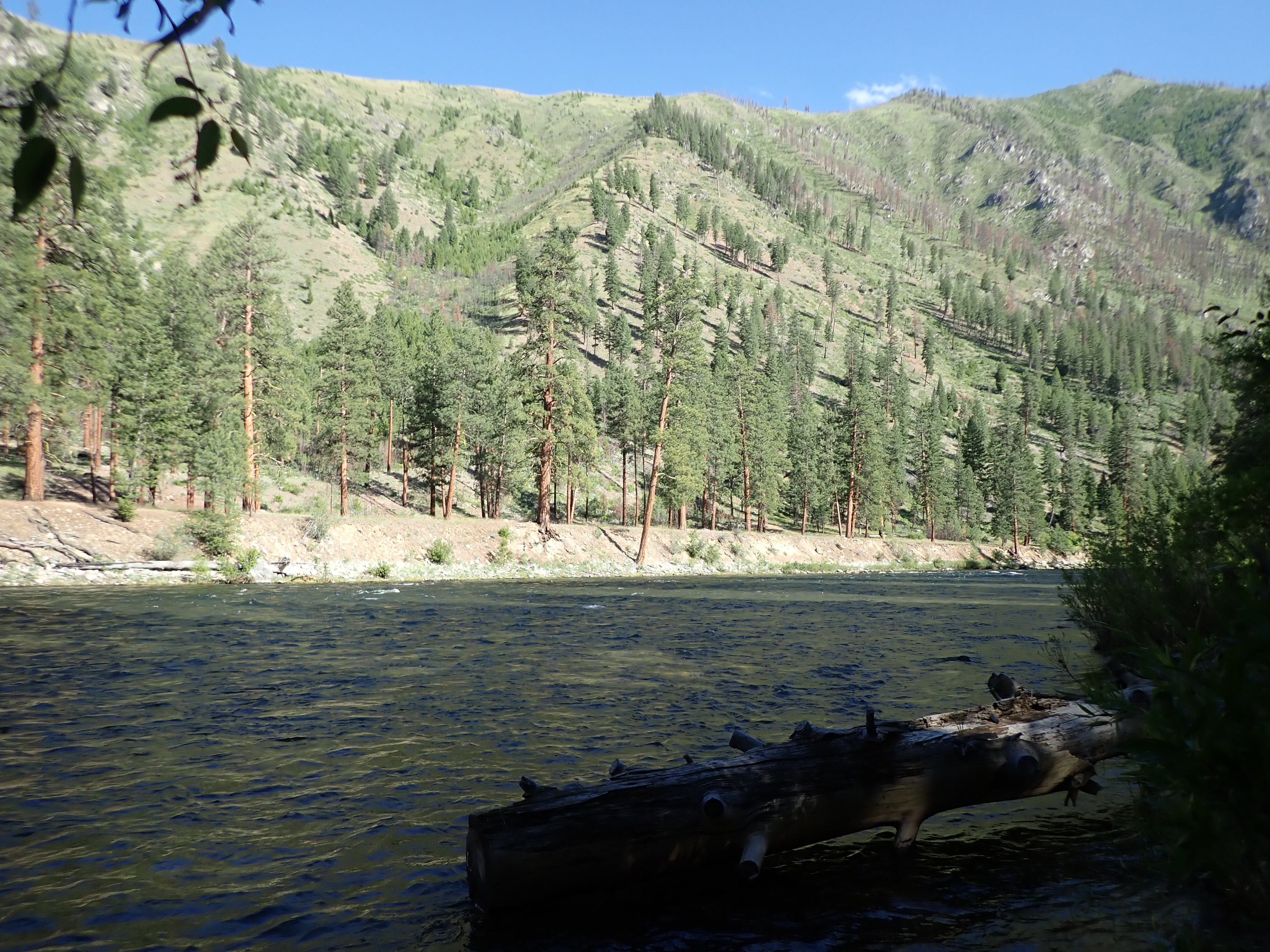
The section of the Green River that we paddled basically cuts through Canyonlands National Park along the beautiful sandstone walls of Stillwater Cayon to the confluence of the Colorado River. We spent a total of five days and four nights exploring and tracing the same route that Major John Wesley Powell did back in 1869 down this very section of the Green River.
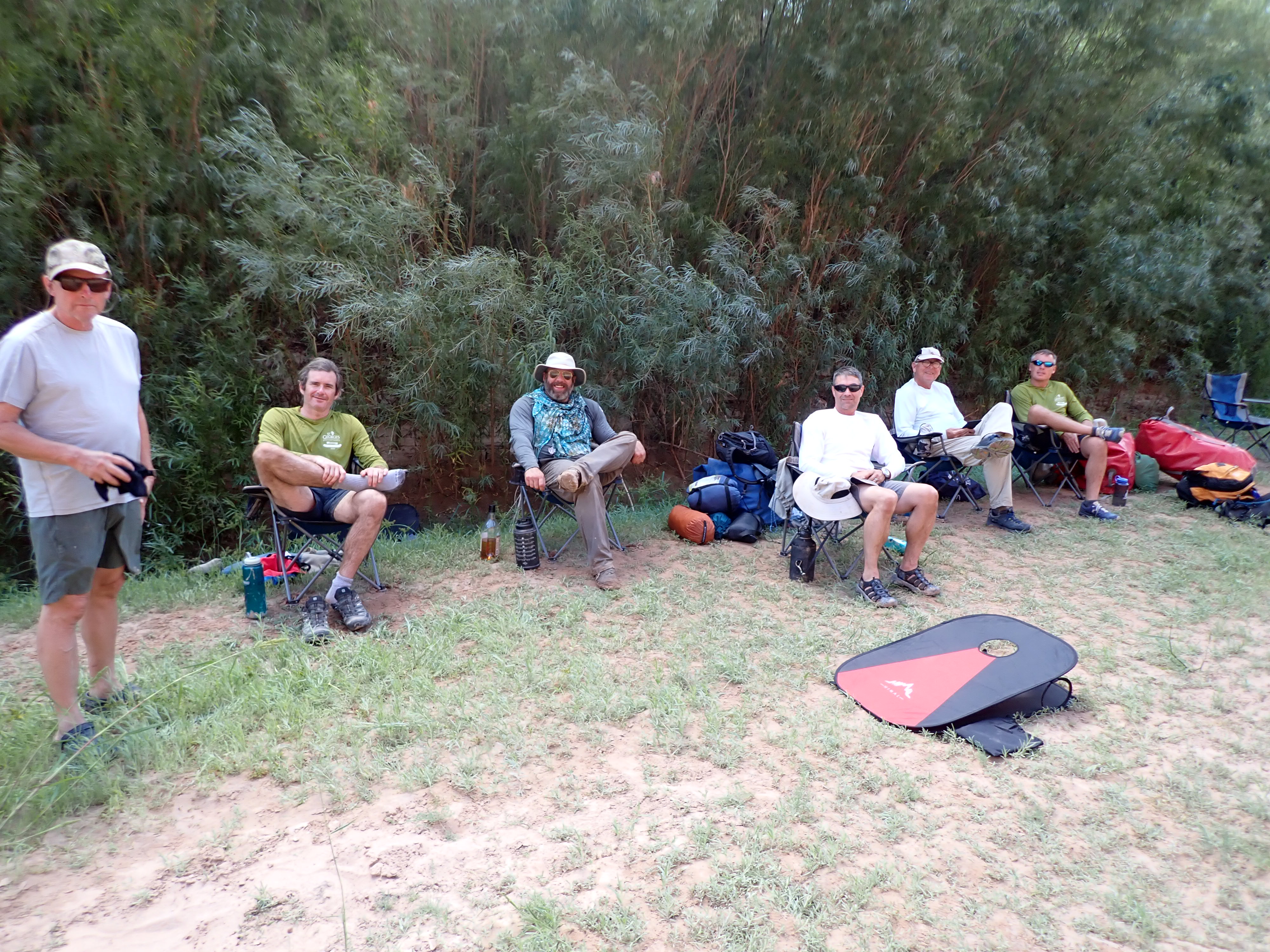
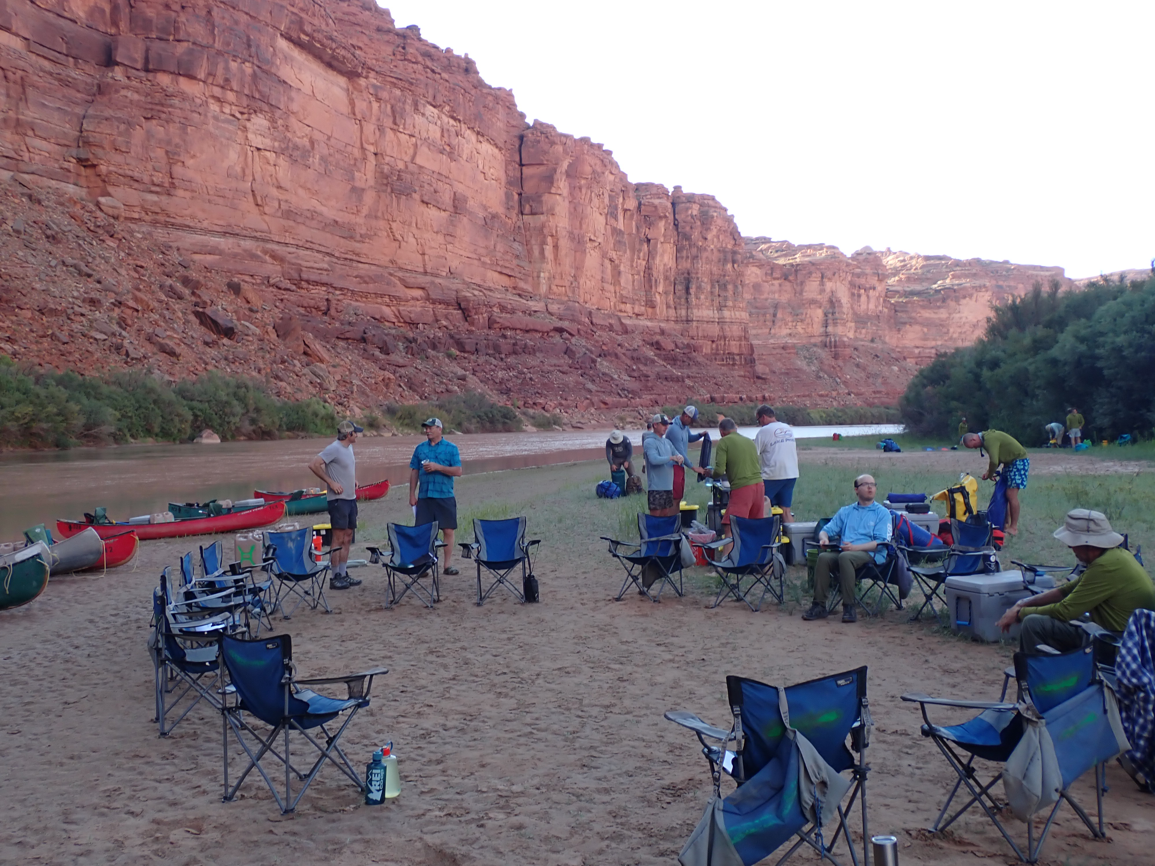
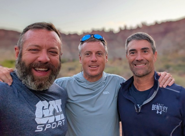
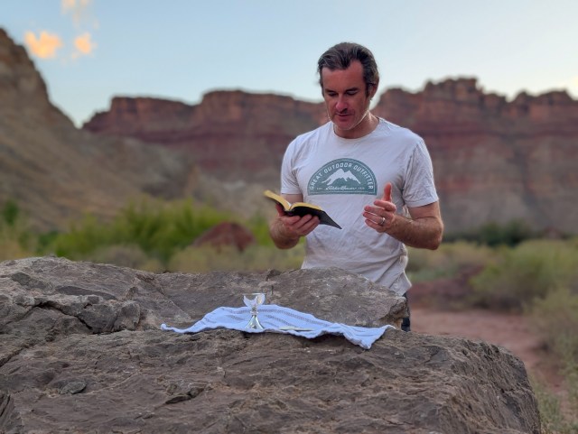
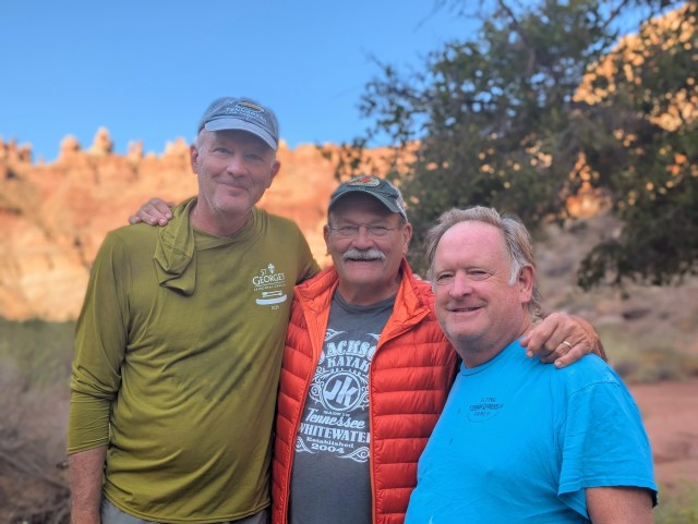
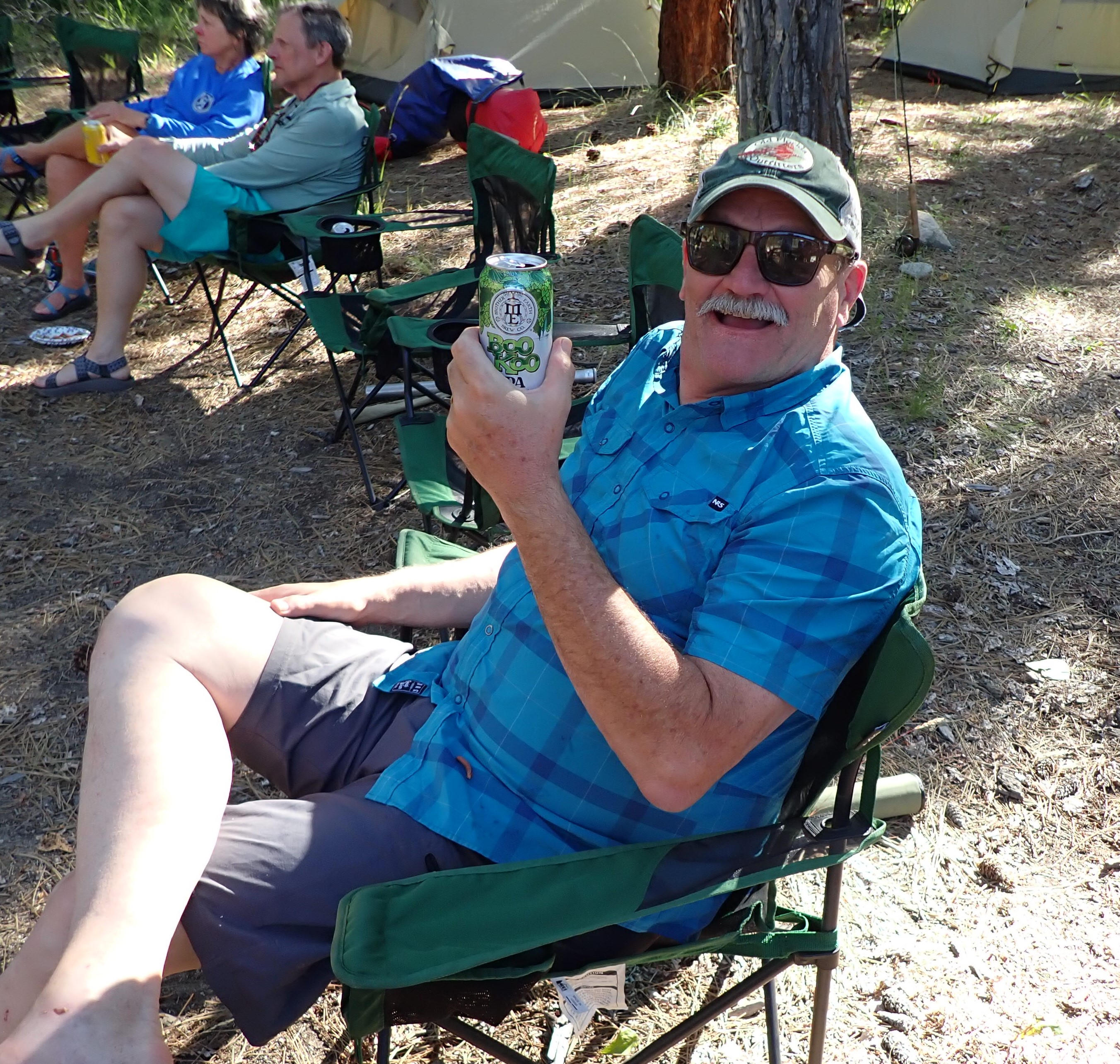
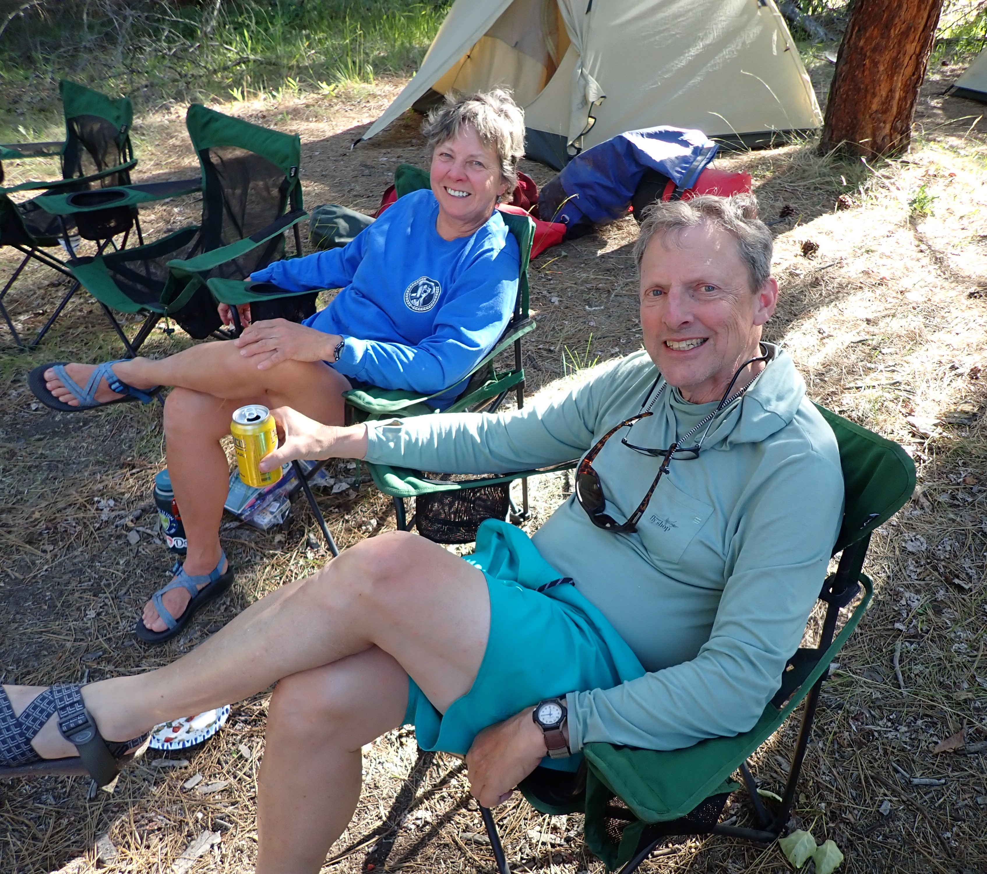
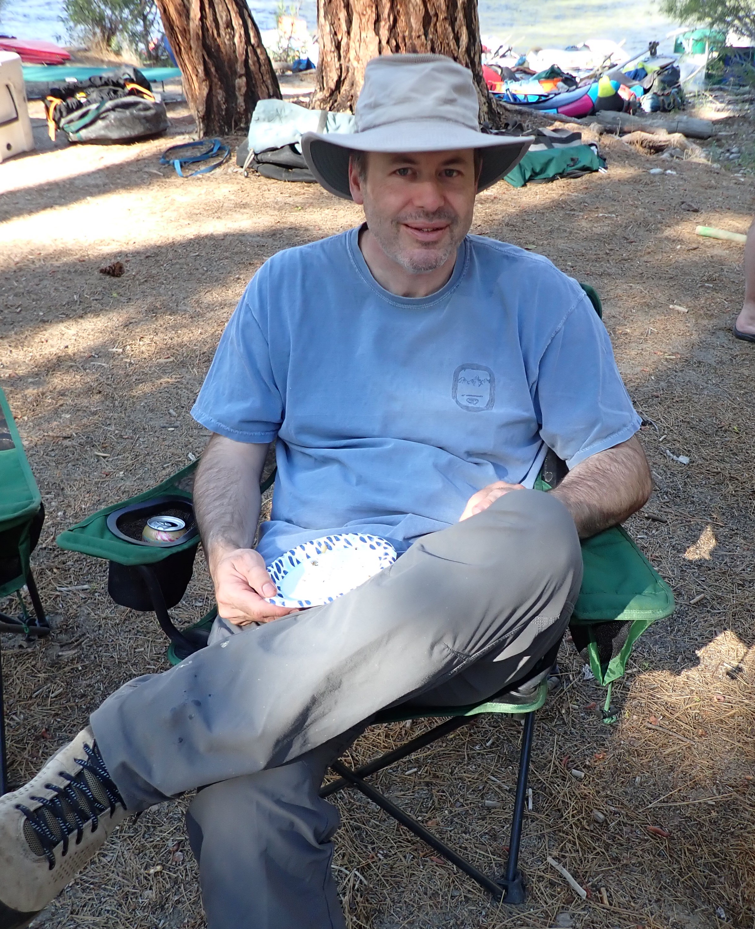
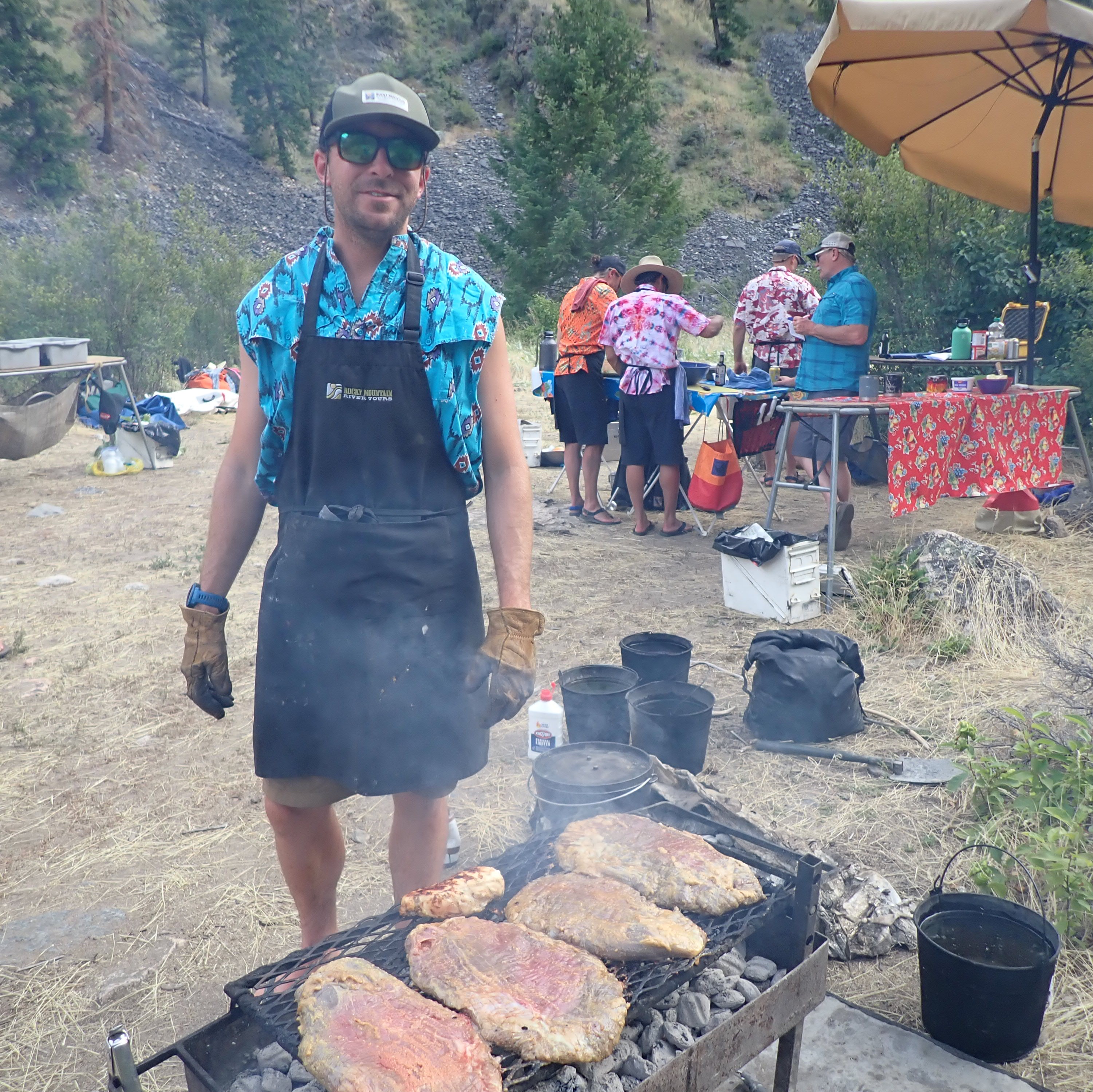
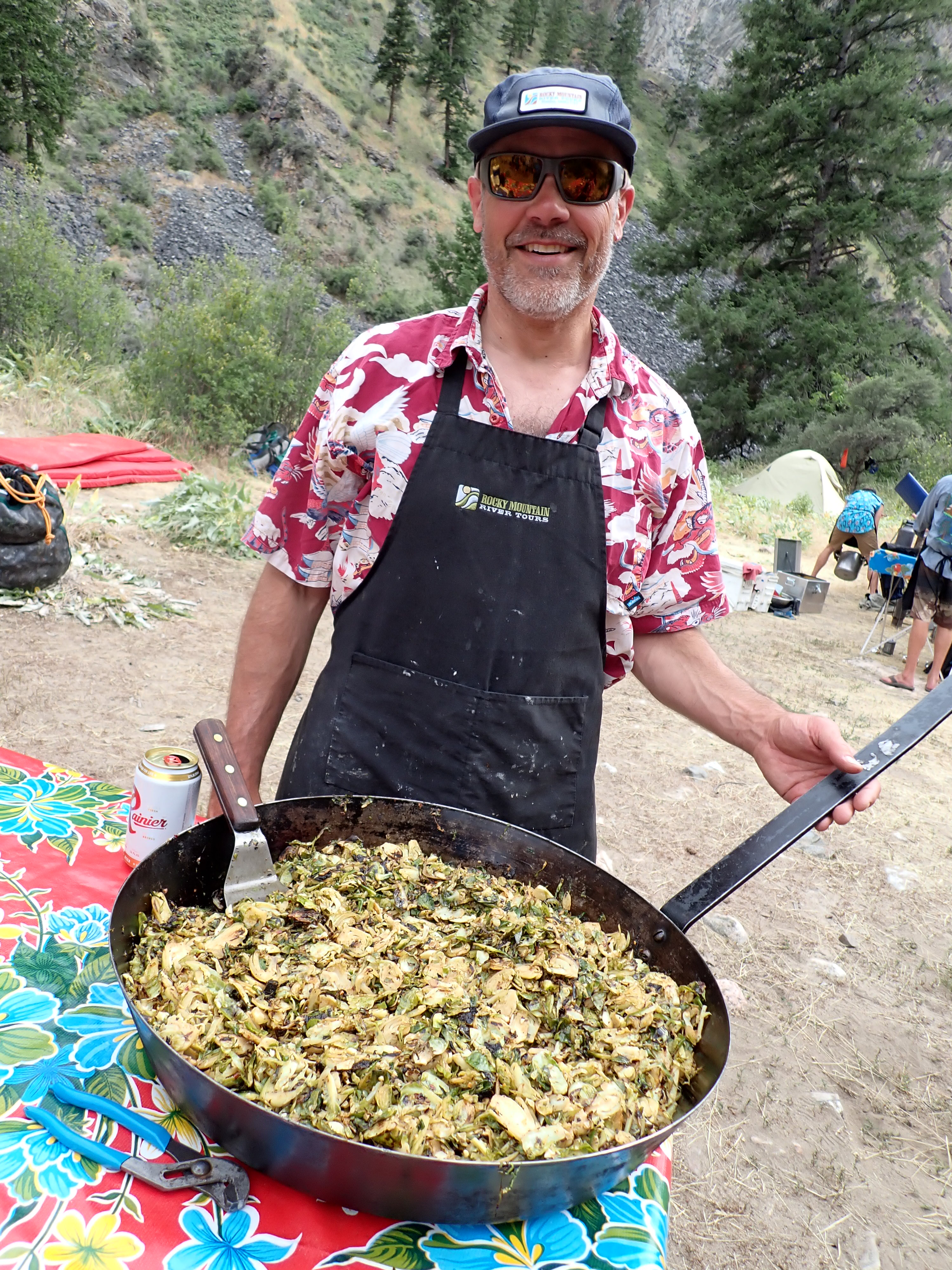
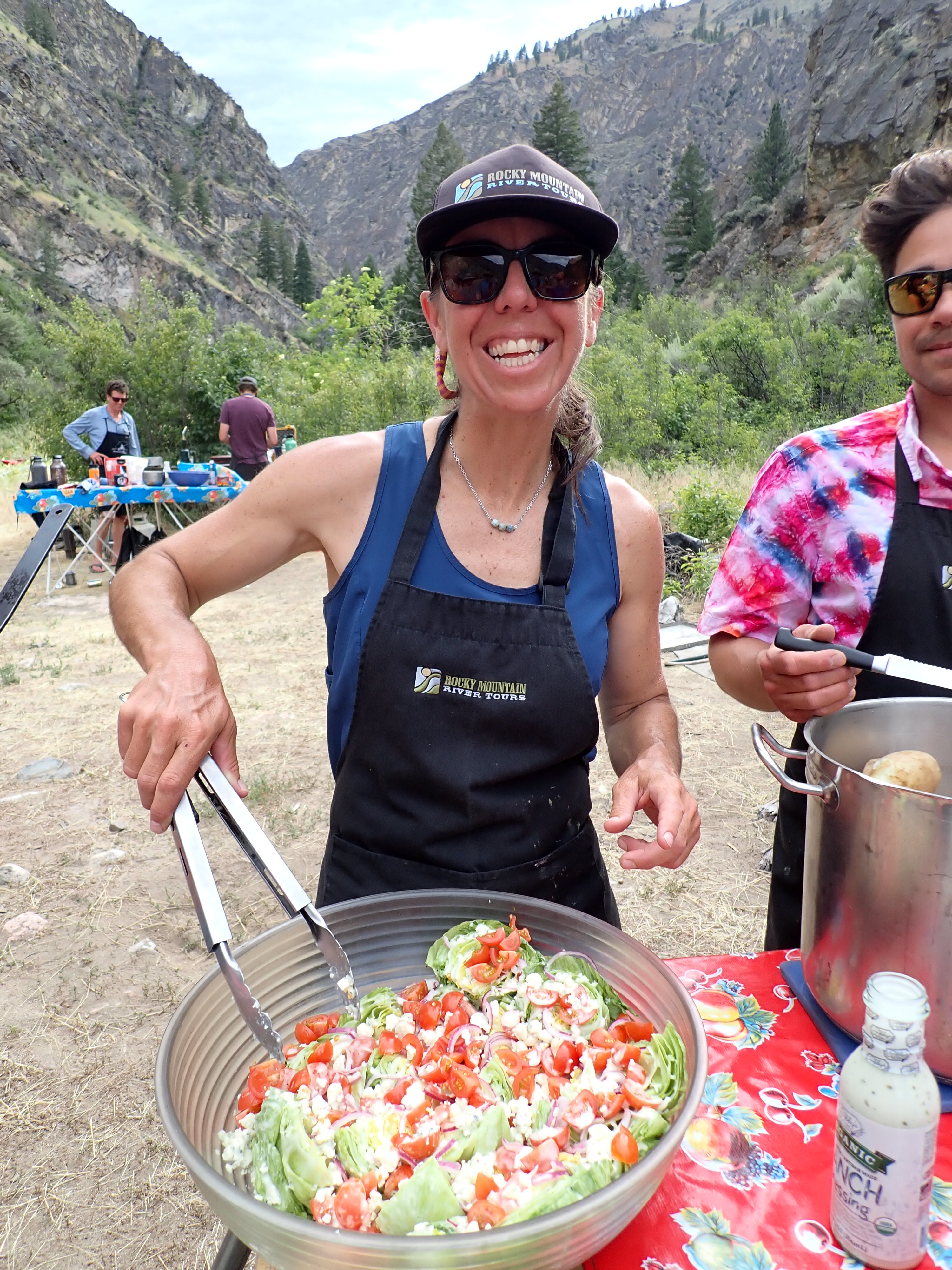
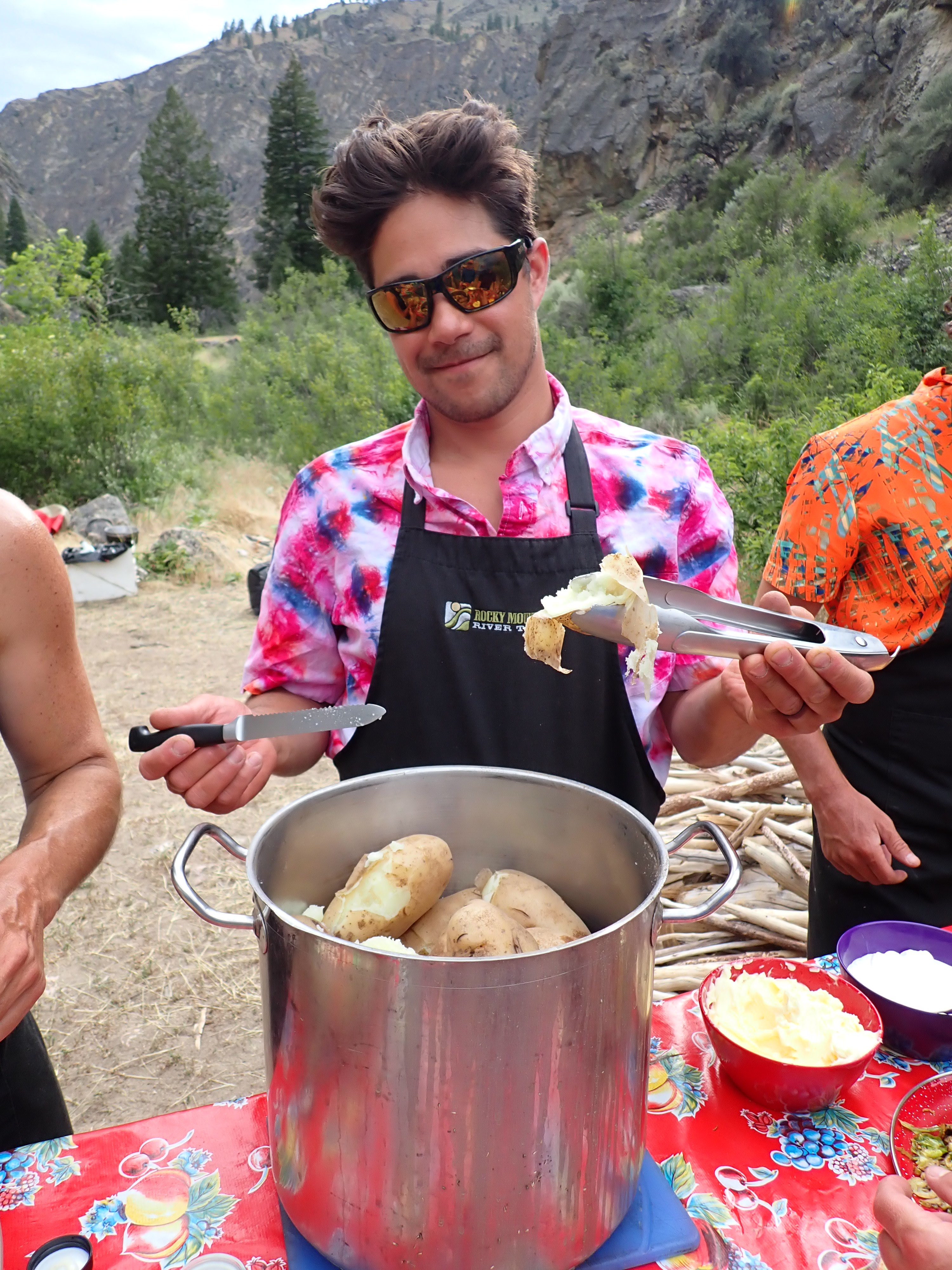
A big thank you needs to go out to Steve Hinkley and David Smith for organizing, planning and preparing our meals on this trip. You two truly did a fantastic job. Also, a thank you needs to go out to the Rev. Colin Ambrose, Gerry Senechat and Don Padfield for their work planning and conducting the morning and evening devotions for each day that we were on the water.
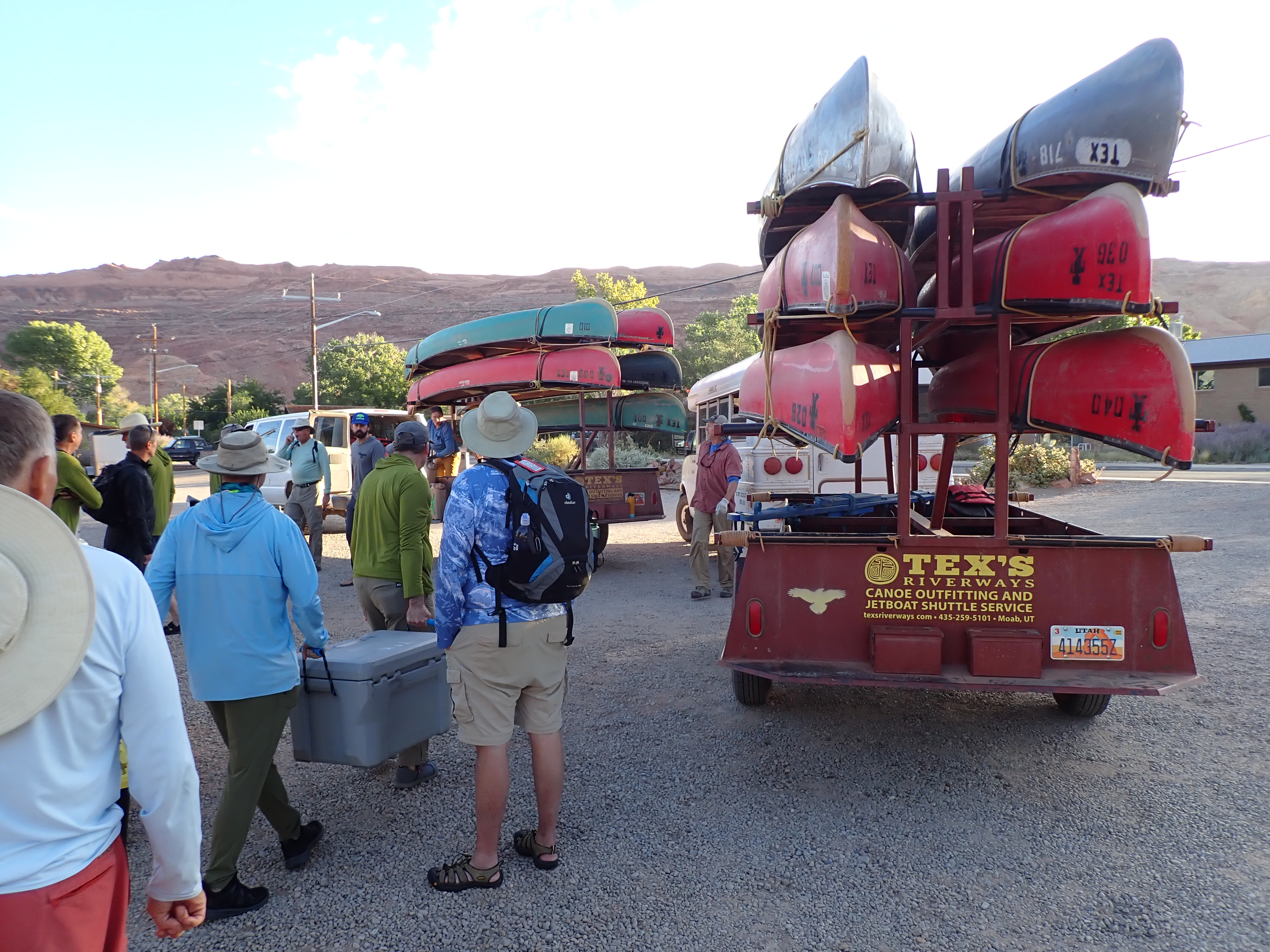
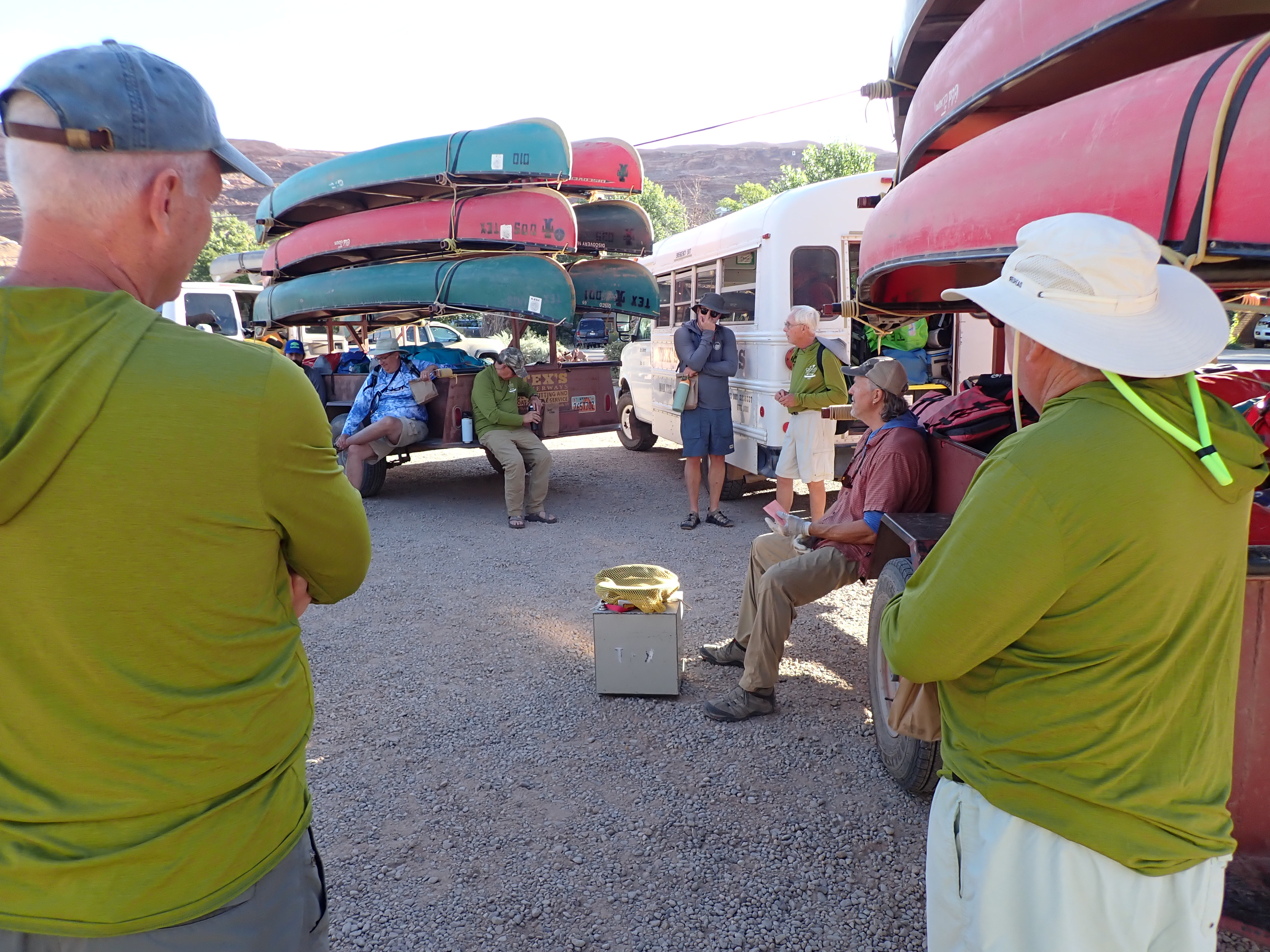
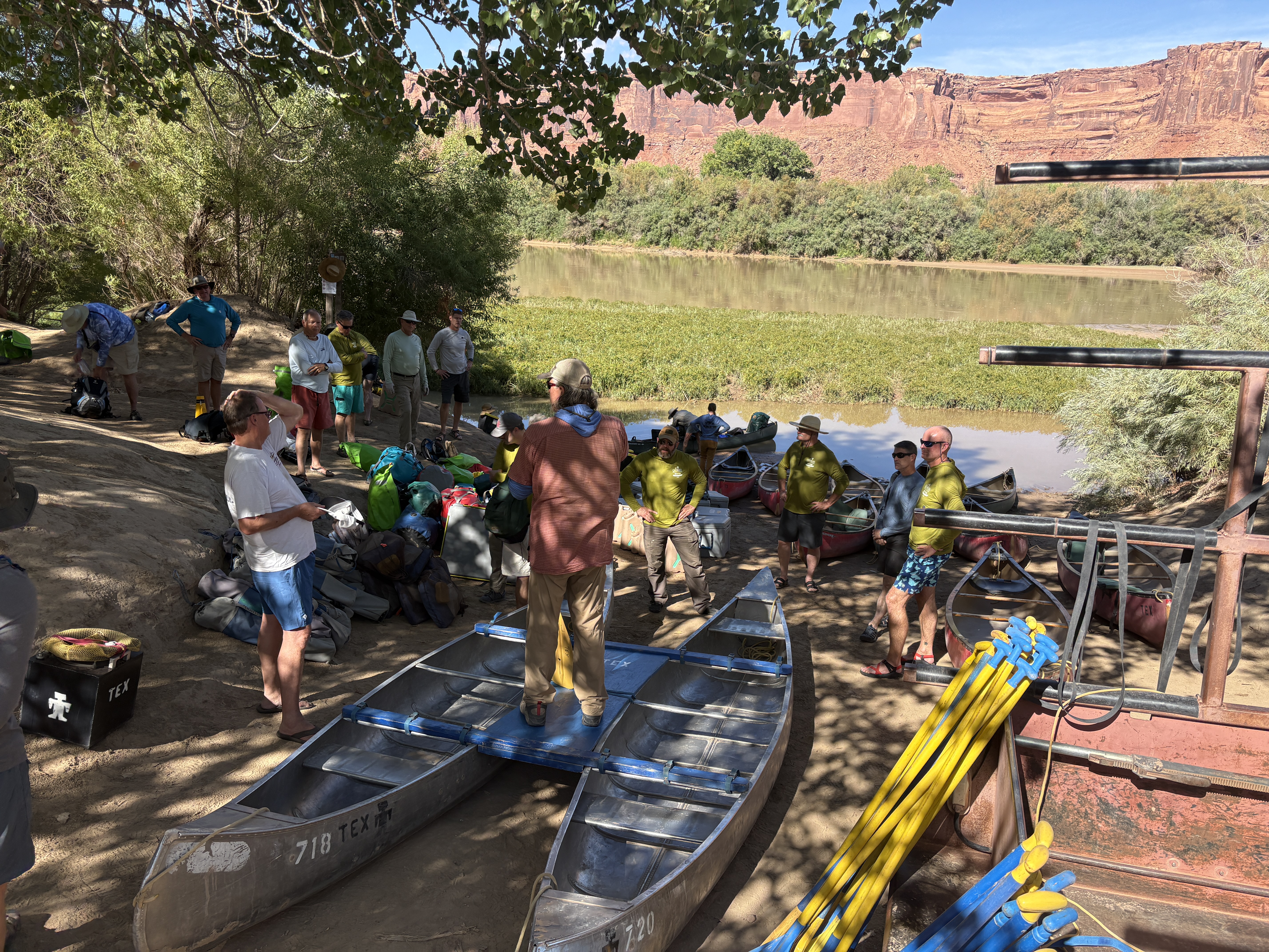
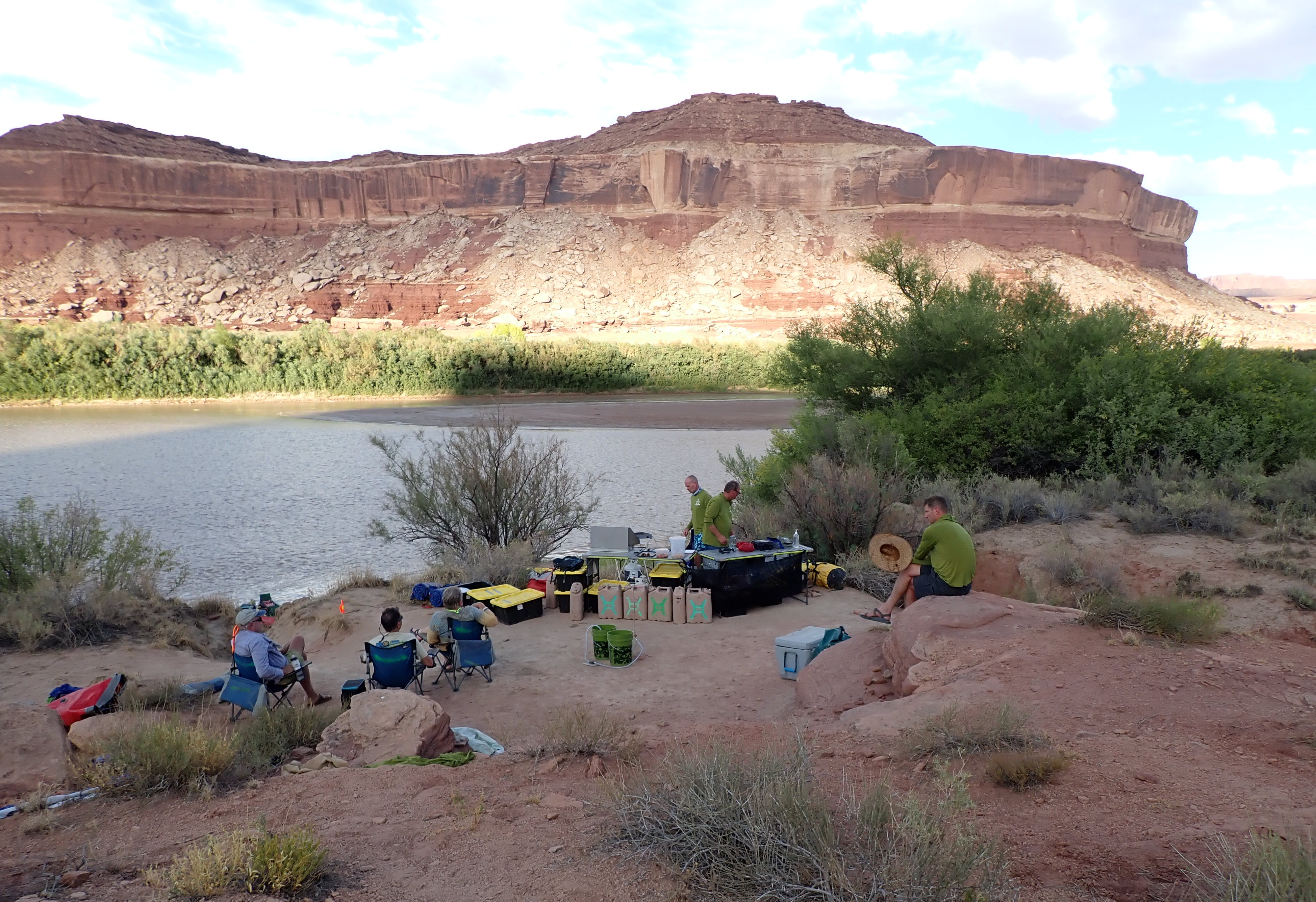
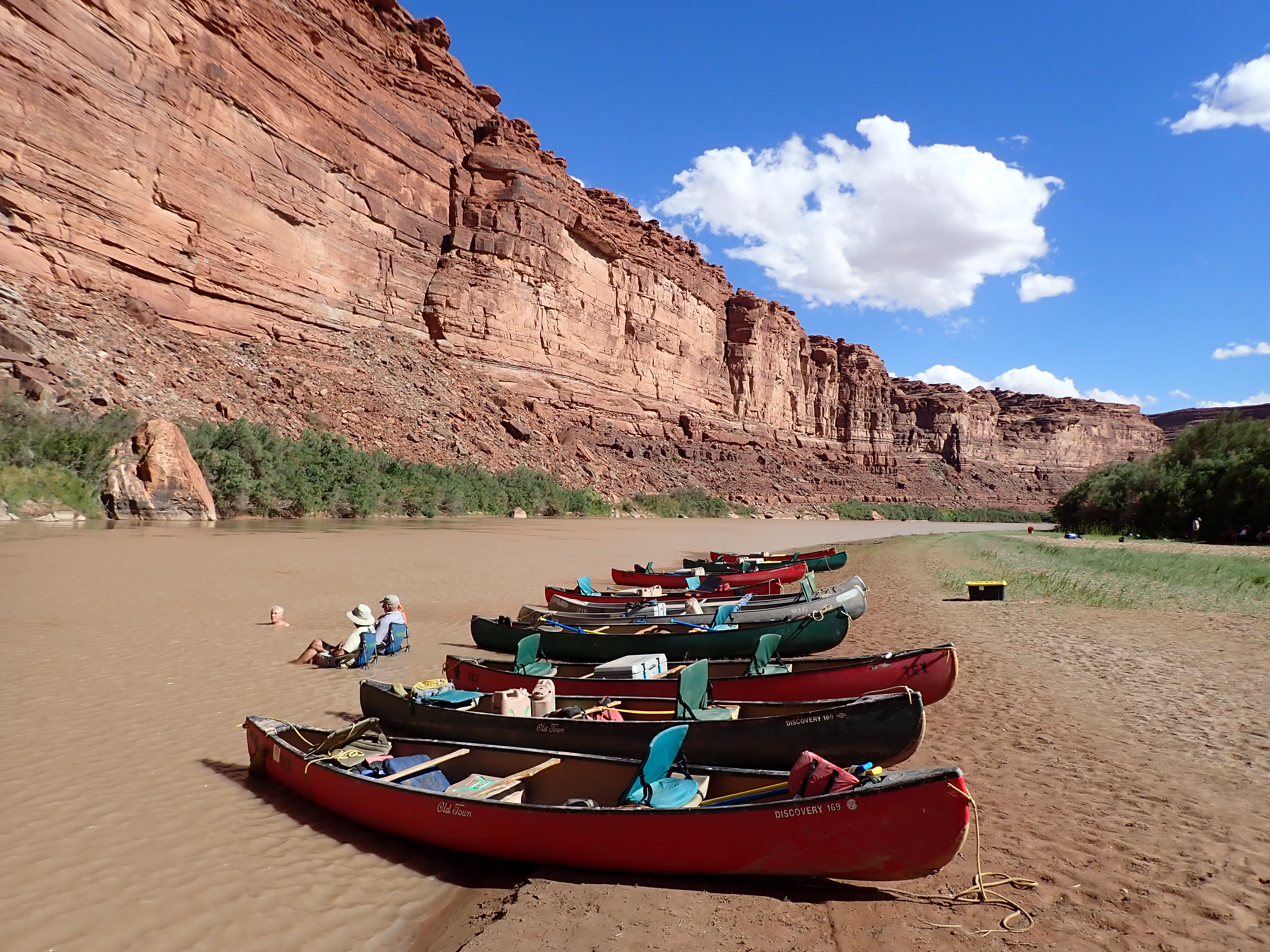
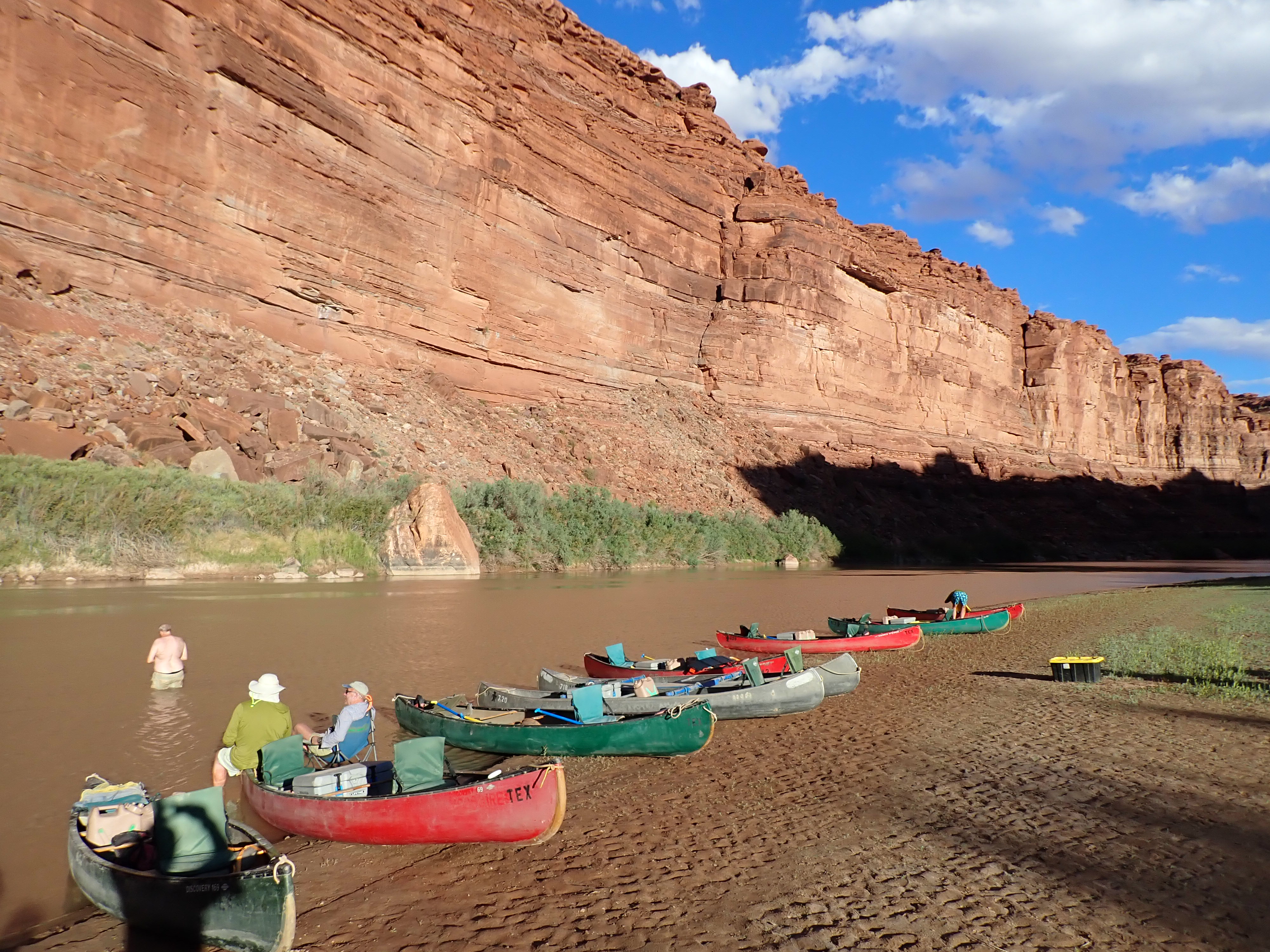
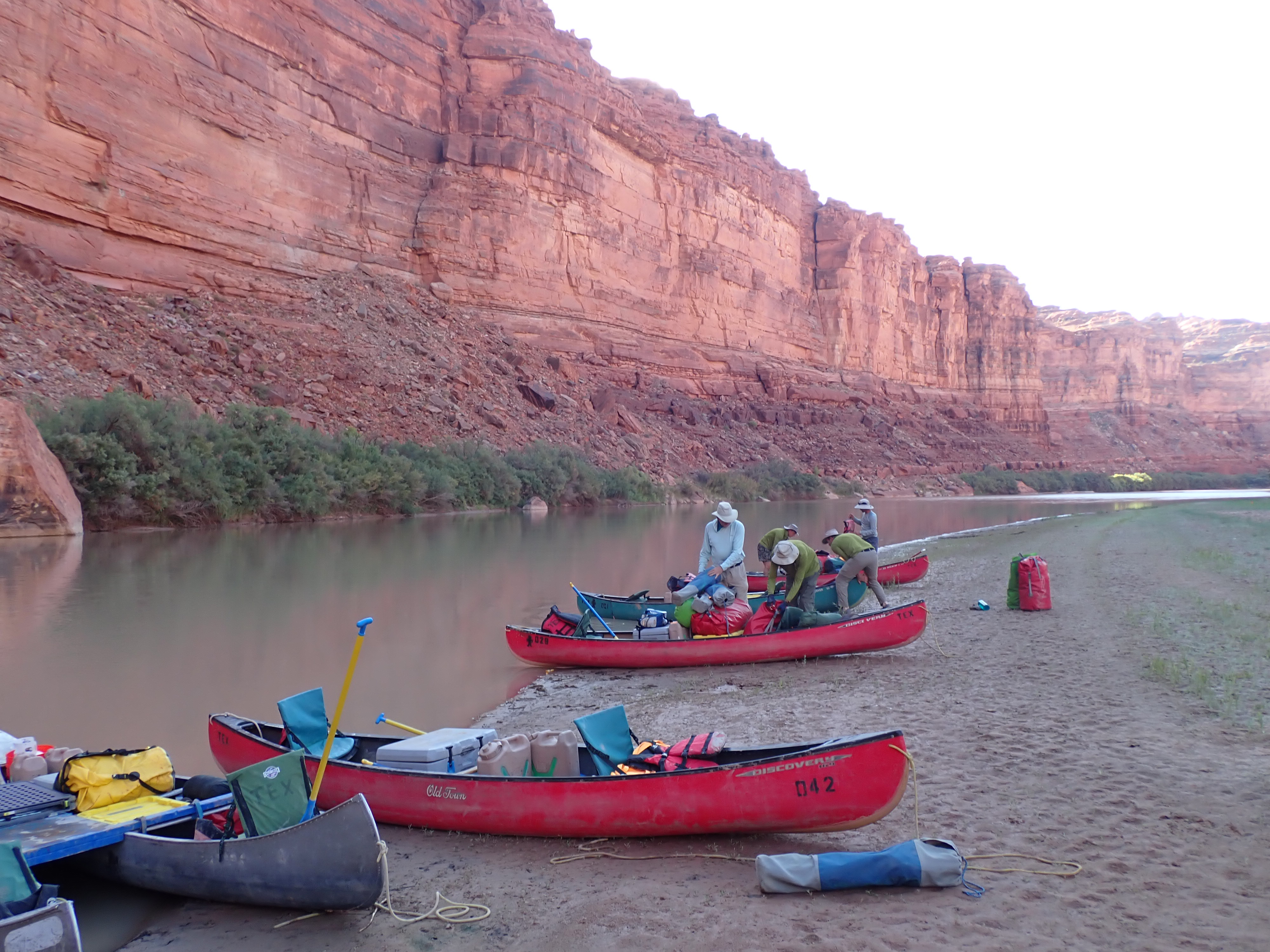
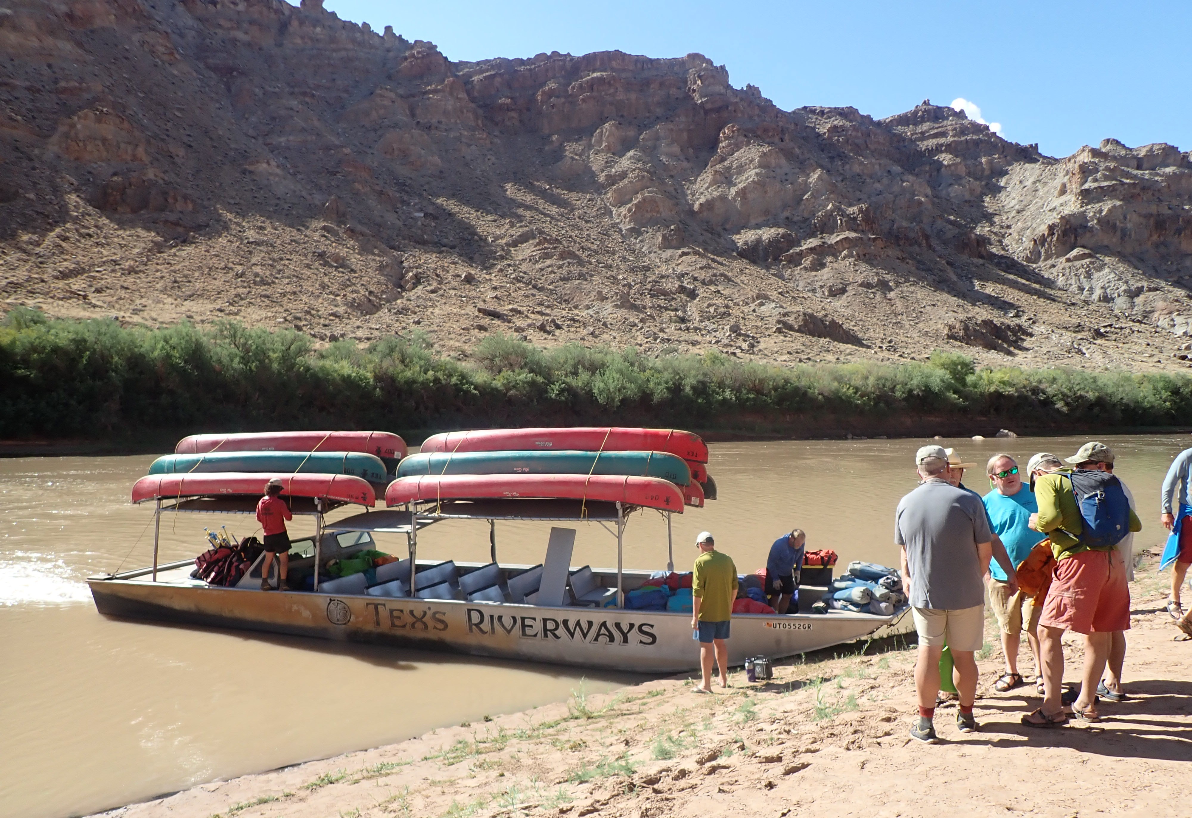
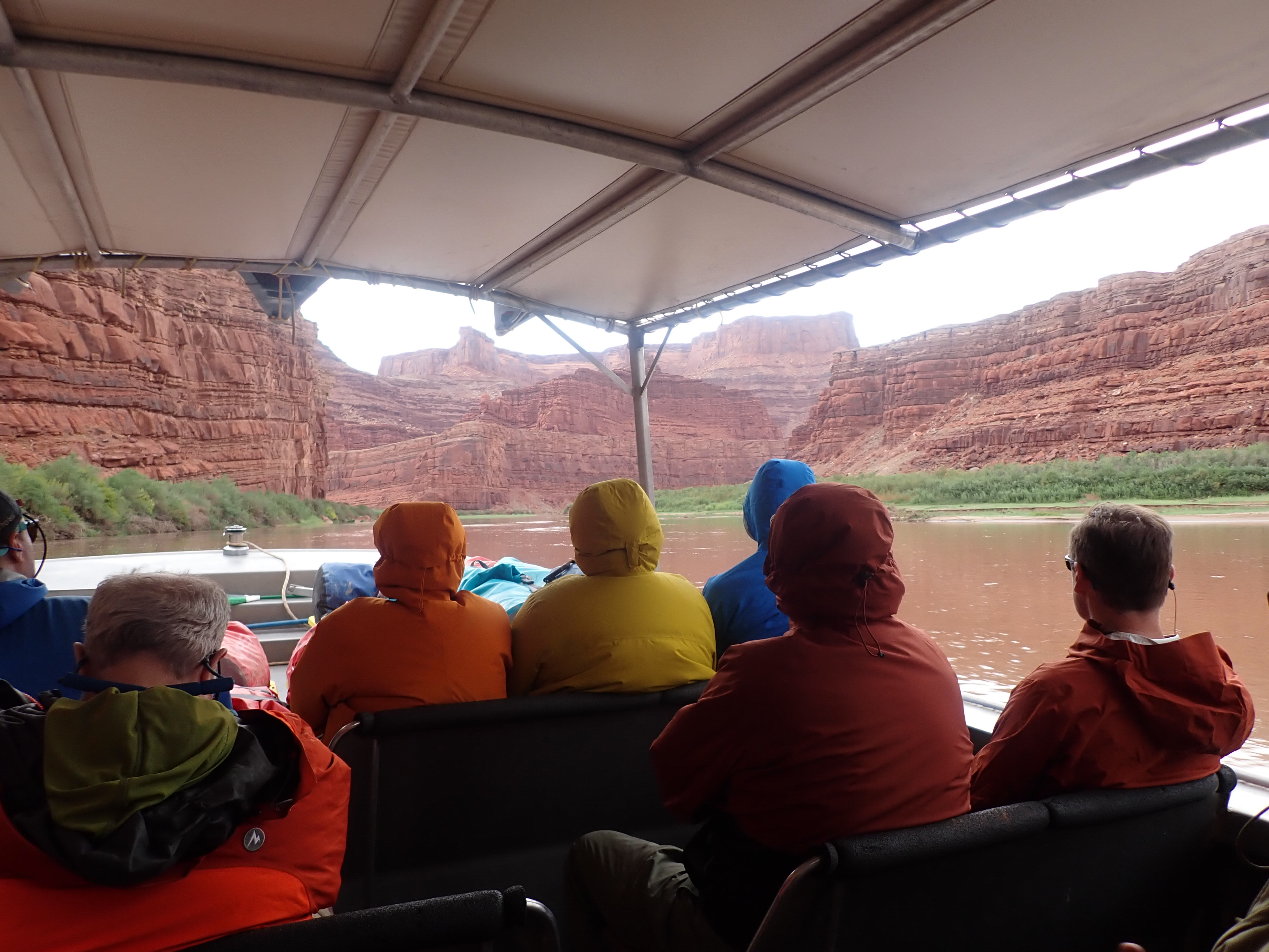
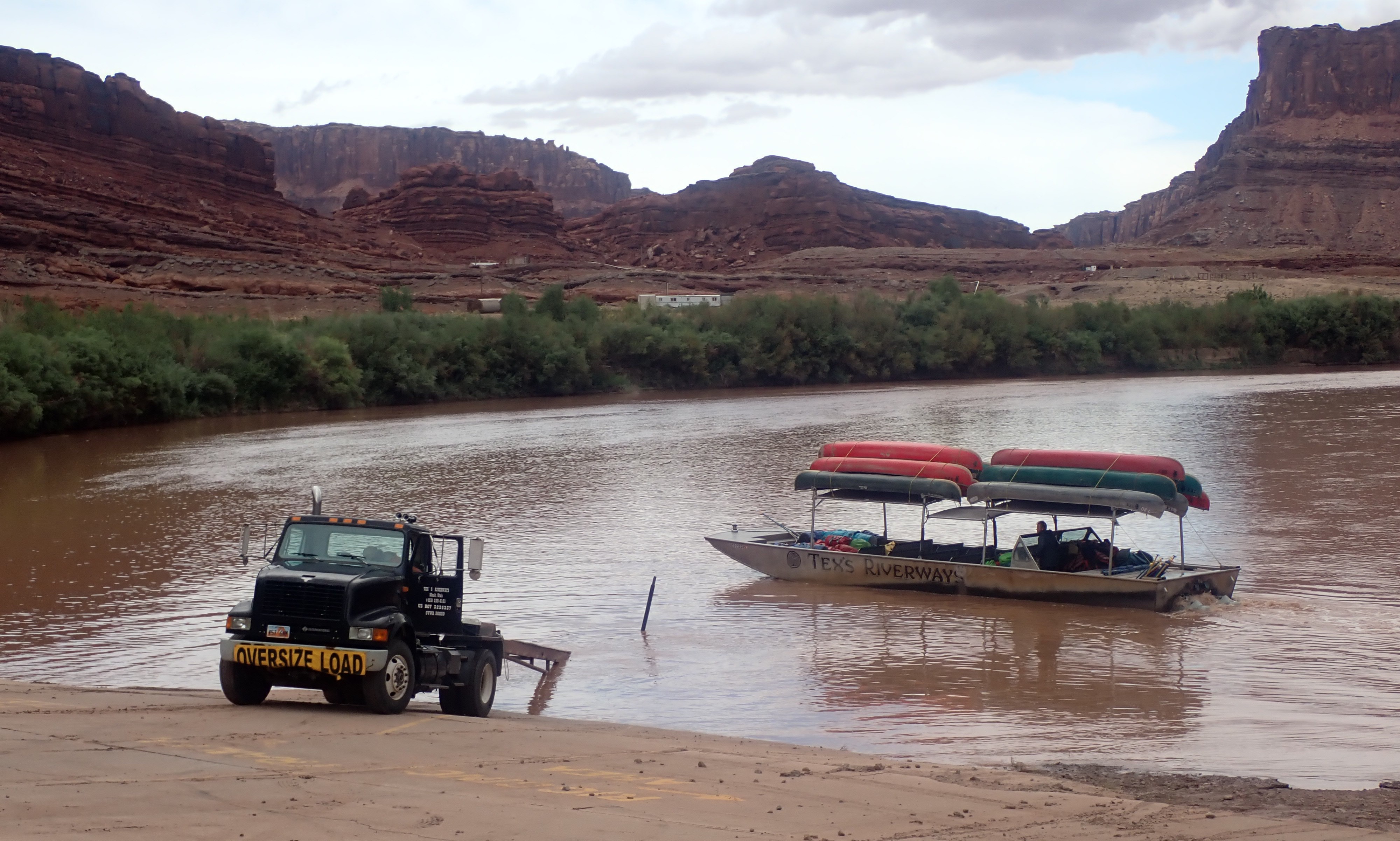
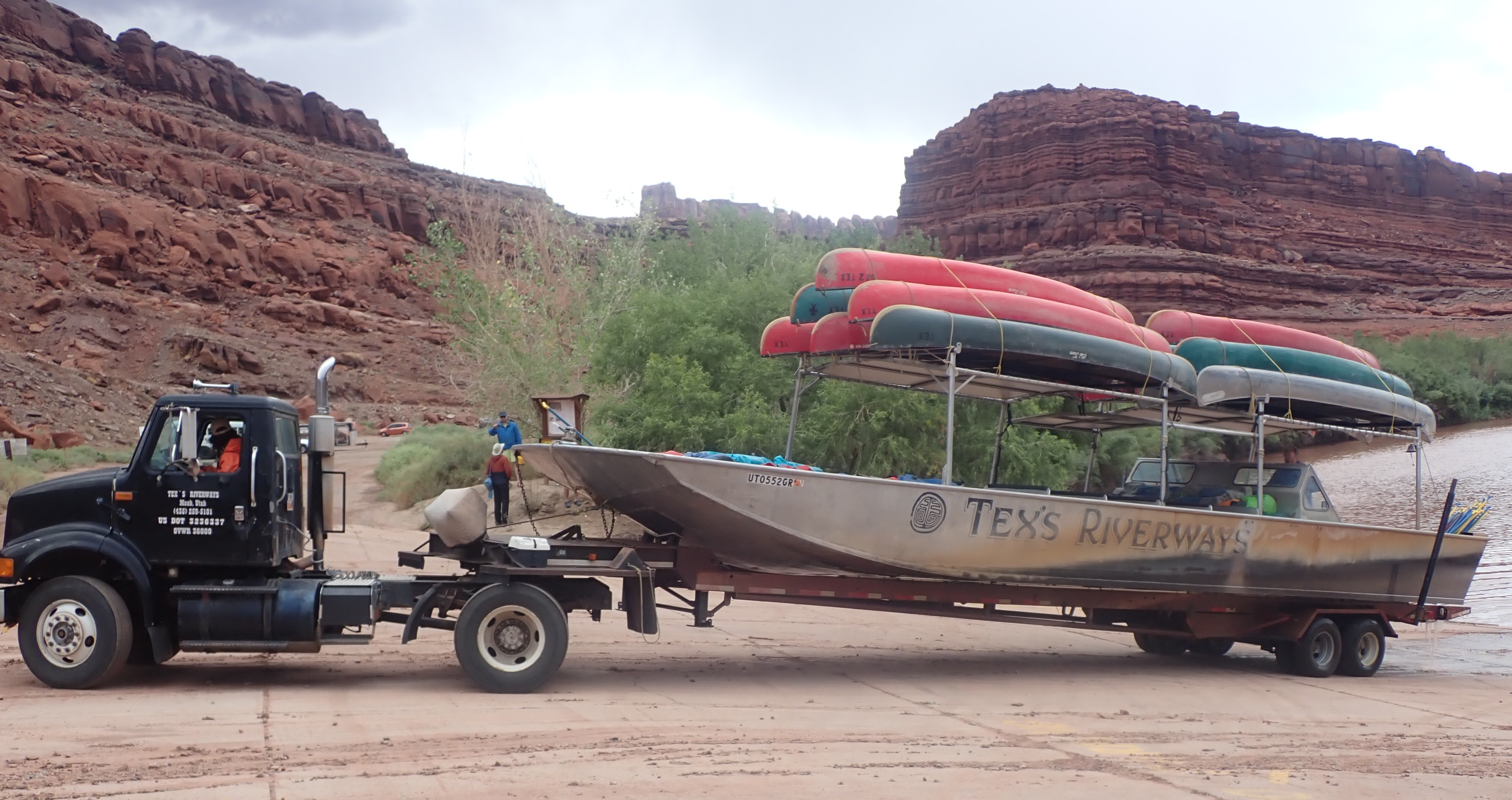
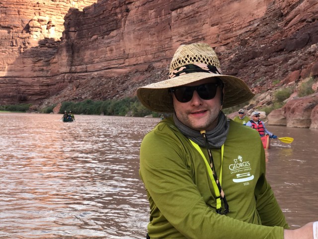
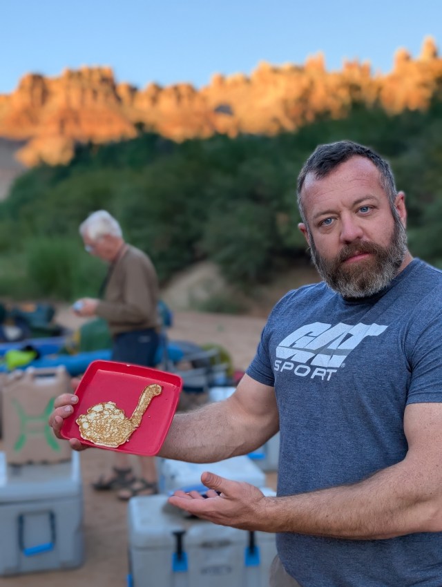
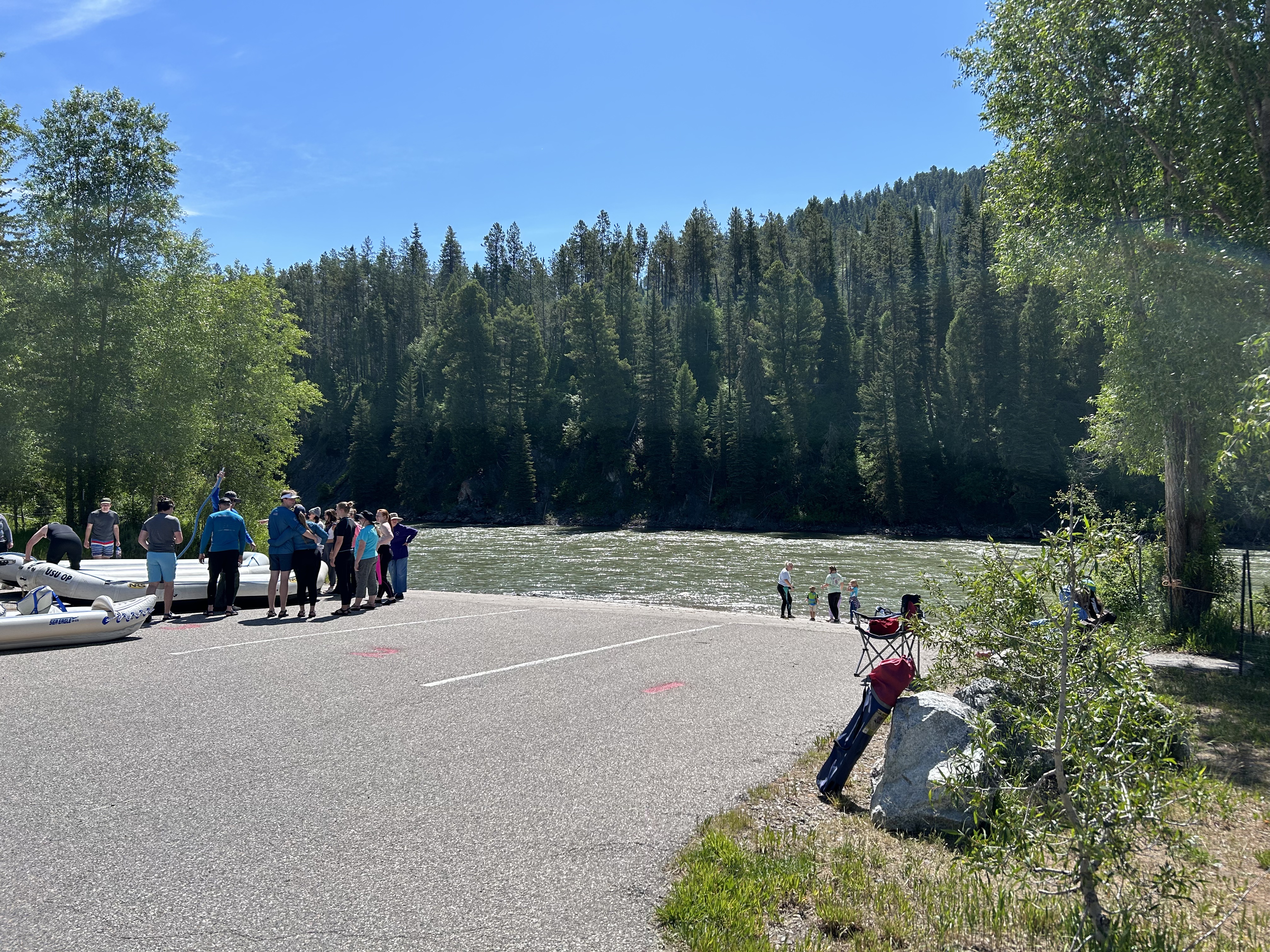
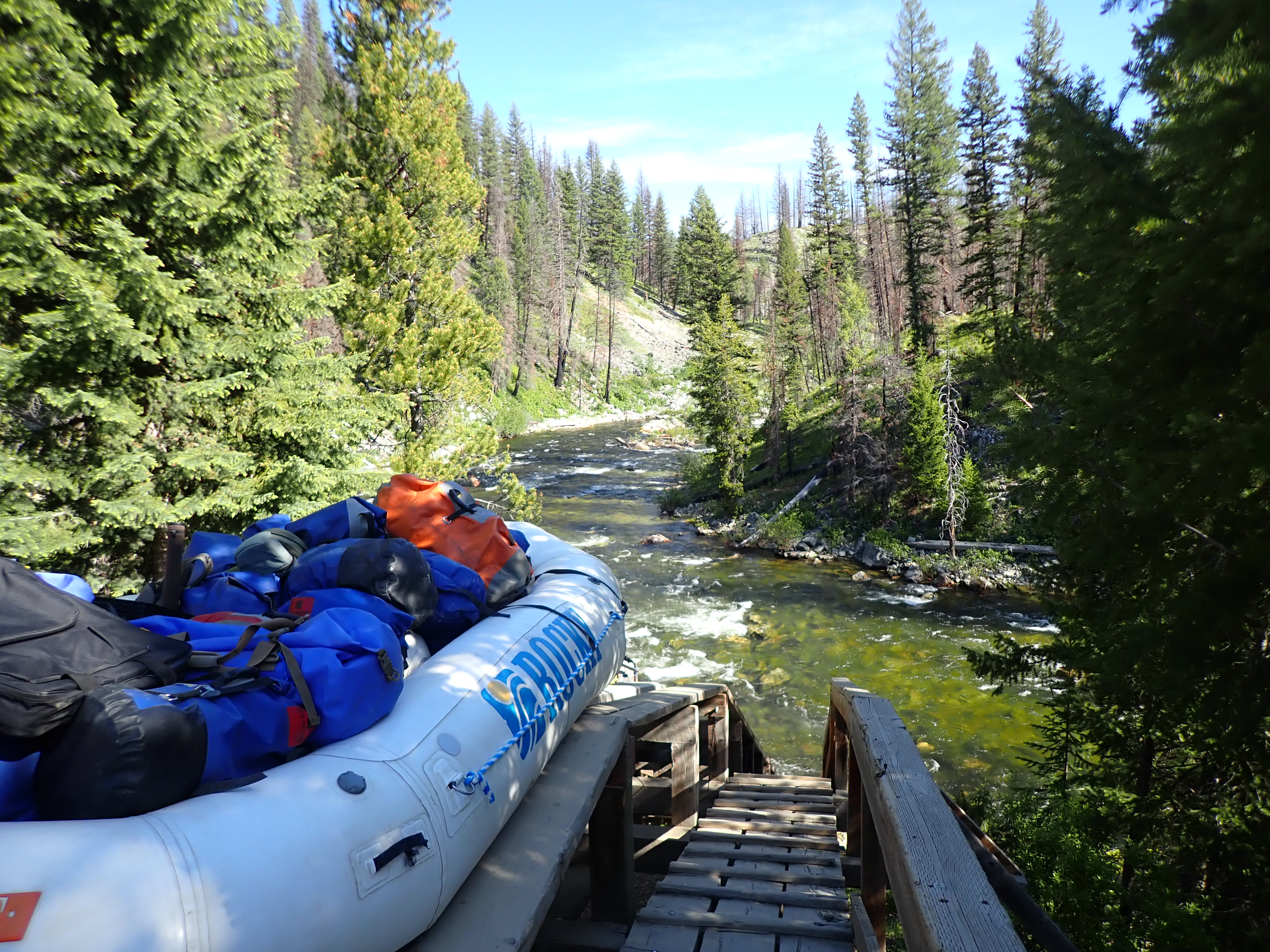
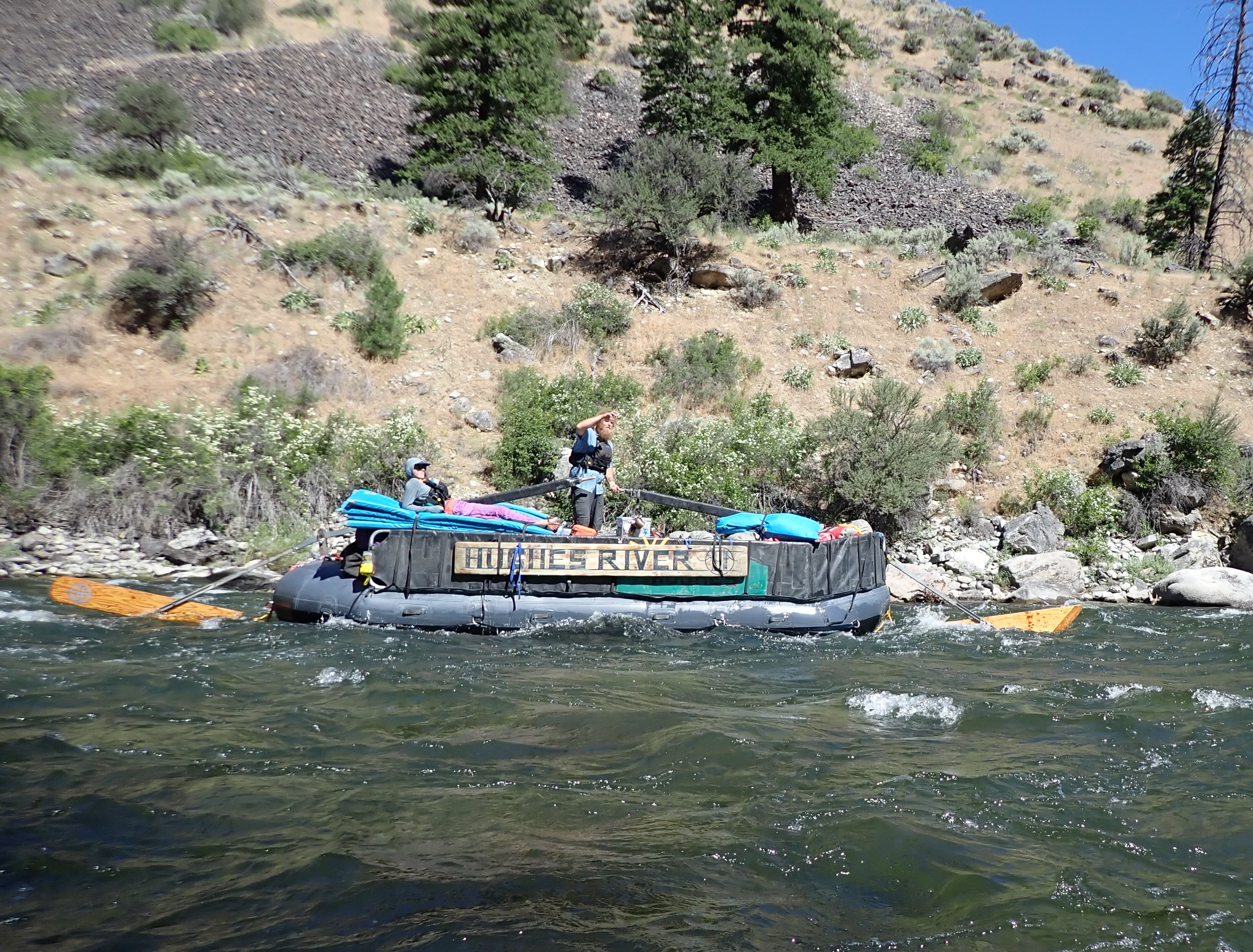
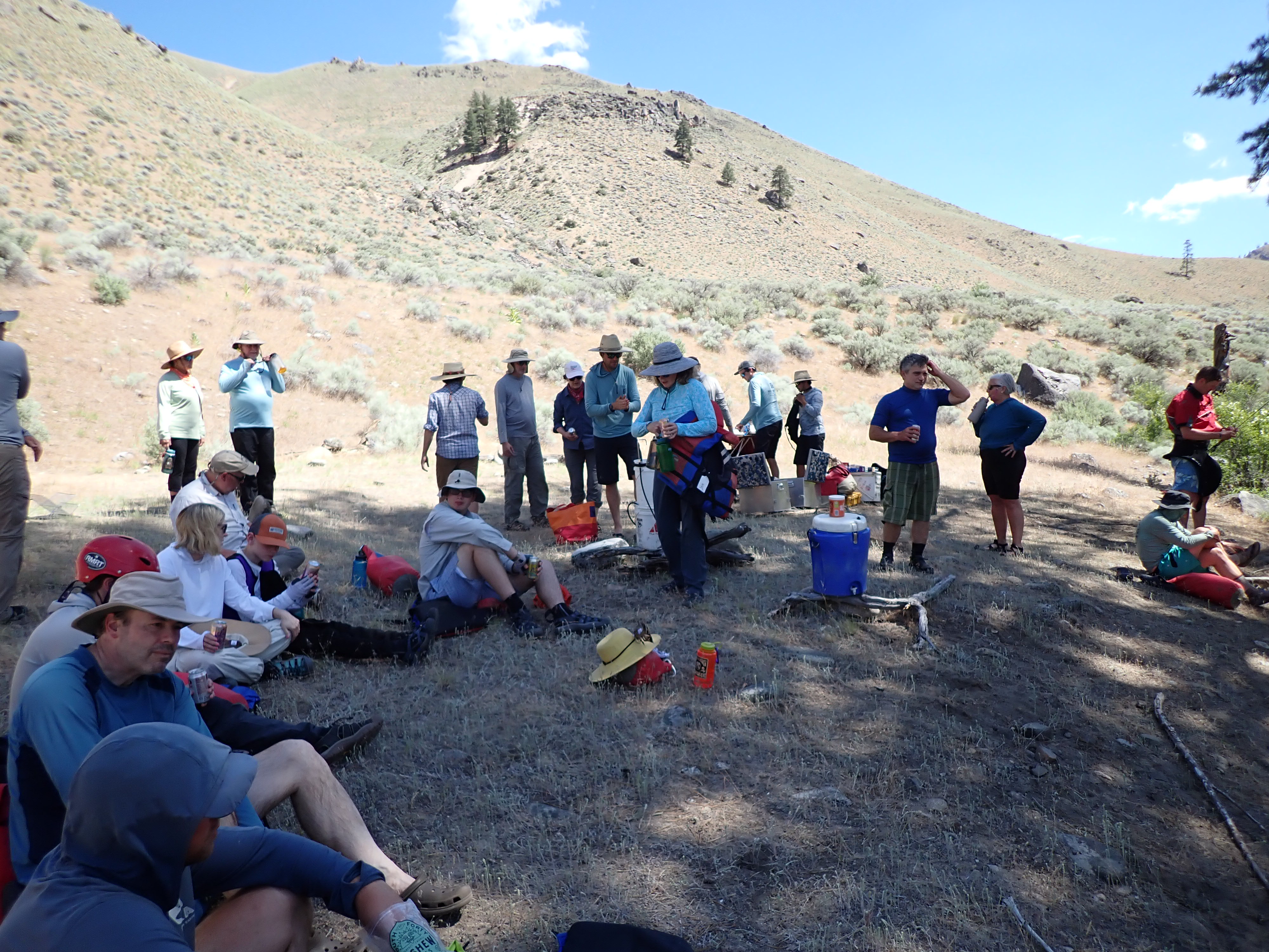
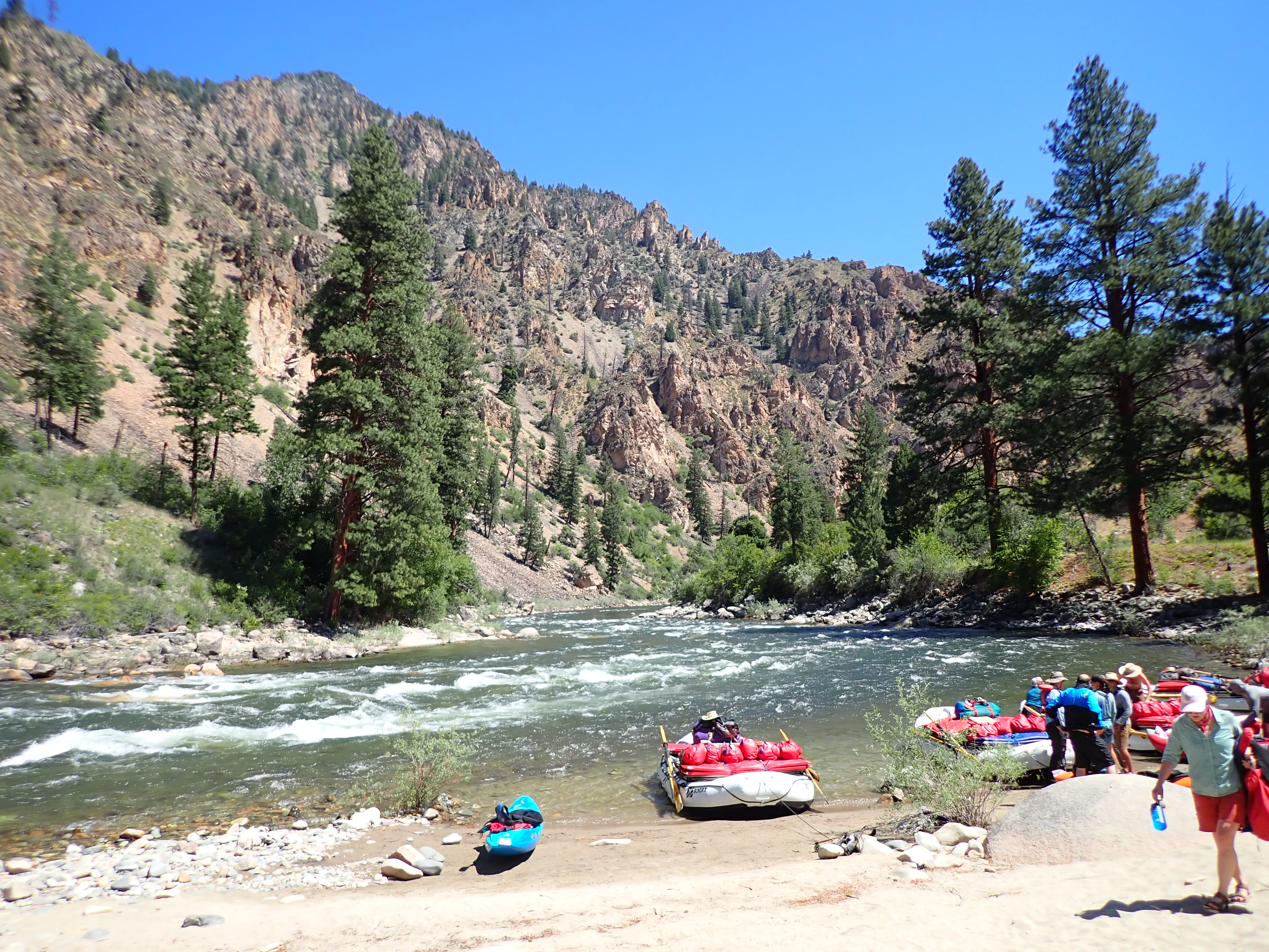
Tuesday, September 9th – We had an early morning start gathering of all the gear at Tex’s Riverways in Moab, and then packing, organizing, having a groover education, and then taking their shuttle down to the put-in at Mineral Bottom Boat Ramp. Being a fairly simple light weight backpacker for years, I was totally amazed by all the gear required and loaded for what was basically a four-night camping trip. Our canoes quickly became small cargo vessels that compared proportionally to any freighter crossing the high seas. With that being said and after reading and later watching a number of YouTube videos on a Green River canoe trip, I quickly realized that all this gear was very normal for this adventure.
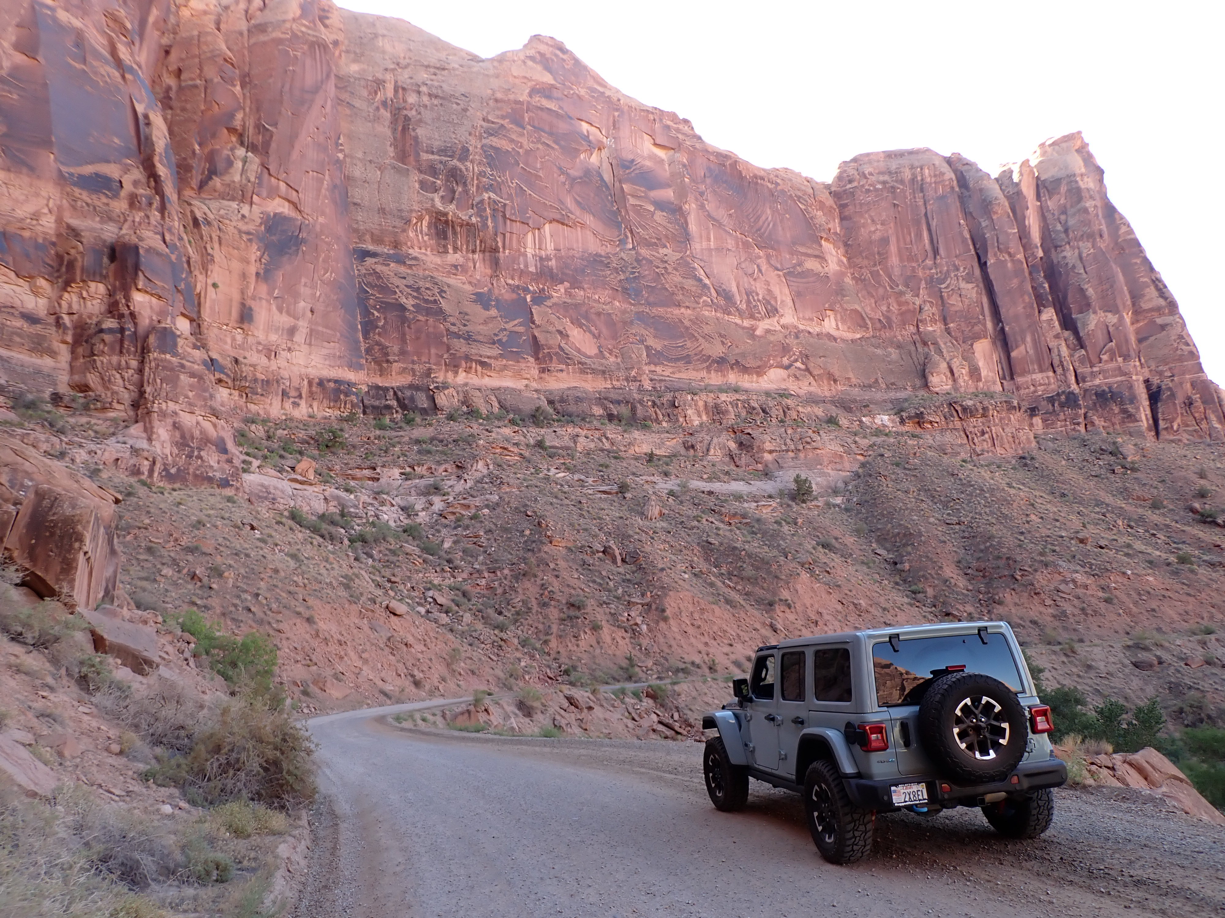
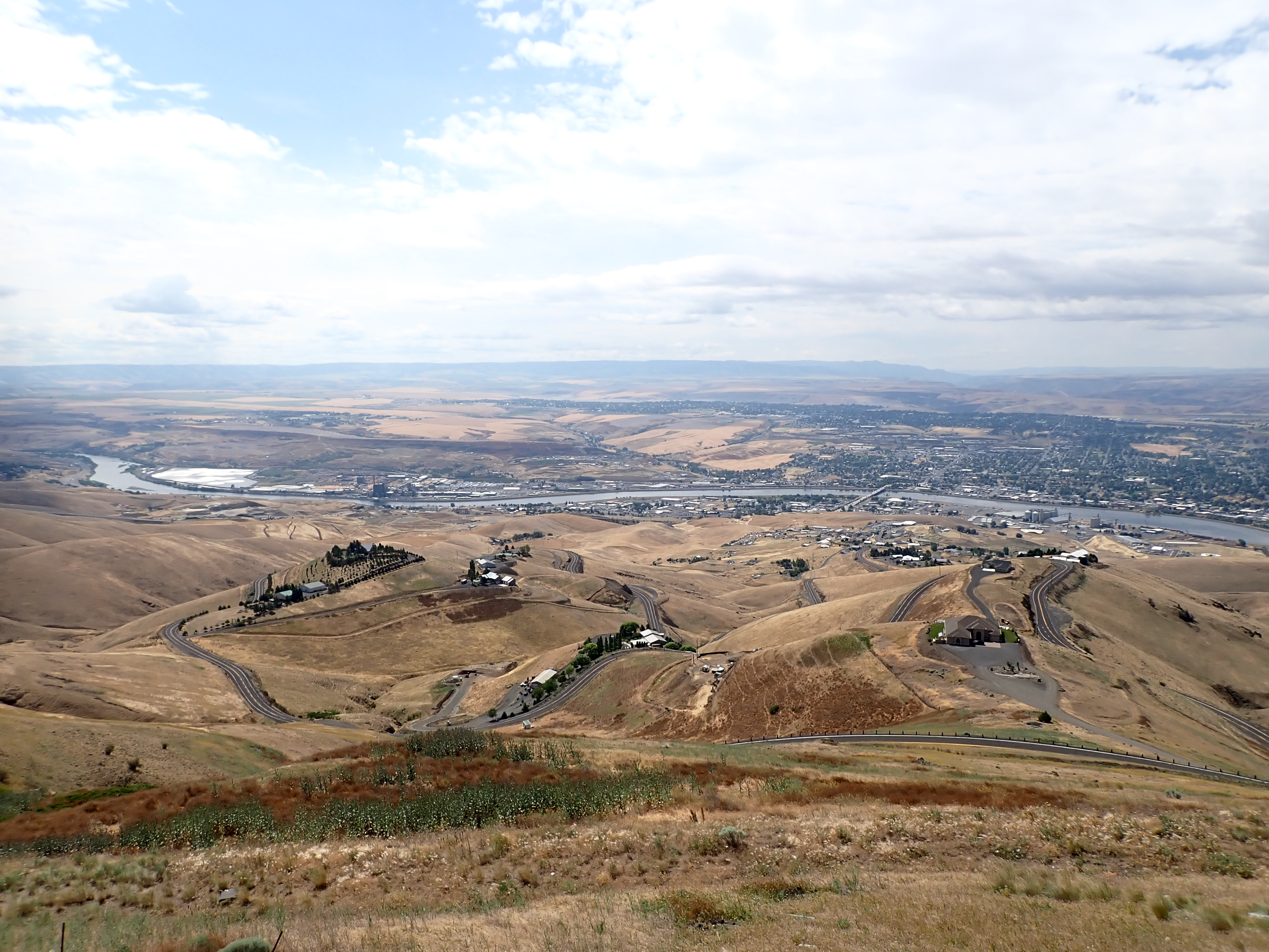
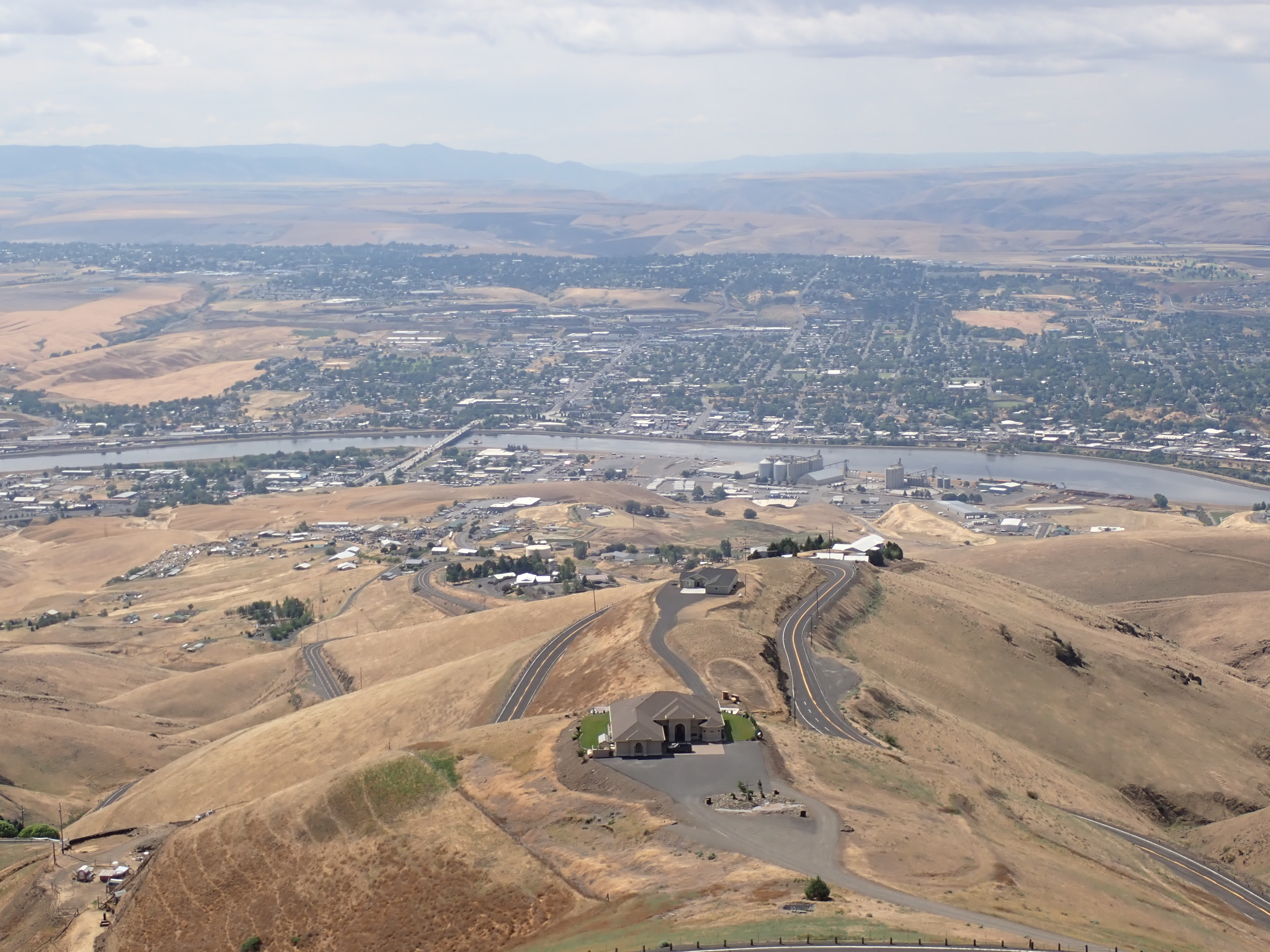
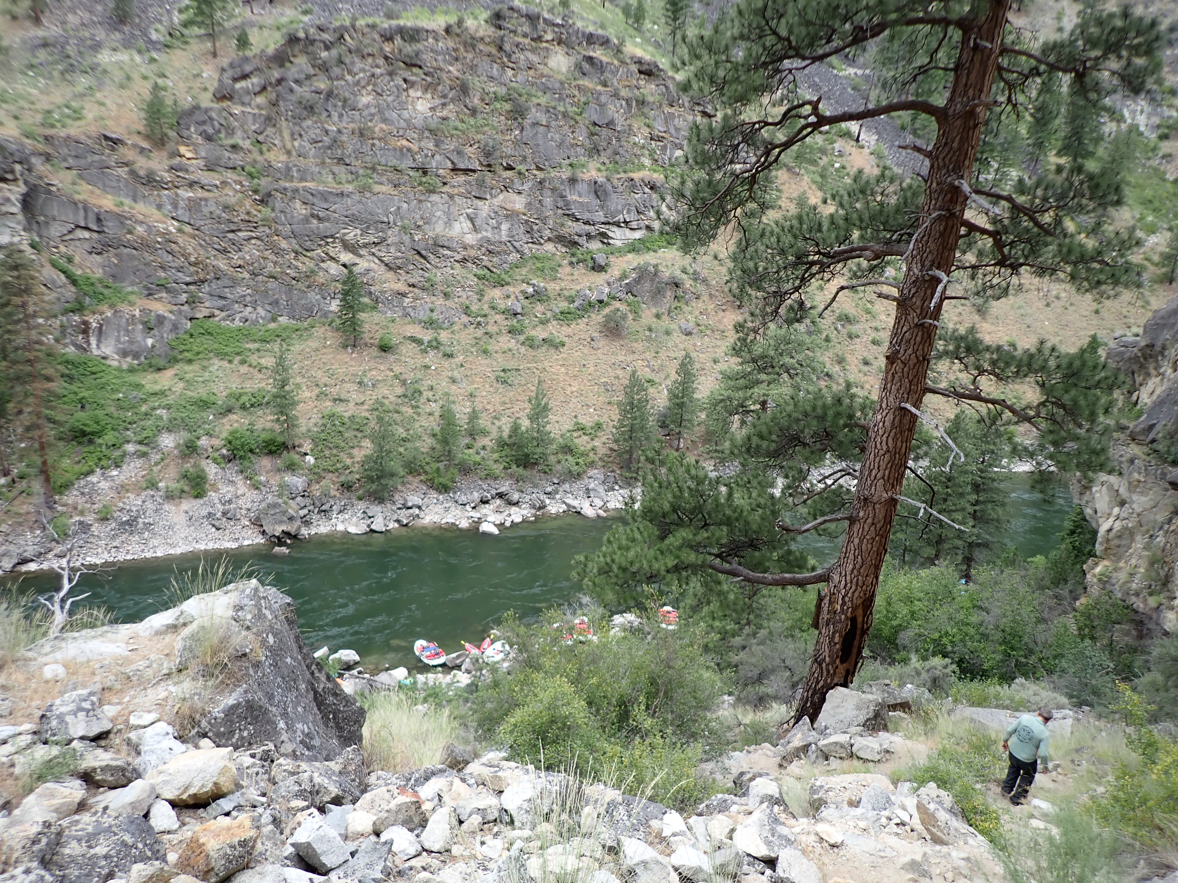
Getting to the river put-in took us about an hour and half drive out of Moab. The last couple of miles down to the river became a pretty epic ride in the bus. We traveled down an old uranium mining exploration road descending somewhere close to 1,000 feet from the top of a mesa down a narrow road with some rather steep and off the edge switchbacks to the Green River below. Today this old road is part of the BLM and provides numerous recreational opportunities for all to enjoy.
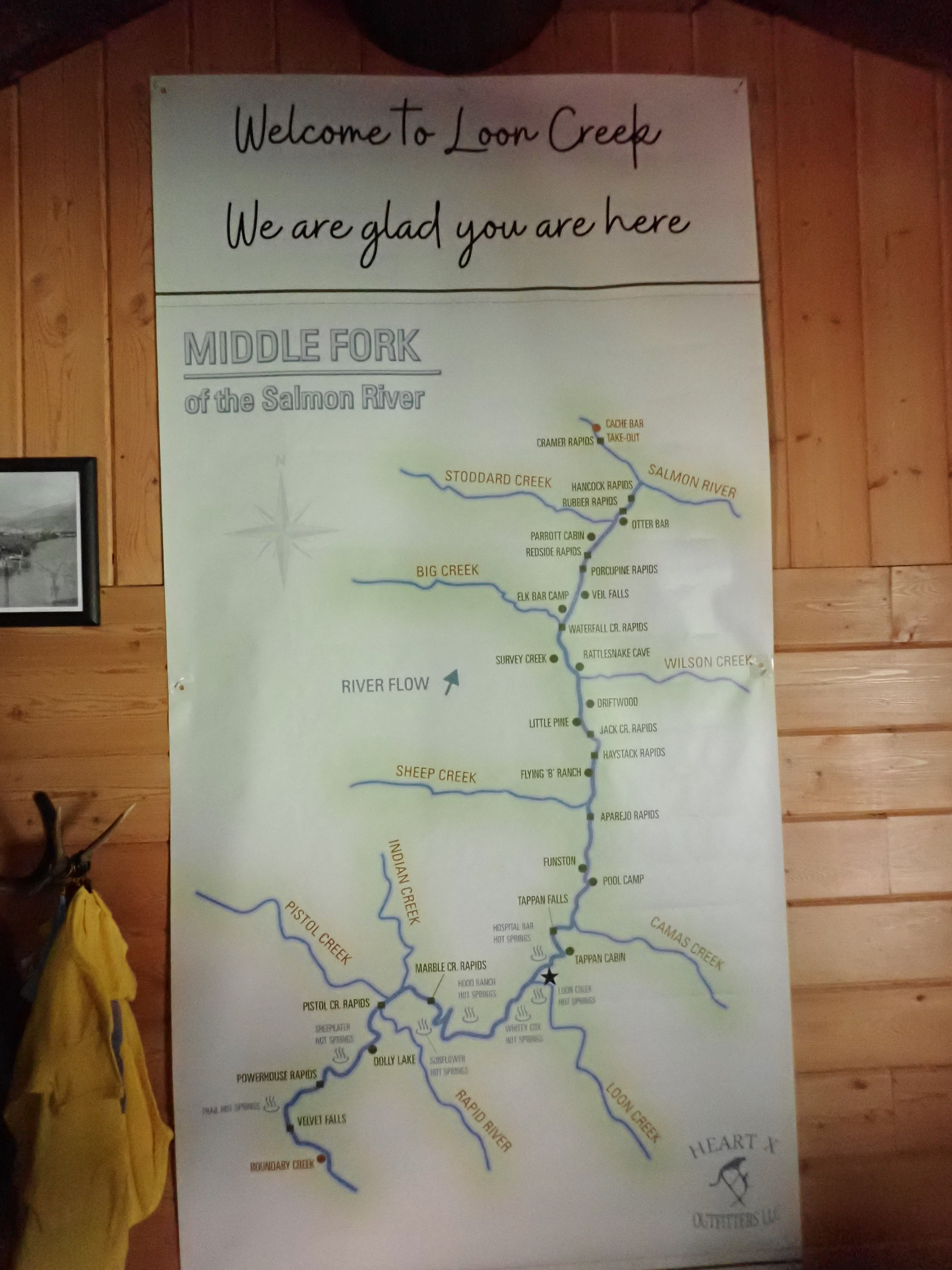
Below is a general map of the Green River and Colorado River sections that we traveled by both canoe and jet boat.
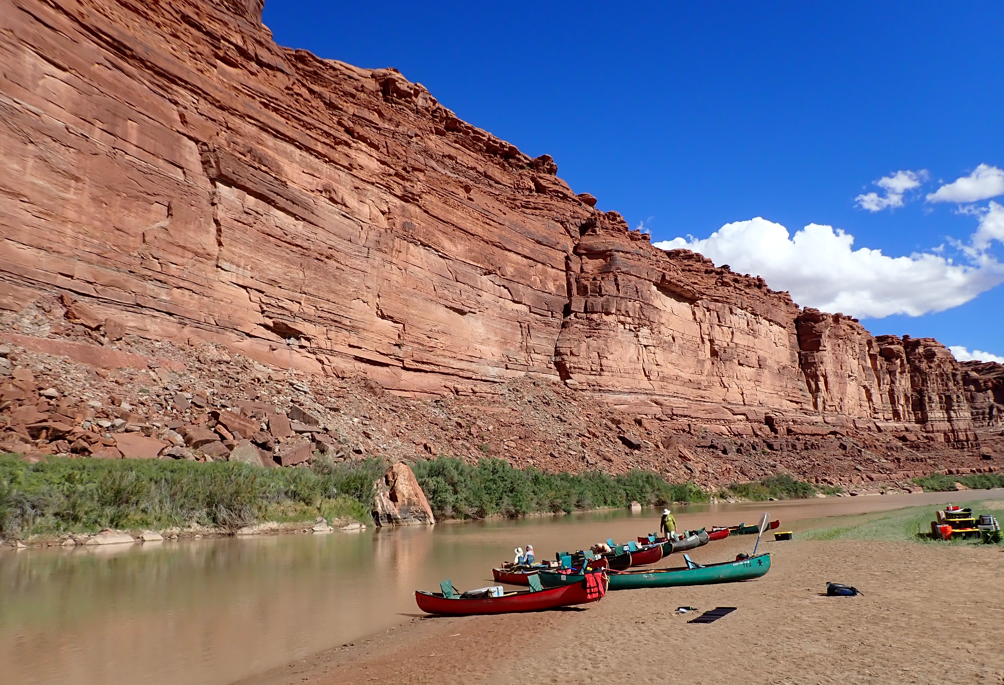
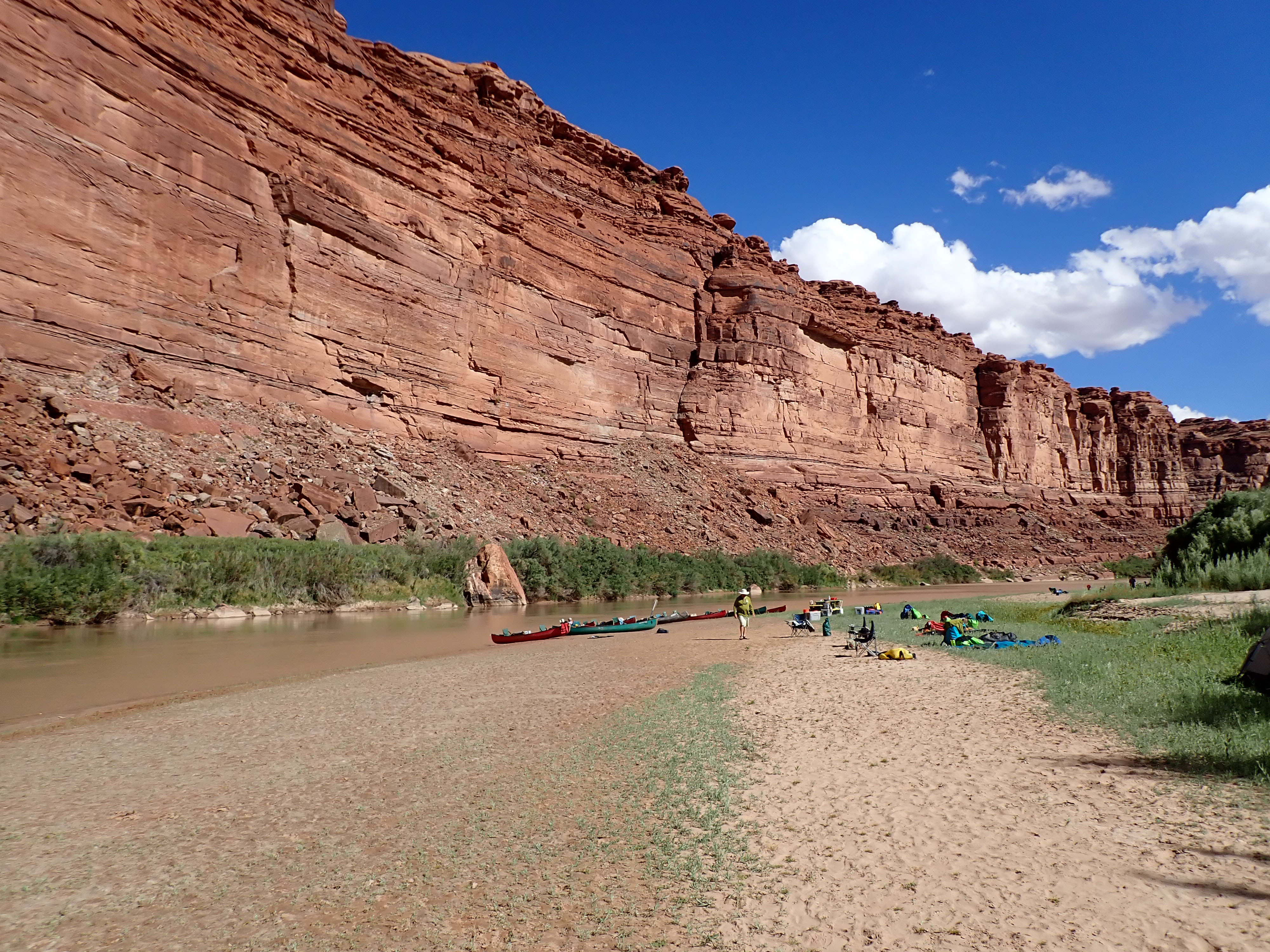
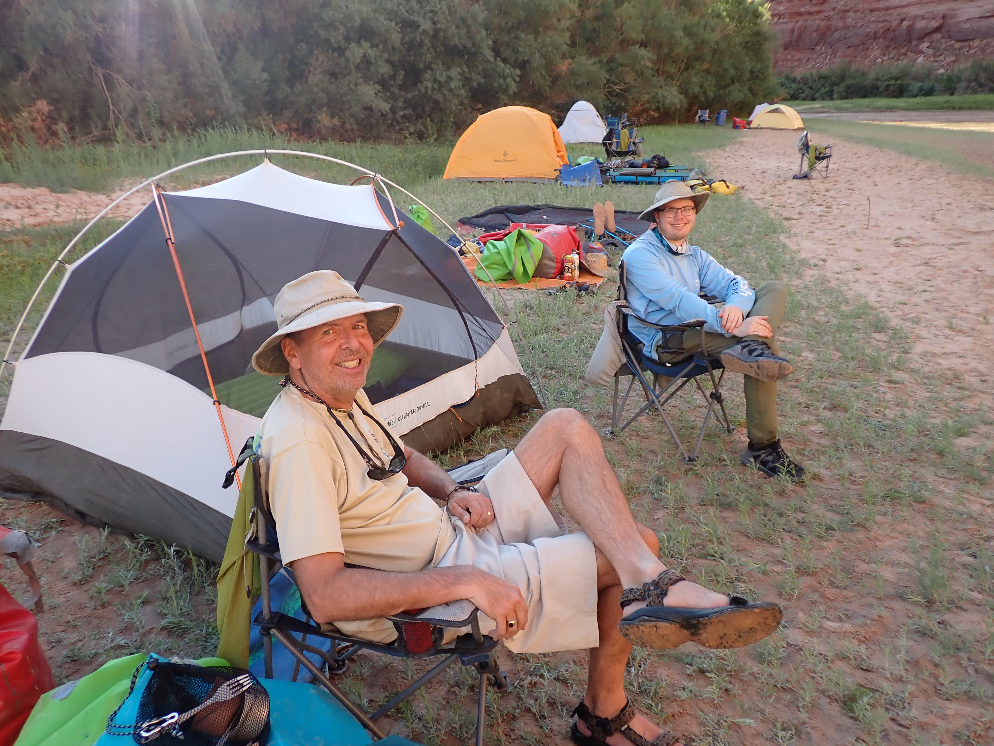
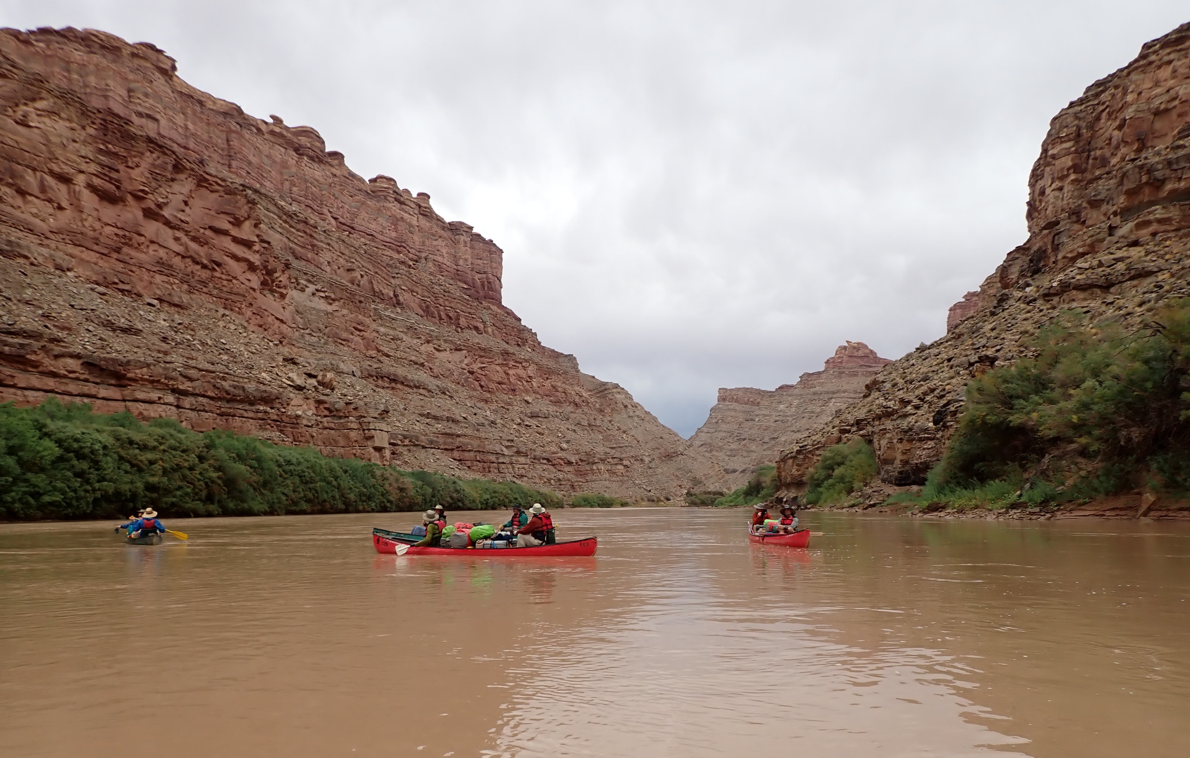
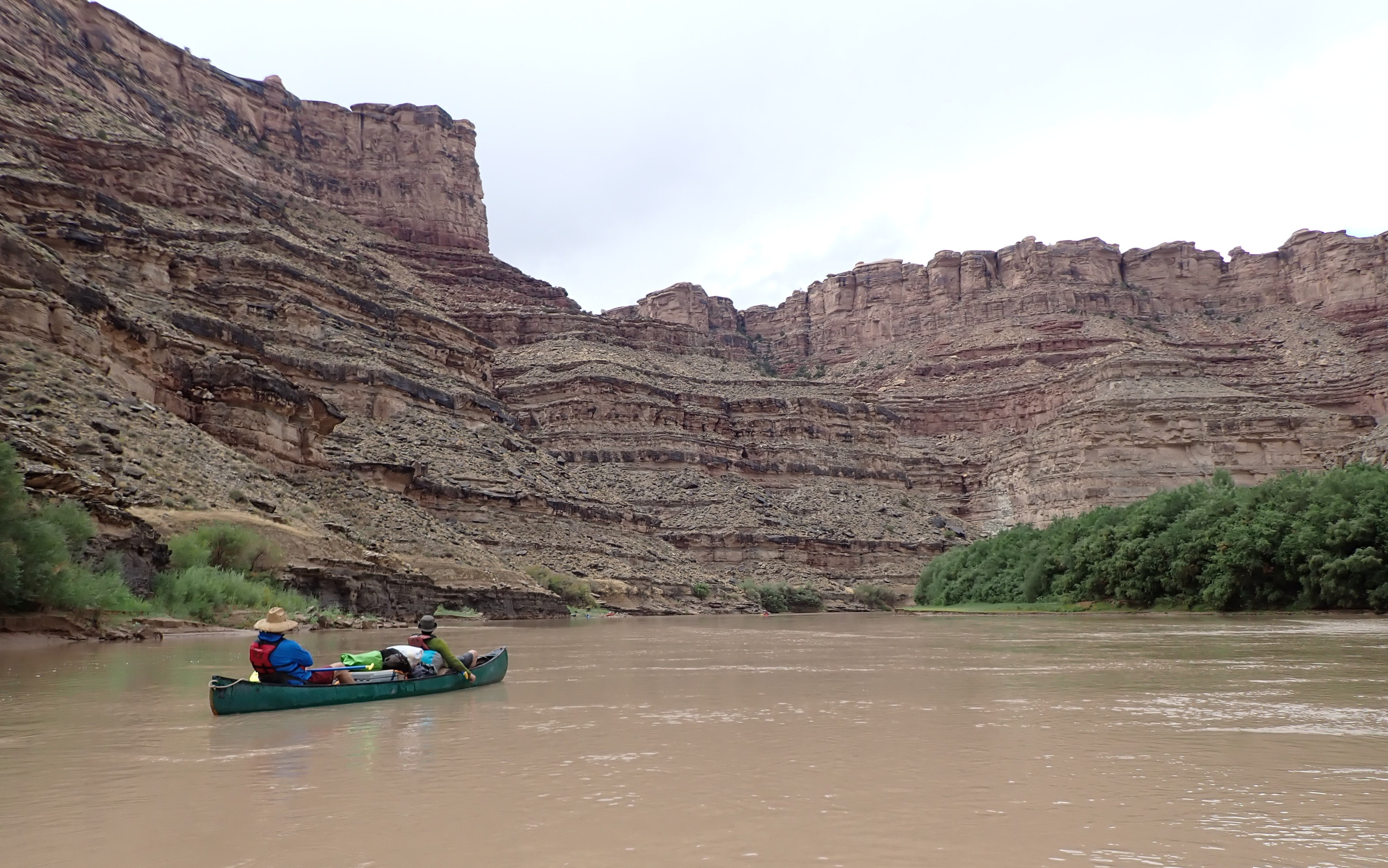
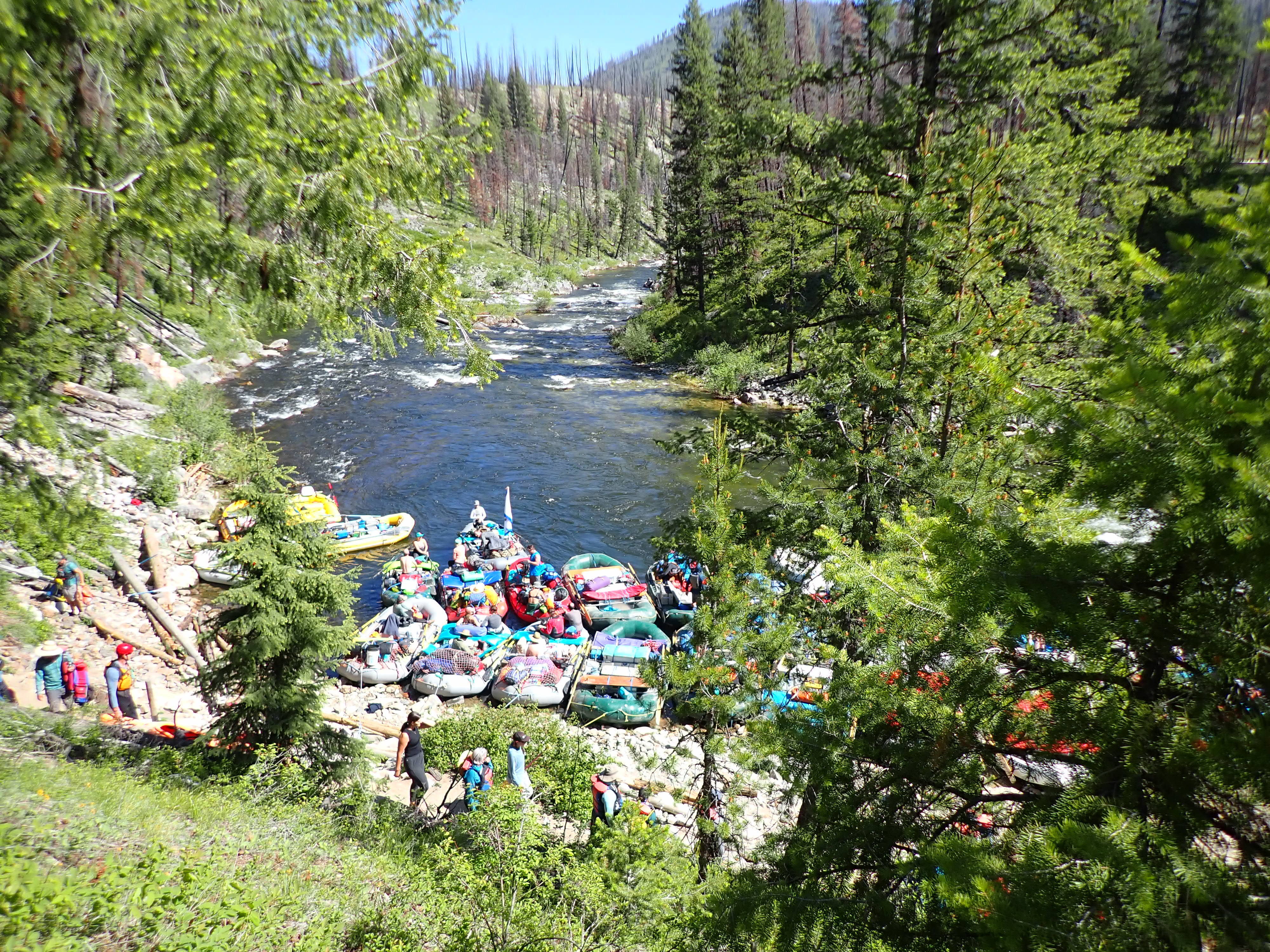
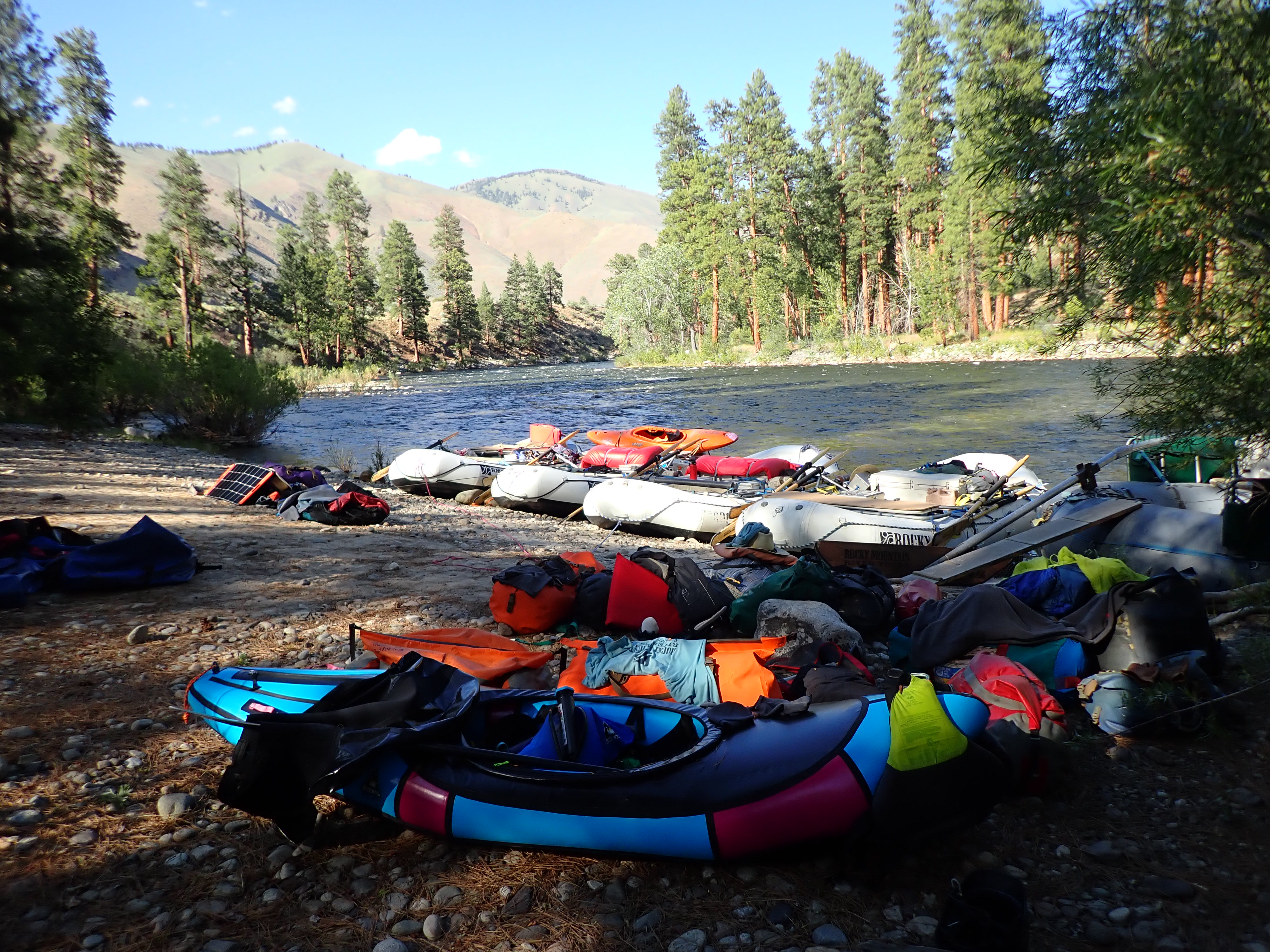
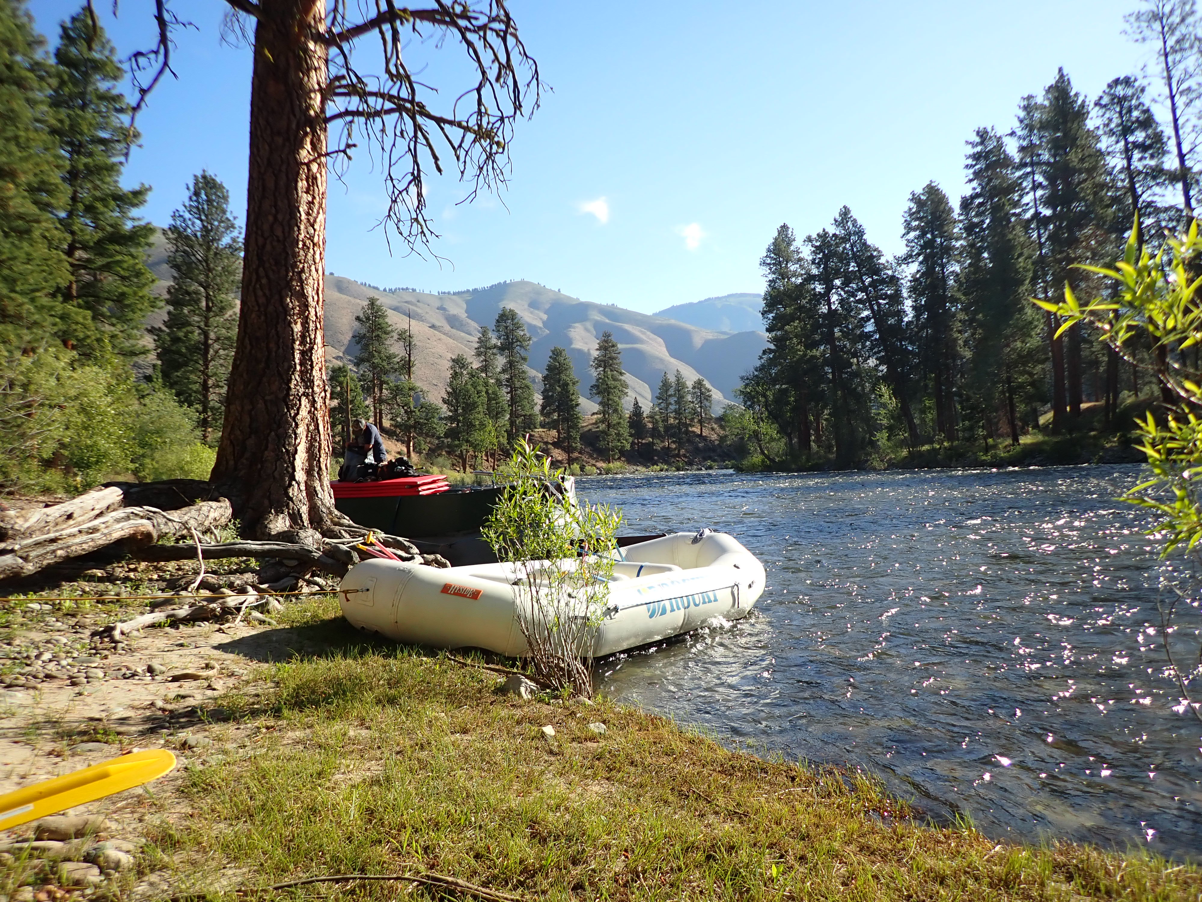
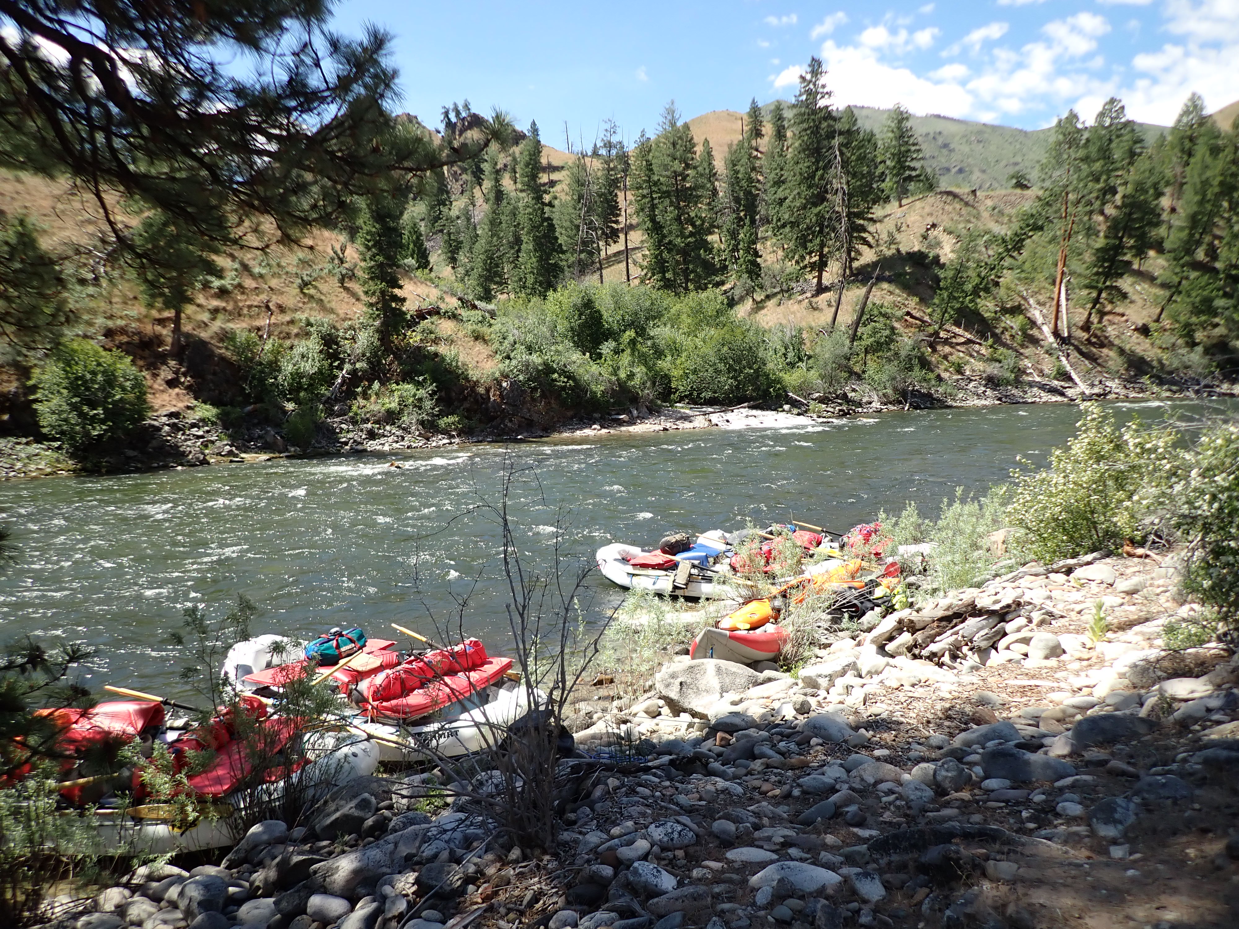
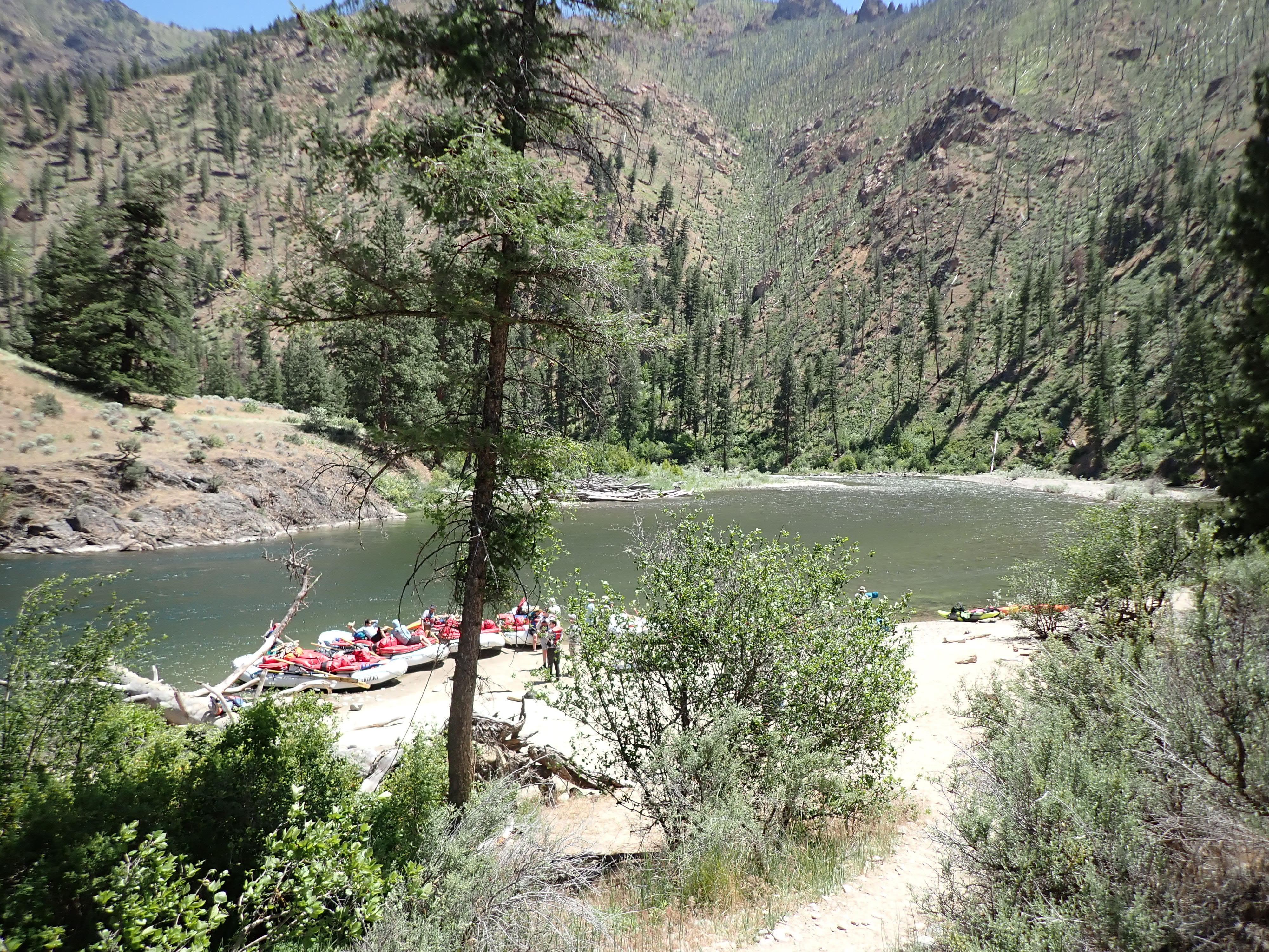
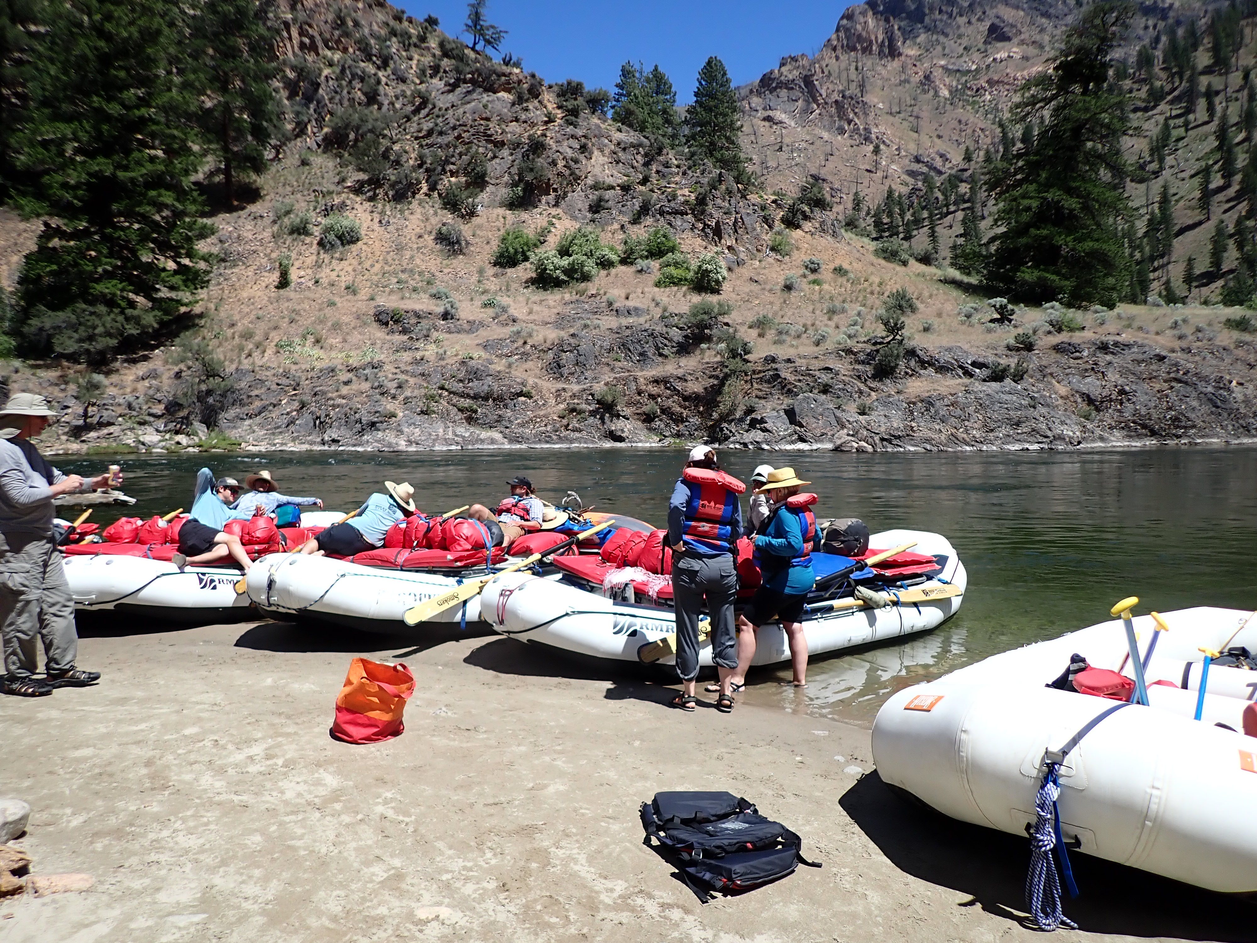
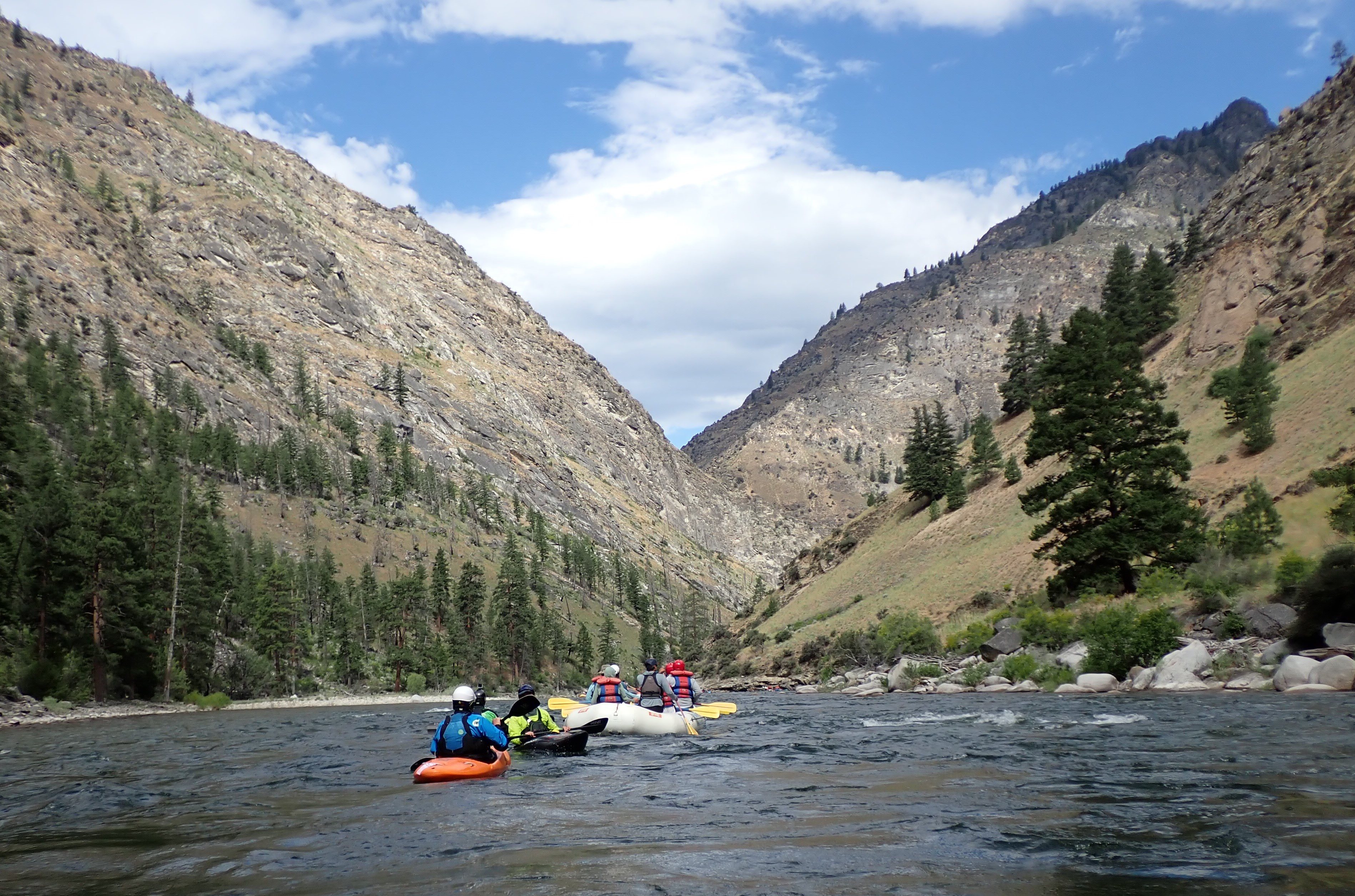
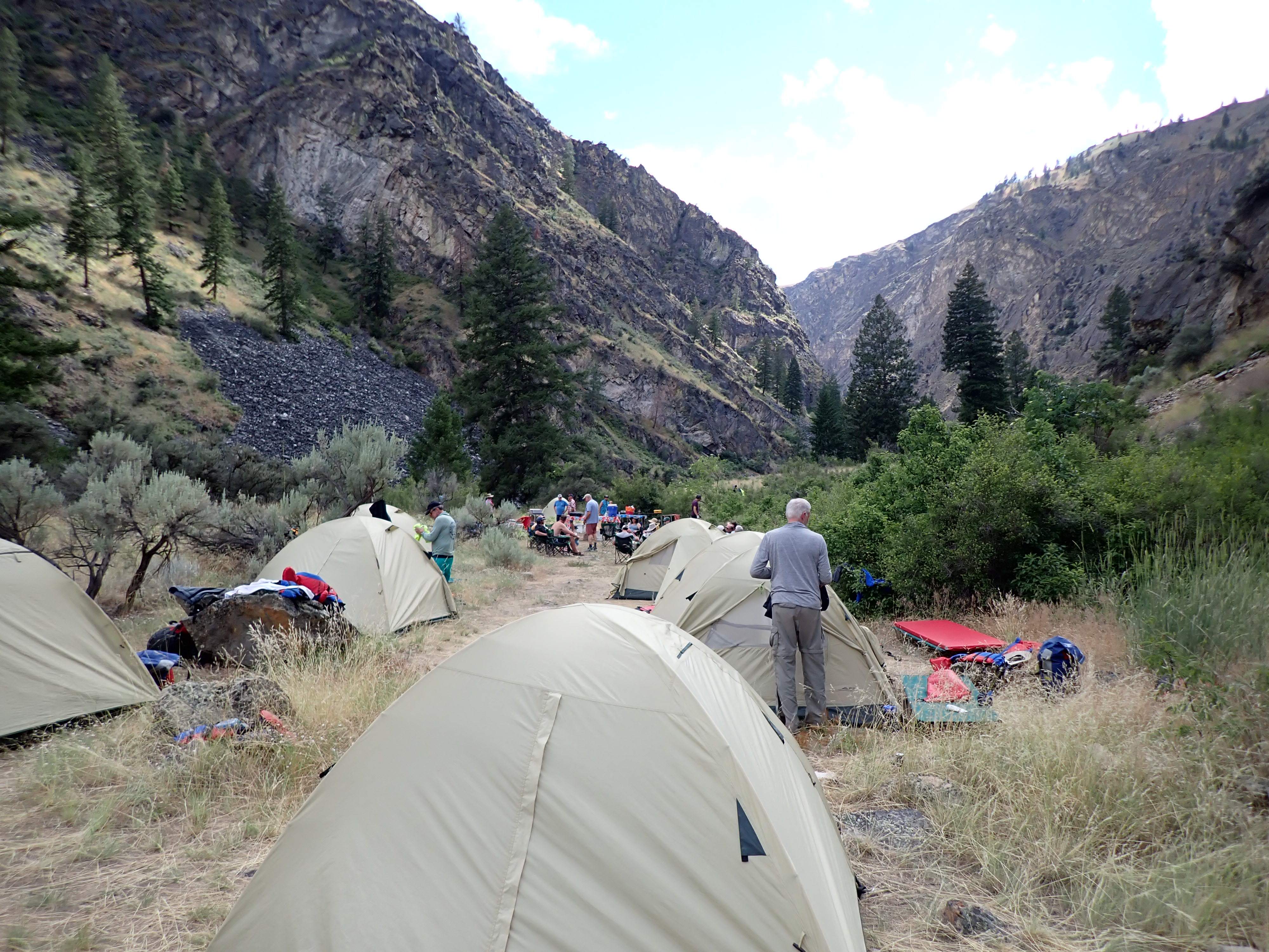
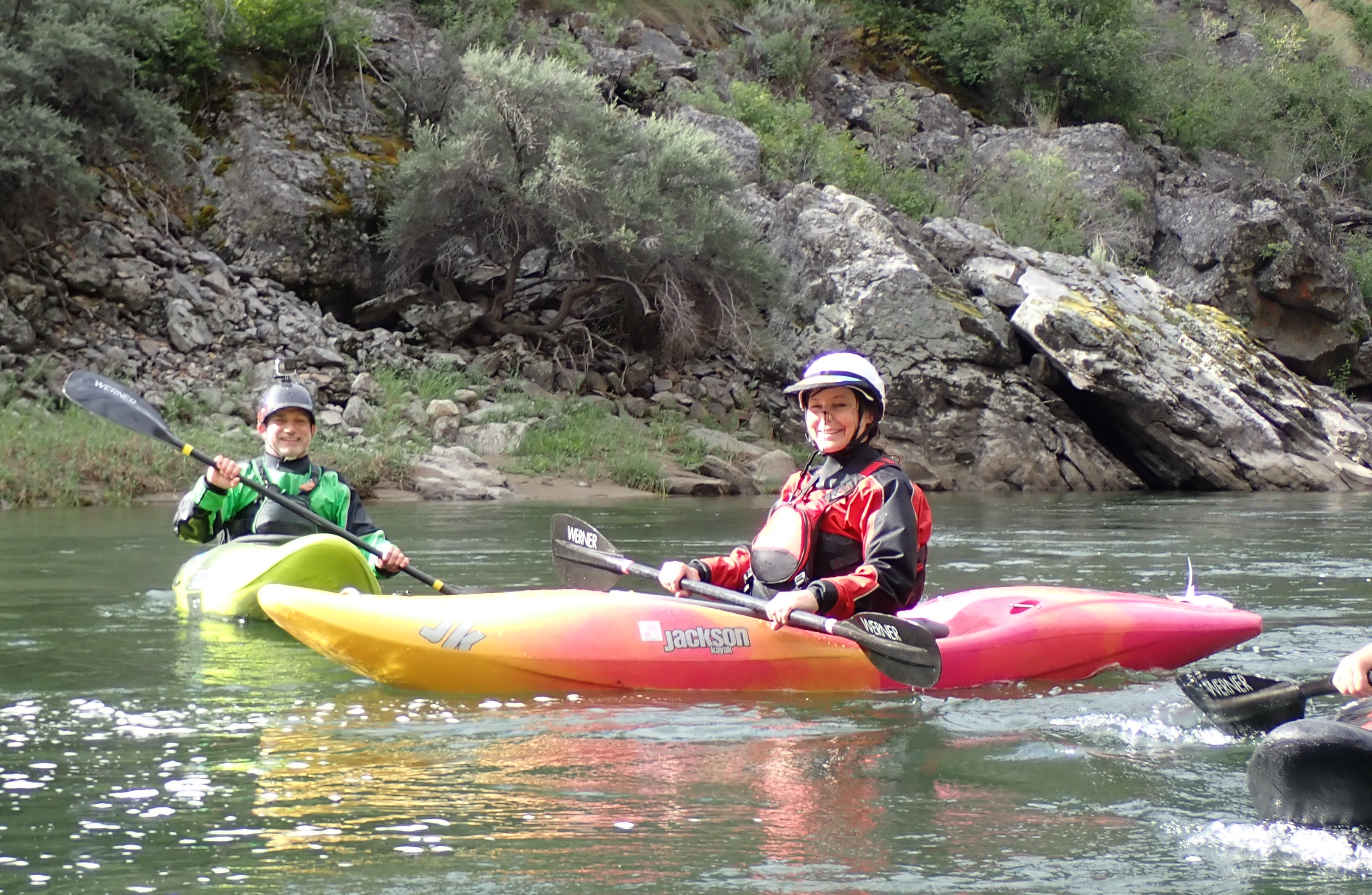
After packing all the canoes up with our gear at the Mineral Bottom Boat Ramp, we were finally off heading downstream on the Green River. We paddled in the sun and heat that afternoon for roughly thirteen miles to a camping spot called Tent Bottom. It was a great campsite up on a ridge where several of us just cowboy camped under the stars. The stars above were awesome until the full moon appeared.
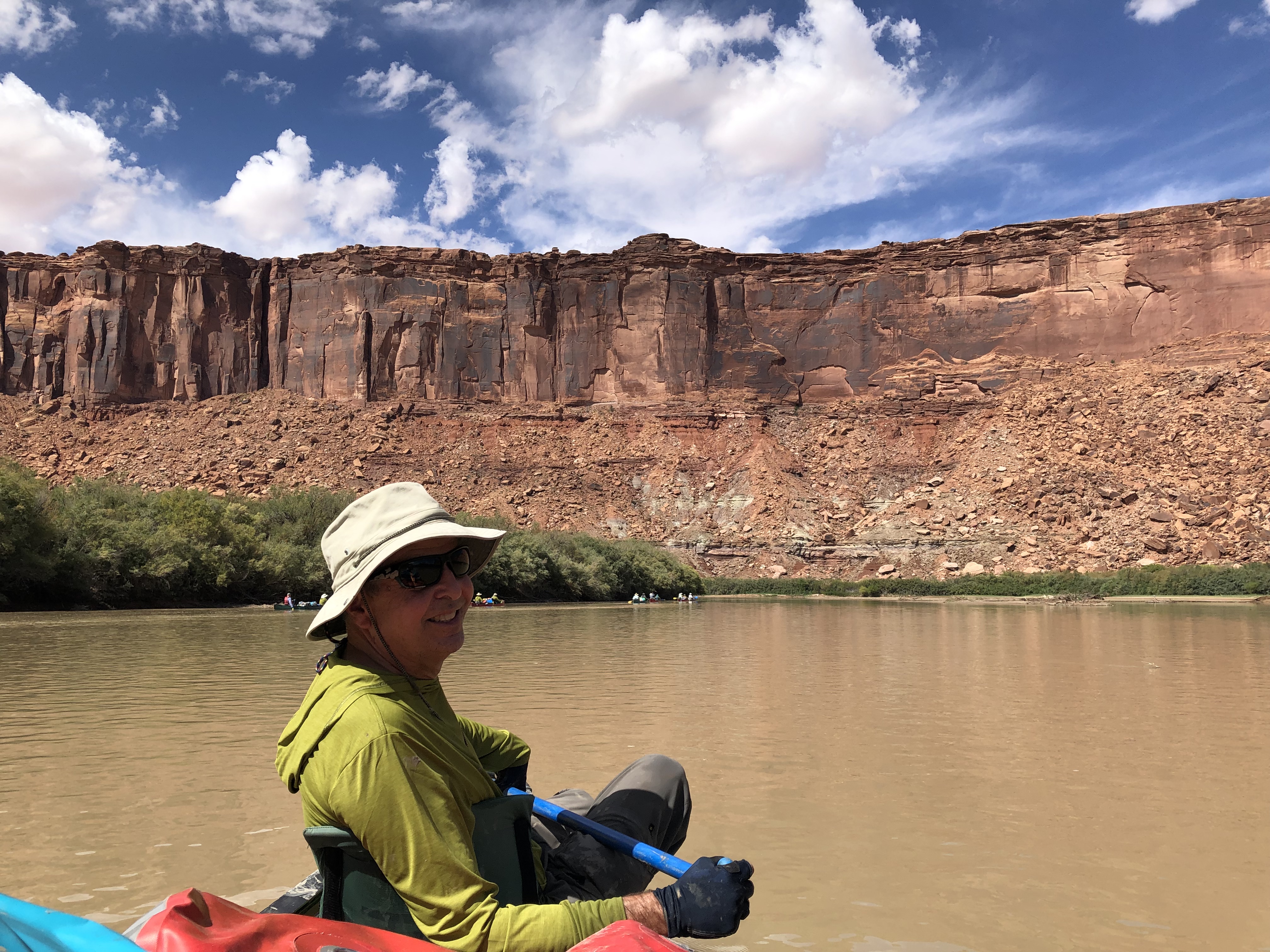
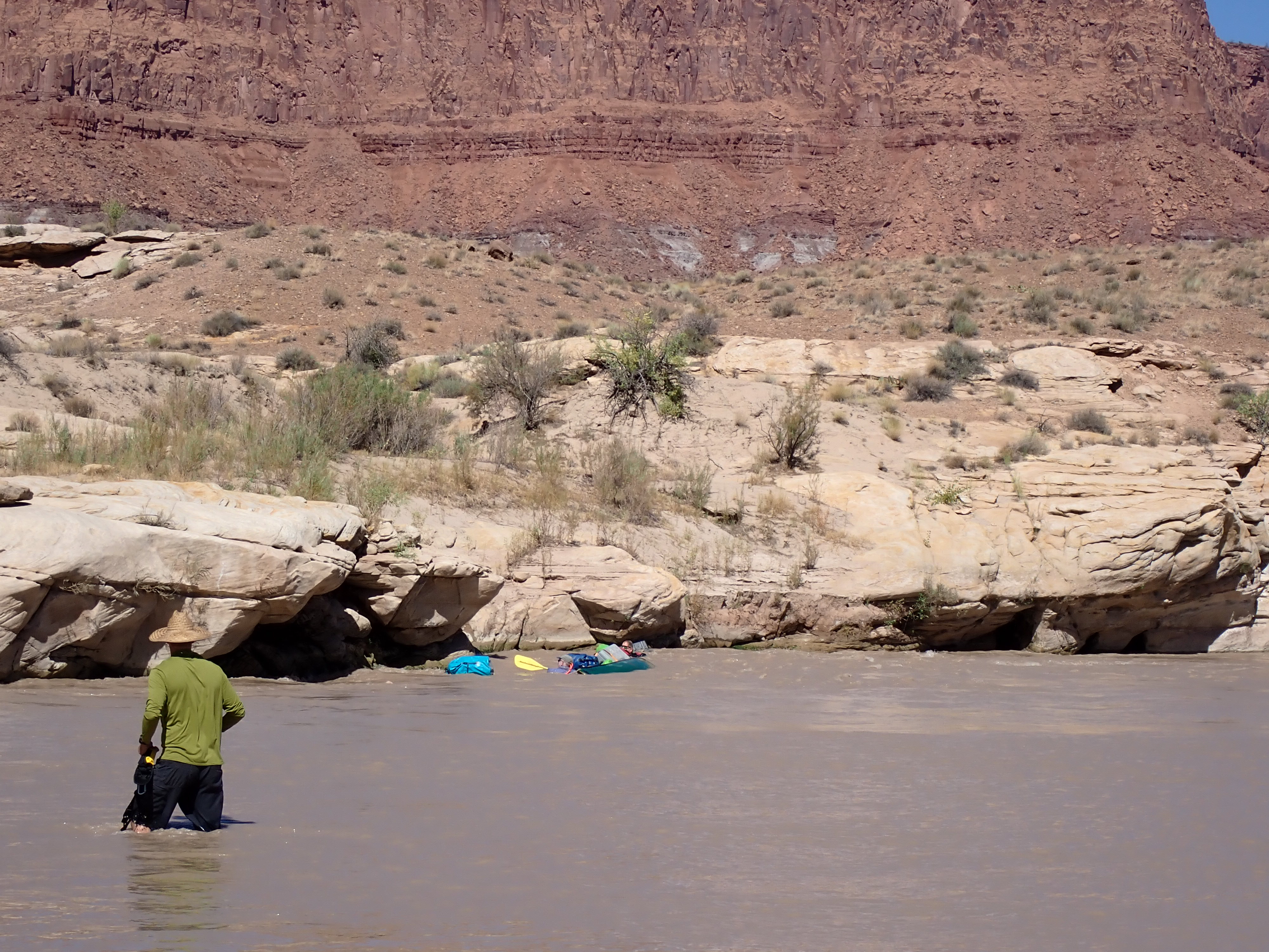
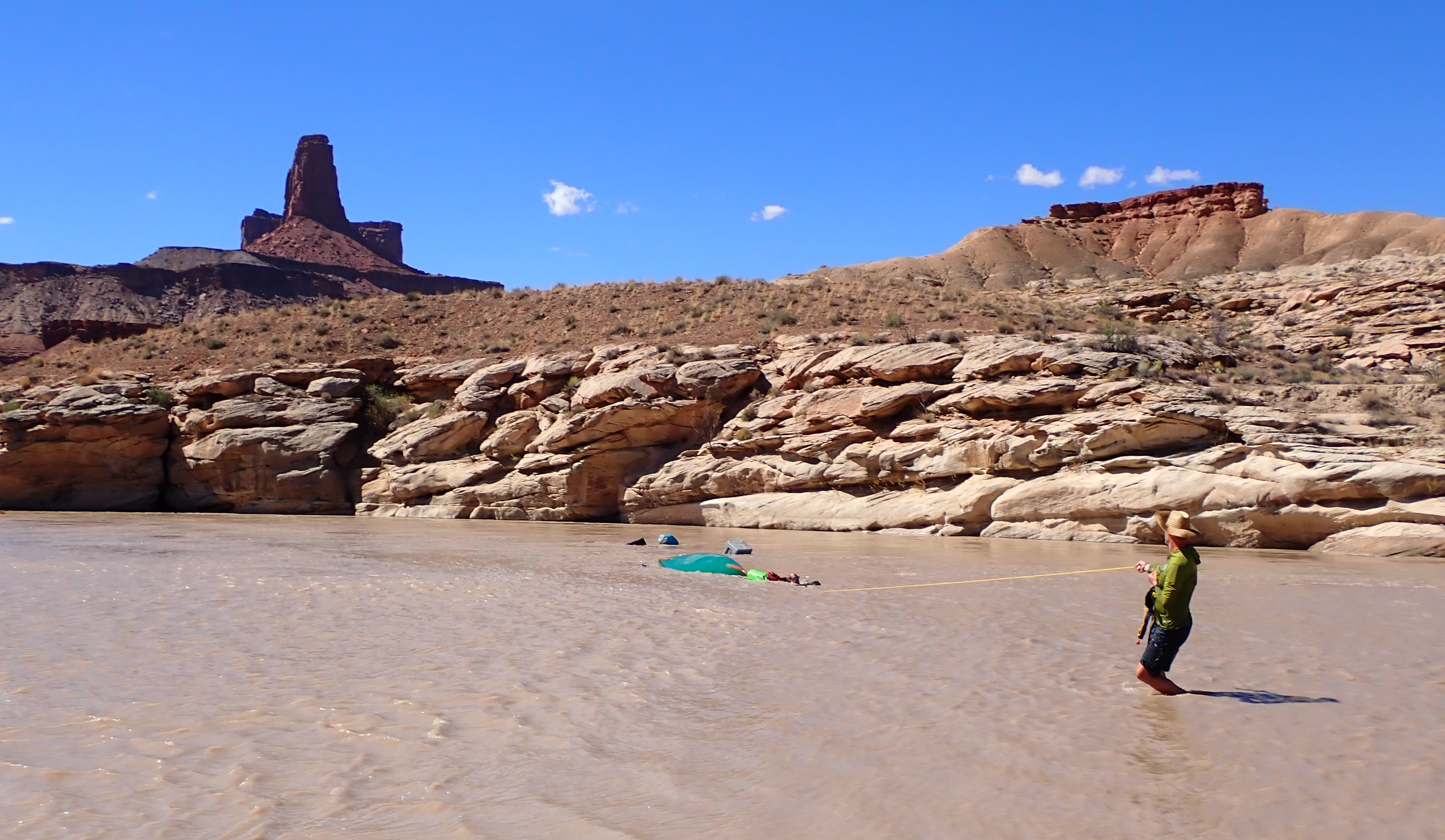
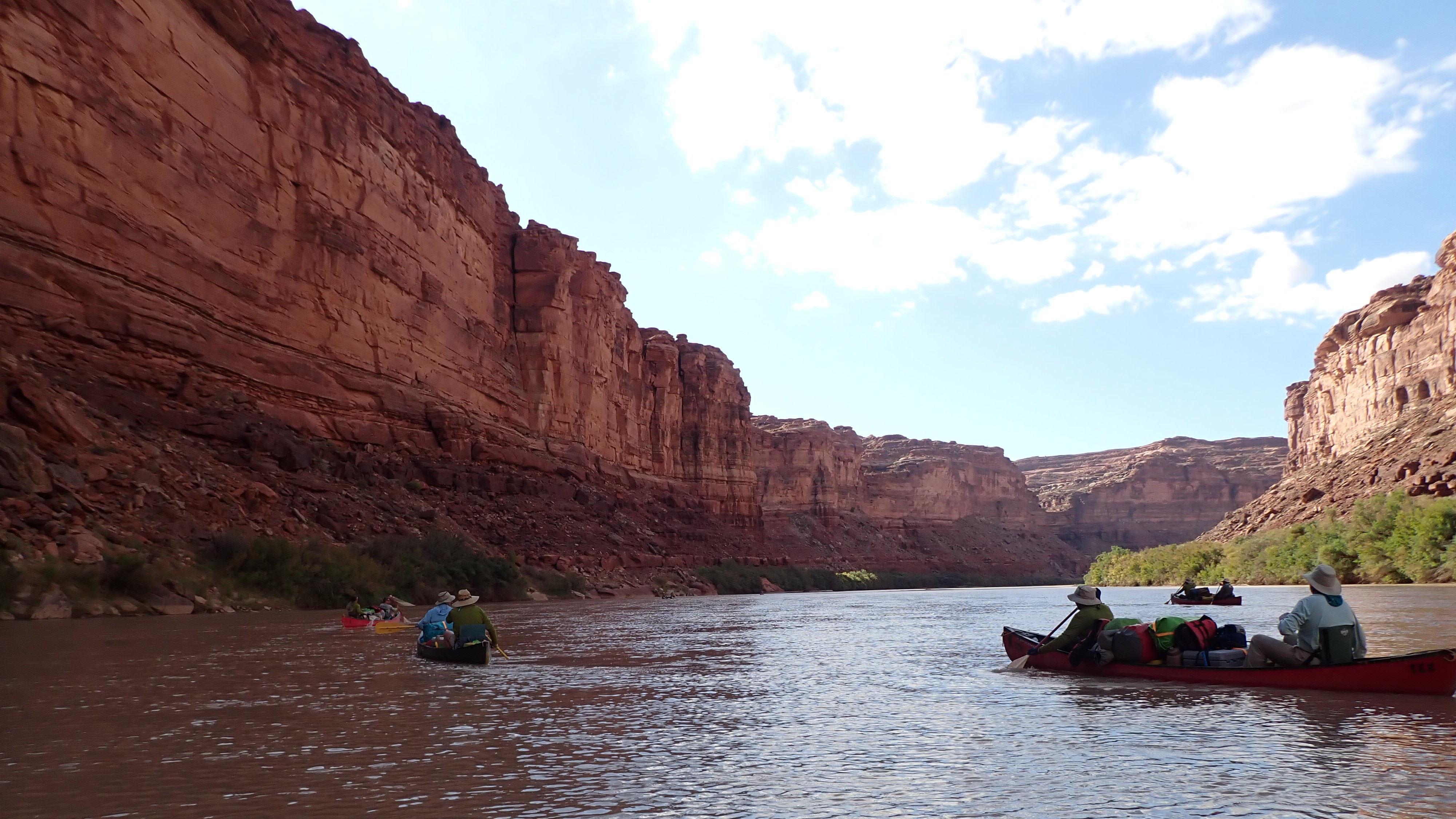
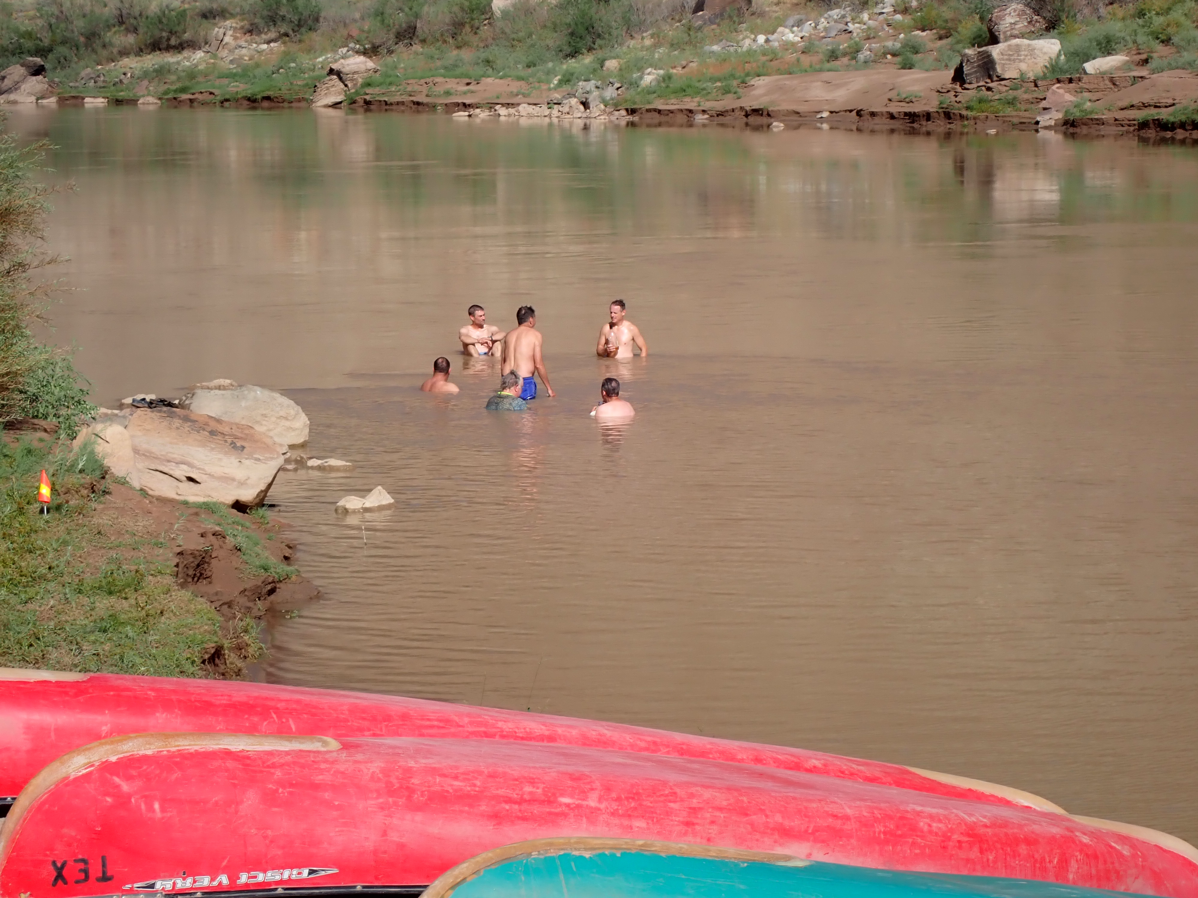
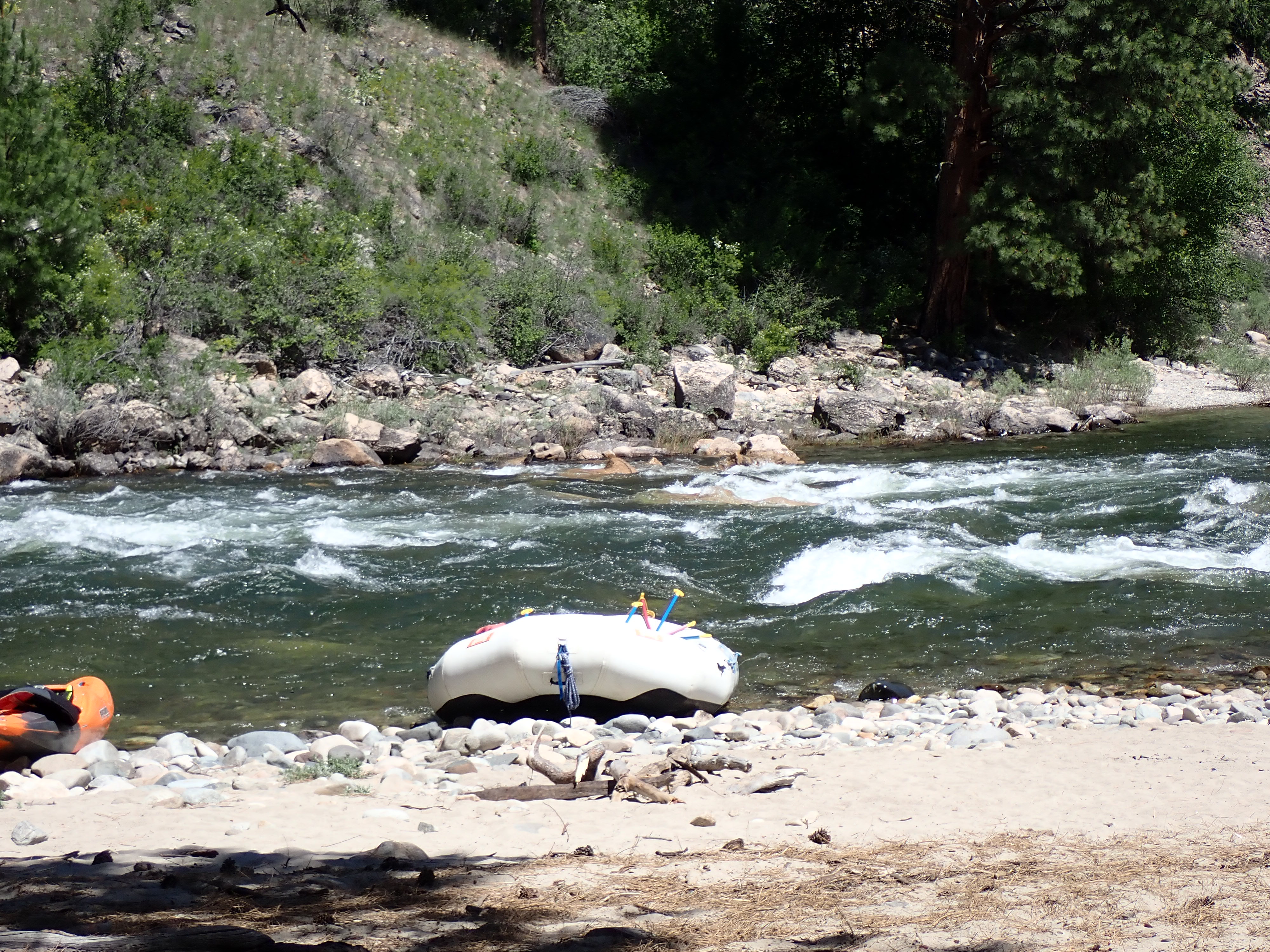
Wednesday, September 10th – It was another hot and sunny day, but a super day on the water with more beautiful scenery as we paddled further down the river. By early afternoon, we were approached a spot in the river called “The Ripple” which equates to a class .01 rapid rating that unfortunately does end in a small eddy up against a rock wall. The goal here is to skirt the outside corner, move to the inside and miss where the current will take you into the eddy and wall. All of us made it around the corner except one boat. It was like watching a slow motion capsize. There was a moment where I honestly thought that they were going to remain upright. But I was wrong when I saw their canoe broadside up against the wall. I quickly changed my mind and realized it was going to be a matter of seconds before the eddy would grab them and slowly turn their canoe over. Most of us watched the fun carnage from the sandbar on the opposite side of the river as Greg, Joe and the gear got recycled a couple of times in the eddy prior to Andrew Gregory throwing them a rescue rope. All was good and we recovered Greg, Joe and their gear fairly quickly and resumed heading downstream. However, we did end up losing all our bread for the reminder of the trip which was in a black plastic box their canoe at the time. Cheers!
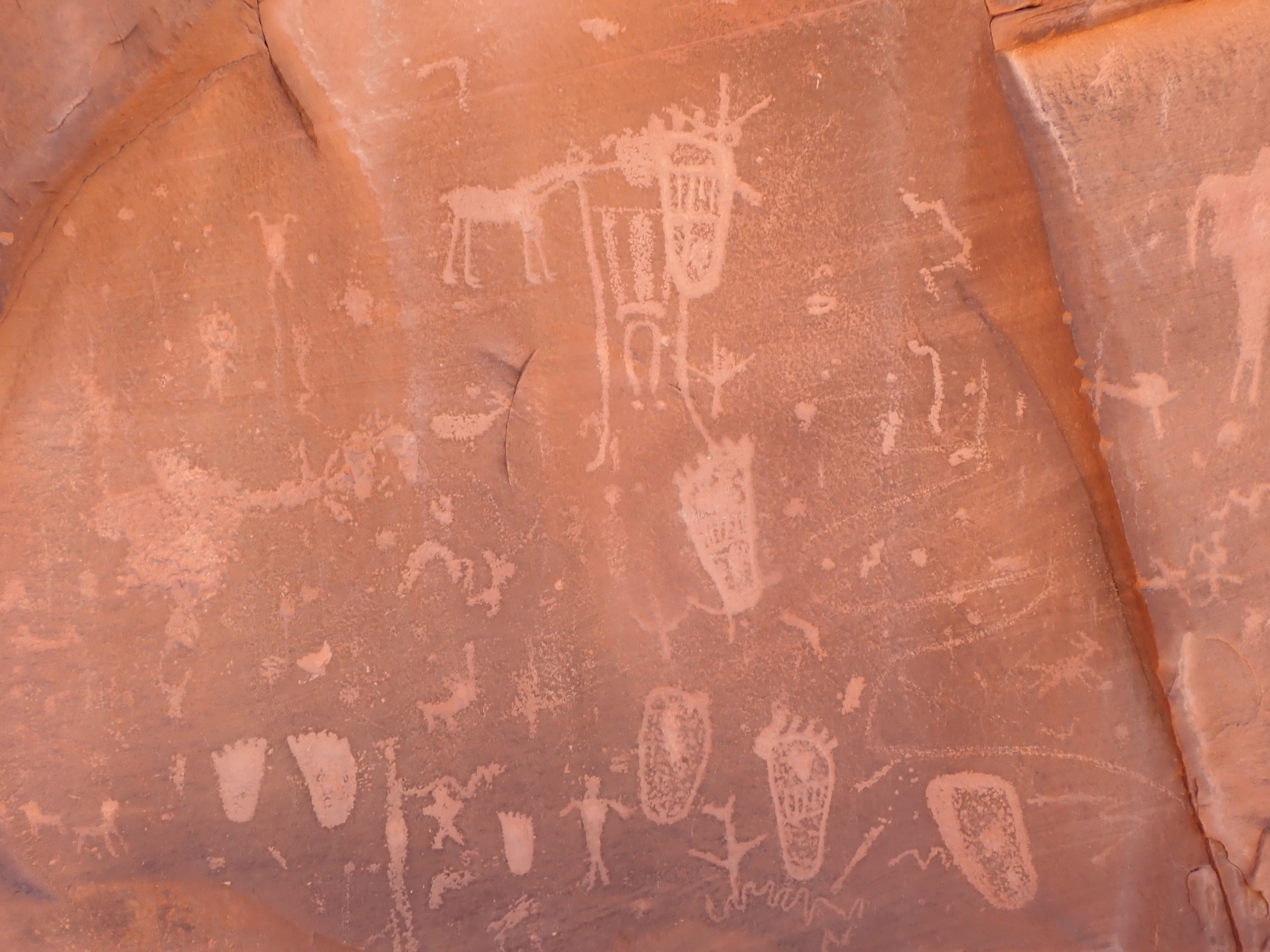
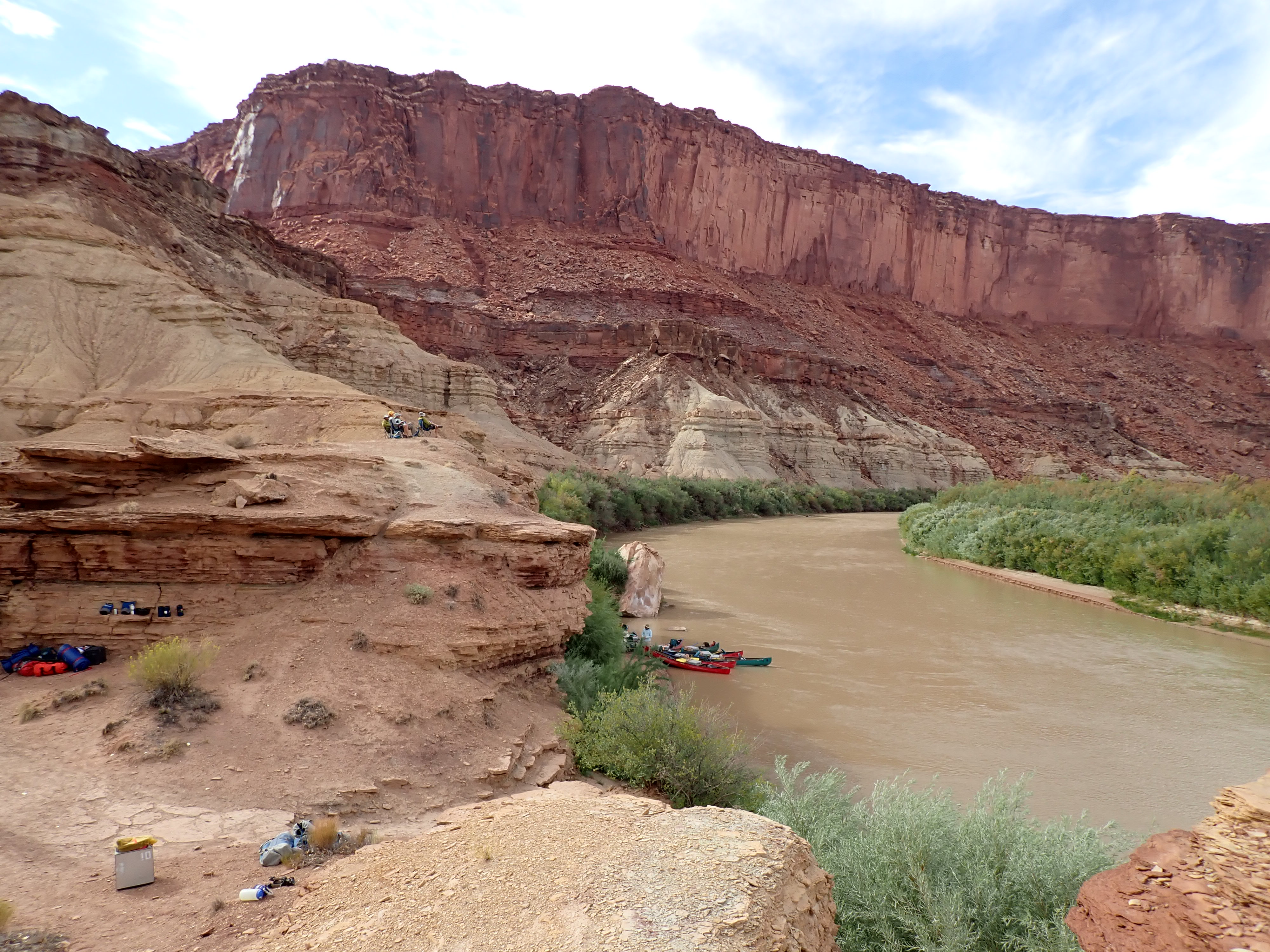
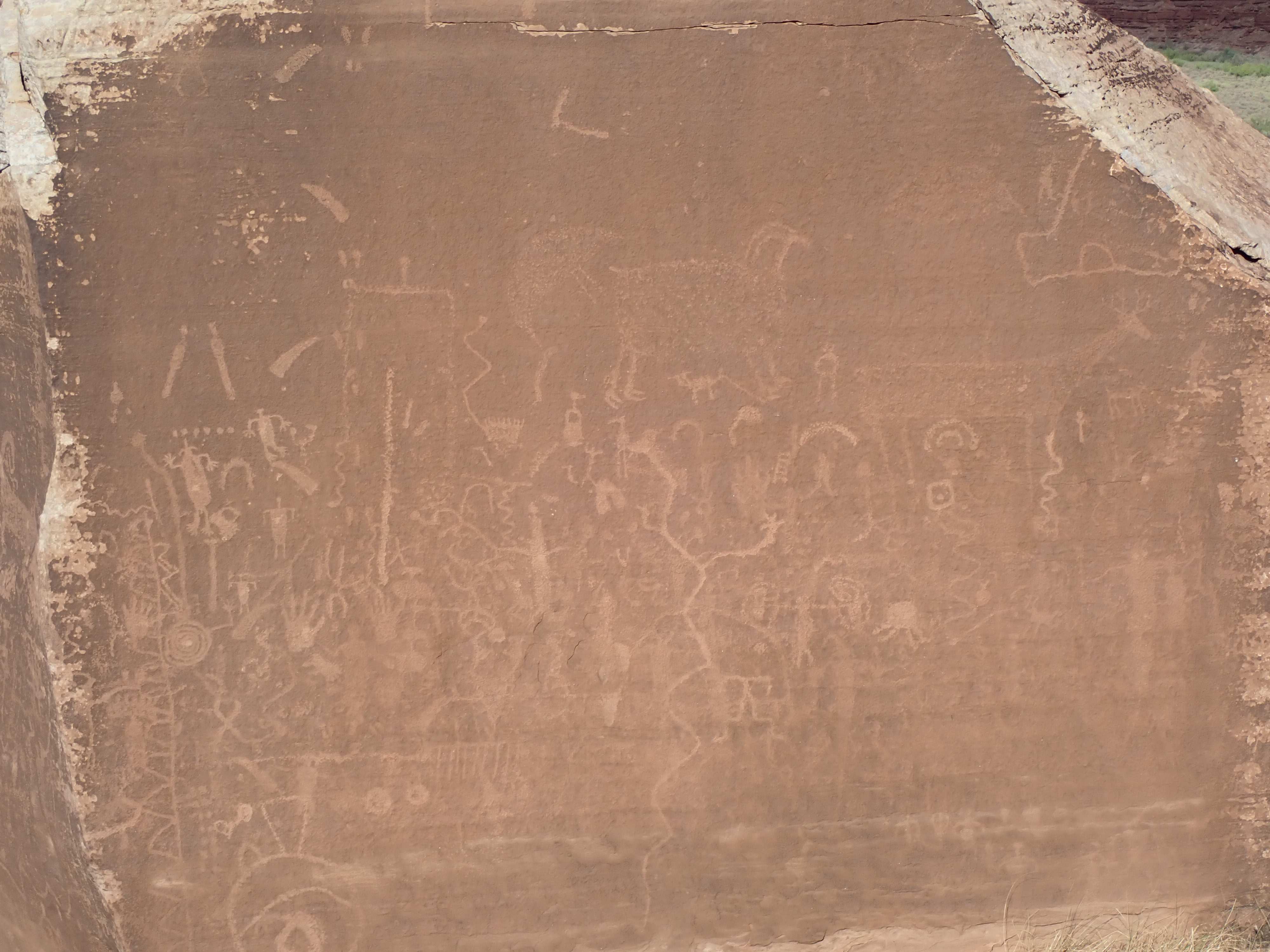
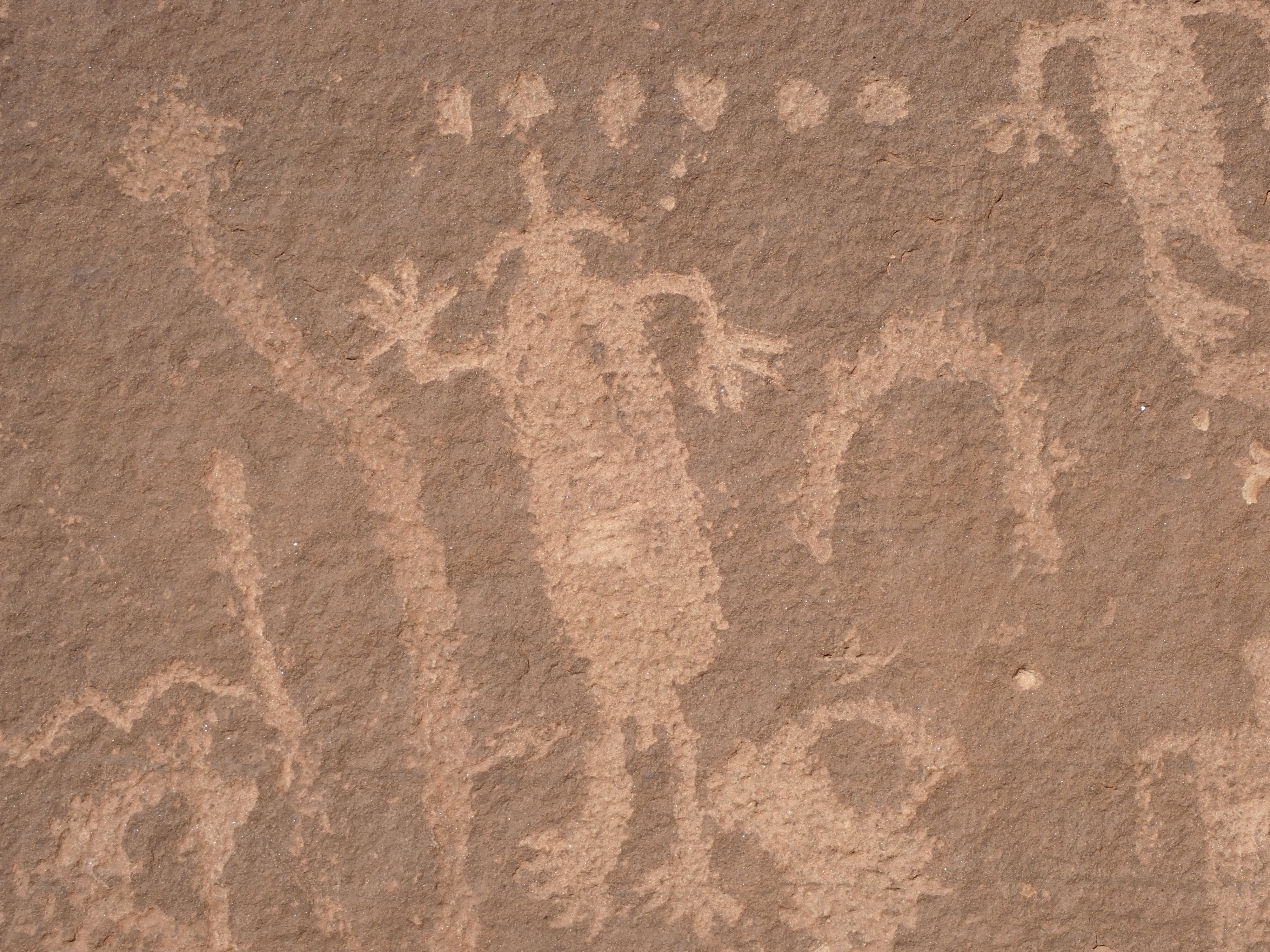
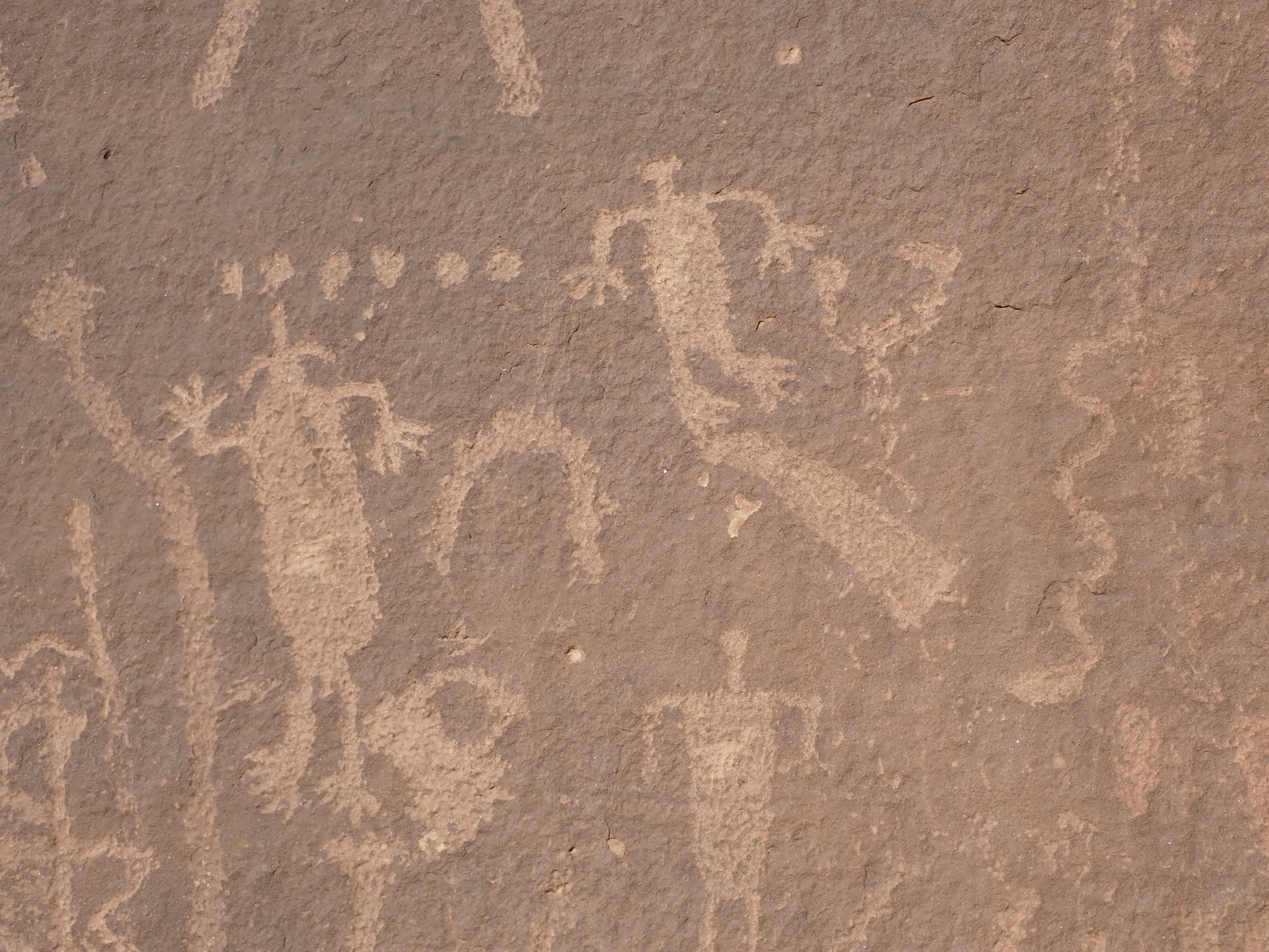
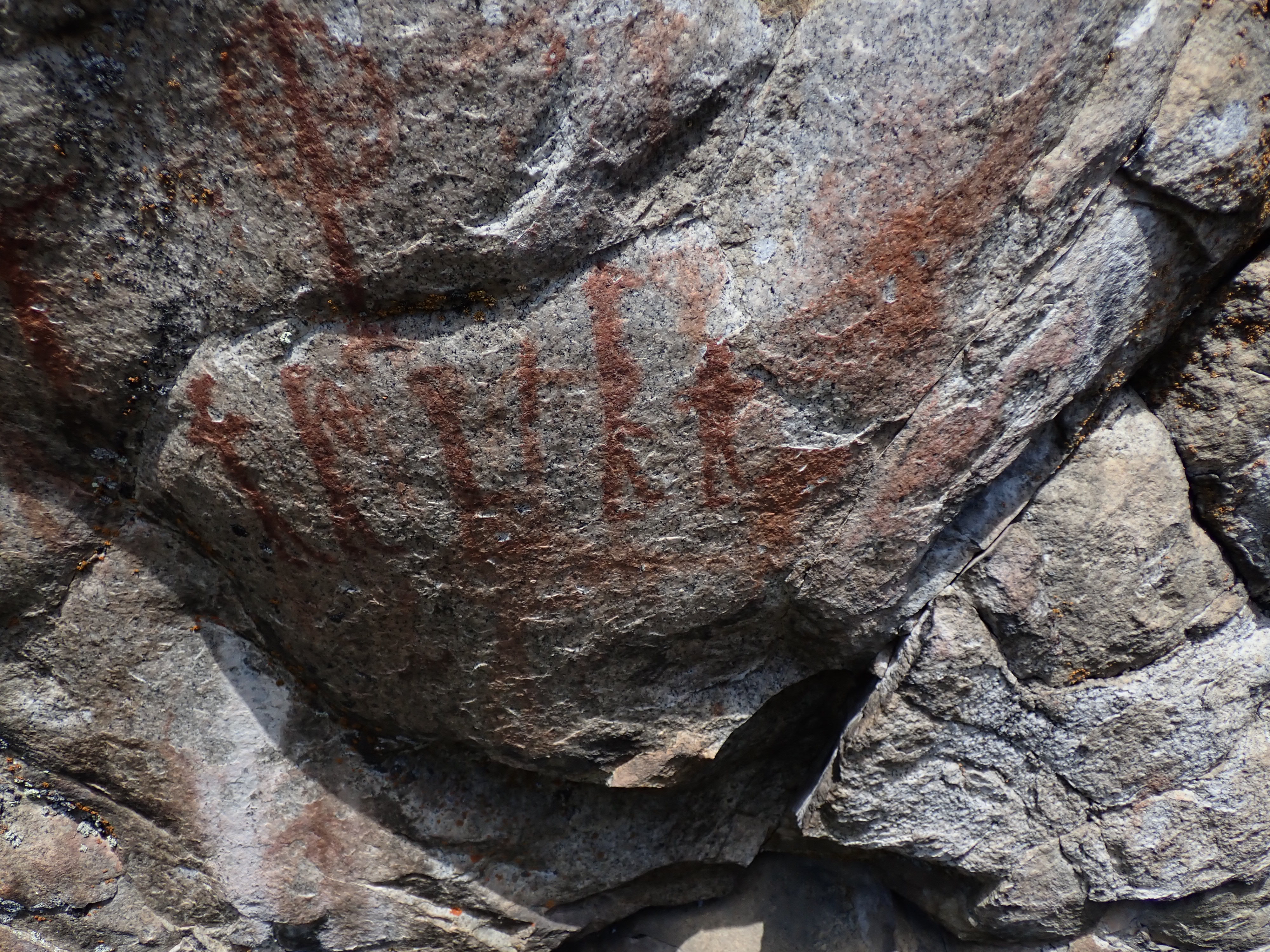
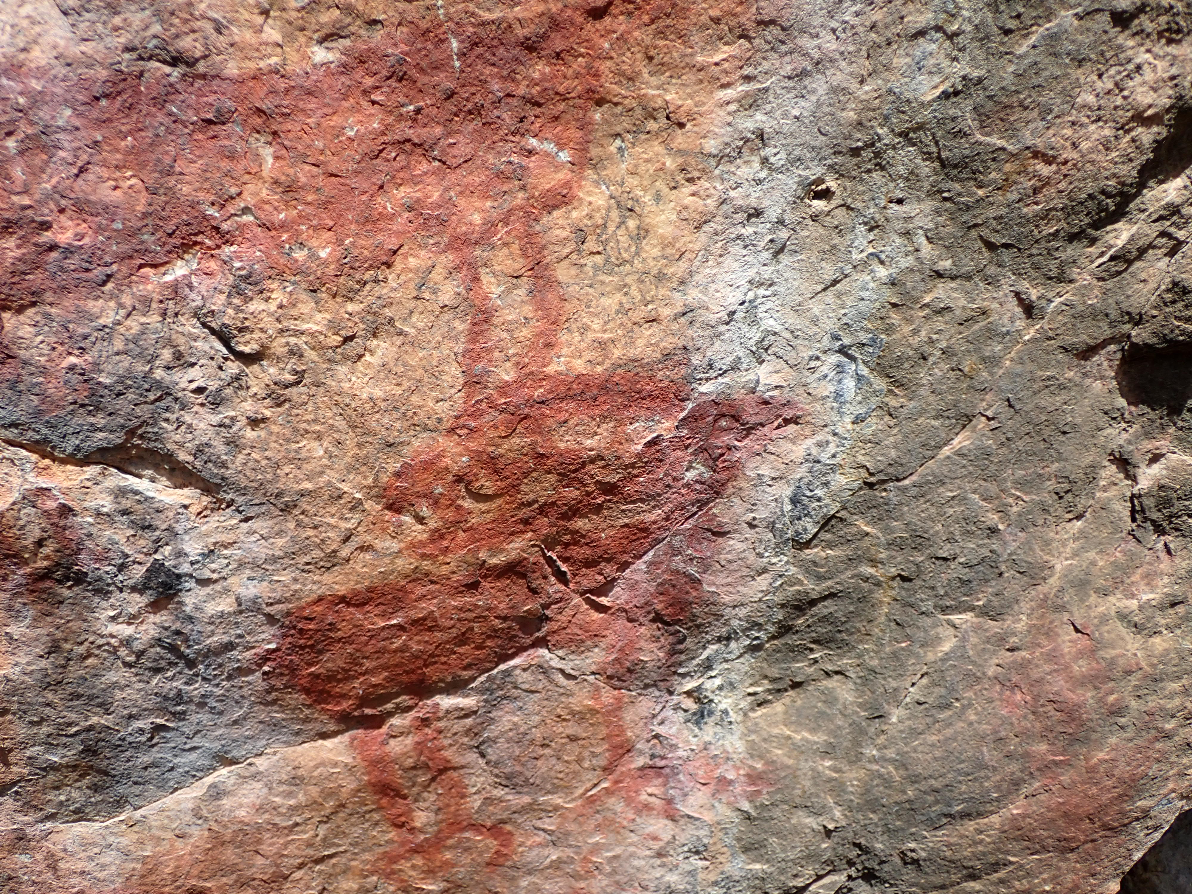
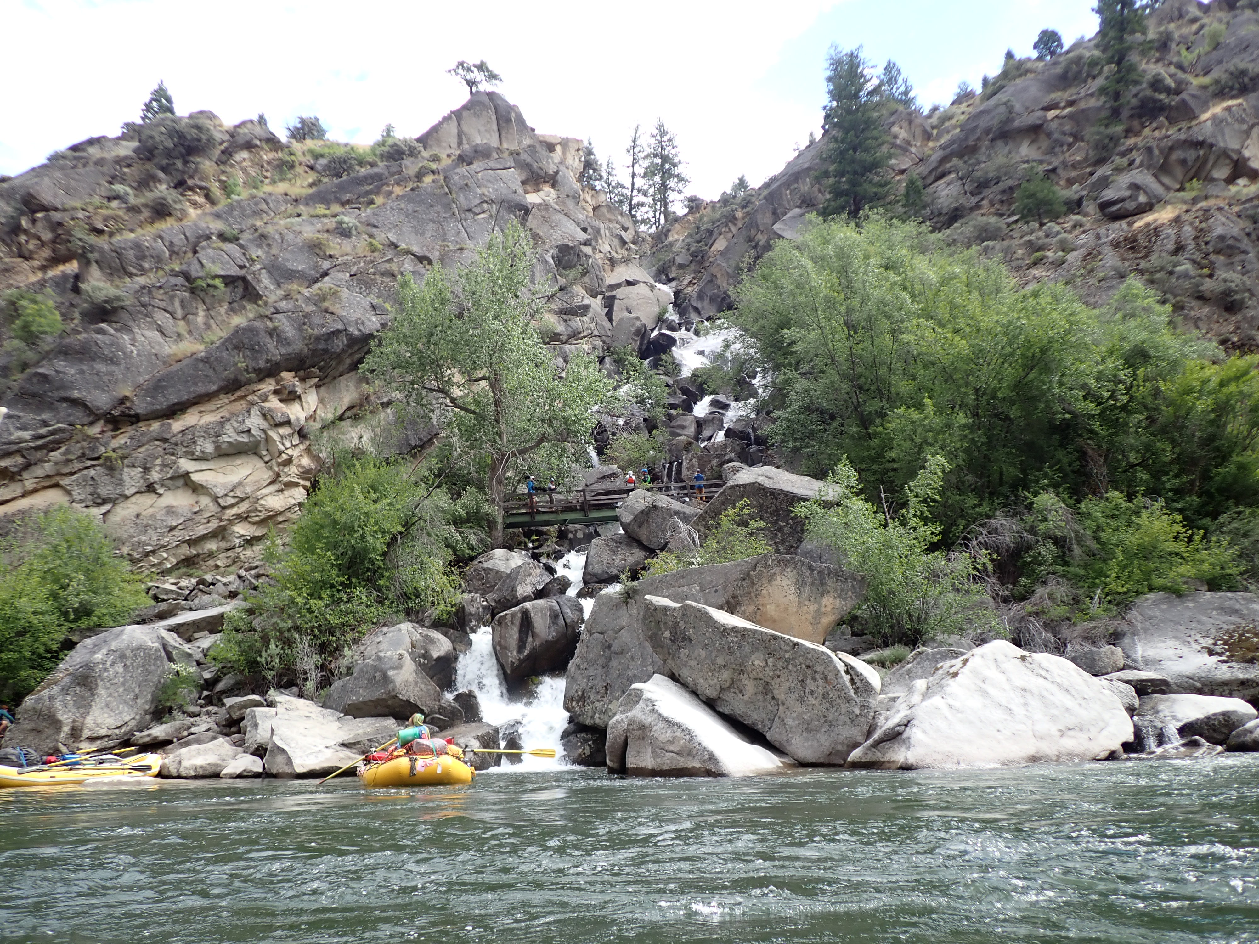
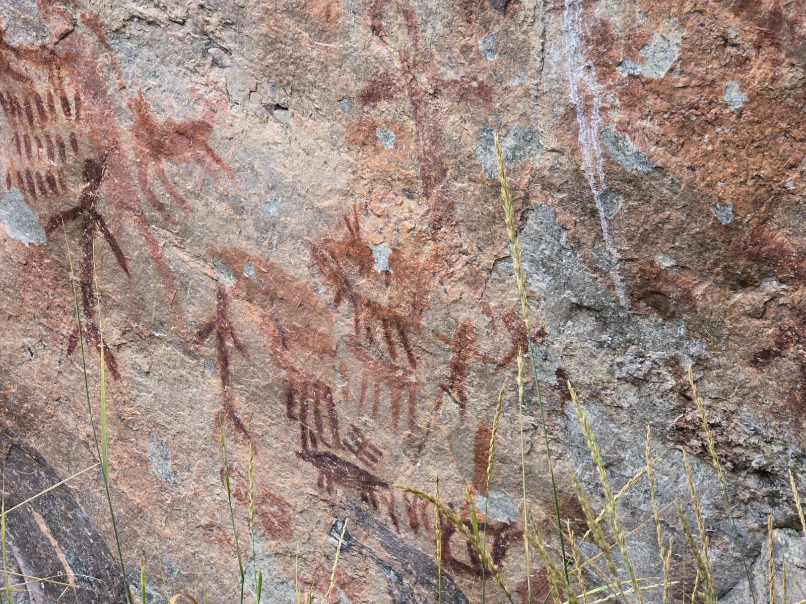
Later that afternoon, we arrived at camp number two where most of us took a short two-mile round-trip hike out to Picture Rock or what I think is called the Boulder Glyphs near Turk’s Head before dinner. It was a large boulder up from the riverbank with some very interesting and unique petroglyphs.
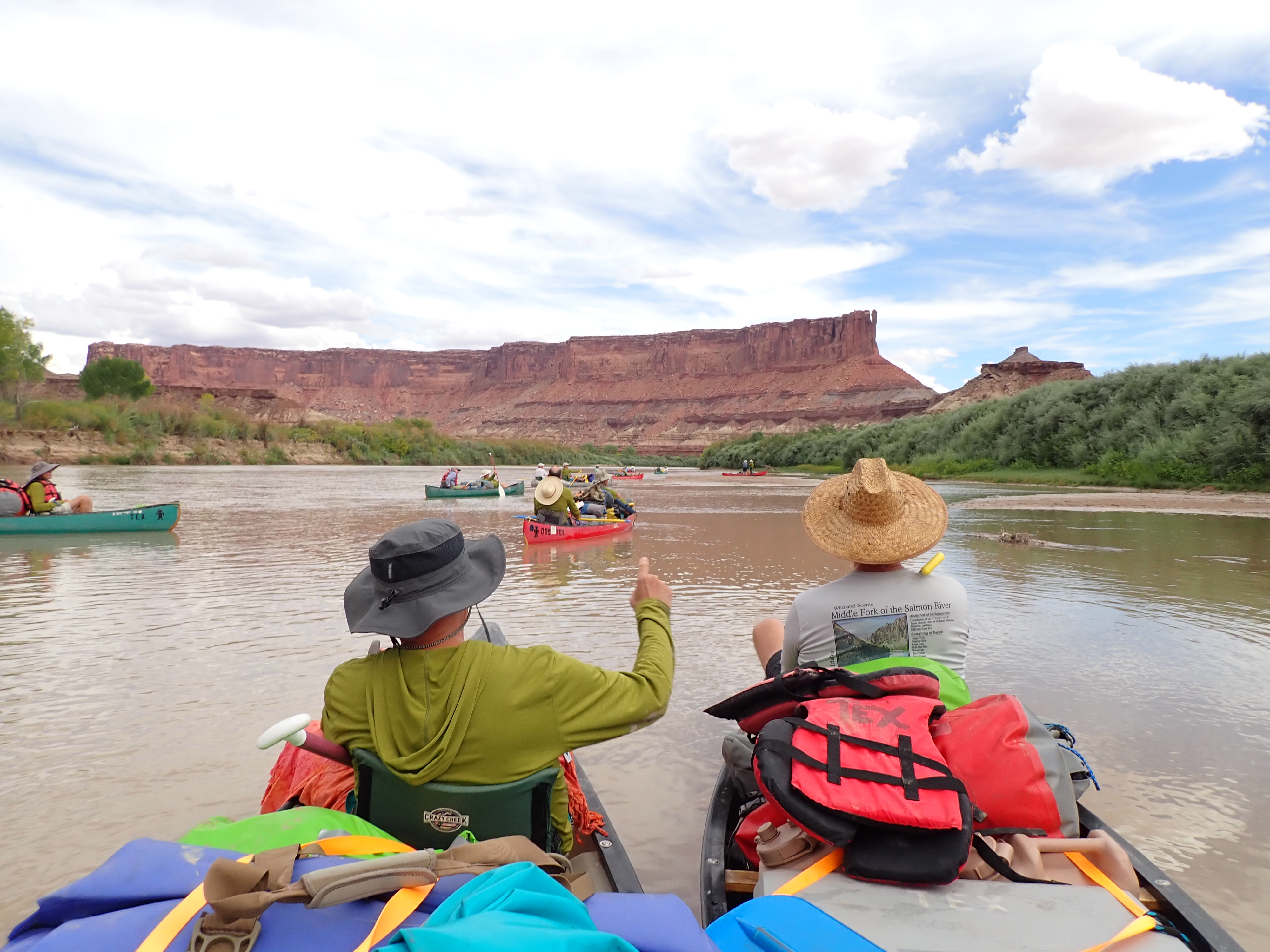
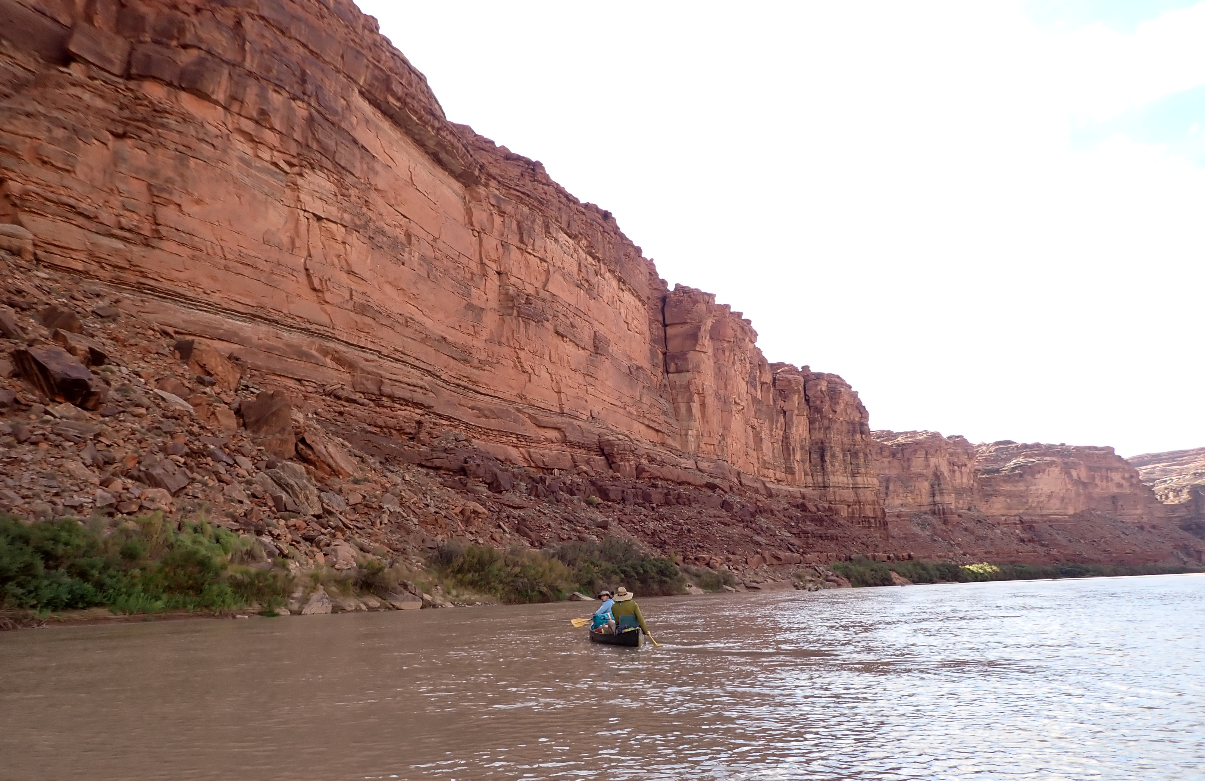
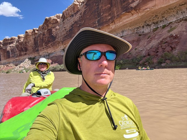
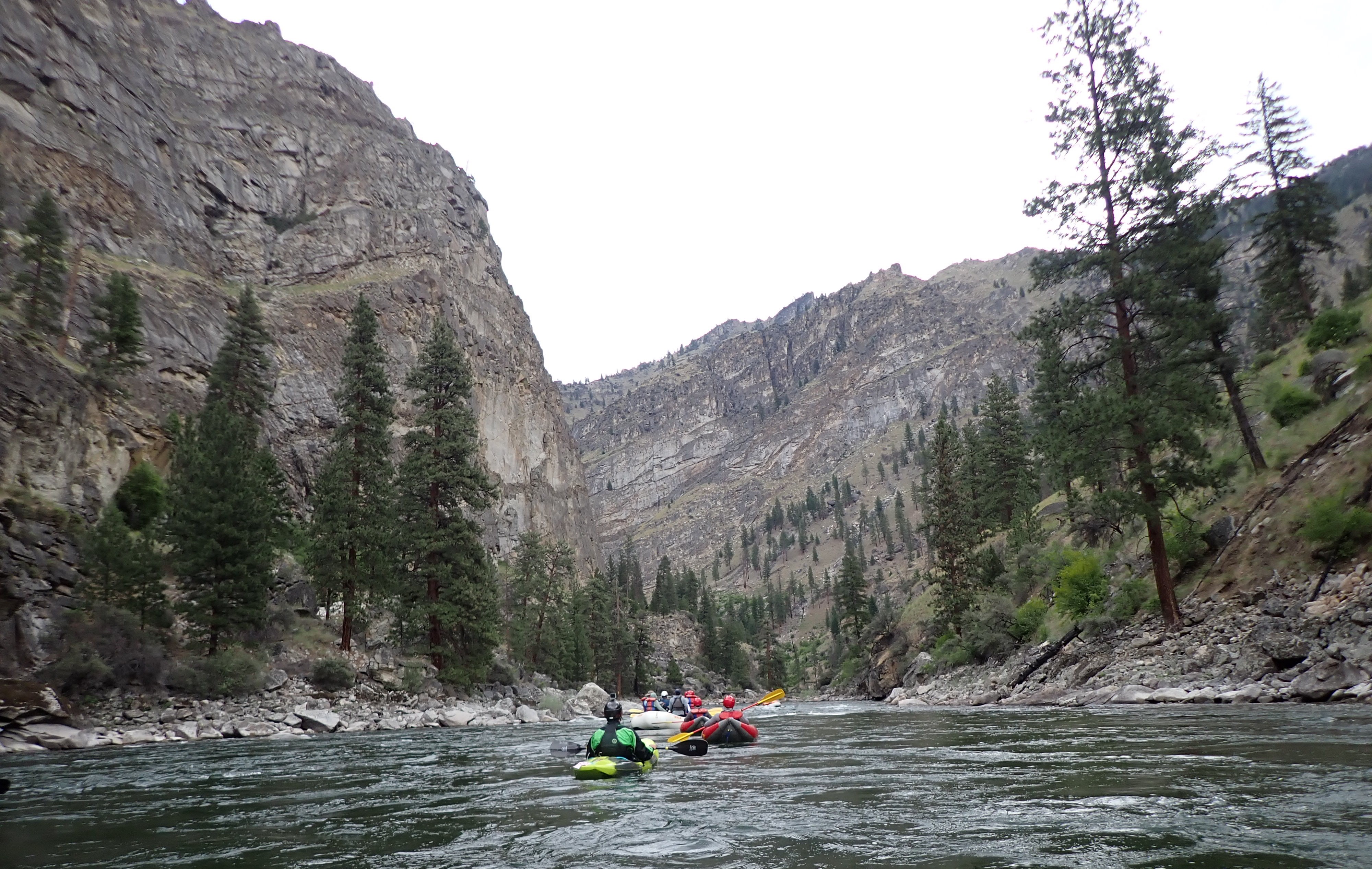
Thursday, September 11th – The day was pretty much spent paddling along some very beautiful and towering red sandstone cliffs with a short lunch break on a small sandbar. Most days we only covered somewhere between 13 and 15 miles on the water.
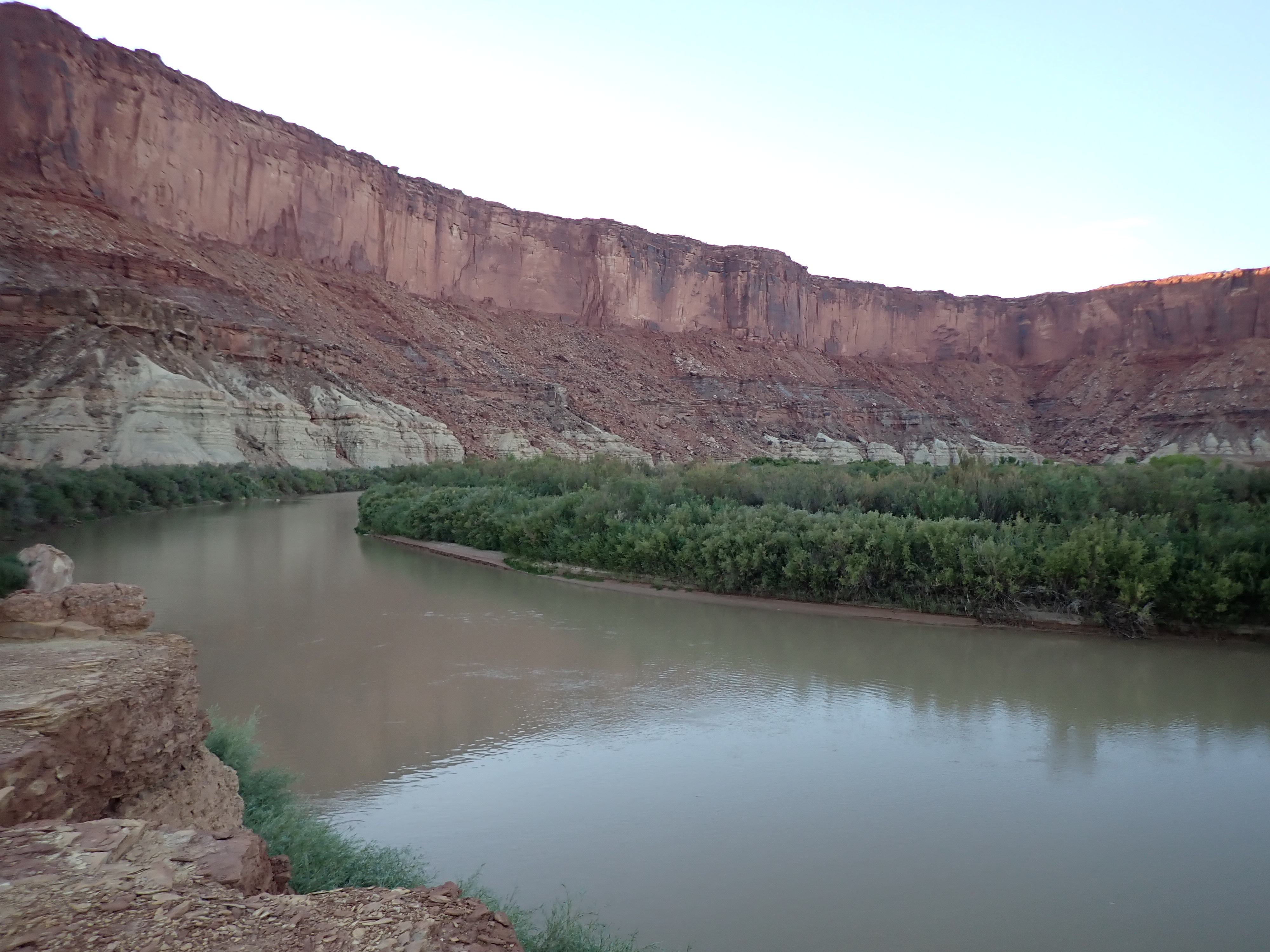
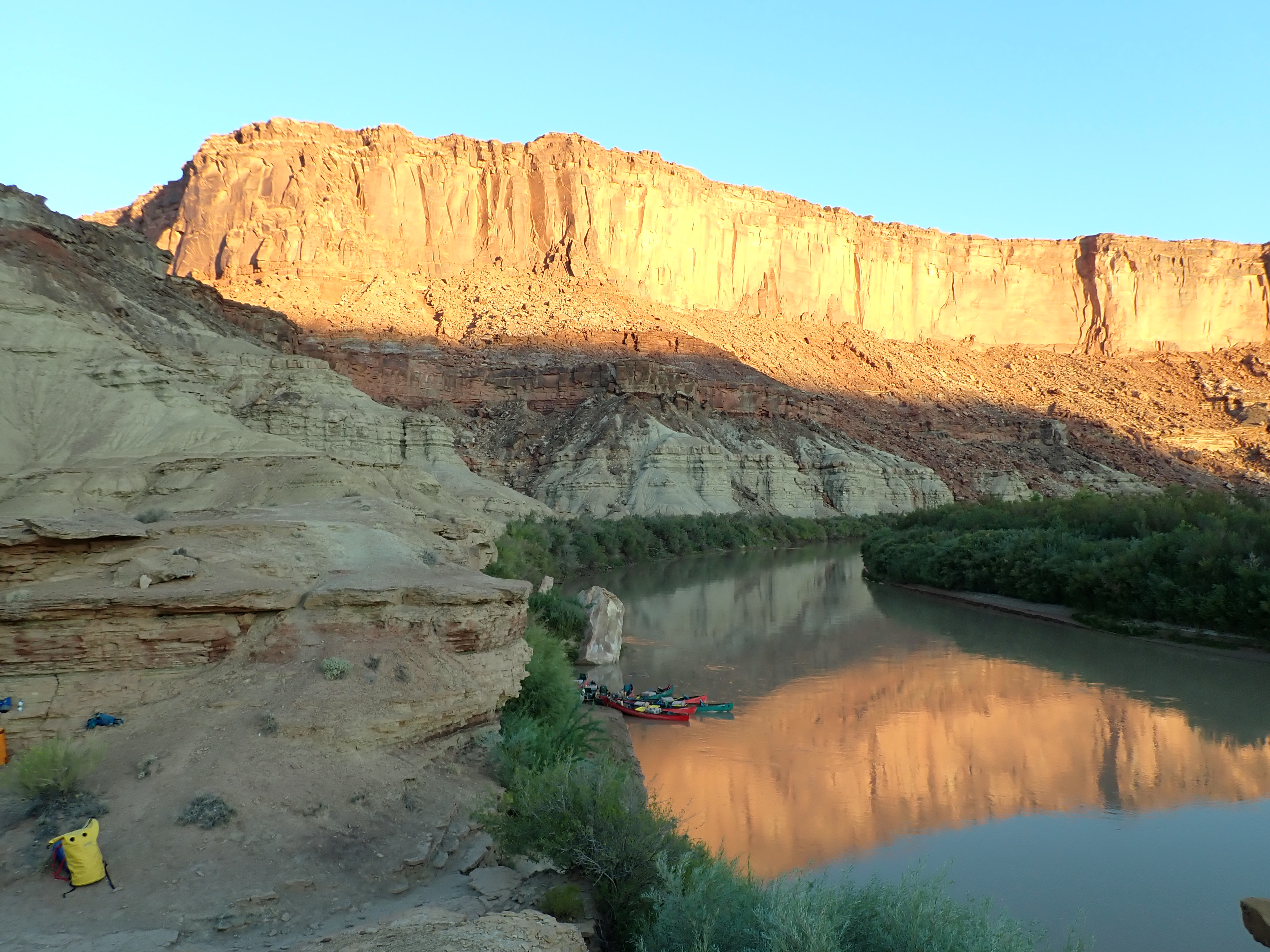
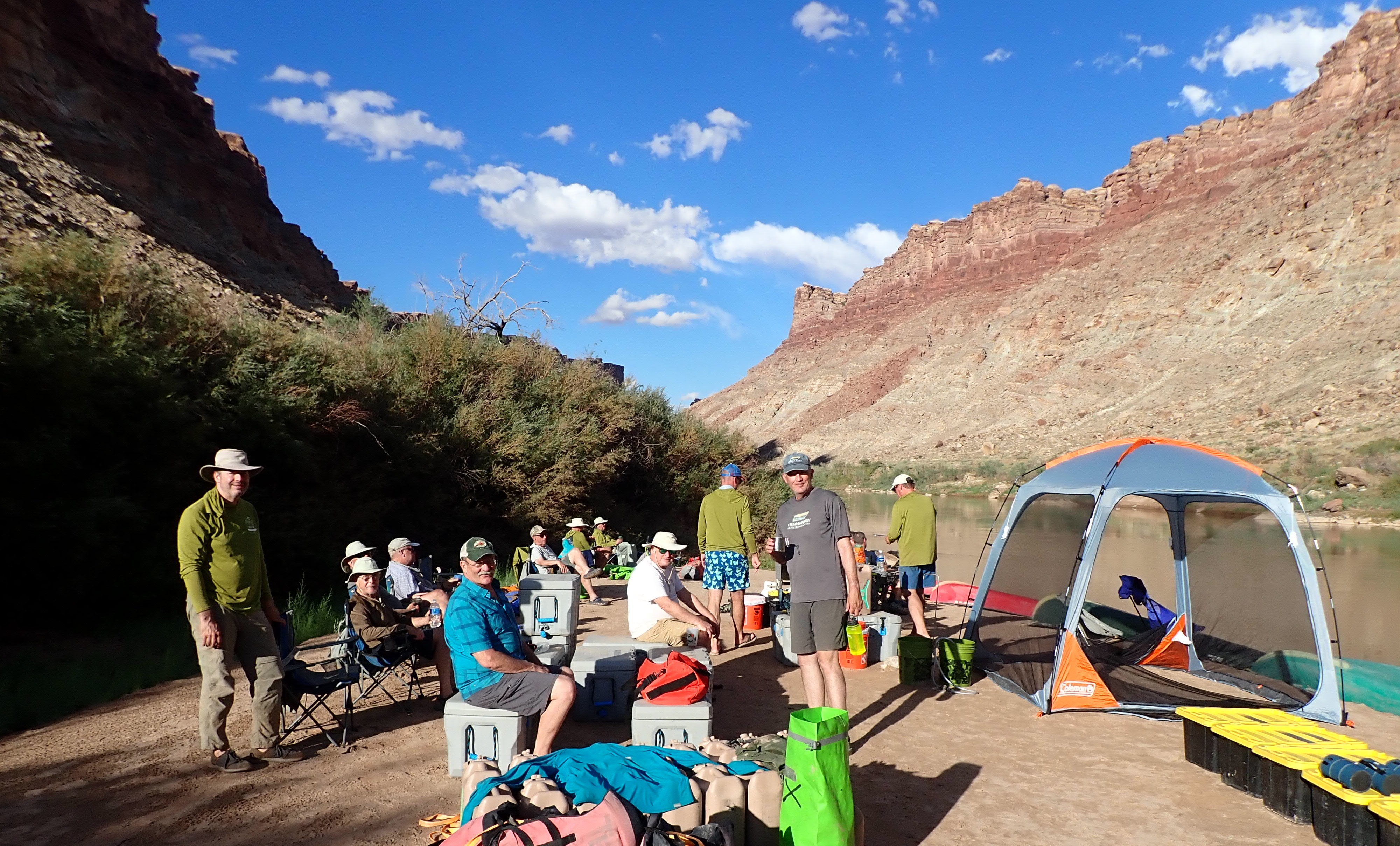
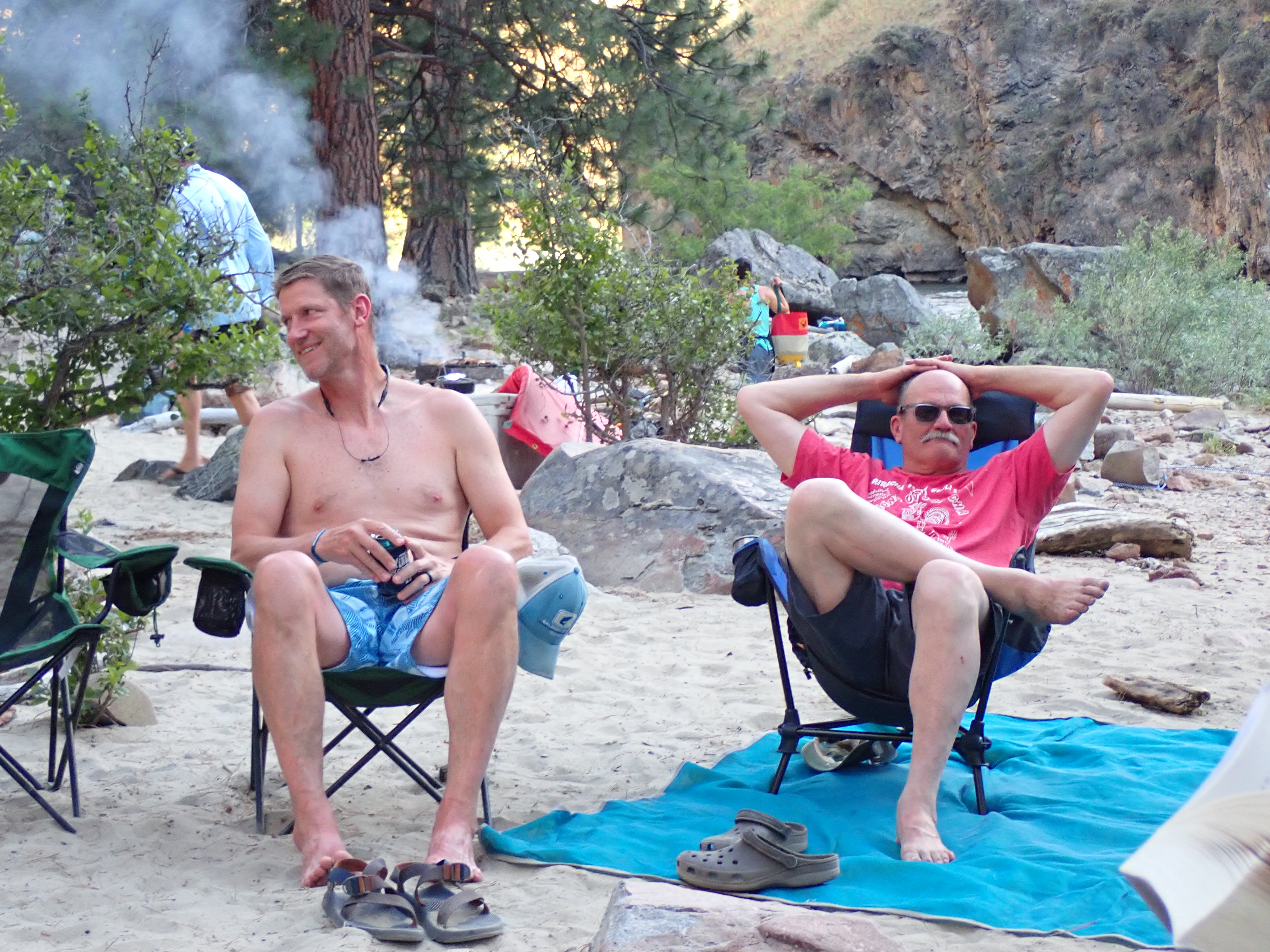
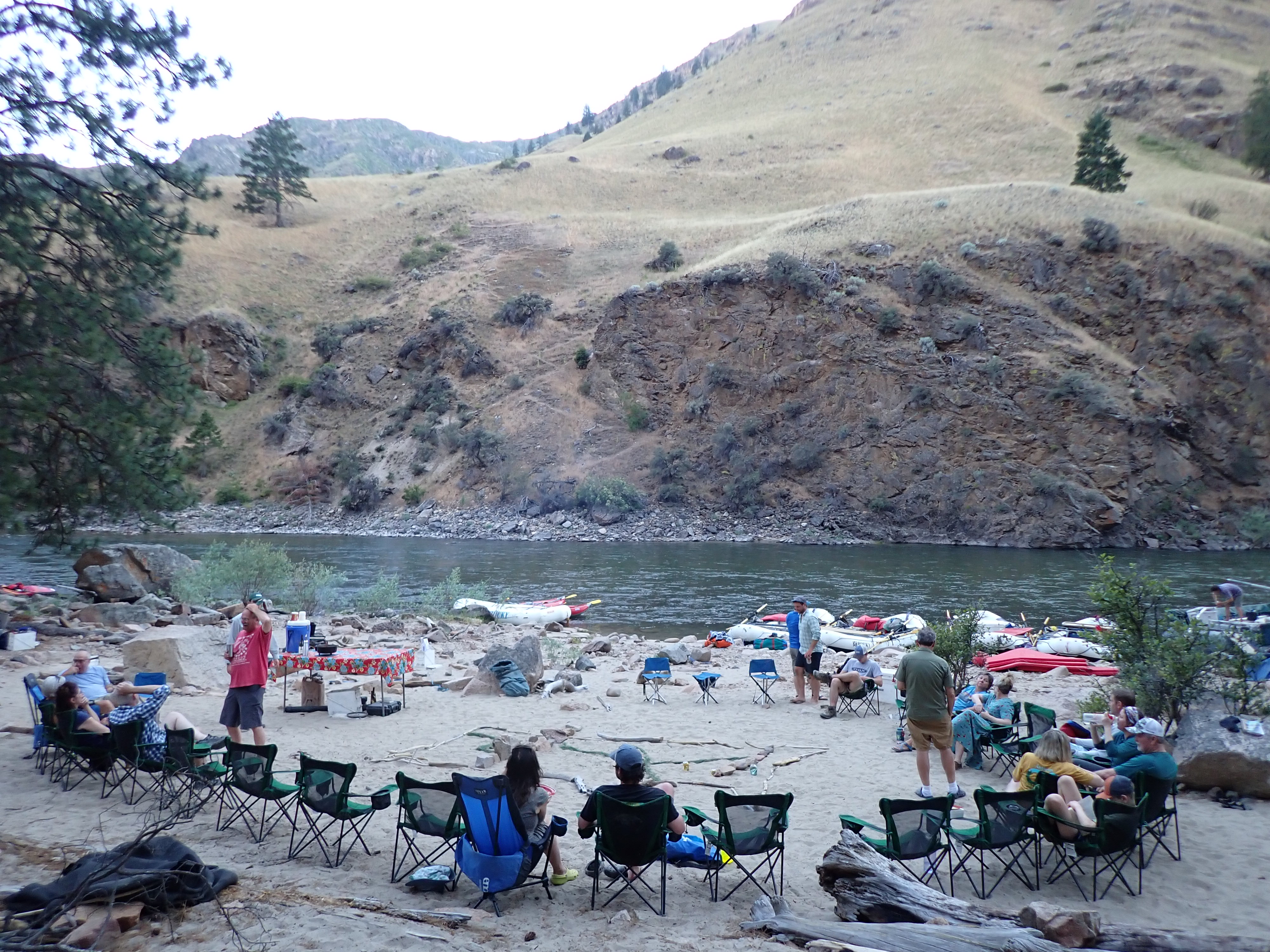
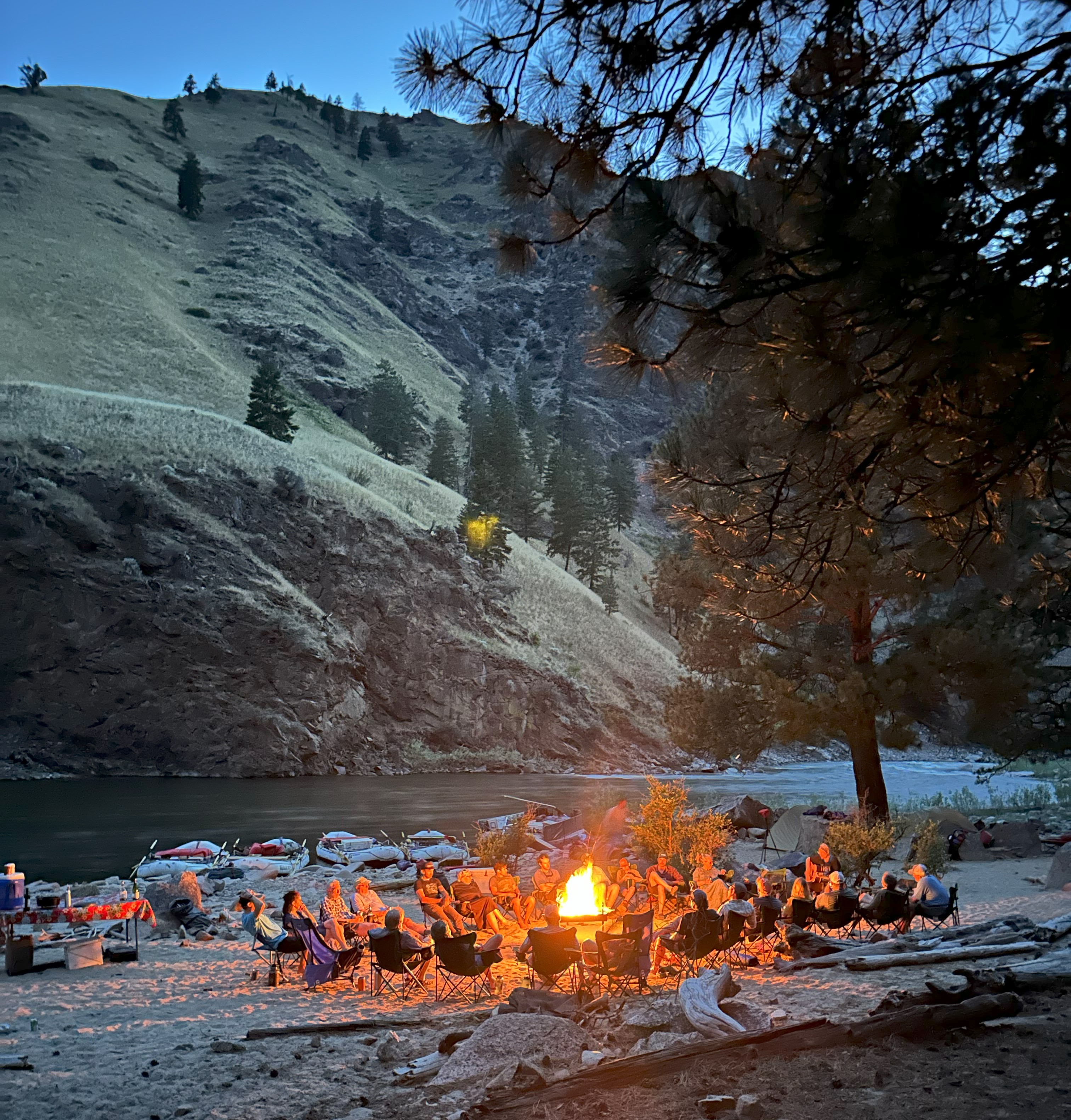
We got to camp three fairly early that afternoon, which was on a pretty large sandbar where almost everyone took a break from the sun and heat lounging along the tree line of the sandbar through the reminder of the afternoon. When the sun finally gave way to the cliffs behind, the games and fun reappeared prior to dinner.
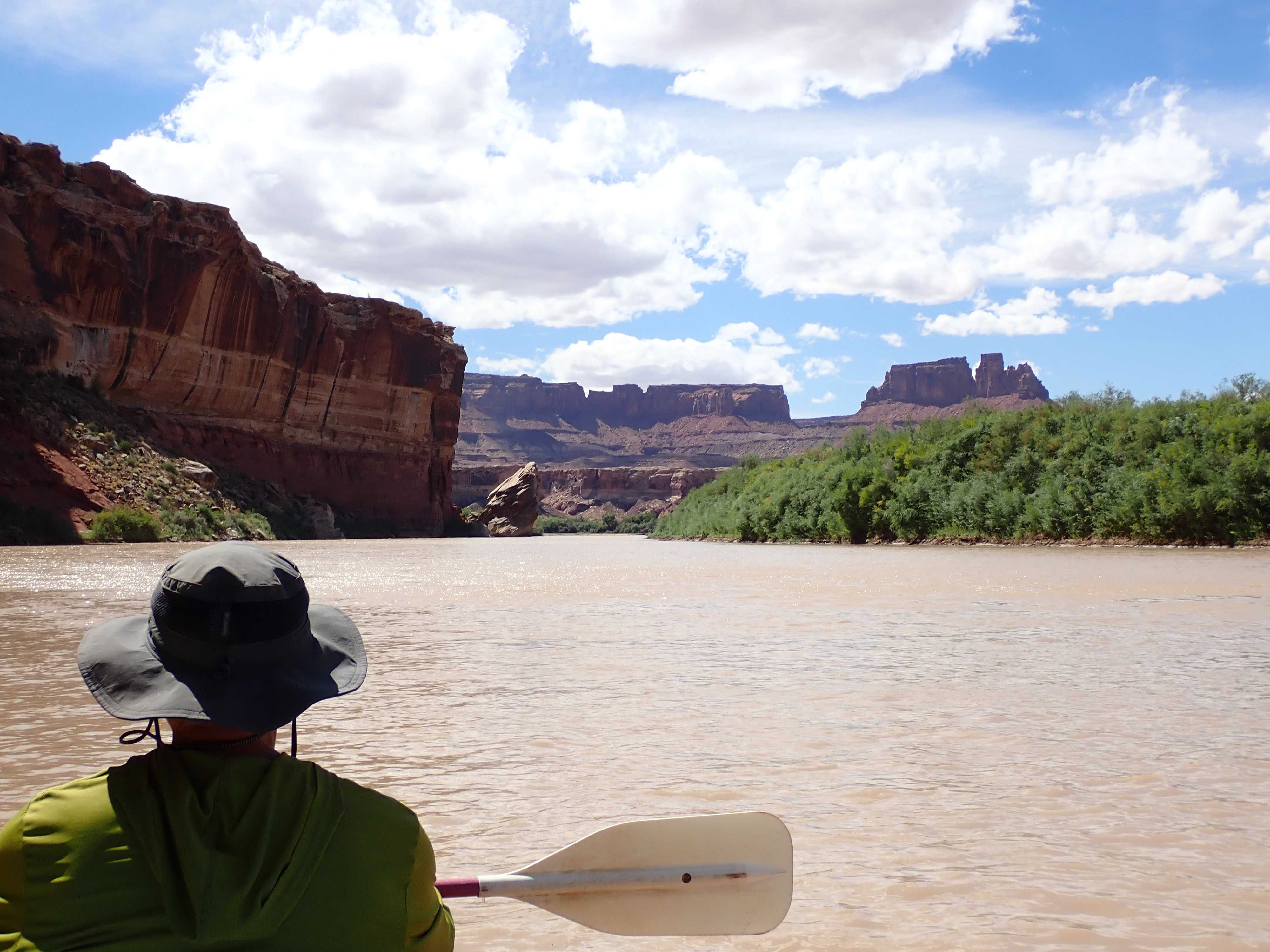
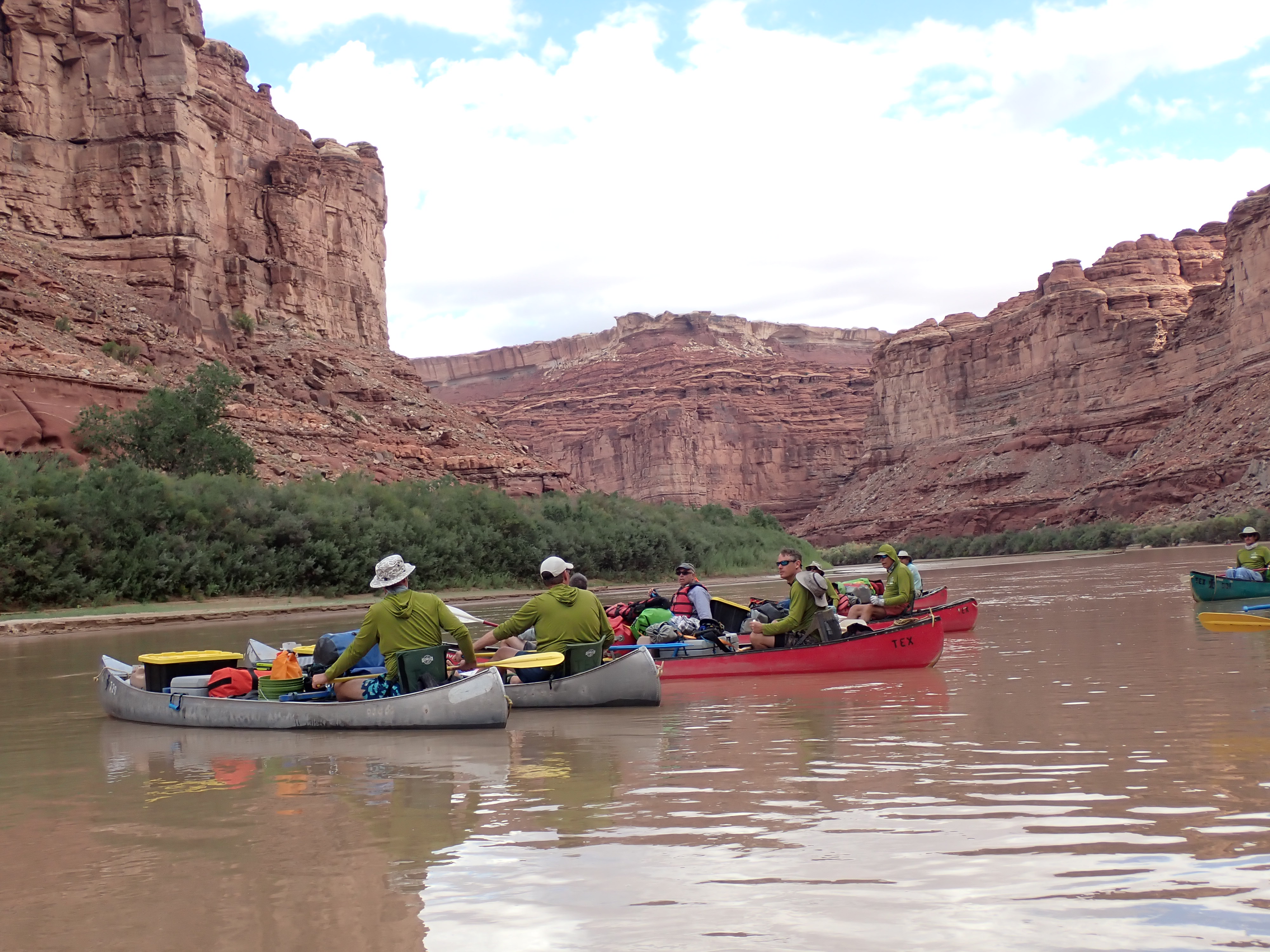
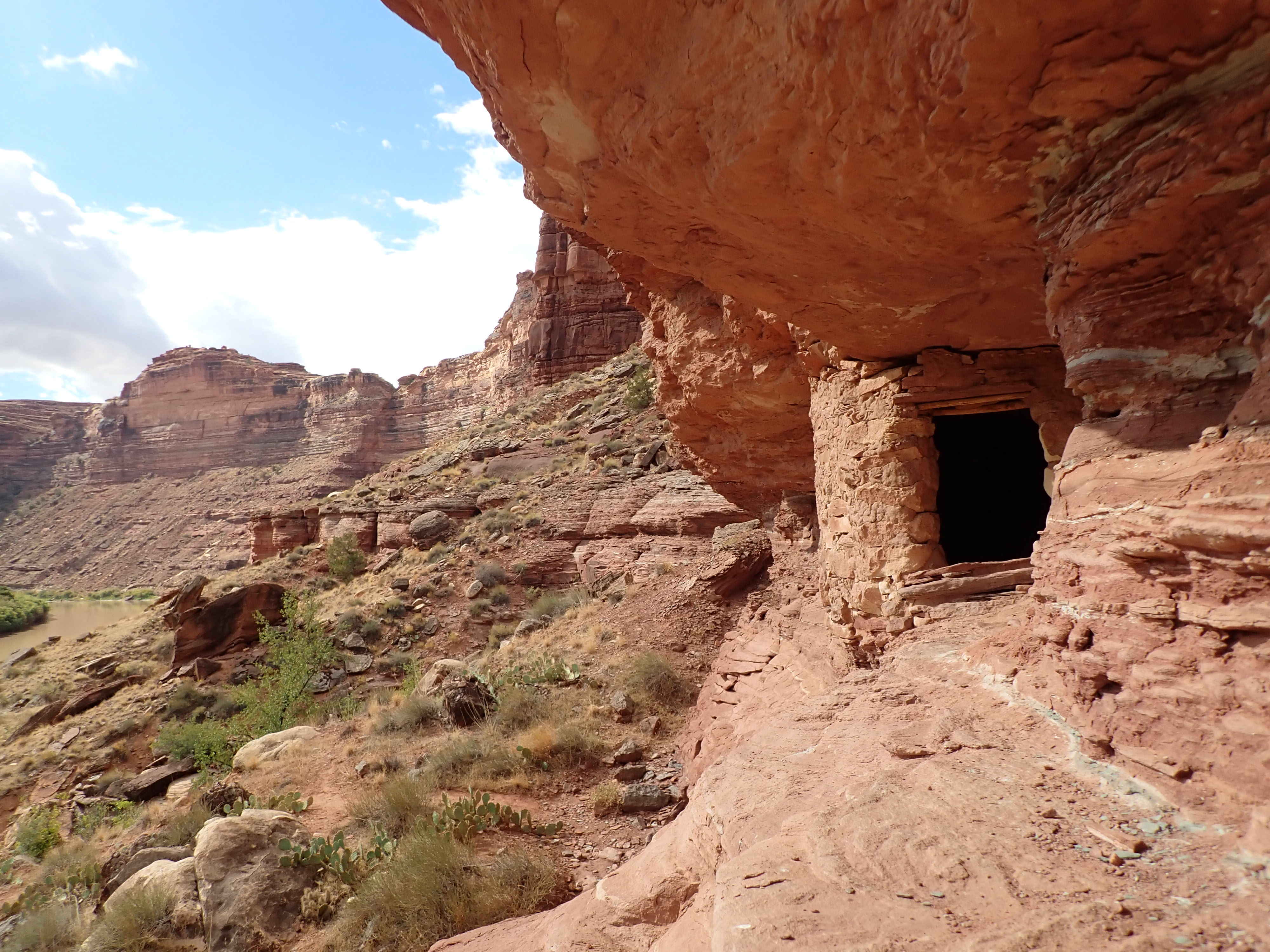
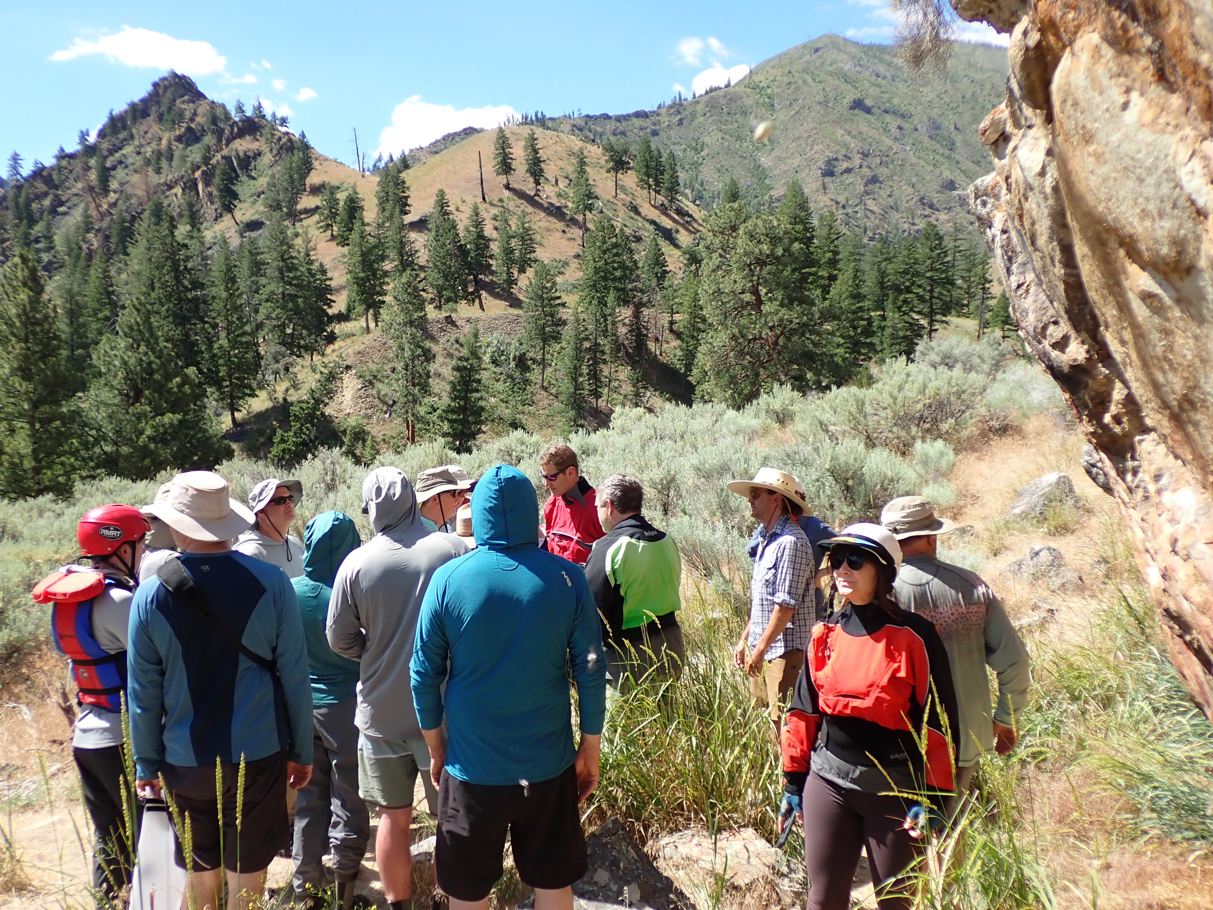
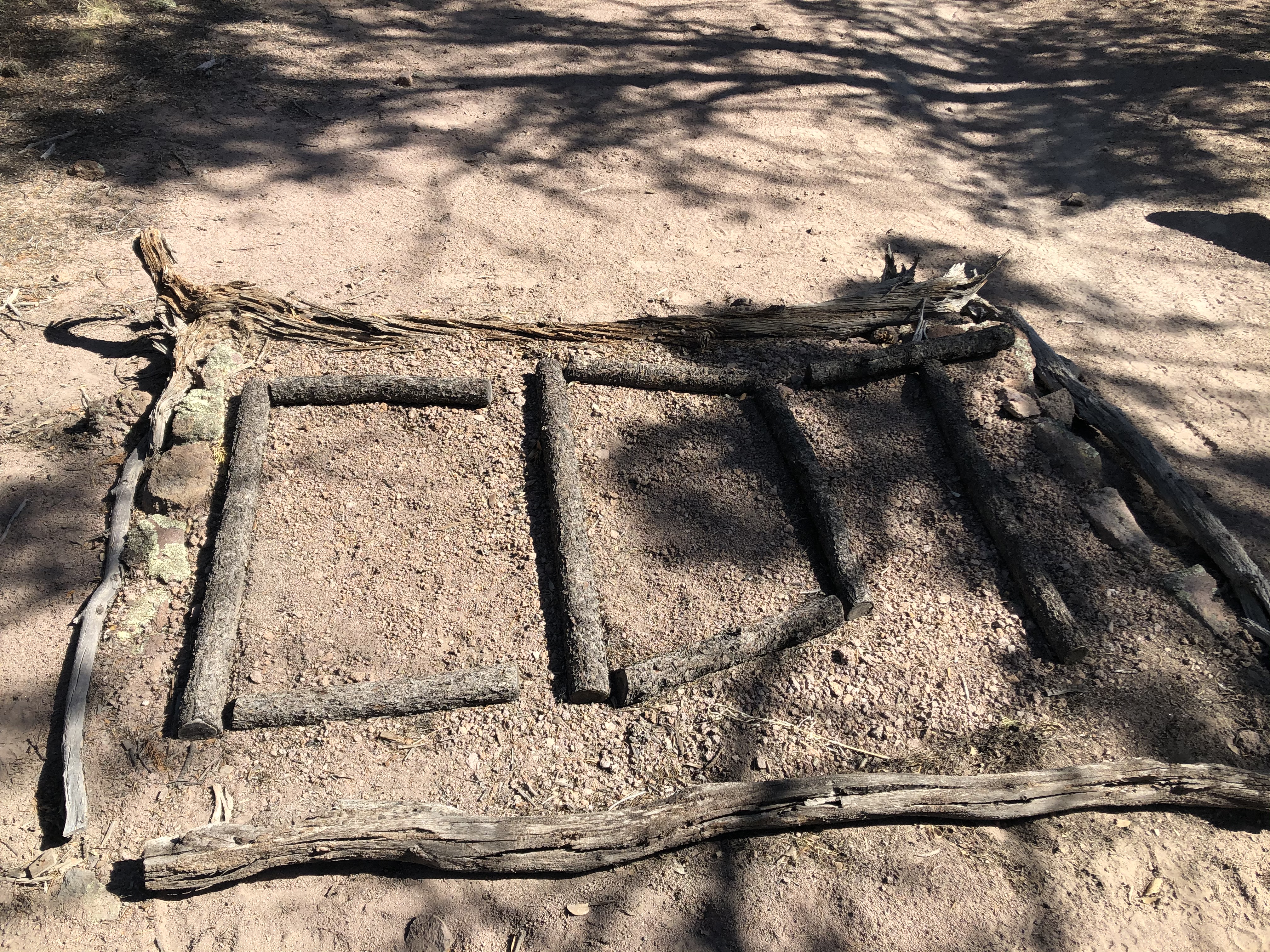
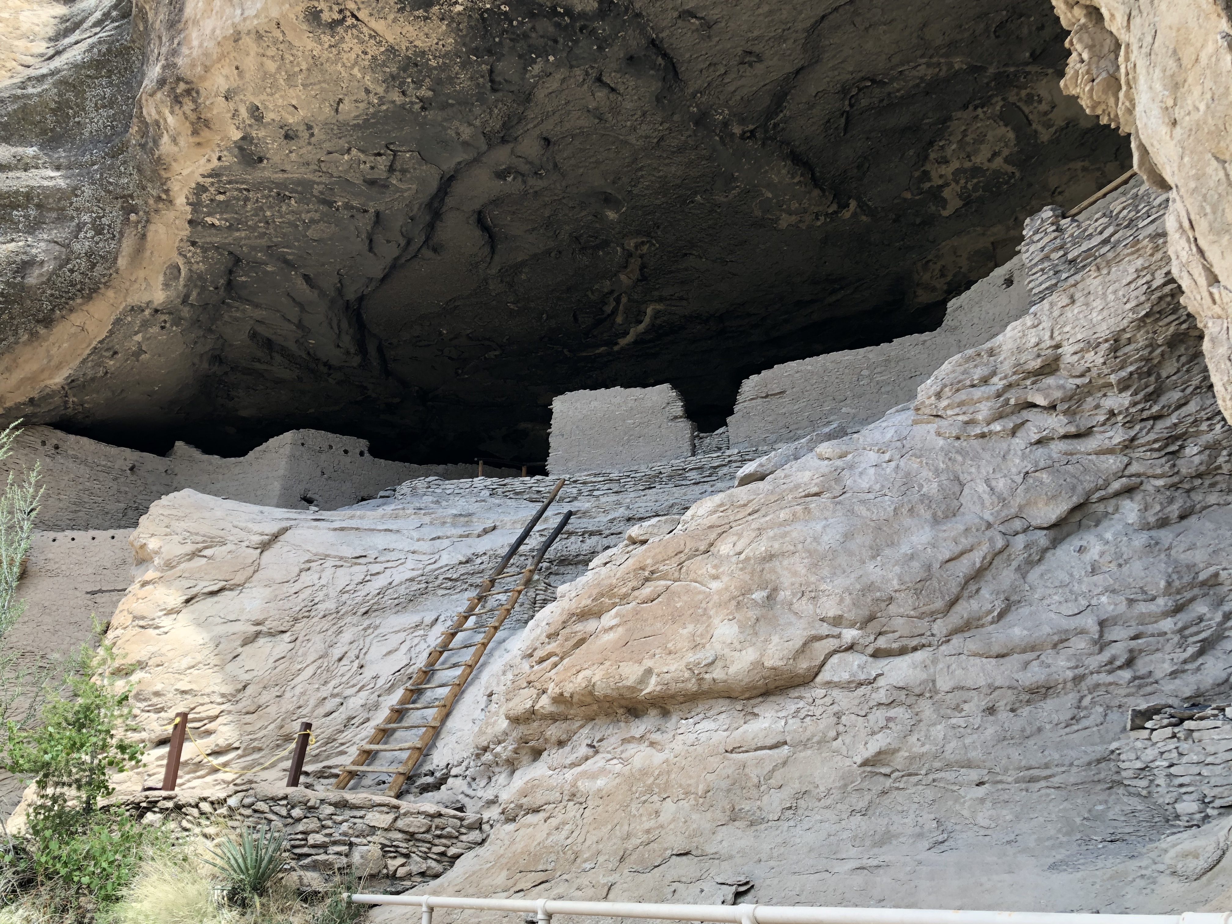
Friday, September 12th – Our final day of canoeing arrived on the Green River, and by midafternoon we merged into the Colorado River at its confluence. It was another early morning start from the red sandstone cliff canyon that was our camp the night before. The paddle from camp down to the confluence was absolutely beautiful. It was one of my favorite sections. We made a quick stop and scrambled up to an old granary that was built by Ancestral Puebloan under the overhanging rock ledges dating back some +/- 1,000 years ago and used to store food supplies such as corn, beans and squash.
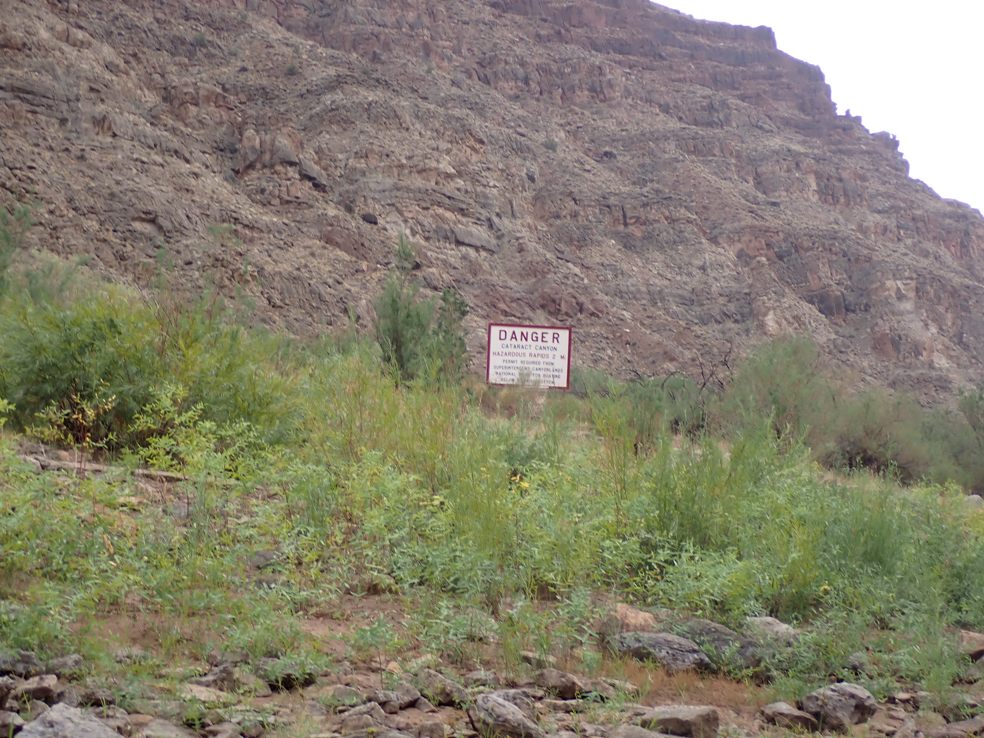
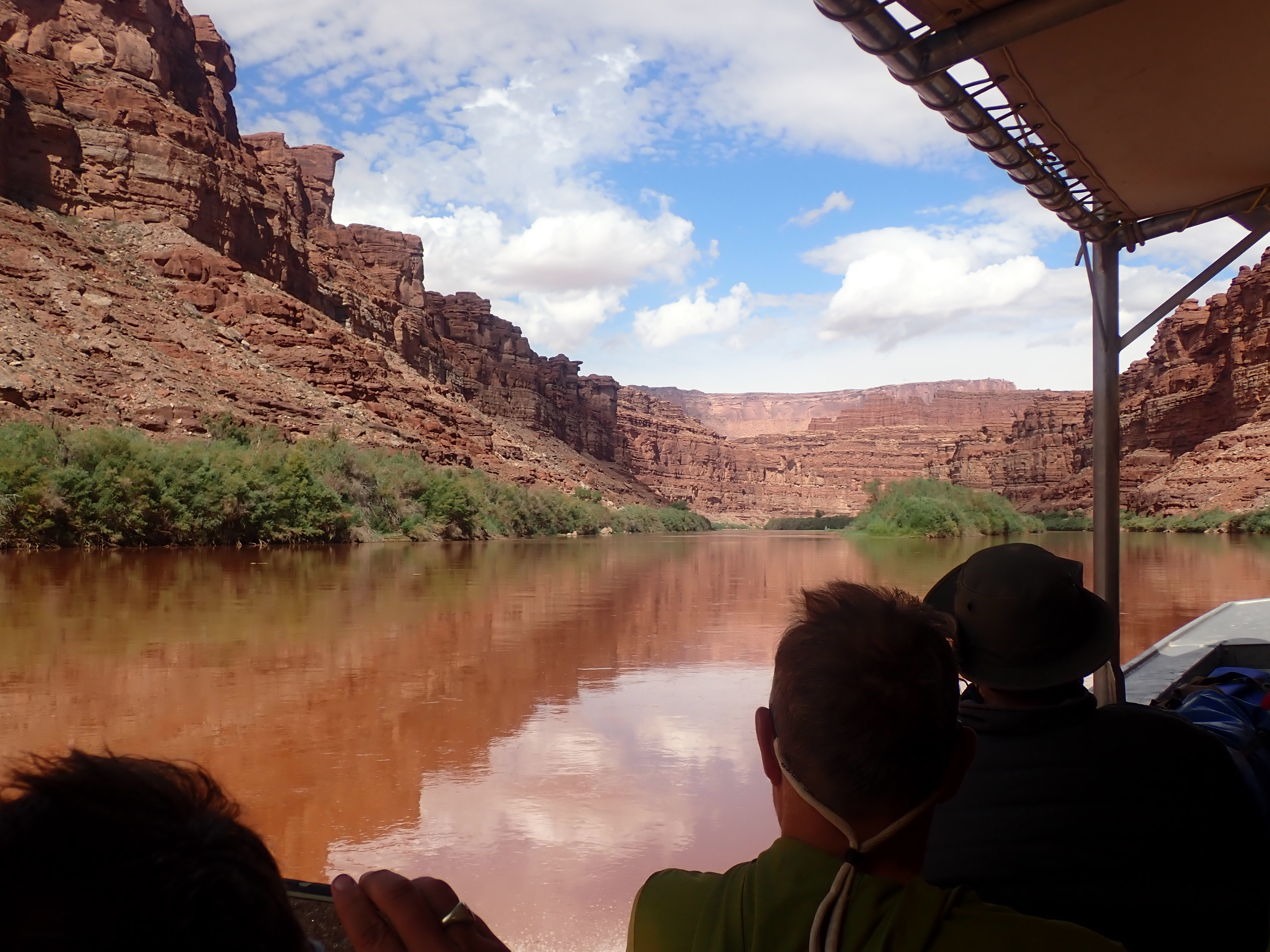
Throughout the morning, we noticed that the skies above were changing. By early afternoon we found ourselves in the middle of gusting high winds, rain and hail. The temperature changed quickly from being very warm to very cool. We located a small sand / rock bar where we took some shelter from the passing storm. After a short time, we shoved back off the small sand bar and within a few miles we had met up with the Colorado River. The canyon opened up some here as we paddled on down the Colorado to our final camp at Spanish Bottom. It was located just above a more adventurous section of the river called Cataract Canyon. I’m pretty sure I would enjoy that section more in one of my whitewater kayaks vs my currently overloaded canoe.
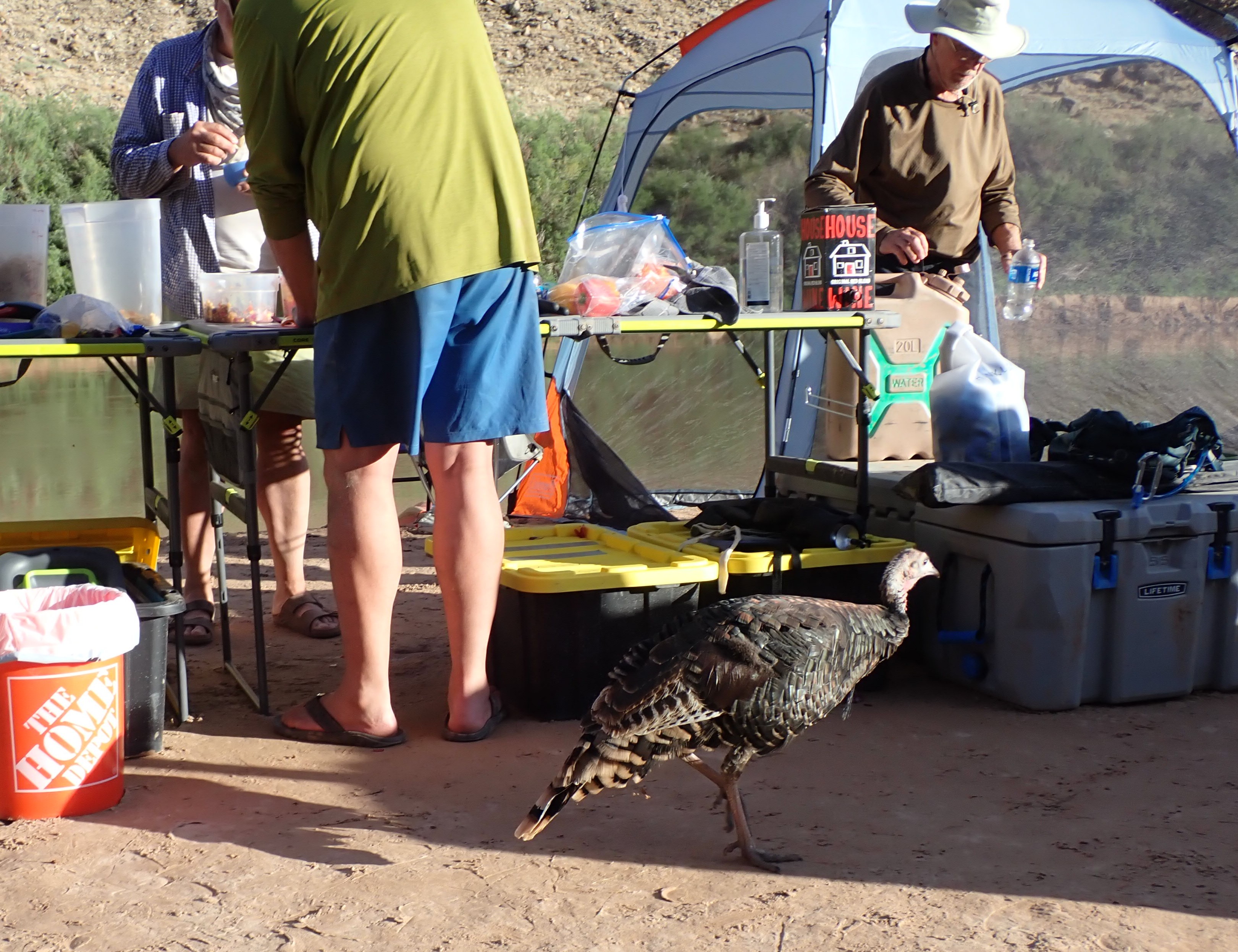
Shortly after arriving at camp, several of us noticed a large bird flying downstream across the river from us, when it suddenly took a turn and swooped in on the beach with us. That large bird turned out to be a turkey. We pretty much concluded that this may be one of the smartest wild turkeys known to exist or that she may have been truly mentally handicapped. Either way we quickly realized that this was her beach, and she was definitely the mayor of it!
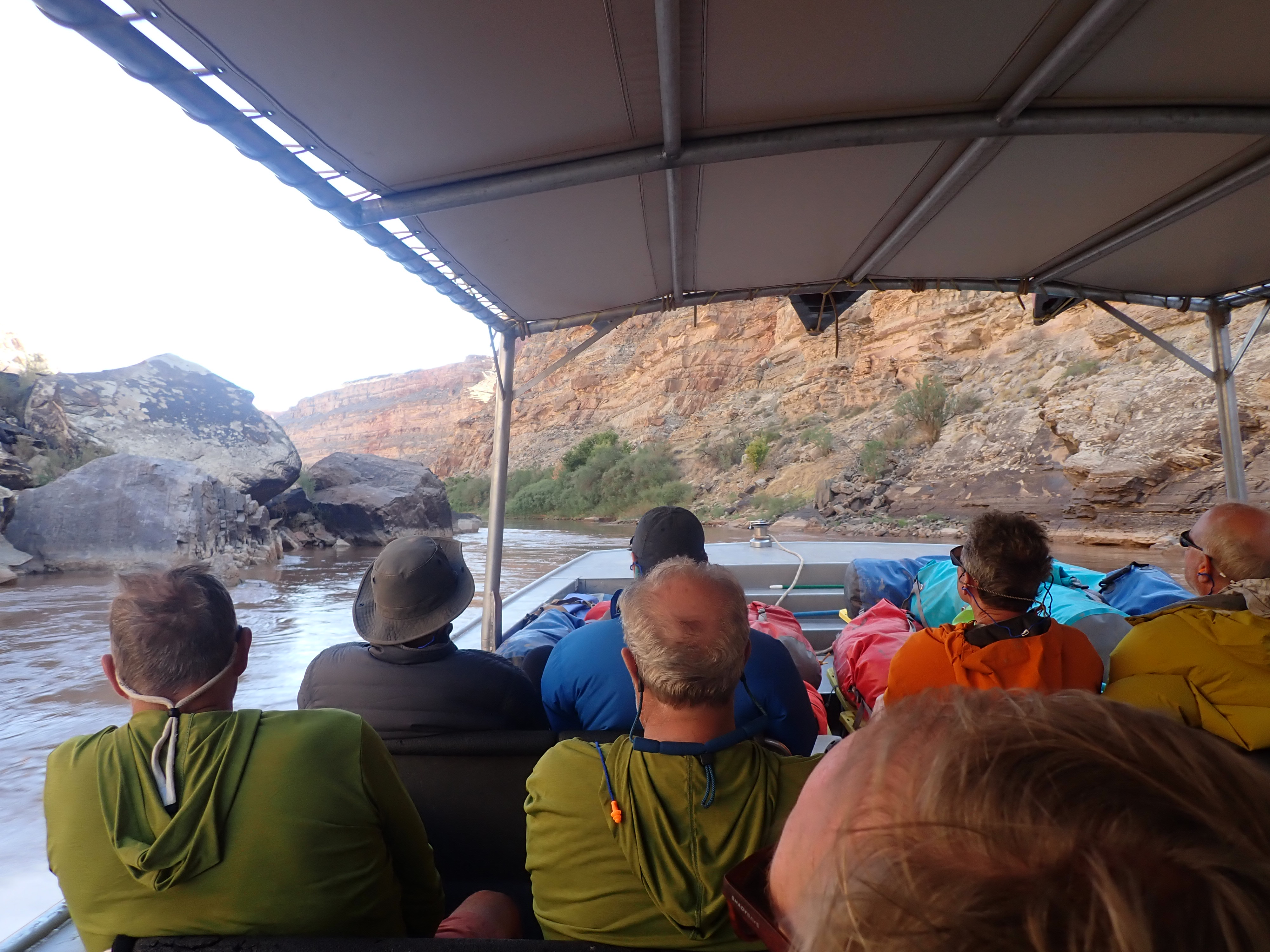
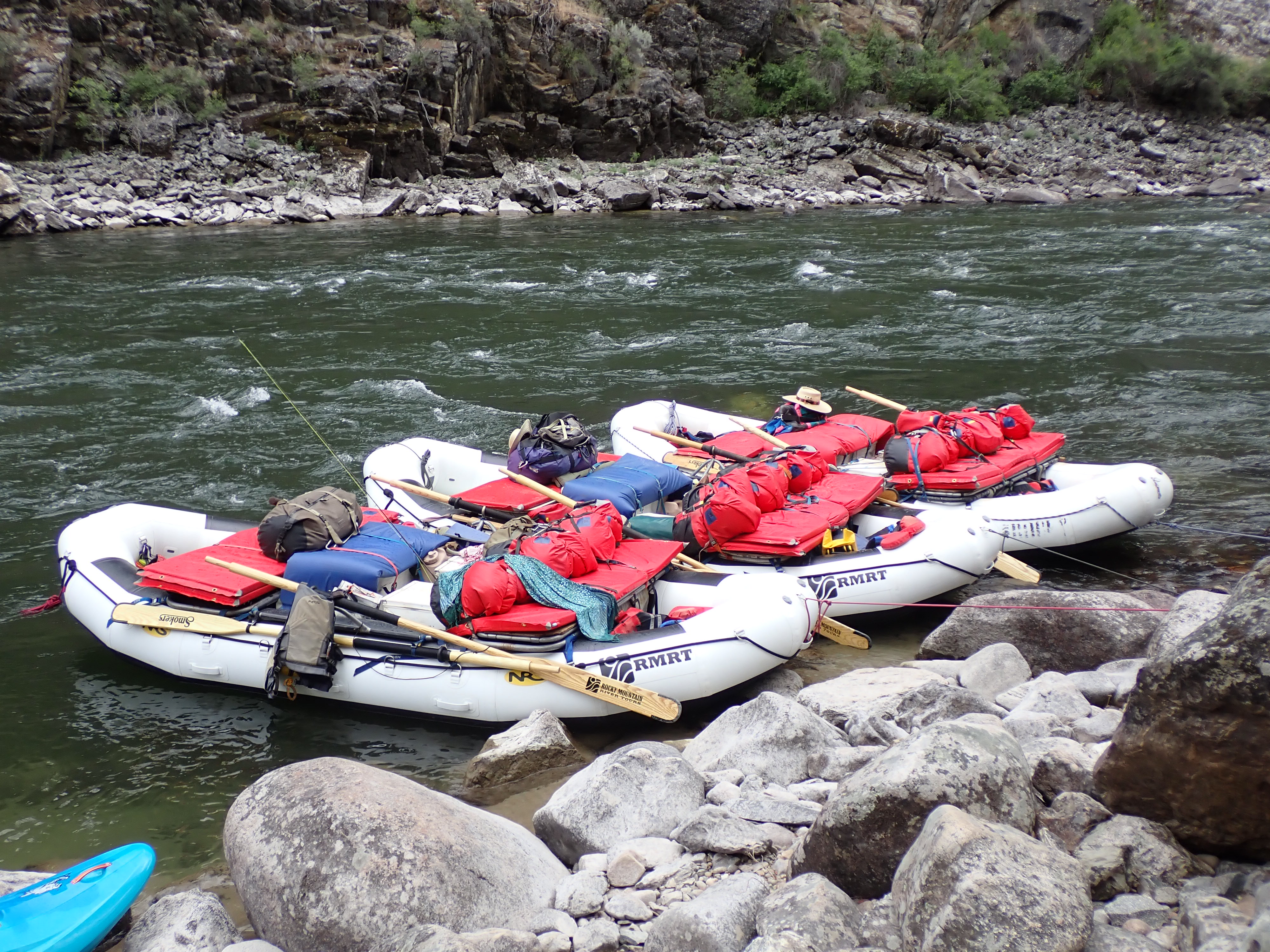
Saturday, September 13th – We woke up early for coffee and breakfast, along with our newfound turkey friend. The day mainly consisted of getting the gear loaded on the jet boat that arrived around 10:00 a.m. that morning to pick us up and headed back upstream on the Colorado River towards Moab and the Potash Boat Ramp.
Wow, what a fantastic trip! Thanks for the invite, Bob! It was great privilege to meet and get to know some new folks!
A short video clip from our jet boat ride back up the Colorado River heading towards the Potash takeout near Moab.
Slideshow of some of the crew along on this adventure. Thanks to Gerry Senechat for sharing his photos as well.
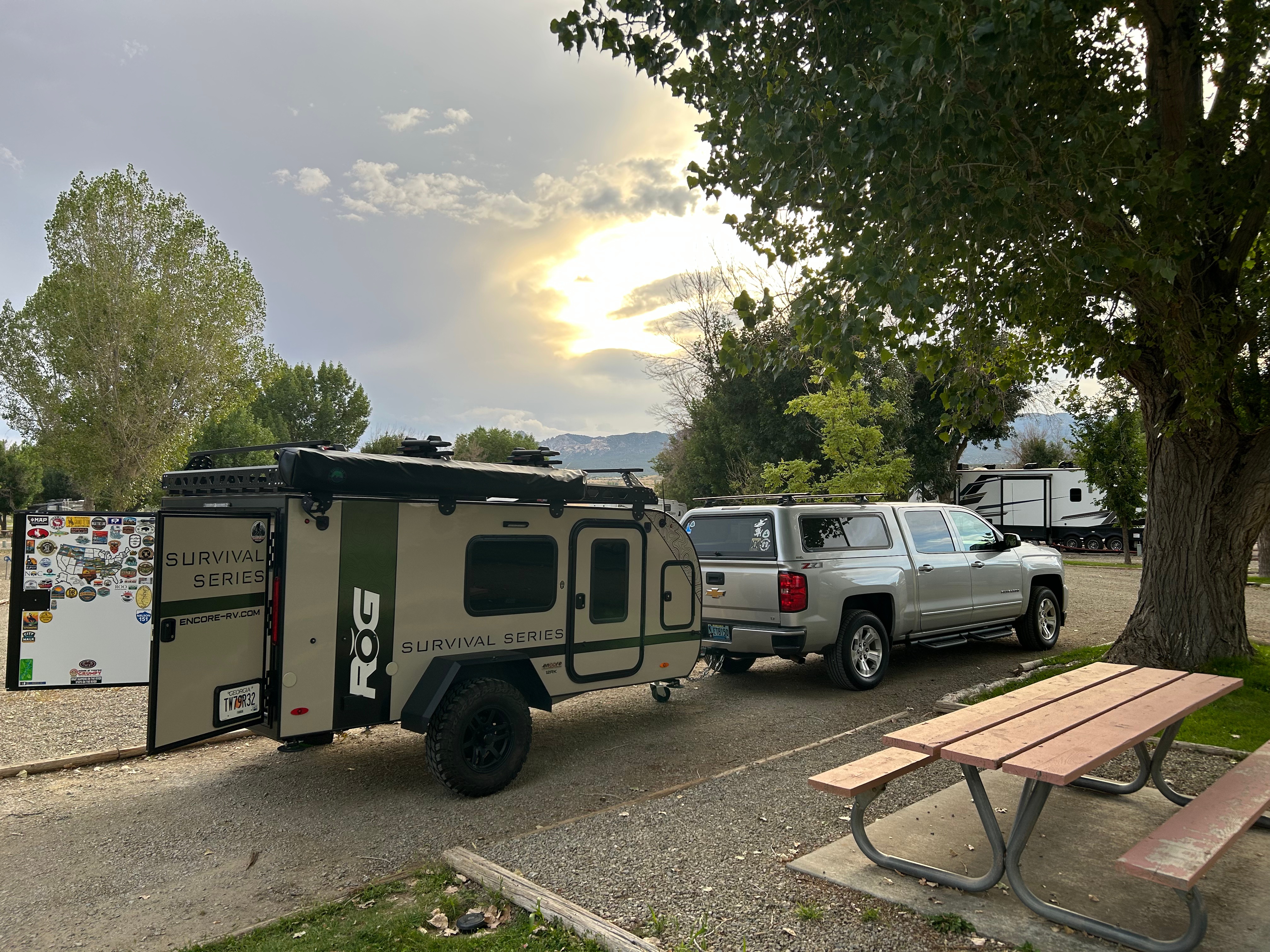
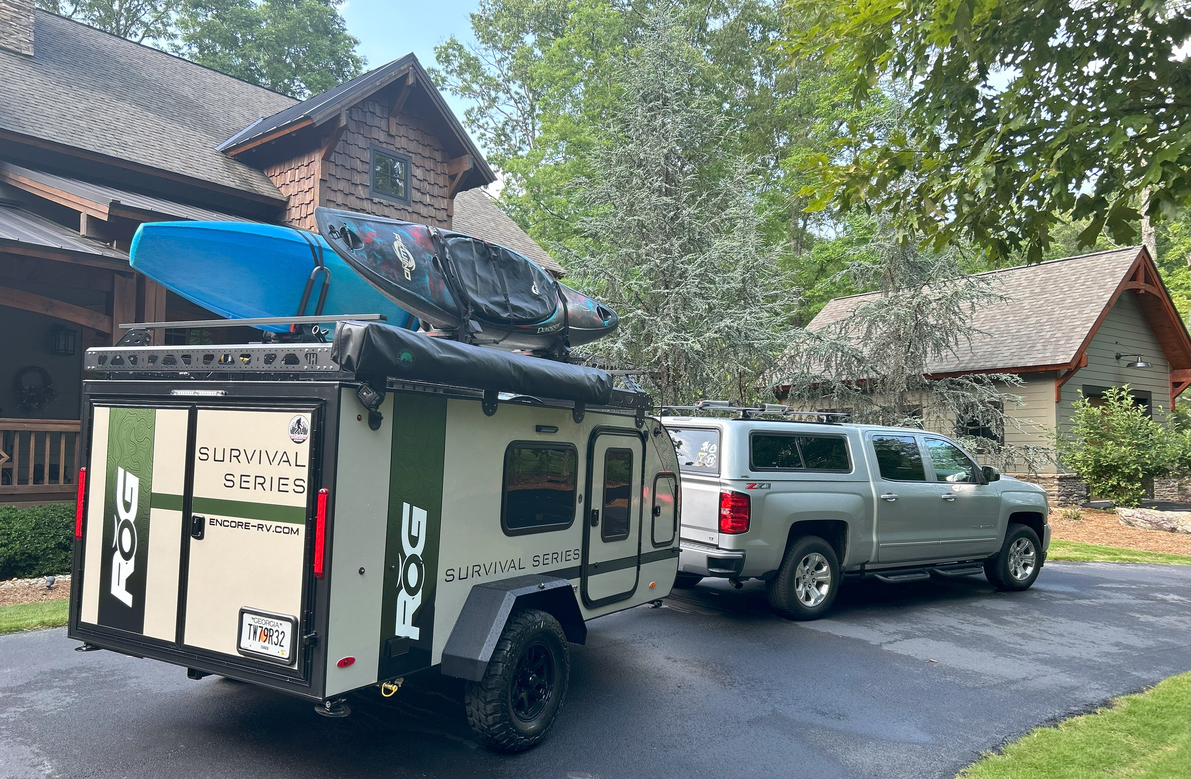
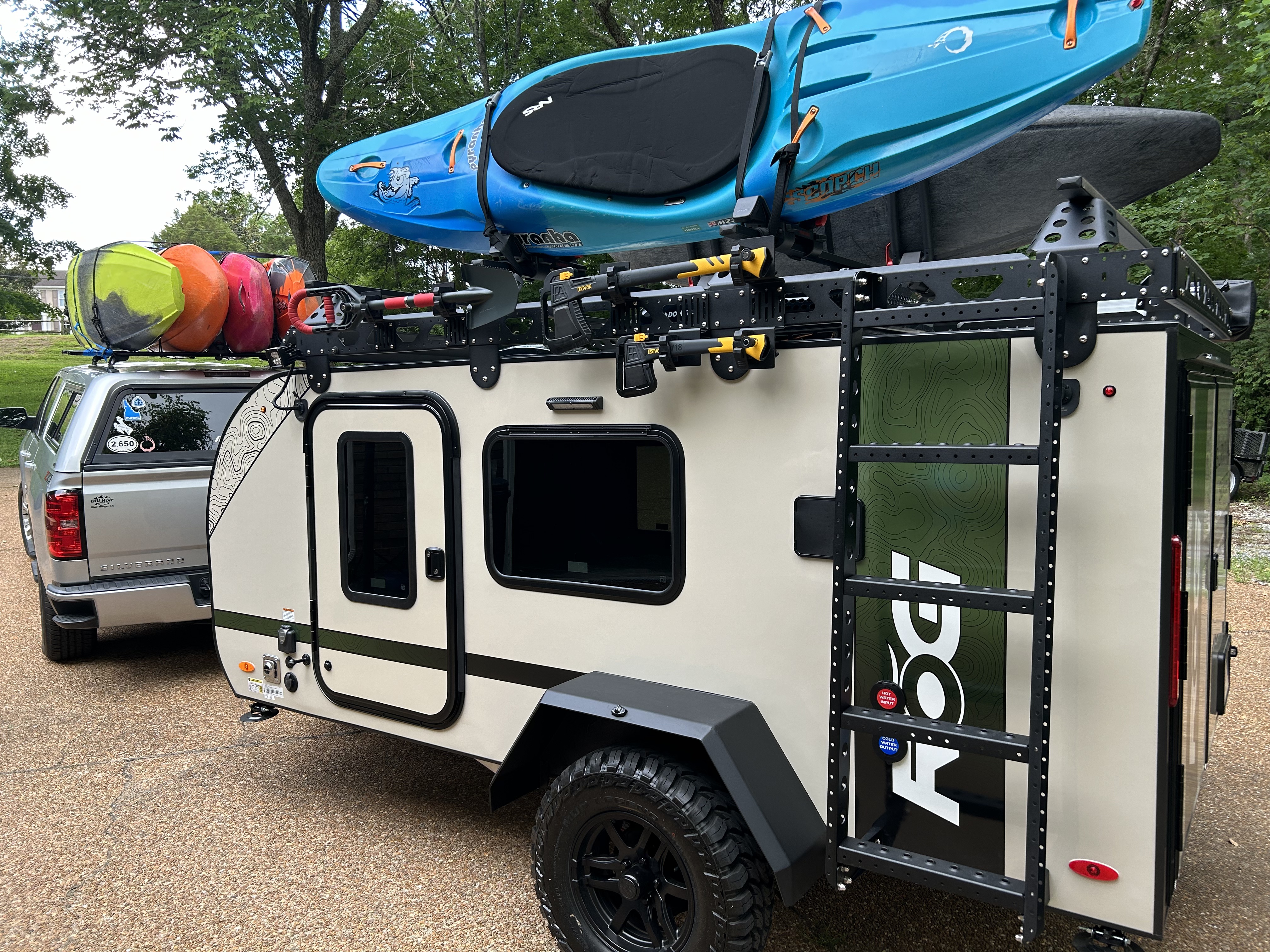
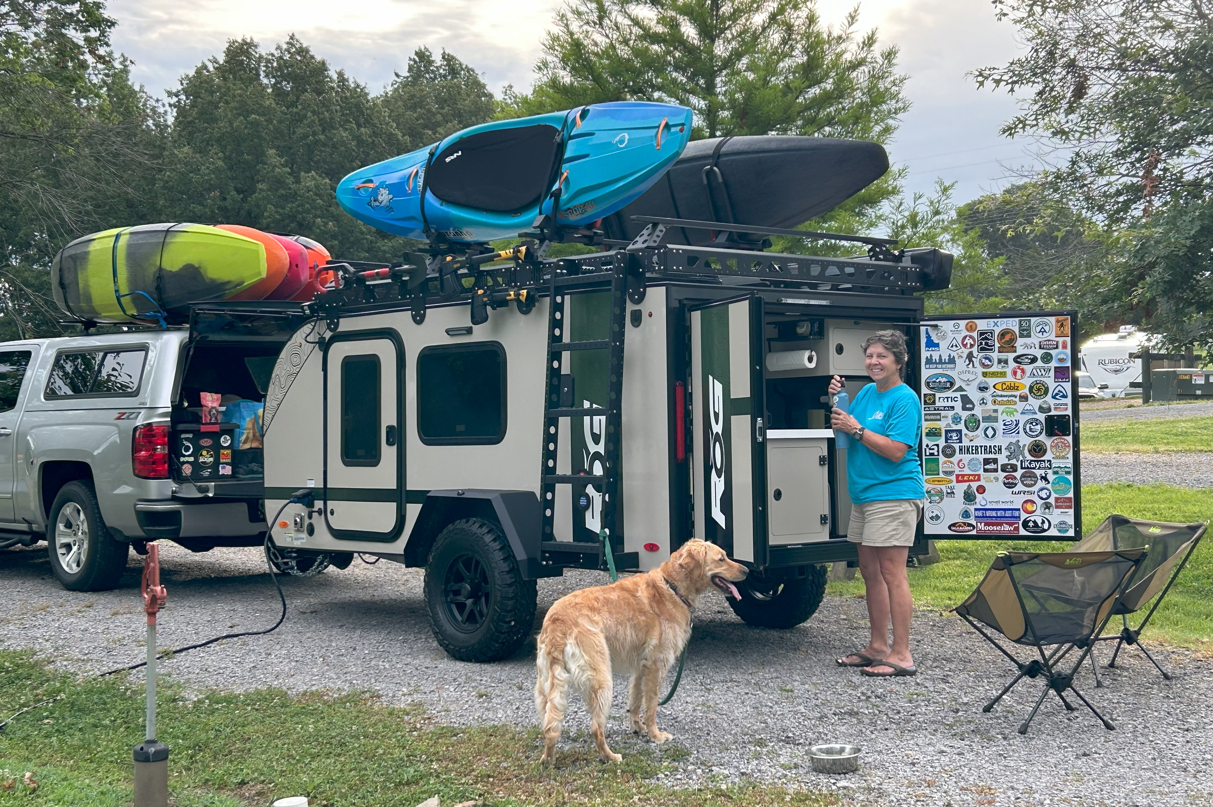
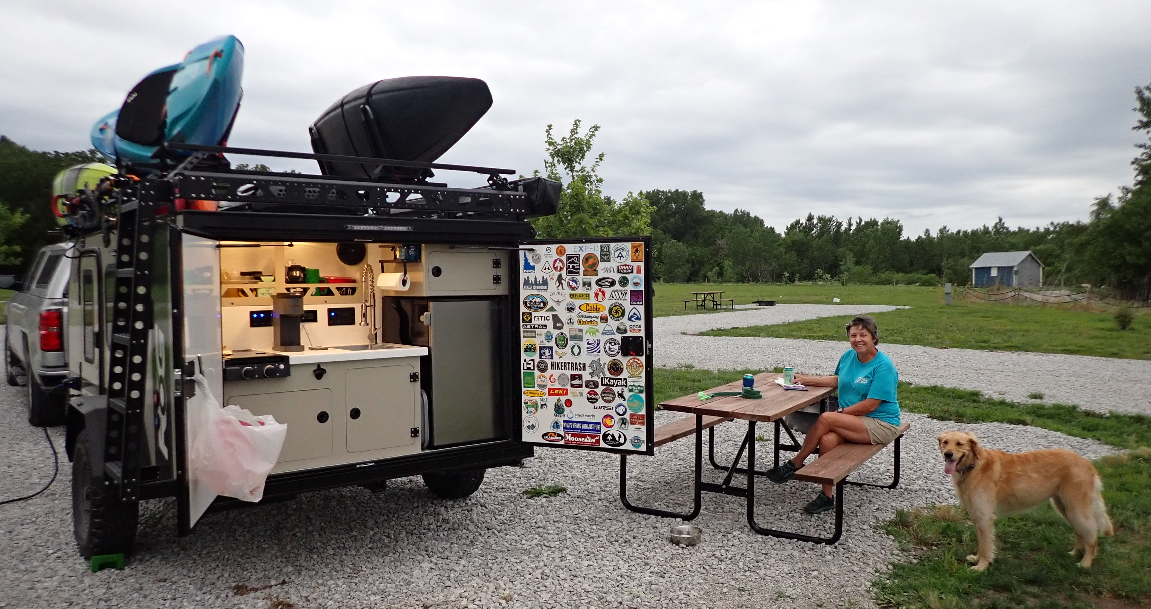
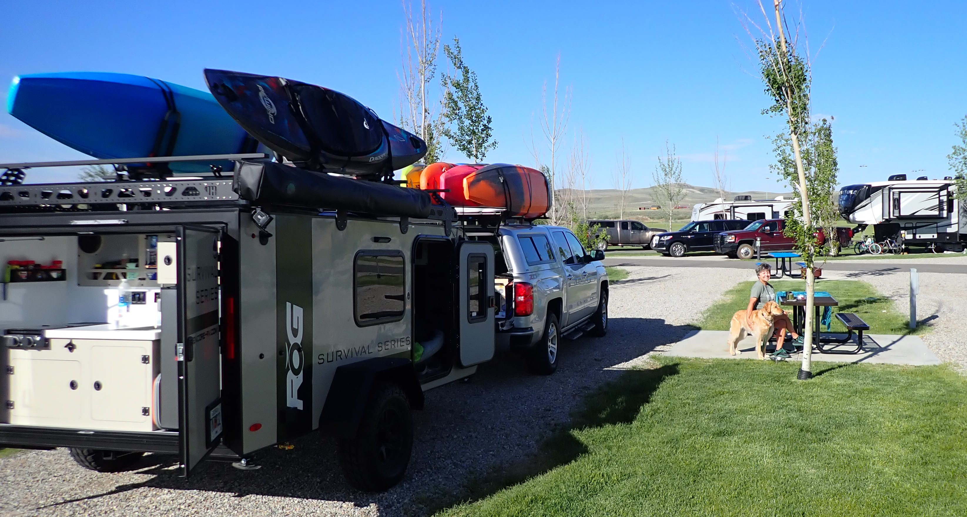
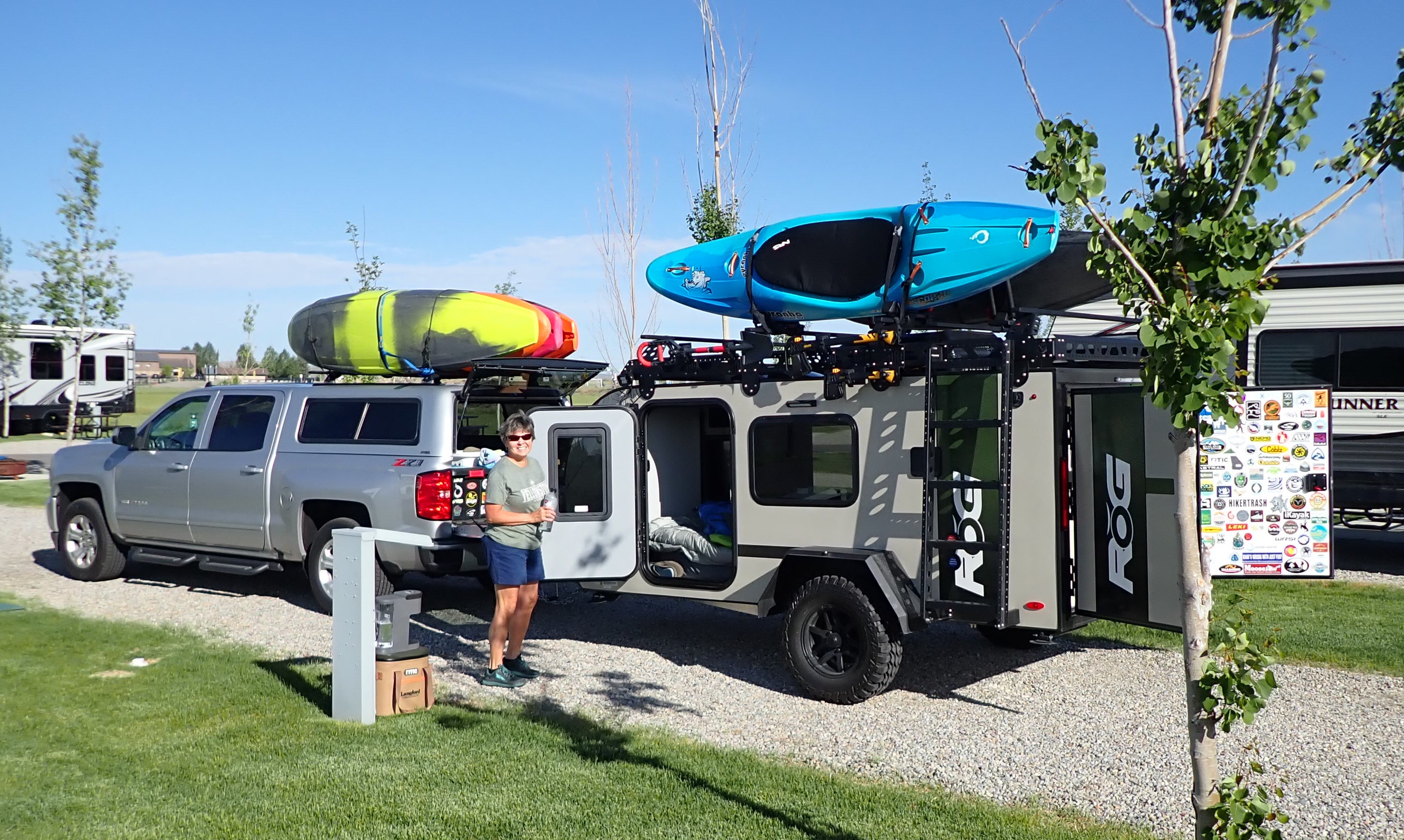
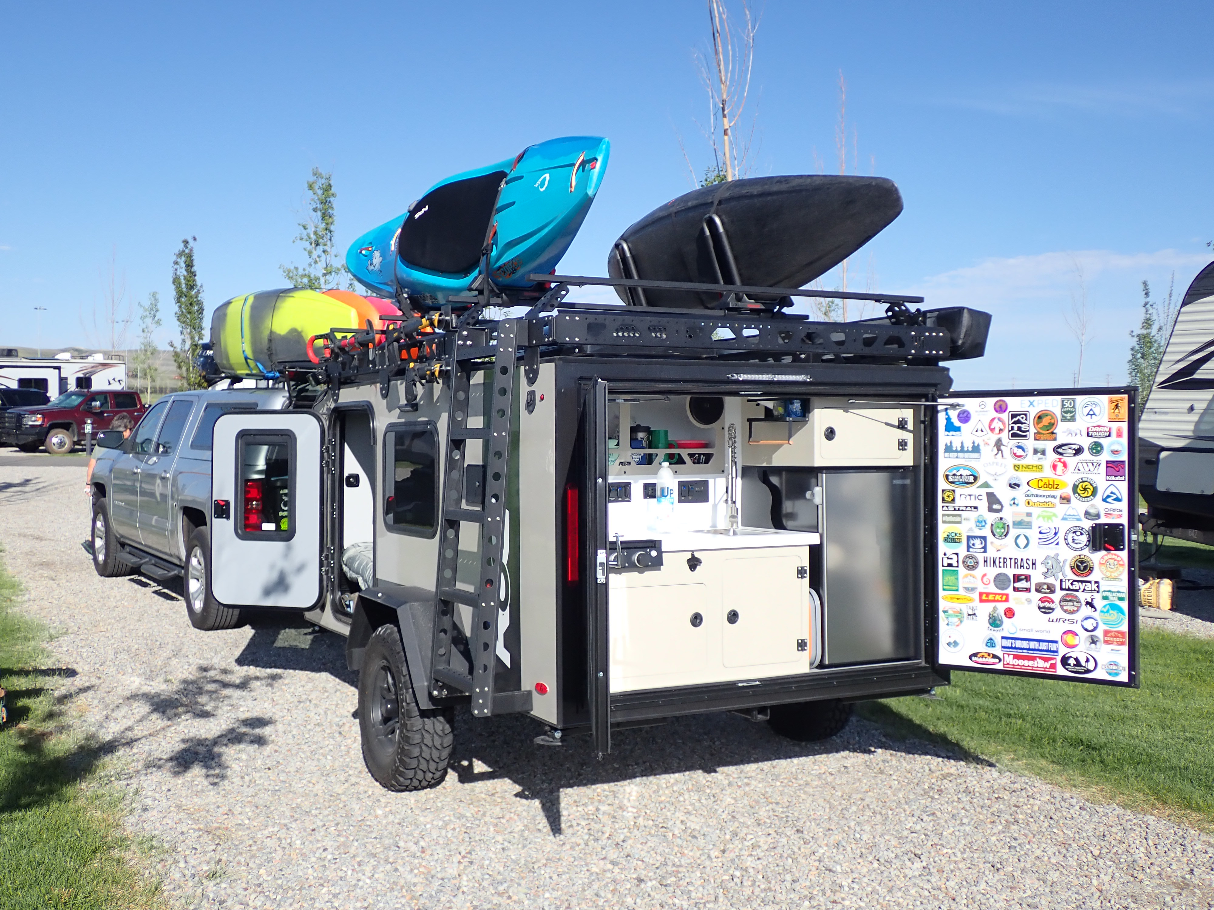
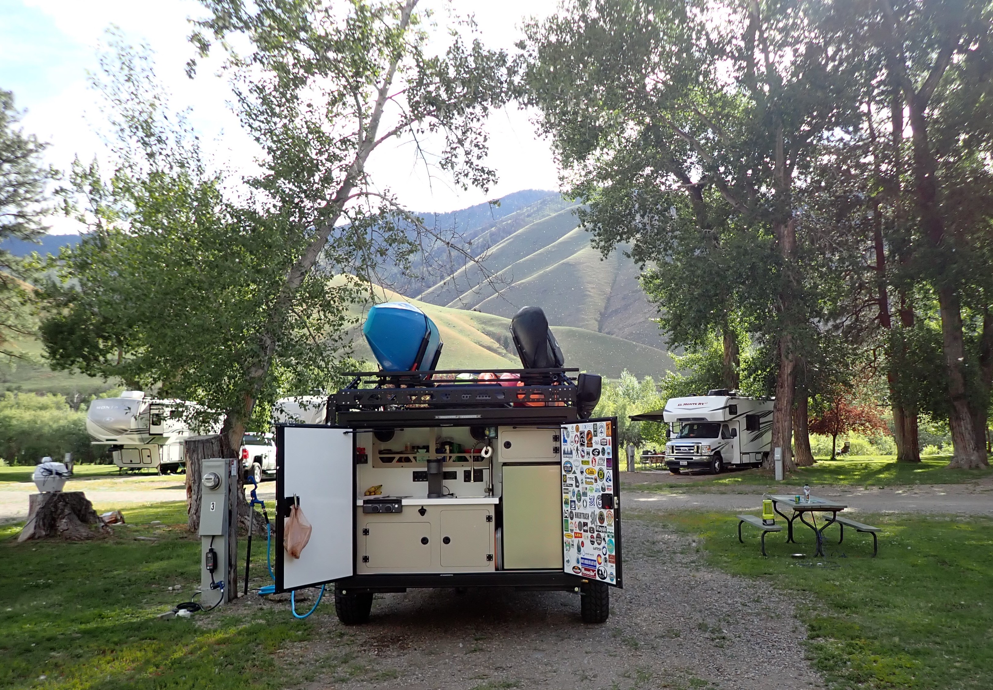
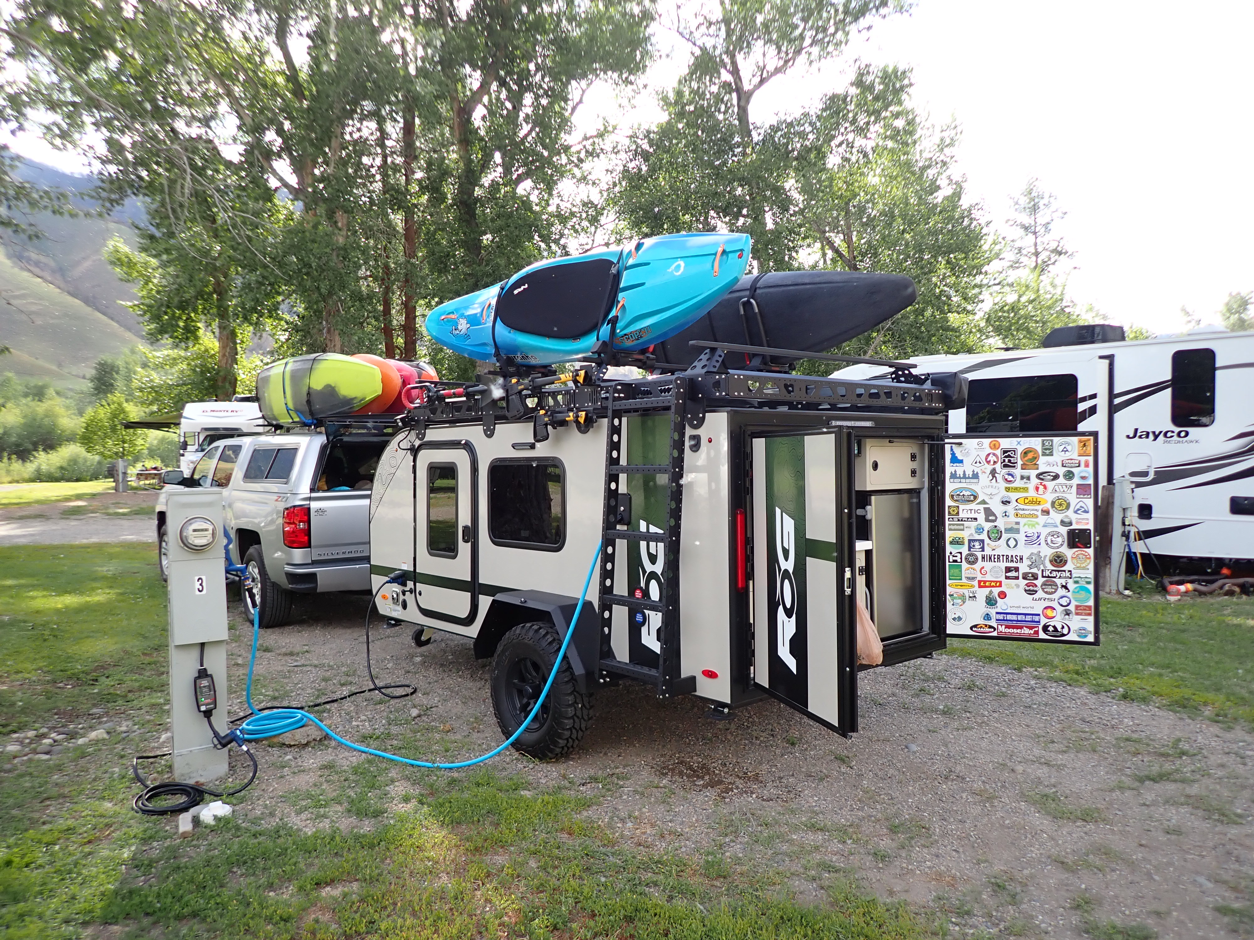
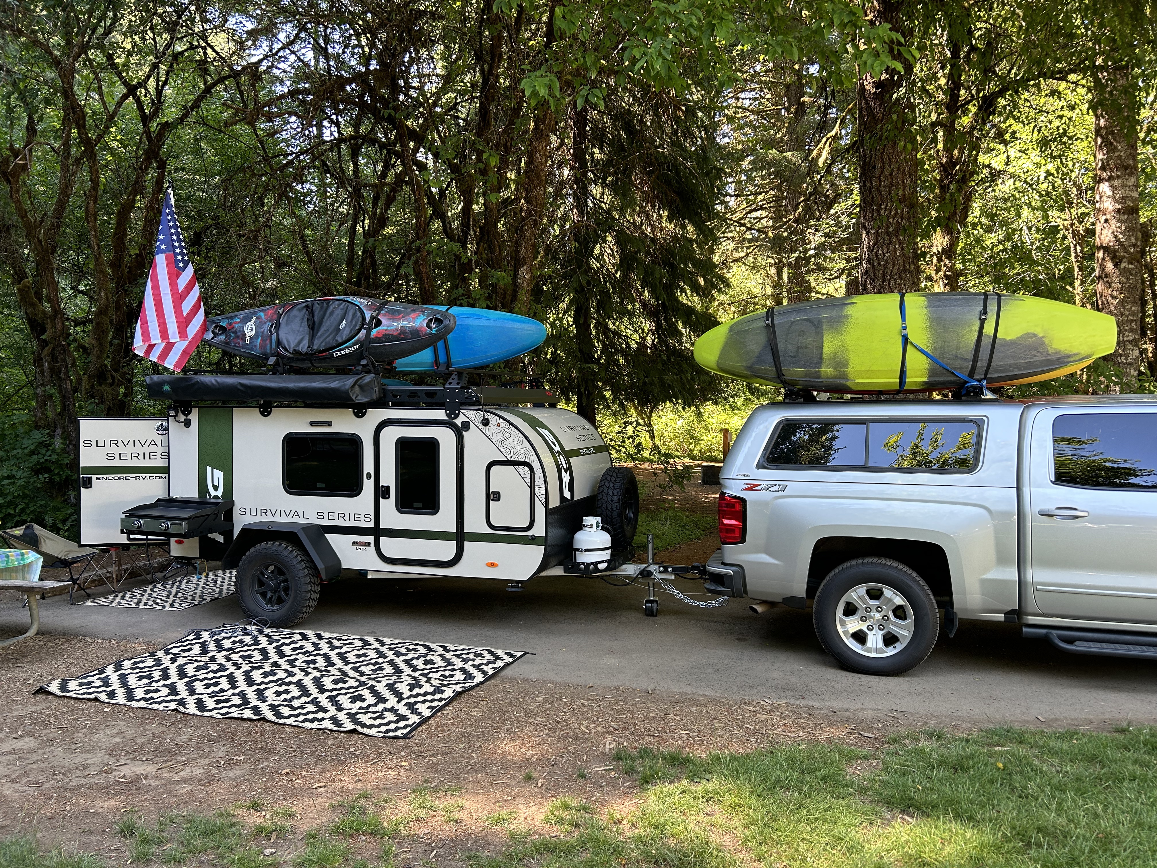
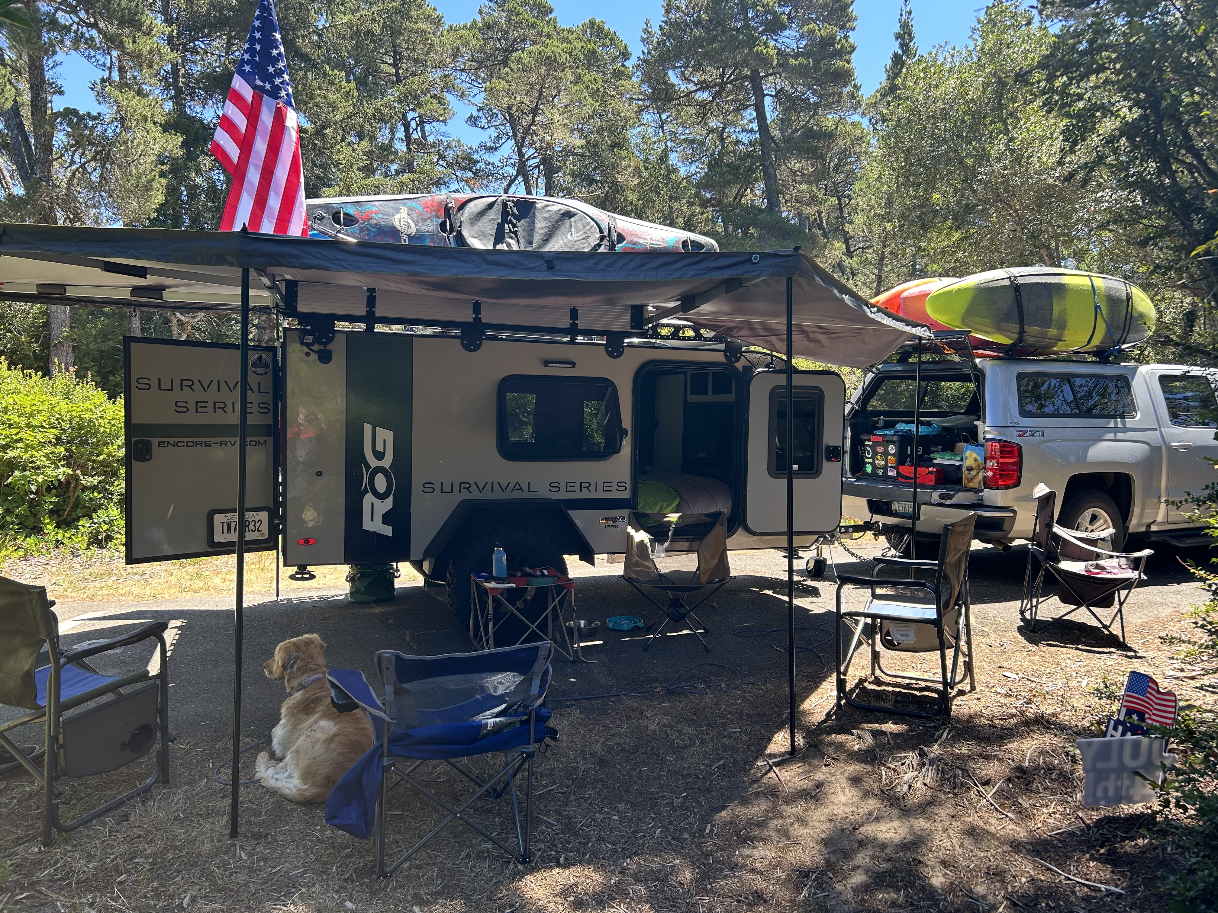
After several years of researching vans and campers, David finally settled on purchasing the ROG made by Encore. He read many reviews, checked out their Facebook owners page, and we went to see one at camper show. It has turned out to be wonderful! He’s had fun and has done a great job finding accessories and making it super comfortable.
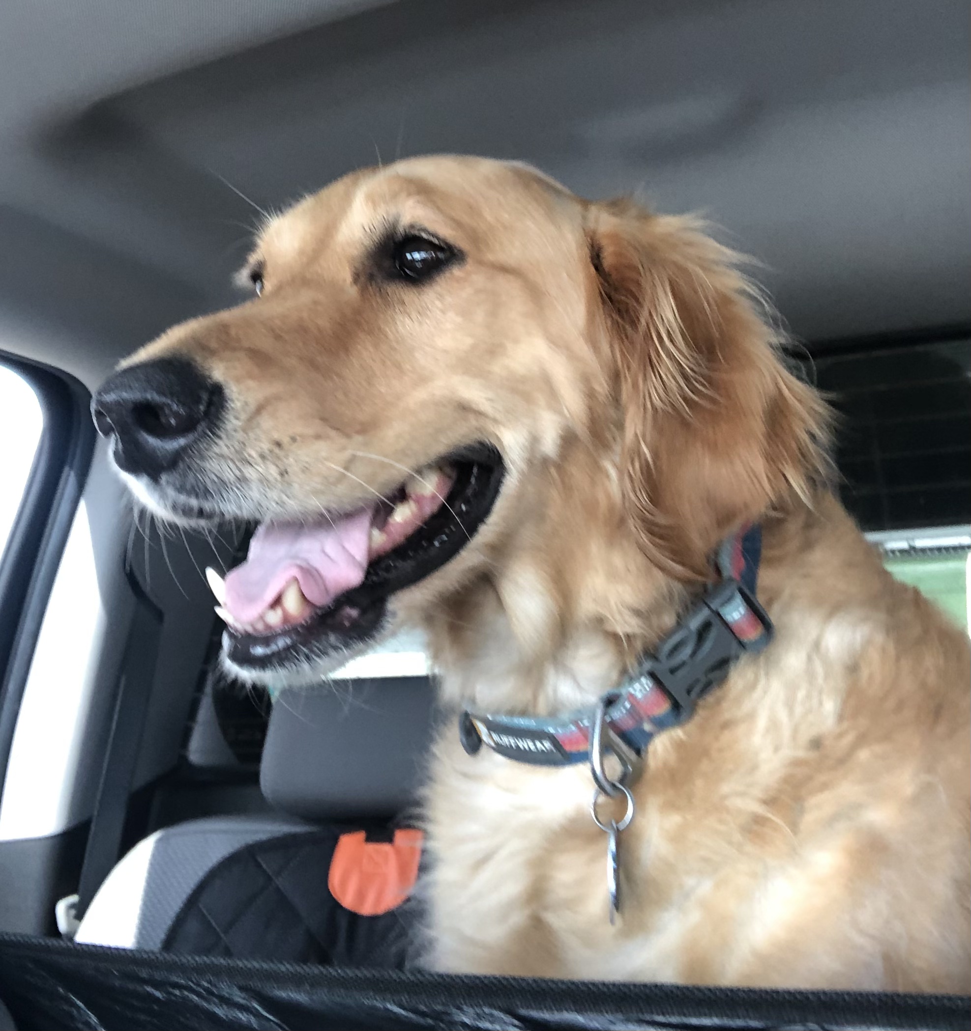
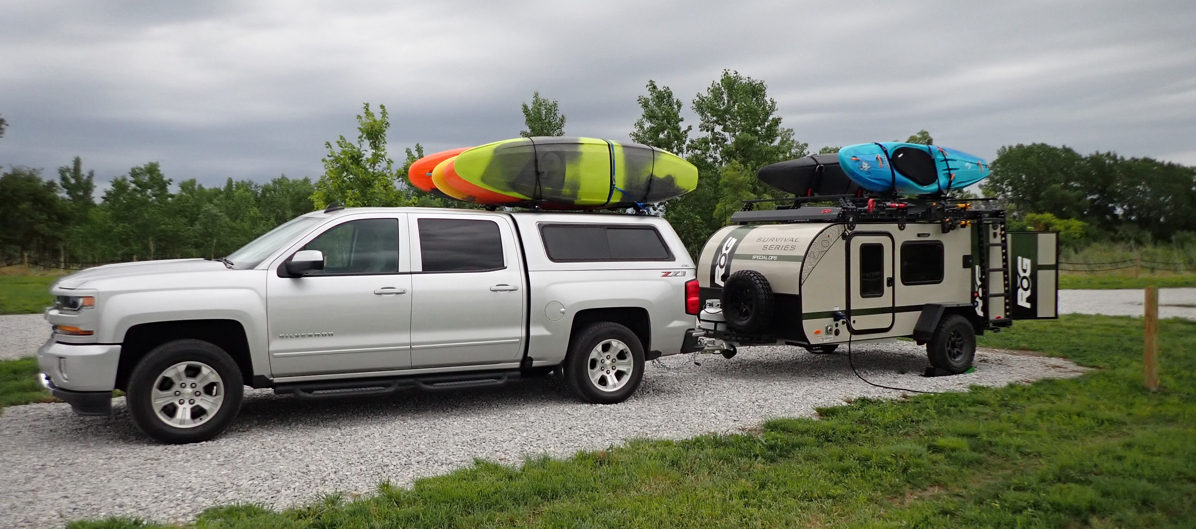
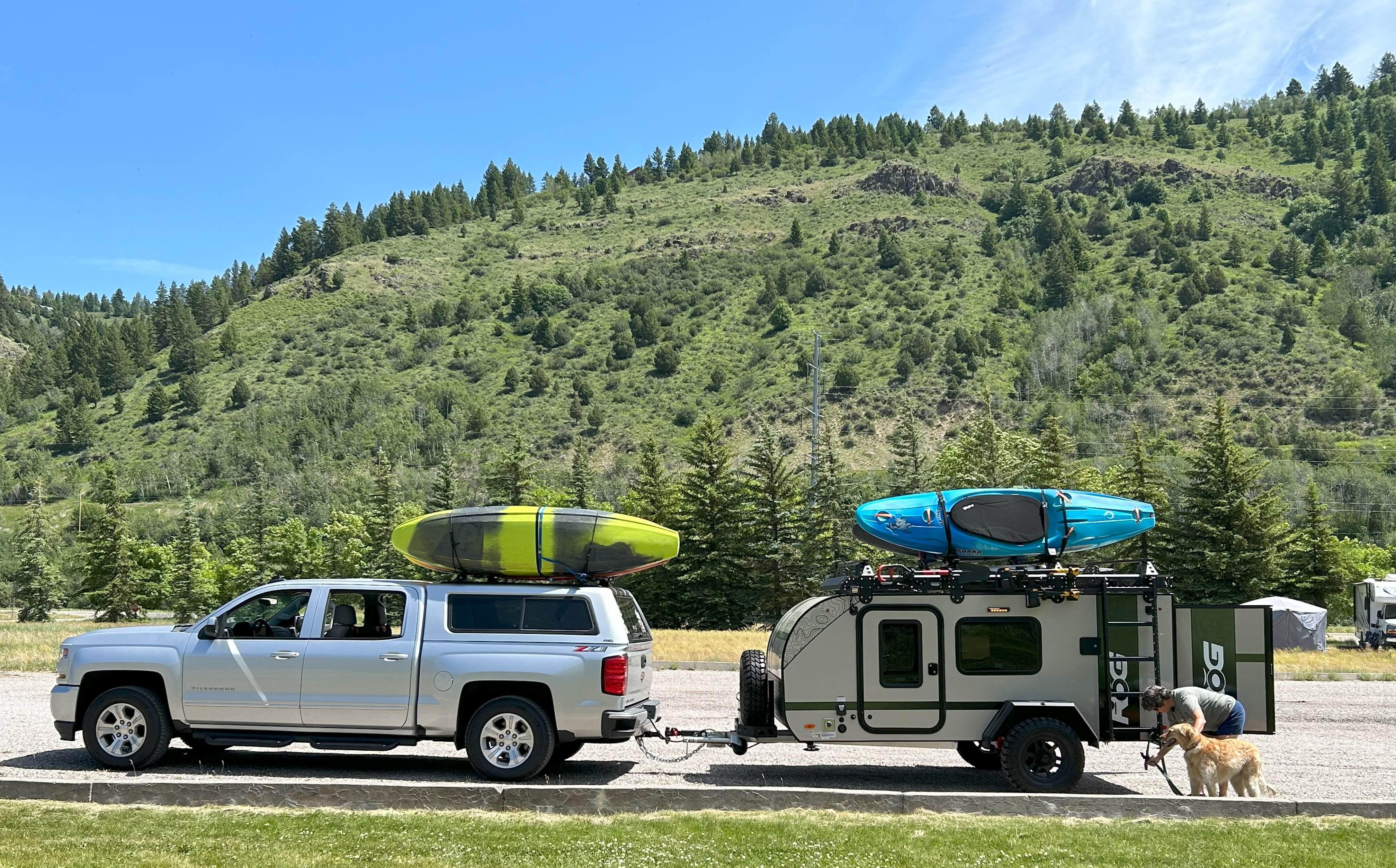
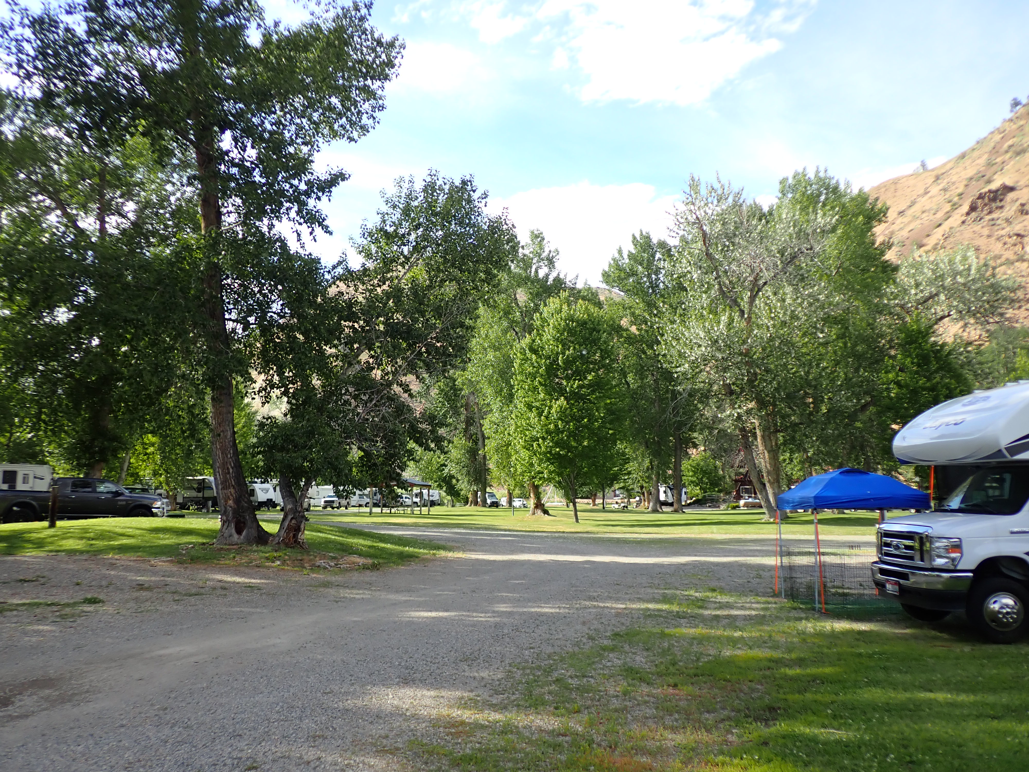
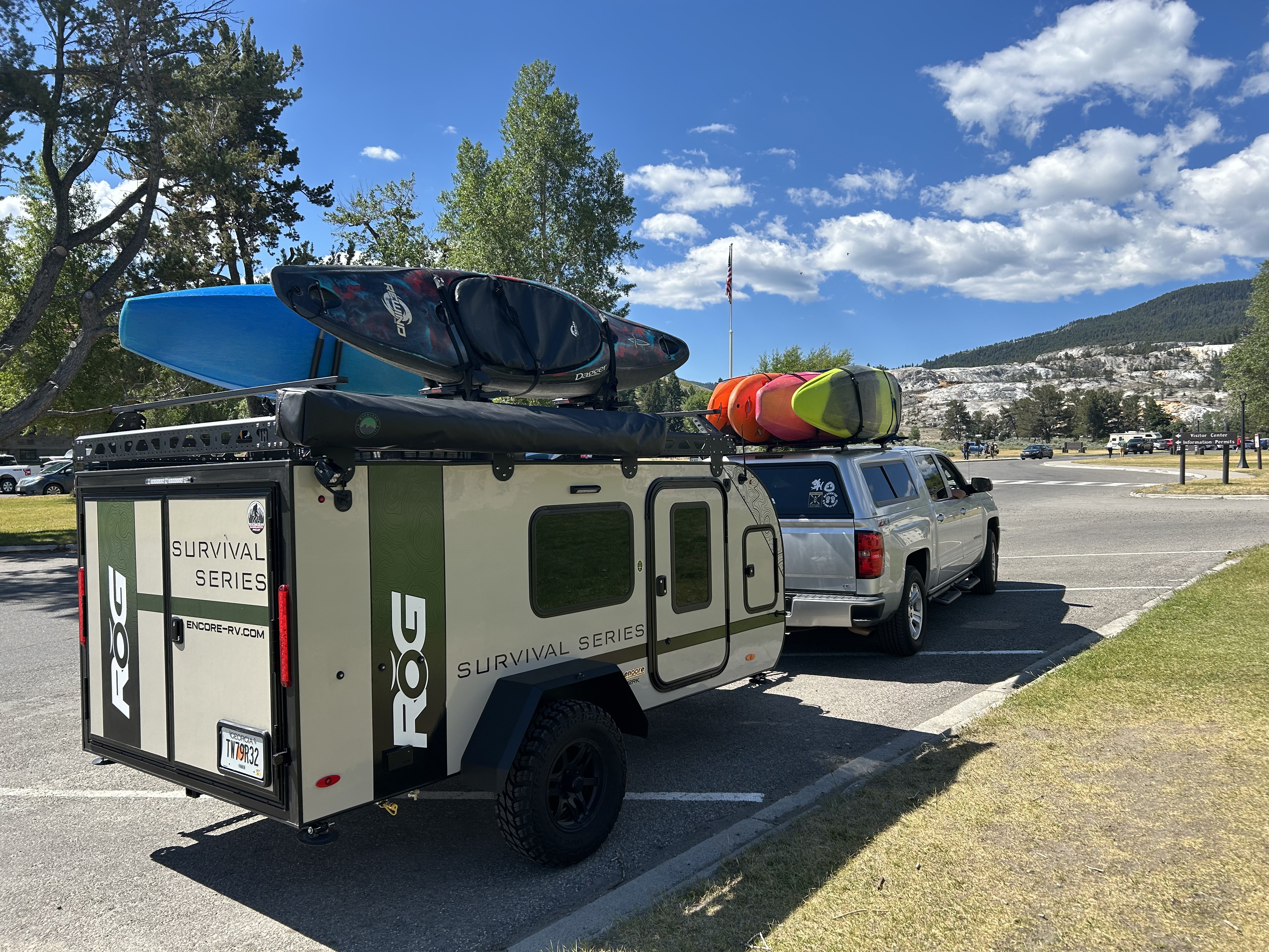
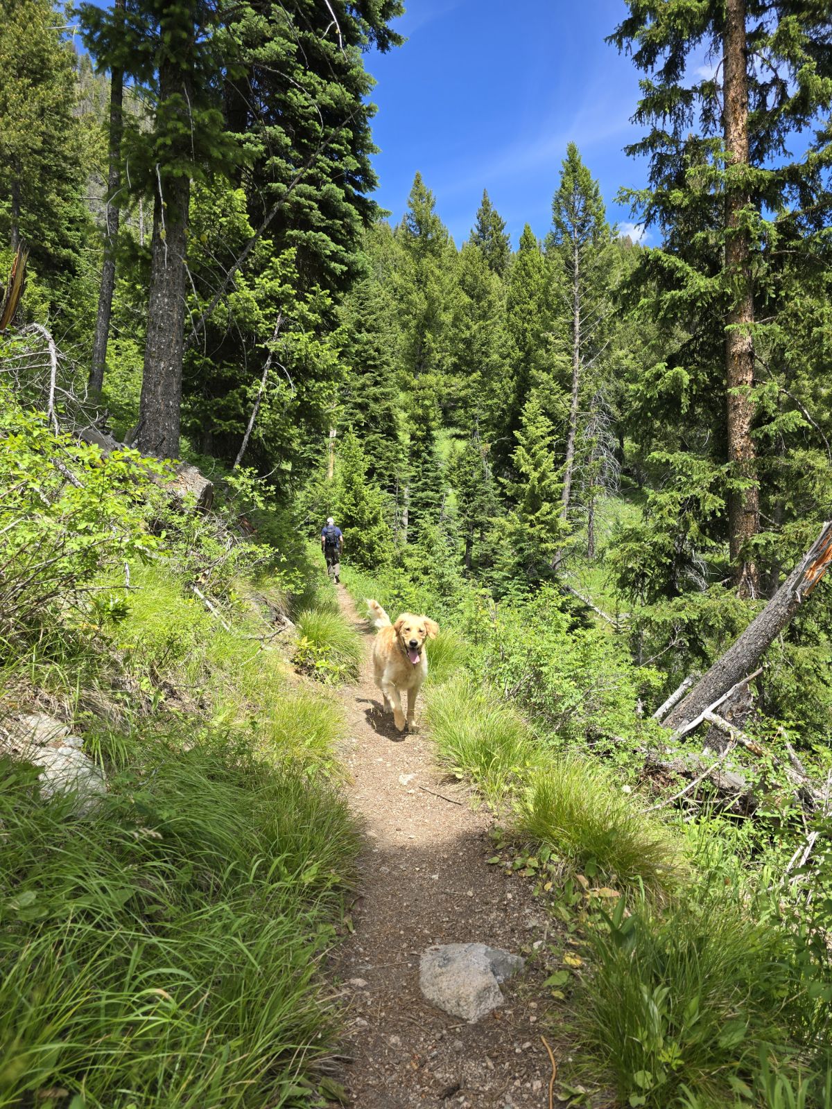
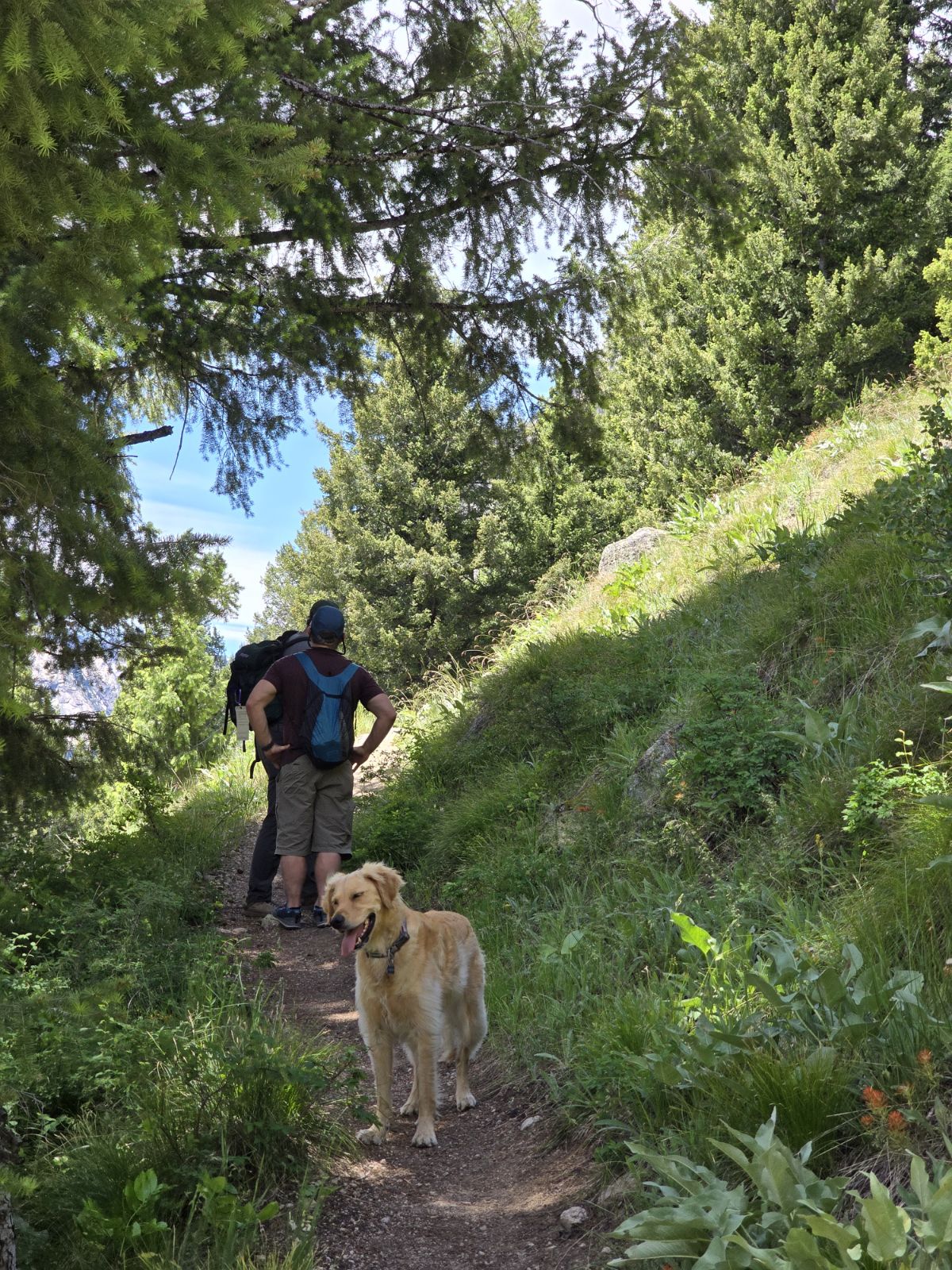
So, on Monday, June 17th, we hit the road loaded up with 2 kayaks on the ROG for the Middle Fork trip, lots of camping gear and Millie. She settled right into her hammock in the back seat of the truck complete with her pillow bed and a large towel to scratch up into the perfect nesting spot. We left home just before noon with 128,069 miles on the Silverado odometer. Soon we stopped at Bob and Sandra’s house in Franklin, Tennessee to load 4 more kayaks on the truck. Later that day, we picked up groceries and sandwiches at a Publix and proceeded into Kentucky and on to southern Illinois where the rainy evening gave way to a gorgeous orange and blue sunset. Our first night was spent in Site 42 of Shawnee Forest Campground, a former golf course on a hill, in the tiny town of Vienna, Illinois.
Tuesday, June 18, 2024
We woke up early after a good night’s sleep on the big comfy mattress with the air conditioning in the ROG keeping us cool. After exploring the grounds with Millie, quick showers, and enjoying coffee made in our little camper kitchen, we headed toward Missouri. Our first site of the arch in St. Louis was around 11:00 AM. We traveled through Missouri, briefly into Iowa and on into Syracuse, Nebraska to Rivers Edge Campground. It was very small with 14 sites and we were the only ones there except for one other car camping couple. The skies remained cloudy, but we had no rain and slept well with the AC on again. For someone who wasn’t too sure at all about giving up tent camping for a camper, I quickly decided that the convenience of just pulling in, plugging in electricity, hooking up water, and having the option of air conditioning was pretty wonderful! 😊
Wednesday, June 19, 2024
Millie decided that we should rise early again. It was super having coffee quickly made in our new one cup Keurig that David decided the day before that we must have in our camper kitchen. It was super easy and convenient. After letting Millie have a walk about in the campground, we hit the road again and stopped later for a break at a beautiful rest area covered with green grass and huge cottonwood trees. About midafternoon we crossed the state line into Wyoming. After a dinner stop of salad from Love’s (our new favorite gas station with large pull throughs, grass for Millie, good snacks, and clean restrooms), we arrived in Pinedale around 11:00 PM and pulled into the Yellowstone RV Park. We enjoyed a great night’s sleep using only the fan and open windows.
Thursday, June 20, 2024
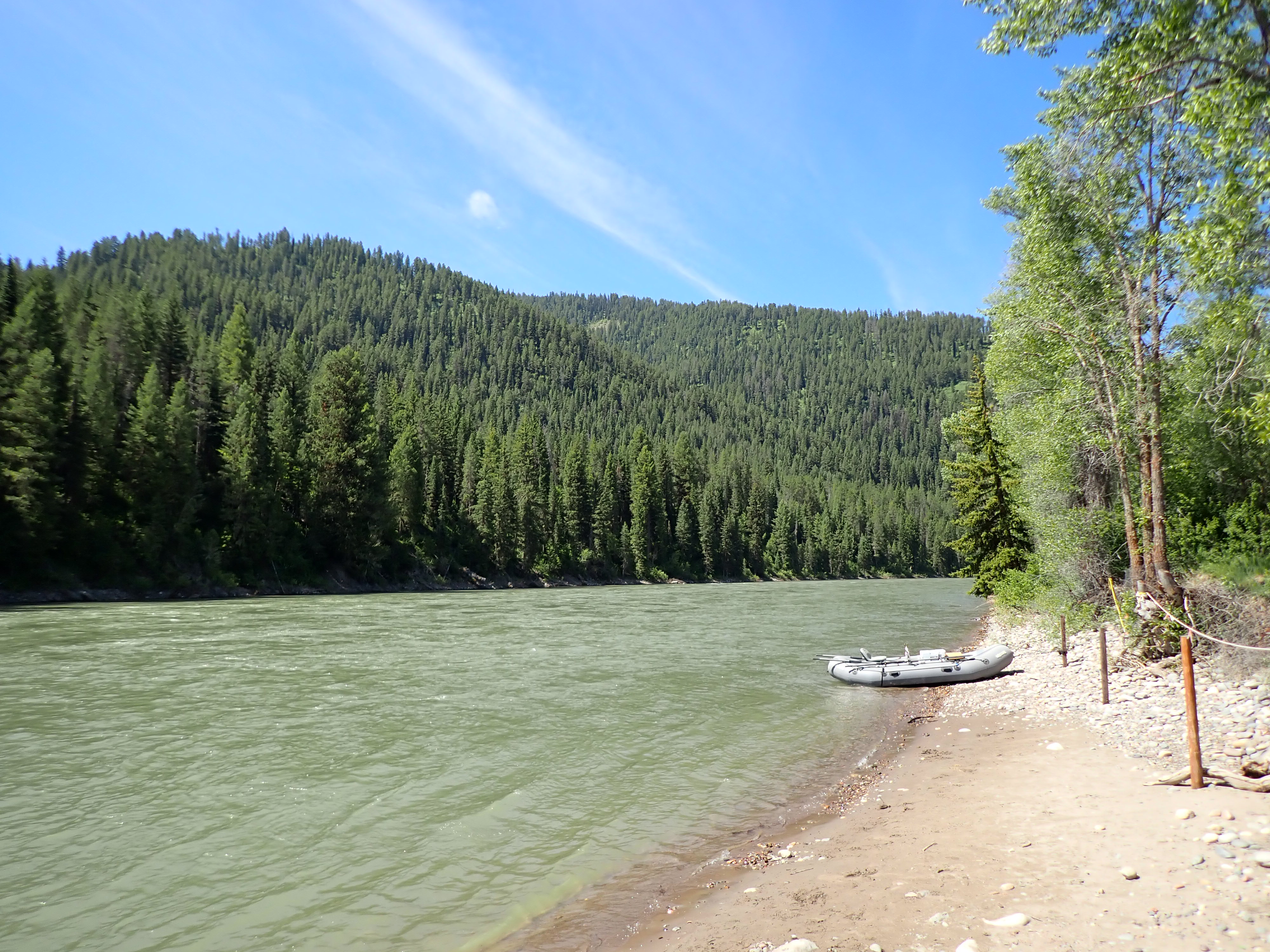
Waking up to fantastic cool temperatures in the 50’s was amazing. The RV park had the cleanest restrooms and showers ever, a big field for Millie to run in and friendly owners. It was a great stop! We took our time leaving and then headed north on WY highway 189/191. We were treated to beautiful mountain views coming through Bridger-Teton National Forest. After passing through Hoback Junction (just south of Jackson), we took a brief stop at West Table (the put in for the Snake River) and then onto through Alpine and into Idaho. We stopped for a picnic lunch near the Paradise Reservoir and Dam. The afternoon took us north up to Salmon, Idaho viewing the beautiful Sawtooth Mountains to our west and surrounded by huge yellow canola fields. Just before 4:00 p.m., we crossed the 45th parallel of latitude- halfway between the equator and the North Pole. After making a couple of stops in Salmon for gas, groceries, and a truck and trailer wash, we checked into to the Wagoneer RV Park just south of North Fork, Idaho. One of the campground host couples, Terri and Johnny from Florida, greeted us warmly and directed us to our campsite next to them. It was really nice to get into camp early, take Millie for a walk and run, and relax. The RV park was full of cottonwood trees that were shedding their cotton seed fluff. It blew around, covered the ground, and looked like snow! Dinner was simply cantaloupe, cheese, pretzels, beer and wine. We visited with our neighbors and another host couple and went to bed early to escape from the mosquitos.
Friday, June 21, 2024
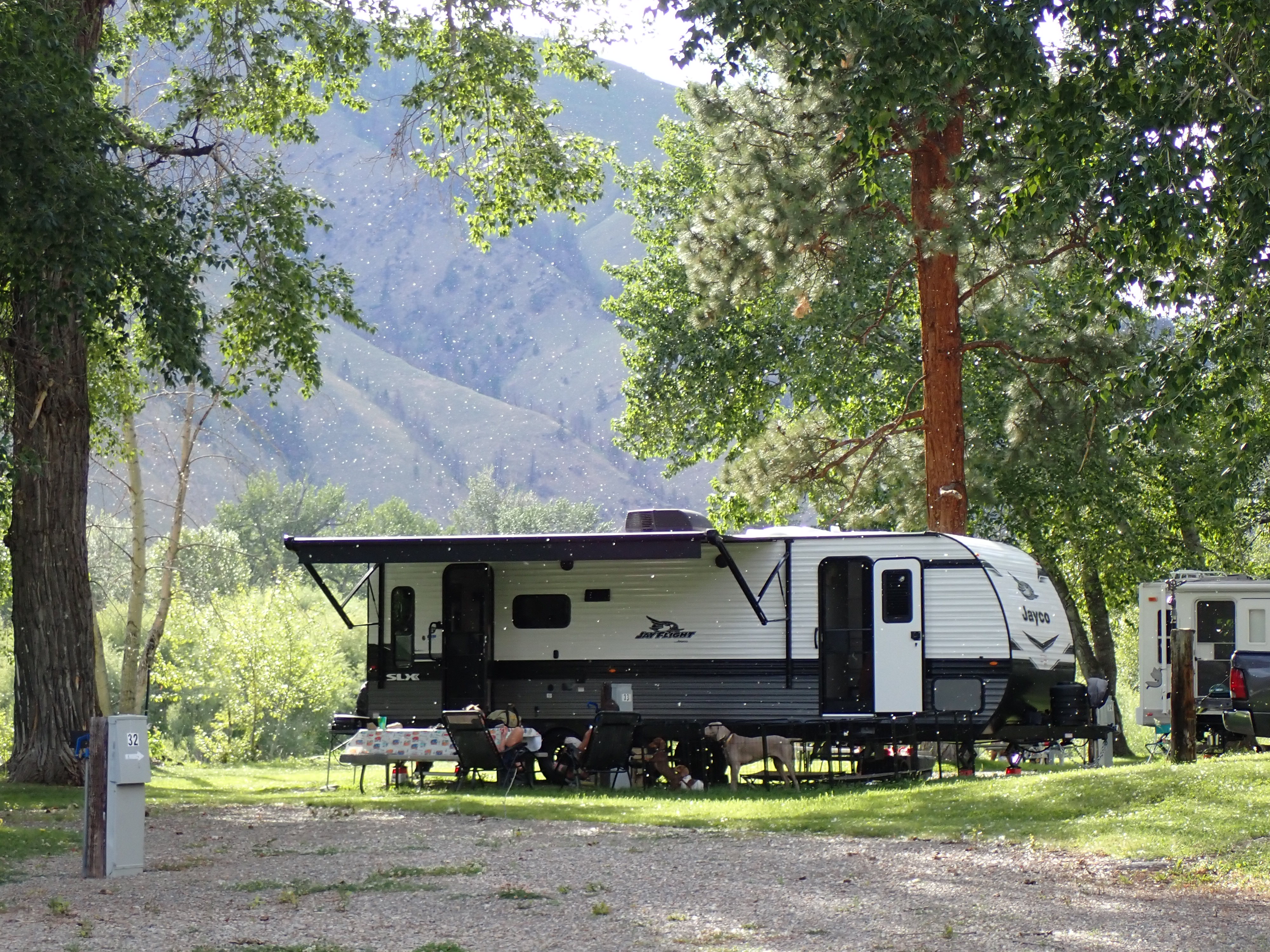
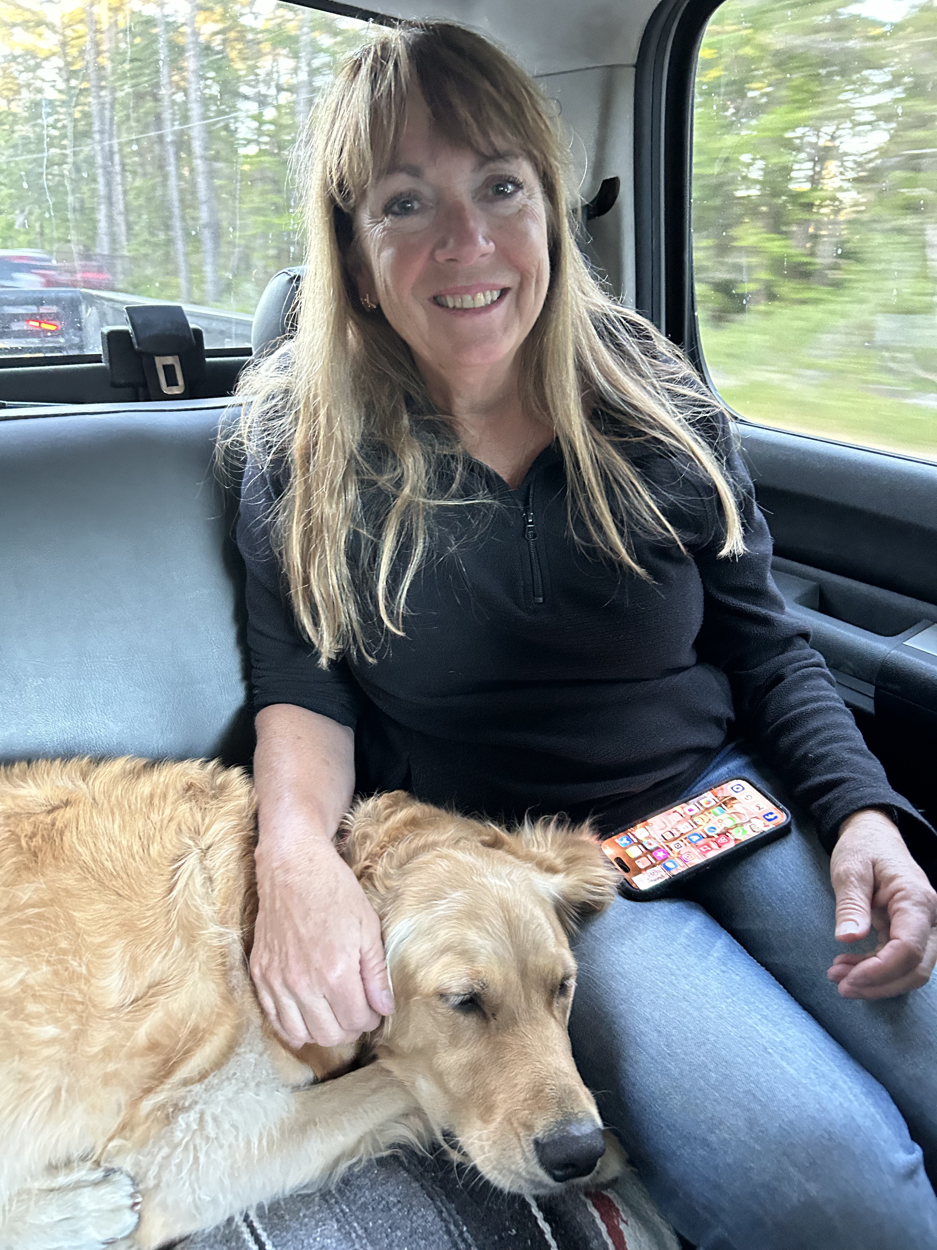
We slept well again in our cozy camper with no need for air conditioning. It was a beautiful day, and it was nice to stay at our campsite for a while doing laundry, letting Millie play and knowing that we only had a short drive today. Around noon, we dropped Millie off for a week at Western Dog Salon with Catherine. We were a bit nervous leaving her, but knew she couldn’t go on the river trip with us. So, we headed back south through Salmon and arrived in Stanley at the Mountain Village Resort around 3:30 p.m. Our mileage so far was 130,394. We had traveled 2, 325 miles already!
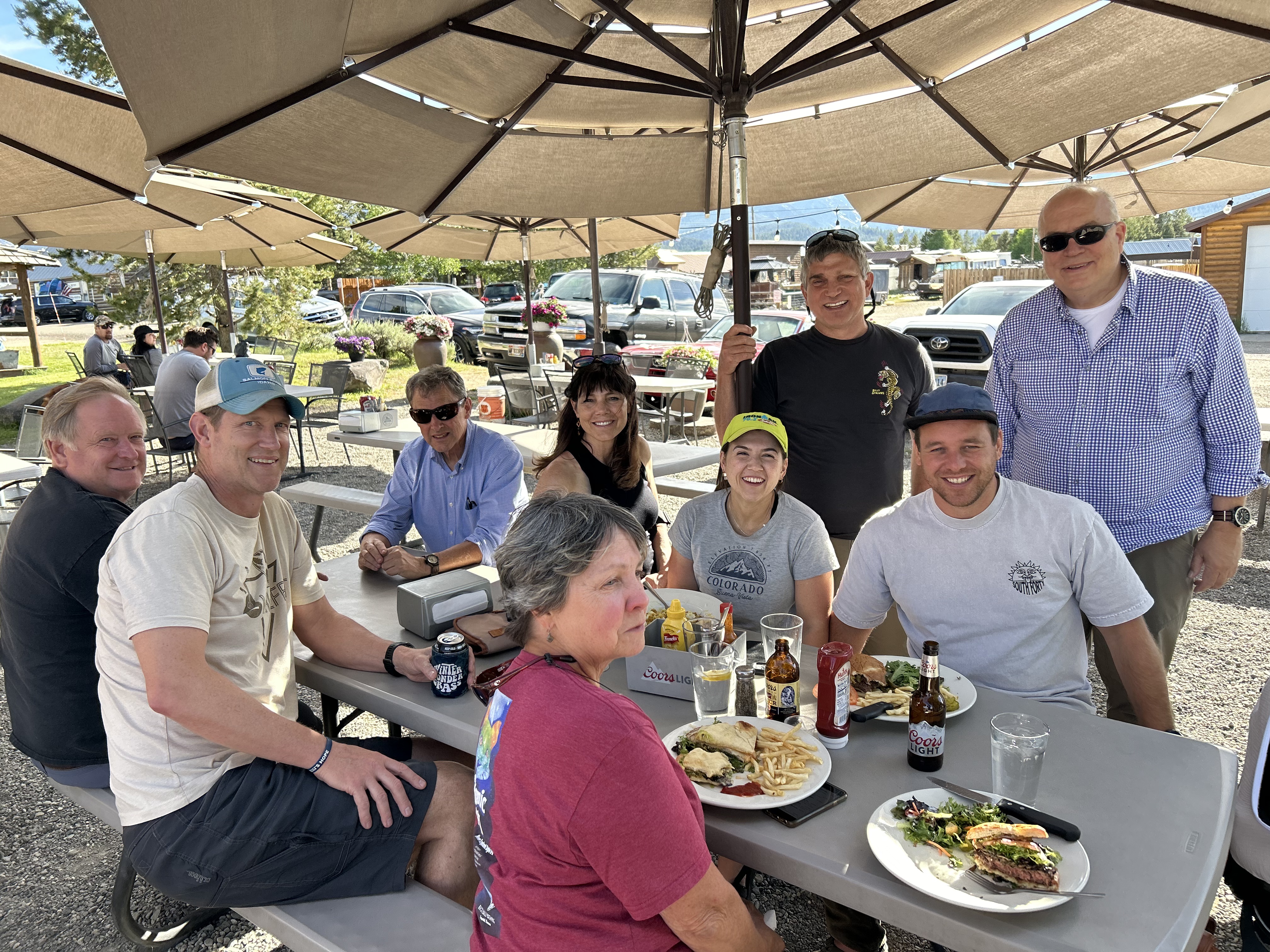
After checking in, we got to meet precious baby Ava Freudenberg who graciously brought her parents, Jimmy and Crissy out to Idaho. We met Jared, owner of Rocky Mountain River Tours and Sawtooth Adventure Center, picked up our dry bags and headed over to Sawtooth Luce’s for a delicious dinner and meeting up with some of our river trip group.
Friday night, June 21 – Saturday, June 29 – see our Middle Fork Trip
After one last coffee at Peaks and Perks, we left Stanley about 8:30 a.m. and headed southwest on Idaho 21 toward Lewiston. We drove along the South Fork of the Payette River, then the main Payette, and soon turned right on ID 55 to follow North Fork. The North Fork consisted of miles of Class IV and V continuous whitewater. As we continued to head north, we noticed that most of the traffic was headed south toward Boise. Passing by Lake Cascade State Park and then winding through the obvious tourist town of McCall on Payette Lake, we realized that it was definitely a weekend destination for many. Soon we arrived in Riggins, crossed the Salmon River and entered the Pacific Time Zone. Going through some rain, we headed farther north to Hell’s Gate State Park on the Snake River. The Snake is the state line between Idaho and Washington. Arriving early at our beautiful campsite with a large sycamore tree, a walking path along the river, and shady grassy areas, we spent a cool evening finally trying out the amazing 270-degree awning on the ROG, having a solo stove campfire, and watching the native rabbit play and hop around the woods.
Monday, July 1, 2024
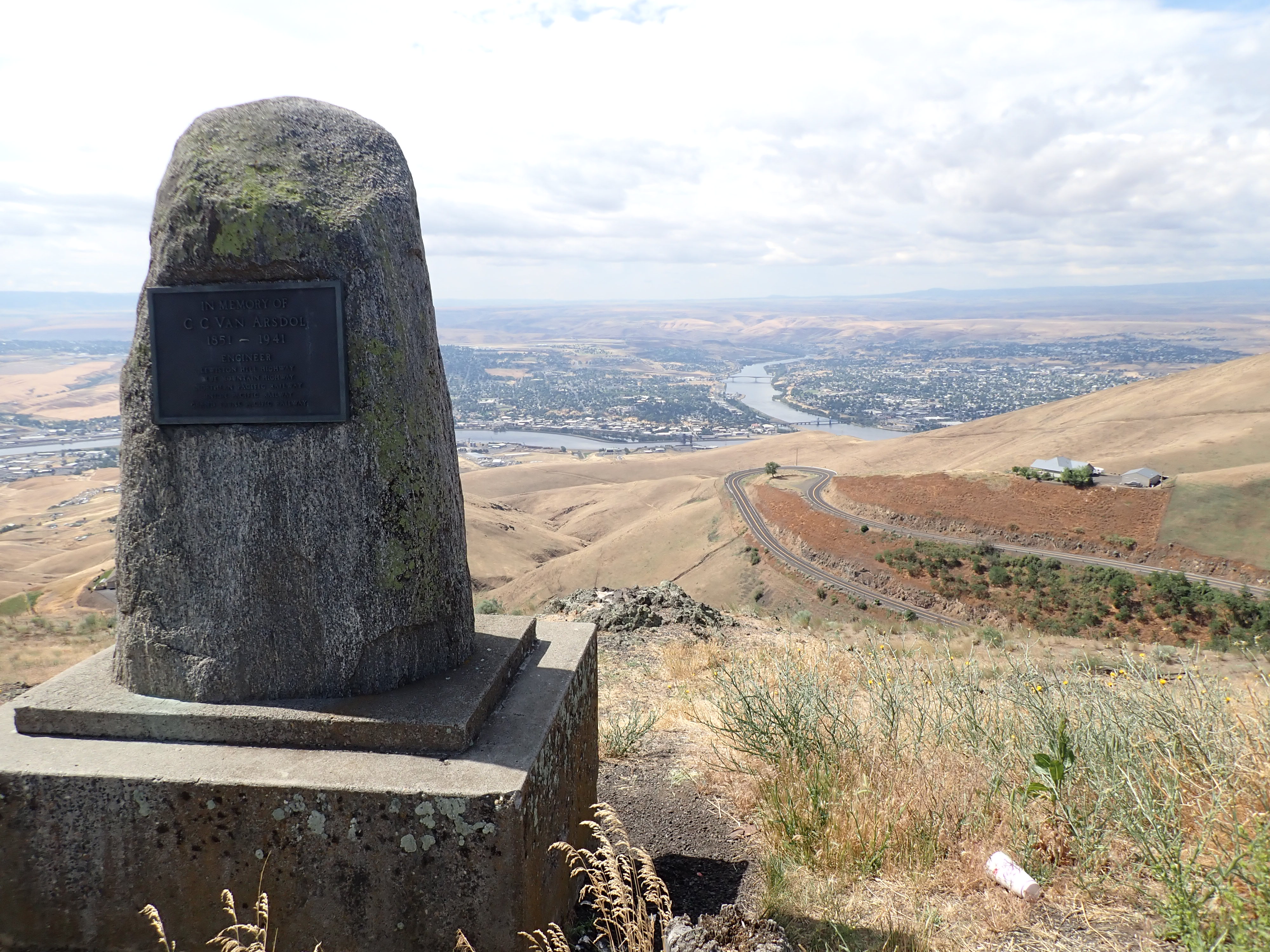
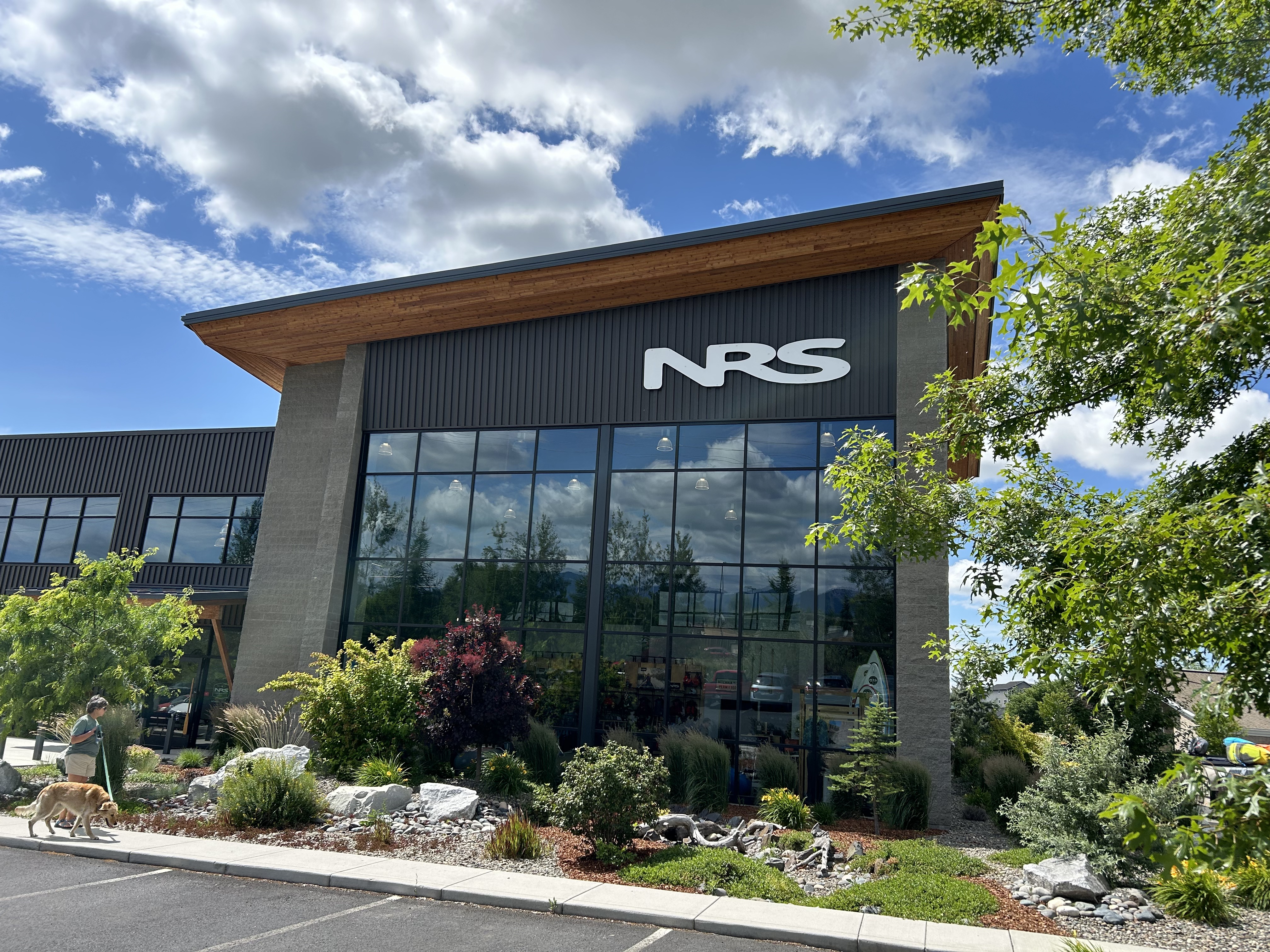
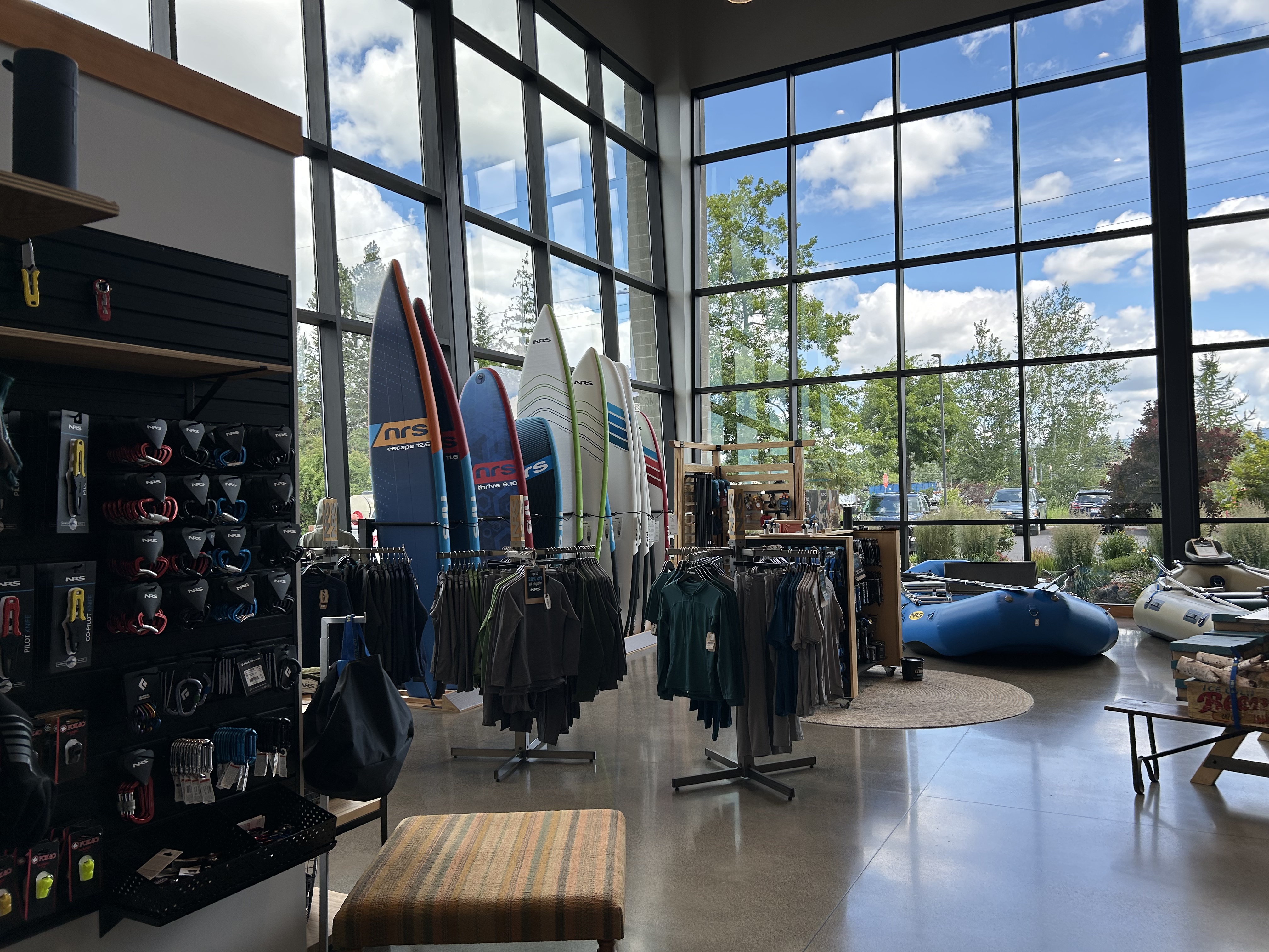
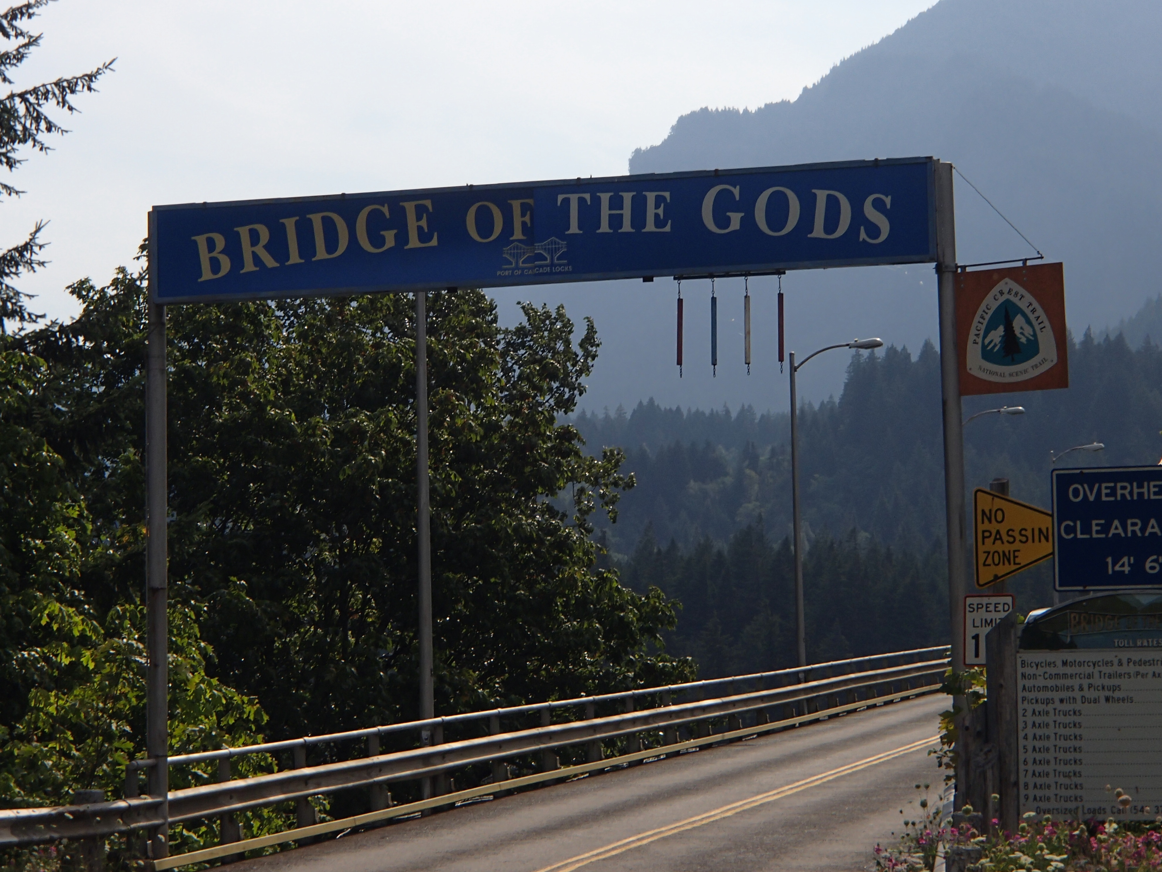
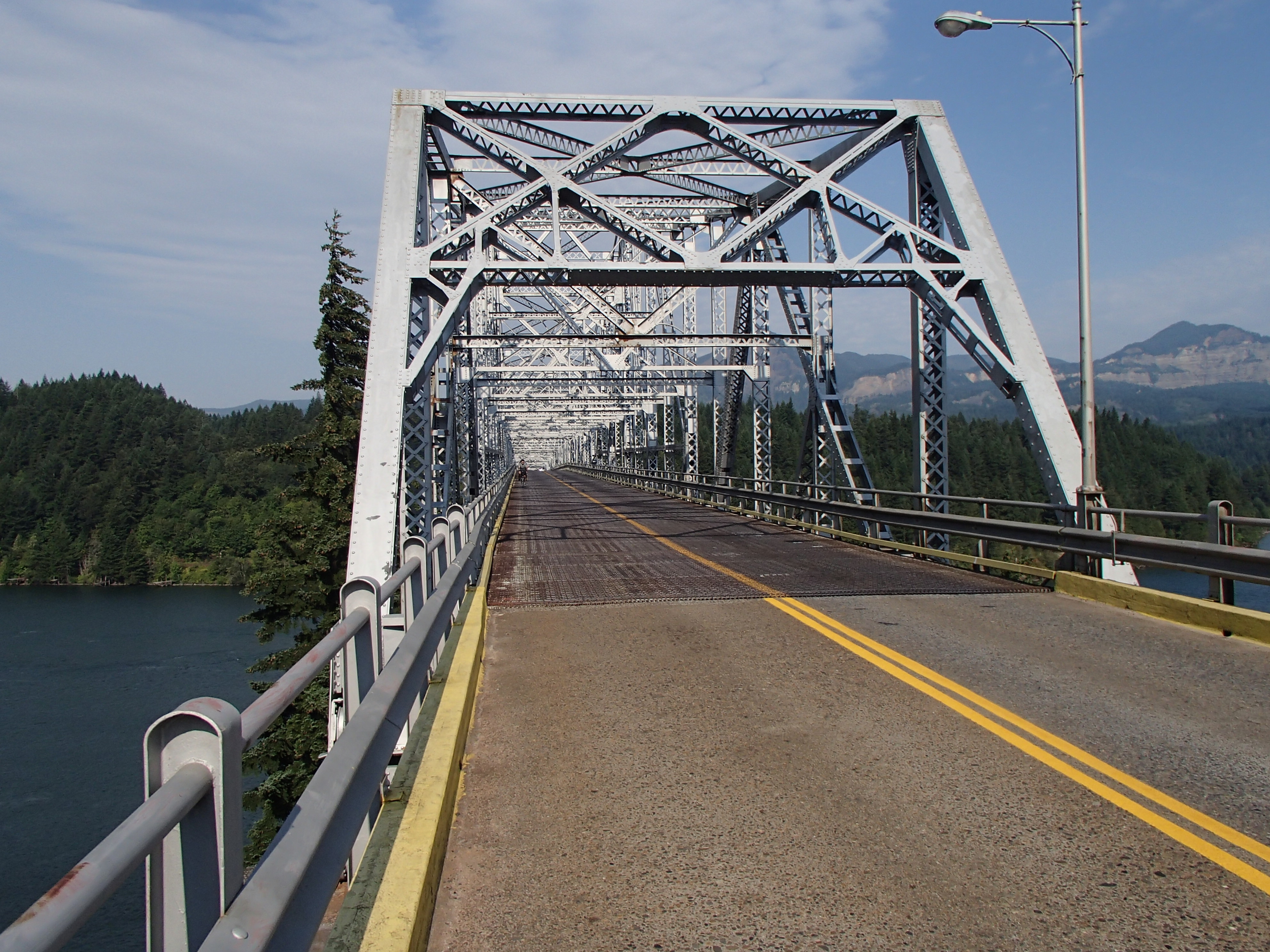
We woke up early, ate a leisurely breakfast and had coffee, took Millie for a good walk and then headed north to Moscow, ID to visit the NRS (Northwest River Supply) flagship store. It was not nearly as big as we expected but had a friendly staff who welcomed Millie in to shop with us. They graciously exchanged David’s paddling jacket that had ripped on the Middle Fork, and we found a few other items to purchase. Soon after, we came to the confluence of the Snack and Columbia Rivers and moved into southern Washington. It was pretty rural with many wheat and yellow canola fields. We continued on to the small town of Cascade Locks, home of the Bridge of the Gods, and reminisced about the time we spent there when David hiked the PCT in 2014. After a brief stop in town, we spent a comfortable night at the Cascade Locks KOA which was a beautiful campground full of giant trees. The only drawback was that a busy train track was located just behind the campground and the many train whistles continued through the night.
Tuesday, July 2, 2024
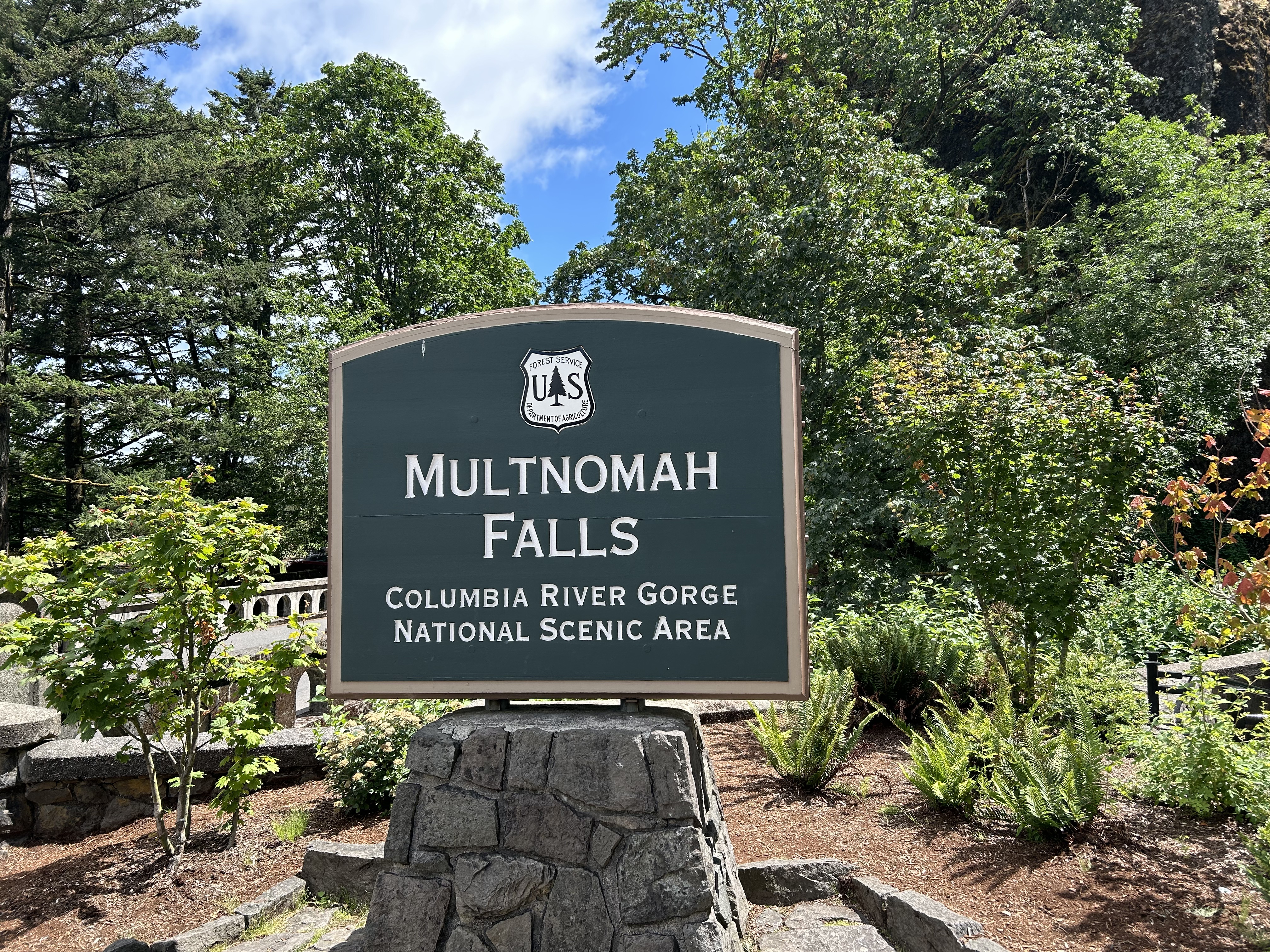
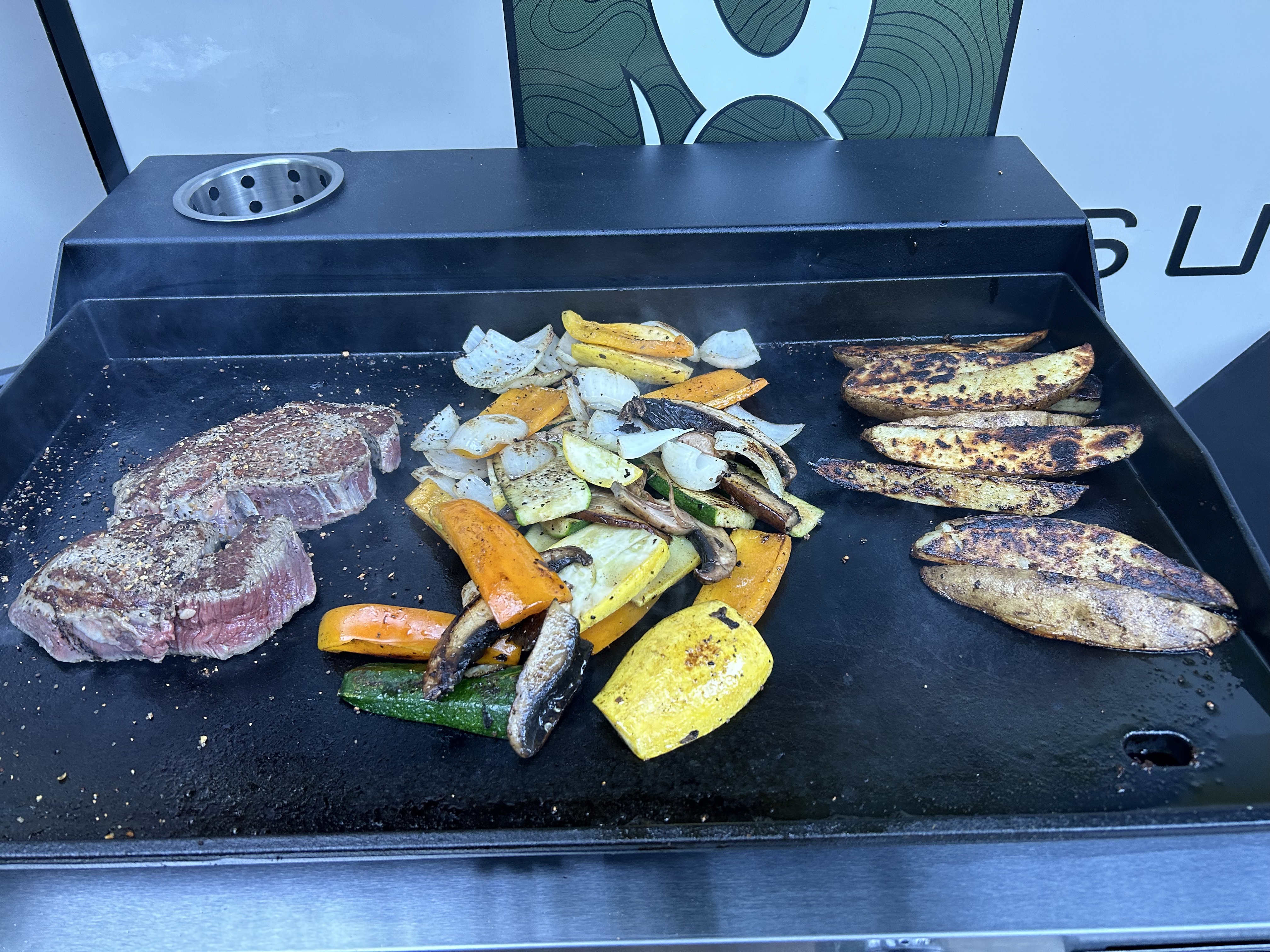
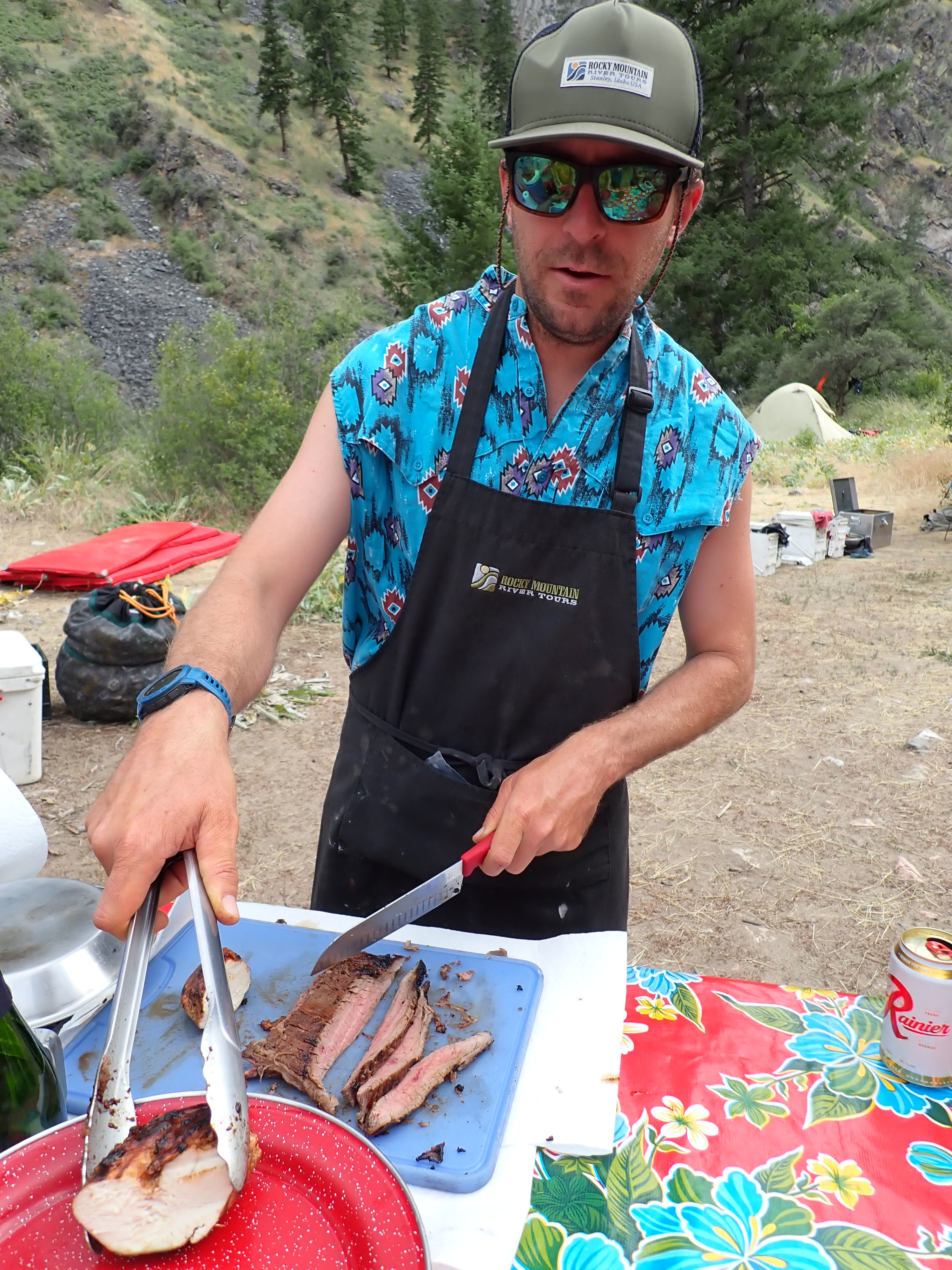
Our first stop on this day was Multnomah Falls. It’s a beautiful place, but it was extremely crowded as it is one of the main tourist attractions near Portland, Oregon. After passing many Christmas tree farms and vineyards on this beautiful sunny day, we decided to stop at Silver Falls State Park around 3:00 p.m. What a fantastic place! We had a grassy shady campsite in a clearing with lots of privacy. Millie and I took a long walk on a nature trail while David set up the grill that attaches to the side of the ROG. After enjoying some libations and cheese and apple appetizers, David cooked us a delicious dinner of grilled vegetables, steaks and potatoes. What a feast! It was fun trying out yet another accessory on the ROG! After dinner we took a walk through the rest of the campground which was filled with campers enjoying great sites under giant Douglas firs. It was such a peaceful place. We really wished we had more time to stay there and take the waterfall hikes and enjoy the scenery.
Wednesday, July 3, 2024
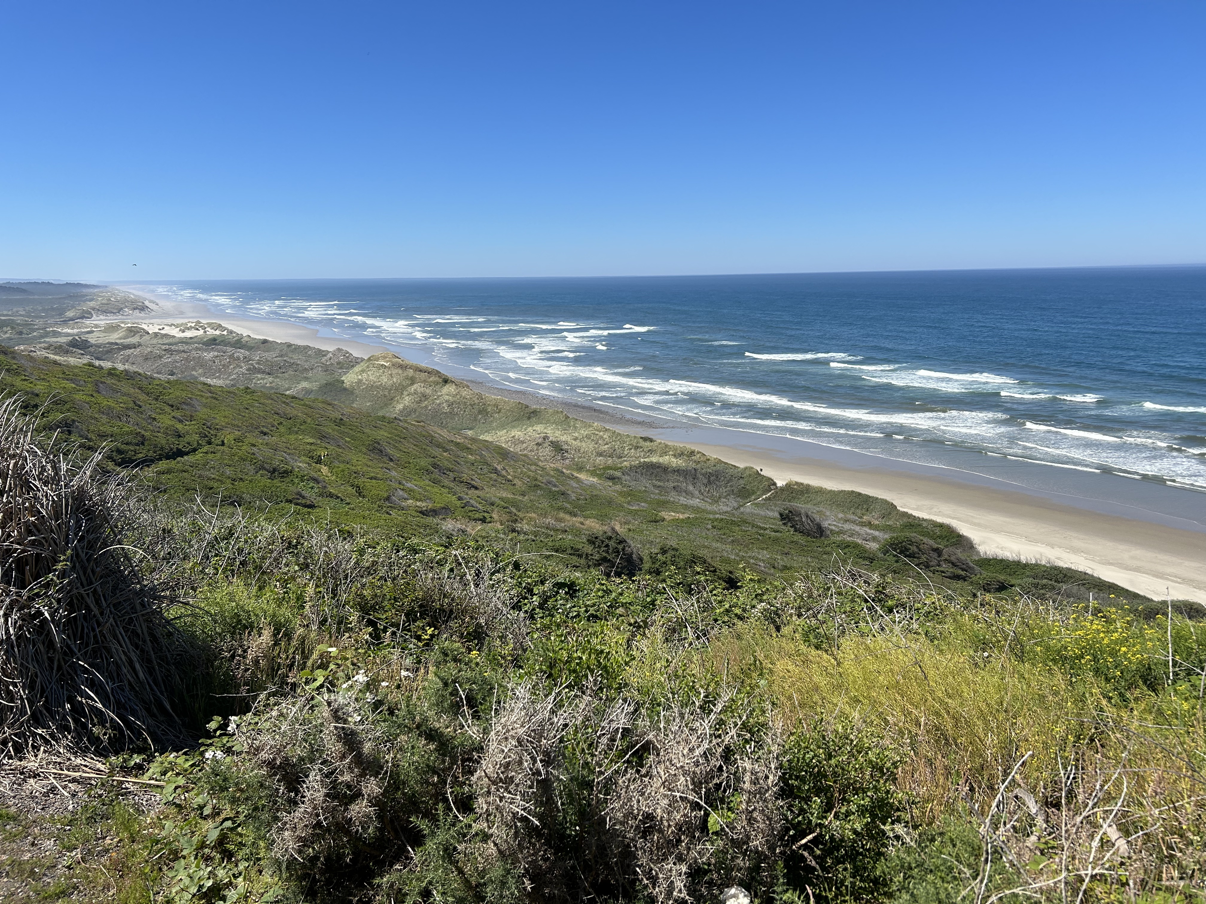
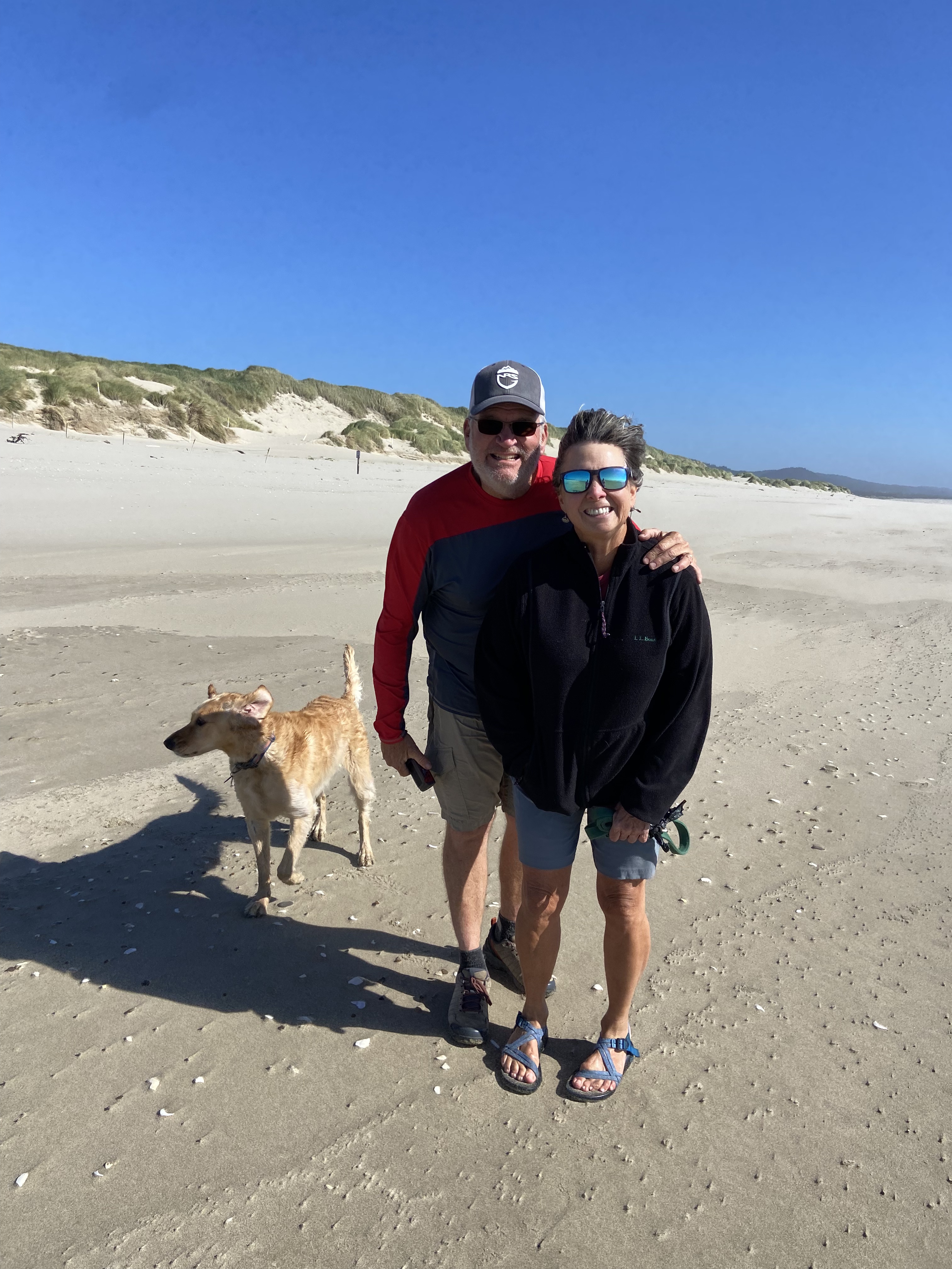
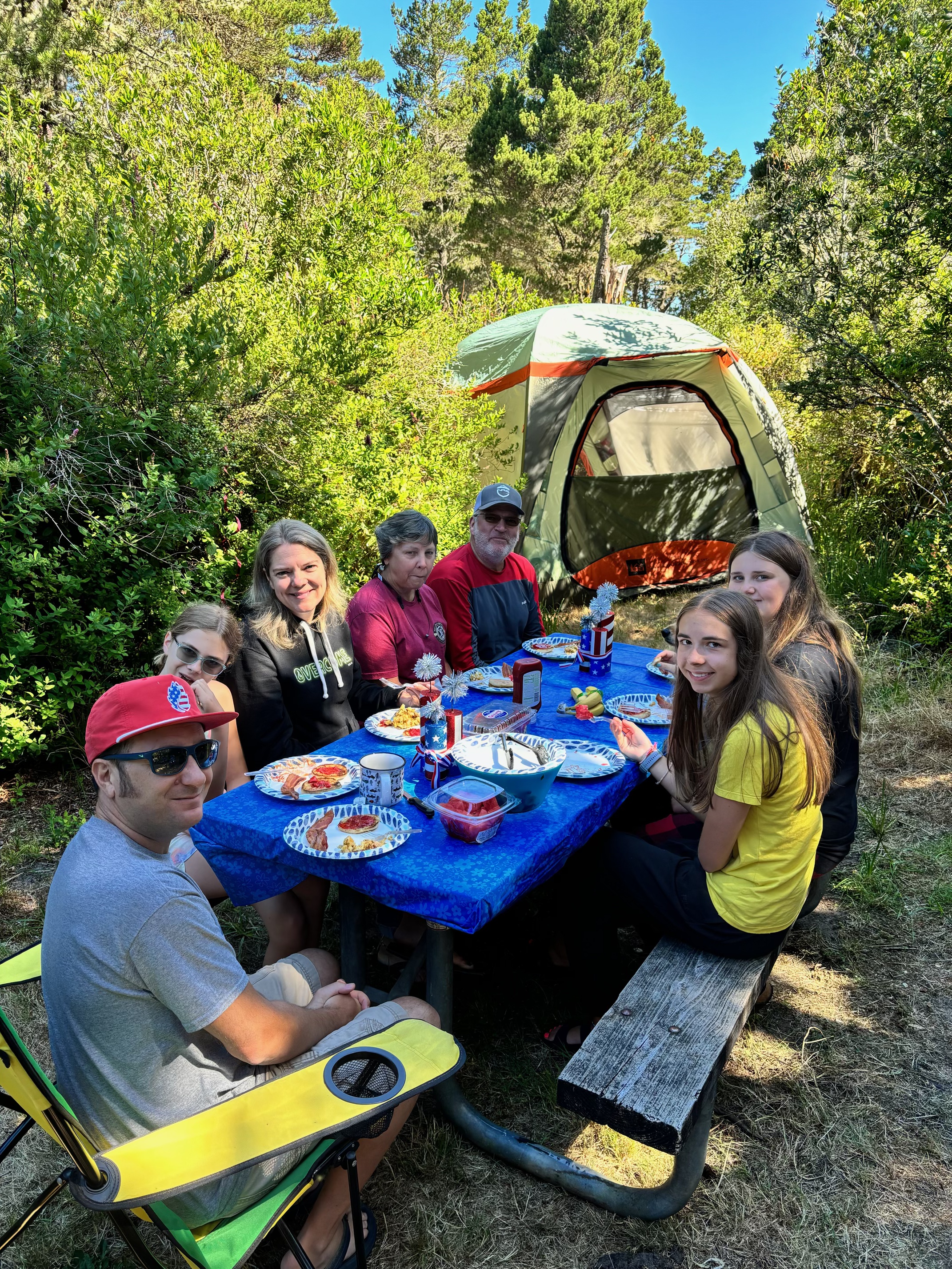
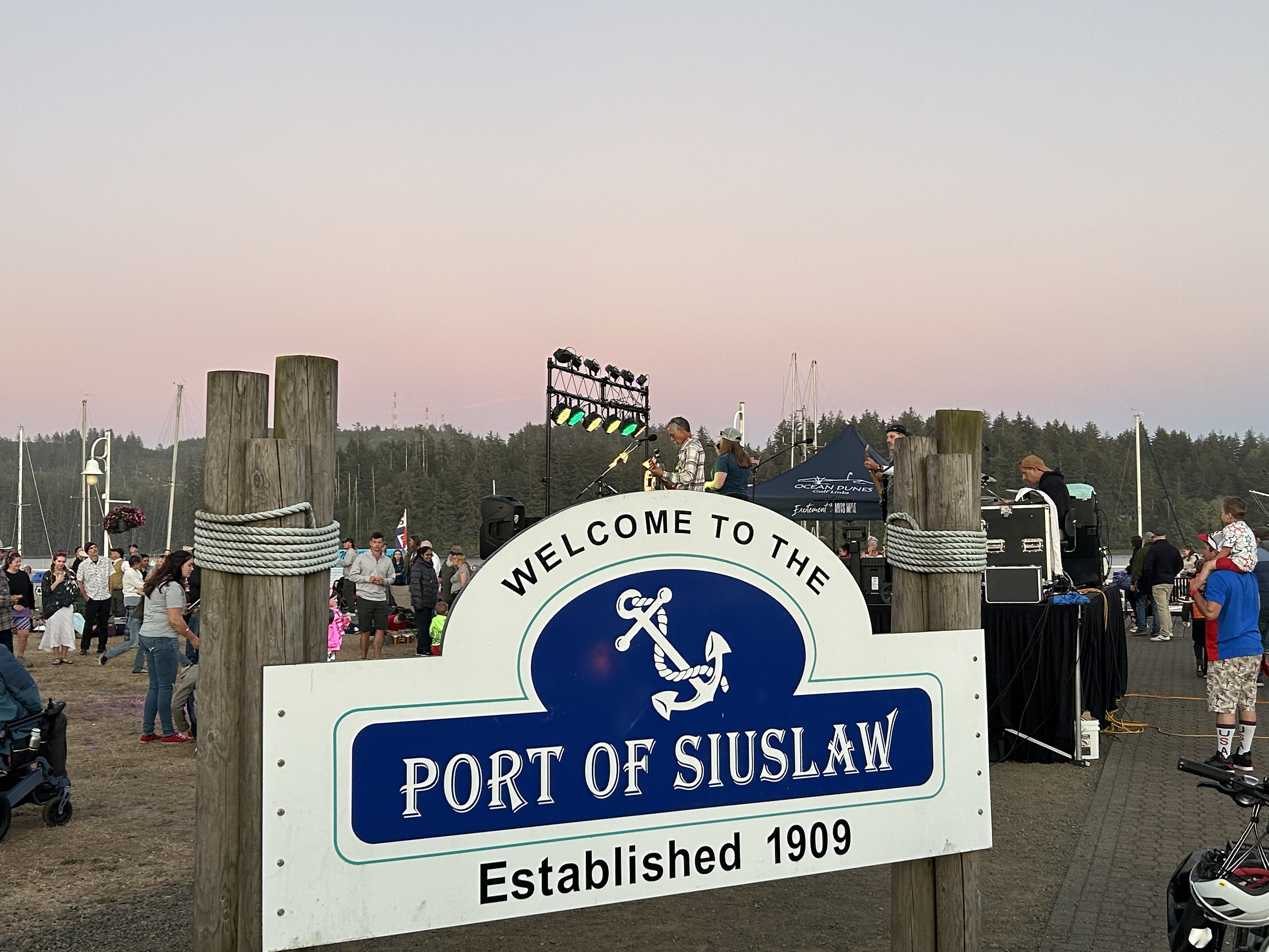
We woke up to a beautiful sunny morning with the temperature around 50 degrees and Stellar’s Jays squawking all around us. They are much bigger than bluejays in the south with big black crests on their heads. We took our time and didn’t leave until around 11:00 a.m. heading over through Eugene, Oregon and then on to Wax Myrtle Campground near the Siltcoos River and is situated among shore pine, huckleberry, and other coastal shrubs. Most of the campsites are surrounded by coastal shrubbery. The campground is part of the Oregon Dunes National Recreation Area, which is known for its sand dunes towering up to 500 feet above sea level. Many OHVs (off highway vehicles) enjoy the trails and those big dunes. We arrived around 4:00 p.m. and soon after our friends, Jeanene and Loren Hall, their granddaughter, Abby, niece, Holly and her family, Dan, Kayla, and Shayna arrived. We all walked down the road & up over the huge sand dunes to the beach and the Pacific Ocean. The ocean water was chilly, and it was VERY WINDY!! Needless to say, we didn’t stay on the beach long. That evening we went to the Siuslaw Marina in the port town of Florence for a seafood dinner and ice cream and returned to the campsite for a fire. It was a beautiful, but cool night.
Thursday, July 4, 2024
It was cool, but comfortable when we got up and less windy than the day before. Jeanene cooked us all a delicious breakfast of bacon, egg scramble, toasted English muffins with her own homemade strawberry jam and fruit. We were spoiled!! Later, Jeanene’s sister, Kathy and her son Dana joined us. The Oregon family kayaked up the river toward the lake and David and I stayed at the campsite with Millie and enjoyed a walk and a nap. Loren and I took a short walk around the river with Millie and were blessed with beautiful views of the Pacific. Burgers on the grill, chips, fruit, and veggies were a great 4th of July meal. Just before dark, we headed toward town searching for a spot to view the fireworks and ended up at the Siuslaw Marina where there was a huge crowd and a band. They had a terrific fireworks display, and Millie survived the loud noises tucked in between all of us. It was hard for David & I to comprehend wearing a jacket and being chilly on July 4th!
Friday, July 5, 2024
We spent the early morning chatting with Loren and Jeanene, enjoyed a Holly’s breakfast of “sausage goodness” (which we plan to have again at home), and said goodbye to the Oregon gang around 11 a.m. They headed out to kayak to the ocean and on Loren’s advice we took the highway along the Pacific Coast to Newport. It was an absolutely beautiful drive! We then headed east across Oregon seeing The Three Sisters, and Bend. The temperature gage in the truck registered 100 degrees that afternoon in eastern Oregon and the highway went through lots of open land. We found a little campground on our DYRT app just past Burns, Oregon and headed through town to get there. As we traveled through the small town, a truck pulled up behind us flashing his headlights and beeping his horn. We pulled over to see what the all the fuss was about, and he informed us that our camper door had come open and bags were falling out. About the same time, we got a phone call from an unknown number which we didn’t answer. A few minutes later, a text came through from the same number and a kind man had found David’s duffle bag and was waiting to return it to him. Greatly relieved to have encountered such nice guys, we retrieved the bag, thanked the man and then went on to the campground. After a bit of frustration locating a site, we finally located a nice level one and settled in. Unfortunately, the mosquitos liked it also, so we ate a quick dinner, took showers and jumped in the camper for the night.
Saturday, July 6, 2024
We headed out this morning through southern Oregon and Idaho, wide open spaces, dry, with lots of wind turbines. We stopped at Jimmy John’s for subs. We finally got into Montana, took a break in West Yellowstone for gas, a carwash, and a walk in the park for Millie. We then headed north up Highway 191 for a beautiful drive along the Gallatin River through the Gallatin National Forest and arrived in Belgrade, Montana at Dawn and Les’ house around 9:30 P.M. Their dog, Kai, got to know Millie while we sat outside in their beautiful backyard looking at the Absaroka Mountains. David and Millie spent the night in the ROG while I enjoyed the comfortable upstairs bedroom in the Inafuku’s house.
Sunday, July 7, 2024
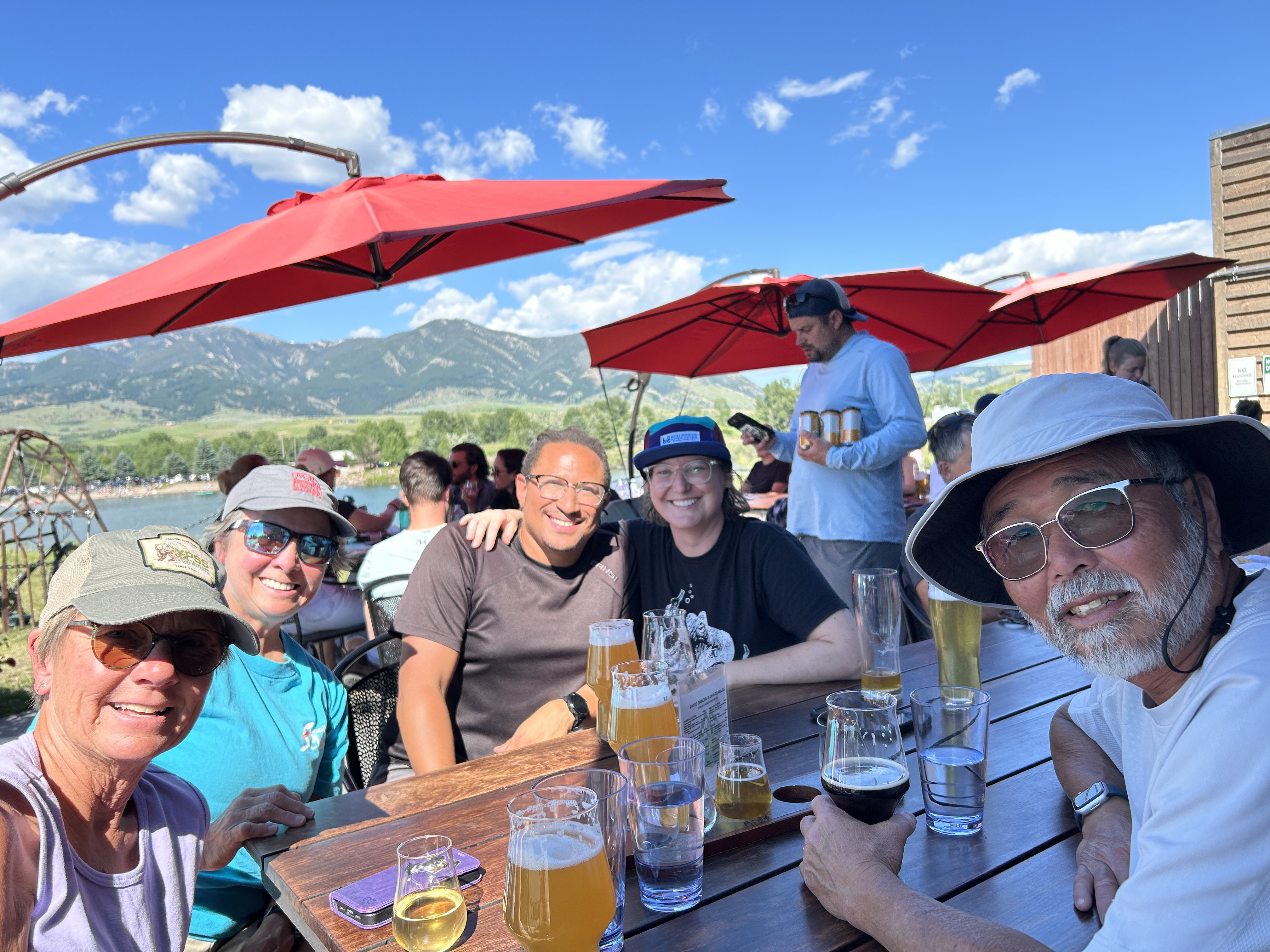
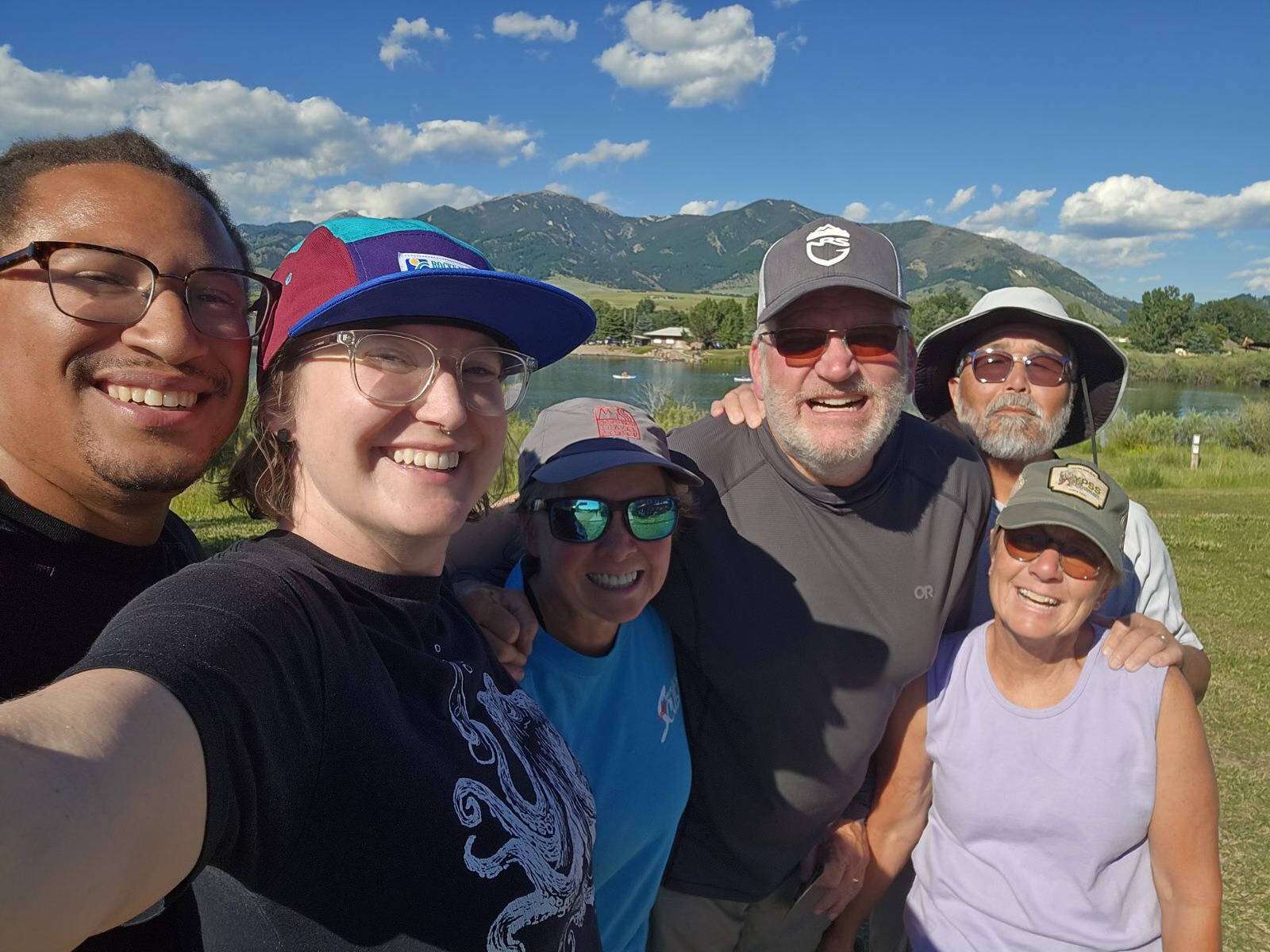
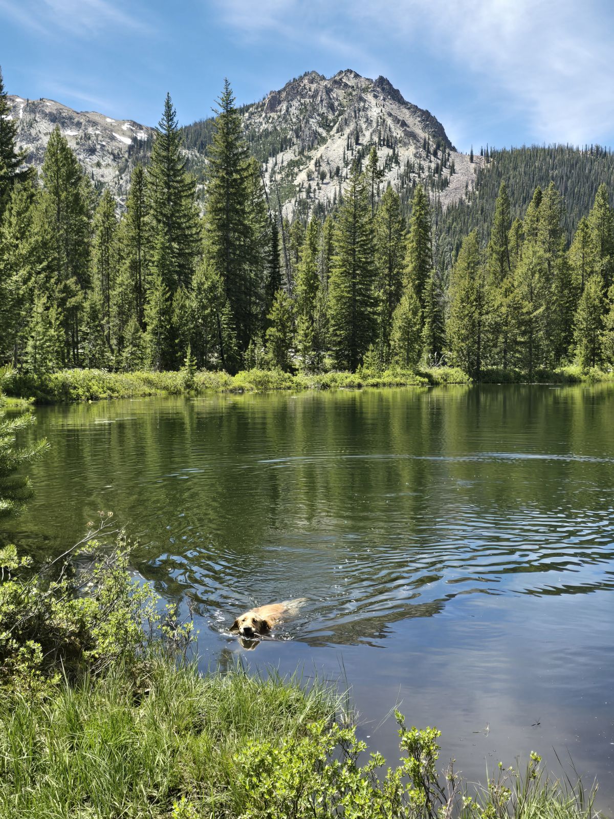
Dawn and Les fixed us a delicious breakfast and then we headed off to hike in Hyalite Canyon. Millie and Kai enjoyed running free on the trails, greeting other hikers and dogs, and sipping water from the creeks as we hiked to Grotto Falls and then to Palisade Falls. Both trails were easily accessible and somewhat busy on this beautiful Sunday. We stopped back by the Hyalite Reservoir where Millie enjoyed a brisk swim. Our Southern golden retriever wasn’t used to the temperature in a high-altitude lake! Later that afternoon, we met Molly Cashion and her partner Andre’ Ray on the patio at MAP Brewing Company in Bozeman. It was great to meet Andre’ and introduce them to both to Dawn and Les. After returning back to the Inafuku’s for chicken enchiladas, salad fresh from their garden and ice cream, Dawn and David reminisced about while we looked at some “Dew Crew” photo albums from the 1980’s.
Monday, July 8, 2024
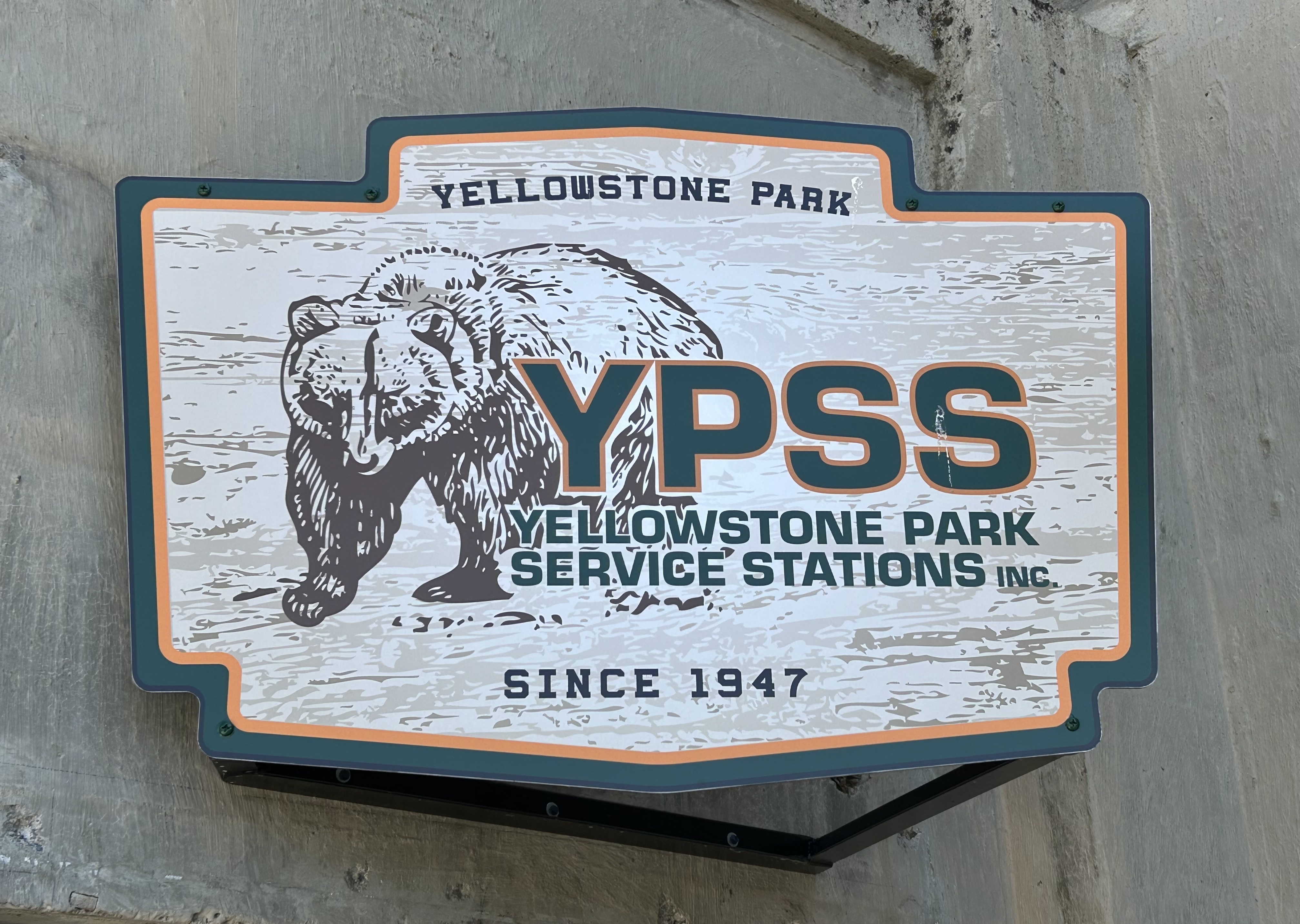
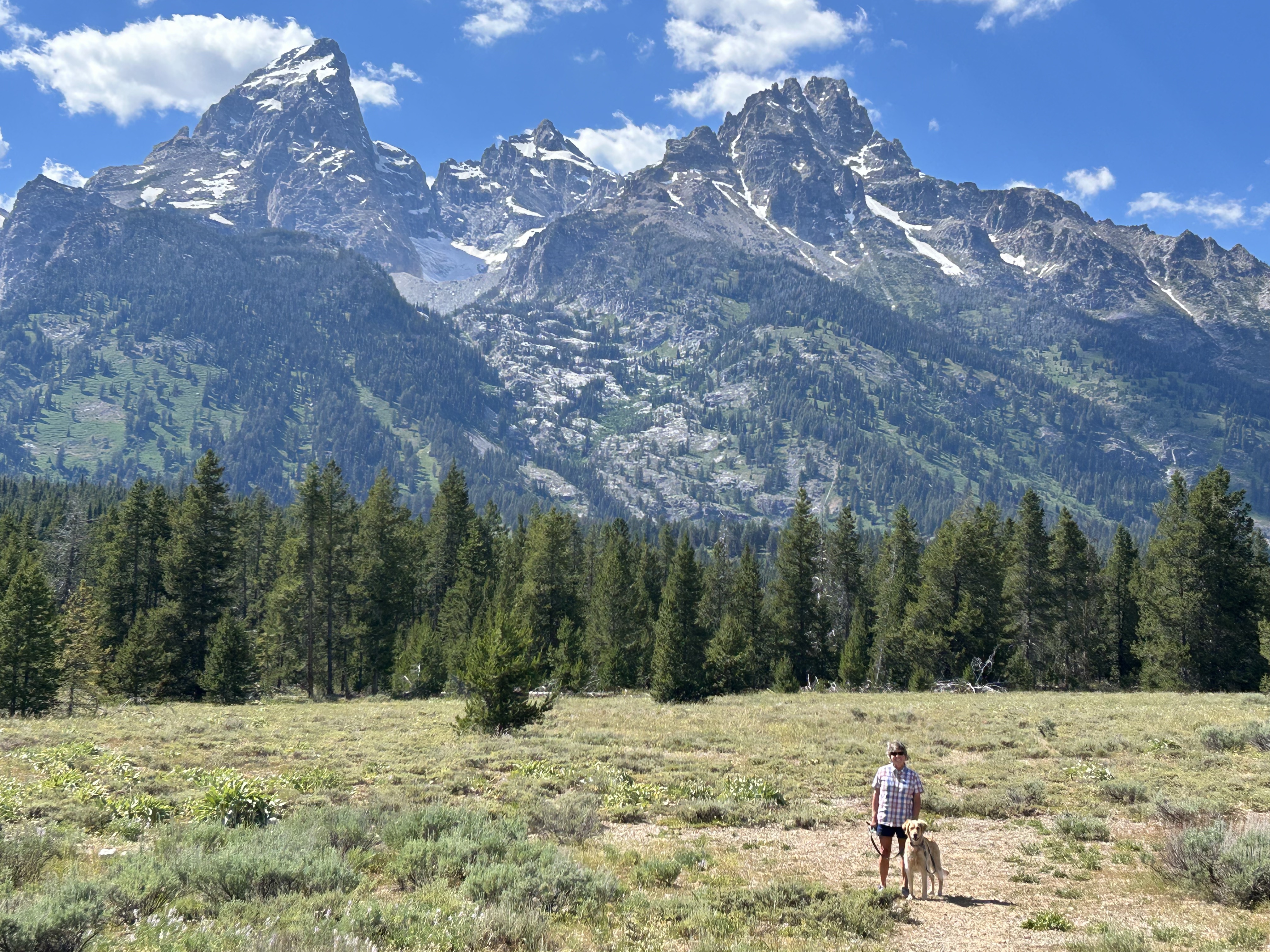
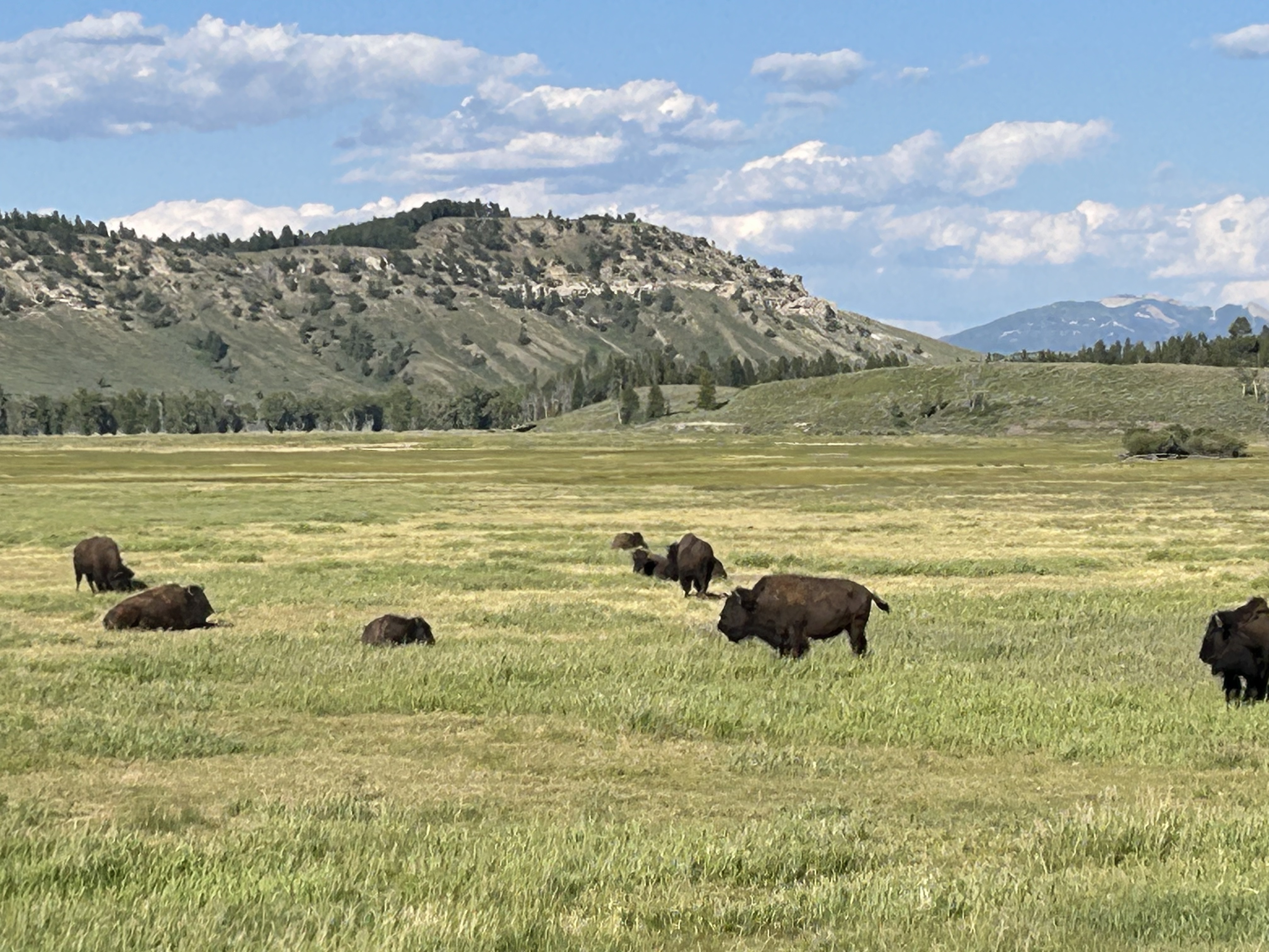
It was hard to say goodbye, but we headed out about 8:30 through Livingston and Gardiner, Montana toward Yellowstone. We stopped briefly at the YPSS (Yellowstone Park Service Stations- David’s employer for 5 summers and mine for 1) headquarters in Gardiner. Here we met a nice young man, Ben, from Hall County, Georgia, just down the road from us, who listened to our tales of old times and gave us a couple of new YPSS ball caps. Then we drove through the North entrance and into the park on the new road. The old one was destroyed by the flood in June 2022 when the area received more rain in one day than it usually did in an entire month. We continued on the North Loop by Mammoth, Roosevelt, Tower, over Dunraven Pass and stopped in Canyon for a short break. After seeing a few bison in Hayden Valley, we stopped at Fishing Bridge for some engine oil and then went out through the South entrance. Lucky for us, the park was easy to navigate and there wasn’t much traffic at all. We continued on through Grand Teton National Park, passing by Jackson and Jenny Lakes and took another break in Jackson. We were disappointed with how much it had grown, how crowded it was, and how it seemed that there were many more trinket stores and many less art galleries. We were happy that Tom Mangelsen’s Images of Nature Gallery, Teton Mountaineering, and the beautiful St. John’s Episcopal Church and grounds were still on North Cache Street. The evening drive through the fascinating rock formations in Shoshone National Forest and enjoying the views of the Wind River Range was a perfect end to the day. We settled into the cozy Windhaven RV Resort around 8:00 P.M. where Millie enjoyed a brief walk, and we all appreciated the cool breeze and lack of mosquitos.
Tuesday, July 9, 2024
Early this morning, Randy and Melissa, one of the campground host couples, came by with their little white dog, Texas, to see the ROG and say hello. We discovered in our conversation that they have been to Blue Ridge several times and really like our home turf. We left around 9:45 with beautiful sunny skies and a nice 77-degree temperature. After a while, we stopped in Rawlins for gas and groceries. Later in the afternoon a rock flew up from an 18-wheeler in front of us and nicked the truck windshield. Since Laramie was close by, we stopped, found an auto glass repair shop and a super nice young man repaired and glued the cracked spot. After a delicious DQ stop, we drove south, by Denver and on to interstate 70. Once again, using the DYRT app, we found a nice KOA in Strasburg, CO and pulled in for the night.
Wednesday, July 10,2024
We began driving again today with sunny and nice temperatures. After a few hours, we entered Kansas and returned to the Central Time Zone. We spent a long day driving across Kansas passing endless fields of corn and wind turbines. It is a long way across Interstate 70, but we finally made it through St. Louis around 12:30 P.M., drove a bit longer to a TA Travel Truck Stop in Mt. Vernon, Illinois and decided to hop in the camper for some rest. With the fan on and windows open, we slept well in the parking lot with several other vehicles doing the same thing.
Thursday, July 11, 2024
We were on the road again by 7:30 A.M. and arrived in Franklin, TN at Sandra and Bob Sarratt’s house around 11:45 A.M. After unloading the kayaks, catching up with the two of them and letting Millie run around with Tilly for a little while, we took off again around 12:30 P.M. excited to be getting close to home. However, we hit our worst traffic and road construction in and around Chattanooga. There were so many delays! After so many travel days, we were quite frustrated. We finally got through it all, and then got stuck behind an 18-wheeler on Highway 64-74 driving along the Ocoee River. We made it to our local brewery, Buck Bald in Copperhill, TN just in time for a local’s night beer with our hometown friends. Around 8:40 P.M., we pulled in our driveway ending our first fun ROG trip of 24 days and traveling 6,514 miles. 😊
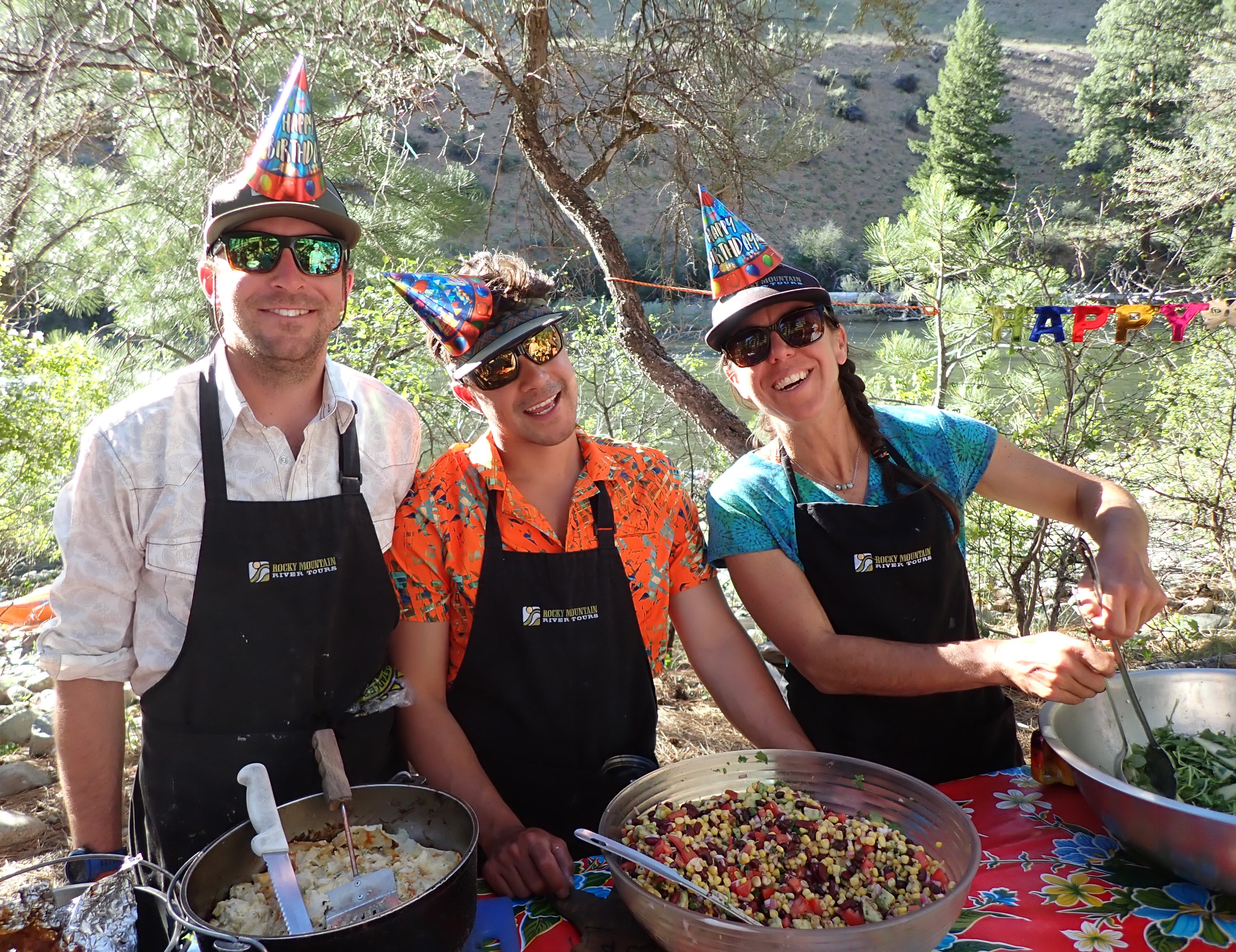
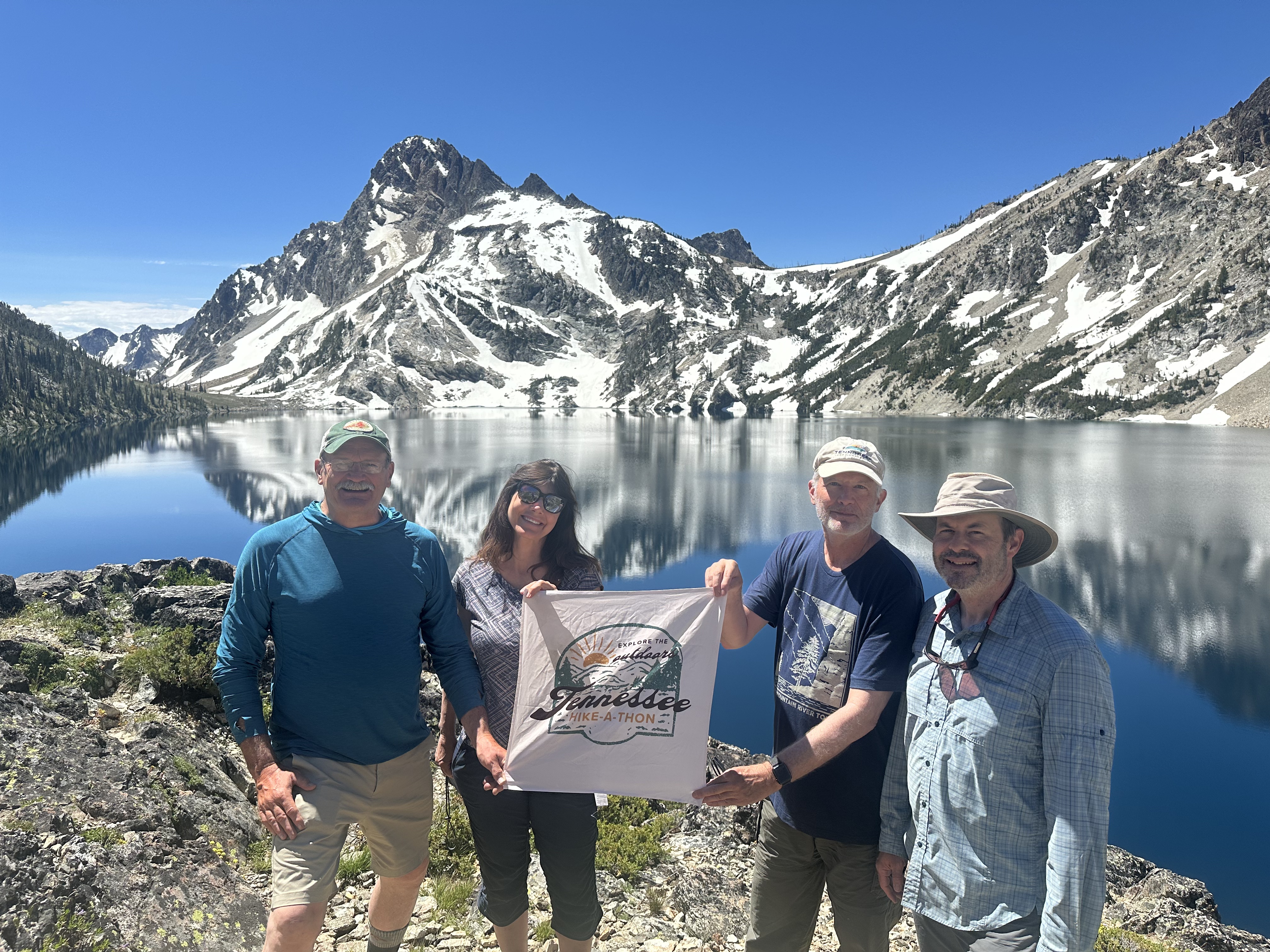
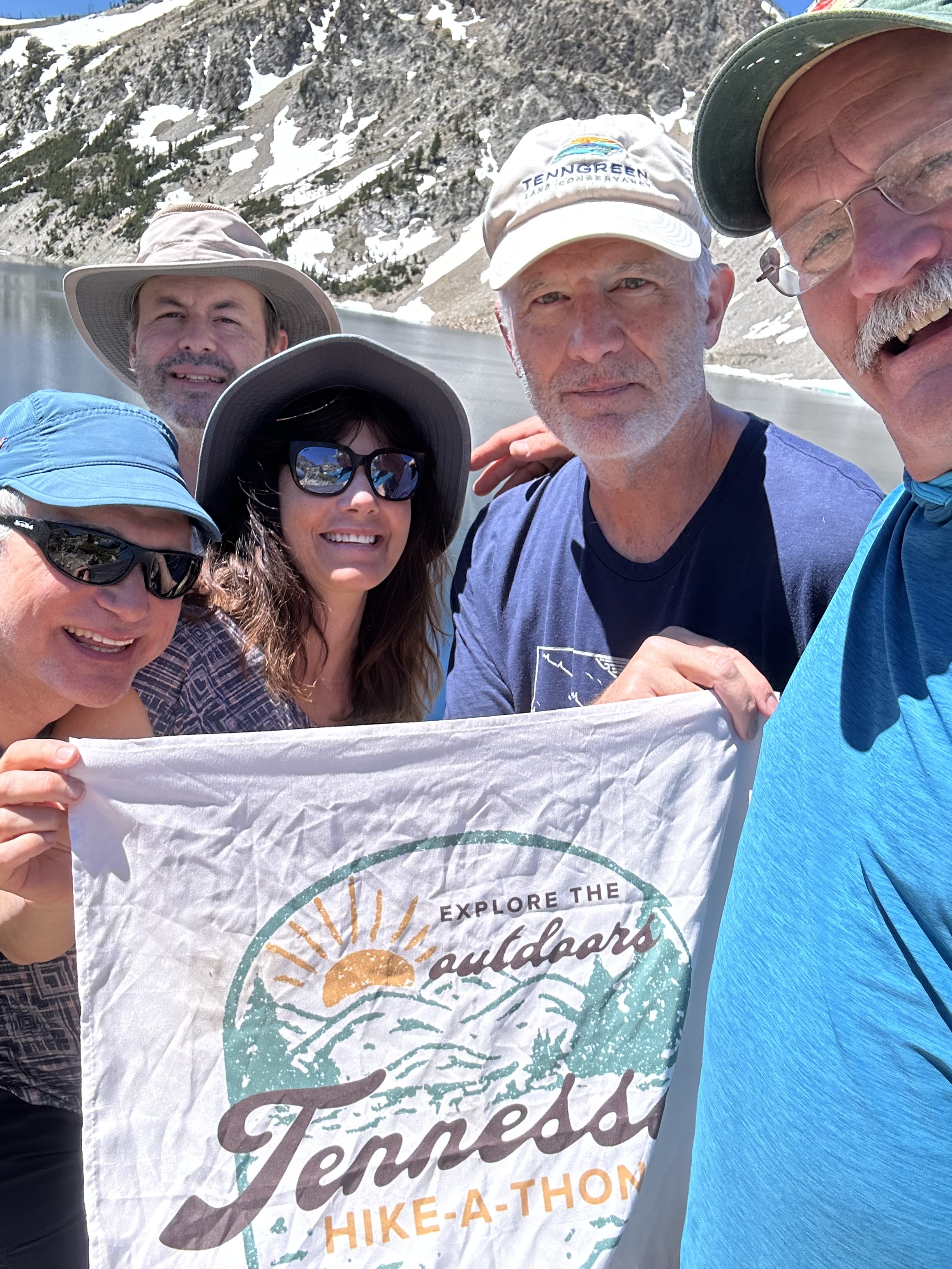
Many thanks to Bob Sarratt, who put another awesome river trip together for the group below with the team at Rocky Mountain River Tours and for making the second trip down the Middle Fork Salmon River another wonderful and fun filled outdoor river adventure. The following blog update was prepared and written by both Bob Sarratt and Mary Langford and was taken from their journals that each kept on our weeklong trip down the Middle Fork.
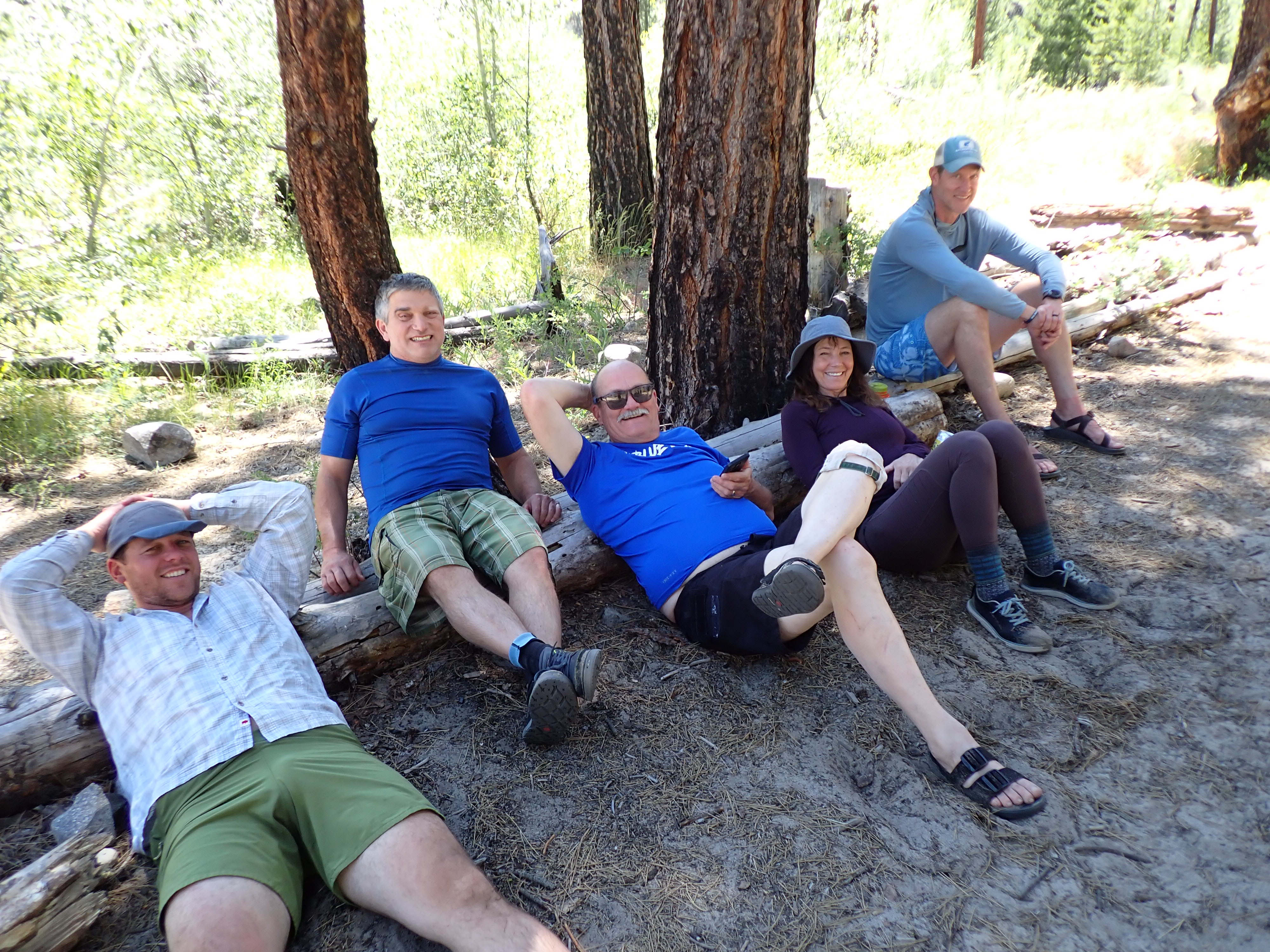
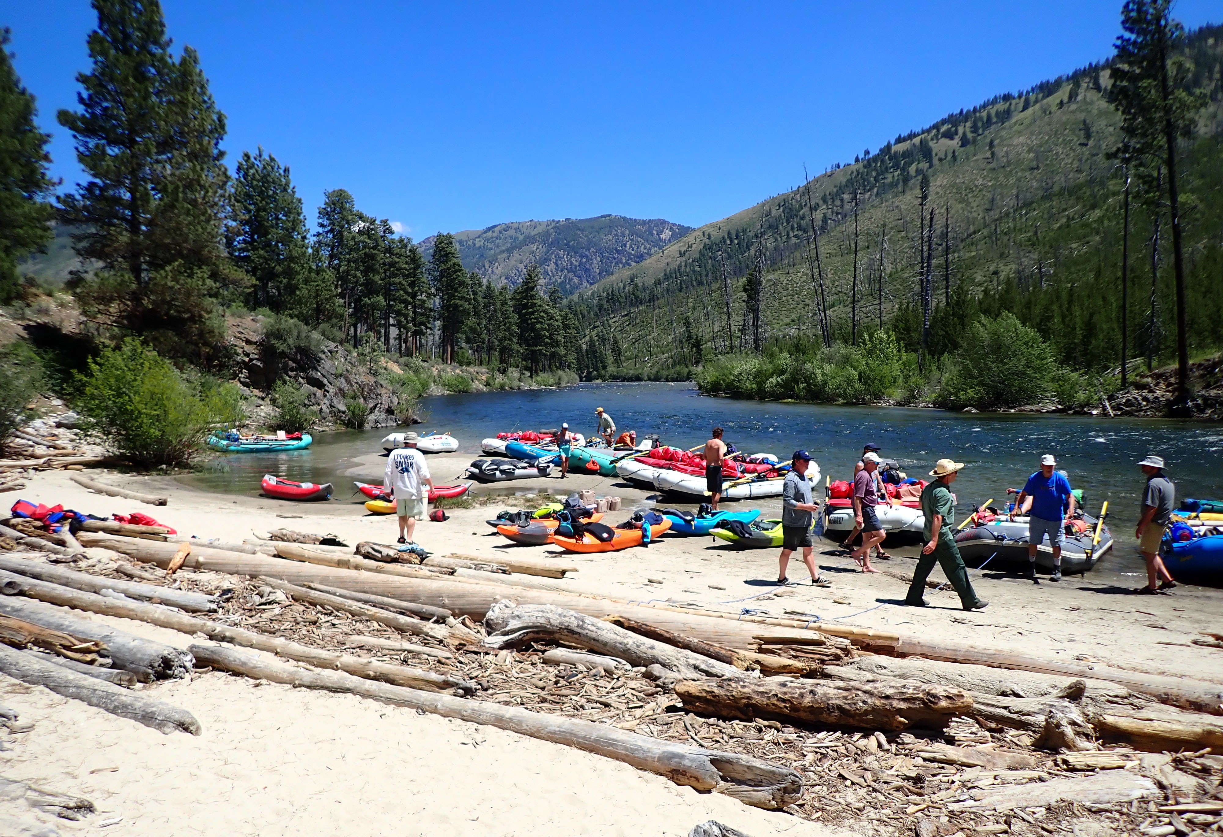
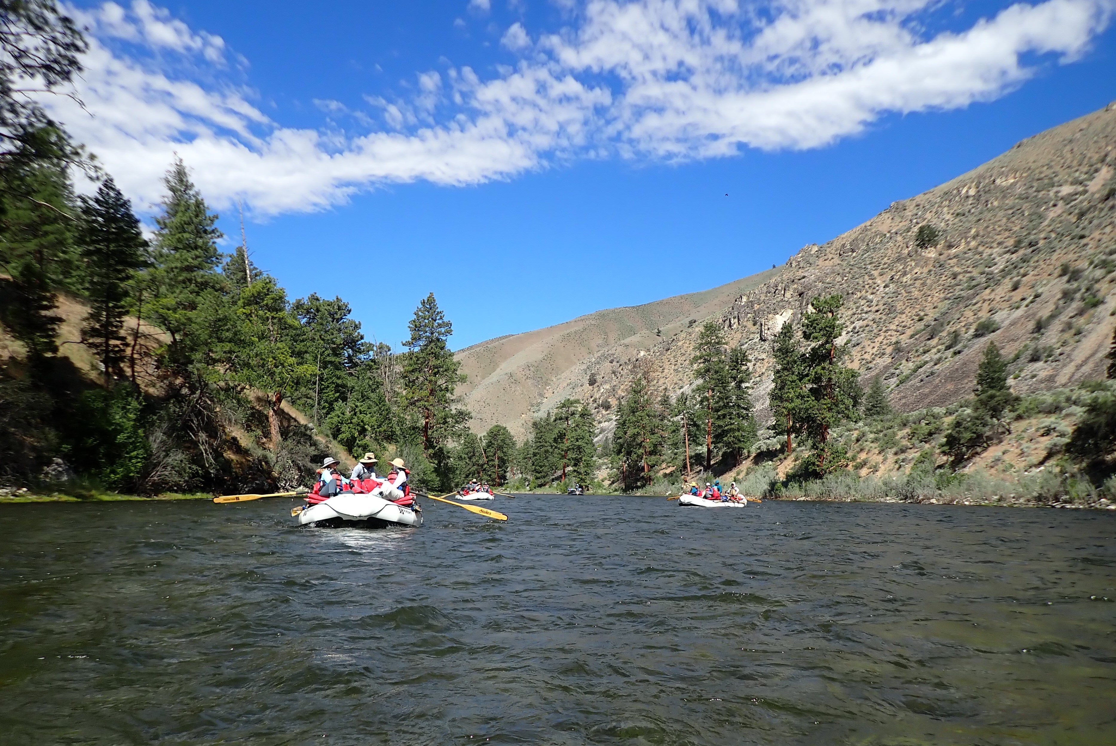
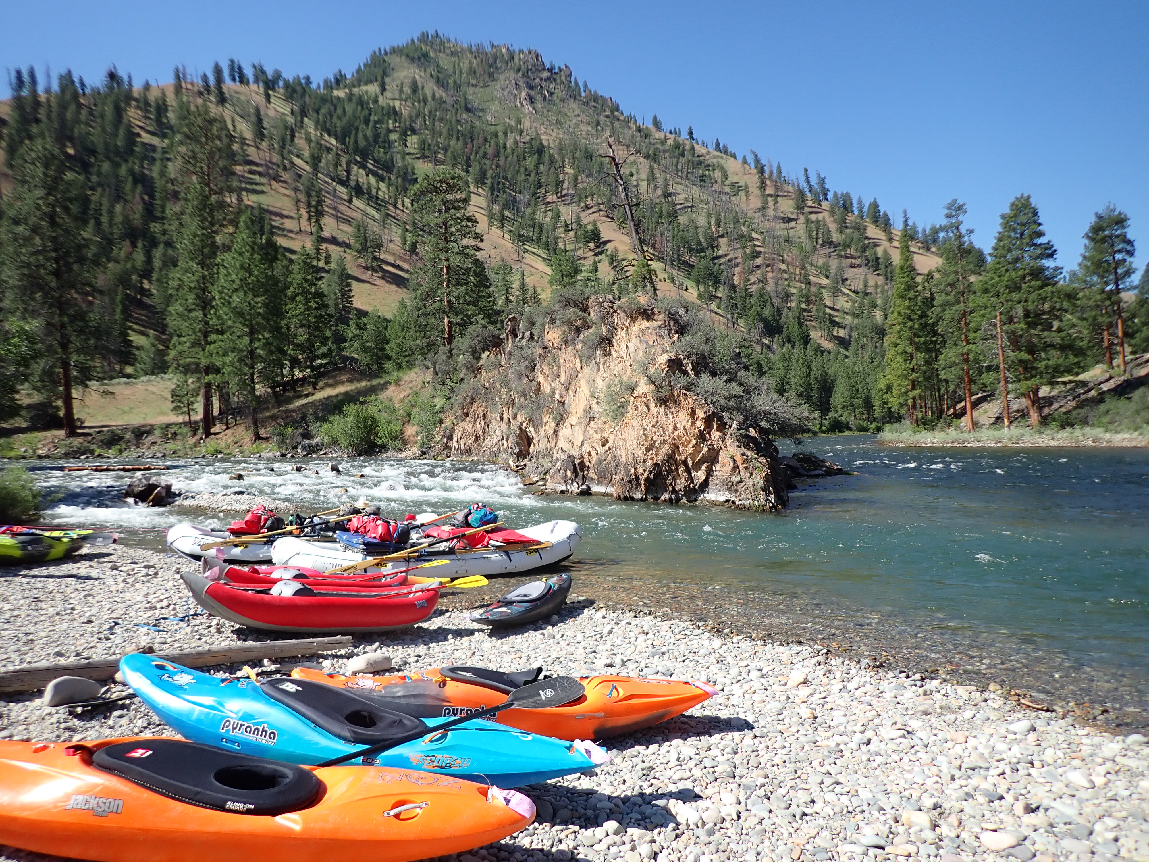
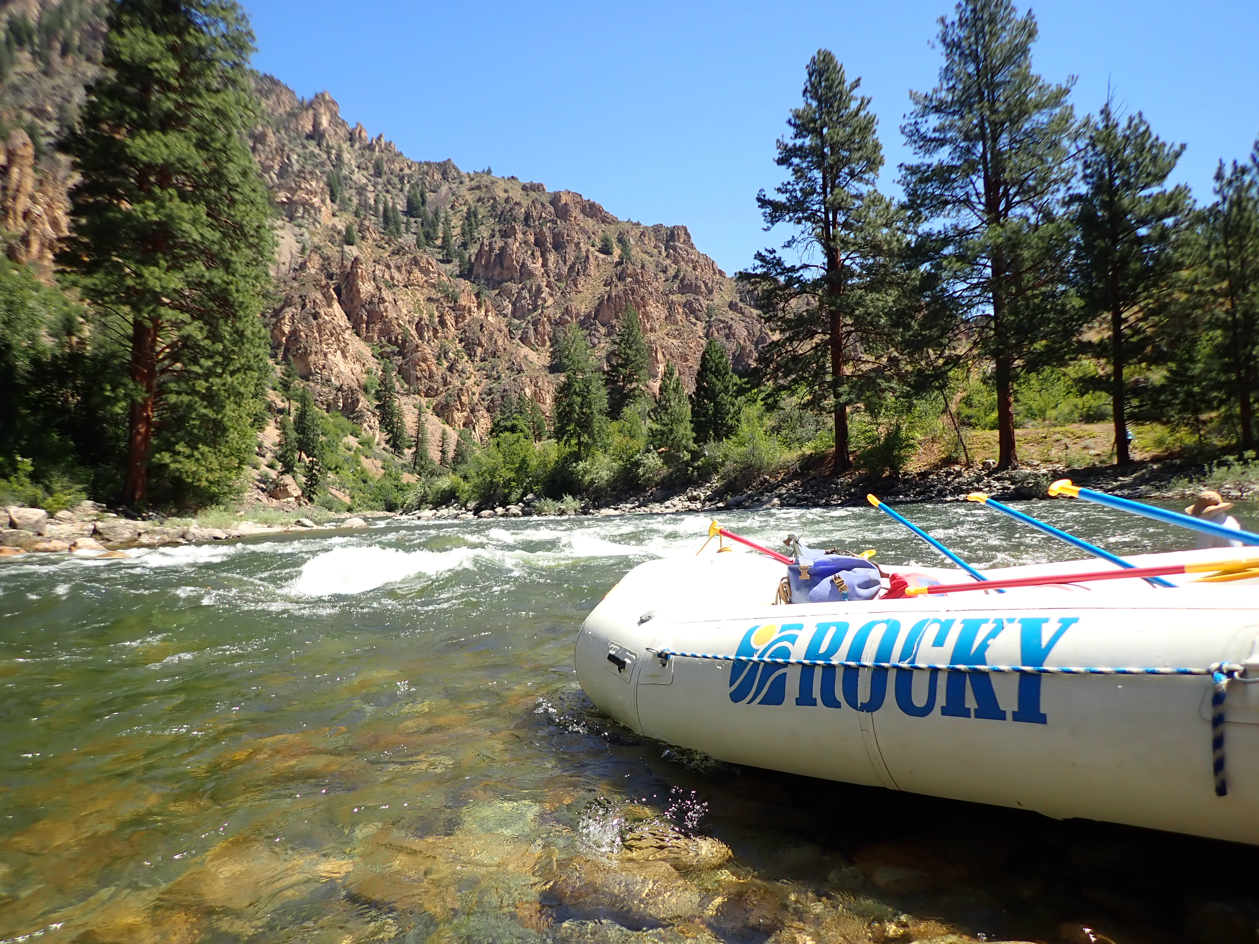
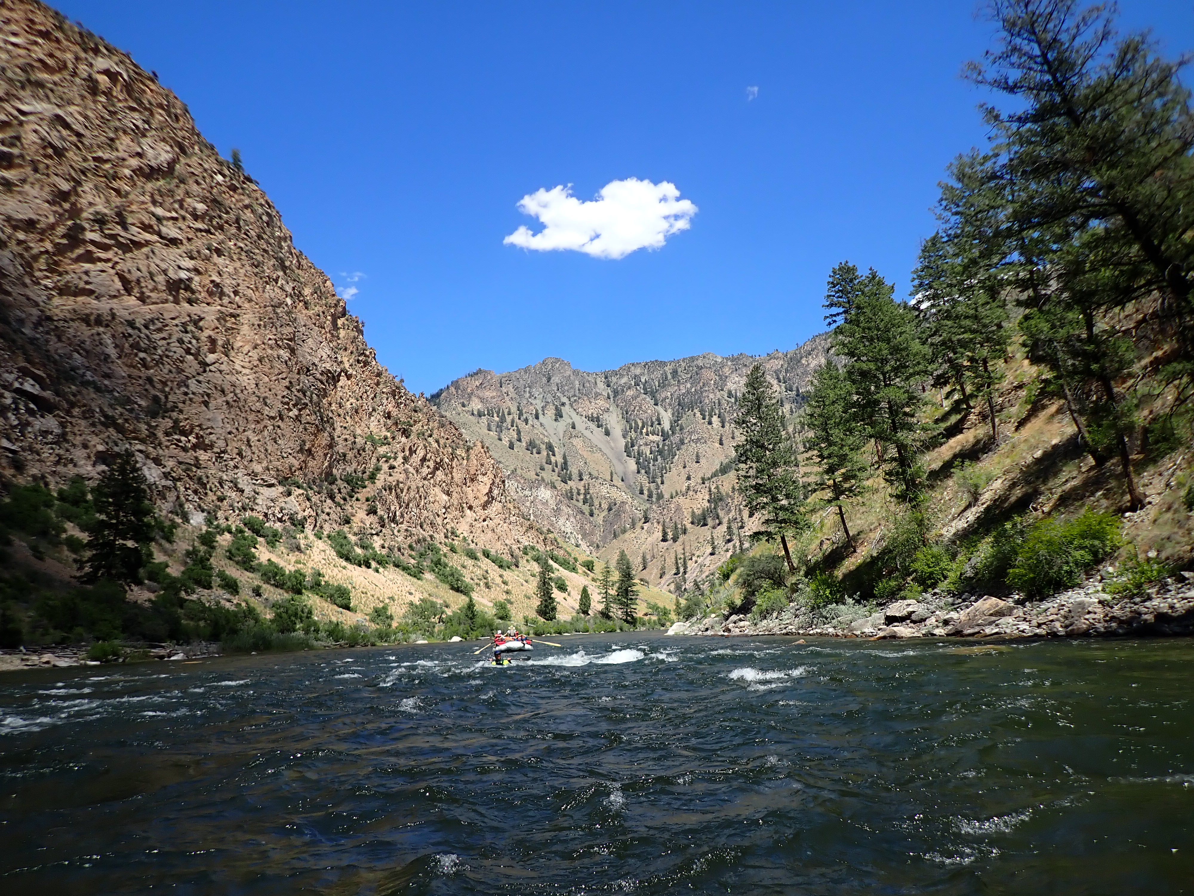
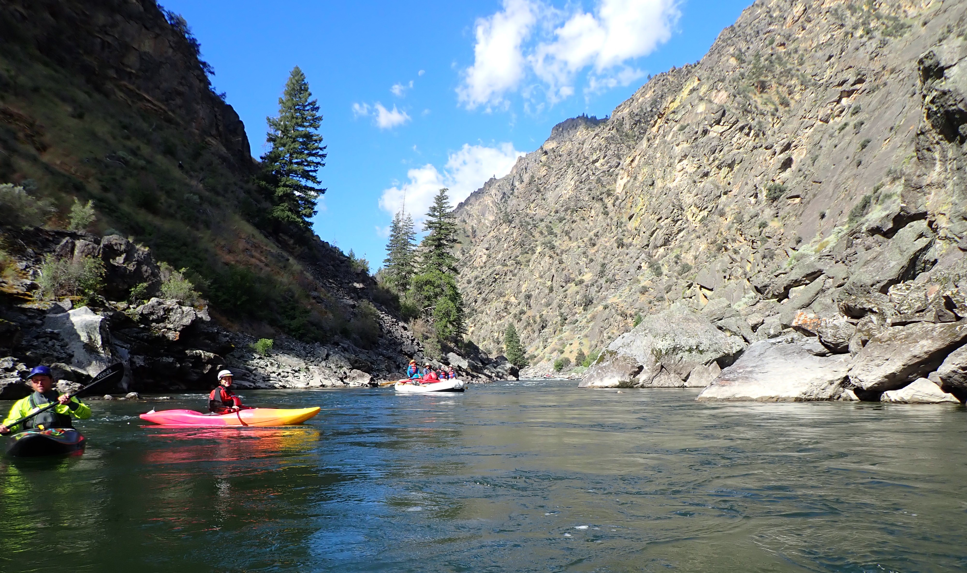
We met at 7:00 AM outside at Perks and Peaks Coffee Trailer, loaded the kayaks and the bus and headed to Boundary Creek put in on the Middle Fork of the Salmon. Some of us had the privilege to take a trip down the Middle Fork in 2017 and we were very excited to get to spend time on it again. The Middle Fork of the Salmon is one of the 8 rivers in the United States originally designated as Wild and Scenic back in 1968. After the usual safety talk, rounding up gear, and meeting our guides, we embarked on the Middle Fork at a level of 3.25 feet. Our guides for the trip were Taylor Wilcox, Fritz Horst, Thomas Batey, Cody Pugil, Rob Dela Cruz, and Chris and Sara Lundy. Little did we know how fortunate we were to have such an incredible team for our trip. The riverbanks were quite changed from our previous trip due to the wildfires of 2022. The grass and low plants had returned, but there were still many standing and downed burned trees. We ran the super fun upper part of the river, including Sulfur Slide, Half Mile (a solid Class IV at the top went between two rocks followed by three large holes that you had to navigate), and Velvet Falls, all fun rapids. We scouted Half Mile and Velvet due to landslides and downed trees changing the course of the river. The river this day was full of large punchable holes, big waves, and lots of fun. It was a very different level and more technical than last time at 6.5 feet. The water was cold and splashy and most of us were happy to have wetsuits.
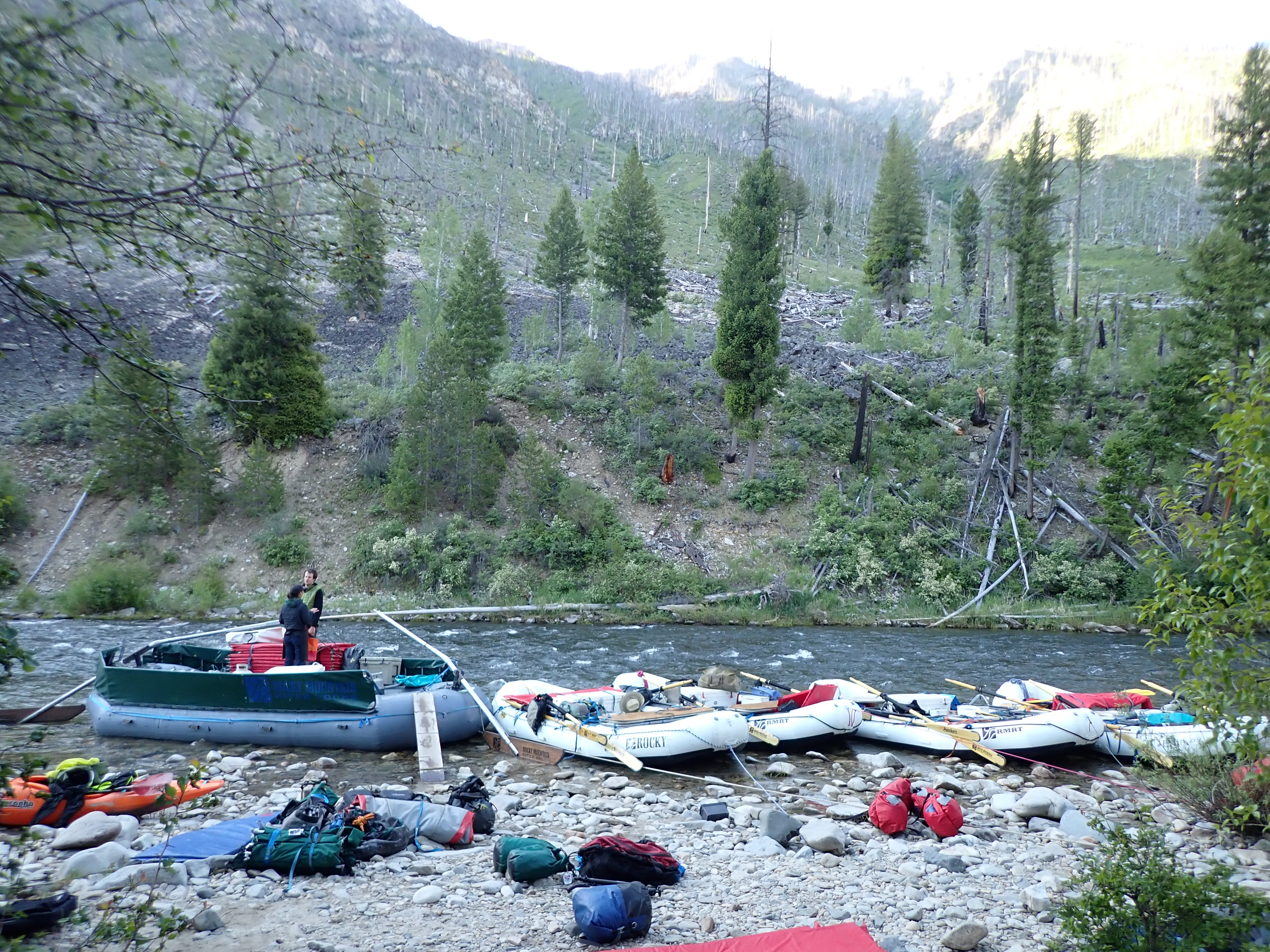
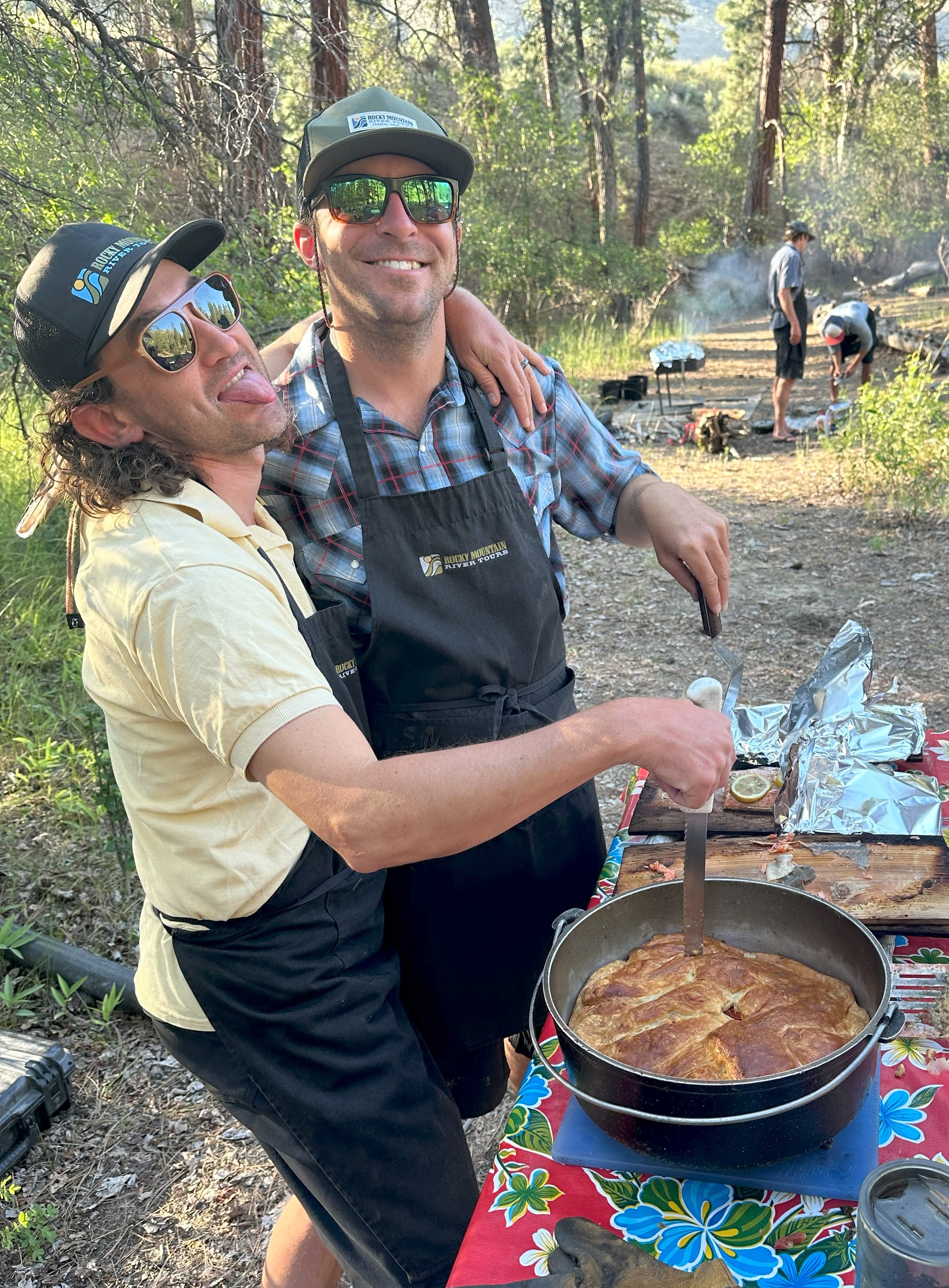
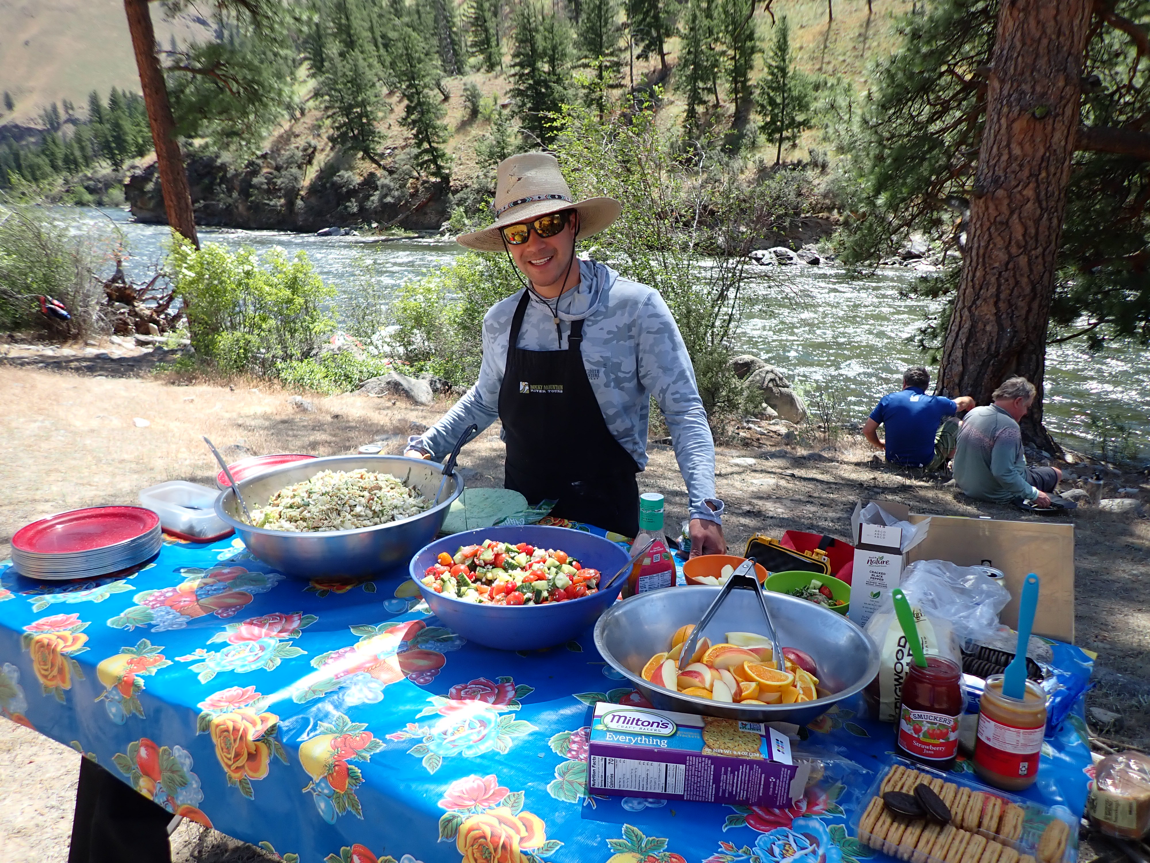
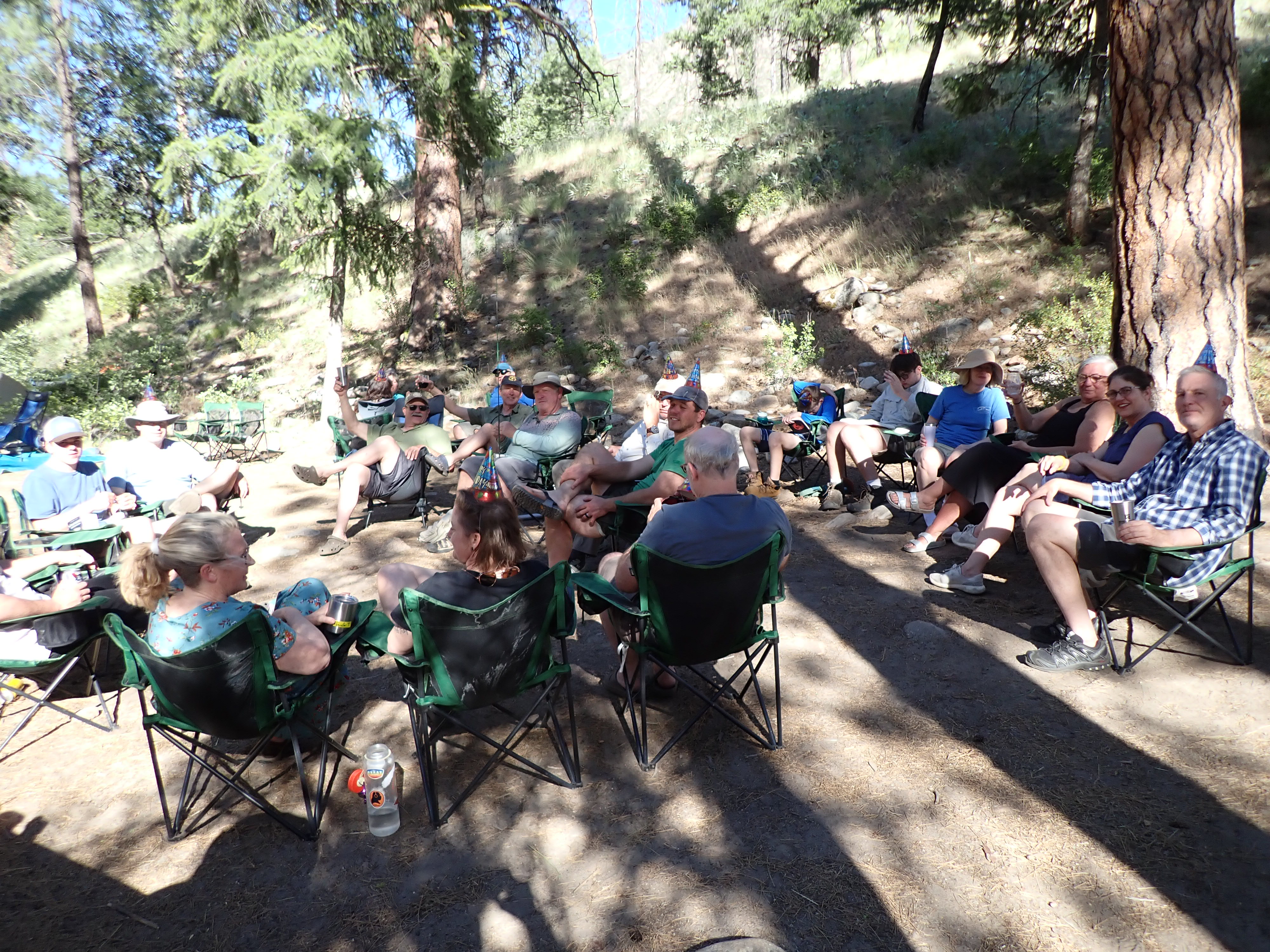
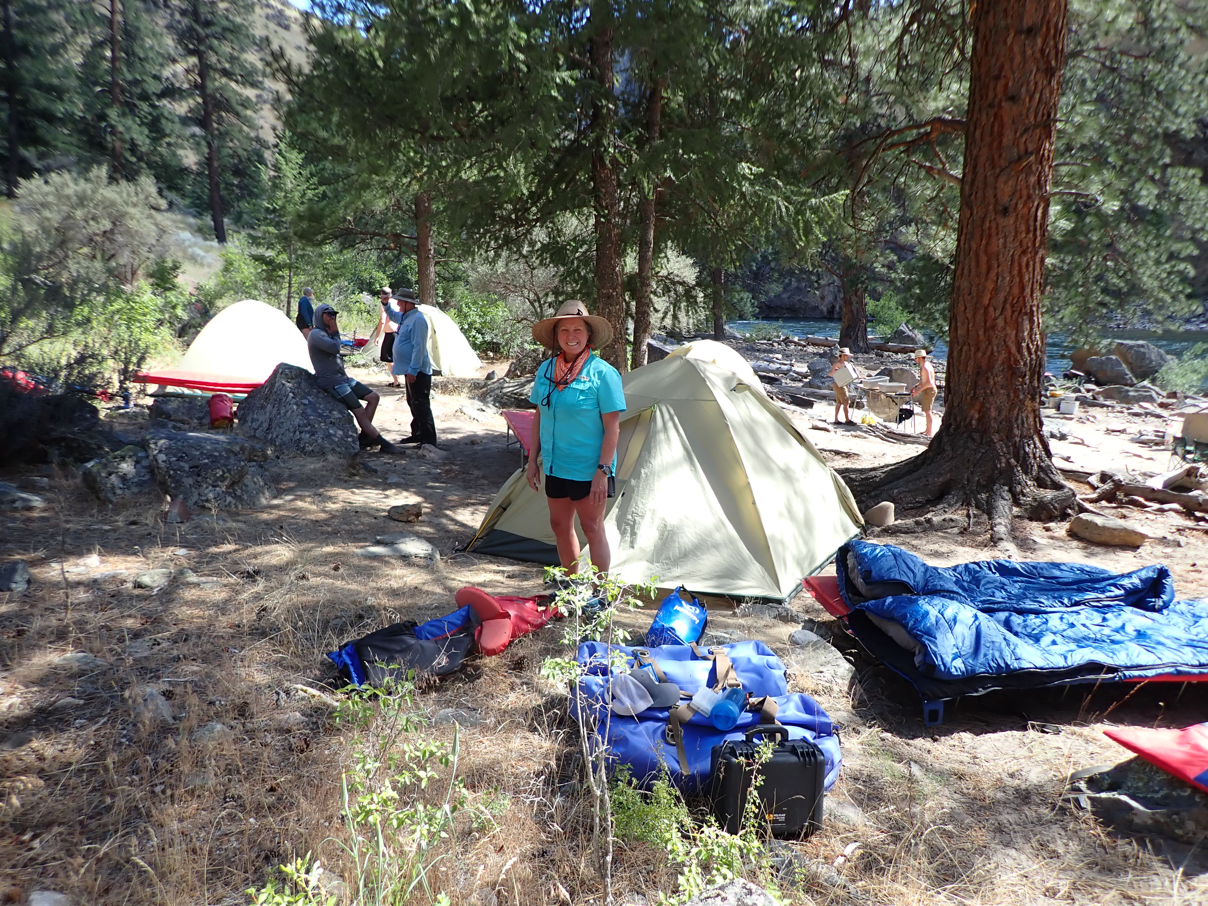
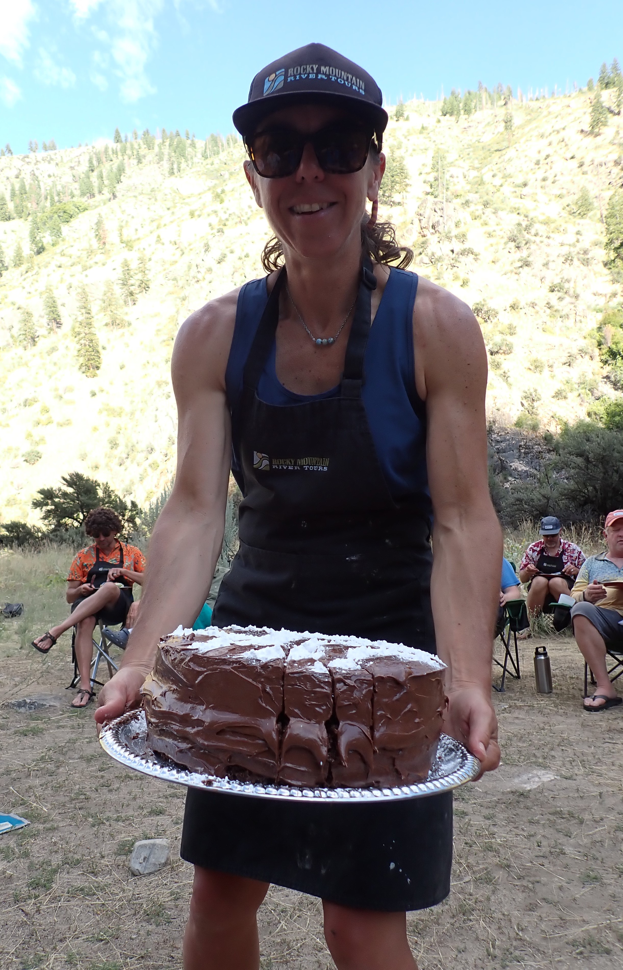
After about 12 miles, we came to our first campsite named Scout around 4:00 PM. Rocky Mountain River Tours had all the tents and cots set up when we arrived. The campsite was in willow reeds with little paths to the tent areas. The open gathering area was small, but beautiful with large trees encircling it. Dinner was amazing lasagna cooked in Dutch ovens. We had plenty of food and drink with lemon cake for dessert. In spite of the very active mosquitos, most of the group stayed up and talked until about 10:00 p.m. enjoying a cool clear evening.
Day 2, Sunday, June 23, 2024
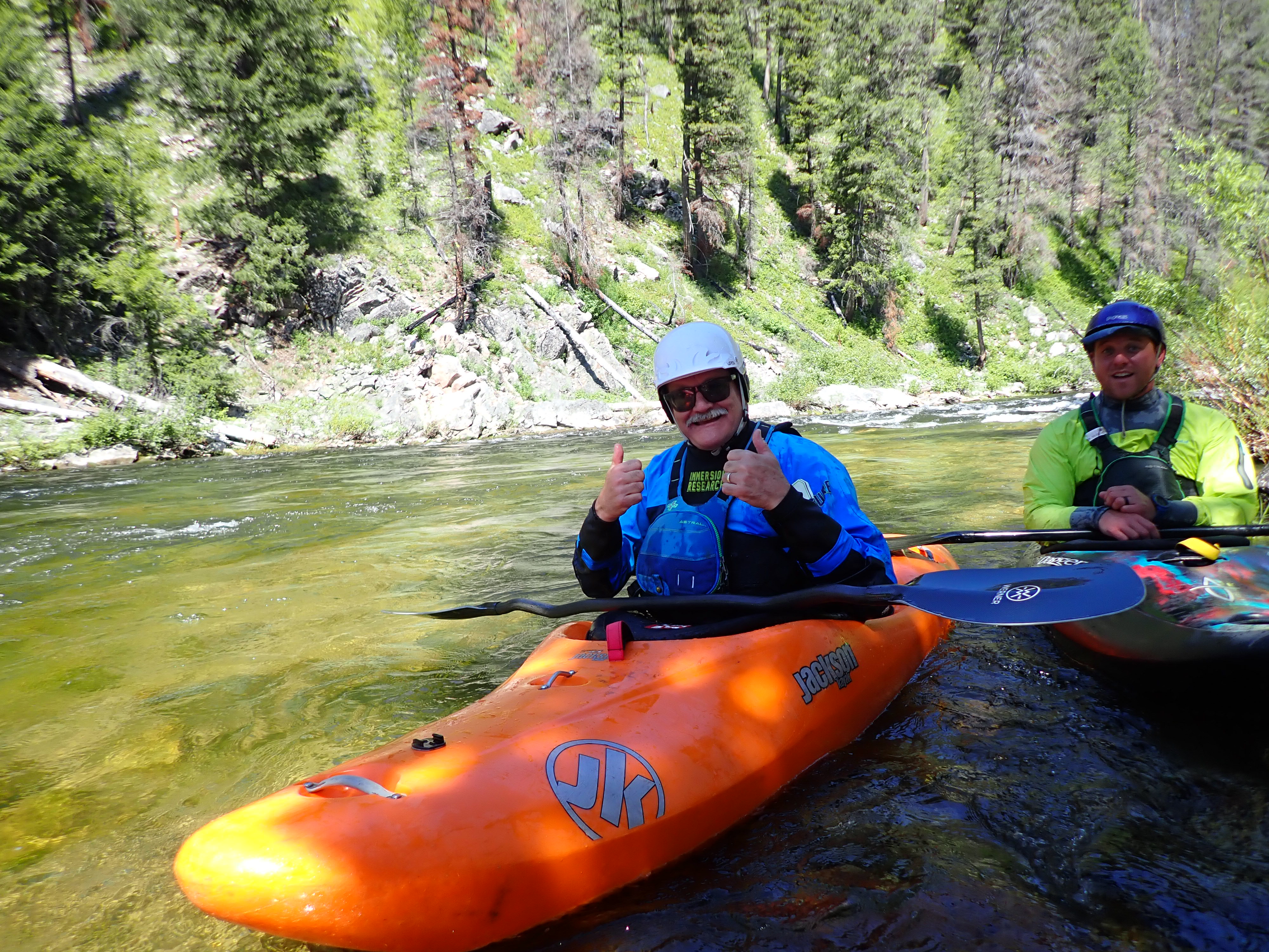
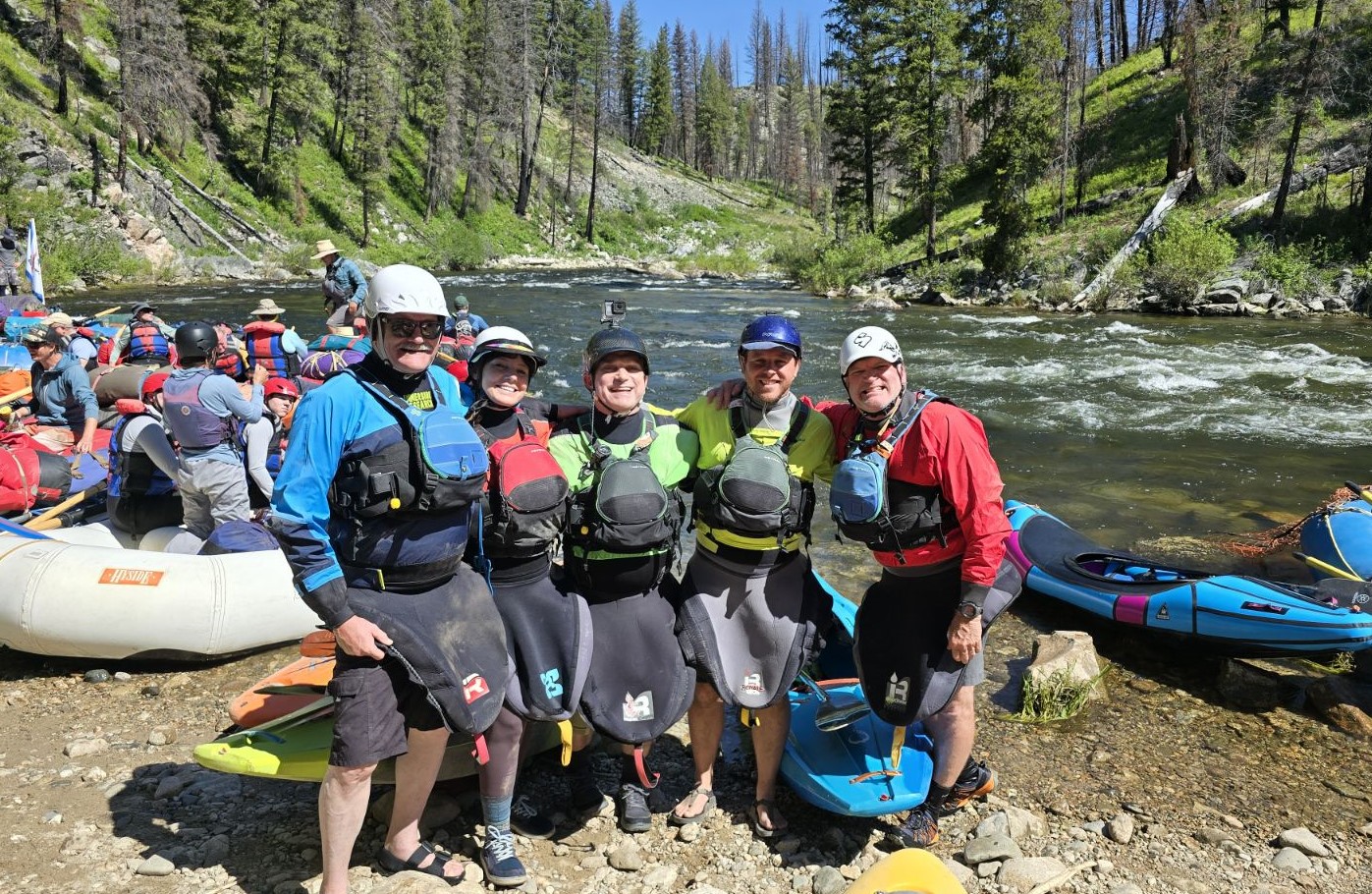
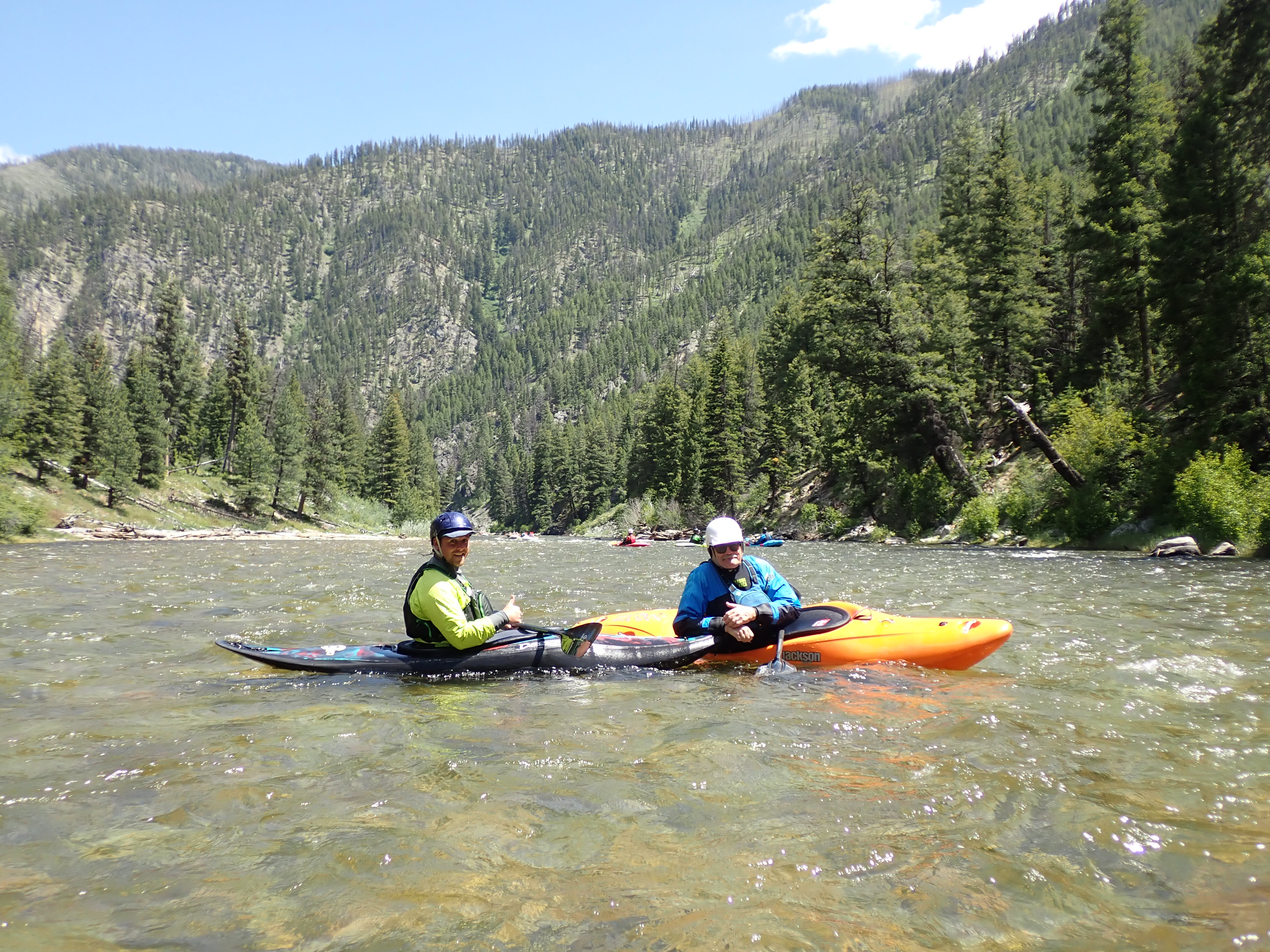
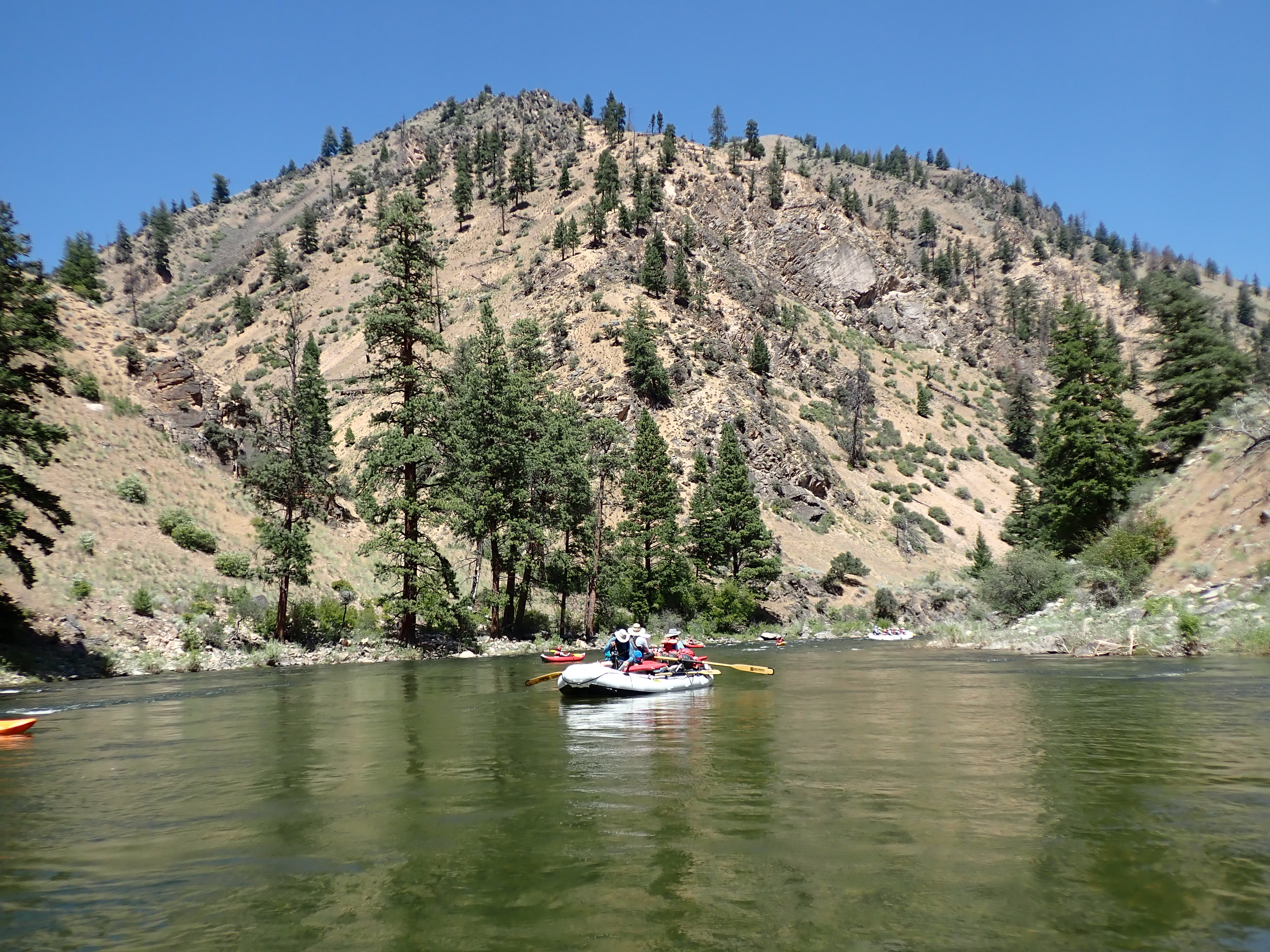
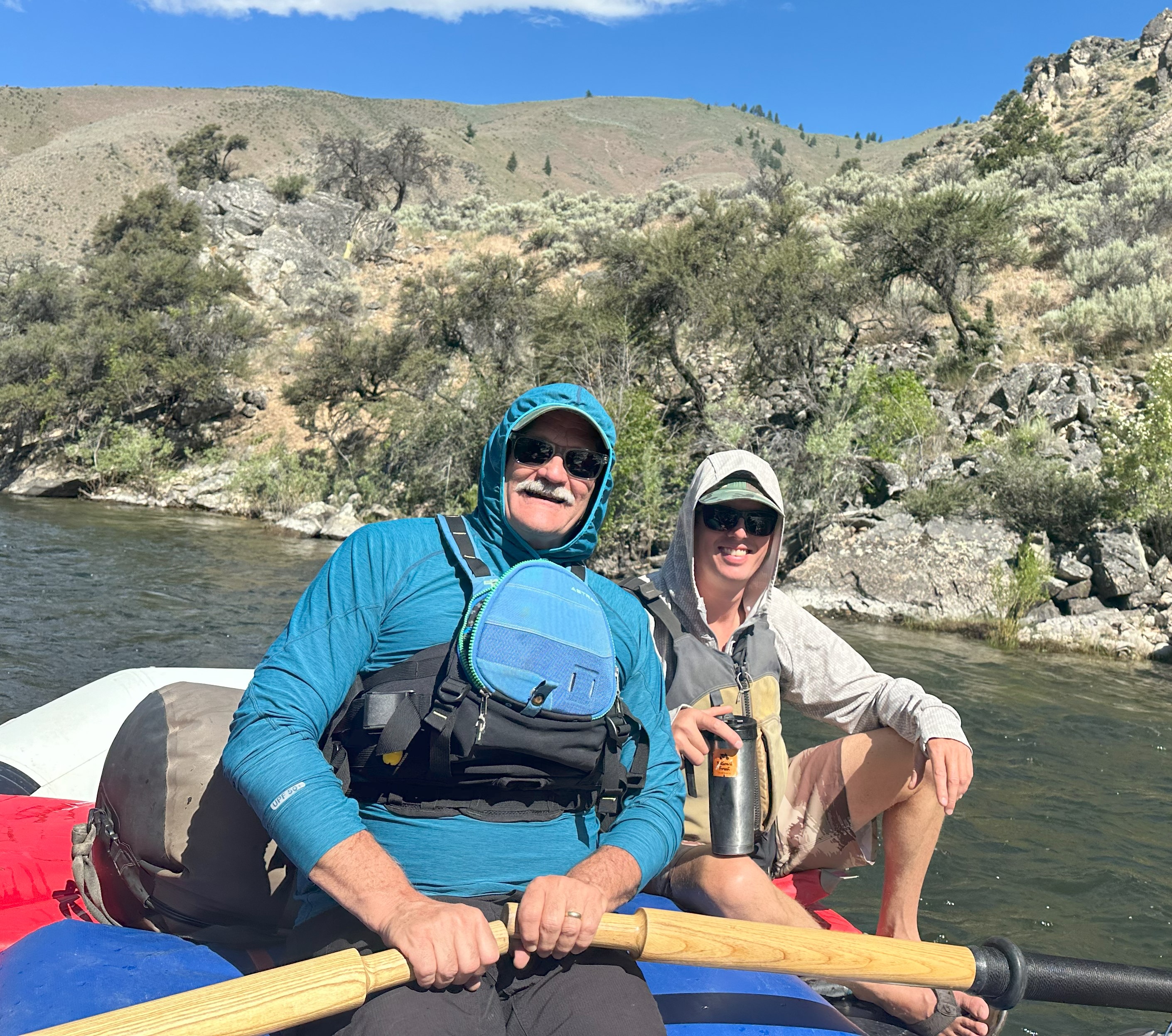
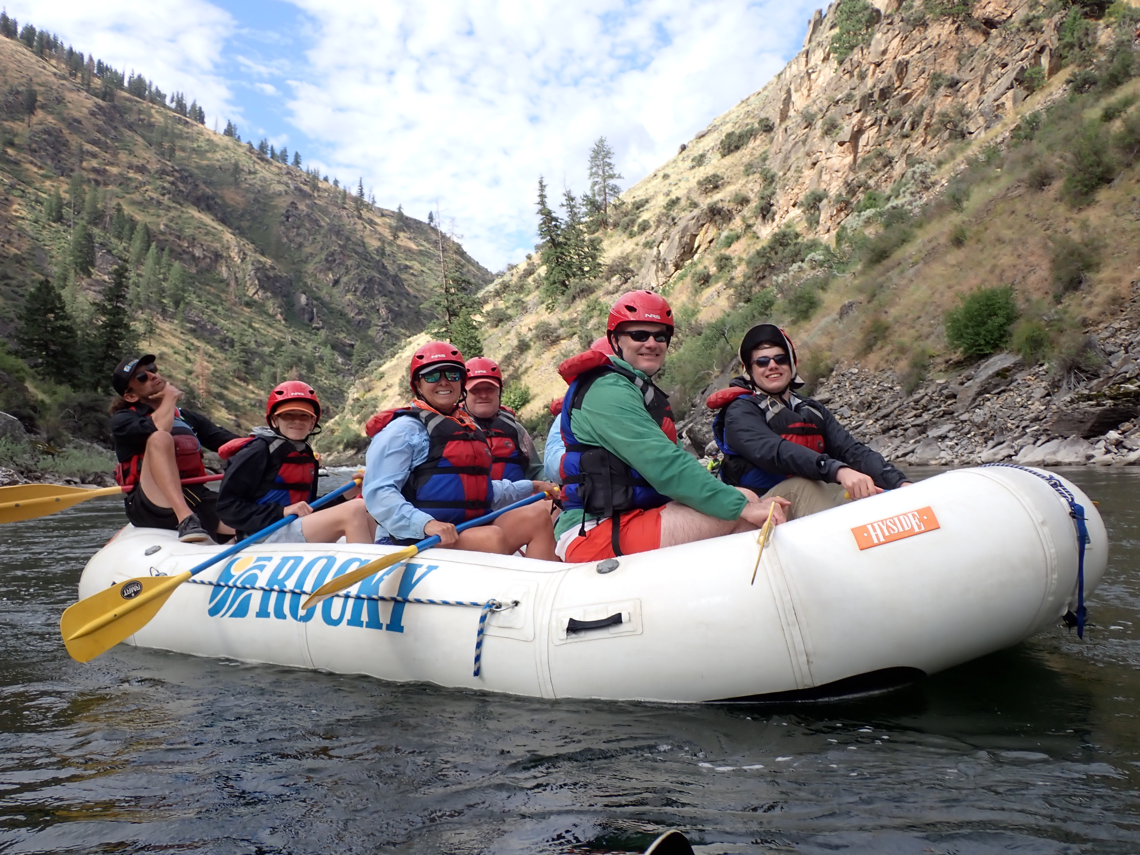
We began Day 2 with coffee and a relaxed morning time at Scout campsite. After a great breakfast of egg and sausage casserole and mixed fruit flavored with mint, Fritz unfurled a large map of Idaho and pointed out the 3 major regions and the unique features of each- the lake area in the north, the middle area with the mountains (the Batholith) and the lower Snake River plains. After leaving camp around 10 a.m., we began another fun river day traveling through busy water at the top with a few larger rapids. We soon came to Pistol Creek Rapid, a big S turn that went right and then left into a big hole – big water, big fun. We had all of our kayakers paddling that day-Paul, Sheryl, Dave, David, Jimmy, and Bob.
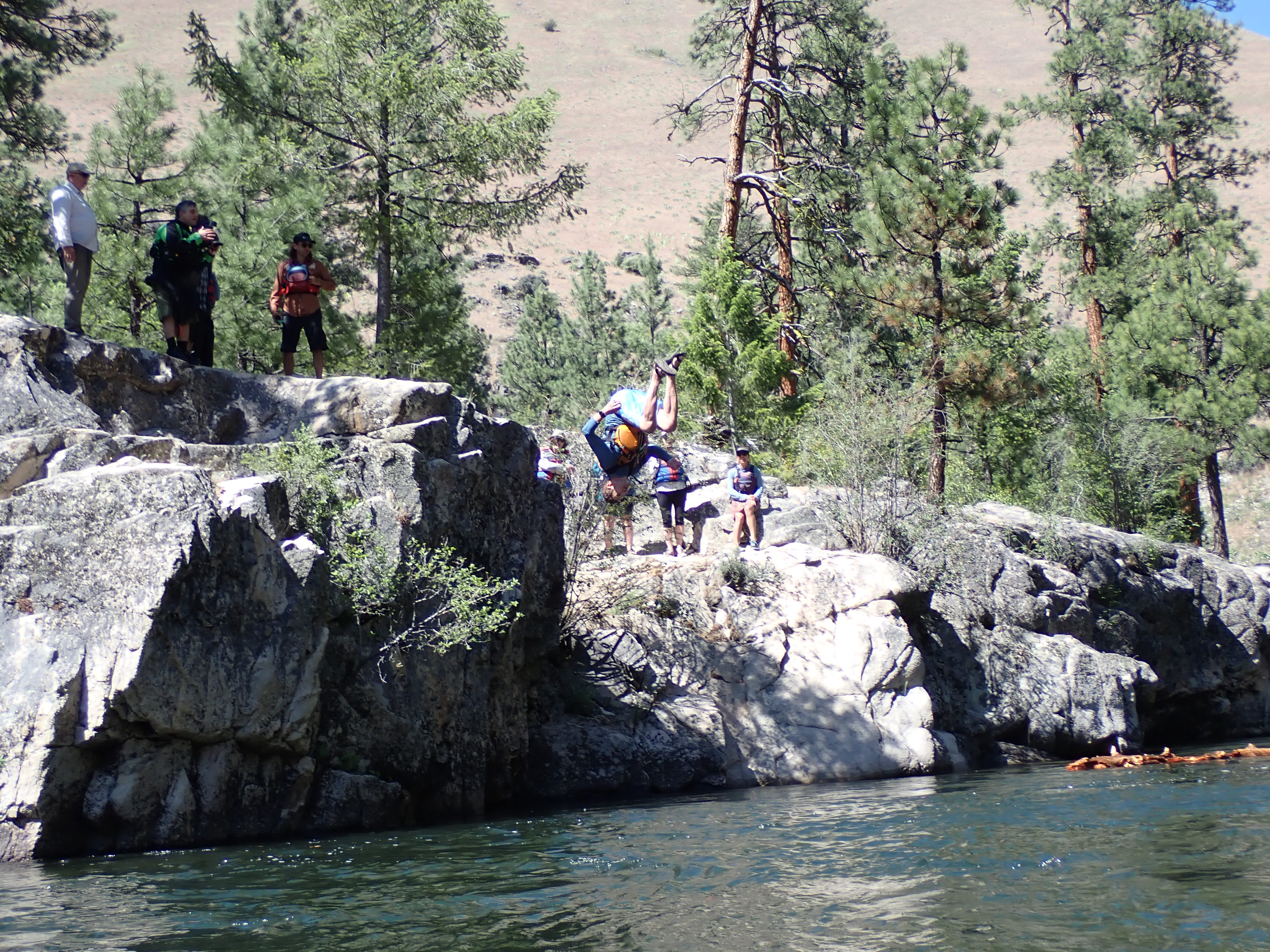
The Indian Creek Launch site was our lunch spot where we feasted on chicken Caesar salad, fruit, sandwich fixings (including PB and J), Oreos, and Nutter Butters. The river was crystal clear. Andrew caught several cut-throat and rainbow trout – at least three in three casts! After lunch, the guides brought out two duckies and Mary and Lochlan started down the river. The upper part of the river had a lot of burned areas, but this section was full of Ponderosa pines with no evidence of burning. The waves were awesome, and the skies were cobalt blue.
During the afternoon, we passed Middle Fork Lodge, which was owned by Charlie Harrah of Harrah’s Casinos, but recently sold to some New Yorkers. It was a rustic cabin-looking place that is supposedly very nice inside. Many famous people have stayed there according to guide Rob. We also stopped to jump off some high rocks near Marble Creek Camp. Soon after, we ended the 22-mile day at State Land Left Camp. It is one of the few areas on the Middle Fork that is actually not part of the national wild and scenic river but owned by the state of Idaho and includes a landing strip. The campsite was beautiful – big Ponderosa pines, sandy beach and level camping area, great river view, and no mosquitoes! After a wonderful dinner of salmon, onion and tomato Dutch oven bake with a salad, we were all sitting in the chair circle when Bob created a treasure hunt with the booty being a bottle of Buffalo Trace Bourbon. He was hoping it would redeem him from the folly at the Grand Canyon in 2019. The clues started with Rob reading the written hints with a pirate accent while covering one eye and balancing on one leg. His creativity set a precedence! Everyone read the clues in his style. The booty bottle was eventually found and passed around the circle, but you had to toot the bottle before taking a swig. That night Joe Swaim taught the guides and Lee Cashion how to remove a cork out of a wine bottle using only a bandana. Now, that was a great evening!
Day 3, Monday, June 24, 2024
We got up early and had a great breakfast of pancakes (with Vermont maple syrup courtesy of Fritz’ family), bacon, and scrambled eggs followed by a lengthy talk by Cody about the life of the sockeye salmon in the Idaho and Washington river system. We learned about their life cycle, how dams have blocked their passage up the rivers, and the efforts of Idaho congressman to remove some of the dams. The thing is the main four are on the Snake River in Oregon and Washington, not in Idaho. Fritz encouraged us to write to our representative in Congress since the dams are controlled by the Army Corp of Engineers.
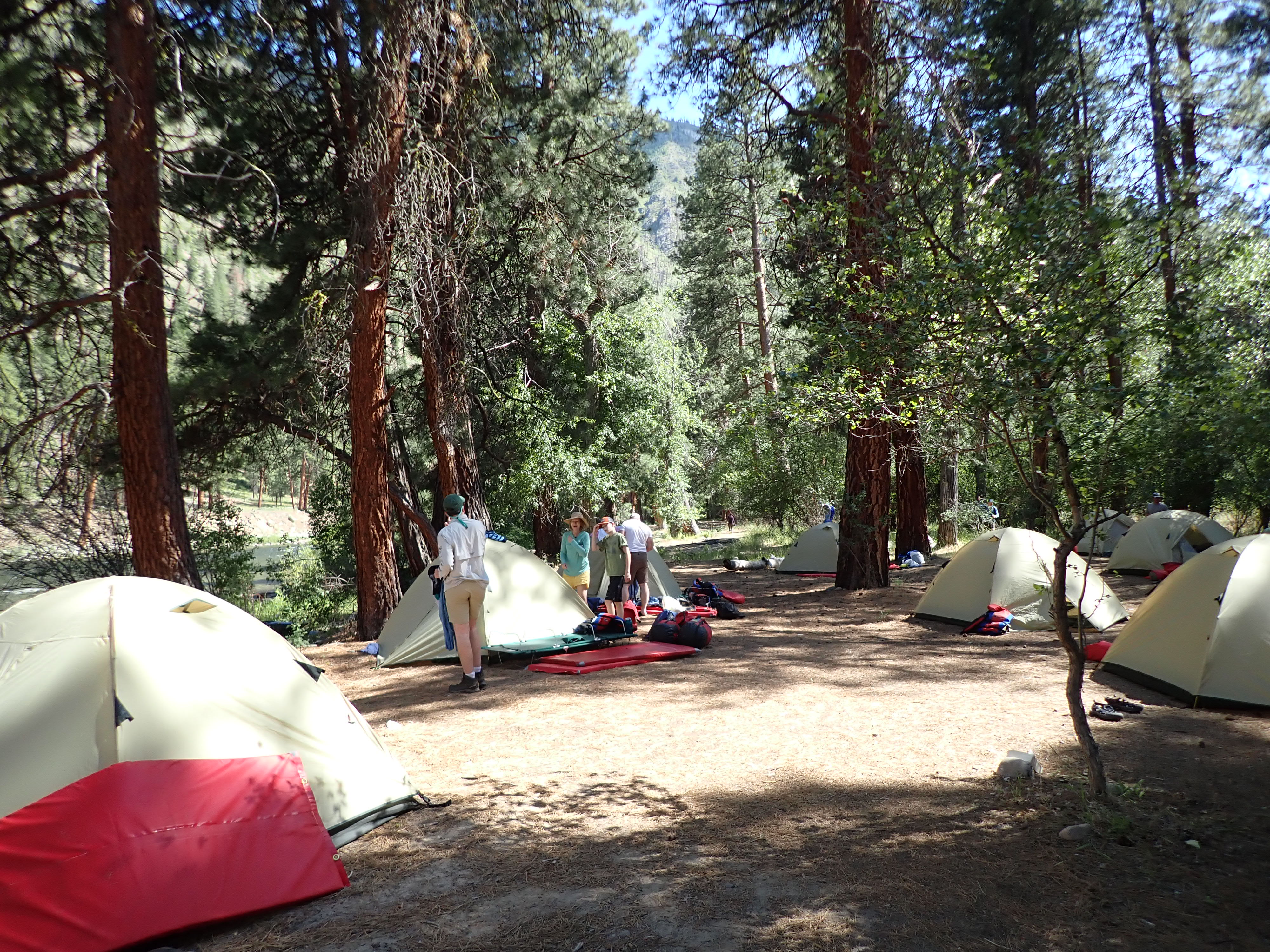
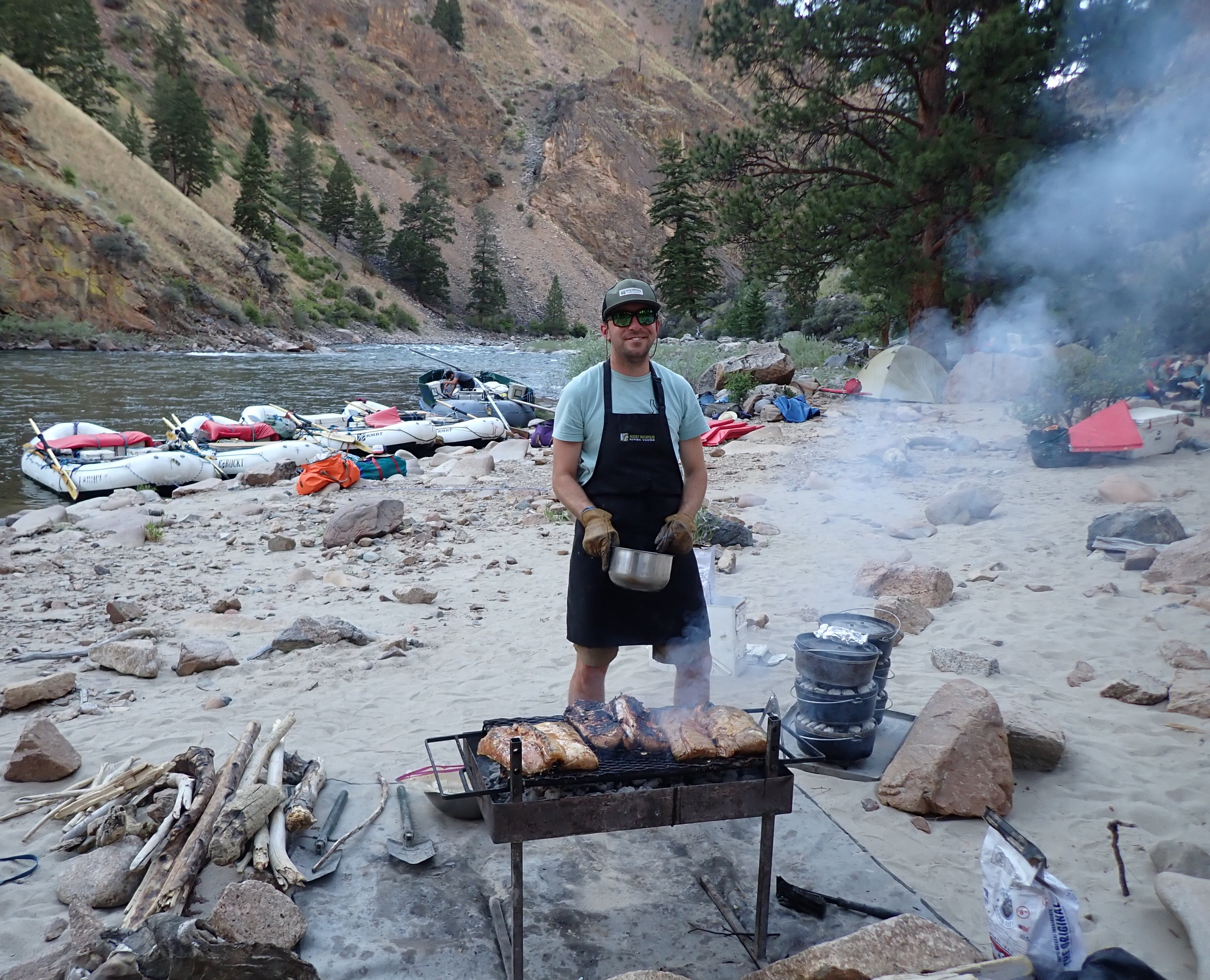
We got on the river about 10 a.m. Bob floated on the raft and let Andrew paddle his kayak. He had a great time on the boat with Taylor who let him row through some of the easier stretches. He had a lot of fun pushing the oars and Taylor was great teaching the small strokes that maneuver the raft and how to check the bubbles for your speed. Between straight downstream and 30 degrees, the raft tracks in that direction, with a very little push it kind of auto ferries the direction it is pointed in. Anything greater than 30 degrees, you have to really push. Perpendicular paddling will stop downstream speed. In the afternoon, David jumped on a raft and Bob paddled his Scorch. During our lunch break, we took a short hike up the hill to view some pictographs likely drawn by the Sheepeater tribe. Later, we stopped for a short break and visited Whitie Cox’s gravestone. He was a World War 2 veteran who was killed in a mining accident.
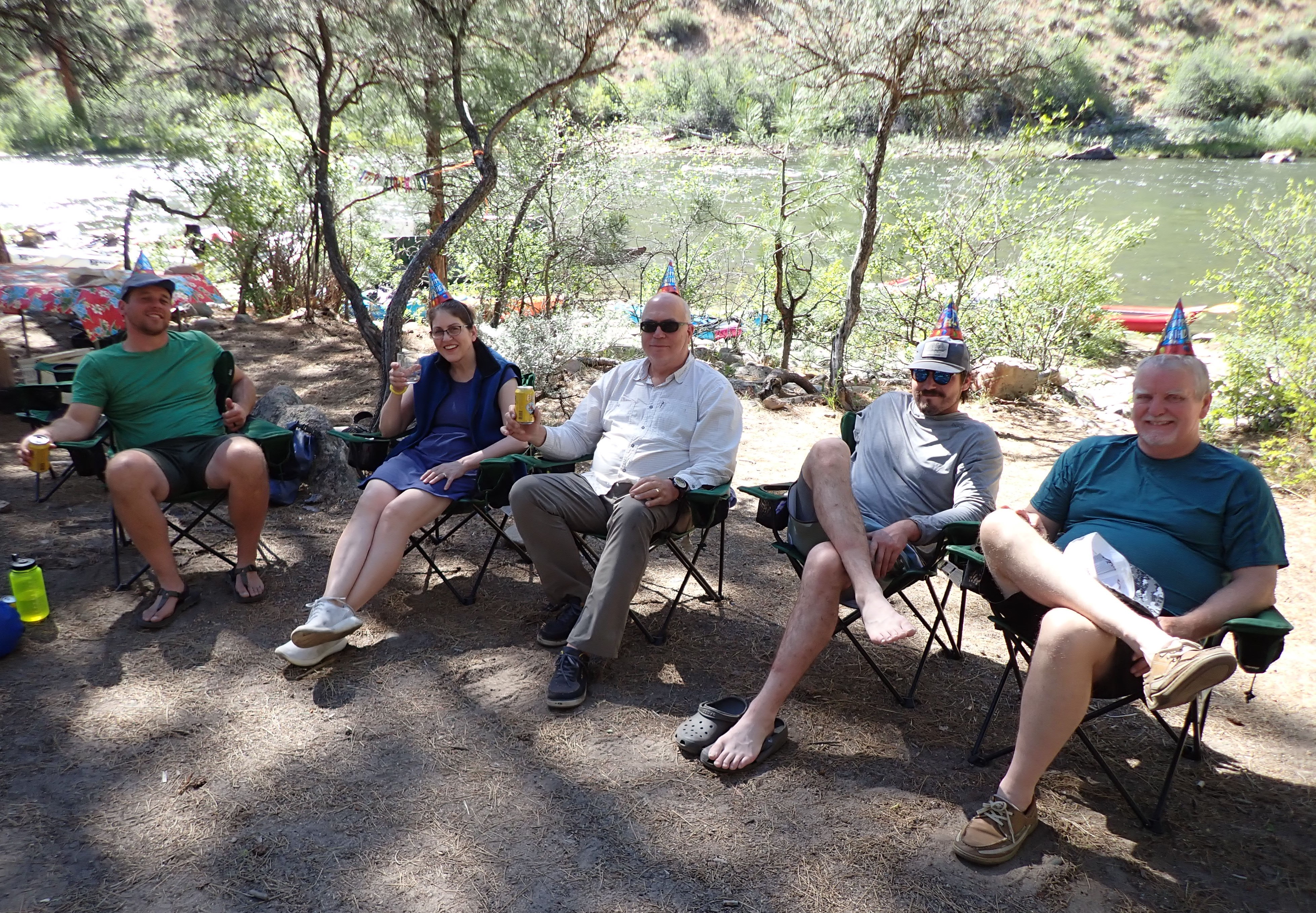
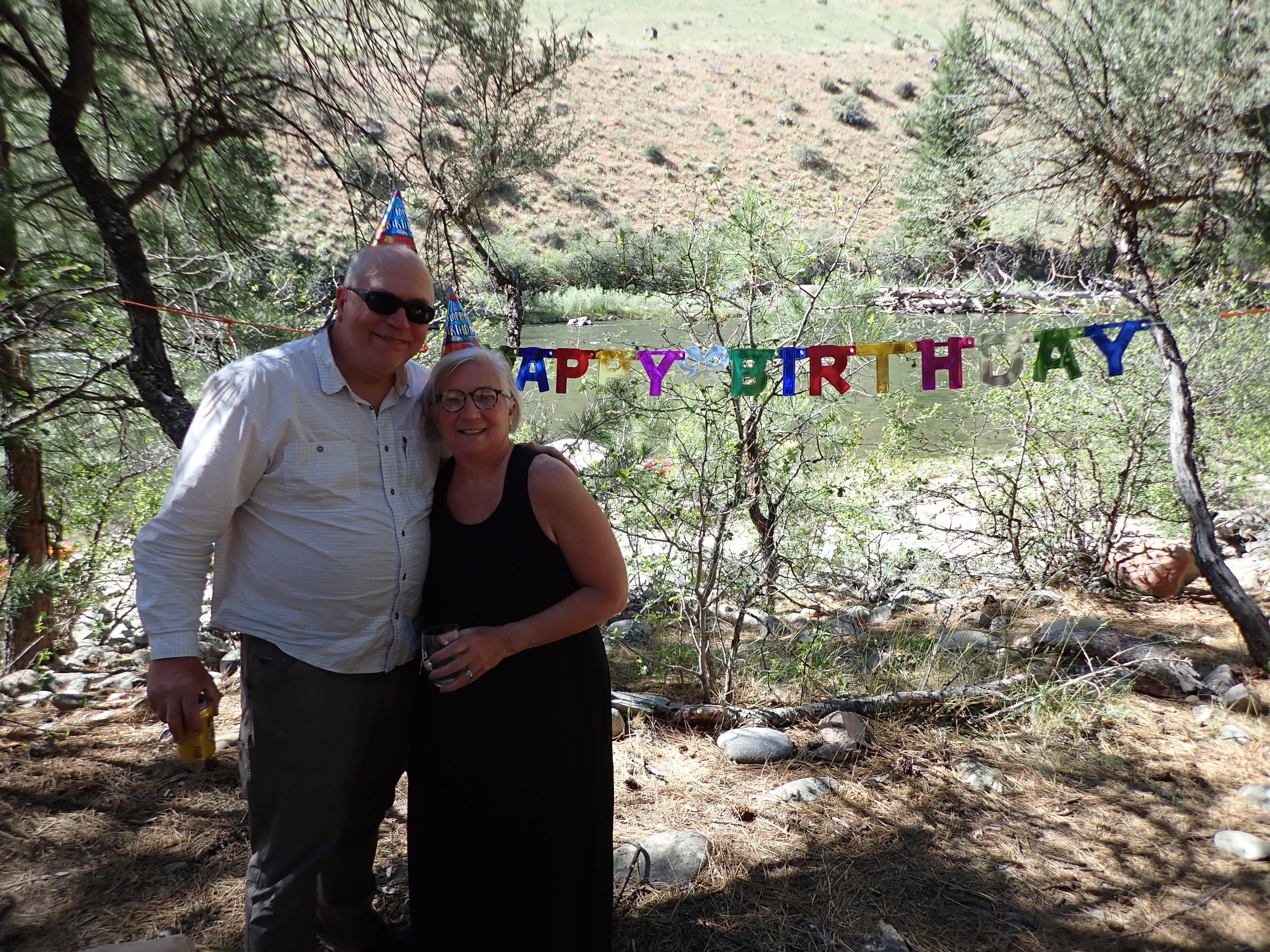
After traveling close to 14 miles, we arrived at Shelf Camp around 4:00 p.m. Our tents were set up in 2 long rows under the trees with a walkway in between. Many of us put our cots outside instead of in the tents. This night found us enjoying margaritas and a Mexican dinner and celebrating Joe Swaim’s 65th birthday. Molly and Rob treated the group to guitar music and Greg E. especially enjoyed an exciting back adjustment by Thomas. As they parted ways to head to bed, Greg’s voice rang out clearly with the simple words to Thomas “Call me…” much to the amusement of those still sitting around the fire.
Day 4, Tuesday, June 25, 2024
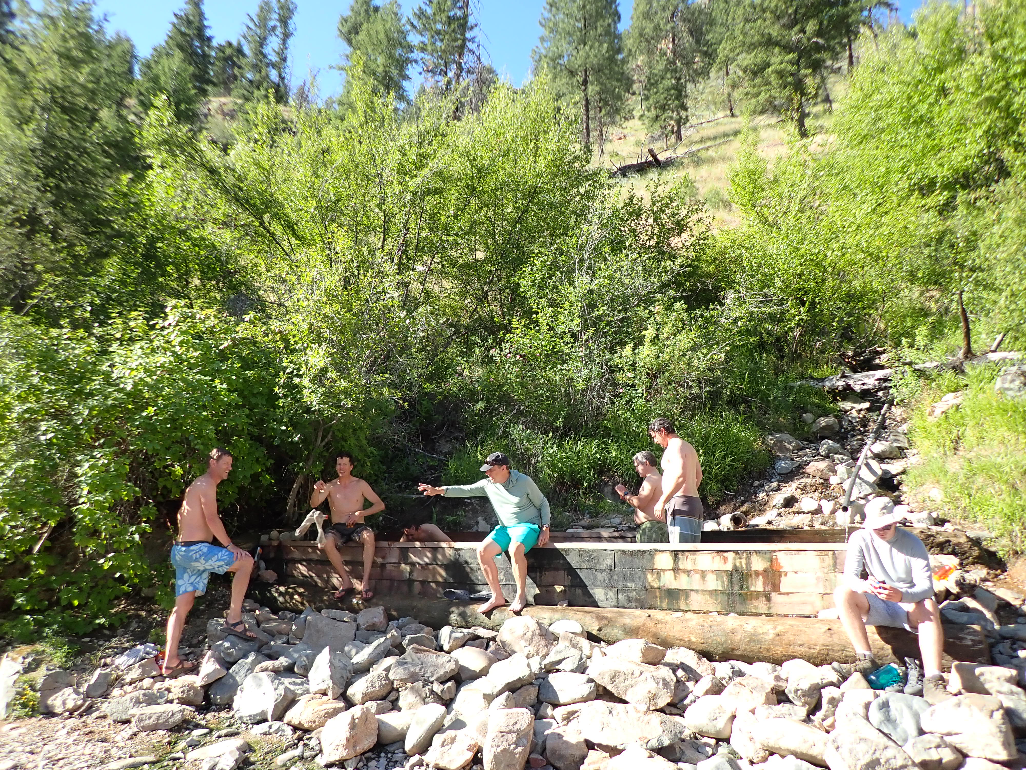
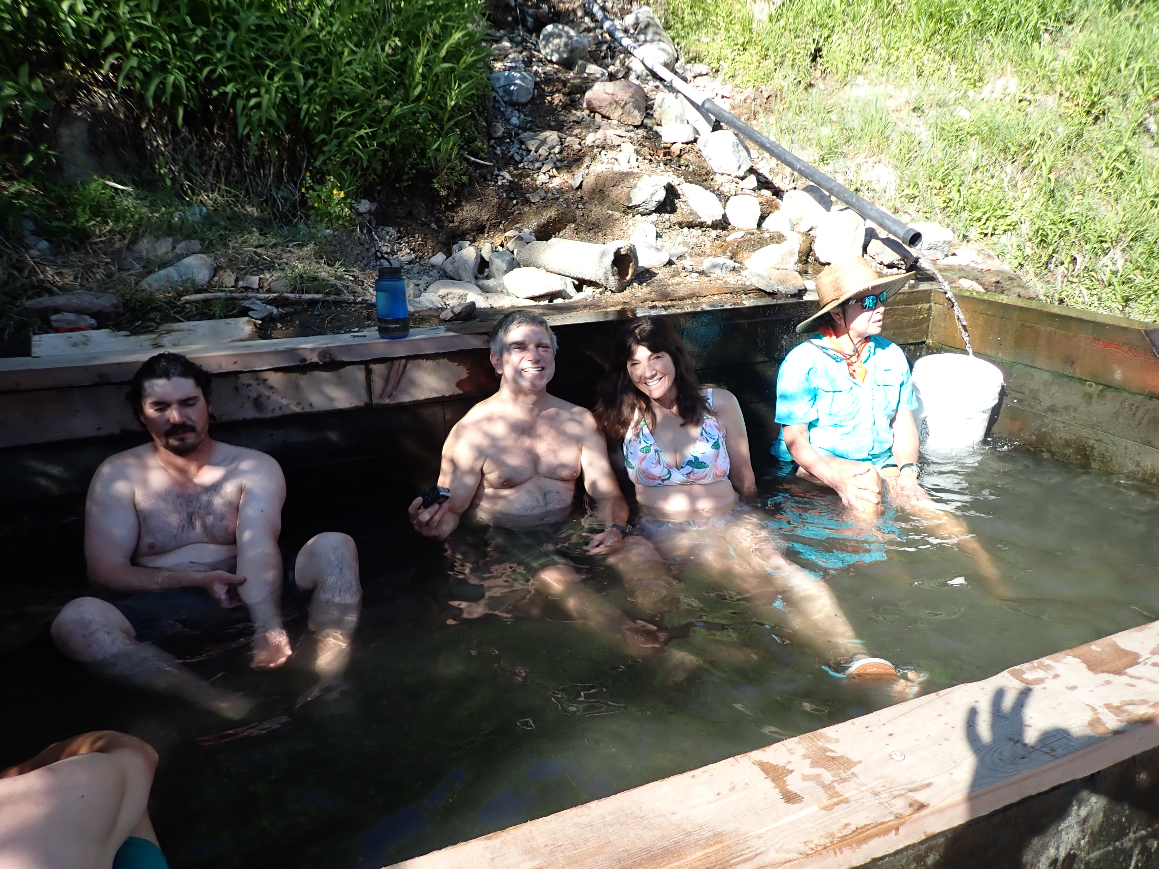
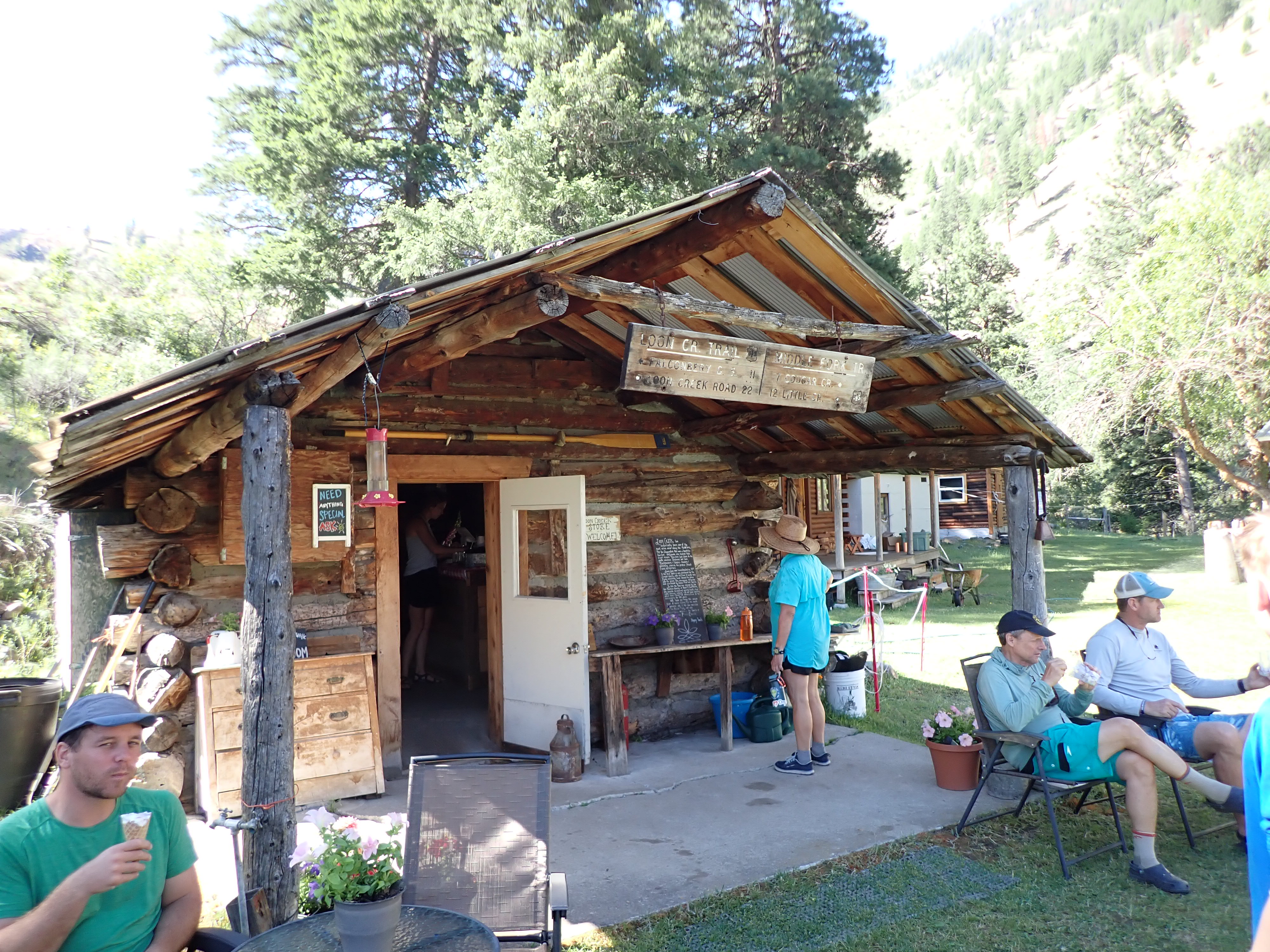
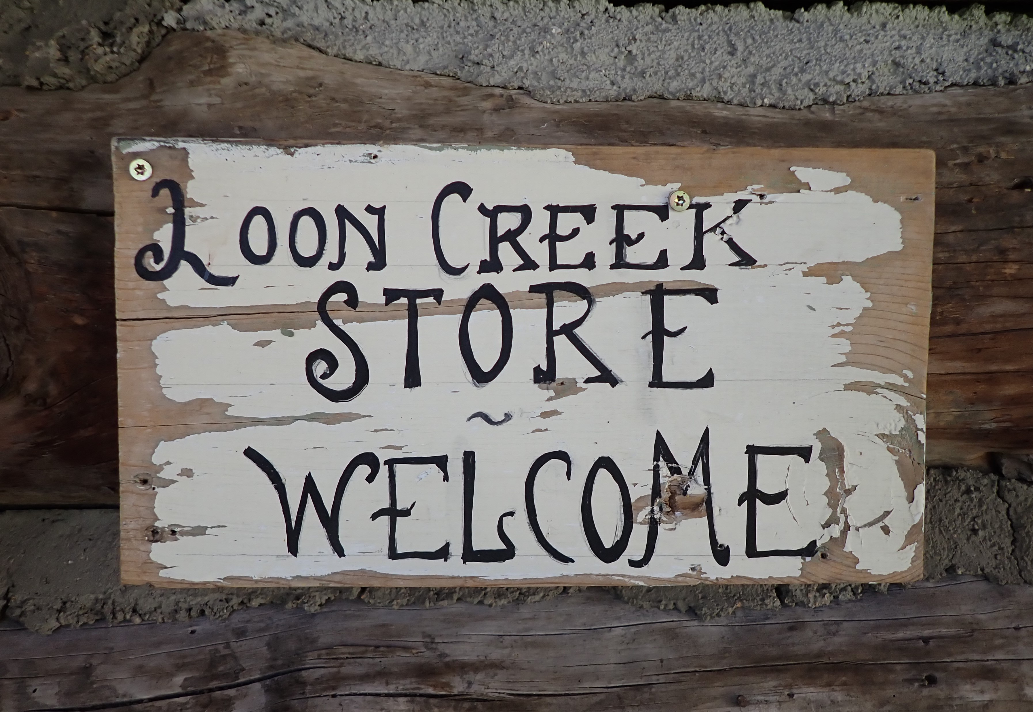
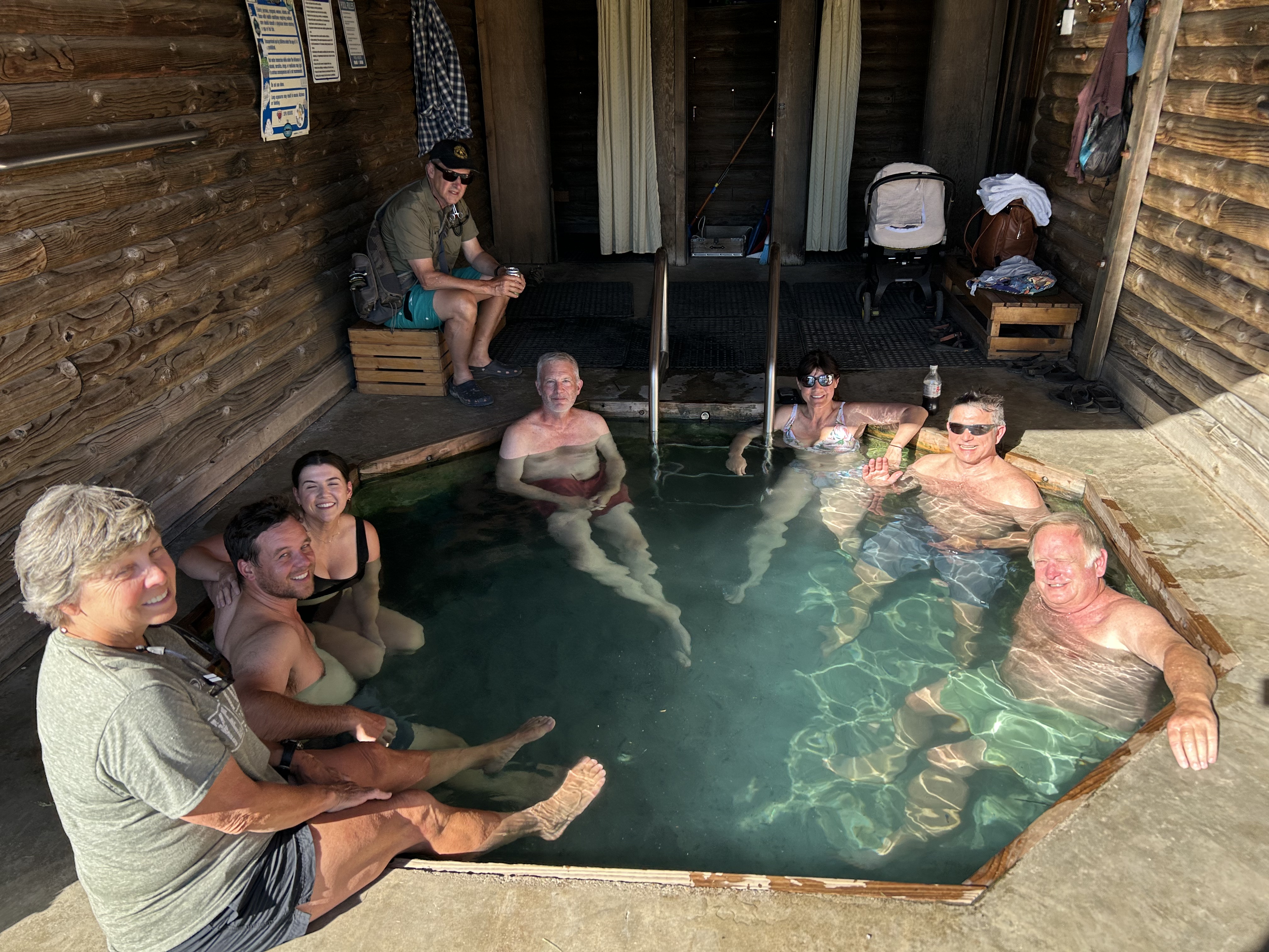
After an amazing night sleeping outside under the stars, breakfast was especially good with custom-made omelets and cinnamon rolls. We cleaned up quickly, struck camp and went on a hike to Loon Creek Hot Springs through the Idaho forest. Along the way, were beautiful flowers including yellow Arrowleaf Balsamroot and white Syringa, the state flower of Idaho. Taylor pointed out that their smell is like the scent of orange blossoms. We so enjoyed walking along Loon Creek, a beautiful tributary at approximately halfway (mile marker 50) down the Middle Fork that it seemed that we arrived at the Hot Springs pretty quickly. The hot springs had recently been improved with a wooden tub with a stone floor. After soaking in it and enjoying the view, we then got into the refreshing cool Loon Creek to cool off and relax. Next, we headed back down the trail and across the creek to the Loon Creek horse camp (a former Chinse mining camp in the 1800s) where some of us indulged in their delicious ice cream.
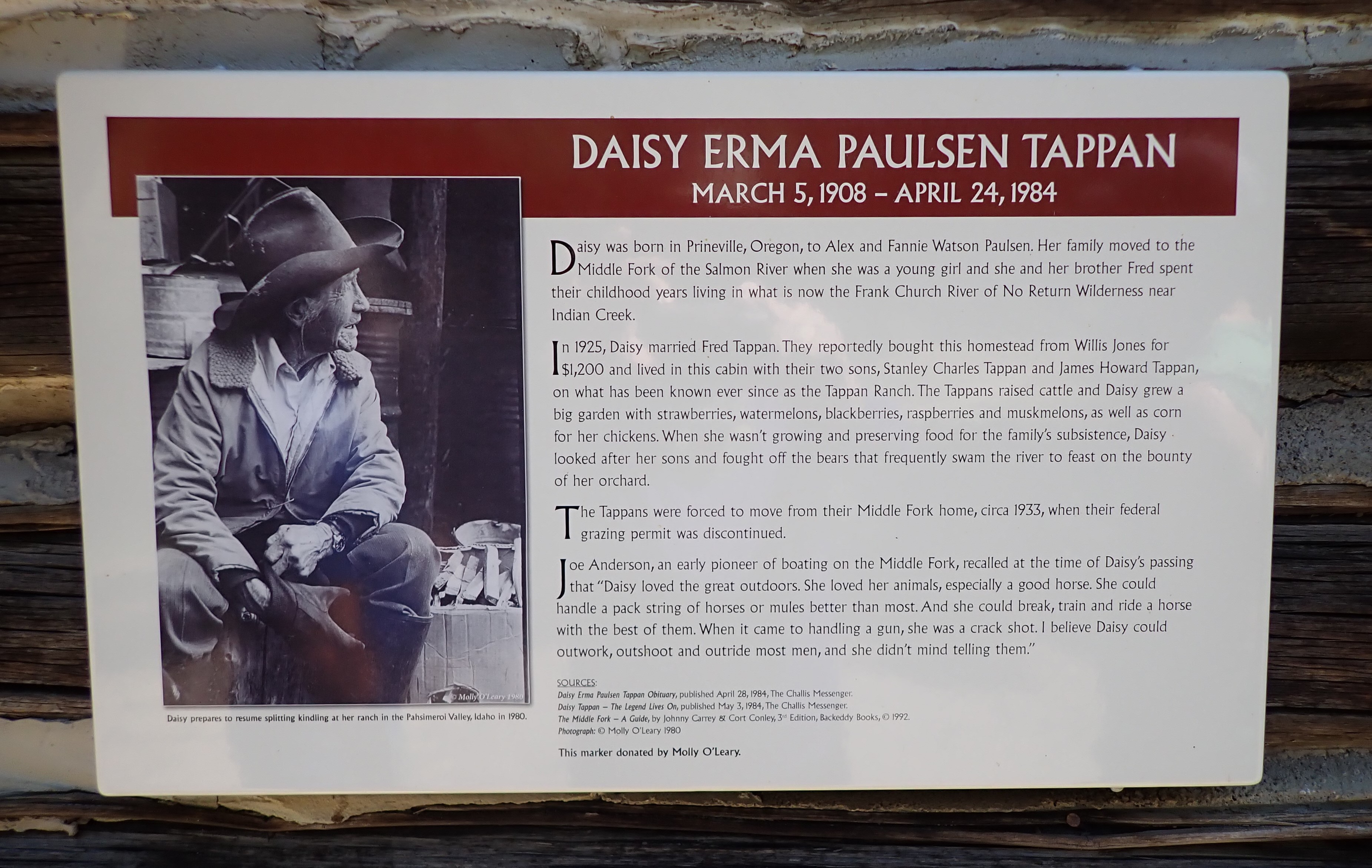
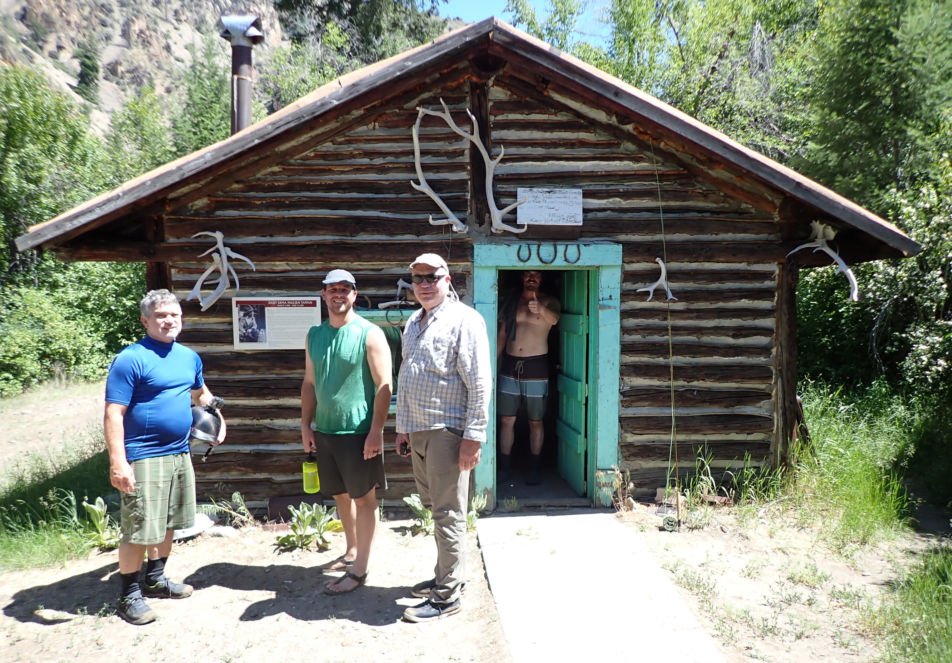
While we were hiking, the guides floated all the rafts and kayaks down to the Loon Creek confluence where we joined them. The MF this morning was class 2/3 busy water. Soon we came to Tappan Falls, a great rapid with a 3-to-4-foot drop with a lot of water pushing through. As we navigated the river, Frank caught 2 trout and Andrew caught 4. A short while later, we stopped for lunch at Daisy Tappan’s old homestead cabin, now used as a hunting camp. After a lunch of chicken salad with fresh pineapple, we sang happy birthday to a raft guide from another company who was a friend of our crew & then got back on the river. The river opened up into high plains after coming through a canyon section that had great water. The high plain area included Flying B Ranch where we remembered stopping in 2017. This year we floated on past to get down to our campsite at Driftwood after a 23-mile day. Prior to Driftwood we had about 2 to 3 miles of really fun canyon busy water-great waves, lots of surfing and straightforward drops. Lee Cashion and Lochland Thompson paddled the duckies. Bob spent some time working with them on how to read the river. Just before camp, some of the rafters saw bighorn ewes and their babies on the riverbank. Driftwood Camp had a wide sandy beach with lots of room for the chair circle overlooking the river. It was a perfect spot for Taylor’s pre-dinner talk about the Lewis and Clark western exploration complete with his US map constructed of natural materials. After a delicious dinner of grilled pork chops, asparagus, salad, sweet potatoes and blueberry pear cobbler, we engaged in a game of Mind Meld and then were privileged to have more guitar music by Molly and Rob.
Day 5, Wednesday, June 26, 2024
After another clear night under the stars, we had a leisurely breakfast of egg casserole and coffee cake. We soon got on the river in the canyon section and had a great morning paddling through continuous fine big wave white water. There were wildlife sitings galore this morning – big horn sheep with ewes, one raft saw a bear cub, and others saw a bald eagle in a burned tree. Weber Rapid was a big drop with huge holes but very straightforward.
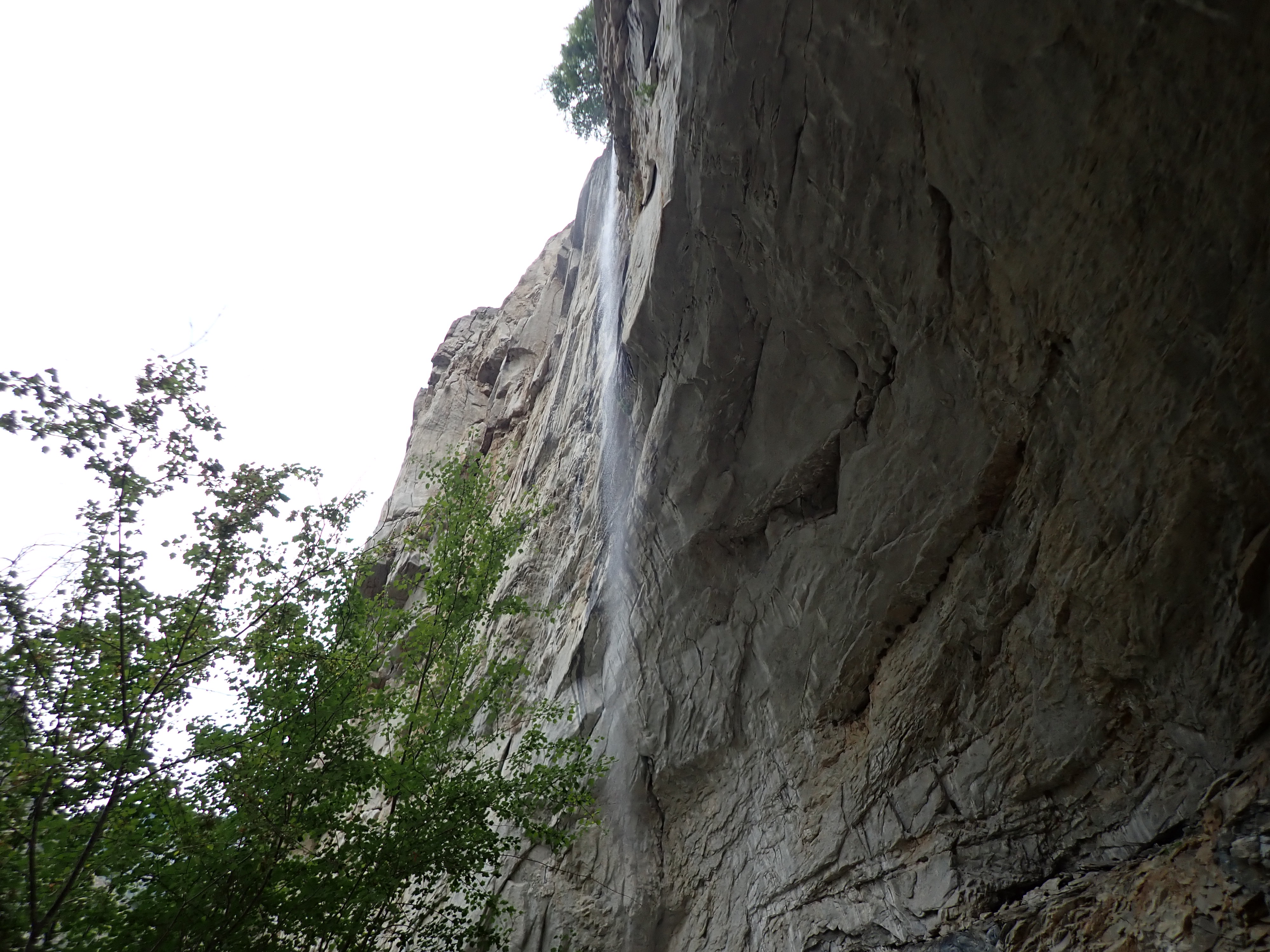
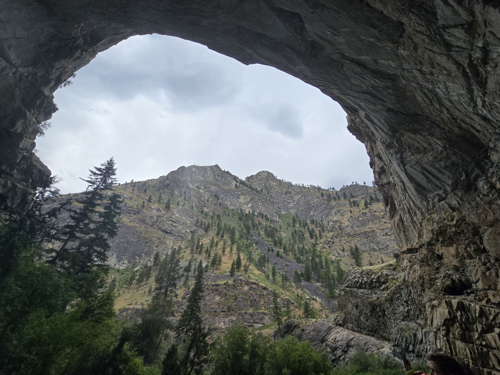
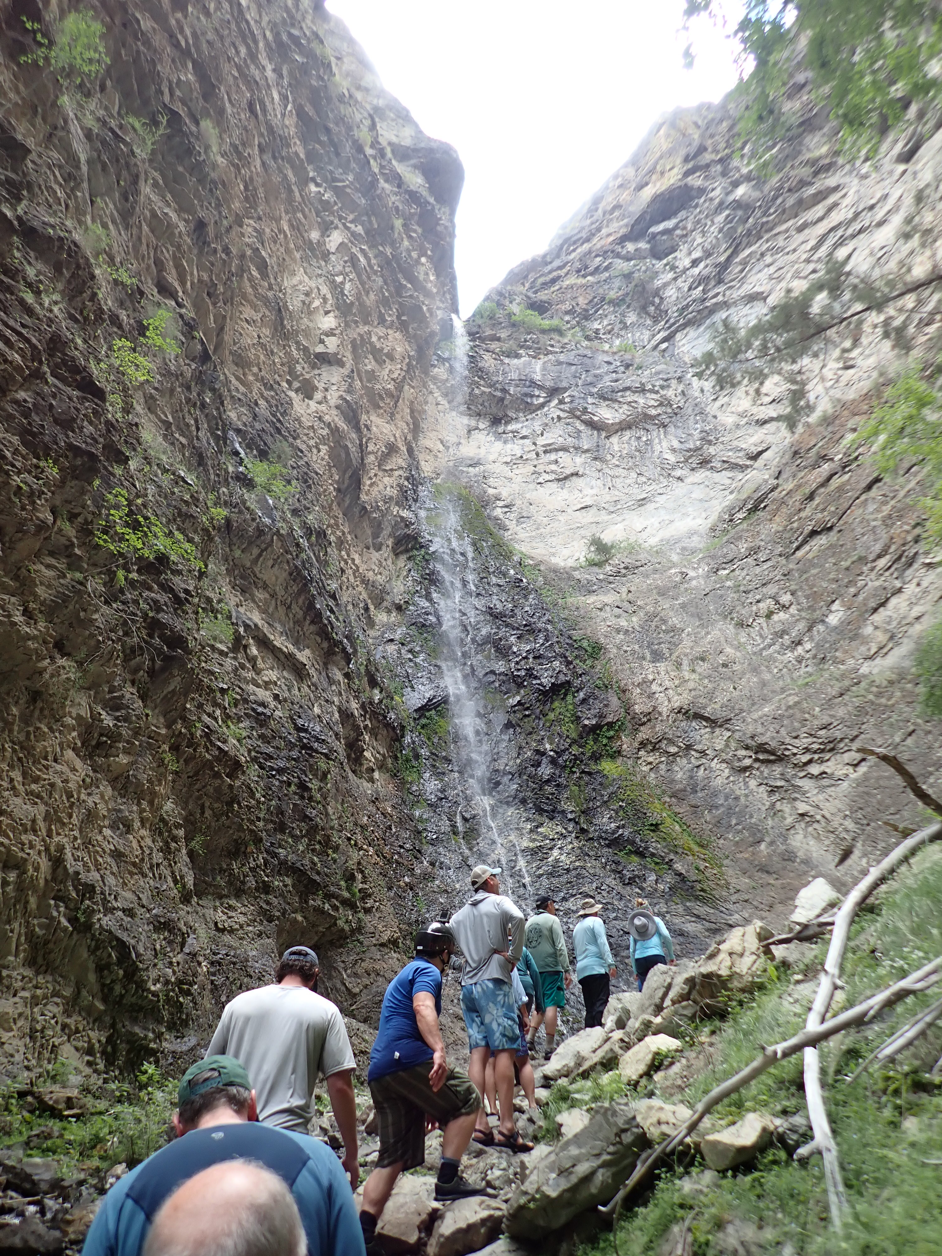
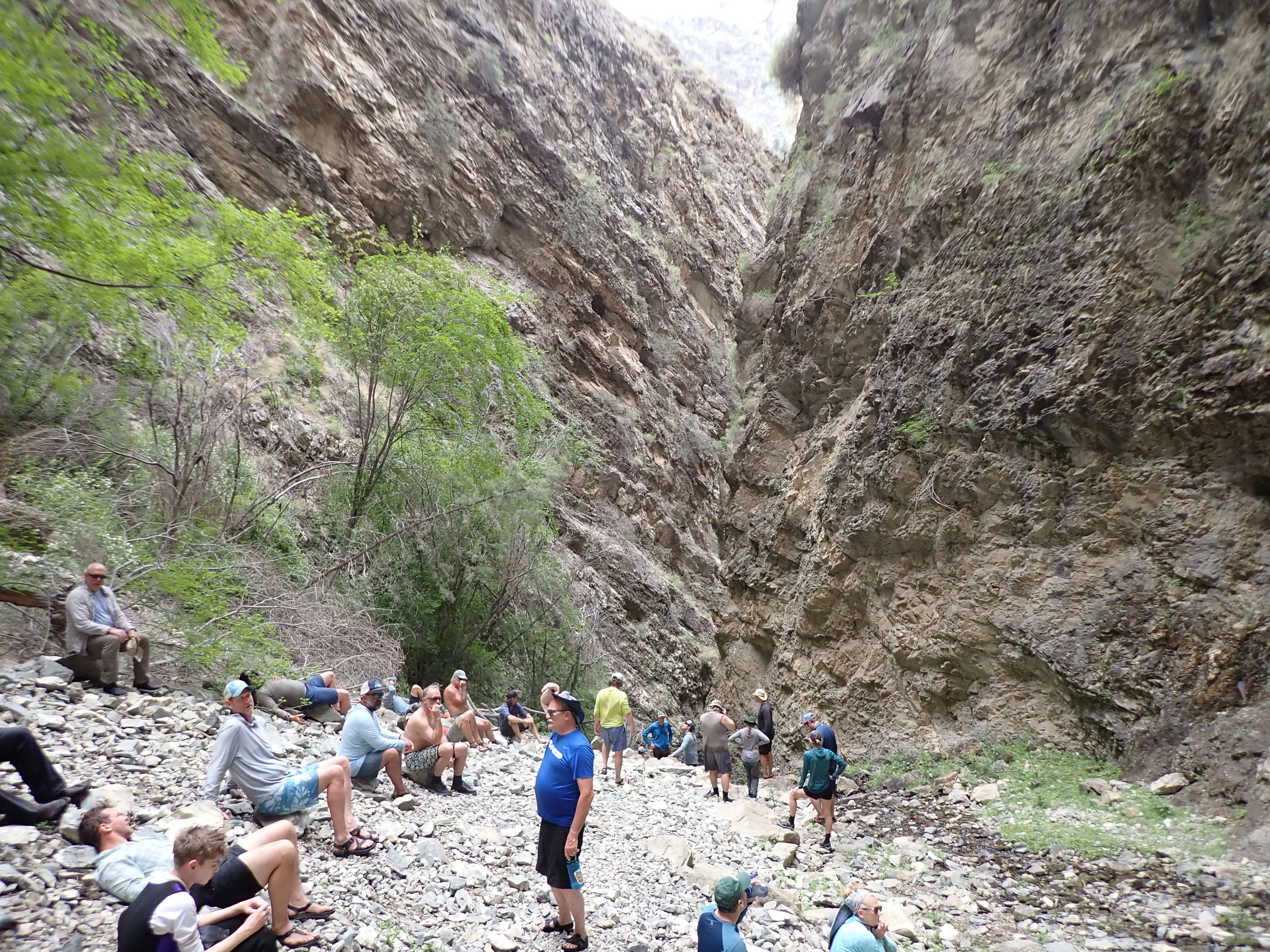
At midday, we stopped and took a short steep hike up to Veil Waterfall where we ate our picnic lunches. It was a beautiful thin line veil waterfall with a lot of greenery around it and provided fantastic views of the river below. We got back in the boats and headed down through the canyon encountering more busy water with nice big waves, but nothing too difficult. Later, we stopped at Parrot Falls, which was the home site of a hermit named Earl Parrot. We hiked up to the grotto waterfall above and as we started hiking down, it began raining on us (first rain of the trip!). We soon headed downriver through more of the canyon which was absolutely beautiful in the rain.
In another mile or so, and after a total of approximately 18 miles for the day, we came to Stoddard Campsite in Impassable Canyon. It was on a flat shelf above the river with lots of grass, Arrowleaf Balsam root and grasshoppers! After the rain, the sun came out and it was very hot for an hour or so until the sun went behind the canyon walls. Our guides brought out champagne and we all toasted to a great week! Once again, we had lots of laughs playing Mind Meld and our last dinner of steak, chicken, potatoes, brussels sprouts and chocolate cake was fantastic! Andrew and Molly played some guitar music, and several people stayed up until the fire pit went out and watched the stars.
Day 6, Thursday, June 27, 2024
River level- finished at 2.7 feet
Bob and several others slept outside on cots under the stars, which were magnificent. There were a few clouds while he was falling asleep. Bob woke up at 5:15 AM with a raindrop hitting him right on his eyelid- one single raindrop. Then he heard thunder in the distance, so he jumped up and quickly put his sleeping bag into the drybag and cleared the sand mat and chairs from the camp area. He helped the guides get things out of the rain in the early morning light. The thunderstorm came as he got into the tent. It rained very hard for 20 minutes and then started hailing and Bob questioned whether or not the tent would hold up. The hail stopped after a bit and then it was just rain. He slept for about another hour till 6:30.
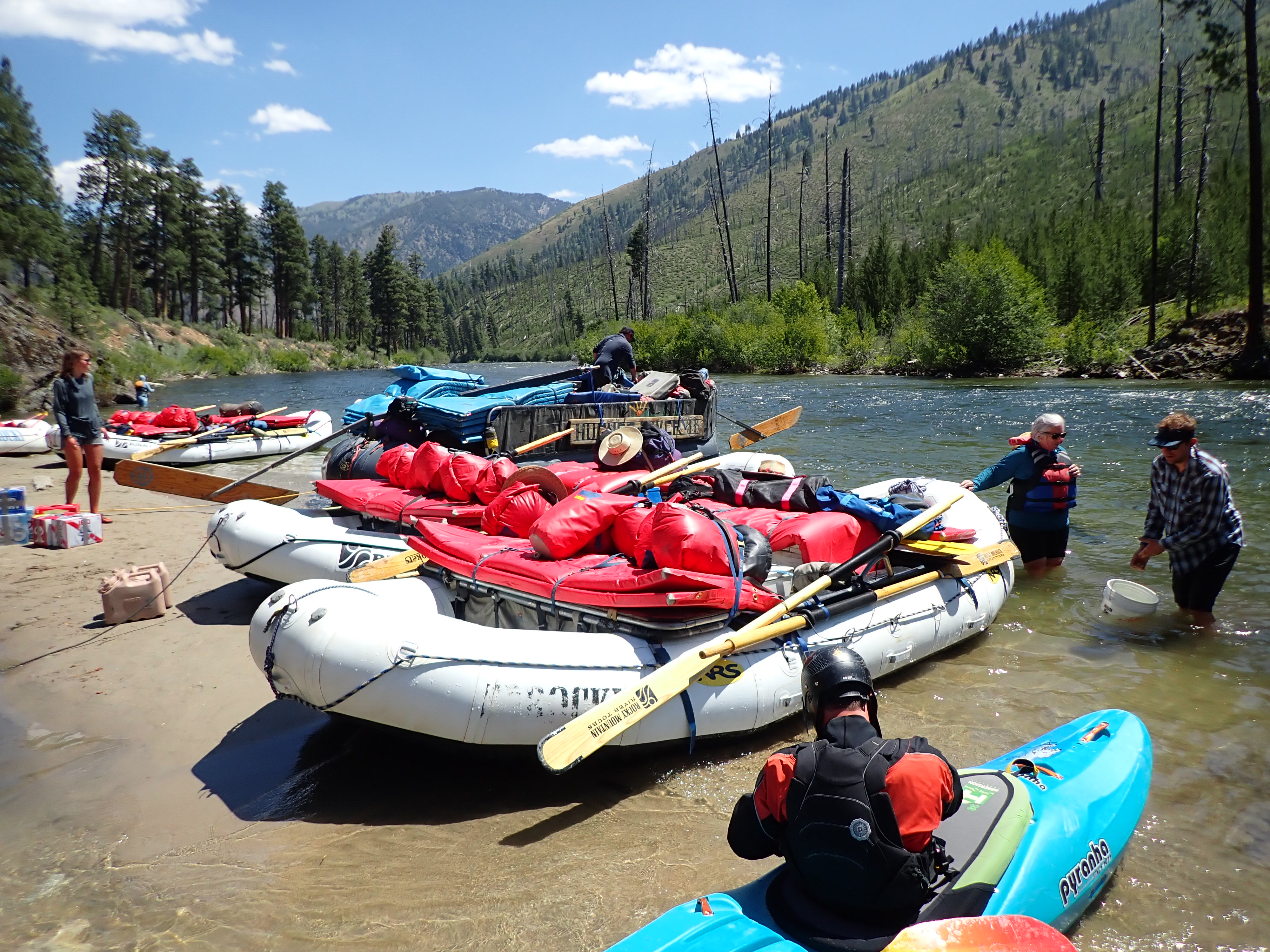
Breakfast on our last day was simple- overnight oats and fruit. After striking the tents and getting organized, we took a brief hike to see some unique pictographs near our campsite. We put on the river about 9 a.m. heading through Impassible Canyon on the river with great big waves. It was a chilly windy morning. We soon met the confluence of the main Salmon where Bob did one last surf on the Middle. We made it through Cramer Rapid which was the biggest drop wave of the week. It was too much fun! After 6 days and dropping close to 3000 feet in one hundred miles, we exited the river at Cache Bar/Corn Creek take out. After changing into dry clothes, bidding our guides goodbye, and picnicking under the trees, we loaded the bus and headed to North Fork Village. Soon after, we picked up Millie, (David and Mary’s golden retriever) from the dog kennel down the road, and headed back to Stanley on the bus. After a long slow drive, we arrived back at Mountain Village Resort around 7:00 P.M. Andrew Gregory packed up his car quickly and headed to the airport to fly home.
Day 7 – BONUS- Friday, June 28, 2024
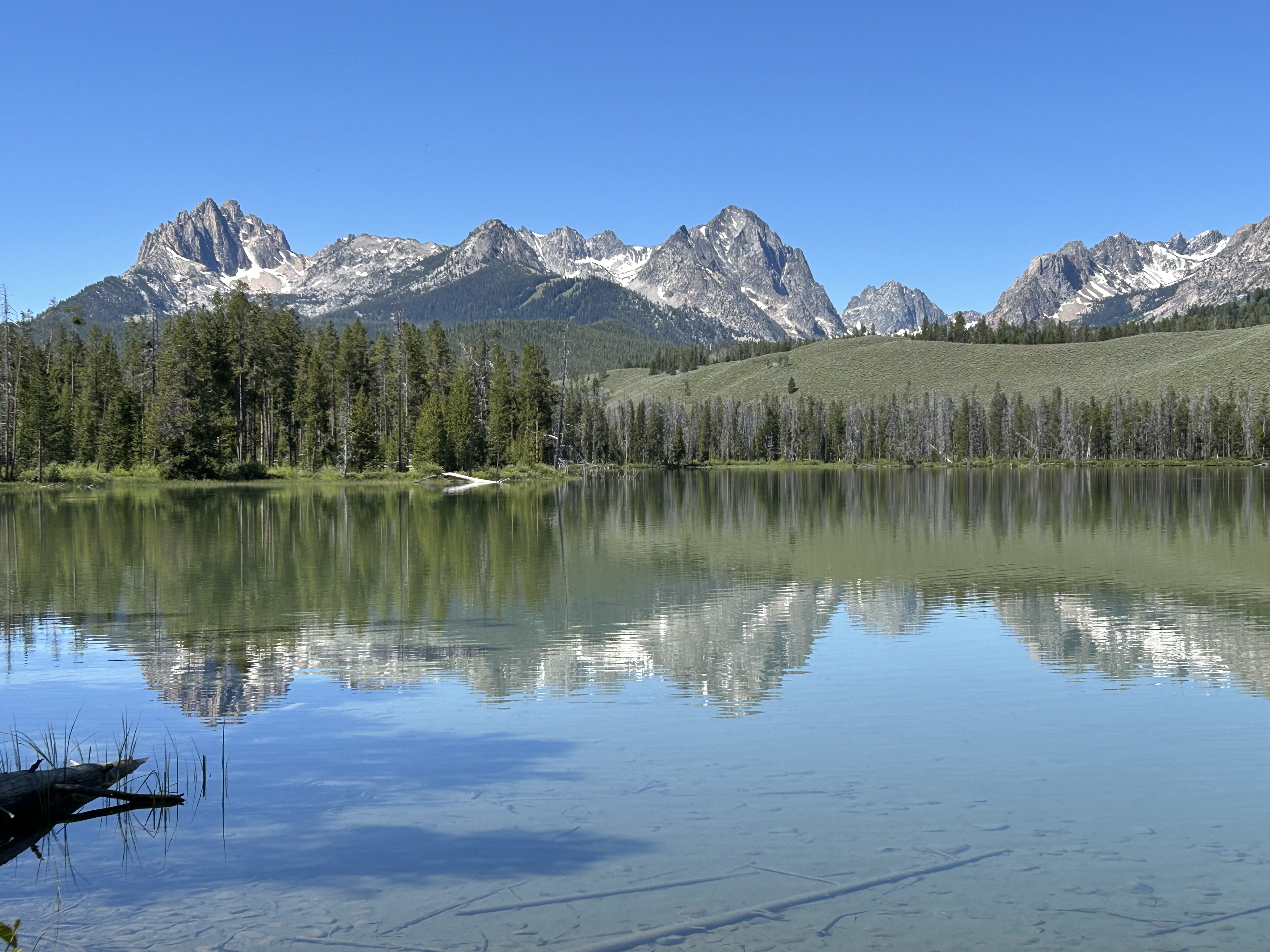
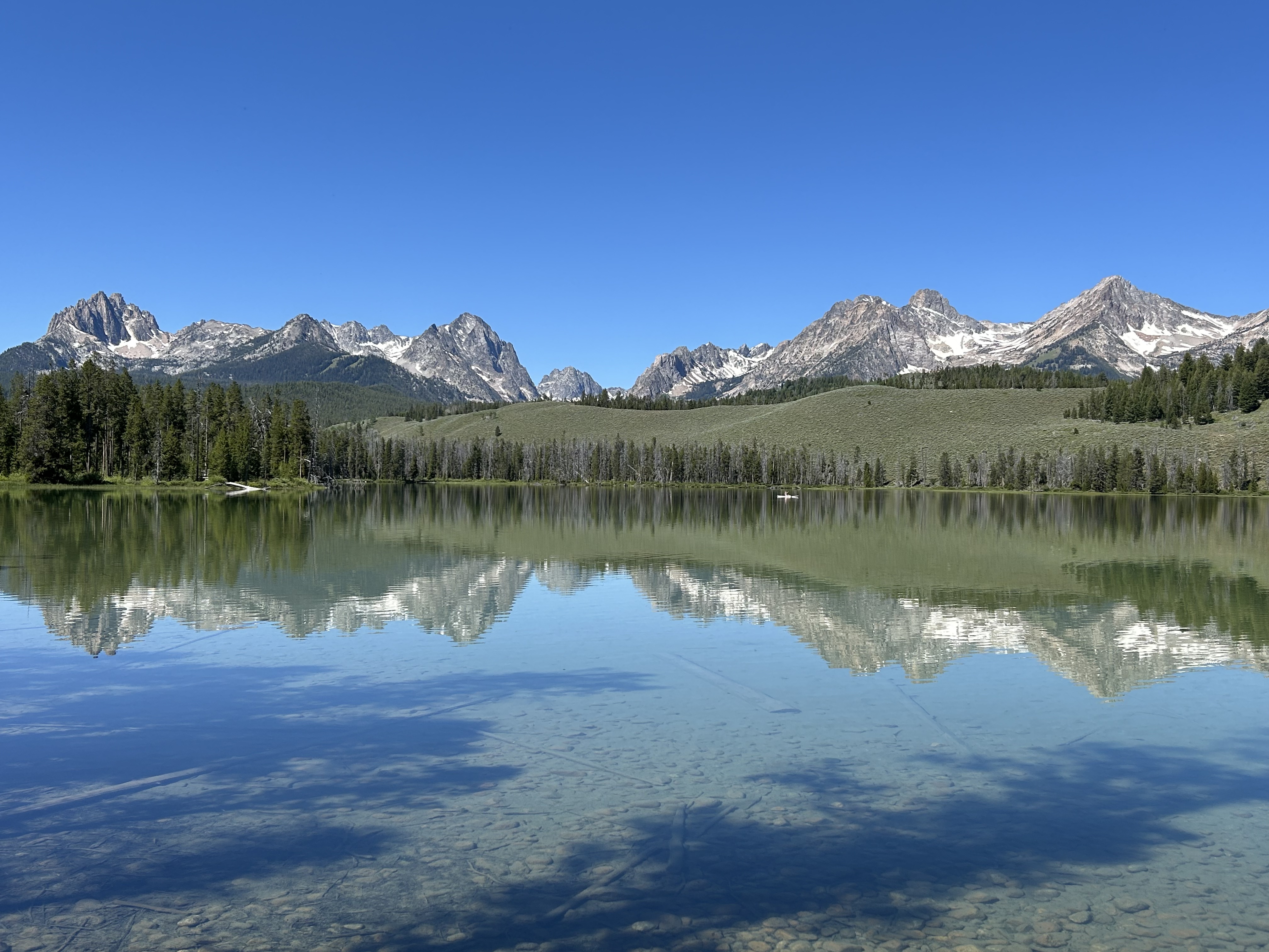
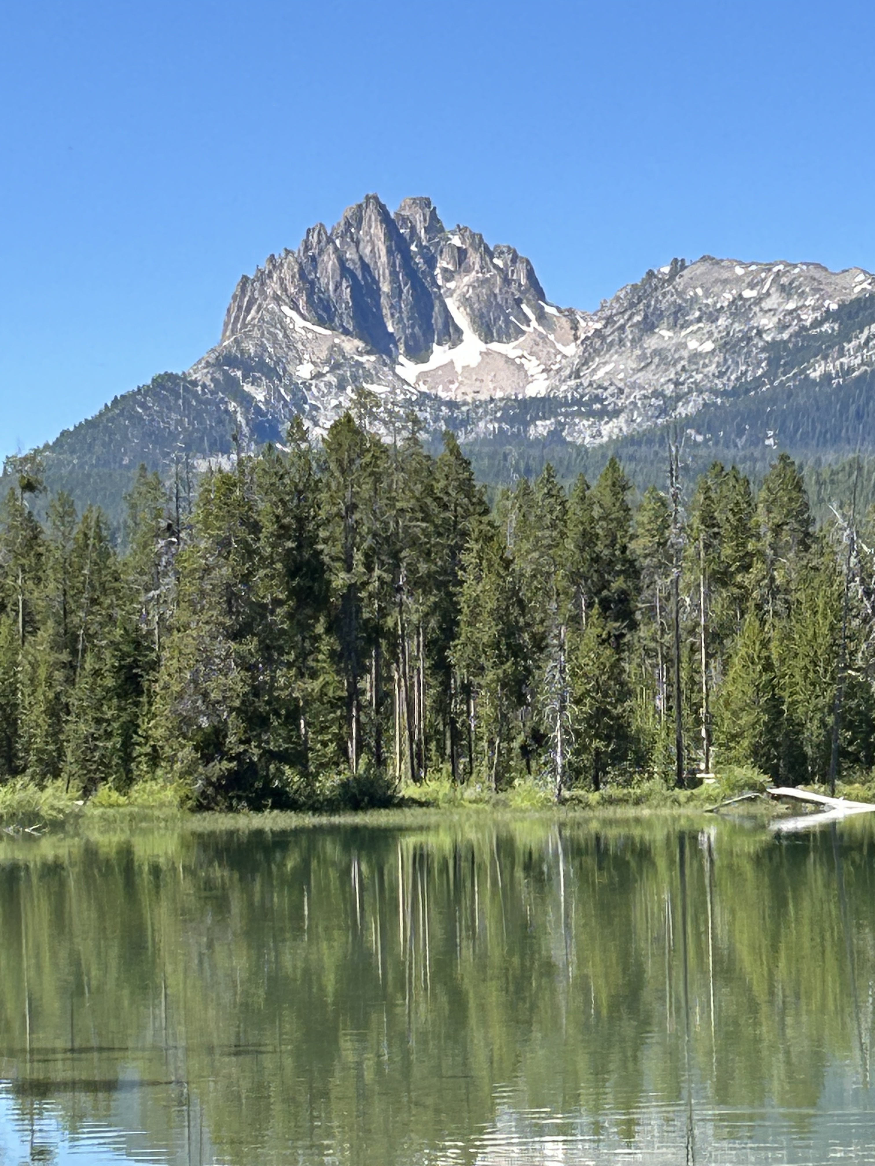
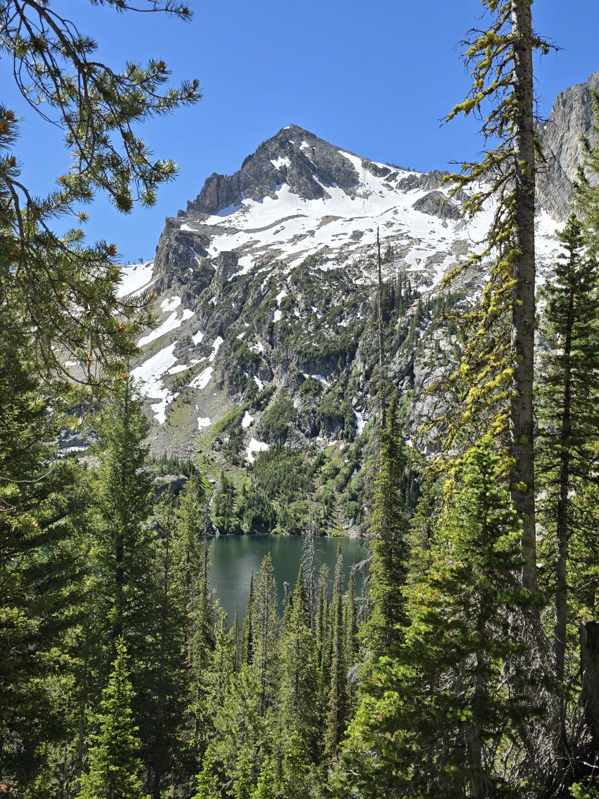
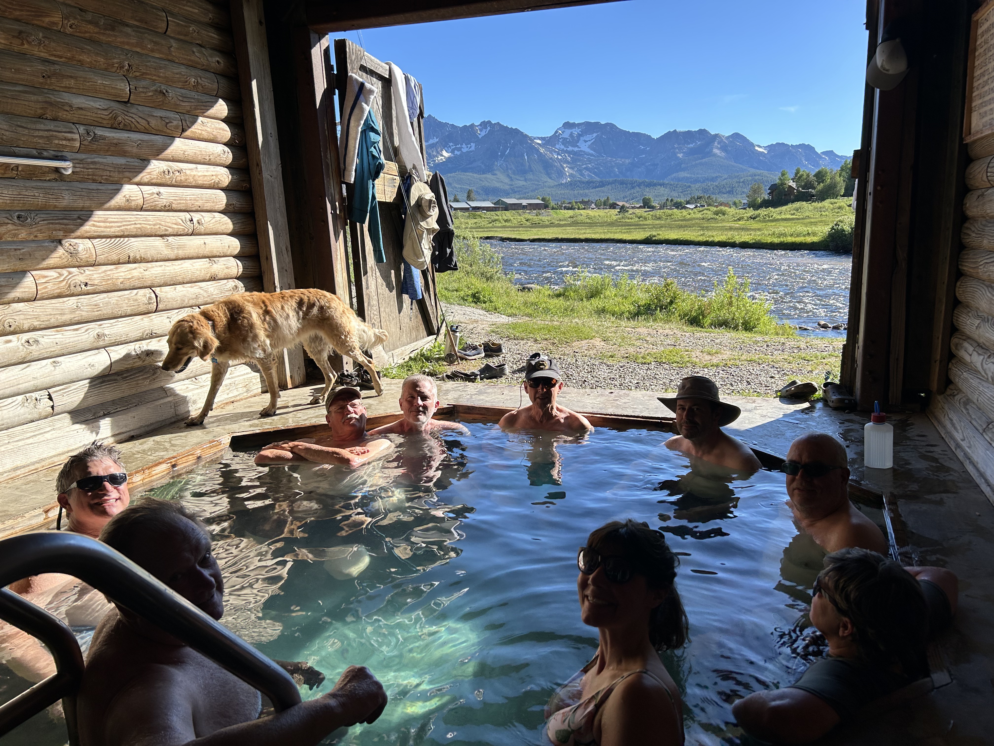
After breakfast, we told Jen and the Jim Thompson family goodbye, did some cleaning up and then some of us decided to go to Redfish Lake. The Redfish Lodge is about 10 minutes from Stanley, and an amazing little resort on the lake with boat rentals, cabins and a lodge. Some of us took a pontoon boat ferry to the far side of the lake to an area called The Gates of Heaven. It was an absolutely beautiful view from the lake. From there, we hiked up 3 1/2 miles to Bench Lakes-a series of five lakes on a mountain bench. Along the way we saw many wildflowers, like the White Mariposa Lily, Western Chokeberry, and Arrowleaf Balsamroot, with amazing views of the Sawtooth Mountains and Redfish Lake. We hiked back down to the boat dock and caught the 5 o’clock return ferry back to Redfish Lodge, came back to Stanley for a quick dip in the hot springs, and joined the rest of the crew for dinner at Brunee’s Pizza in Stanely. The Cashions left today to go to Bozeman. Molly recently moved there, and we are planning to introduce her to the Inafukus and Lane Lyle to bring everything full circle.
Day 8 – BONUS-Saturday, June 29, 2024
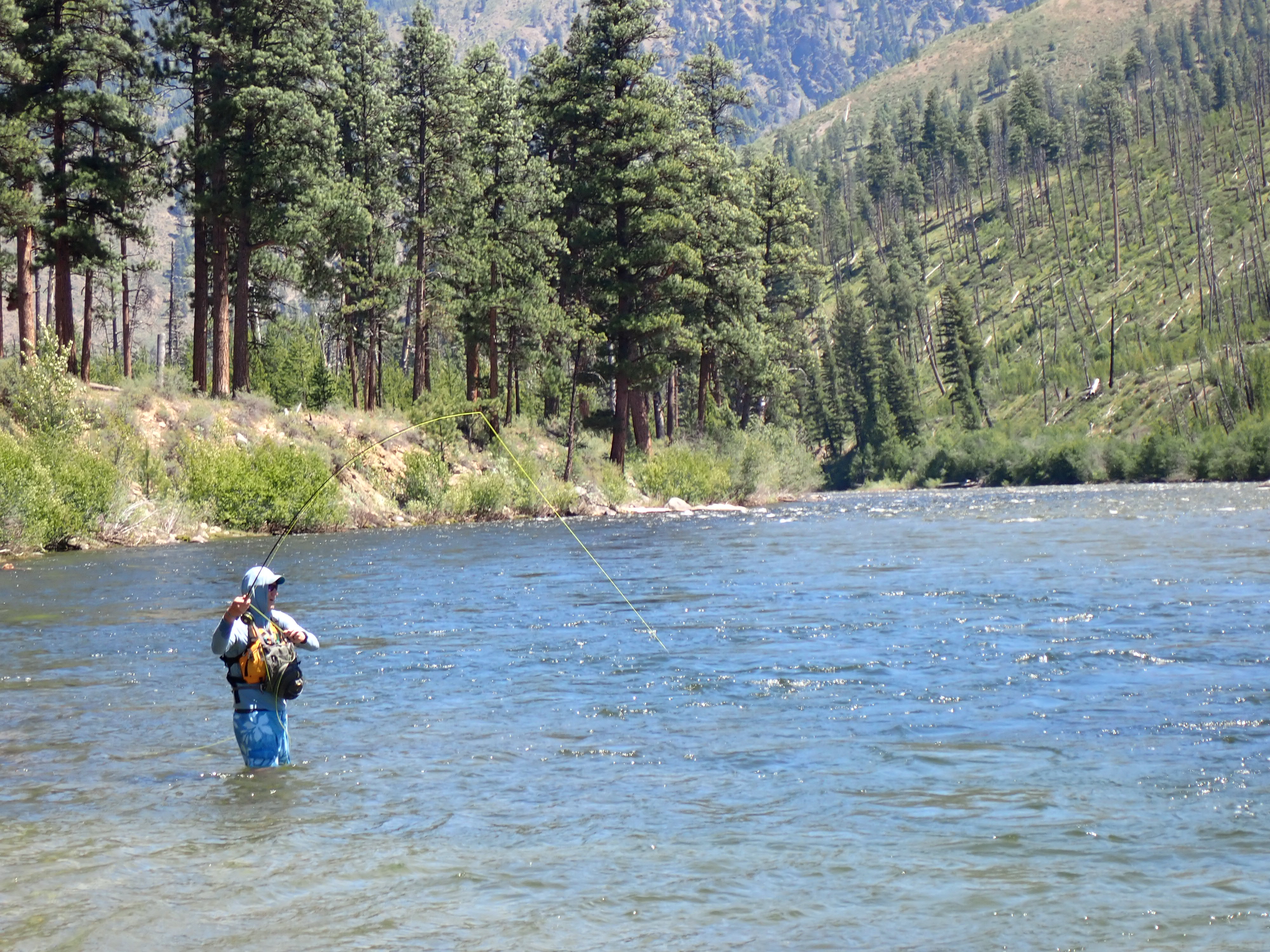
Play day in Stanley number 2! Last night at dinner, some of the decided to hike to Sawtooth Lake -a 10-mile round-trip hike from Iron Creek Trailhead. Paul, Sheryl, Bob, Mark and Dave got up early and enjoyed coffee and bagels at Peaks and Perks next to MVR. They arrived at the trailhead about 8:40 a.m. Frank and Greg headed to main Salmon for a day of guided fly fishing and the rest of the group stayed around Stanley having breakfast at The Stanley Baking Company and Café, shopping, and enjoying the sunshine on the back deck looking over the Salmon at River 1.
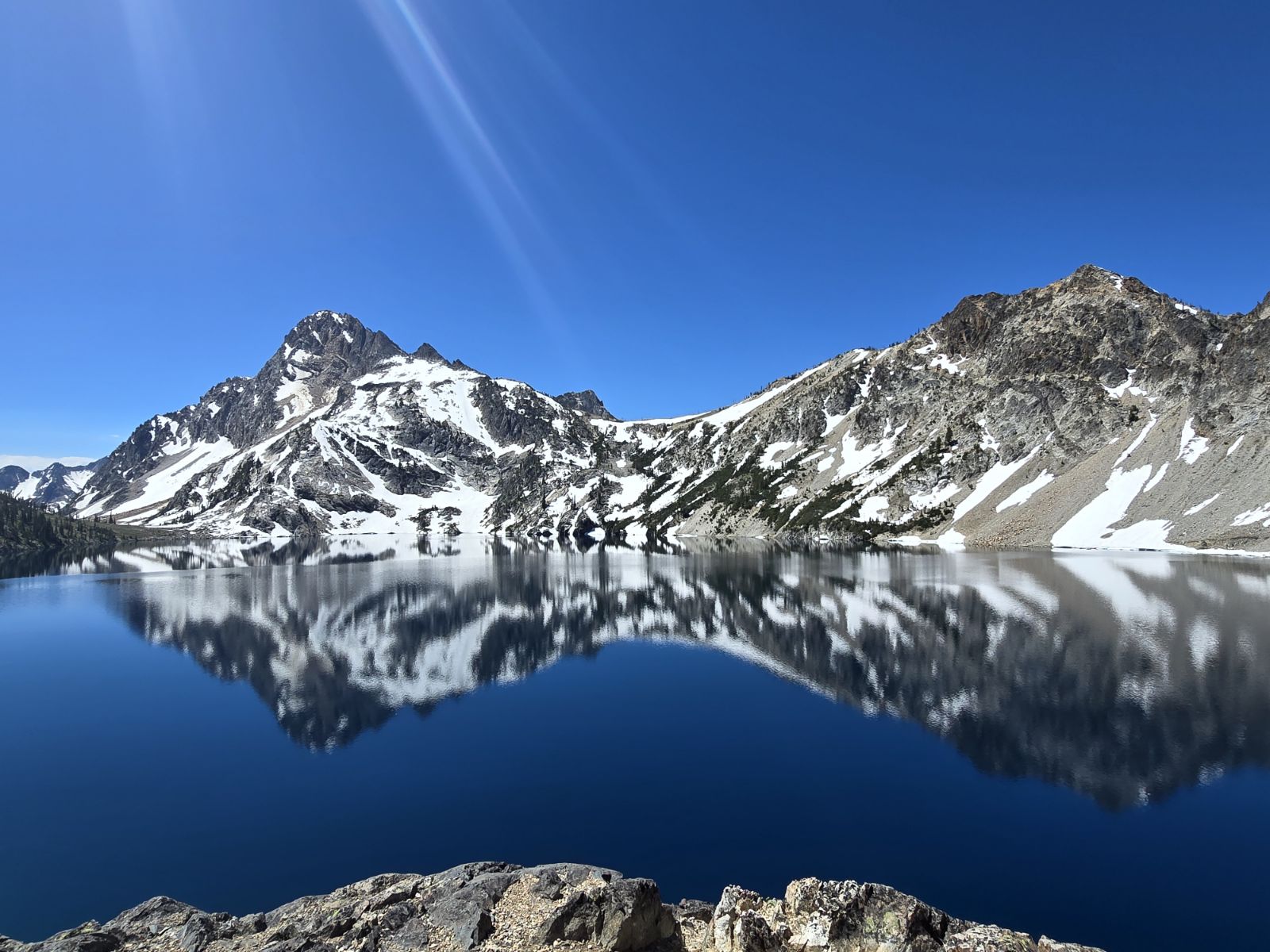
The hikers had an amazing walk up through the forest and then into an alpine environment. The first lake they came to was Alpine Lake that took 15 switchbacks once starting up. After that, they hiked up 26 more switchbacks to Sawtooth Lake which was one of the most beautiful lakes Bob had ever seen, and he is certain it rivaled the Tetons in its alpine beauty. They climbed up to a great place to have lunch above Sawtooth Lake and enjoyed views of the lake, mountains and cobalt blue sky. They lost most of the crowd getting up to Sawtooth Lake where there were multiple snow fields and melting snow creeks. After the hike they returned to Stanley, took a quick dip in the Hot Springs at the MVR. Sandra had made reservations for dinner at 5:30 at Redfish Lodge and they barely made it. They had an amazing dinner of halibut and trout and had a great time at their last dinner together. Jimmy, Crissy, Ava, David and Mary had an amazing dinner at the Supper Club in Stanley. The Freudenberg’s then headed out to Boise and the rest of the group came back to the resort, told David and Mary goodbye and packed up their bags to be ready for an early departure the next morning. Having a couple of days around Stanley to relax and explore was a wonderful way to end our Middle Fork adventure!
If you haven’t already heard, the New Mexico desert heat was just a bit more than I wanted to tolerate, so I got out of the oven for now. My plan will be to start again next year, earlier in the season, when the temperatures are a bit cooler and easier to deal with. It was a great learning experience where I still managed to cover 83 miles in five days of hiking. During most of those days I was trying my best to avoid any walking between the hours of 11:00 a.m. and 4:00 p.m. due to the intense heat during that time of day. So don’t worry, I’m not giving up on the CDT yet, just postponing it until April of next year. 🙂
To pass the time between now and then I plan to enjoy the summer, fall and winter in the cool rivers doing what I love best, whitewater kayaking.
Well, after a crazy year of COVID-19 for all of us, I’m super excited to say that I’m officially headed towards the southern terminus of the CDT and ready to “Embrace The Brutality” on a large section hike of the trail this summer! I’ll be starting at “Crazy Cook” at the U.S. / Mexican border and going north to Rawlins, Wyoming roughly covering half of the trail or 1,505 miles. Due to some already planned obligations for 2021, I was unable to attempt a total thru-hike this year, but felt the need to go ahead and get a jump on the CDT and continue working towards completing my Triple Crown at this point. I figured breaking it up into two sections and completing it the following summer wasn’t a deal breaker for me.
I’m flying out of the Chattanooga, TN this evening to Tucson, AZ where I’ll spend one night and catch a Greyhound Bus on Tuesday to Lordsburg, NM. That should be fun. I don’t think I’ve been on a Greyhound Bus since the 1960’s. I will be spending the night in Lordsburg before catching a shuttle ride on Wednesday morning to the border and the southern terminus of the CDT. Since my start time is in May instead of mid April like most hikers, it should make hiking through the high country of Colorado much easier and more fun not having to deal with the snowpack and the extra gear weight that I would have needed by leaving in April.
For now, I’m only planning to do a couple of blog updates while out on the trail this summer. I’m going to focus on enjoying the journey more and spending less time trying to find a library with a good Wi-Fi connection. However, the map, trail stats, and my Garmin inReach location link over in the margin area of this blog will get updated often. If you’re ever curious to see where I am and what I’m seeing, feel free to check it out. My exact location will be password protected, but all my family and friends are welcome to get the the password by simply asking either Mary or me. My map tracking and location is scheduled to be turned on around 9:00 a.m. (Mountain Time) on Wednesday, May 12th. It should track me every 30 minutes on the map. The red trail line provided on the Explore Garmin map is just one way to hike the trail. You will quickly notice that the CDT offers lots of alternate routes that can be taken. You can also request my location at any given time during the day. My inReach will be turned off at night to conserve power. My inReach satellite device does not have a phone number assigned to it. An inReach can only send SMS (text), email or inReach messages. If you’re interested in sending me a text message, see below.
To send me a text you will need to reach me through MapShare Messaging(a password is required…see above).
In the Send Message window enter your email address or phone number, and a message.
Select Send.
It’s been busy the past couple of weeks visiting with friends, family, river rat buddies and my B3 (Buck Bald Brewing) gang saying bye for the summer. The grand finale was my niece’s wedding this past weekend. Congratulations to Taylor and Kody Parker, I wish you guys the very best! Stay young at heart and enjoy your journey and all the life adventures you can stand.
My spirits and fat reserves are high, but it’s time to burn those fun calories away and crush some miles walking. I’m really looking forward to getting back to that Hiker Trash life style. Anyway, many thanks to all those who have wished me well on my journey. It’s greatly appreciated! Cheers to all for a great summer! See you in August!
When all my summer hiking plans fell apart due to COVID-19, I decided, along with some nutty paddling friends, that it was time for a summer road trip west to take on some big whitewater paddling fun. Our plan was to basically play on all the rivers we could hit, starting in Colorado and moving on up towards Wyoming, Idaho and Montana. Knowing that lodging and other amenities may be difficult to find, our plan was to rough it along the way camping on the river banks or in nearby National Forest campgrounds. The only required stops needed would be for gas, groceries, beer and ice. Everything else we knew we could live without for a couple of weeks.
WHITEWATER HOME COMPANION – Southeastern Rivers Volume I (1981) by William Nealy
Saturday, July 11th – The big plan headed south right from the start. This day was originally set aside for packing and getting the boats loaded on the trailer for our early Sunday morning departure. However, after some limited thought process, we decided unanimously that we should just begin our whitewater adventure by doing a quick lap down our home river here on the Ocoee to get this trip started. We spent the rest of the afternoon trying to dry out our gear and pack it up for the road trip west.
Sunday, July 12th – We finally hit the road around 9:00 a.m. and drove straight through to Buena Vista, Colorado and the Arkansas River, making only one stop along the way to pick up Larry in Ocoee, TN. That worked out well as Larry took the wheel all the way from Nashville to Buena Vista.
Monday, July 13th – We arrived in Buena Vista in time for morning coffee, so we all decided to purchase a cup from the Buena Vista Roastery Cafe. We paid at the front entrance and walked around to the rear entrance door to pick it up. I wish I could have said it was delicious coffee after driving all night, but unfortunately, noone in our group was very excited about it. In my opinion, McDonald’s has much better tasting coffee for a lot less money. We continued to walk around town for a bit, but quickly realized that due to COVID restrictions doing anything in town was a bit weird to say the least. We decided to head out of town and set up camp for the next several nights on the banks of the Arkansas River at the Railroad Bridge Campground. We met up with Crissy and Jimmy, a kayaking friend who was already in Colorado, later that afternoon to do a lap on the Fractions section to town. It was a super way to end our day. After the long drive and couple of beers, we were all ready to hit our tents for a good nights’ sleep.
Tuesday, July 14th – We got a late start, but after breakfast we decided to drive south into Salida, Colorado. I was excited to visit this town since my new Katabatic Gear sleeping quilt, purchased for my CDT hike this year, was made in Salida. I was hoping they would have a small store to visit, but learned after stopping by that they only manufacture the bags there in Salida and have no storefront area to speak of. It was a little disappointing since I think their bags and quilts are top quality for ultralight backpacking gear and would have liked for my friends to see them.
We walked around town for a few minutes and shared a few chuckles and comments over some of the signage we were seeing around town. Obviously, by what we were noticing, the town of Salida really seemed to support Black Lives Matter. (From my point of view, all lives matter and I’m not a supporter of what the BLM organization stands for at all.) A little later we made our way to the Moonlight Pizza & Brewery. It was around noon time so we hung around on the patio there and enjoyed a couple of local brews. They were all excellent beers! As the conversation progressed, we were puzzled by what we’ve noticed in town. We hadn’t seen a single person of color anywhere. We actually spent the next hour and a half in search of anyone who wasn’t white. We had basically given up, until on our way back to Buena Vista, we noticed a black man sitting along the side of the highway with two shopping carts filled with his personal belongings in front of the local Walmart. We all asked ourselves, how does the only African American that we’ve seen become homeless in this town that is filled with BLM signs? Just wow…
By the way, the racial make up for Salida, which is also the largest city in Chaffee County, Colorado is: 92.66% White, 0.05% African American (which may be 2 people), 1.44% Native American, 0.38% Asian, 0.02% Pacific Islander, 3.29% from other races, and 2.16% from two or more races. Hispanic or Latino of any race were 10.76%. Wikipedia~
That afternoon we headed back to our base camp, picked up our kayaks and headed up the Arkansas River to tackle the Numbers section. What a fun and beautiful section of river that was! A great time was had by all! We finished our day with a great gang at the Eddyline Brewery in Buena Vista.
Wednesday, July 15th – It was a busy whitewater day for sure. Jimmy and Larry wanted to do a morning lap on the Numbers section and that afternoon the three of us kayaked Browns Canyon while Clay, Crissy and Kevin enjoyed some wild whitewater rafting.
Thursday, July 16th – This was a travel day north to Pinedale, Wyoming. While camping along the Arkansas River, we noticed that my Big Agnes Three Forks Shelter had been damaged by the strong winds in Colorado. So, on our way up to Wyoming, we stopped by the Big Agnes store in Steamboat Springs to drop off my shelter for some badly needed repair work. 🙂
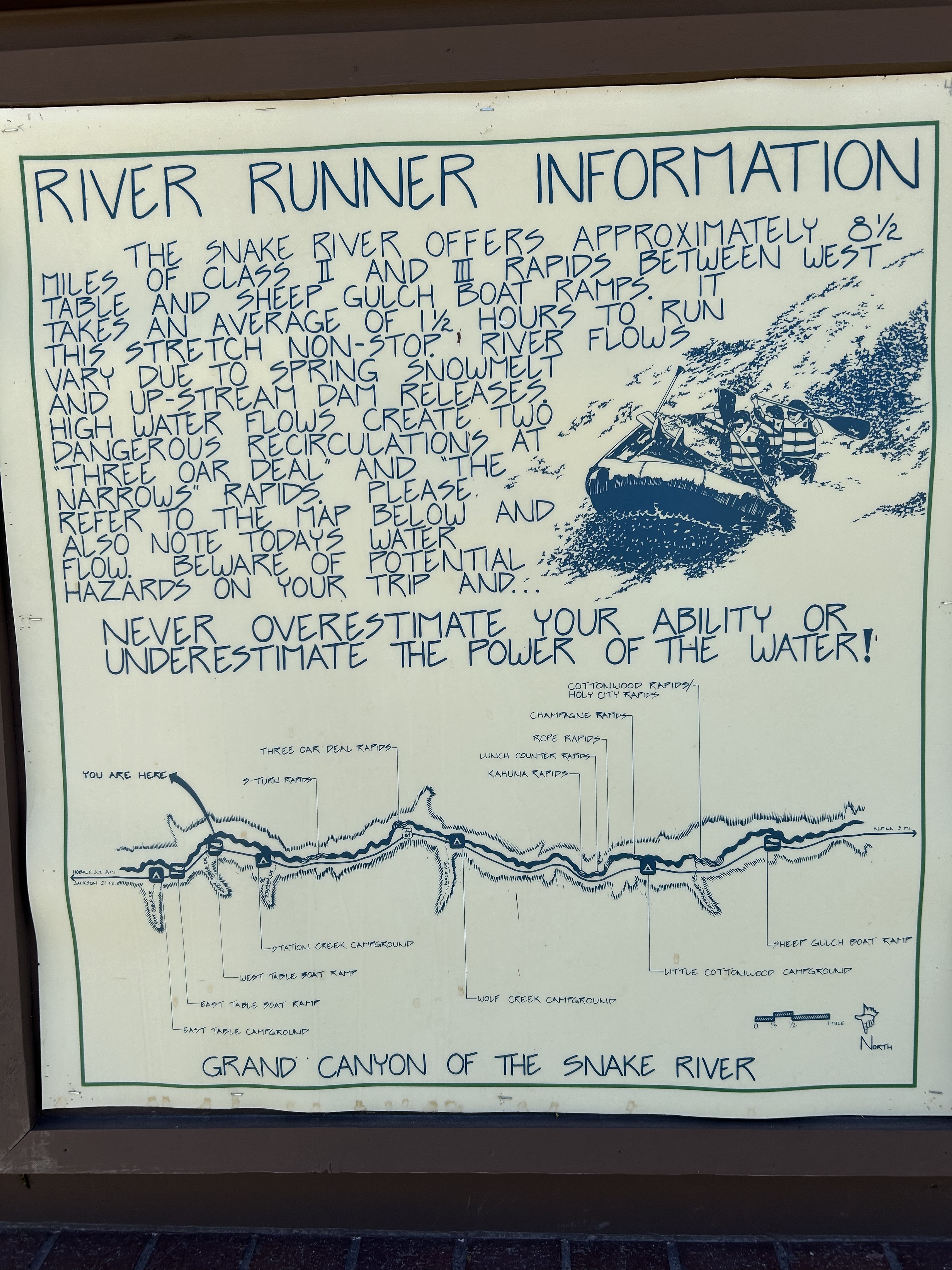
Friday, July 17th – We enjoyed a good breakfast in Pinedale and continued north hoping that we would arrive at the East Table Campground on the banks of the Snake River in time to grab a campsite as folks were leaving. We lucked out and found the last available site and claimed it for the next three nights. We set up camp quickly and were able to get two laps through the canyon completed by late afternoon. What a great feeling to be back on one of my favorite rivers!
Saturday, July 18th – This was a bit of a slow moving day. After breakfast at camp, we drove into Jackson and messed around for a bit in town. However, with the COVID pandemic going on, the town was not a very appealing place to spend any time. We decided to drive out and take a look at the water level in the Gros Ventre River and to my surprise, it had plenty of water to kayak. It wouldn’t be super exciting like the early springs flows, but it would be fun and a beautiful paddle. So we made plans to run the Gros Ventre on Sunday morning. We returned to camp that afternoon, grabbed our gear, and took another fun lap down the Snake River.
Sunday, July 19th – We met up with Bob “Bernie”, Paul and Sheryl in Kelly, Wyoming to run two laps down the Gros Ventre River just outside of Grand Teton National Park. It’s an awesome run with great view of the Tetons. Afterwards we stopped in Jackson for some BBQ at Bubba’s and then headed back south to the Snake River for another late afternoon paddle through the canyon.
Monday, July 20th – We left the East Table Campground and headed north through Grand Teton and Yellowstone National Parks site seeing for the day. It was all going great until Paul and Sheryl’s rental car decided to give out. They called my old park employer, YPSS, and got a wrecker to the Fishing Bridge Repair Shop. After a couple of hours, we were on our way again. The car’s computer just simply needed a reboot. Basically they turned it off, disconnected the battery, reconnected the battery, turned the ignition and it was ready to go. That evening we decided to stop for pizza at one of my old hangouts, the K-Bar in Gardiner, before heading on to Bozeman, Montana for the night.
Tuesday, July 21st – After dropping Kevin off at the airport, we stopped by for a quick visit with Dawn and Les, some old friends from my younger years working in Yellowstone. We had a great visit with them even with the COVID pandemic going on. After our visit, we drove out to the Gallatin River, found an open campsite, set up camp, grabbed our kayaking gear and headed towards the river putting in just behind where we set up our tents. It was a great afternoon on the water. Afterwards, we drove to Big Sky for some dinner and drinks. Another awesome day!
Wednesday, July 22nd – We spent a large part of the day traveling back through Yellowstone and out of the North gate to the Gardiner area and the Yellowstone River. We put on late in the day, but accomplished a beautiful 20 mile sunset paddle through the Gallatin National Forest and Yankee Jim’s Canyon. I took no photos that day, but I managed to steal this one from Sheryl’s Facebook page.
Thursday, July 23rd – Clay and I decided that we would pack up and begin our journey home by way of the Beartooth Highway. We figured just getting across the pass would take up most of the day, so our plan was to have some fun and find a couple of local breweries along the way. Red Lodge was a great place to just hang out and take a break that afternoon. Our stops included Red Lodge Ales, Snow Creek Saloon and the Lost Cabin Beer Co. After staying in Billings, Montana for the night, we hit the road for home the next morning.
Friday, July 24th thru Saturday, July 25th – Clay and I drove straight through the day and night from Billings, Montana in time for happy hour on Saturday evening with our friends at Buck Bald Brewing in Copperhill, Tennessee. Those double IPA’s “As the Cro’s Fly” were deadly for two tired travelers!
For the past couple of weeks I’ve been hanging on to all of my hopes that I’d still be able to pull off my CDT NOBO hike with this Coronavirus sweeping across the country and the world. After several attempts of trying to keep my April 16th launch date on go, the current variables, that change daily, are just too many. Just yesterday, the San Juan County Sheriff’s Department in Colorado issued a statement prohibiting recreationalists from backcountry activities in the county due to the limited Medical, Emergency and Search and Rescue Services currently available due to the virus crisis. On top of that, the Continental Divide Trail Coalition (CDTC), Pacific Crest Trail Association (PCTA), and the Appalachian Trail Conservancy (ATC) all have recommended that hikers postpone or cancel their immediate thru-hiking plans due to the Coronavirus. As you can only imagine, humans seem love those debates on social media.
The big topic out there on social media today is, wouldn’t a thru-hiker be safer out on the trail? I would say on a trail, absolutely. Social distancing would be fairly easy to accomplish when in the wilderness. However, much of a thru-hike journey involves both fellow hikers, better known as “hiker trash”, and visiting the many small towns along the way for resupplying, a good meal and of course a cold beer or two.
OLYMPUS DIGITAL CAMERA
OLYMPUS DIGITAL CAMERA
OLYMPUS DIGITAL CAMERA
Thru-hikers often rely on Trail Angels and the locals for a hitchhike to and from these small communities and back to the trail. Some of these folks even open their homes to hikers and treat them like true family. The help and assistance from these small towns is really an amazing thing to experience on a thru-hike. So I would really hate to miss that part of the trail life during this Coronavirus crisis. Second, I would hate for the hikers to bring the virus into a small community for sure. The risks here just out weigh any reward. That’s been very hard for me to digest to say the least.
OLYMPUS DIGITAL CAMERA
However, I’m not totally knocked out yet for a long distance hike in 2020. I’ve already made a new or revised hike plan which will give me a couple of months to see where all this Coronavirus crisis takes us. My adjusted plan would be to do a Southbound (SOBO) thru-hike in lieu of a northbound (NOBO) hike. As mentioned in my previous blog post, most NOBO hikers start +/-mid April from the Mexico border, while SOBO hikers typically start from the Canadian border +/- mid June.
OLYMPUS DIGITAL CAMERA
OLYMPUS DIGITAL CAMERA
OLYMPUS DIGITAL CAMERA
As hard as this has been for me, I know I’m not alone in having all my plans blow up in front of me in a very short period of time. The silver lining for now is, all my family and friends have remained healthy in this crisis thus far. Hopefully, there’s another day for me to complete the CDT and my Triple Crown. Not taking away from the seriousness of the Coronavirus, but I truly feel sorry for so many hikers here and abroad that have planned for this moment to do a long distance hike for many years. Many of these hikers have already quit their real jobs, sold or given away most of what they own and have given up their apartments or current housing. That’s pretty tough when you don’t have a place to land. The good thing is for most of these hikers it’s not their first long trail rodeo, so adapting to a bad situation is probably where they shine the most, besides the trail. Hopefully, we will all see the end to this virus soon and can move forward in the future with those plans, commitments and dreams previously made.
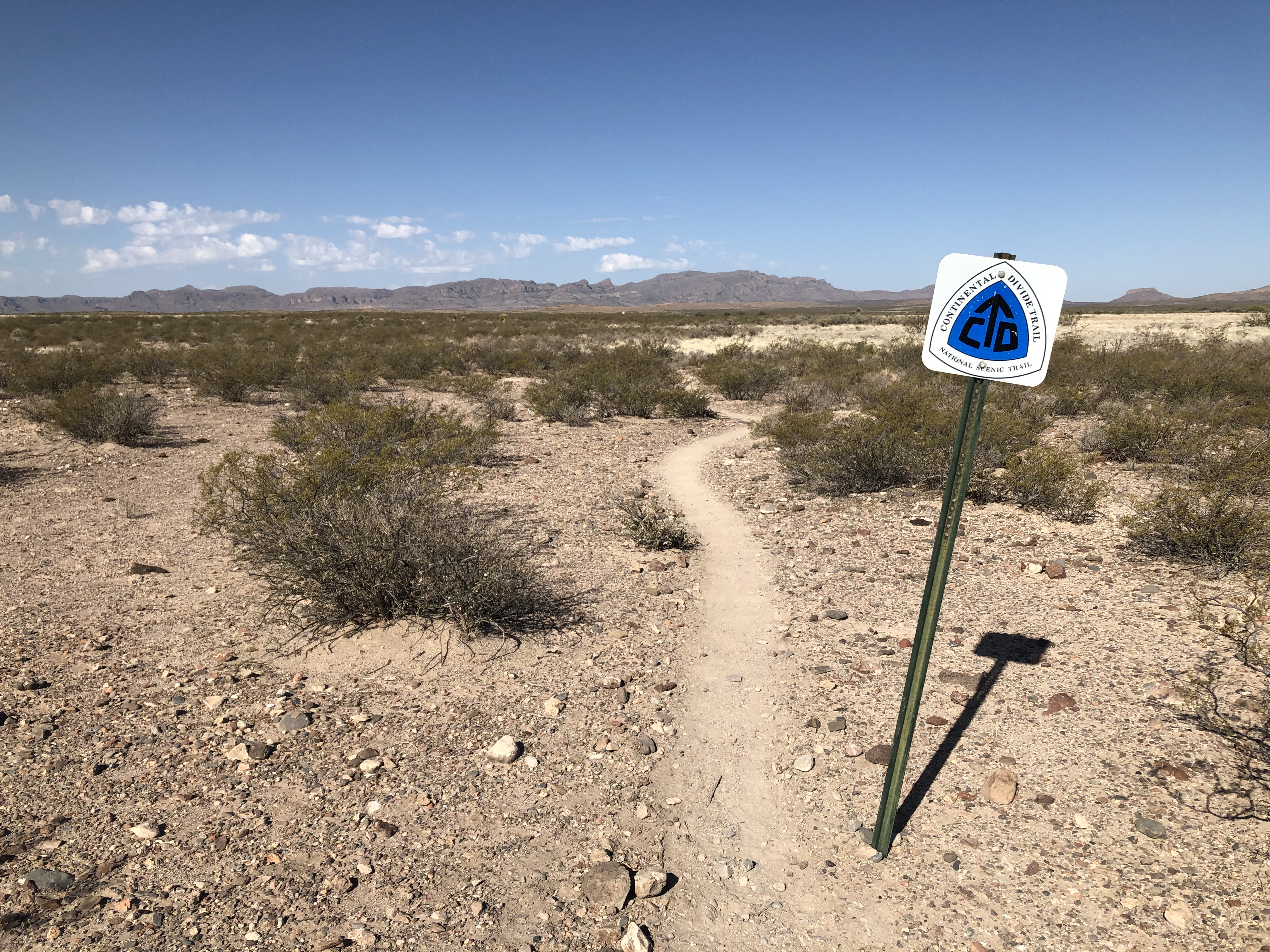
My plans are now set for my departure for New Mexico and my shuttle ride to southern terminus of the Continental Divide Trail (CDT). The Southern Terminus “Crazy Cook” is located on the border of New Mexico and Mexico in the Big Hatchet Mountains on Bureau of Land Management federal lands in a fairly remote desert area of New Mexico. The cool thing is that the Continental Divide Trail Coalition (CDTC) along with volunteers and independent contractors operate a shuttle service for hikers from late March to mid May. They typically schedule no more than ten hikers per day, so your shuttle spot becomes a very important key in setting up your total travel plans. I will be flying into Tucson, AZ from Chattanooga, TN, boarding a Greyhound bus over to Lordsberg, NM and the CDTC shuttle service will pick me up from there. So my tentative hike is pretty well planned at this point. I know many hikers don’t care to plan, but I enjoy semi knowing where and when I plan to be somewhere along the trail. This makes it much easier for family and friends who may want to fly west and schedule a trip to the Rocky Mountains for a visit during the summer which I will appreciate and enjoy greatly!!
Being a little bit of a gear junky, it’s been fun going through my gear and making some changes for this year’s CDT hike. One of the biggest changes I’m doing is in my sleeping system. I going with a Katabatic Gear Flex15 sleeping quilt in lieu of a sleeping bag.
Many thru hikers are using quilts these days, mainly to reduce weight and increase comfort. The Flex15 is should be good down to 15 degrees. The Flex does have a zippered foot box and closure guard for those really cold nights, but on the milder nights it can completely open up to a blanket. It’s truly a very flexible sleep system and that’s what I’m hoping for on my hike.
What makes a quilt different from a conventional sleeping bag? A quilt style sleep system eliminates the insulation that is on the bottom of a conventional sleeping bag. With a conventional sleeping bag, any insulation under your body is crushed. Since insulation must have loft and trap air to be effective, the crushed insulation under your body is wasted. So a quilt leaves the insulation out of the bottom of the bag. One other major difference is that no hoods exists on quilts. The Katabatic quilt features an overstuffed down collar around the neck opening. This becomes a critical area to seal the warmth inside your sleeping system or bag. This collar should fit comfortably around the neck, and will keep the warm air where it belongs. So, what happens on those really cold nights when you need your head to be warm as well? You use a separate hood. I purchased a Windom Hood which is basically an ultralight balaclava. The idea here is that your sleeping bag will stay in place on top of your pad and your hood will stay in place on top of your head. I know in my days of using a conventional sleeping bag that I’ve woken up on many nights wet from condensation with my head stuck way down in my sleeping bag and trying to figure out where I am with the bag tangled up around me.
Another important device that I’ve purchased and have chosen to bring with me this year is a Garmin inReach Mini. It’s a palm-sized satellite communicator and weighs only 3.5 ounces. Knowing how I can be 100 miles from nowhere, the inReach Mini will allow me to send and receive text messages, track and share my journey, and if necessary, will trigger an SOS alert to contact a GEOS 24/7 emergency response team. By carrying this inReach device, my family and friends will know they can stay in touch with me along the trail. To me, it’s a great investment for everyone’s peace of mind.
I will also be sending myself some additional snow gear and clothing around Chama, NM for hiking through the San Juan Mountains and farther north in Colorado in the early spring. These items will include a ice axe, microspikes and snowshoes.
Why all the snow gear? Check out Mitch Lenington video from his 2019 hike last year. 🙂
I’m also going to start the trail with a new sleeping pad this year. I’m just a little afraid that my old Therm-A-Rest NeoAir XLite pad that I’ve had since my 2012 Appalachian Trail thru hike may decide to give out on me at some point. So I plan to go with a new one and keep my old sleeping pad ready to mail out to me in case of a problem. My new pad will be a Therm-A-Rest NeoAir UberLite Sleeping Pad. It’s basically the newer and lighter version of my current NeoAir XLite pad.
It’s definitely been a while, but I will try to update my gear page soon to reflect more of what I’m planning to use on my CDT hike. If anyone is interested, I have also put a link over on the right had side of this blog to view my current hike plan.
Length: 2700 – 3150 miles (depending on route) Time to hike: 5-6 months Start and end points: Southern terminus: Crazy Cook Monument Northern terminus: Waterton Lake Highest Elevation: 14,278 ft (Grays Peak CO) Lowest Elevation: 4,200 ft
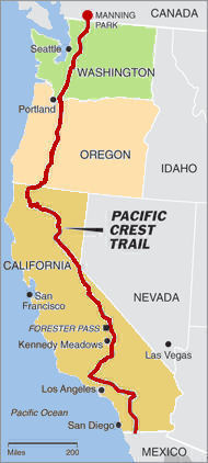
The Continental Divide Trail (CDT) is a long-distance trail that runs from the Canadian border to the Mexican border. The CDT, alongside the Appalachian Trail and the Pacific Crest Trail make up the triple crown of hiking. The CDT is by far the most rugged of the three, being only 70% fully completed with many portions of road walking and off-trail travel.
The trail is most commonly hiked from South to North starting at the Mexican border.
The trail passes through five states – New Mexico, Colorado, Wyoming, Idaho and Montana – and ends at the Canadian border in Glacier National Park.
Although not strictly “completed”, the trail came into existence in the seventies with the first person recording a thru-hike in 1977. It was designated a National Scenic Trail in 1978. Very few people still hike the trail to this day with an estimated 200 people starting the trail per year. This makes the whole experience on the CDT a much more lonesome and solitary experience compared with the Pacific Crest Trail or the Appalachian Trail. It also passes through much more remote and rugged terrain than the other two trails.
Because of the incomplete nature of the Continental Divide Trail, the route is somewhat open to interpretation. Overall mileage can vary from 2600 up to 3100 miles. There are a few different alternates that can be taken on the trail although there is a generally accepted official route.
To Print PDF: Step 1) Expand to full screen view (click box in top right hand corner of map). Step 2) Zoom in to your desired map section view. Step 3) Click on the three white vertical dots and then “Print Map” from that drop down menu.
Typical Trail Timing, Weather and Seasons
April to October for northbounders.
June to November for southbounders.
Whether headed Northbound or Southbound, snow is the major deciding factor in planning your departure time.
Southbounders may deal with snow in Glacier National Park at the start and therefore start around June. They may also face snow in Colorado in the San Juan Mountains, so they need to arrive there in September.
Northbounders will usually start towards the end of April so as to not arrive too early in the San Juan mountains and deal with heavy snow. They must also reach the end of the trail up in Glacier National Park before winter storms set in.
Hikers on the CDT will deal with an array of different weather scenarios, from harsh sun exposure to freezing cold temperatures. Rain, snow and frequent summer thunderstorms are all possible. Mosquitoes and other flying bugs also definitely exist. Lastly, you’ll have to take normal precautions against rattlesnakes and other wildlife.
Featured Photo Credit (for this blog post): Daniel Johnson-Utsogn “Mammoth”
Times have been busy since returning from the Grand Canyon trip in late summer. Shortly after returning home, I traveled to the 88 Ranch in Wyoming with my brother and a couple of friends from the North Georgia mountains to go on a antelope hunt. We had a super time in Casper and a very successful hunt on top of that.
OLYMPUS DIGITAL CAMERA
OLYMPUS DIGITAL CAMERA
OLYMPUS DIGITAL CAMERA
After Casper, Mary and I left for a Yellowstone “Dew Crew” Reunion at Belknap Hot Springs on the McKenzie River in Oregon. What a fun time we had visiting with our old friends from Yellowstone National Park. Some of these friendships go back as far as 1979. Oregon is a definitely a beautiful state to visit. We hiked, rafted and played hard. I even got a chance to re-visit the PCT at McKenzie Pass. What a great “Dew Crew” reunion it was!
OLYMPUS DIGITAL CAMERA
OLYMPUS DIGITAL CAMERA
OLYMPUS DIGITAL CAMERA
OLYMPUS DIGITAL CAMERA
Since about 2012, I’ve been doing a backpacking trip somewhere between Christmas and New Years. This year Douglas Tew “Chainsaw” and I did a 36 mile section of the Benton MacKaye Trail between Cherry Log, Georgia and the Ocoee River in Tennessee. It was a great hike with approximately 8,500 feet of uphill and 8,500 feet of downhill elevation change. Man, I sure missed my trail legs, but look forward to this April, as I plan to head out to thru hike the CDT and hopefully complete my Triple Crown.
I was also fortunate enough to get several days of kayaking in over on the Tellico River with some good local friends.
This past summer I was invited to join a group going back to Ecuador for some winter whitewater kayaking and of course I couldn’t turn that down. This year the trip was with Endless River Adventures which turned out to be another awesome and exciting trip on the equator! I would like to thank Juliet and her team at ERA for making this journey a very special adventure. Juliet is credited for many of the photos below as well. Thank you!
Our group all turned out to be super fun and a talented group of paddlers! It was truly a blessing and a honor to paddle with such a fine group of boaters! However, I’m not sure I can include Netflix Kevin there. 🙂
The rivers we paddled included the Rio Quijos, Cosanga, Jondachi, Misahualli and Jatunyacu Rivers.


 I’m flying out of the Chattanooga, TN this evening to Tucson, AZ where I’ll spend one night and catch a Greyhound Bus on Tuesday to Lordsburg, NM. That should be fun. I don’t think I’ve been on a Greyhound Bus since the 1960’s. I will be spending the night in Lordsburg before catching a shuttle ride on Wednesday morning to the border and the southern terminus of the CDT. Since my start time is in May instead of mid April like most hikers, it should make hiking through the high country of Colorado much easier and more fun not having to deal with the
 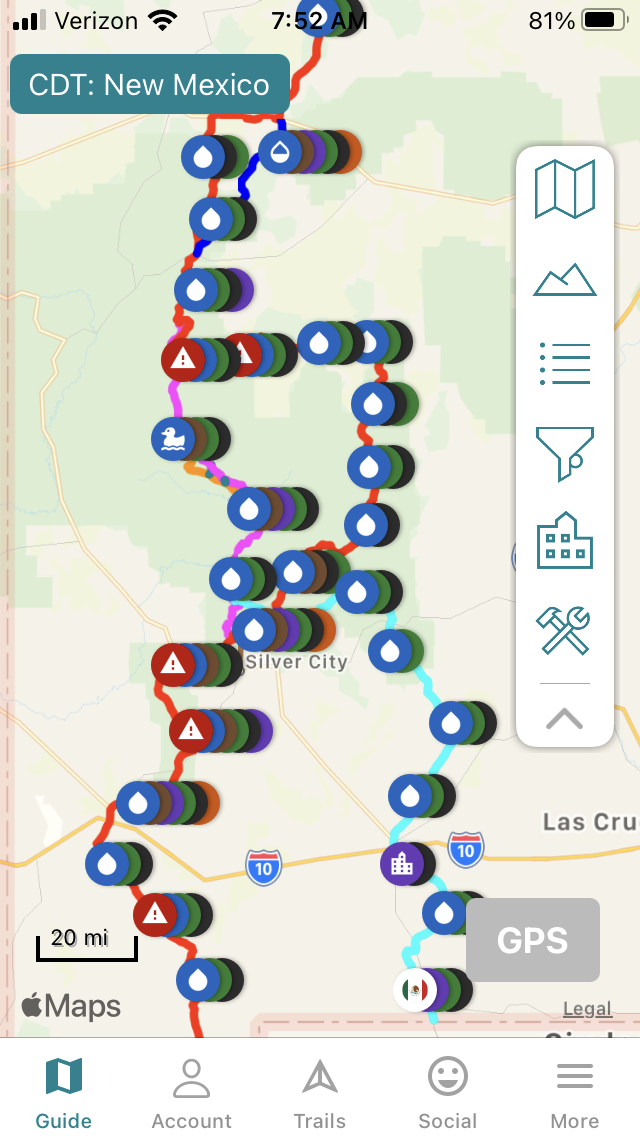 The red trail line provided on the Explore Garmin map is just one way to hike the trail. You will quickly notice that the CDT offers lots of alternate routes that can be taken. You can also request my location at any given time during the day. My inReach will be turned off at night to conserve power. My inReach satellite device does not have a phone number assigned to it. An inReach can only send SMS (text), email or inReach messages. If you’re interested in sending me a text message, see below.
 When all my summer hiking plans fell apart due to COVID-19, I decided, along with some nutty paddling friends, that it was time for a summer road trip west to take on some big whitewater paddling fun. Our plan was to basically play on all the rivers we could hit, starting in Colorado and moving on up towards Wyoming, Idaho and Montana. Knowing that lodging and other amenities may be difficult to find, our plan was to rough it along the way camping on the river banks or in nearby National Forest campgrounds. The only required stops needed would be for gas, groceries, beer and ice. Everything else we knew we could live without for a couple of weeks.
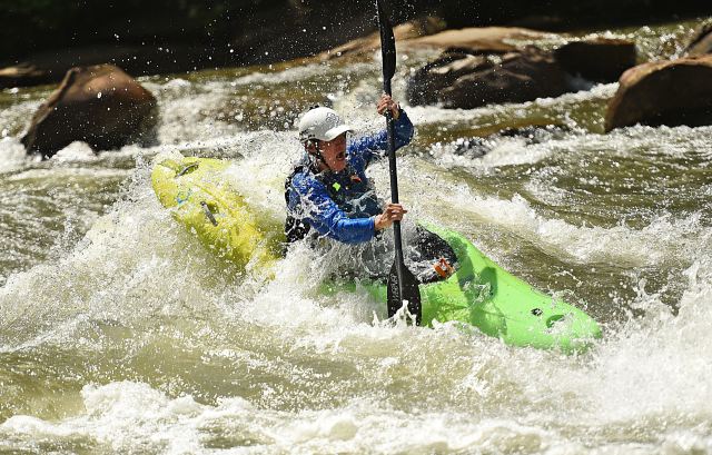


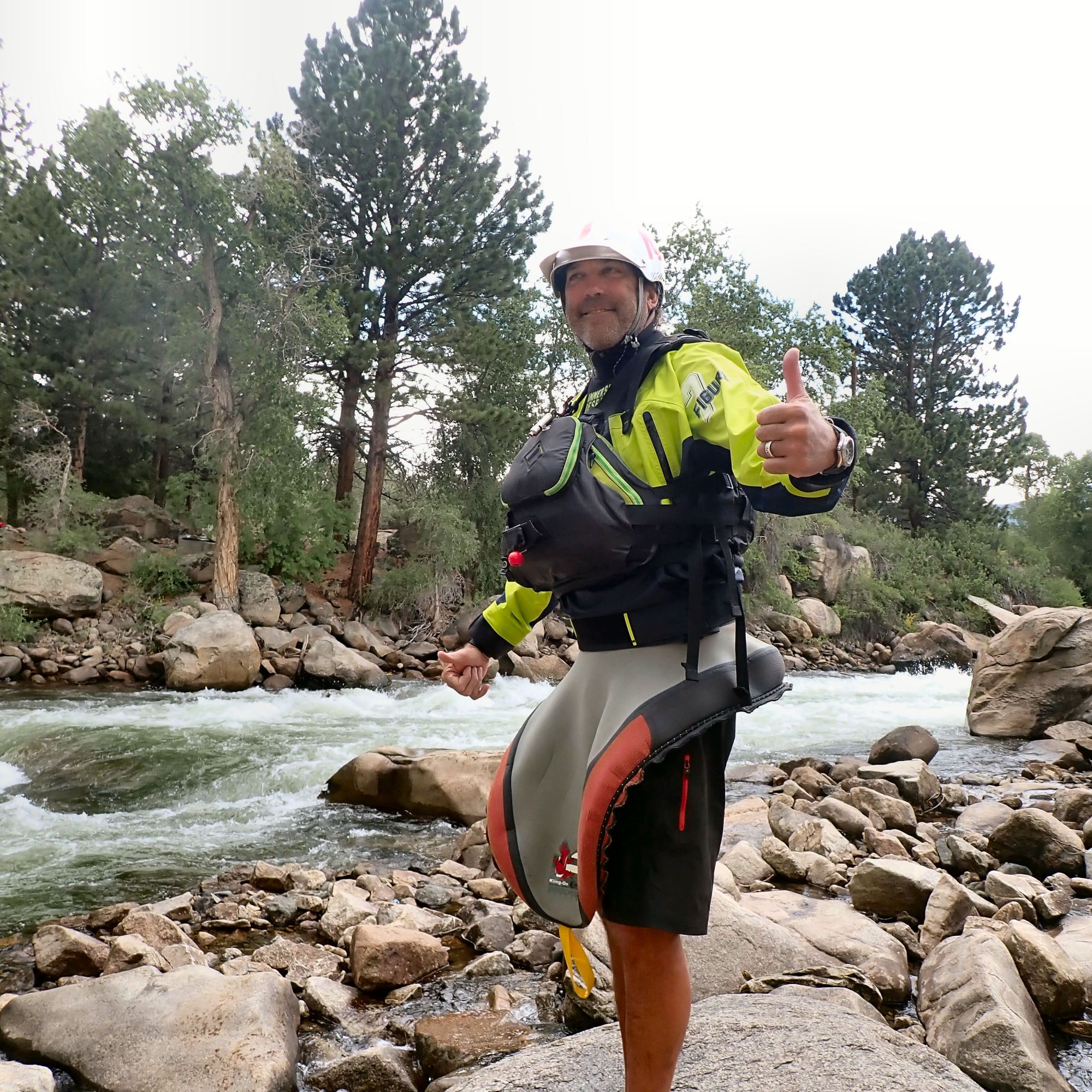
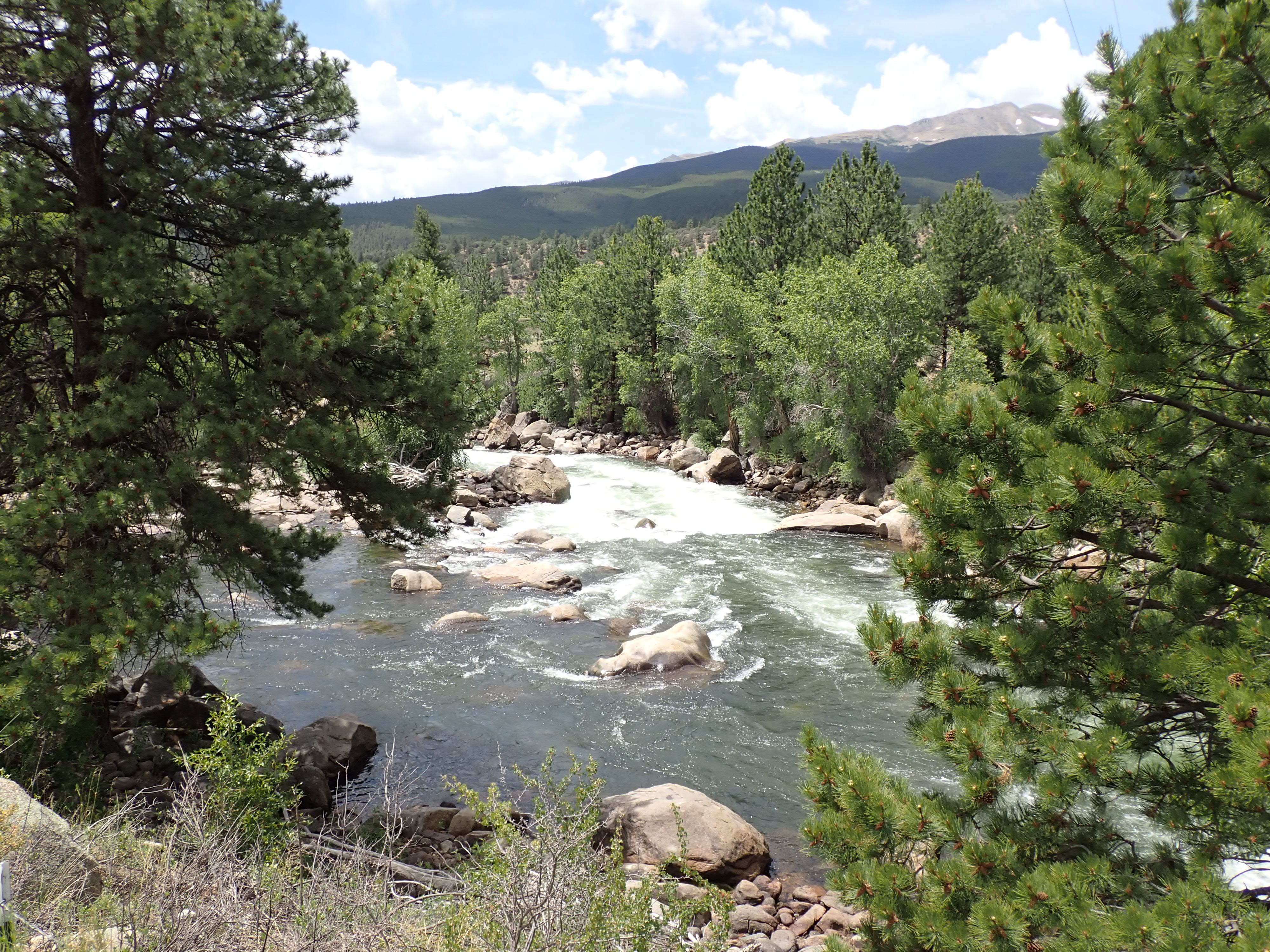


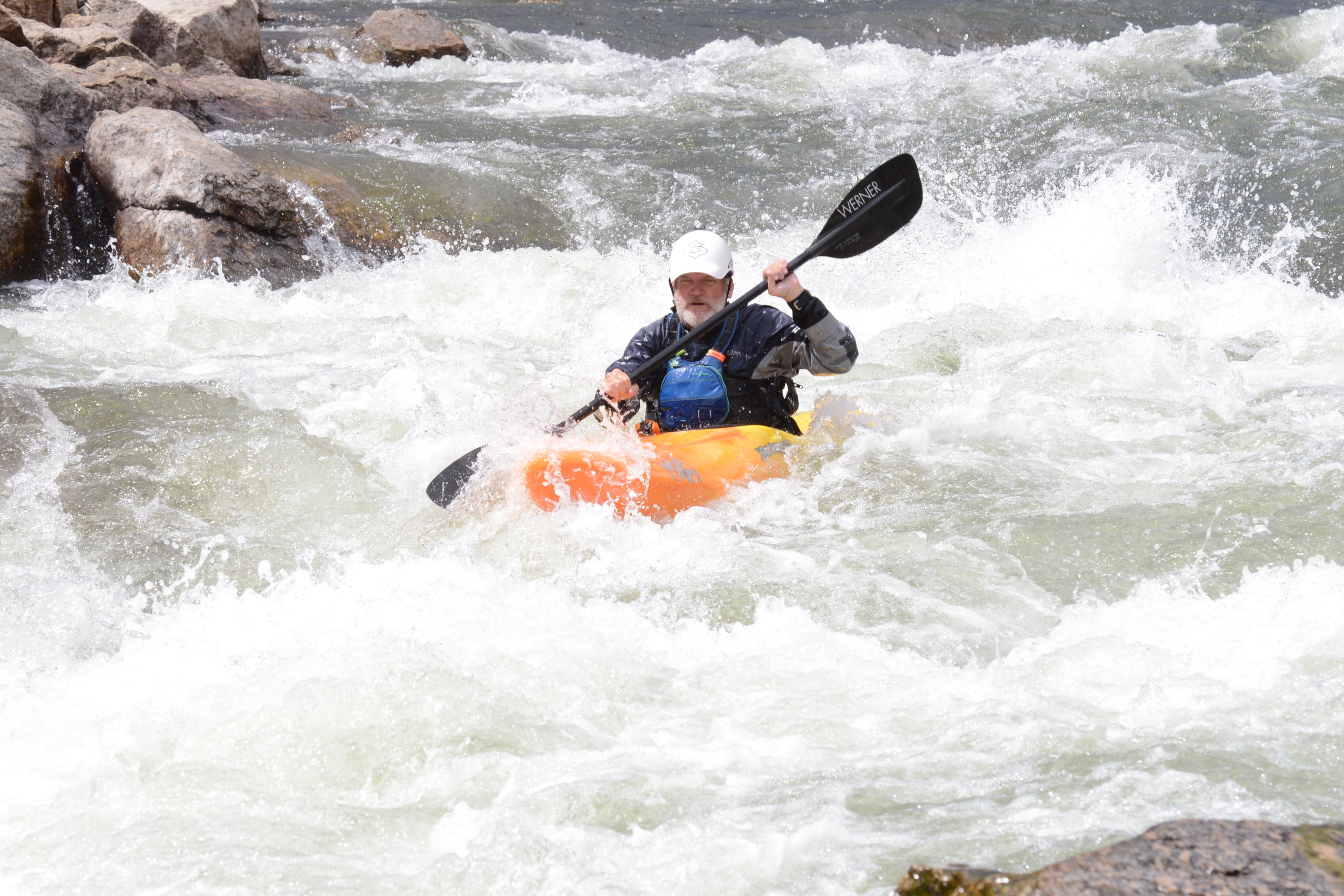

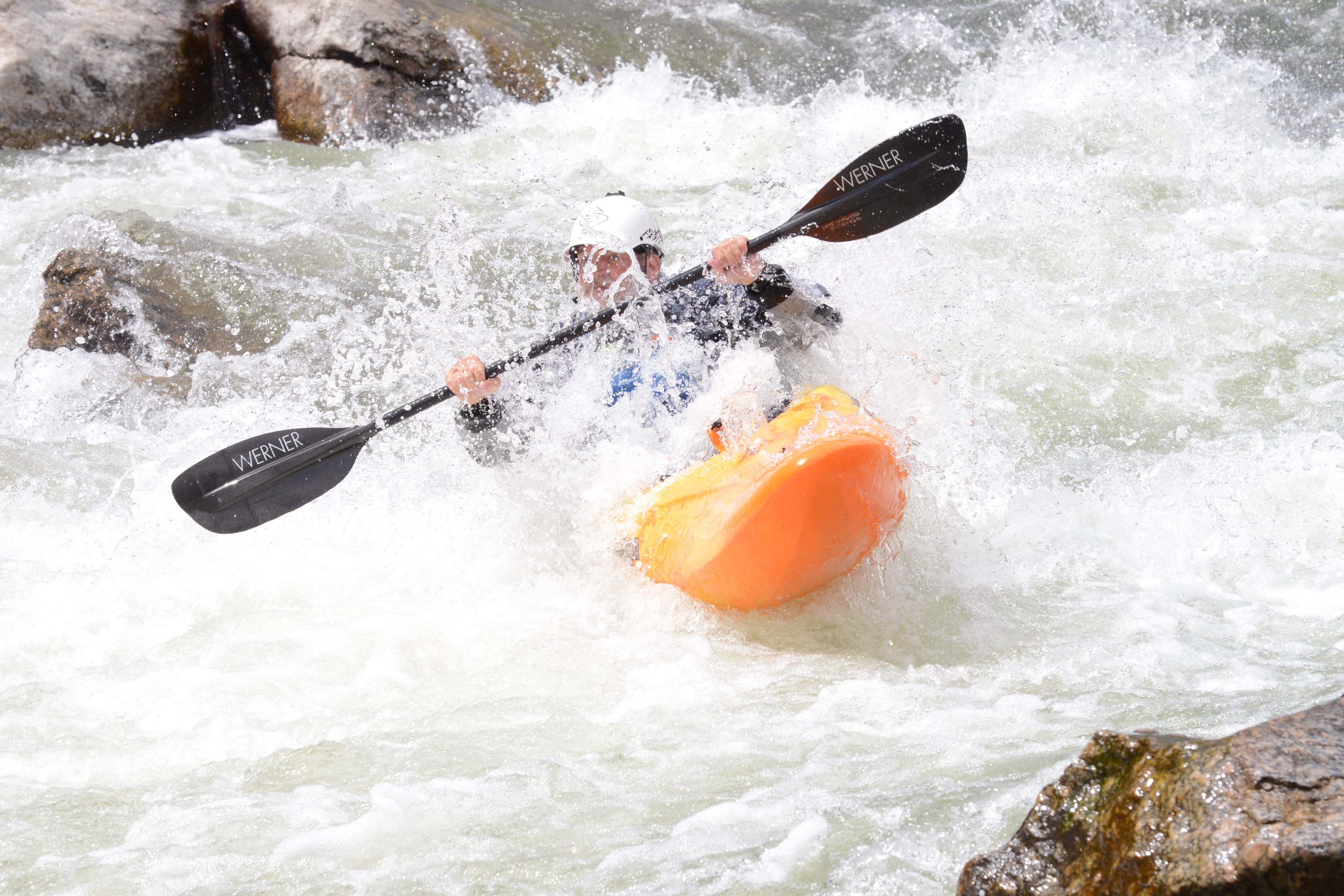
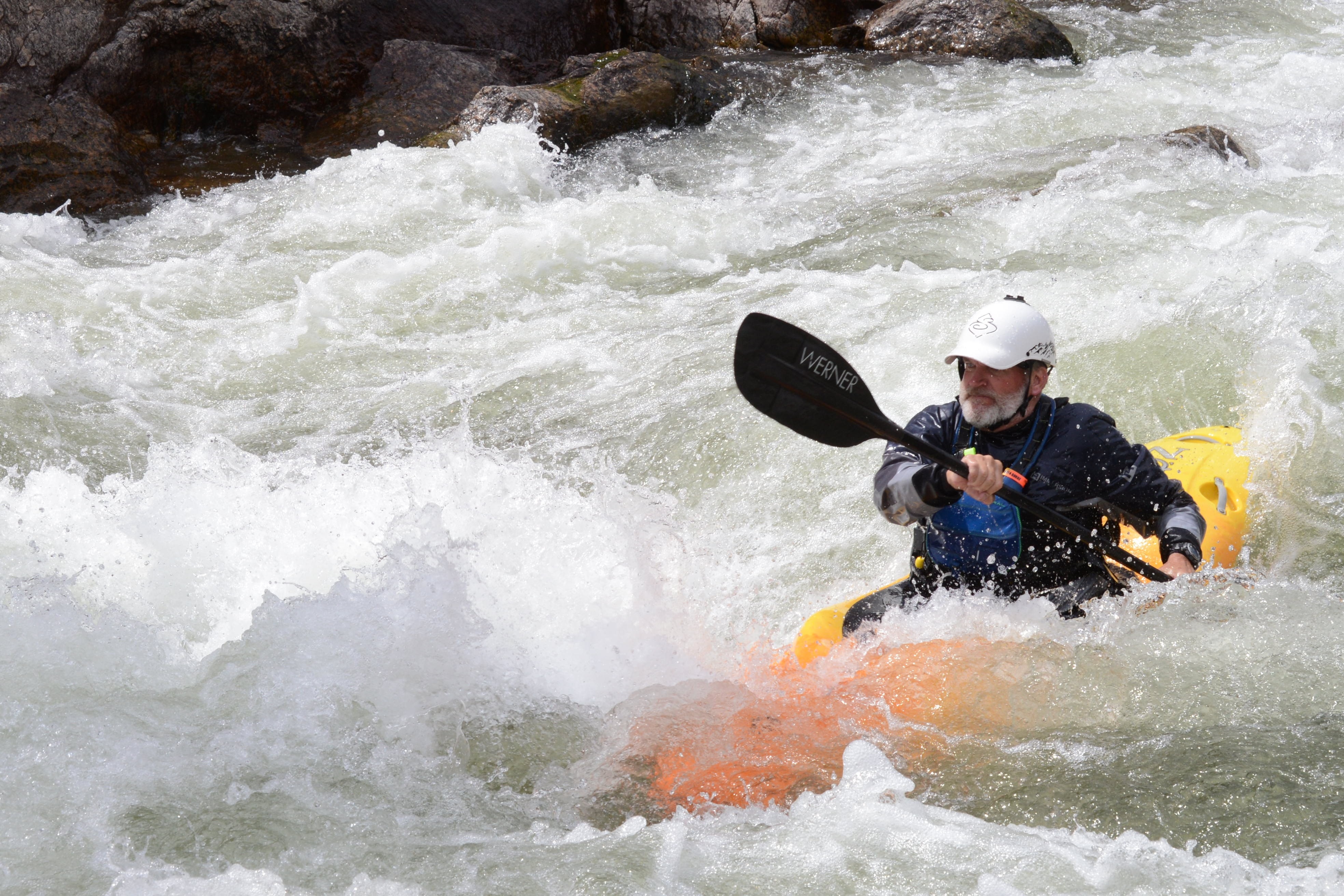

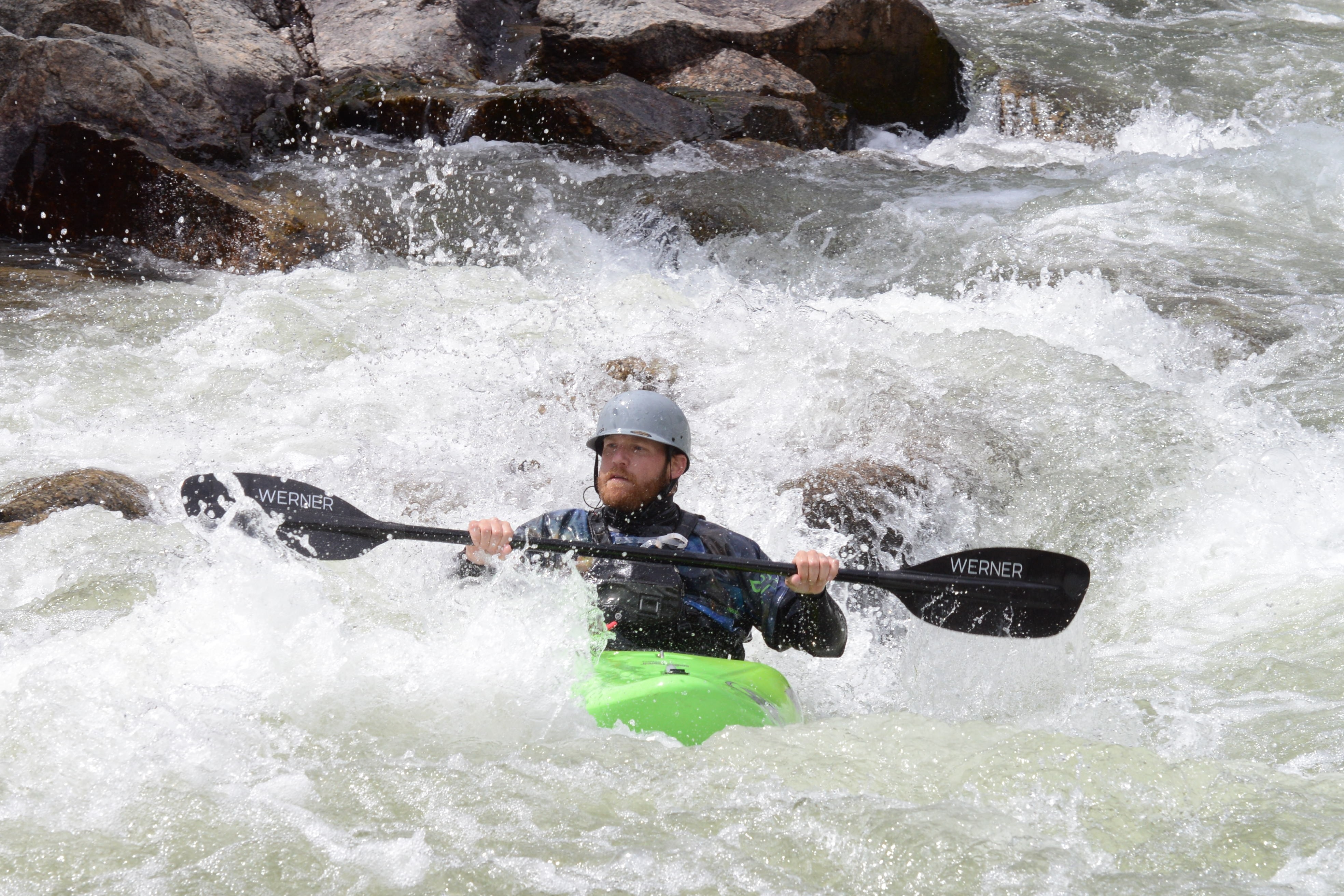
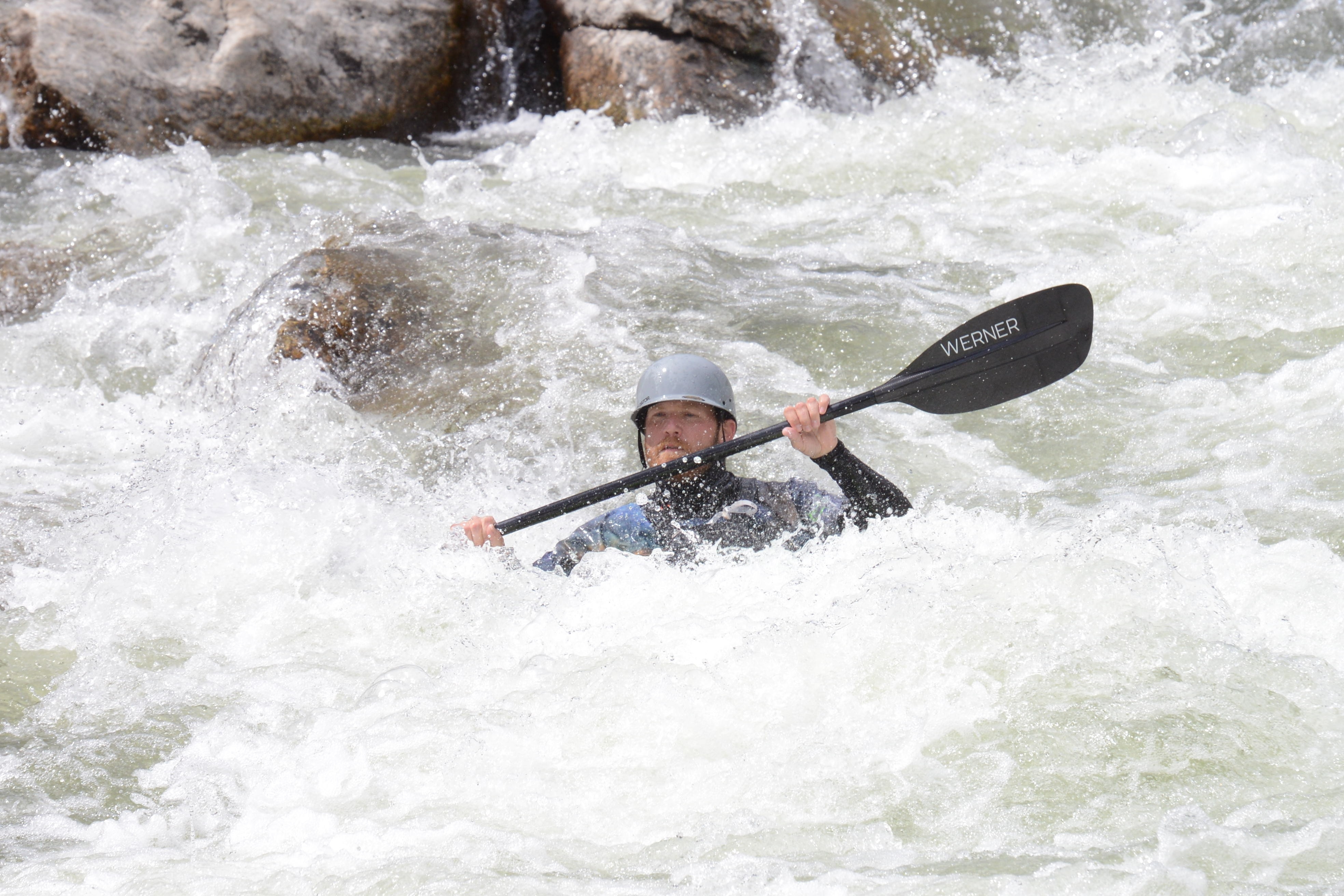
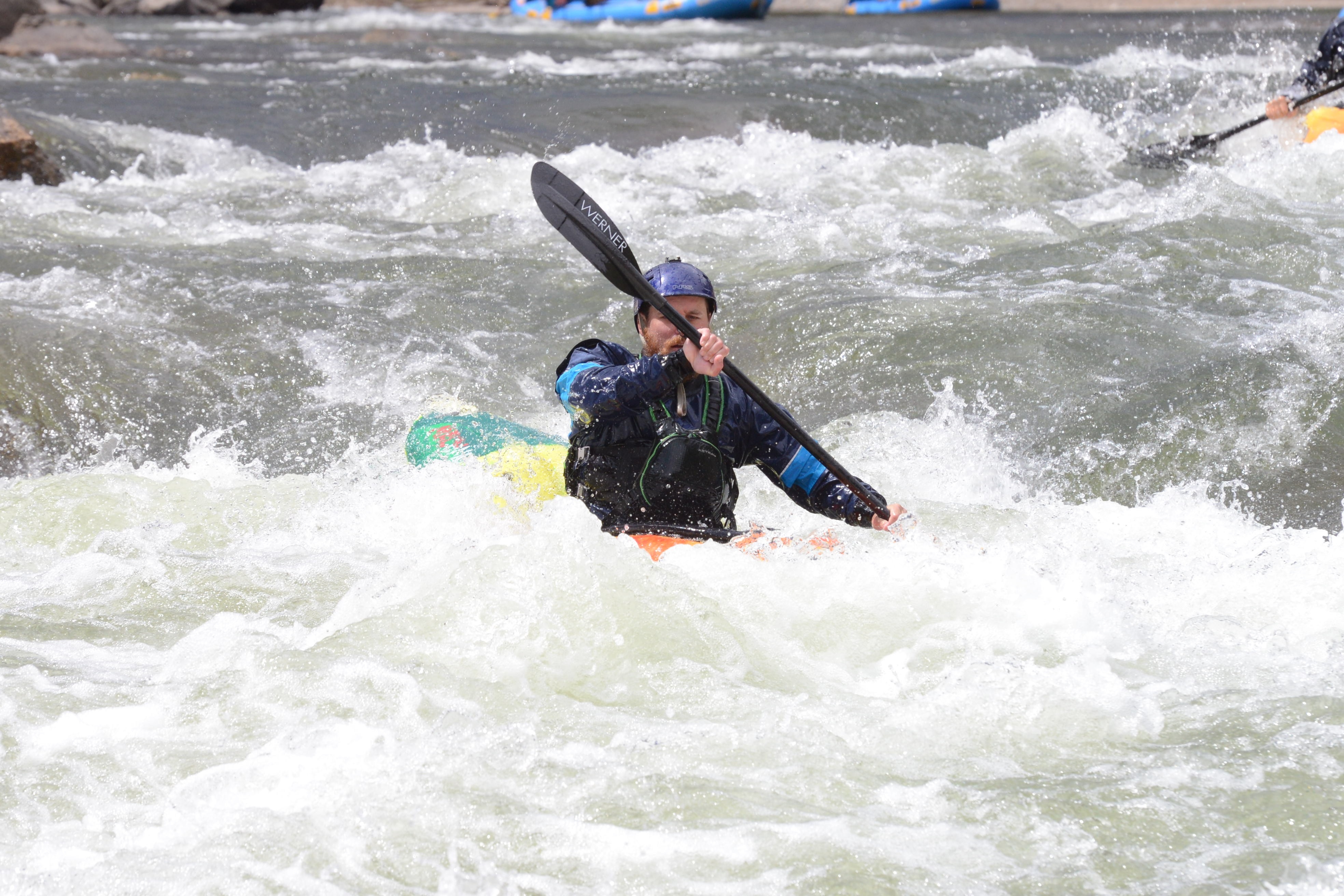

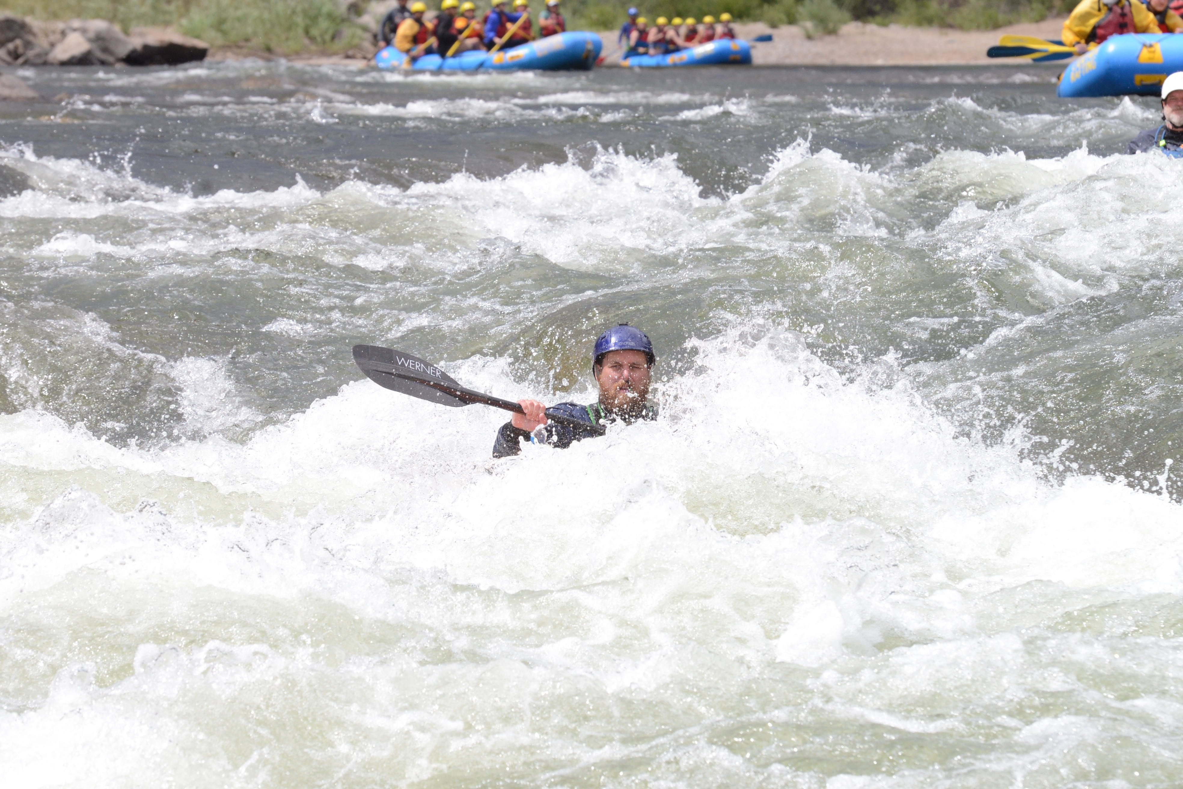
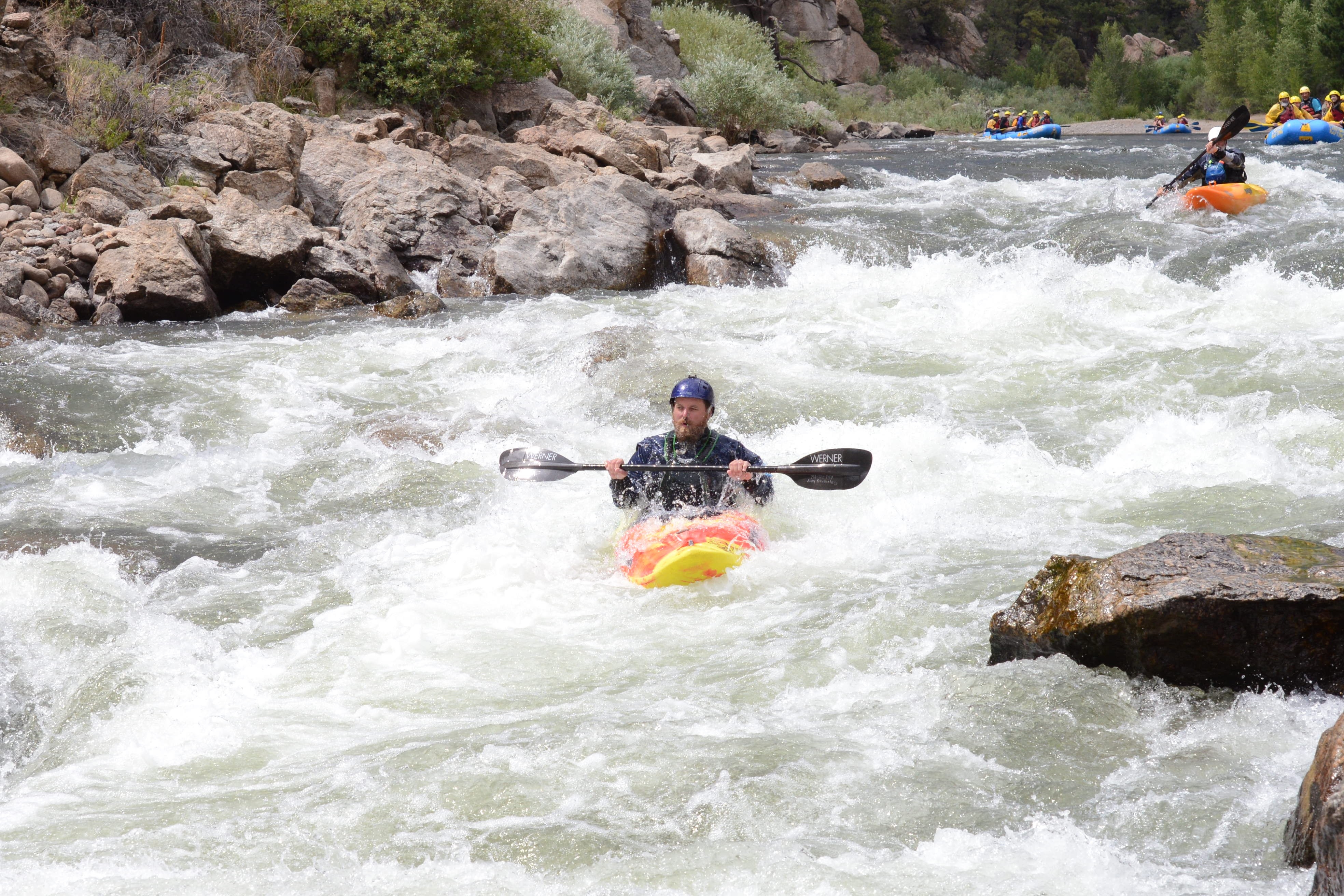
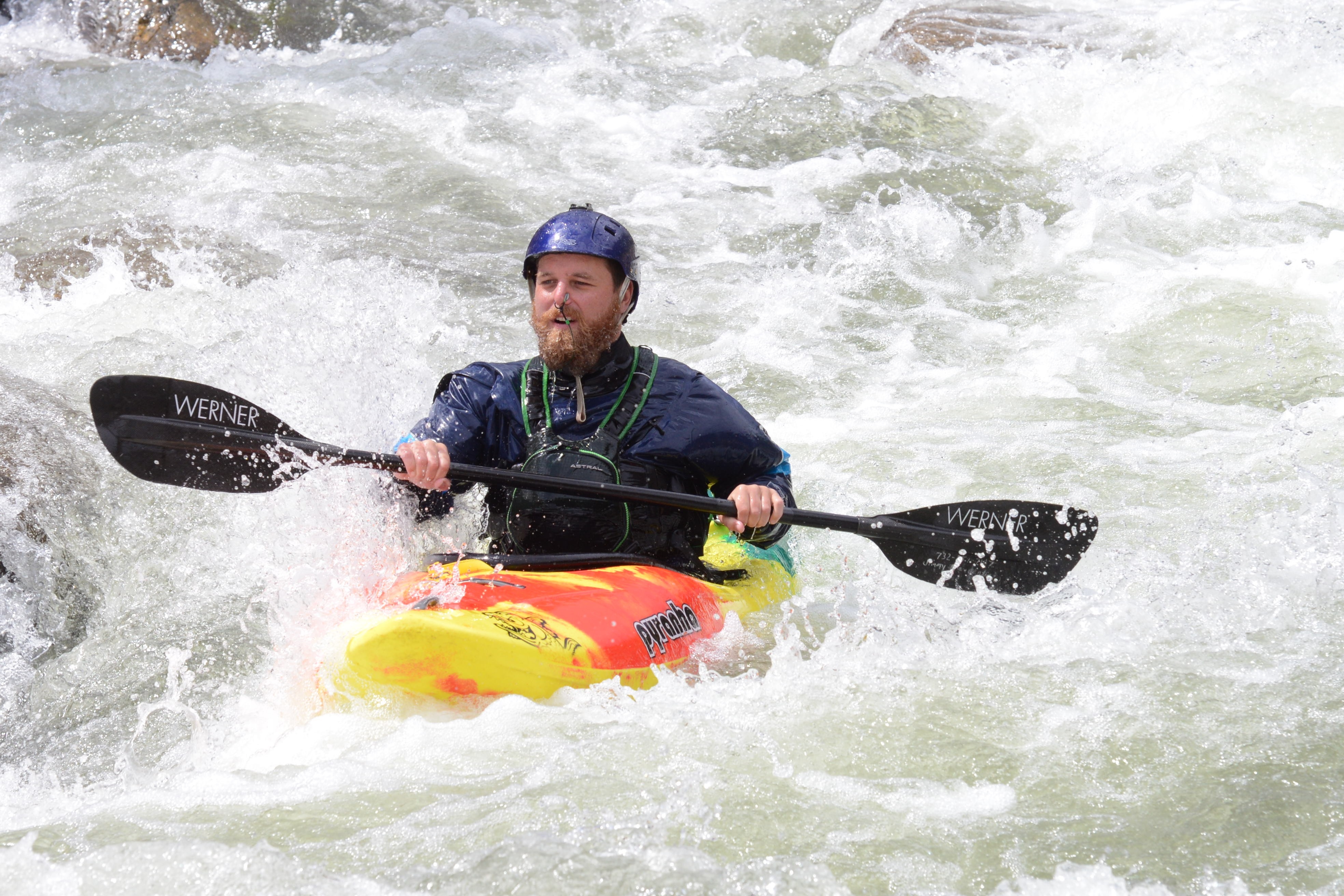


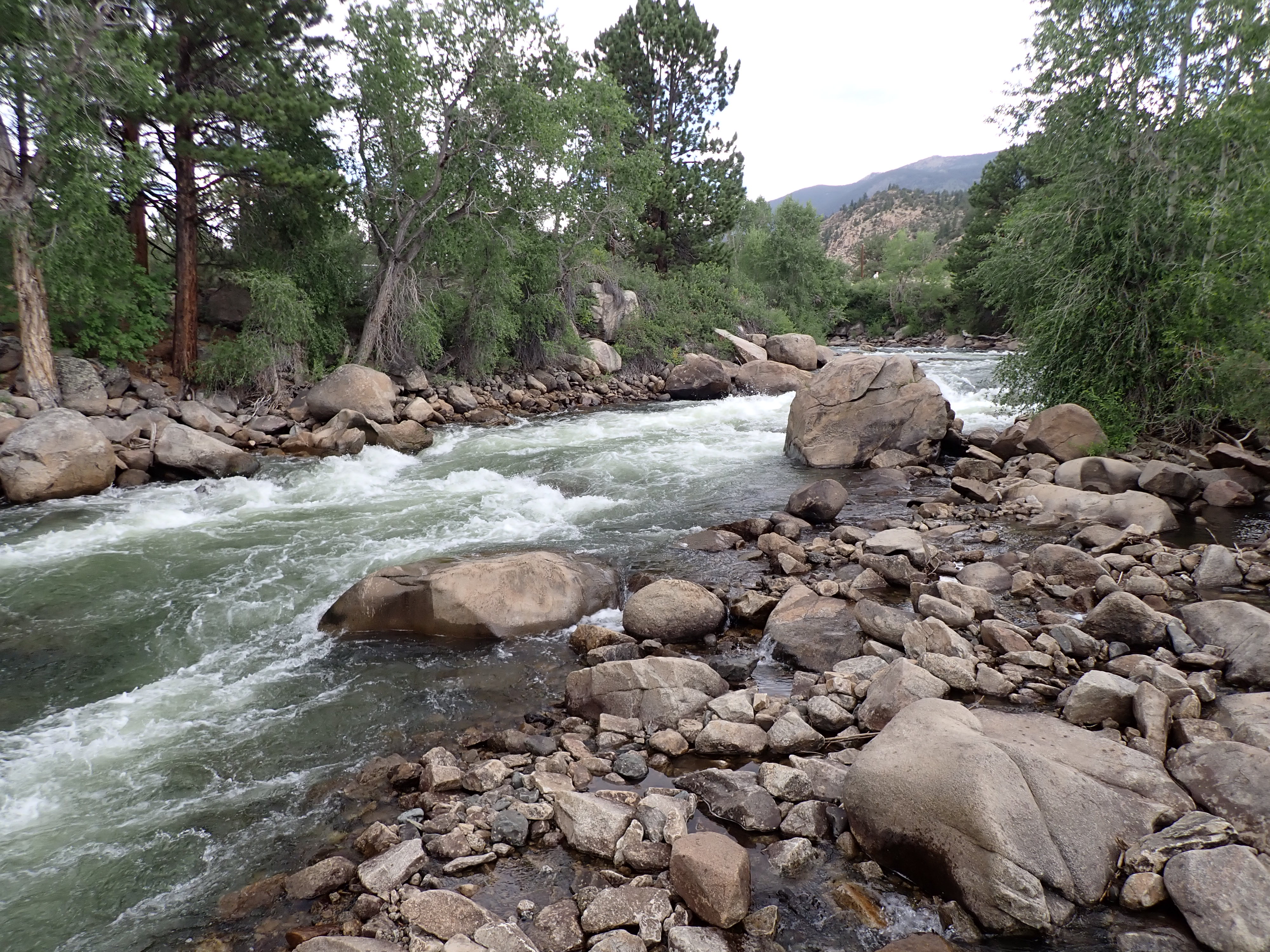
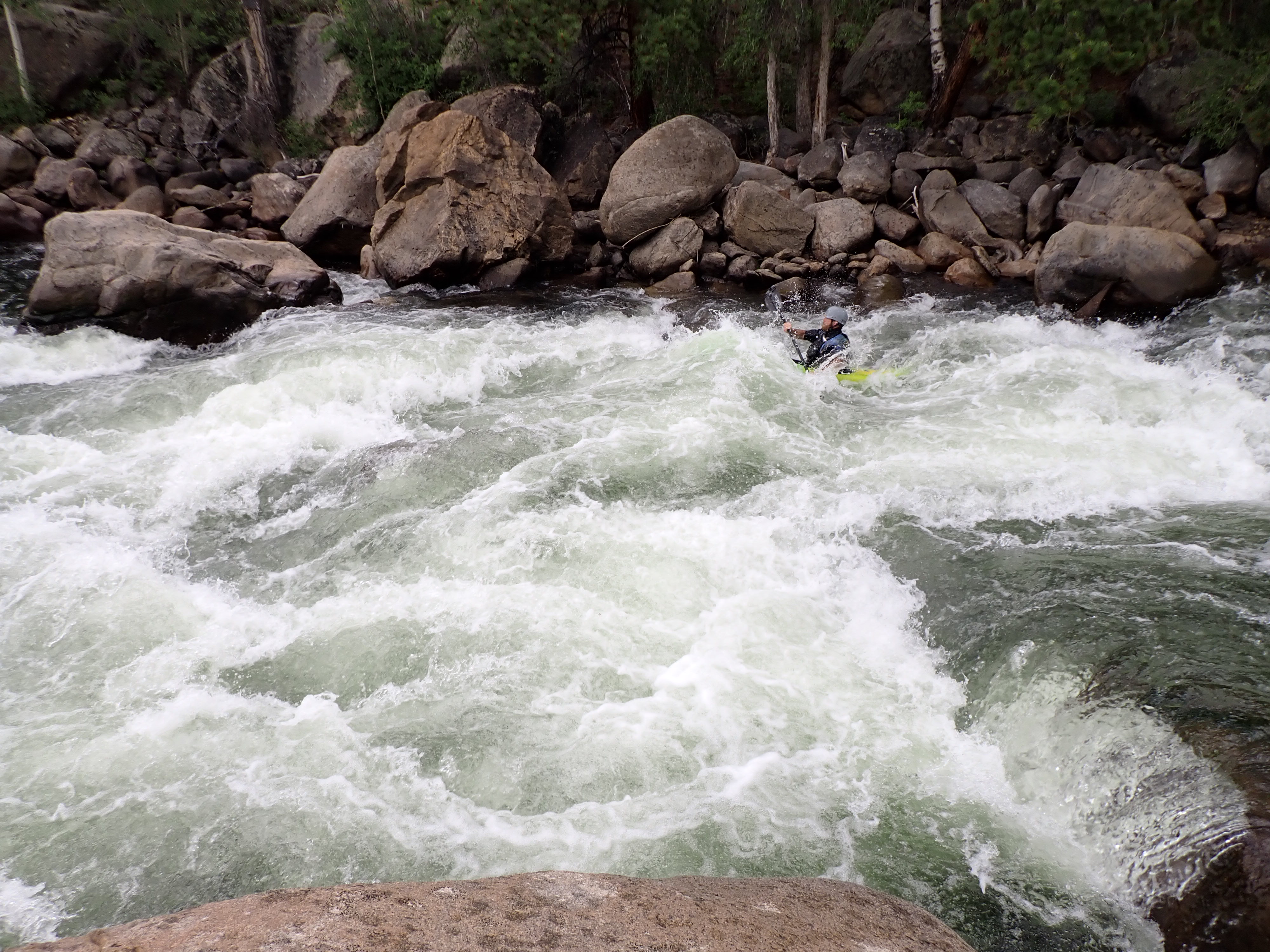

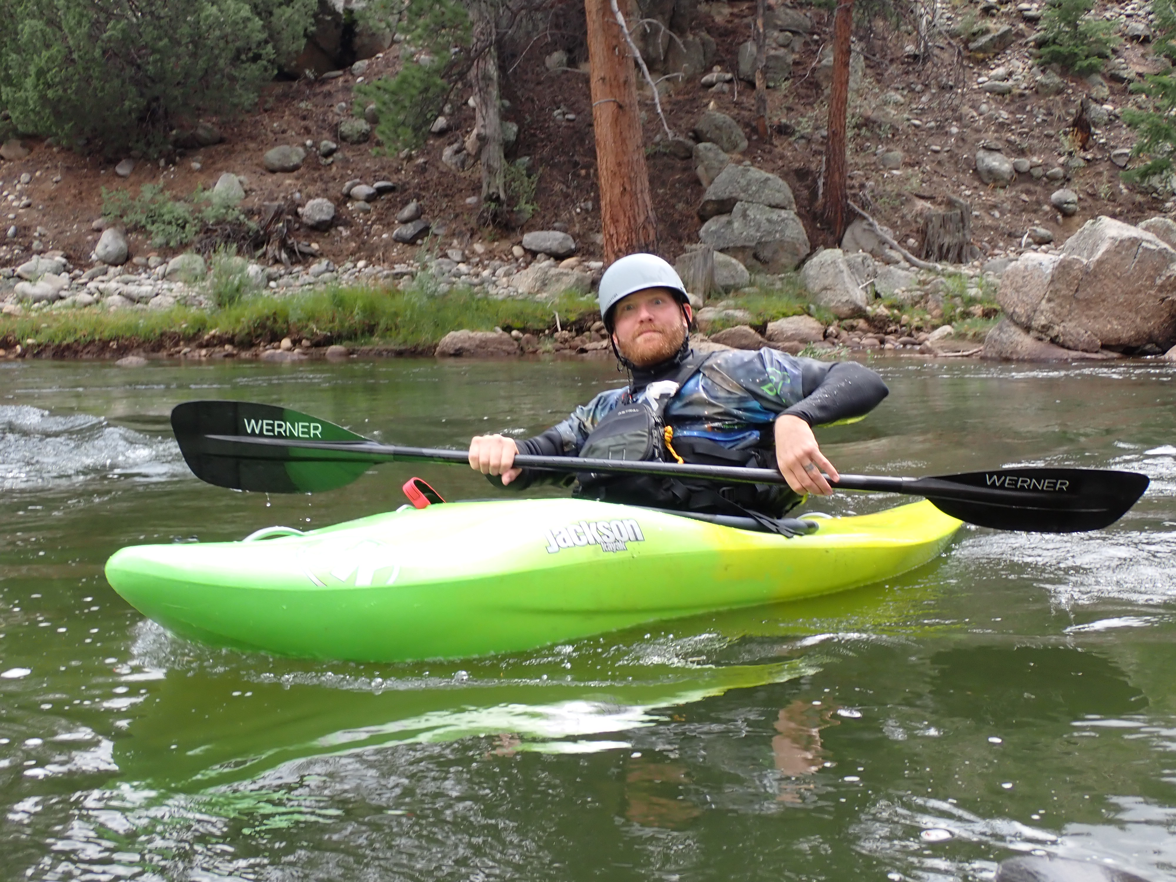


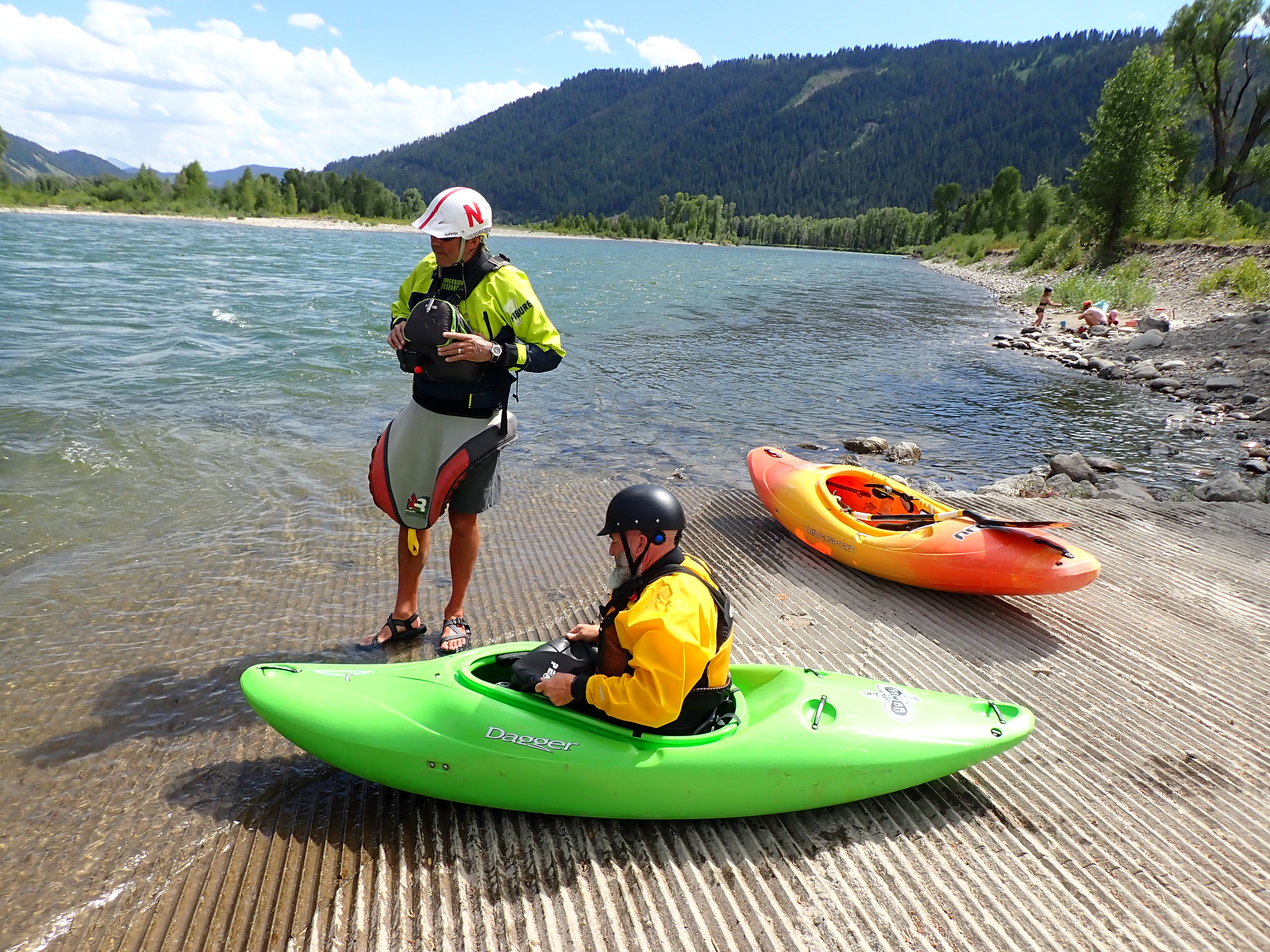


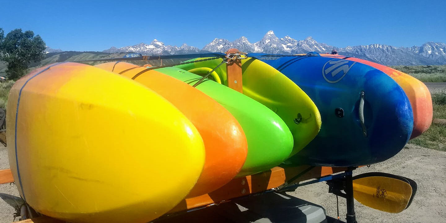
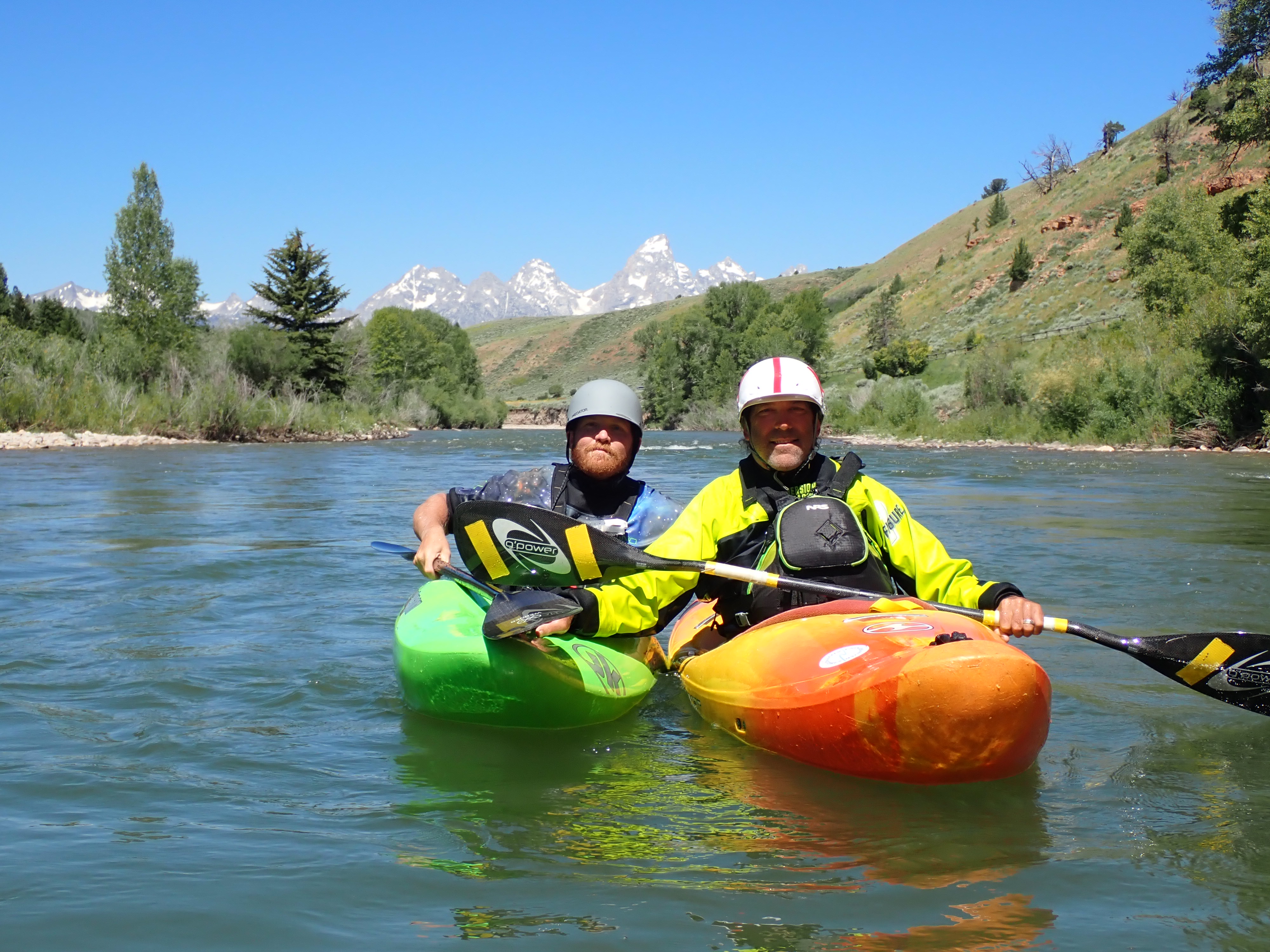
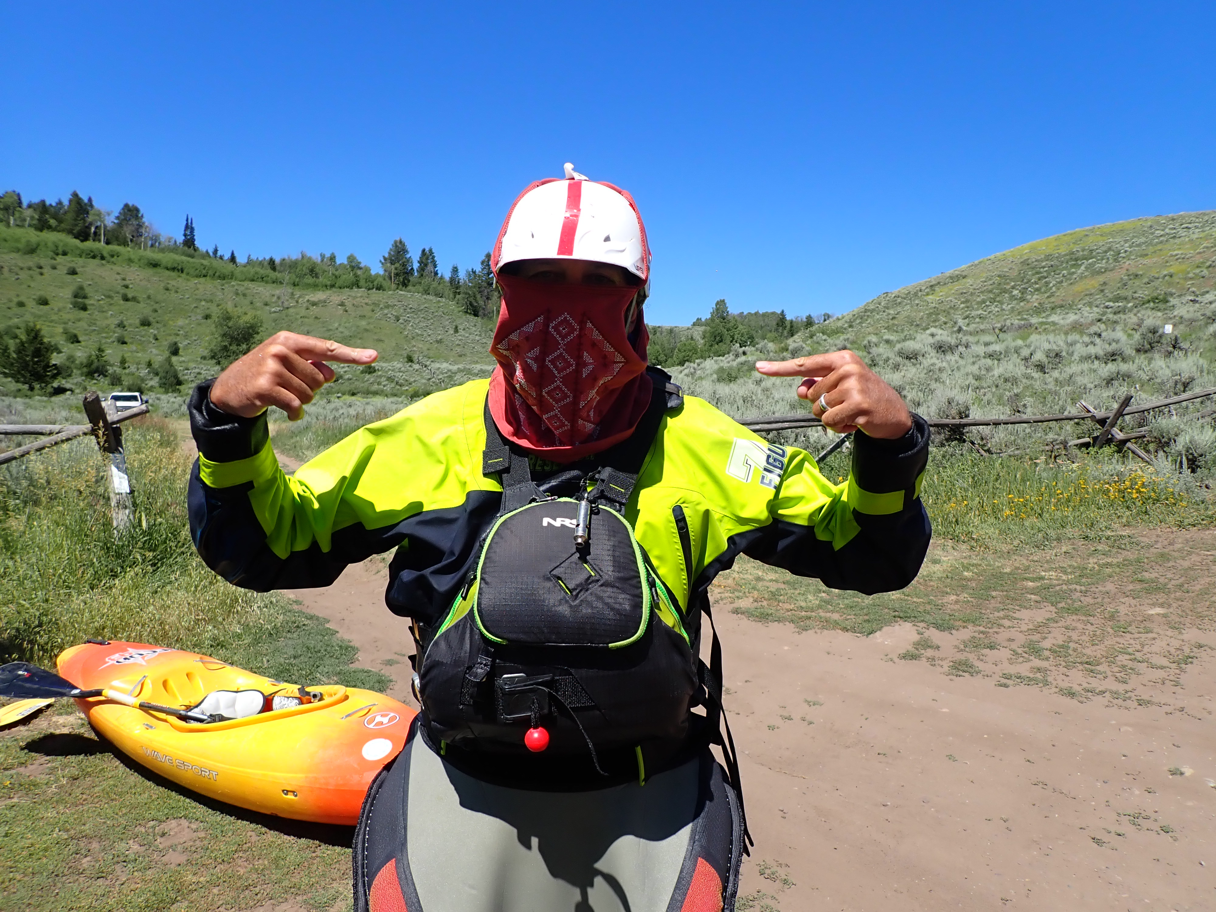

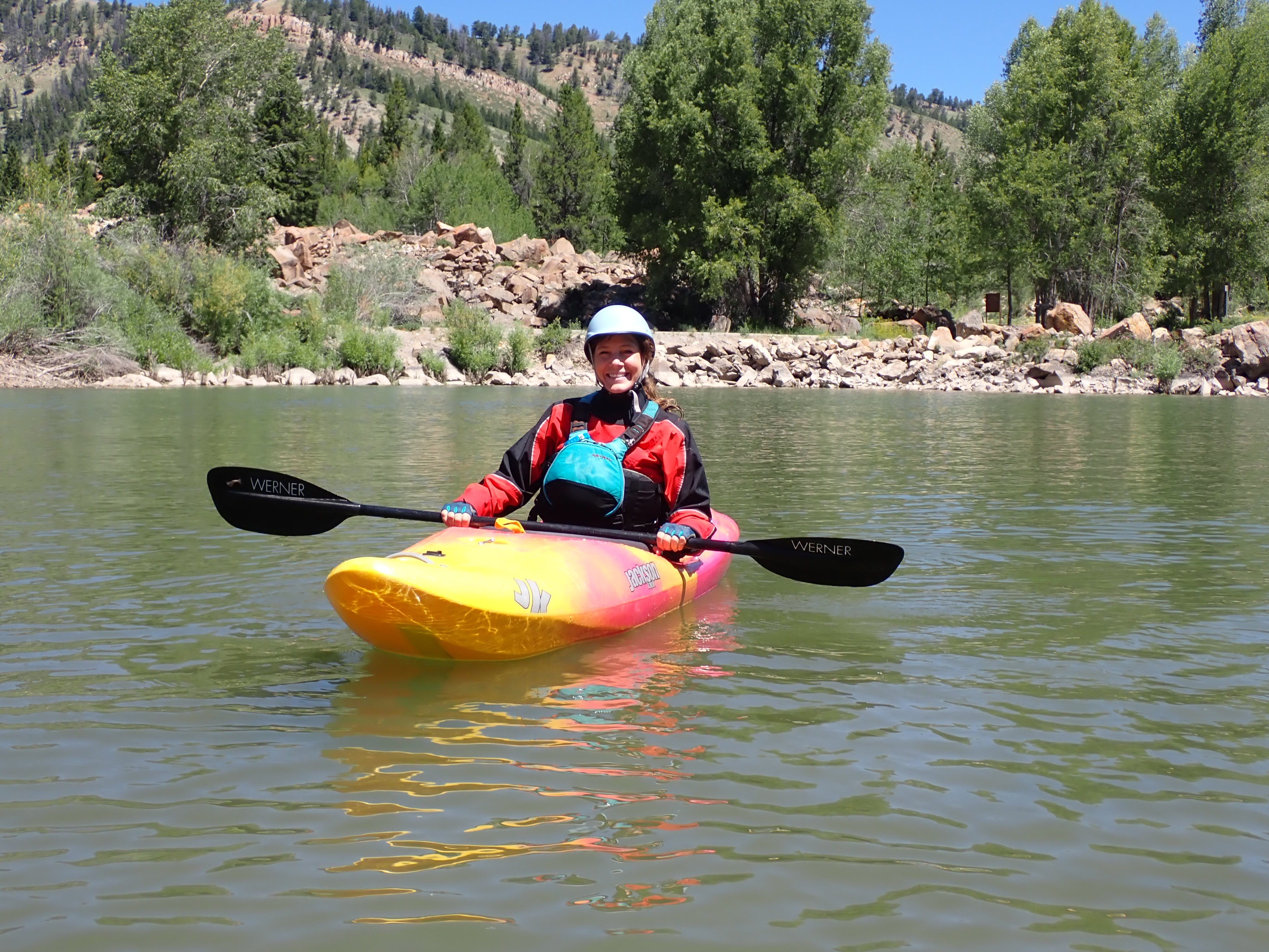


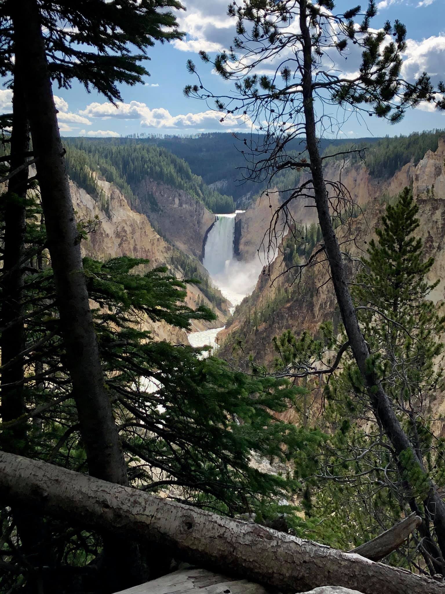

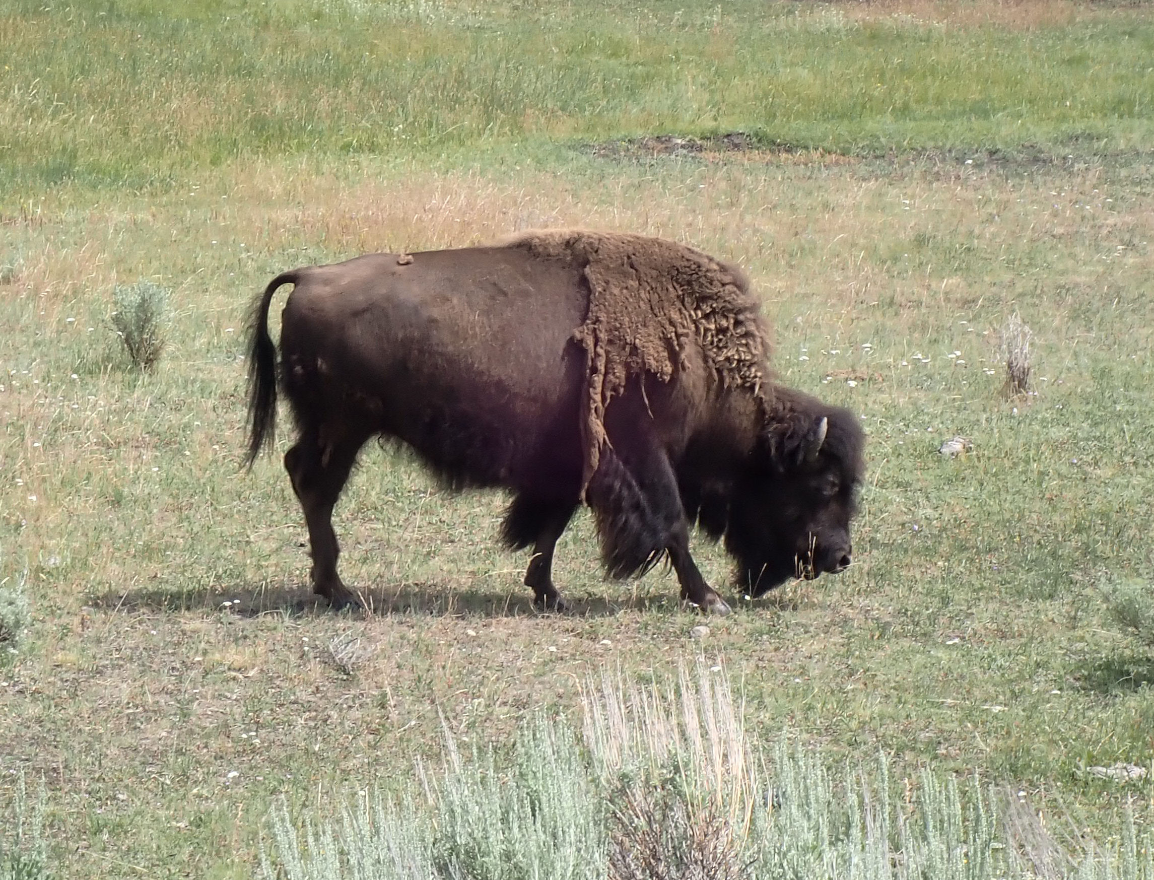

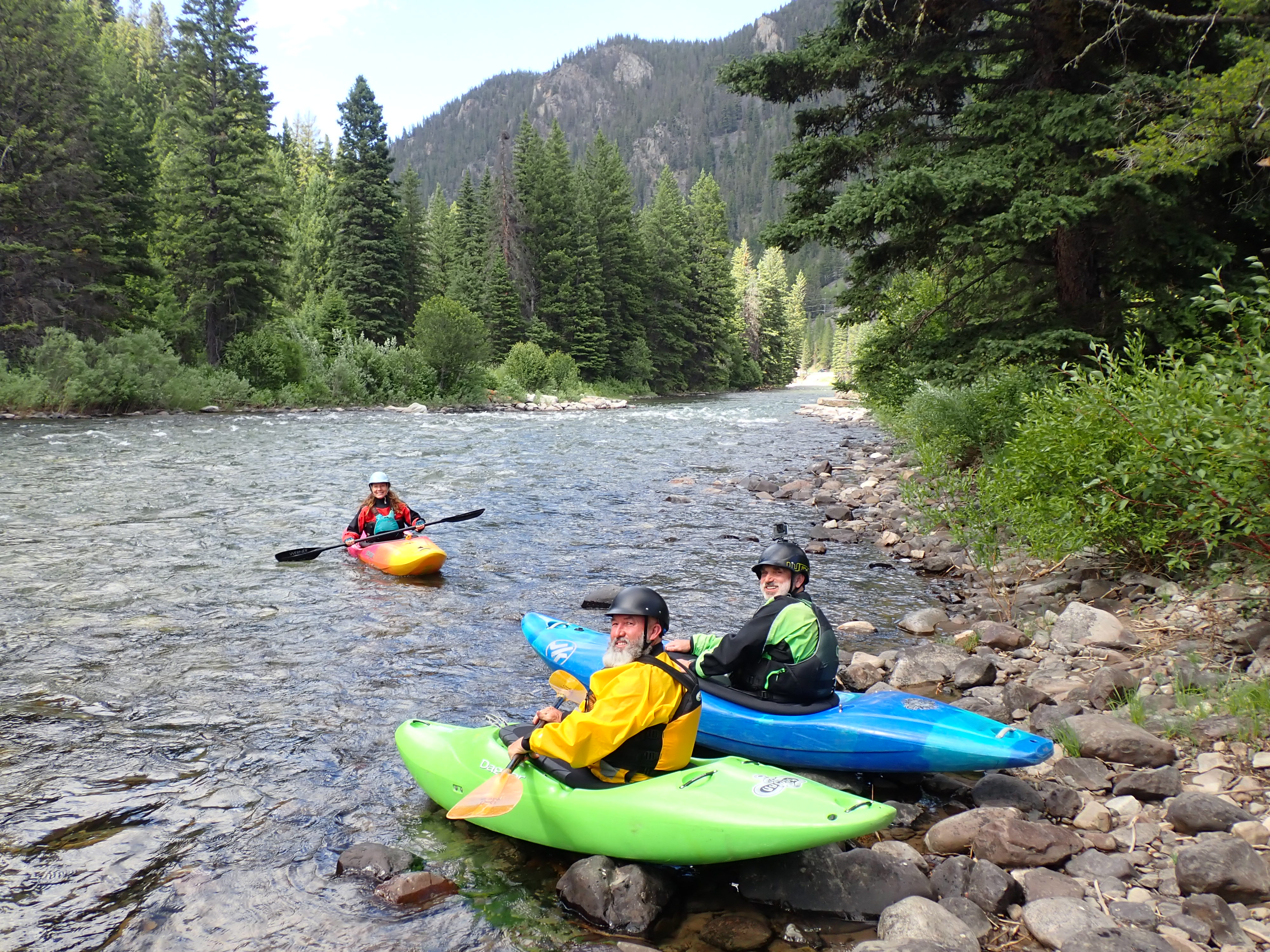


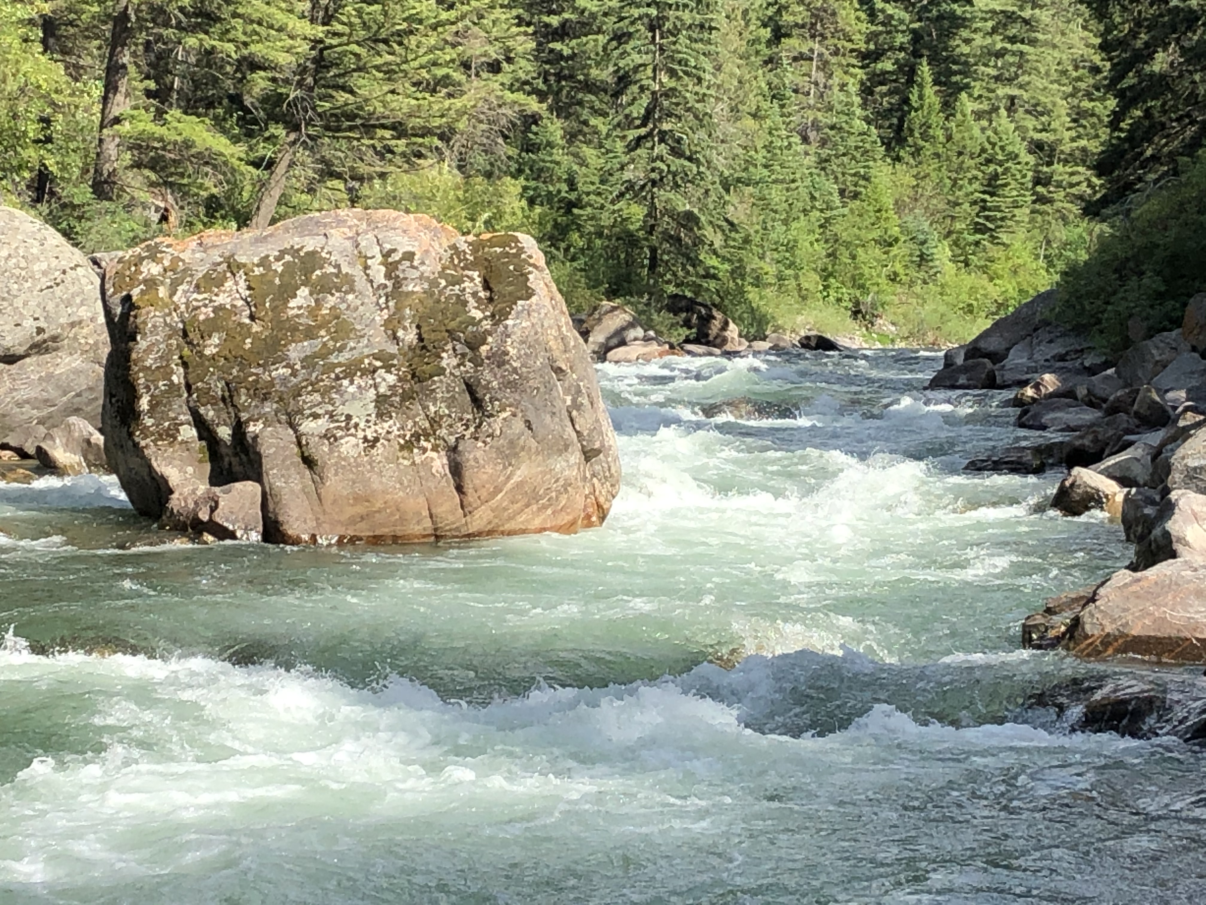


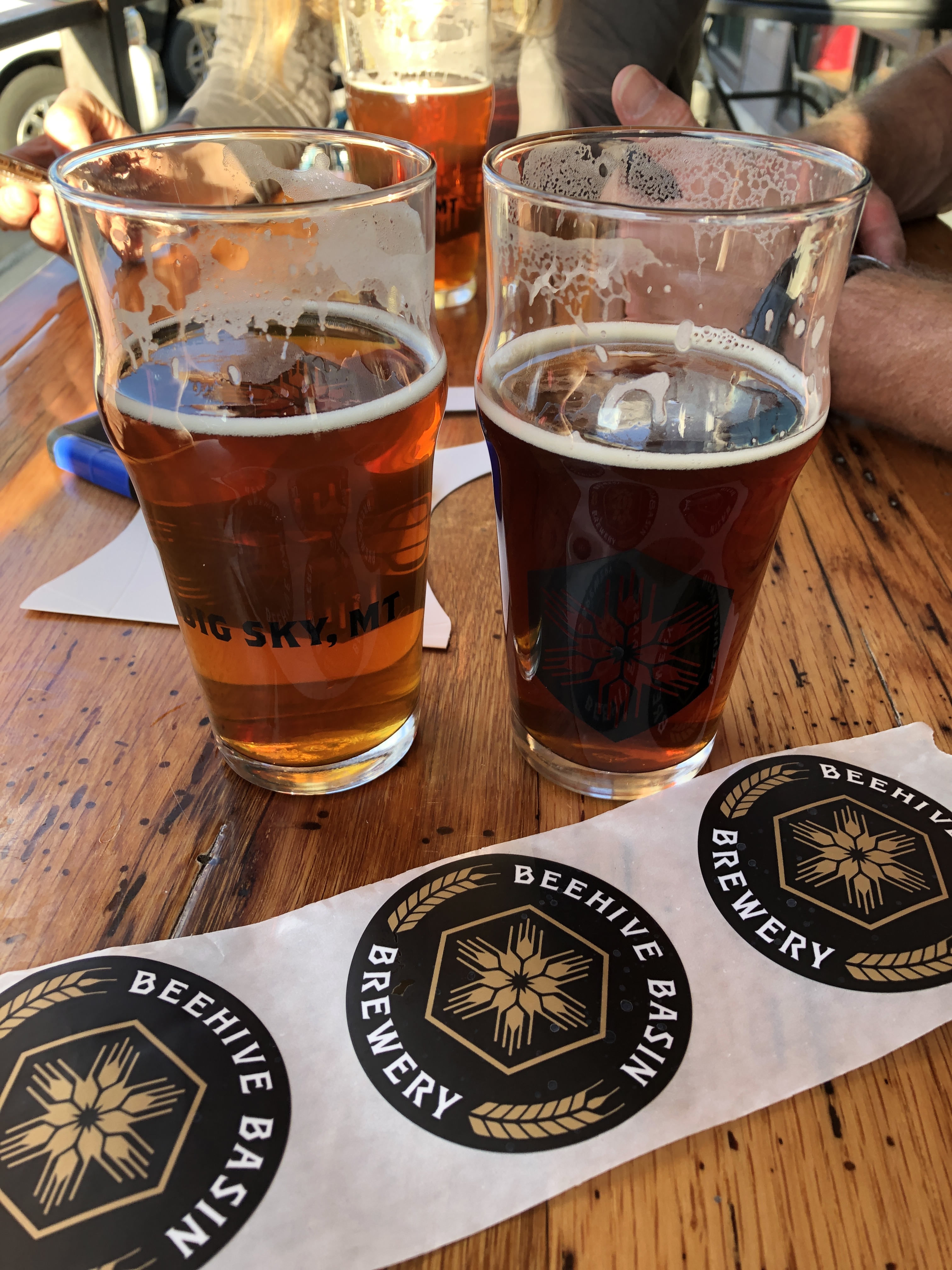
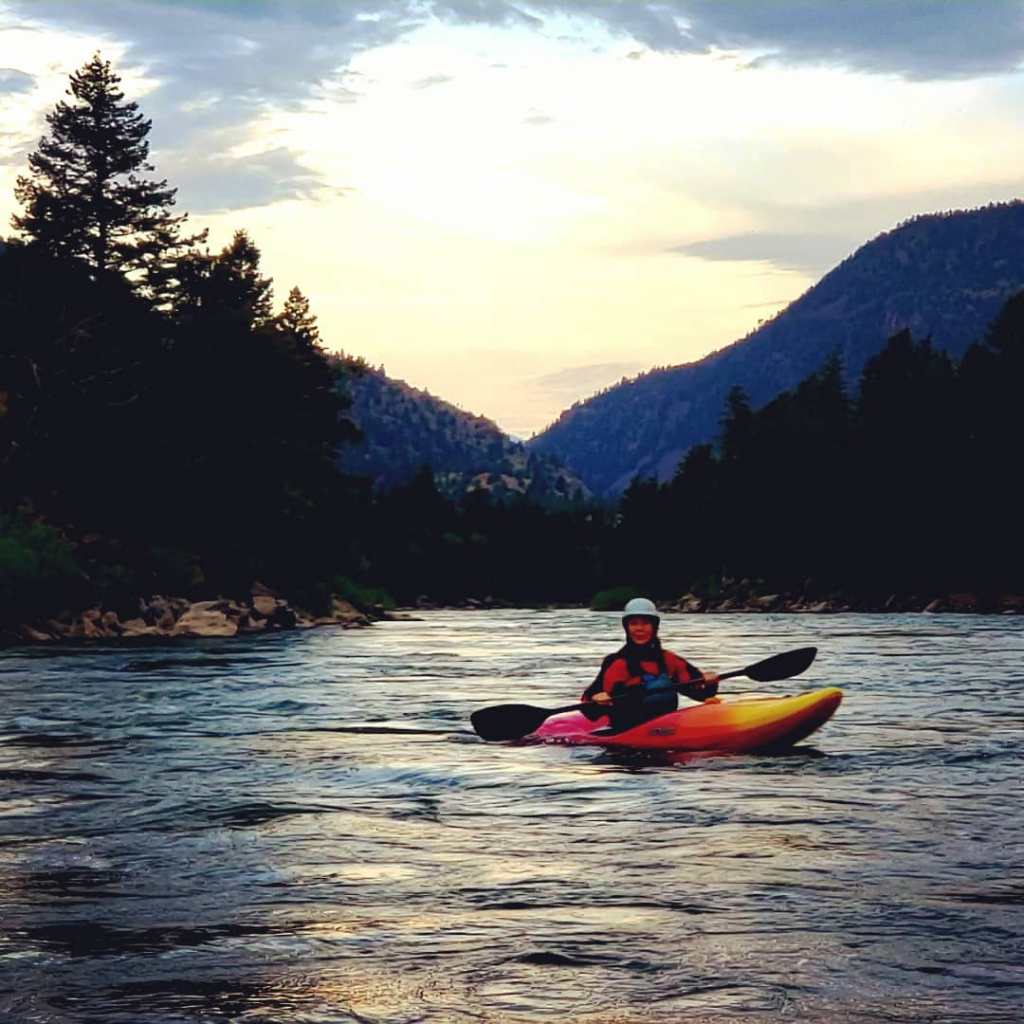
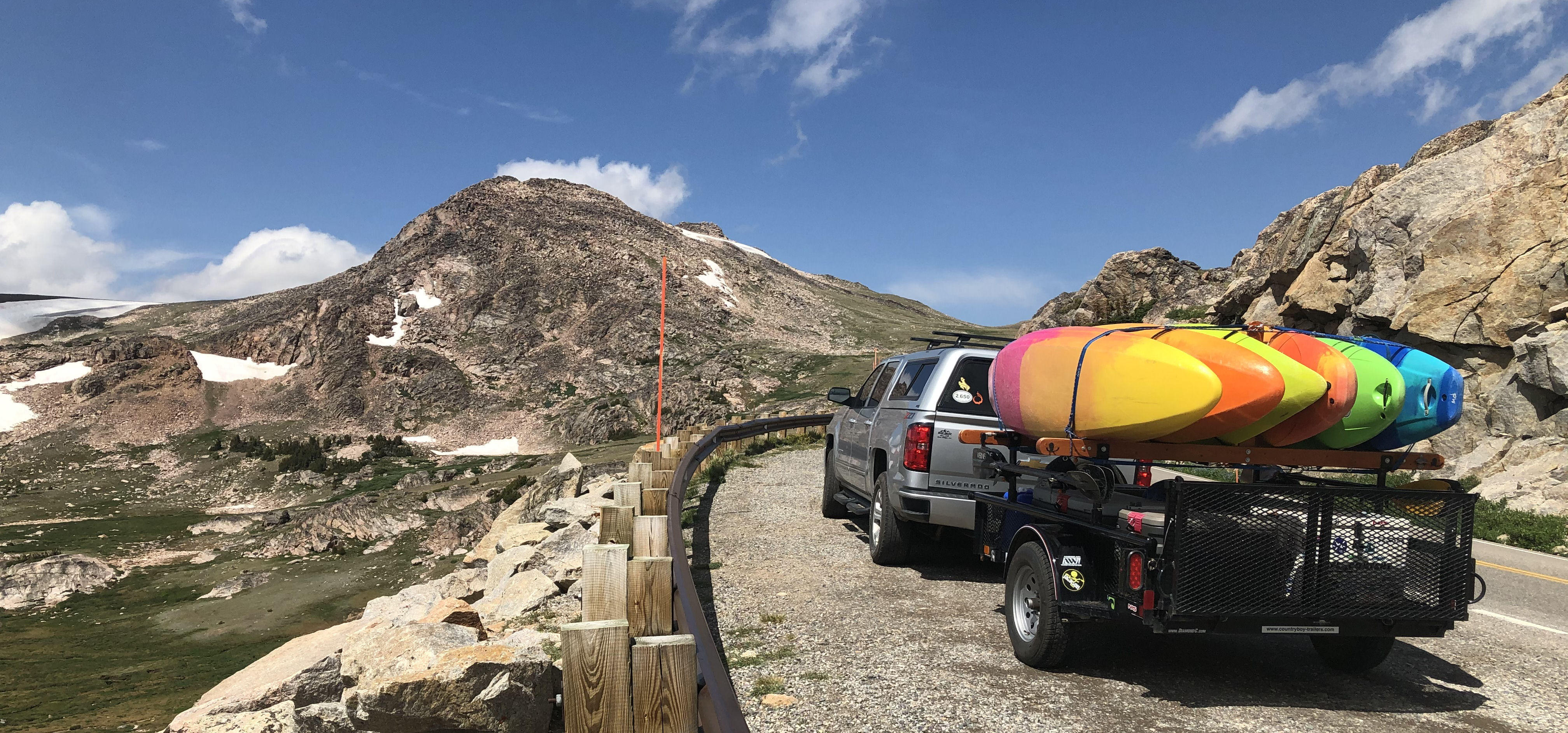


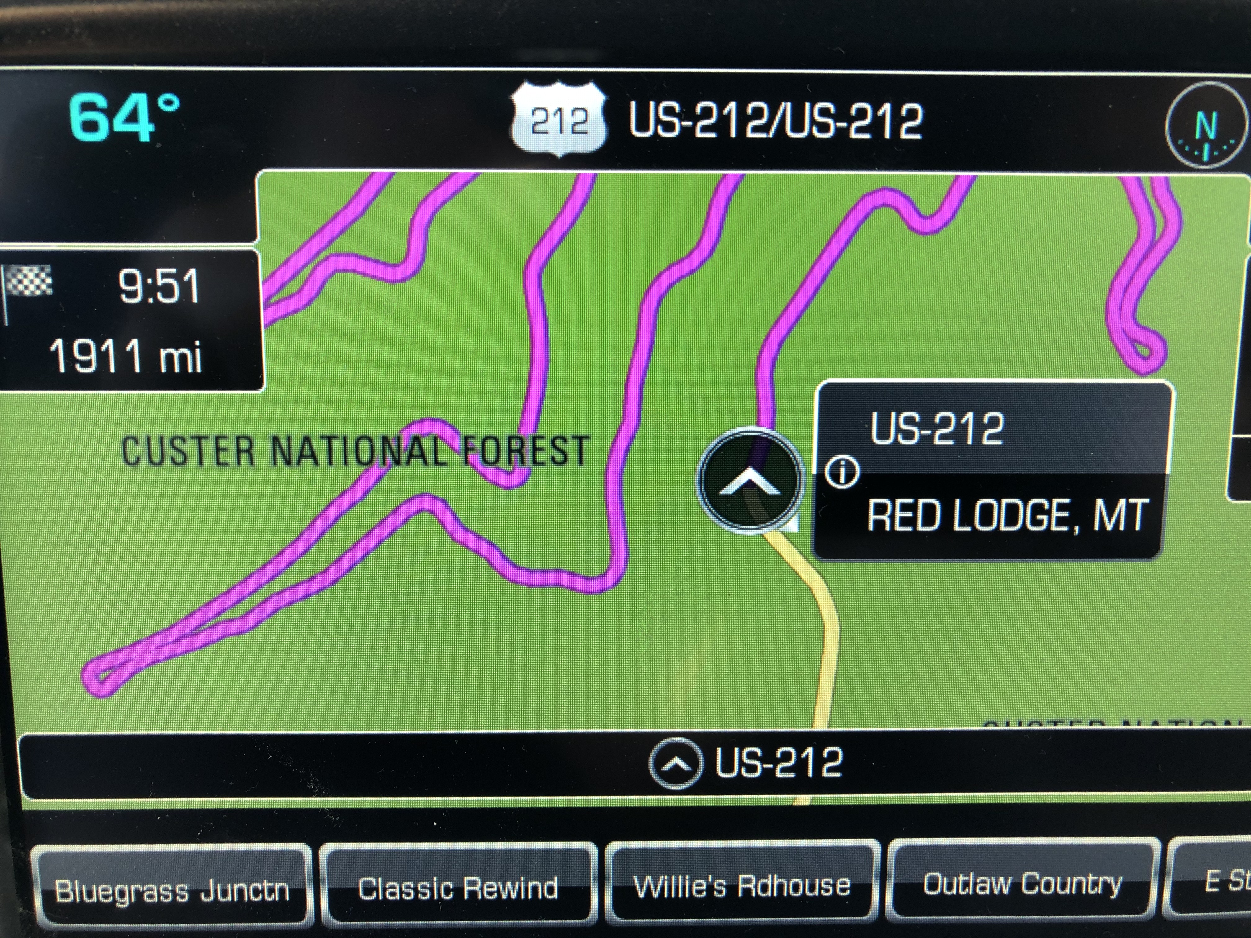
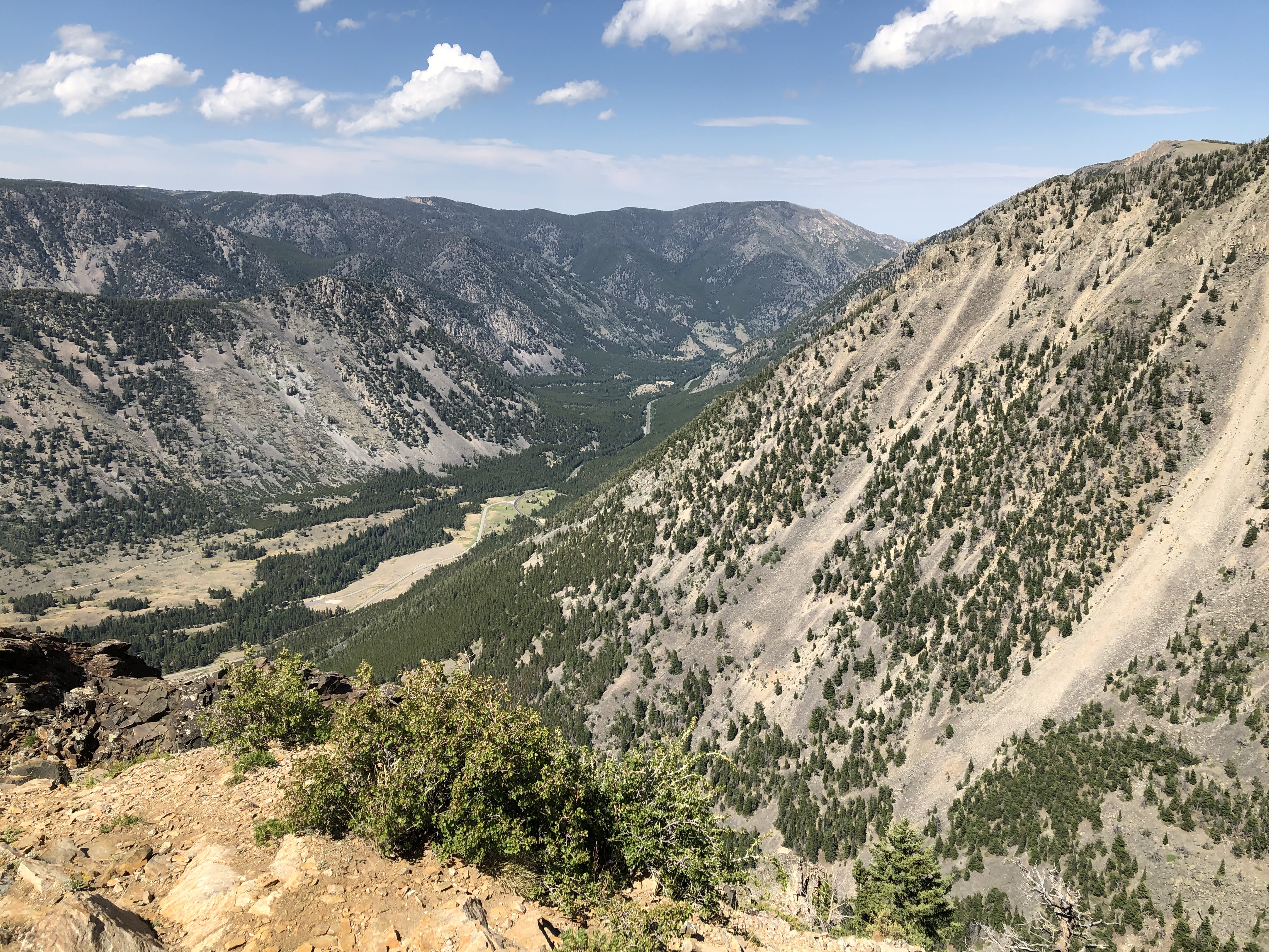


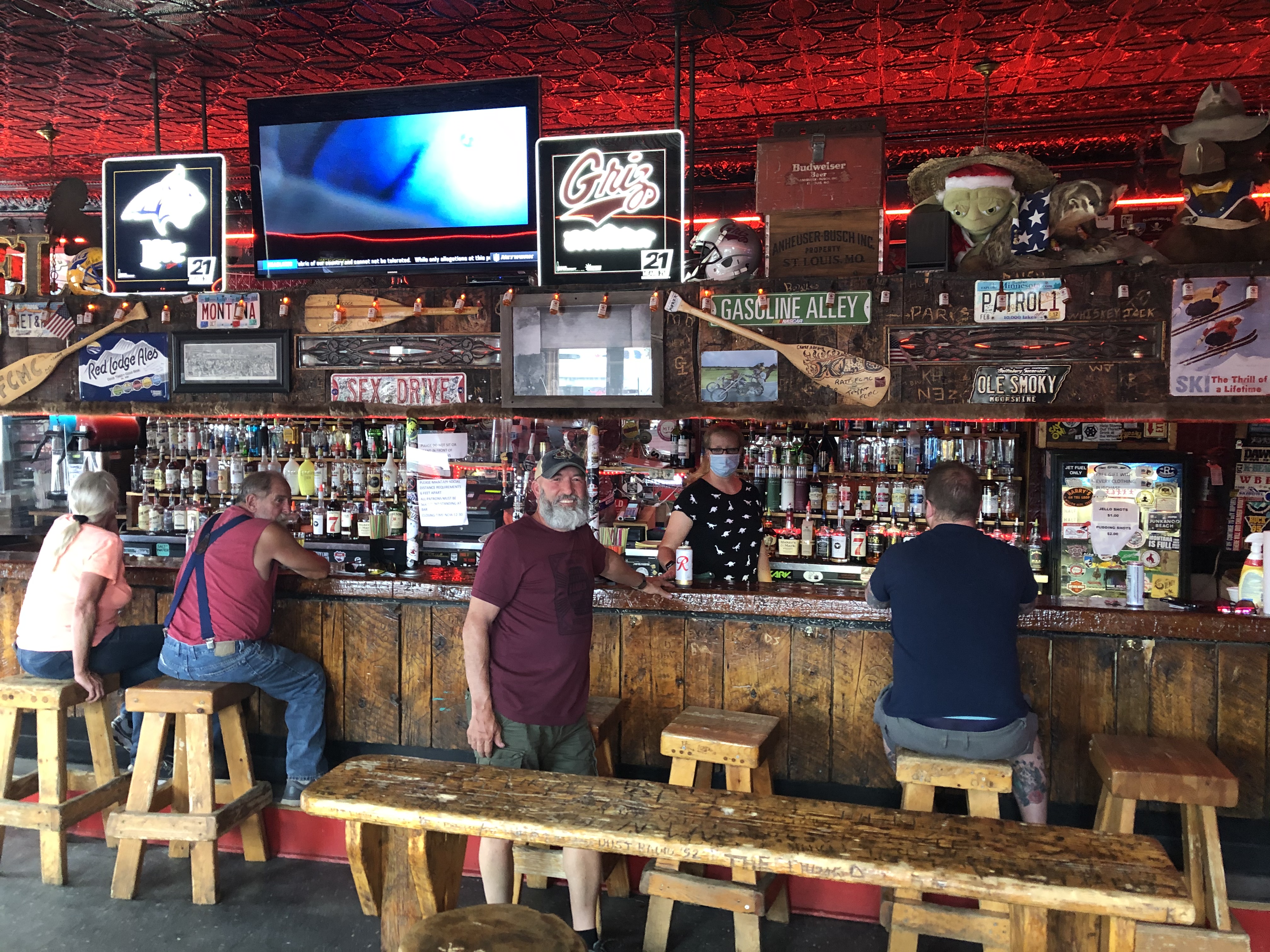


 For the past couple of weeks I’ve been hanging on to all of my hopes that I’d still be able to pull off my CDT NOBO hike with this Coronavirus sweeping across the country and the world. After several attempts of trying to keep my April 16th launch date on go, the current variables, that change daily, are just too many. Just yesterday, the San Juan County Sheriff’s Department in Colorado issued a statement prohibiting recreationalists from backcountry activities in the county due to the limited Medical, Emergency and Search and Rescue Services currently available due to the virus crisis. On top of that, the


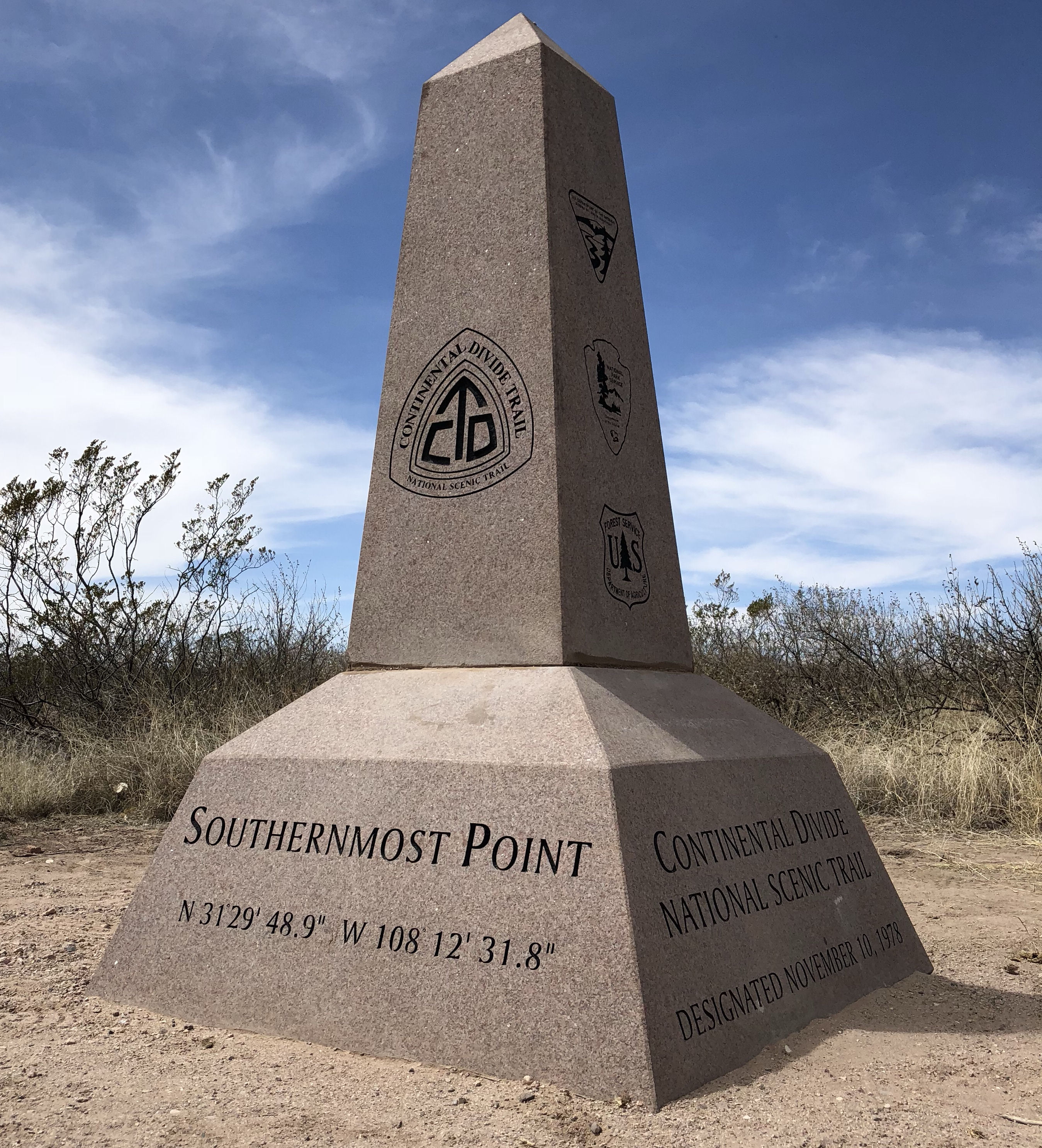 The cool thing is that the


 You use a separate hood. I purchased a Windom Hood which is basically an ultralight balaclava. The idea here is that your sleeping bag will stay in place on top of your pad and your hood will stay in place on top of your head. I know in my days of using a conventional sleeping bag that I’ve woken up on many nights wet from condensation with my head stuck way down in my sleeping bag and trying to figure out where I am with the bag tangled up around me.
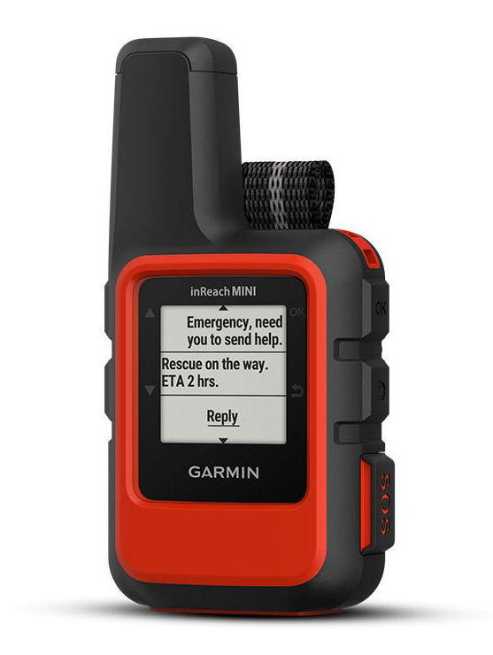 Another important device that I’ve purchased and have chosen to bring with me this year is a Garmin inReach Mini. It’s a palm-sized satellite communicator and weighs only 3.5 ounces. Knowing how I can be 100 miles from nowhere, the inReach Mini will allow me to send and receive text messages, track and share my journey, and if necessary, will trigger an SOS alert to contact a GEOS 24/7 emergency response team. By carrying this inReach device, my family and friends will know they can stay in touch with me along the trail. To me, it’s a great investment for everyone’s peace of mind.
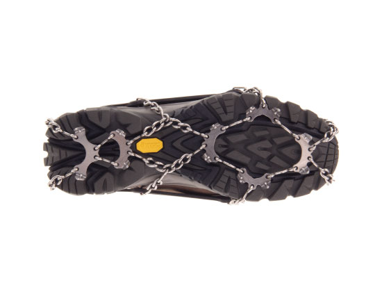

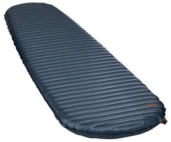 So I plan to go with a new one and keep my old sleeping pad ready to mail out to me in case of a problem. My new pad will be a