
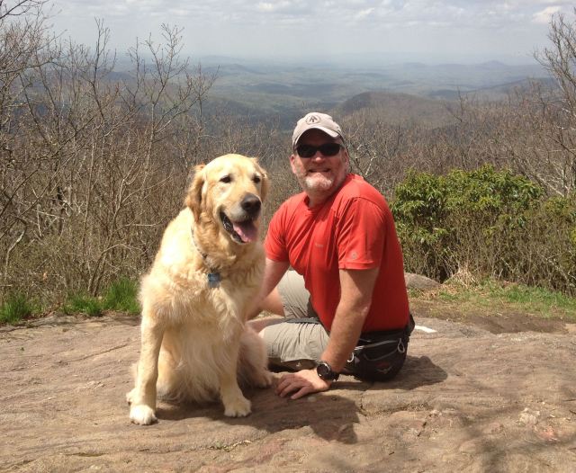
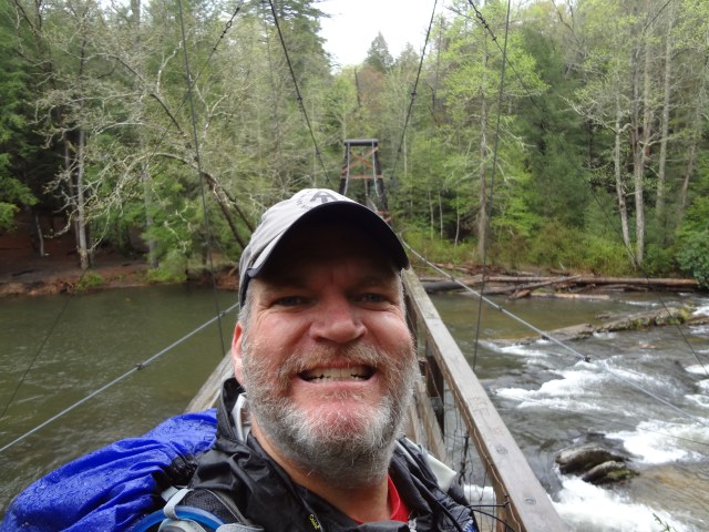
Well, I had another great send off from Amicalola Falls State Park on Thursday, April 18, 2013 as I started my hike from the AT approach trail up to the top of Springer Mountain. Mary, (Mrs. Whitewater) and Jackson drove around that afternoon to meet me on the summit. It was a beautiful day and I think Jackson had a ball!

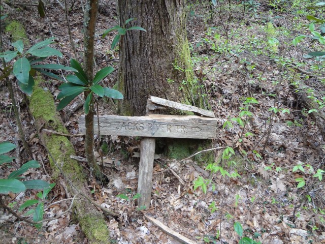
 So, where do I start telling you about my trail journey? The BMT is often refered to as a brother/sister trail to the Appalachian Trail. After thru hiking it, I think the family must be pretty upset with the BMT because it appears to me that it is the red-headed step child of the family. It’s my feeling it has been abandoned to some degree. While the trail has some very well marked and maintained areas, I found just as many miles where the trail was hardly visible at all in my opinion and very difficult to follow. The tough areas pretty much lay between the end of Jacks River or Daily Gap (if you missed the BMT trail intersection like I did) in Georgia to the Twentymile Ranger Station at the entrance to the Great Smoky Mountain National Park (GSMNP).
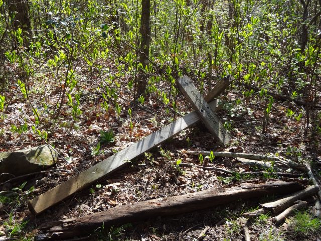
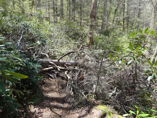
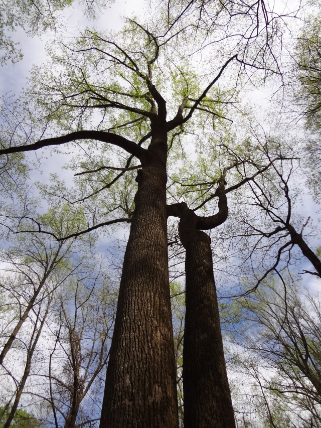
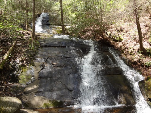
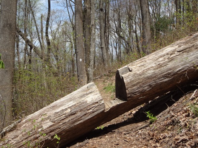
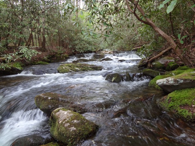
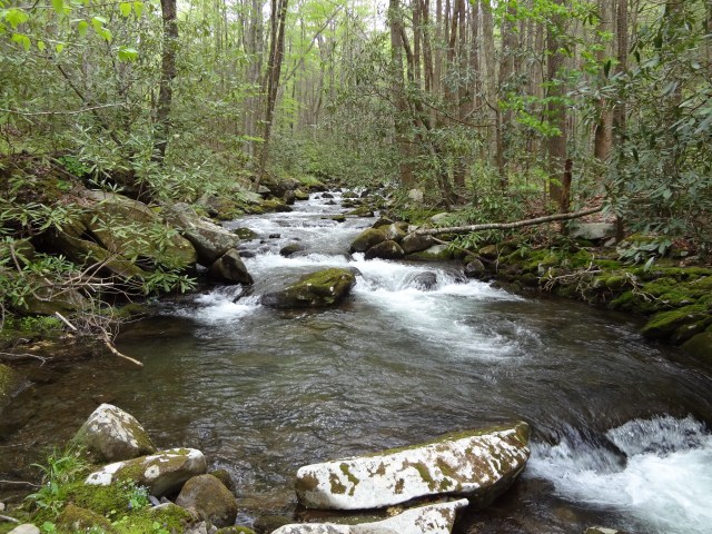
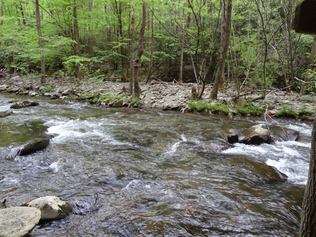
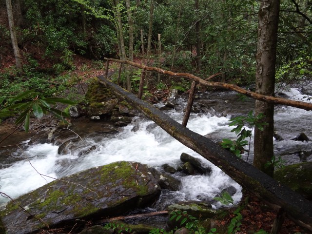
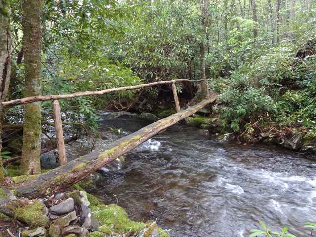
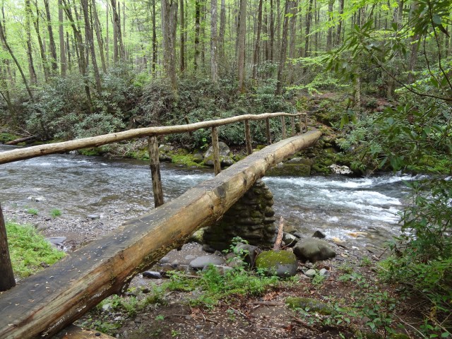
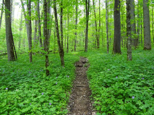
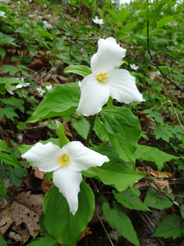
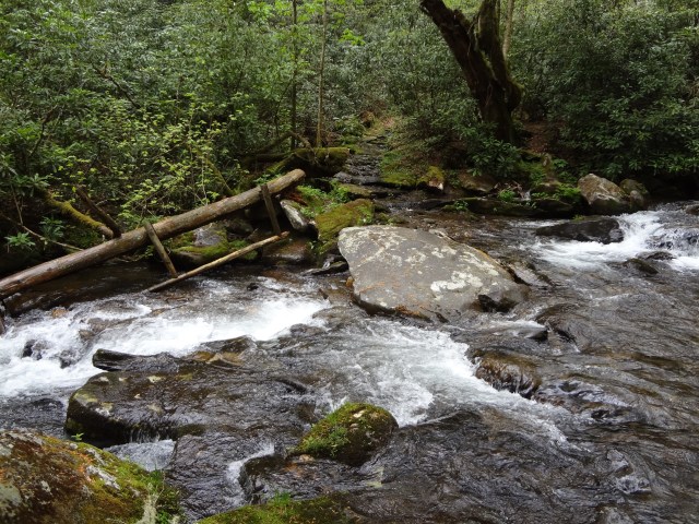
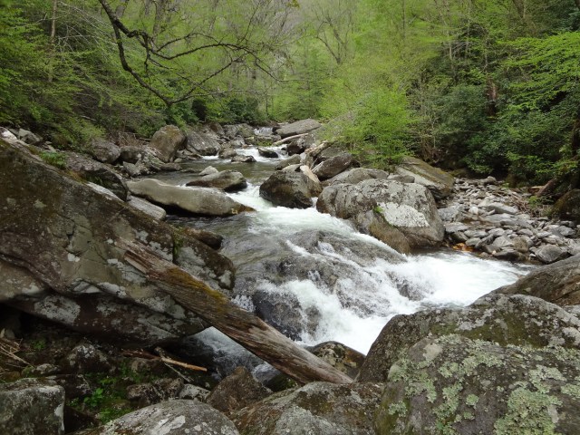
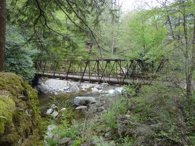
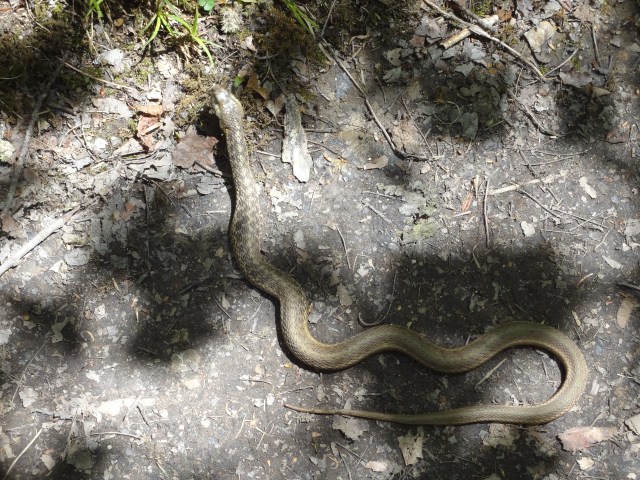
Just a few photos of what the trail really looks like below…this stuff goes on and on!


With all that said …the BMT is still a fairly new trail. It officially opened on July 16, 2005 and is mostly maintained and funded by volunteers and donations. I do realize that it has taken many, many volunteer hours to get the trail established. I do appreciate the hard work. THANK YOU!
Did I have fun? I would still have to say YES, but I did find it very hard to mentally keep in sync with the trail this year. The weather was pretty much mostly wet and rainy with unusually cool temperatures for this late in spring. Last year on my Appalachian Trail thru hike, I never even spent one night camping alone. I didn’t plan it that way, that’s just the way it worked out. On my Benton MacKaye trip, I only shared a campsite twice with fellow hikers and that was when I was already in the Smokies. I could easily count the number of hikers on one hand that I saw on the entire BMT. All of whom were basically day hikers. So my journey was really about three weeks of solo hiking with very limited to no people interaction. I always thought that I enjoyed solitude, but I’ve since learned that more than a week is too much.
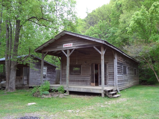
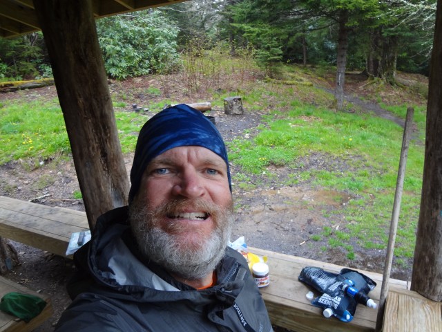
During my first real weekend on the trail, I found myself waiting out one of the many rain monsoons that took place on my trip just hanging out in a bunk house for three nights at the Hiwassee River Outfitters in Reliance, TN. This place was completely quiet and dead. I became the “chief security guard” on the property, basically because there was no one else around and no other place to visit within walking distance. The Hiwassee River Outfitters doesn’t open for business until Memorial Day weekend each year. I watched it rain and rain for two and a half days with zero entertainment. I was able to find one location on the property that I could call out to Mrs. Whitewater a few times between the almost constant rain throughout the weekend. I know now what solitary confinement in a prison must feel like, but at least they get three meals a day, TV, and a recreation hour! Being stuck in an empty bunk house in Reliance, TN was a pretty horrible experience to say the least.

 Now, on to all the good stuff about the BMT which still far out weighed the bad.
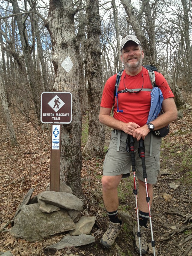
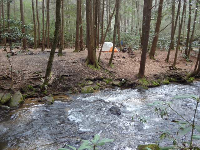
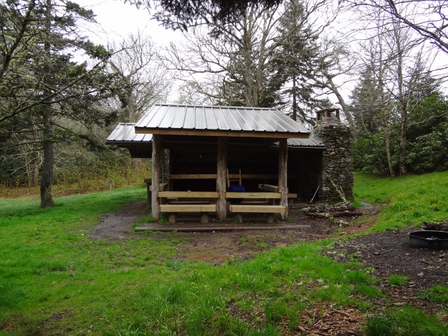
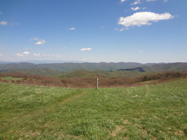
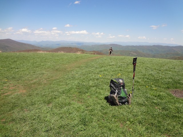
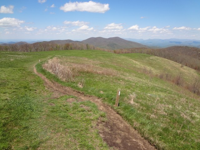
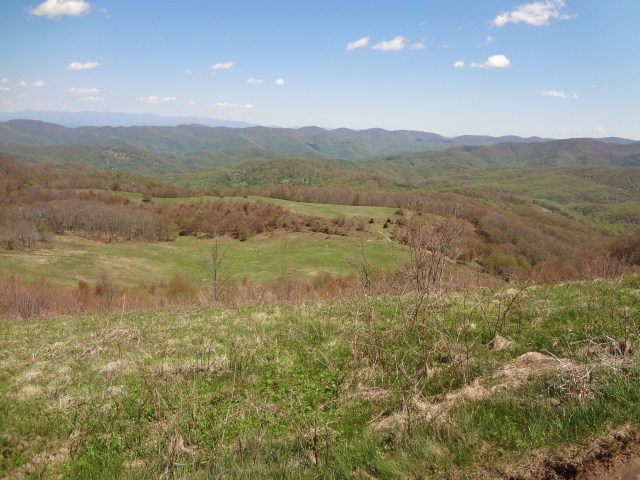
After completing the 8.8 mile AT approach trail and enjoying some time with Mrs. Whitewater and Jackson on top of Springer Mountain, I began my journey on the BMT. For the first few miles the trail winds down Springer, occasionally crossing and sharing the same path with the Appalachian Trail. The BMT also follows a portion of the old original AT, which I understand was rerouted after 1957. Looping further west, the BMT crosses Chester Creek a couple of times before Three Forks (Chester is one of the creeks that make up Three Forks) about 6 miles from the top of Springer. I made camp the first night at Three Forks and what a beautiful spot it was.

The next day after leaving Three Forks I hiked over The Bald, Wildcat Ridge, across the Toccoca River Bridge, and back up and over Mount Toonowee onto GA60. Then I hiked down the road to Skeenah Creek Campground for the night to dry out from all the rain.

 After leaving the Skeenah Creek Campground, I made my way toward Blue Ridge, GA.

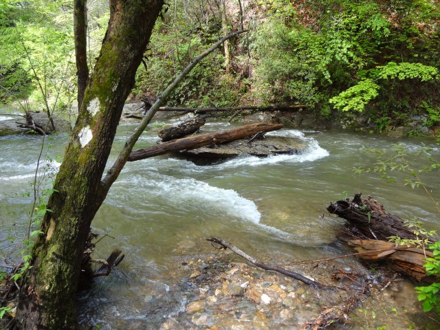
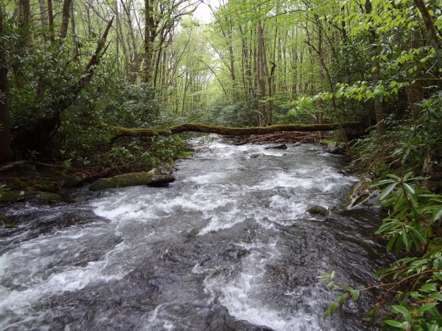
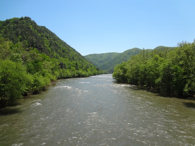
 If you like fording creeks and streams, then the BMT would be for you. I honestly lost count of how many I crossed, but it was a lot! The heavy rains made for a couple of really epic crossings with the water well above my waist. All I could think about was how long it would take someone to find me if I got into trouble!

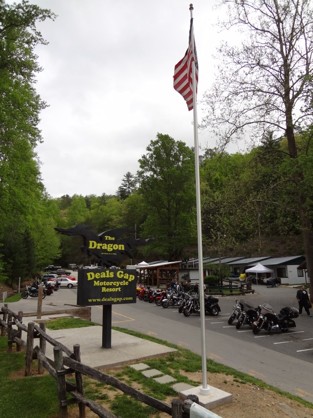
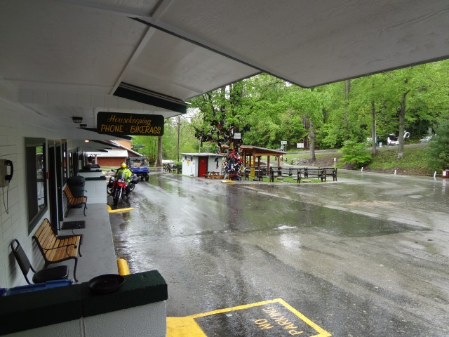
Before entering the Great Smoky Mountains, I was able to get to Deals Gap, TN on a Friday night before another weekend long rain out. At least this time I had some people around, a TV, and a place to grab a burger. Life was good!
Deals Gap Motorcycle Resort is just that, a place where motorcycle enthusiasts come from all over to ride the famous Dragon. The 11-mile stretch of the Dragon in Tennessee is said to have 318 curves. Some of the Dragon’s sharpest curves have names like Copperhead Corner, Hog Pen Bend, Wheelie Hell, Shade Tree Corner, Mud Corner, Sunset Corner, Gravity Cavity, Beginner’s End, and Brake or Bust Bend. The road earned its name from its curves being said to resemble a dragon’s tail. The Dragon also seems to be a very popular destination now for Mini Cooper owners as well.
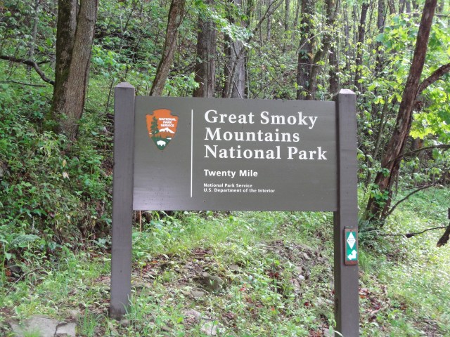
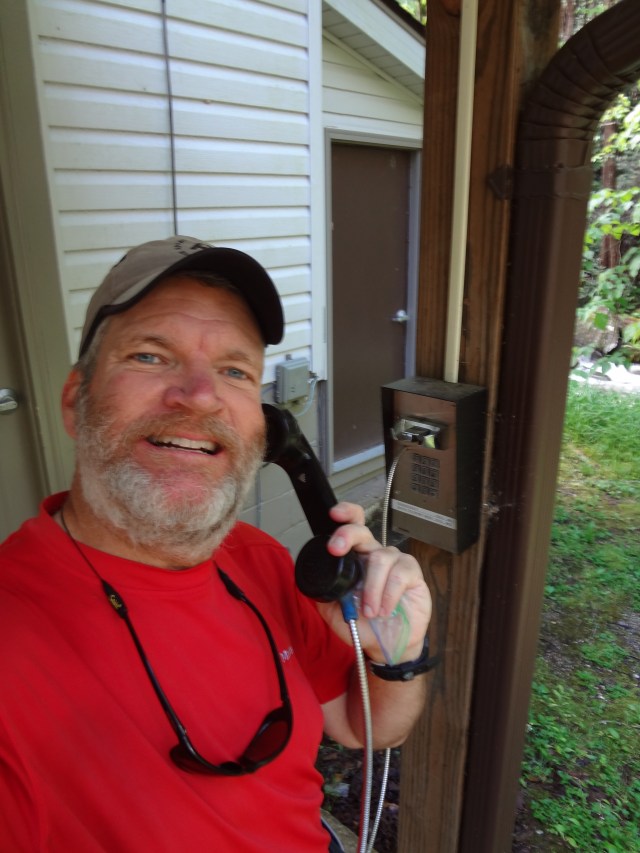
On Monday, the skies began to clear and I was able to leave Deals Gap and head into the Great Smoky Mountains National Park. Upon arriving at the Twentymile Ranger Station, I tried to make a backcountry reservation using the phone provided by the park service, but it was out-of-order. I proceeded on without a permit and truly didn’t feel one bit bad about it.
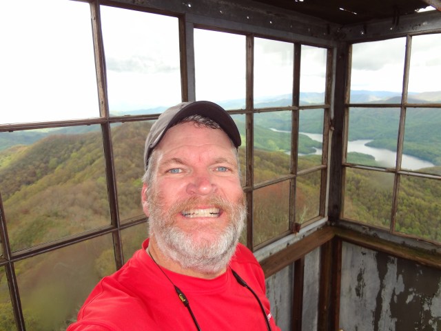
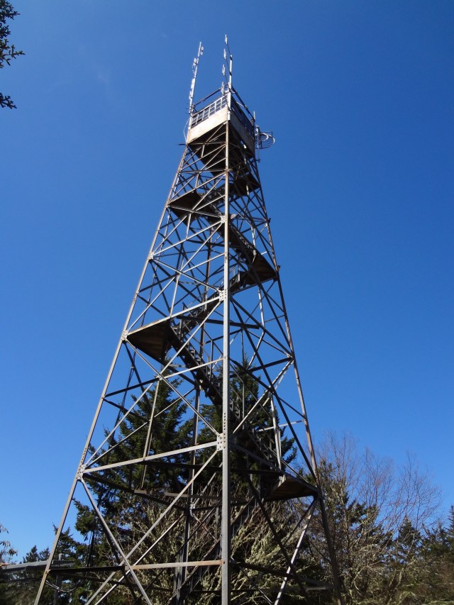
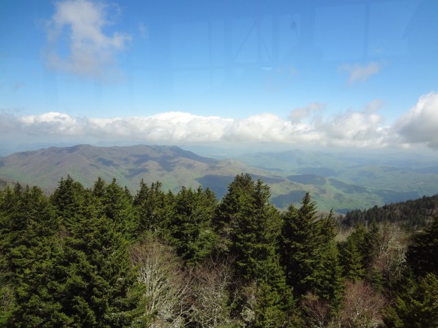
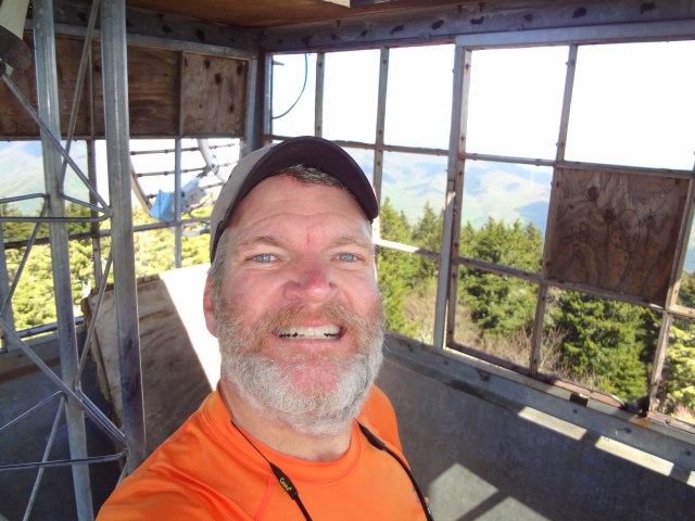
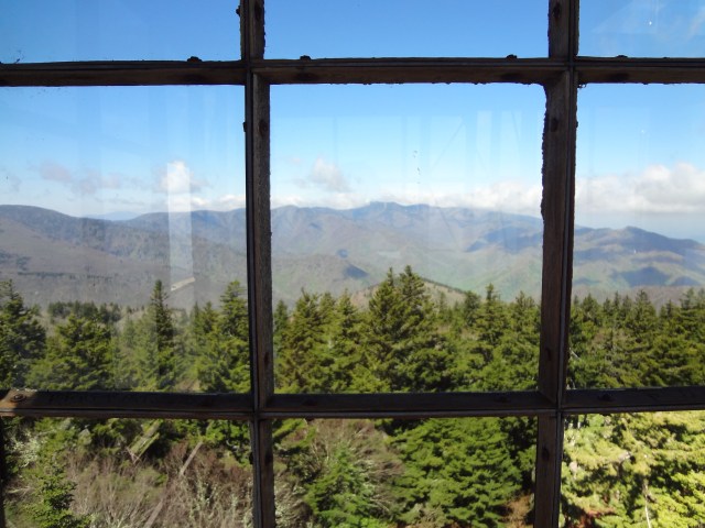
After several miles, I took a detour on the AT and went up to the Shuckstack fire tower. What a great view! The fire tower is old and dilapidated, a scary climb up, but what fantastic panoramic scenery awaits from the top.
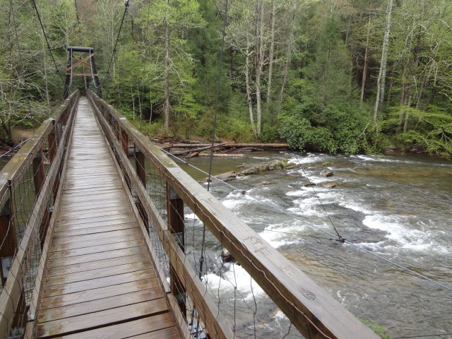
For the most part, the Smoky Mountains provided some better ways of crossing the creeks and streams.

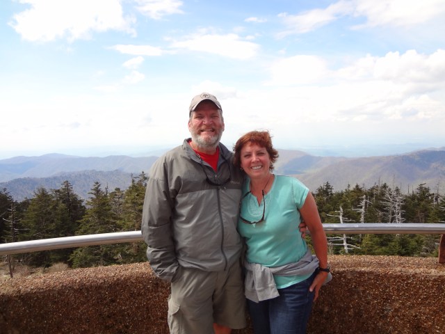
During my first three days in the Smokies, I covered 66 miles of trail and arrived at Newfound Gap a day earlier than I had expected. So I camped at the Smokemont Campground there in the park. My camping neighbors were very nice. One couple brought me coffee in the morning and another couple brought me a bag of home-made cookies. I’m guessing they probably felt sorry for me and thought I may have been a bum or something. That’s a pretty common thing that can happen when you’re living in the woods for too long . Mrs. Whitewater drove up the next day and we toured the park and drove on into Cherokee, NC for the evening. What a great time we had and I enjoyed just relaxing. The shower, clean clothes, and food were a welcome change as well.
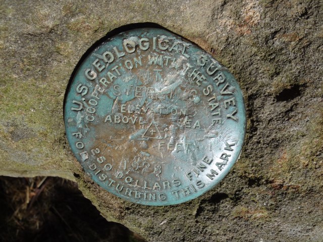
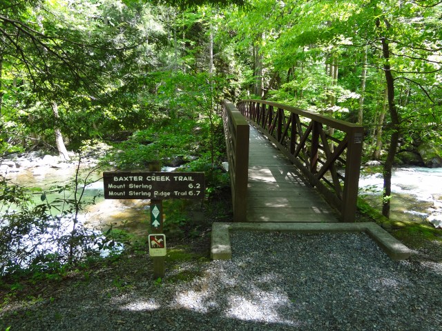
On my last night in the Smokies, which was also my last night on the BMT, I stayed at the Laurel Gap Shelter. I arrived very early, before noon, having covered only about nine miles so far for the day. The weather was rainy and I didn’t really want to summit Mount Sterling on an ugly day. I’m glad I waited because the next day was clear and beautiful. I enjoyed my walk up to the summit of Mount Sterling, which is also the highest point on the BMT at 5,842 feet. I took in the views from another old fire tower that still stands on its summit. From there I dropped down more than 4,000 feet to the bridge over Big Creek which is basically the end of the Benton MacKaye Trail (BMT).

I spent two additional days hiking north on the AT before ending my hike in Hot Springs, NC. The AT was like hitting a major interstate! It was so well marked and full of people hiking north and south! On my thru-hike last year I had to hurry across Max Patch due to the weather. This year I had great weather and really enjoyed just taking my time across this beautiful area.


What an incredible adventure! And the pictures are incredible!
Thanks Nina!!
Glad you enjoyed your hike. Love the pictures and your story of the hike. The trail seemed to very interesting especially wet with all the crossings. Where you able to make it to Trail Days after your BMT hike? Wish I could have met you this year at TDays. My wife is doing much better. Maybe someday we will meet. Enjoy the great PCT. RC Slowpoke
Thanks Will!!
I did make it to Trail Days and plan to do a small post on it here shortly. I’ve been gone out of pocket for a long Memorial Day weekend.
Take care,
WW
Thanks for sharing. Lots of water on this one.
Way too Much!!
WW
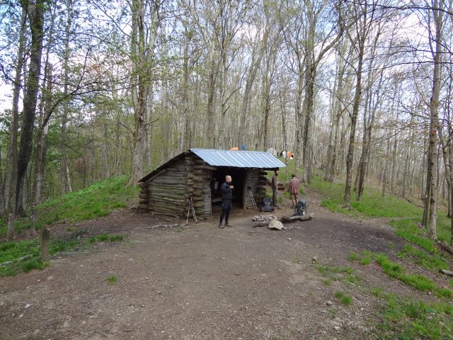
I am a member of the Benton McKaye Trail club and help maintain the trail in Georgia. I hope you found the 80 miles of the trail in Georgia to be clearly marked and well maintained. Work trips go out every month to keep the trail in good shape. One thing I like about the BMT is the solitude you find there. The BMT has only one shelter and a fraction of the traffic found on the AT. I am glad you had a successful thru-hike and enjoyed the trail.
Steve,
Thanks for your comments.
Yes I did enjoy my BMT hike and yes most of Georgia was in good shape as I mentioned in my blog above. The trouble started between Jacks River and Daily Gap (towards the end of the Georgia section) where I later found the BMT sign broken and thrown under a tree where the trail branches off to the left +/- .5 miles from Daily Gap. It also at this trail junction where the diamond blazes basically stop (I understand the problem with paint on the trees in a wilderness area) it just seems to me that some comprise, with minimal impact, could be achieved to mark the trail well enough to keep hikers and thru-hikers on the right path for the BMT….at least at trail intersections, road walks (including the Georgia road walk sections) and etc.
I would love to get a better understanding of the overall goals of the BMT Association. I do plan to make it to a meeting and volunteer some hours helping maintain the trail to give back.
Steve, thanks for all your efforts as well as helping maintain the trail, it’s greatly appreciated!
Whitewater
Signage is a problem on some sections of the trail. I’m told by a friend who hiked section 6 and 7 (Shallowford Bridge to Bush Head Gap) that it’s easy to lose the trail there. The sign on the north side of the BMT at Dally Gap needs to be replaced. Your picture shows how badly it looks now as it lies on the ground. The sign at Double Springs Gap has been chewed on by bears, so I’m told. Signage in the Big Frog Wilderness is restricted and it’s easy to get lost. In that area (section 11) you have to follow the trail number which is #2 for the BMT. Come by and visit the Benton McKaye Trail Association anytime. The Georgia work trip is scheduled for the second Saturday of each month. We usually meet at the Village Restaurant in Blue Ridge at 8 am before heading out to the trail. We’d be glad to have you join us.Check the Benton McKay Trail Association web page for details. .
Thanks Steve! I will attend a BMTA meeting in the fall.
Whitewater,
Wonderful photos. It gave an excellent synopsis of the trail. I’m hoping to complete the BMT this summer although my hiking opportunities are very uncertain since I am a full-time caregiver for my wife (dementia). The guide book is on order, though. My AT experience seemed to be a lot about “following the herd.” I would be interested in knowing others who may hike the BMT later this summer (fall?).
Slim, I frequently hike the BMT in Georgia. I love the trail for the solitude and wilderness experience. It’s like the AT was many years ago, before it became the most popular trail in America. I hiked 22 miles last Sunday to Springer Mountain and saw one person backpacking the entire day. I am planning a thru hike of the BMT with a friend starting September 28. I don’t know how long you can be away from your wife as you are the full-time caregiver. Would you be interested in hiking the BMT sometime later this summer?
Slim,
Thanks! If I can help you when you’re down this way just let me know. I’m north of Atlanta…but spend a lot of time crossing over the trail between GA and TN. (Blue Ridge, Ducktown and etc.)
WW
Any chance you can post or provide your camp/sleep spots? I’m putting together plans to section hike portions of the BMT and curious about your choice of camp spots, especially during the challenging portions of the trail.
Great post and thanks again for any info.
JustADude,
Thanks…
Feel free to email me at dlangford@dnlangford.com and I’ll send you a PDF file of what I used as my tentative hike plan on the BMT. Some days…I just continued to hiked further and made more miles. Just a guide for me…nothing cast in stone:).
WW
Great pictures & journal, I would like to do one last hike, before I put up my hiking boots, but like Slim I’m also a caregiver for my wife, an hard to get away, completed The AT, LT OHT, PT & climbed the 40 peaks over 6K in the South east. Back in the late 90’s received the map of the BMT, but was not able to use them
It’s still on my bucket list.
Jack
Jack,
Thanks…don’t ever put up those hiking boots, hopefully the BMT is in your future.
Take care,
David
Great info and pictures!!! My husband and I are planning a thru hike. Any other advice and information you may have would be much appreciated!
Hello David,
I have enjoyed reading about your BMT hike and viewing your pictures. I through hiked the BMT in 2014 during the month of June-July…I then hiked up Chestnut Ridge Trail to the AT and hiked sobo to Clingman’s Dome to begin the Mountains to Sea Trail. I can understand the constant overgrowth and blow downs! I was constantly fighting my way down the trail in many areas. I could not wait to get to the Smoky Mts hoping the trail would be better and that I would begin to see other hikers. This hike was a very solitude hike for me also…there were no other backpackers on the BMT or the MST…due to an IT Band problem I got off the trail after 750 miles. I do plan on returning back to the MST to finish and make my way to the Atlantic Ocean.
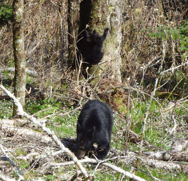
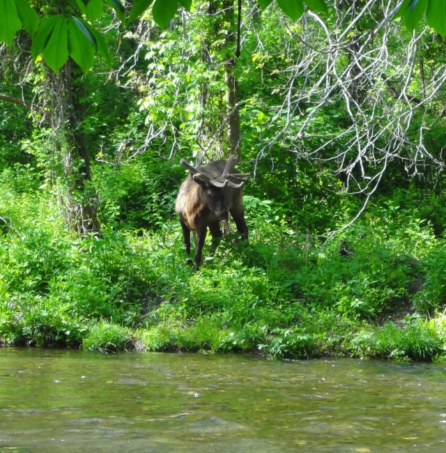
I love that you saw Elk! I kept wanting to see some…I did see 5 bear total but unable to take any pictures.
Thank you again for your story and pictures.
Princess Doah
Great blog! We’re some of the day hikers you’ve seen on the BMT, but have loved every minute of it. To know there are areas that need a lot of work encourages us to give more financial support to the BMTA. Thanks for your account. We’d bring you coffee and cookies too!
Hoping to attempt an AT through hike in 2017 or ’18, depending on when I can wrap up business for a “sabbatical” at 66 or 67 (no, surely not retirement), I have considered taking the BMT as an less-traveled alternate route for the first leg of the trip. Have signage and trail maintenance improved since the original post in 2013? Any further observations on safety of fording streams?
Ken,
Thanks for the post!
I would hope that the maintenance and signage has improved along the BMT these days. I would think if you’re planning an AT thru hike you’ll probably want to stay on the AT the whole way, just so you can say you hike the entire AT. That’s clearly your decision and no problem here, HYOH (Hike you on hike). The stream crossings real probably always be a little tough during the springtime. I’m very comfortable around fast moving water. I’ve seen others that didn’t like it at all. My recommendation would be if you’re not super comfortable at it, don’t try it if the water is high and fast moving.
Good luck and have fun planning your AT hike. It’s an awesome journey.
Happy trails,
Whitewater
Thanks. I am not a purist about staying on the AT the entire route, so long as I start at Springer and end at Katahdin. I’ve always been inclined to take “the road less traveled by.”
Stream fords vs. mob scenes at AT shelters in the spring. Touch choice. I have a lot of deals to wrap up before I power down a law practice after nearly 40 years, so timing is problematical. I’ve done most of the AT in Georgia with my son’s Boy Scout troop in years past (he’s 27 now), but not much of the BMT. Maybe I can work in some exploratory weekend hikes to check it out. What would you say are the diciest sections of the BMT?
Ken,
Really the whole trail has some really nice scenery on it and I didn’t even really mind the road walking through Blue Ridge and the Cherry Log areas. The trail from Jacks River Falls to the Smokies was the toughest areas to follow along the BMT. Really enjoyed the views from Frog Mountain, just before the Ocoee or Thunder Rock Campground. If I remember correctly, most of the stream crossings were between the Hiwassee River area and on through the Smokies. If you need any help with shuttles just let me know and I’ll try and help out. I live up here now between Blue Ridge and the Ocoee.
Thanks. I’ve hiked the section between Jack’s River and Big Frog, and camped at Big Frog with a Boy Scout troop in winter around 13 or 14 years ago. Due to a sudden, violent thunderstorm, it was a memorable night.
I can relate to finding solitude enjoyable but needing some human interaction after an extended period.